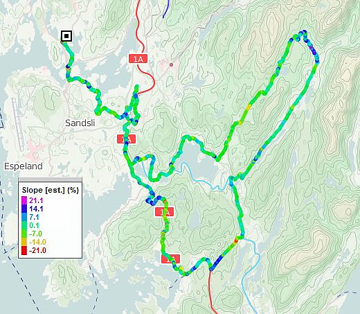
South-of-Bergen cycling with Endre (17.08.2011)

| Startsted | Einerhaugen (45moh) |
|---|---|
| Sluttsted | Einerhaugen (45moh) |
| Turtype | Sykkeltur |
| Turlengde | 4t 00min |
| Distanse | 74,5km |
| Høydemeter | 1425m |
| GPS |
|
| Andre besøkte PBE'er | Bontveit parkering (304moh) | 17.08.2011 |
|---|---|---|
| Bontveitvegen parkering (289moh) | 17.08.2011 | |
| Frotveit p-lomme (285moh) | 17.08.2011 | |
| Frotveit p-plass (kr) (256moh) | 17.08.2011 | |
| Kaland skole (62moh) | 17.08.2011 | |
| Langedalen P-lomme (150moh) | 17.08.2011 | |
| Lysekloster p-plass (50moh) | 17.08.2011 | |
| Stendafjellet p-plass (59moh) | 17.08.2011 | |
| Straume bro (5moh) | 17.08.2011 |
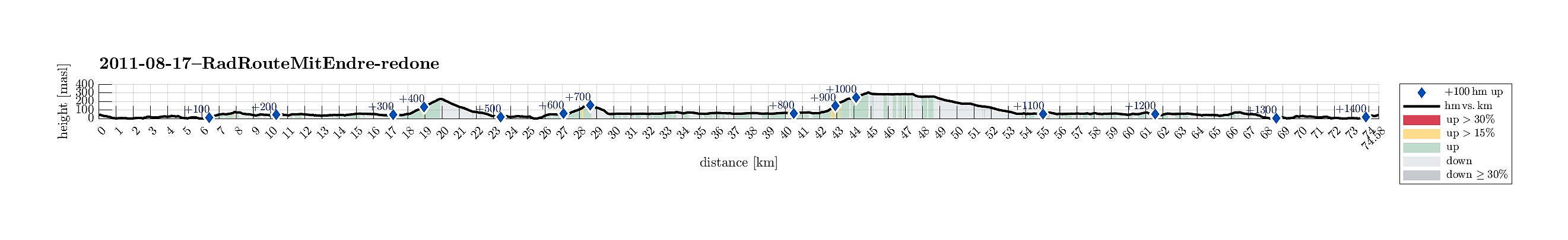
Note that this track has been created a posteriori, i.e., from memory, not automatically recorded.
Trip Summary
Longer biking round, south of Bergen, with some steeper ascents, not at the least up to Bontveit. :-)

Kommentarer