Spjeldsfjellet (26.10.2014)

| Startsted | Near Skulehusvatnet (25moh) |
|---|---|
| Sluttsted | Near Skulehusvatnet (25moh) |
| Turtype | Fjelltur |
| Turlengde | 2t 00min |
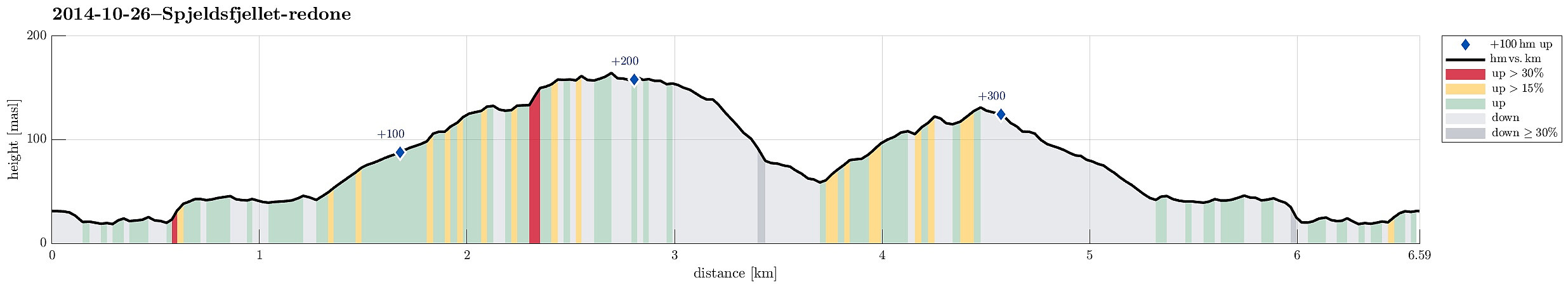
| Distanse | 6,6km |
| Høydemeter | 344m |
| GPS |
|
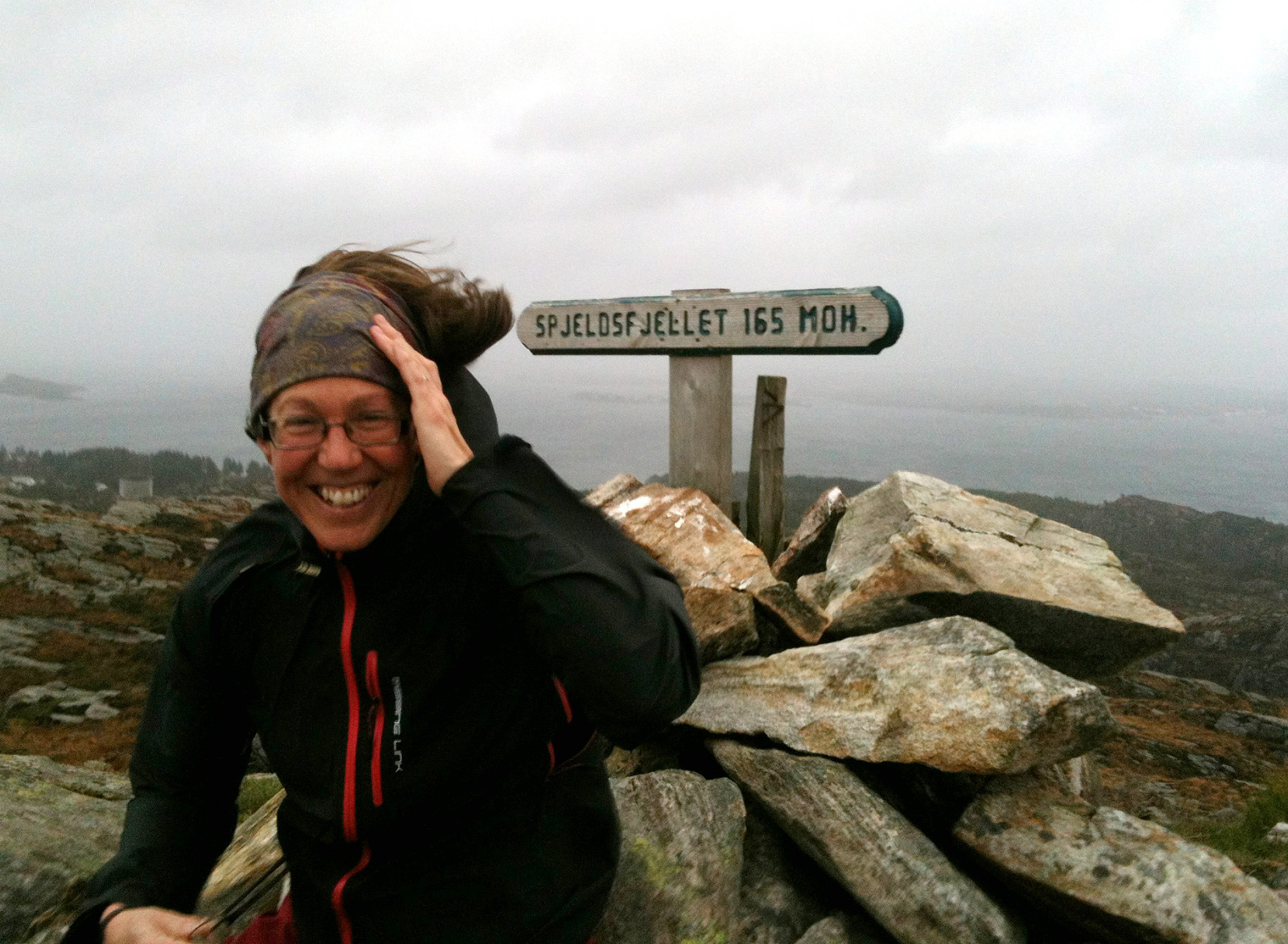
| Bestigninger | Spjeldsfjellet (166moh) | 26.10.2014 |
|---|
Note that this track has been created a posteriori, i.e., from memory, not automatically recorded.
Trip Summary
From road 210, some ~500m from Landrovegen, we first headed eastover (following an easy to find and well-used path), before we then started to ascend to Spjeldsfjellet. From the top, where we enjoyed extra-strong winds (so strong that it -- at times -- was difficult to prevent falling over!), we first descended towards Spjeldsunnet, before we then turned back (without path, approx. from km 3.6 to km 4.5), getting back to the same path which we had used first (slightly beneath Spjeldsfjellet). All in all a nice hike in stormy weather! :-)
Useful Resources
Petter Bjørstad has a useful page about Spjeldsfjellet.
Web page UT.no from the Norwegian Trekking Association recommends another hike up and down Spjeldsfjellet.

Kommentarer