Archive - Date
Archive - Activity
-
Bike trip (119)
- Bike trip - mixed (29)
- Bike trip - road (90)
-
Drive (9)
- Car drive (9)
-
Other trip (3)
- Kayaking (3)
-
Ski trip (116)
- Backcountry skiing (69)
- Cross-country skiing (47)
- Trip by foot (1917)
Collected lists
-
Utvalgte topper og turmål i Bergen
(352/353)
 99%
99% -
Alle topper i Bergen
(396/401)
98%
-
Voss ≥ 100m pf.
(96/98)
97%
-
Opptur Hordaland
(145/159)
91%
-
Stasjoner på Bergensbanen
(33/40)
82%
-
Ulvik ≥ 100m pf.
(31/38)
81%
-
Hordaland ≥ 100m pf.
(633/863)
73%
-
Mjølfjell PF > 100m
(21/31)
67%
-
Jondal ≥ 100m pf.
(15/23)
65%
-
Dagsturhyttene i Vestland
(38/62)
61%
-
Sunnhordland PF >= 100m
(113/186)
60%
-
Hordaland: Hardanger PF>=100m
(197/359)
54%
-
DNT-hytter i Hordaland
(25/46)
54%
-
Kvinnherad ≥ 100m pf.
(41/79)
51%
-
Eidfjord ≥ 100m pf.
(14/42)
33%
-
Etne ≥ 100m pf.
(15/51)
29%
-
Sogndal ≥ 100m pf.
(23/81)
28%
-
Gulen ≥ 100m pf.
(15/54)
27%
-
Vik i Sogn ≥ 100m pf.
(10/46)
21%
-
Sogn - Sør for Sognefjorden PF>=100m
(31/159)
19%


Slettafjell via Bagne
- Date:
- 16.07.2026
- Characteristic:
- Hillwalk
- Duration:
- 2:52h
- Distance:
- 6.5km
 An ascent of Slettafjell had been on my wish list for a while, however getting there typically requires some sort of transportation across the fjord, as the alternative route from Langevatnet via Onen is rather long and cumbersome. My search for help with getting to the eastern side of Bagnsfjorden resulted in many interesting suggestions. The most unusual was to take advantage of the fact that there was a property for sale at finn.no that just happened to be located right next to the desired trailhead, with boat transportation provided for interested buyers! I however had to conclude that including an ascent of Slettafjell as part of a viewing might be a bit of a stretch. ;)
The solution to the problem came through a friend of a colleague. She originated from Osa and was going to be staying there with her family for part of their summer >>>
An ascent of Slettafjell had been on my wish list for a while, however getting there typically requires some sort of transportation across the fjord, as the alternative route from Langevatnet via Onen is rather long and cumbersome. My search for help with getting to the eastern side of Bagnsfjorden resulted in many interesting suggestions. The most unusual was to take advantage of the fact that there was a property for sale at finn.no that just happened to be located right next to the desired trailhead, with boat transportation provided for interested buyers! I however had to conclude that including an ascent of Slettafjell as part of a viewing might be a bit of a stretch. ;)
The solution to the problem came through a friend of a colleague. She originated from Osa and was going to be staying there with her family for part of their summer >>>

Viskjer to Tjelmeland via Viskjerstølen
- Date:
- 14.07.2026
- Characteristic:
- Hillwalk
- Duration:
- 10:36h
- Distance:
- 24.5km
 After yesterday afternoon’s short ascent of Hålandshovda , it was time for a much more ambitious hike: following the mountain ridge on the south side of Åkrafjorden including at least seven peaks along the way. I had only been able to find a single report of a similar hike , but that one started from Langfoss and was thus longer than what the bus schedule would allow. (That there is no bus stop at Langfoss also did not help).
I therefore looked into Bjørkestronda as a potential starting point and ascending via Viskjerstølen . The map here indicated a trail, but with its largely straight lines it looked more like a blueprint than a proper trail. It was also going through steep terrain which meant that if I lost the potentially weak trail, finding my own way could be difficult. That I could not find any information about anyone actually using this particular route >>>
After yesterday afternoon’s short ascent of Hålandshovda , it was time for a much more ambitious hike: following the mountain ridge on the south side of Åkrafjorden including at least seven peaks along the way. I had only been able to find a single report of a similar hike , but that one started from Langfoss and was thus longer than what the bus schedule would allow. (That there is no bus stop at Langfoss also did not help).
I therefore looked into Bjørkestronda as a potential starting point and ascending via Viskjerstølen . The map here indicated a trail, but with its largely straight lines it looked more like a blueprint than a proper trail. It was also going through steep terrain which meant that if I lost the potentially weak trail, finding my own way could be difficult. That I could not find any information about anyone actually using this particular route >>>
Hålandshovda from Haukelivegen
- Date:
- 13.07.2026
- Characteristic:
- Hillwalk
- Duration:
- 2:48h
- Distance:
- 9.0km
 Based on last summer's successful peak bagging trip to Skånevik , I decided on a repeat this summer. I however moved my starting point slightly further south and booked a hotel room in Etne. After arriving by bus, I checked in to the hotel, left most of my luggage behind, and got on another bus to Håland with the goal to ascend Hålandshovda .
I first made a shortcut via a tractor road to connect with Skålevikveien. This felt a tiny bit like trespassing and included going through two gates via an area that may be used for grazing cows, however there were thankfully none today. After a short walk along the paved road I then arrived at the marked trailhead and proceeded to follow the marked trail all the way to the large summit cairn. Spectacular views from the summit, which I enjoyed during a short break before returning the same way, >>>
Based on last summer's successful peak bagging trip to Skånevik , I decided on a repeat this summer. I however moved my starting point slightly further south and booked a hotel room in Etne. After arriving by bus, I checked in to the hotel, left most of my luggage behind, and got on another bus to Håland with the goal to ascend Hålandshovda .
I first made a shortcut via a tractor road to connect with Skålevikveien. This felt a tiny bit like trespassing and included going through two gates via an area that may be used for grazing cows, however there were thankfully none today. After a short walk along the paved road I then arrived at the marked trailhead and proceeded to follow the marked trail all the way to the large summit cairn. Spectacular views from the summit, which I enjoyed during a short break before returning the same way, >>>
Bjørnstølen and Livarden
- Date:
- 08.07.2026
- Characteristic:
- Hillwalk
- Duration:
- 2:46h
- Distance:
- 8.1km
 Before heading home from work I made a detour to Bontveit to visit Bjørnstølen - the first DNT cabin first in Bergen! The cabin can be easily reached from the bus stop/parking lot at Bontveit. First along a gravel road and then less than 500 meters on a good trail.
With the main objective out of the way, I had planned to continue to Livarden via Nobbane and Slettegga but with the weather forecast now suddenly indicating heavy rain clouds coming in from the north, I decided to skip the latter two and instead head directly to Livarden. In the end, the intensity of the rain was not too bad and it pretty much stopped all together just as I arrived at the large summit cairn.
For my descent I tried the route via Lavrinden. The start was marked but shortly after the trail disappeared. It later reappeared but was largely hidden underneath >>>
Before heading home from work I made a detour to Bontveit to visit Bjørnstølen - the first DNT cabin first in Bergen! The cabin can be easily reached from the bus stop/parking lot at Bontveit. First along a gravel road and then less than 500 meters on a good trail.
With the main objective out of the way, I had planned to continue to Livarden via Nobbane and Slettegga but with the weather forecast now suddenly indicating heavy rain clouds coming in from the north, I decided to skip the latter two and instead head directly to Livarden. In the end, the intensity of the rain was not too bad and it pretty much stopped all together just as I arrived at the large summit cairn.
For my descent I tried the route via Lavrinden. The start was marked but shortly after the trail disappeared. It later reappeared but was largely hidden underneath >>>
BT-hytten and Vesetfjellet
- Date:
- 05.07.2026
- Characteristic:
- Hillwalk
- Duration:
- 4:28h
- Distance:
- 12.5km
 A return to Mjølfjell to visit BT-hytten . I started from the train station and pretty much followed the marked trail all the way to the cabin, finally getting to use the bridge to Urlandsstølen (it had been taken down for the winter during my previous attempt, resulting in a rather long detour on my ascent of Nordbotnnuten ).
After a couple of pictures of BT-hytten, I continued via a weak trail up to south/southeast of Vesetfjellet , with the trail completely disappearing along the way, and then completed the final off-trail distance to the summit. I visited both competing summits, plus a larger cairn further northwest, before returning to attempt to follow the weak trail east to Mjølbotnen .However, besides a single small cairn at the top of the pass, I did not see many traces of the trail, and instead simply found my own way.
Except for a rain shower, this did not present any >>>
A return to Mjølfjell to visit BT-hytten . I started from the train station and pretty much followed the marked trail all the way to the cabin, finally getting to use the bridge to Urlandsstølen (it had been taken down for the winter during my previous attempt, resulting in a rather long detour on my ascent of Nordbotnnuten ).
After a couple of pictures of BT-hytten, I continued via a weak trail up to south/southeast of Vesetfjellet , with the trail completely disappearing along the way, and then completed the final off-trail distance to the summit. I visited both competing summits, plus a larger cairn further northwest, before returning to attempt to follow the weak trail east to Mjølbotnen .However, besides a single small cairn at the top of the pass, I did not see many traces of the trail, and instead simply found my own way.
Except for a rain shower, this did not present any >>>
Ørneberget and Furukammen
- Date:
- 30.06.2026
- Characteristic:
- Hillwalk
- Duration:
- 0:54h
- Distance:
- 3.9km
 Short local evening hike.
Setreåsen and Kråfjellet
- Date:
- 21.06.2026
- Characteristic:
- Hillwalk
- Duration:
- 2:30h
- Distance:
- 6.4km
 A return to Gullbotn to visit Setreåsen , a recent addition to the Alle topper i Bergen list . From the bus stop I first followed the gravel road to south of the summit where the map indicated a trail heading north. But while there may have been a trail here at some point, this was no longer the case and there were only weak traces that looked more like deer tracks. It was still pretty easy to complete the final short distance to the highest point, but as it provided very limited views I did not stay long before returning the same way.
In order to make the hike a bit longer, I decided to also include my first ascent of Kråfjellet . This included first following the usual route towards Gullfjelltoppen and then heading off-trail to the summit. Or so I thought. Upon arriving at Mannaleittørna I however came across small cairns and a weak trail that led me >>>
A return to Gullbotn to visit Setreåsen , a recent addition to the Alle topper i Bergen list . From the bus stop I first followed the gravel road to south of the summit where the map indicated a trail heading north. But while there may have been a trail here at some point, this was no longer the case and there were only weak traces that looked more like deer tracks. It was still pretty easy to complete the final short distance to the highest point, but as it provided very limited views I did not stay long before returning the same way.
In order to make the hike a bit longer, I decided to also include my first ascent of Kråfjellet . This included first following the usual route towards Gullfjelltoppen and then heading off-trail to the summit. Or so I thought. Upon arriving at Mannaleittørna I however came across small cairns and a weak trail that led me >>>
Kvannto from Rosendal via Kvitegga
- Date:
- 16.06.2026
- Characteristic:
- Hillwalk
- Duration:
- 5:07h
- Distance:
- 16.7km
 I took the day off to enjoy what seemed like the last day of nice weather for a while. Started by taking the boat from Bergen to Rosendal. Upon arriving, I first walked south along the road to Seimshagen (separate cycling and walking paths all the way), before easily locating the marked trailhead for Kvitegga (Kviteggjo on the signs) towards the end of Seimshamrane. There were several signs at the start to show the way up to Seimsakla where there was a nice viewpoint with views back towards Rosendal.
Until this point, the trail had been relatively steep but never exposed or turning into scrambling. At Seimsakla the terrain tuned less steep and soon I also left most of the trees behind, with the bonus of even better views. The final ascent to Kvitegga was straightforward and did not present any challenges >>>
I took the day off to enjoy what seemed like the last day of nice weather for a while. Started by taking the boat from Bergen to Rosendal. Upon arriving, I first walked south along the road to Seimshagen (separate cycling and walking paths all the way), before easily locating the marked trailhead for Kvitegga (Kviteggjo on the signs) towards the end of Seimshamrane. There were several signs at the start to show the way up to Seimsakla where there was a nice viewpoint with views back towards Rosendal.
Until this point, the trail had been relatively steep but never exposed or turning into scrambling. At Seimsakla the terrain tuned less steep and soon I also left most of the trees behind, with the bonus of even better views. The final ascent to Kvitegga was straightforward and did not present any challenges >>>
Knultrane
- Date:
- 13.06.2026
- Characteristic:
- Hillwalk
- Duration:
- 0:53h
- Distance:
- 4.1km
 A return to Bønestoppen for a visit of Knultrane , a recent addition to the Alle topper i Bergen list . The short hike turned out to be a positive surprise with a nice trail across the ridge and good views from near the highest point. Continuing to Gullsteinen and Løvstakken was abandoned due to it started raining.
Kyrelvfjellet
- Date:
- 07.06.2026
- Characteristic:
- Hillwalk
- Duration:
- 1:59h
- Distance:
- 4.6km
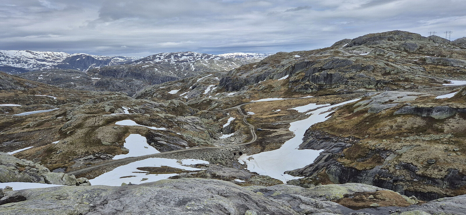 After our successful ascent of Nipahøgdi , we drove the short distance south towards Langavatnet for an attempt at ascending Kyrelvfjellet . Thankfully, this part of the road had been cleared of snow and we could therefore easily drive all the way to our planned starting point east of the summit. Here Endre decided to have a go at the last skiing trip of the season, while Petter and I concluded that it would be just as easy to continue on foot for this peak as well.
Initially, we followed a route marked with small cairns leading us to the small 1168 lake east of the summit. The cairns can most likely be followed all the way to the summit, at least they reappeared higher up, but for now they were hidden underneath the snow. After a short steep ascent that may be more tricky under different conditions, we could easily complete the final distance to the >>>
After our successful ascent of Nipahøgdi , we drove the short distance south towards Langavatnet for an attempt at ascending Kyrelvfjellet . Thankfully, this part of the road had been cleared of snow and we could therefore easily drive all the way to our planned starting point east of the summit. Here Endre decided to have a go at the last skiing trip of the season, while Petter and I concluded that it would be just as easy to continue on foot for this peak as well.
Initially, we followed a route marked with small cairns leading us to the small 1168 lake east of the summit. The cairns can most likely be followed all the way to the summit, at least they reappeared higher up, but for now they were hidden underneath the snow. After a short steep ascent that may be more tricky under different conditions, we could easily complete the final distance to the >>>


