Archive - Date
Archive - Activity
-
Climbing (43)
- Alpine climbing (31)
- Ice climbing (3)
- Mixed climbing (1)
- Sport climbing (3)
- Via ferrata (1)
-
Other trip (5)
- Expedition (5)
-
Other winter trip (5)
- Snowshoe trip (5)
-
Ski trip (441)
- Backcountry skiing (4)
- Cross-country skiing (2)
- Randonnée/Telemark (433)
-
Trip by foot (506)
- Alpine trip (47)
- Hike (195)
- Hillwalk (205)
- Jogging (4)
- Walk (55)
Peakbook-Friends


Jungfrau
- Date:
- 06.07.2022
- Characteristic:
- Alpine trip
- Duration:
- 6:54h
- Distance:
- 9.6km
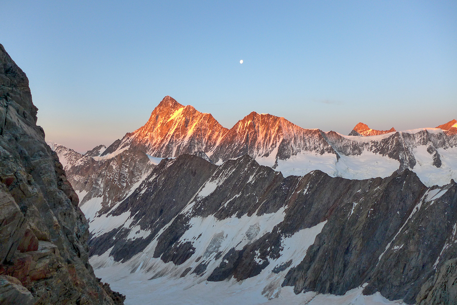
 After Les Droites the weather forecast for my final week in the Alps, with the exception of Monday, was supposed to be more settled, sunny and warm and it looked like the perfect opportunity to (finally) try and do the Täschhorn-Dom traverse which I’d been wanting to do for several years. Initially it seemed like a good idea to head up on the tuesday to the Mischabeljoch bivouac hut and do the traverse the following day, but after discovering the hut was fully booked for tuesday night we decided to scrap that plan. I wasn’t too sure about doing the traverse on thursday either since the forecast was showing cloudier weather so in the end I suggested to Graham that we go to the Jungfrau at the start of the week and try to do the Täschhorn-Dom traverse thursday/friday to make the most of the good weather. >>>
Lauteraarhorn
- Date:
- 17.06.2022
- Characteristic:
- Alpine climbing
- Duration:
- 18:00h
- Distance:
- 30.0km
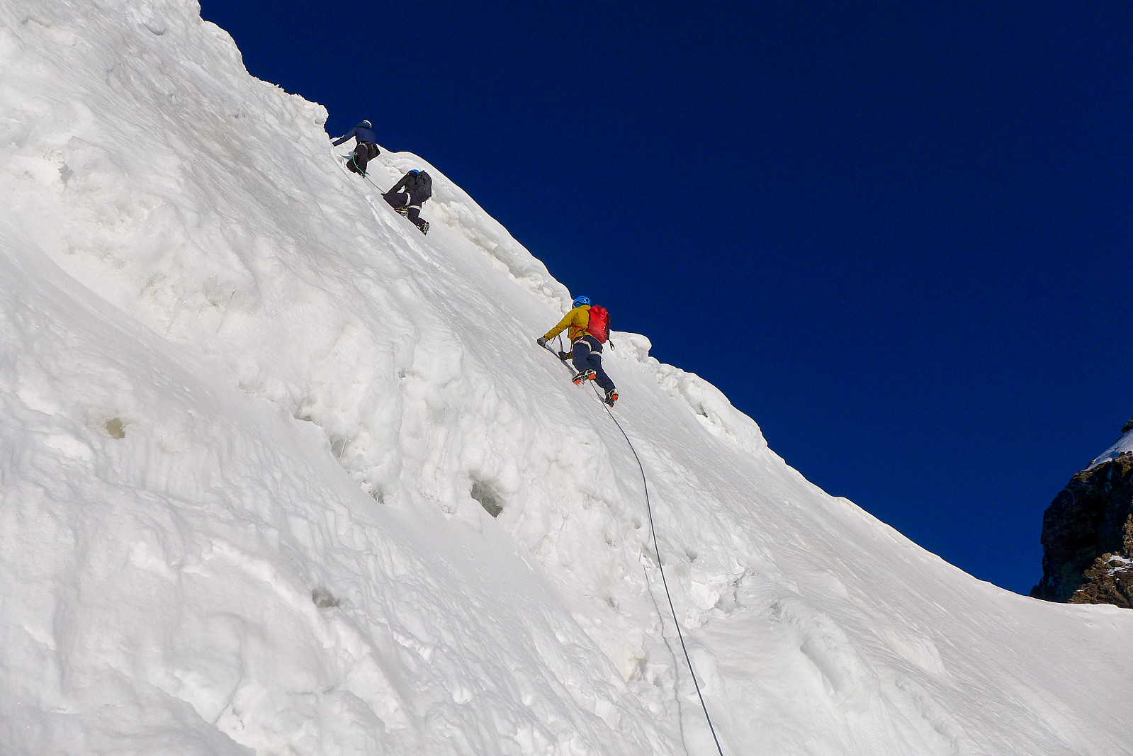
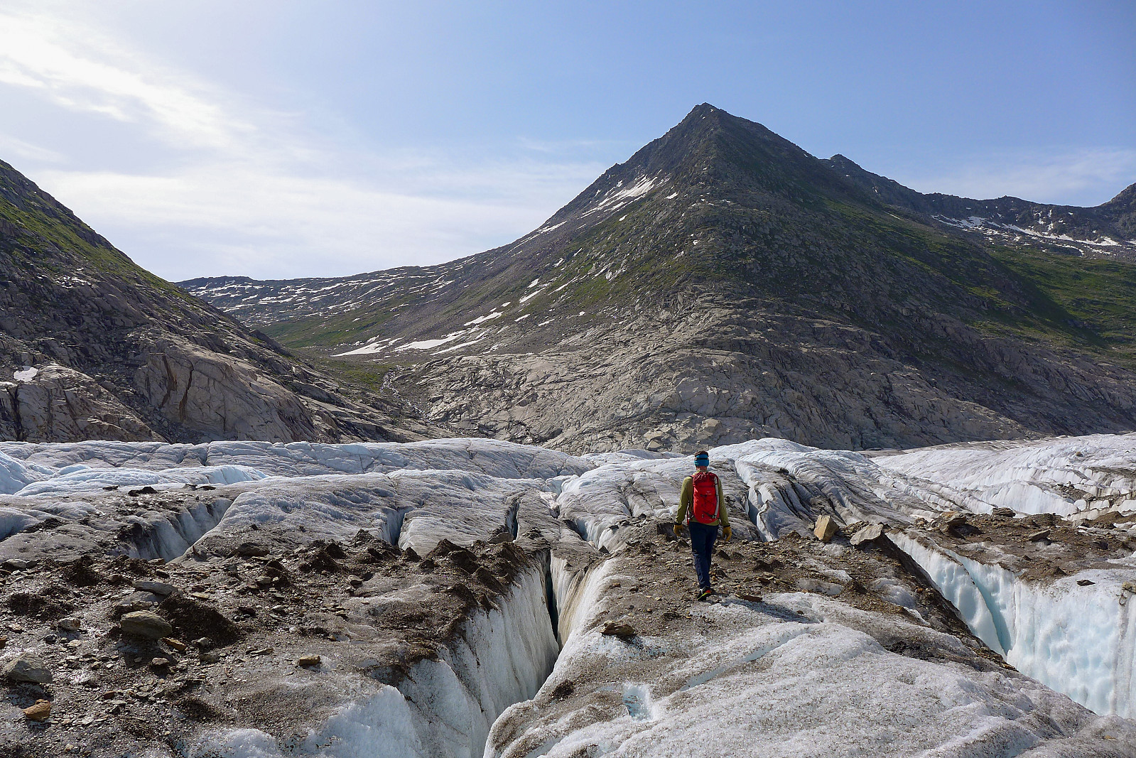
 The Lauteraarhorn has been sitting on my to-do list for the last few years, or basically ever since climbing the Schreckhorn but not continuing to do the traverse across to the Lauteraarhorn. Rather than going back from the Schreckhorn side, the other alternative was to approach it from the Grimsel Hospice to the east and ascend the Lauteraarhorn via its south face couloir and southeast ridge. However, with the length of the walk-in to this route being of the typical Oberland expedition type (i.e. LONG!) I’d sort of hoped that it might have ended up being an approach that I could do on skis. Of course the one year that I manage to get to the Alps with skis it turns out to be one of the driest winter/spring seasons ever, so there was basically too little snow to bother with a ski-in to the Aar bivouac >>>
Mönch
- Date:
- 18.05.2022
- Characteristic:
- Alpine climbing
- Duration:
- 9:05h
- Distance:
- 11.2km
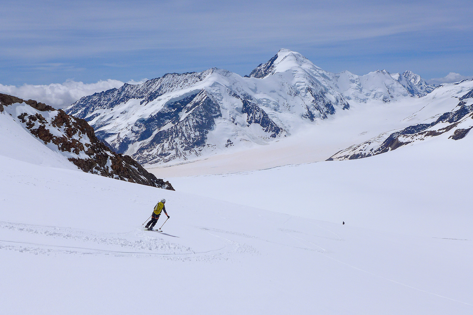
 The day following our trip up the Gross Fiescherhorn was forecasted to be the sunniest day of the whole week, but we had already booked beds at the Mönchjoch hut so after a good dinner of risotto (with double helpings) and salad at the Konkordia hut we settled on a plan to skin up toward the hut and make an ascent of the Mönch via its southeast ridge on our way there the next day. The ski up to the start of the southeast ridge of the Mönch via the Jungfraufirn was expected to take some 4-5 hours, so it would be a long approach compared to the more popular way of climbing the Mönch - which usually involves taking the train up to the Jungfraujoch from Grindelwald and then spending the night at the Mönchjoch hut (a 45 minute walk from the Jungfraujoch) and doing it the day after. As a result we took another >>>
Gross Fiescherhorn
- Date:
- 17.05.2022
- Characteristic:
- Randonnée/Telemark
- Duration:
- 10:31h
- Distance:
- 16.4km
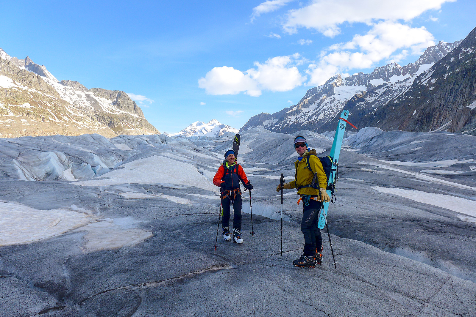
 Ever since last summer’s little foray into the Bernese Oberland, enjoying some superb days on the Gross Grünhorn & Grunegghorn and Finsteraarhorn , I had been very keen to go back and ascend some of the other 4000ers using skis for the approach and a plan was made with Graham (mountain guide I've climbed with previously) and Rachel to do this in May this year. I was in some doubts over whether there was much point in bringing skis at all after hearing how poor the winter in the Alps had been this year, but Graham assured me the week before that it would be definitely be worth bringing them. Fortunately for us too, the weather forecast didn’t look too bad at all and after some debating over whether to start from Grindelwald or Fiesch, we eventually opted for the shorter drive to Fiesch which was also much less expensive since we >>>
Finsteraarhorn
- Date:
- 11.07.2021
- Characteristic:
- Alpine trip
- Duration:
- 7:15h
- Distance:
- 10.5km
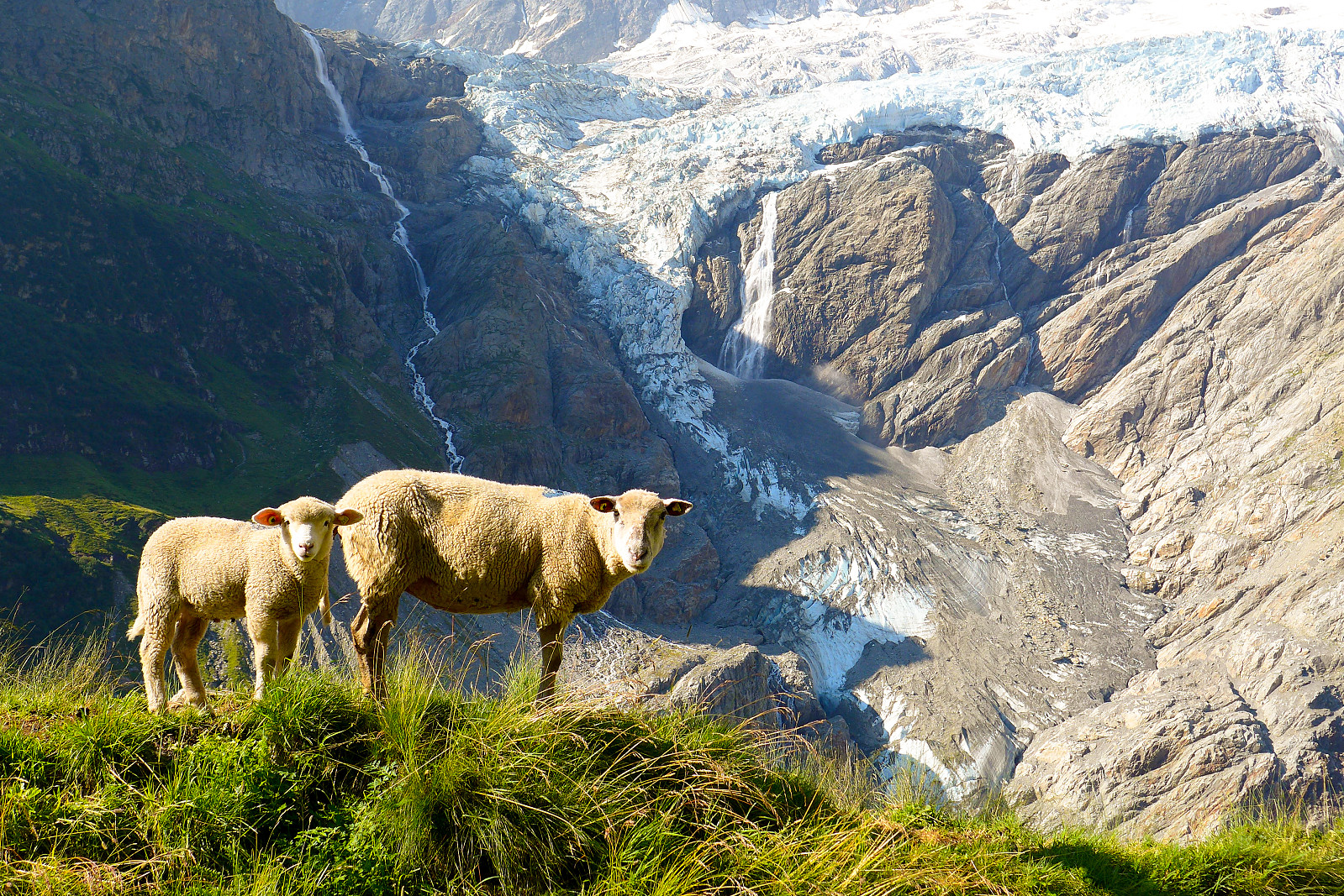
 After having been up the Gross Grünhorn & Grunegghorn and walking over to the Finsteraarhorn hut the previous day, the plan was to climb the Finsteraarhorn via the upper southeast ridge (also referred to as the Sudroute in Martin Moran’s guidebook) as it would hopefully provide a more interesting route to the summit compared with the standard route from the Finsteraarhorn hut via the southwest flank and northwest ridge. However, since the entire southeast ridge was still looking very snowy when we checked it out from the summit of the Gross Grunhorn, we ended up changing our plans to do the standard route instead. Moreover, it seemed like there were going to be very few teams doing the normal route anyway, so there wasn’t much chance of it being too busy. Meteoblue had forecasted some early morning fog so I was expecting >>>
Schreckhorn
- Date:
- 30.07.2020
- Characteristic:
- Alpine climbing
- Duration:
- 13:20h
- Distance:
- 13.5km
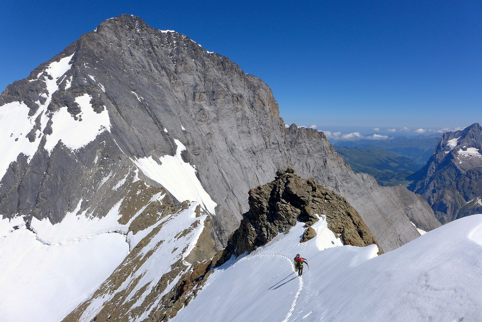
 Unlike quite a few of the 4000m peaks I’ve climbed in the Alps in the last few years, the Schreckhorn has not actually stood at the top of my priority list for many years. It was really only after having heard about how awesome (and long) the Schreckhorn-Lauteraarhorn traverse was, from one of Tim’s friends who’d guided it last year, that it began to spark a bit of interest in me. I remember it having caught my eye when I did the Eiger traverse which ascends the Mittellegi ridge and descends the South ridge, but from that angle I thought it looked a bit bold for my climbing abilitiy (or lack of). Turns out the easiest route up the southwest ridge is actually “only” an AD+ with fairly easy climbing, not above III+. And having checked out various route descriptions it did sound like really nice, >>>
Eiger traverse
- Date:
- 03.08.2015
- Characteristic:
- Alpine trip
- Duration:
- 9:00h
 After spending a night at the Cosmiques hut, Rocio and I discussed a few of our options in Chamonix. Rocio was keen to get some AD/D graded ridge climbs done and first on the list of possibilities was the Eiger since the heat wave in Europe this summer had now made the Mittellegi ridge in reasonable condition. I had of course done minimal research on the Eiger beforehand but I came here really to just do some decent climbing so if Rocio thought it was worth doing then I was more than happy to go along with it! It looked like Monday was going to be a decent weather day for summiting any peak so ideally we needed to be doing the walk in to a hut the next day. Unfortunately it seemed there were no beds available at the Mittellegi hut on Sunday night. So we needed a new plan. The south ridge on >>>

