Archive - Date
Archive - Activity
-
Climbing (43)
- Alpine climbing (31)
- Ice climbing (3)
- Mixed climbing (1)
- Sport climbing (3)
- Via ferrata (1)
-
Other trip (5)
- Expedition (5)
-
Other winter trip (5)
- Snowshoe trip (5)
-
Ski trip (441)
- Backcountry skiing (4)
- Cross-country skiing (2)
- Randonnée/Telemark (433)
-
Trip by foot (506)
- Alpine trip (47)
- Hike (195)
- Hillwalk (205)
- Jogging (4)
- Walk (55)
Peakbook-Friends


Damp day in Langdale
- Date:
- 07.12.2013
- Characteristic:
- Hillwalk
- Duration:
- 5:00h
- Distance:
- 9.5km
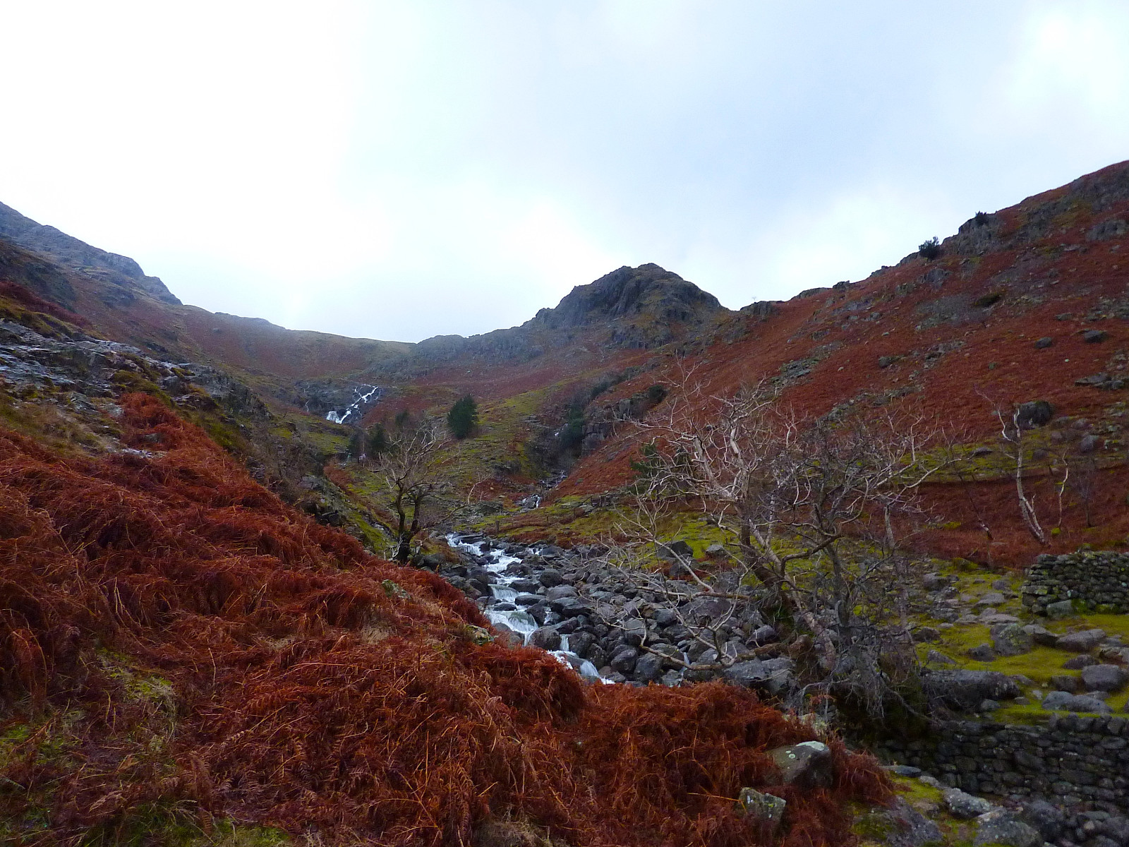 Var i Storbritannia noen dager i forbindelse med et møte, så brukte anledning for en tur med gamle venner. Dessverre var været like dårlig som var meldt og lørdagen ble jeg søkkvått til tross for at jeg hadde nylig impregnert jakken min. Antar at det på tide å kjøpe ny vanntett jakke nå ;-)
Vi begynte turen fra parkeringsplassen like ved Stickle Barn puben og gikk opp mot Blea Rigg istedenfor å bruke stien som går rett opp til Stickle Tarn. Deretter gikk vi videre i retning Easedale Tarn, spiste en liten lunsj der før vi fortsatte opp til Tarn Crag. Ikke god sikt i dag og det var vanskelig å kjenne området som jeg skulle vært ganske kjent med. Derfra var det bare å gå tilbake til Stickle Barn igjen ved å gå ned til Codale Tarn, krysse elva og gå opp på en god sti over >>>
Var i Storbritannia noen dager i forbindelse med et møte, så brukte anledning for en tur med gamle venner. Dessverre var været like dårlig som var meldt og lørdagen ble jeg søkkvått til tross for at jeg hadde nylig impregnert jakken min. Antar at det på tide å kjøpe ny vanntett jakke nå ;-)
Vi begynte turen fra parkeringsplassen like ved Stickle Barn puben og gikk opp mot Blea Rigg istedenfor å bruke stien som går rett opp til Stickle Tarn. Deretter gikk vi videre i retning Easedale Tarn, spiste en liten lunsj der før vi fortsatte opp til Tarn Crag. Ikke god sikt i dag og det var vanskelig å kjenne området som jeg skulle vært ganske kjent med. Derfra var det bare å gå tilbake til Stickle Barn igjen ved å gå ned til Codale Tarn, krysse elva og gå opp på en god sti over >>>
Helm Crag
- Date:
- 16.08.2013
- Characteristic:
- Walk
- Duration:
- 1:30h
- Distance:
- 7.0km
 Took a short walk up Helm Crag after our trip to Helvellyn earlier in the day. Parked up outside of Grasmere since there was little space along the road in the town. Went up fairly briskly in trainers. It was a little bit boring, except for the top 10m which involved a little scrambling. Cloudy but fortunately no rain until we were nearly back down again.
Langdale in winter
- Date:
- 28.11.2010
Yet more fine and settled weather brought the wonderful cold and crisp conditions for winter walking that we often dream of having, so after a late start I headed over to Langdale to set off amongst some of my most well-known fells. Snow underfoot was hard and in fact, perfect for crampons - so I pulled on the pair I'd brought with me and speedily made my way across Bowfell first, then on towards Esk Pike and Esh Hause. I met only one other group of hikers along the way, who were very friendly and chatted for a while with me but they were going in the opposite direction so sadly I didn't have their company for long! Anyway, after that I continued along the familiar route towards the top of Esk Pike, then down to the haus and Angle Tarn. At this point I was debating whether or not to take the >>>
Derwentwater to Langdale
- Date:
- 13.12.2009
After what had been a weekend of crisp and gorgeous weather, today was by comparison a bit disappointing and overcast. Nevertheless it meant that it was also a bit milder too and it wasn't raining at least! So from Derwentwater youth hostel I took the track up to Watendlath via Ashness Bridge, passing a couple of farms and bored-looking cows and sheep along the way, and when I got to Watendlath it was quite deserted. I guess that's winter in the Lakes. No tourists to demand tea shops should be open! Anyway, from there it was up onto High Tove, to gain the ridge above Watendlath, and a somewhat but not very boggy trudge across Long Moss and by the edge of Blea Tarn to access Standing Crag and Ullscarf. This is probably my least favourite fell; its a very tedious trudge up a very tedious and >>>
Langdale Pikes to Grasmere
- Date:
- 25.05.2009
A very steady and pleasant ascent of High Raise, apparently the most scenic viewpoint in the whole of Lakeland. The route took me up in warm sunshine from Landale youth hostel over the undulating plateau of Dow Bank-Lang How-Castle How up towards Sergeant Man, a nice little top shortly before the rather more dull shoulder that leads onto High Raise. Its not an interesting mountain itself to climb, but you do indeed get very good views all around; west towards Great Gable and Scafell and more closeby the drop down into the Langstrath valley, then north to Keswick, Skiddaw and Blencathra and the Drewent fells ot to the northwest. And east gets you the views of the Helvellyn ridge stretched out from Clough Head all the way down towards Fairfield and Rydal Fell near Ambleside. Great stuff. From >>>
Grasmere circuit
- Date:
- 09.02.2008
It was a misty start to the day, but we took a nice little route from the Grasmere youth hostel, up onto the low ridge above the Langdale valley, following Silver How all the way up to Sergeant Man. It was actually a rather pleasant day after we walked above the cloud line. Then we had uninterrupted sunshine and a beautiful blanket of cloud all below us while enjoying some late morning snacks at the top. From here we walked across High Raise and over Greenup Edge but descending down the Wythburn route by mistake. We eventually had to do a big job in locating something looking like a path, but not very successfully finding one! So it was very wet underfoot as a result and somewhat an adventure too, leaving us with only a very short time to spare before catching the bus to the train station for >>>

