Archiv - Nach Datum
Archiv - Nach Aktivität
-
Andere Tour (5)
- Expedition (5)
-
Andere Wintertour (5)
- Schneeschuhtour (5)
-
Fußtour (507)
- Bergtour (205)
- Hochtour (47)
- Jogging (4)
- Spaziergang (55)
- Wanderung (196)
-
Klettern (43)
- Alpinklettern (31)
- Eisklettern (3)
- Klettersteig (1)
- Mixed-Klettern (1)
- Sportklettern (3)
-
Skitour (449)
- Langlauf (2)
- Randonnée/Telemark (441)
- Tourenskilauf (4)
Peakbookfreunde


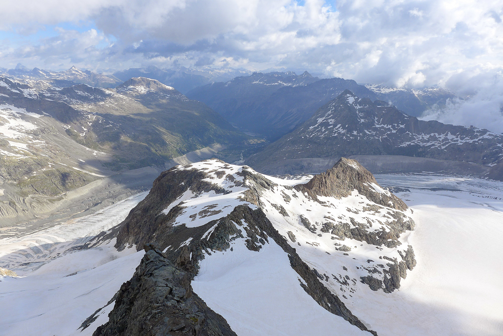
Gross Grünhorn & Grunegghorn
- Datum:
- 10.07.2021
- Tourcharakter:
- Hochtour
- Tourlänge:
- 11:07h
- Entfernung:
- 19,9km
 I haven’t spent much time exploring the Bernese Oberland previously, and the only two peaks I’ve climbed there before now – the Eiger and Schreckhorn sit more on the outskirts of the region rather than in the central part of the area. I’d always imagined my next visit to the Bernese Oberland would be on a pair of skis, having heard so much about how big the glaciers are and with rather large distances between the huts and 4000m peaks. Summer 2021 had other plans for me, with each sunny weather window being followed by a new big dump of snow in the mountains, which rendered a lot of steep snow routes avalanche-prone and the usually-dry ridges plastered in snow. However, a new weather window had appeared in the forecast and this time it looked like there might even be 3 full days of sunshine, which >>>
Bishorn East ridge
- Datum:
- 06.07.2021
- Tourcharakter:
- Hochtour
- Tourlänge:
- 10:03h
- Entfernung:
- 21,6km
 After having come back from Lyskamm, there looked like there might be a possibility of a new weather window on the tuesday the following week, but it wasn’t going to be a very long weather window, with more bad weather arriving already in the afternoon, ruling out any long and committing routes. After much pondering, checking of weather forecasts and consultations with Martin Moran’s 4000m guidebook I arrived at the conclusion that the East ridge of the Bishorn might be a suitable objective, since it would provide a more interesting line of ascent than the standard easy trudge up from the Tracuit hut, and the descent down the Turtmann glacier would be straightforward and quick(ish) though quite long. I ran the suggestion past Graham and we ended up settling on this as a plan and booked >>>
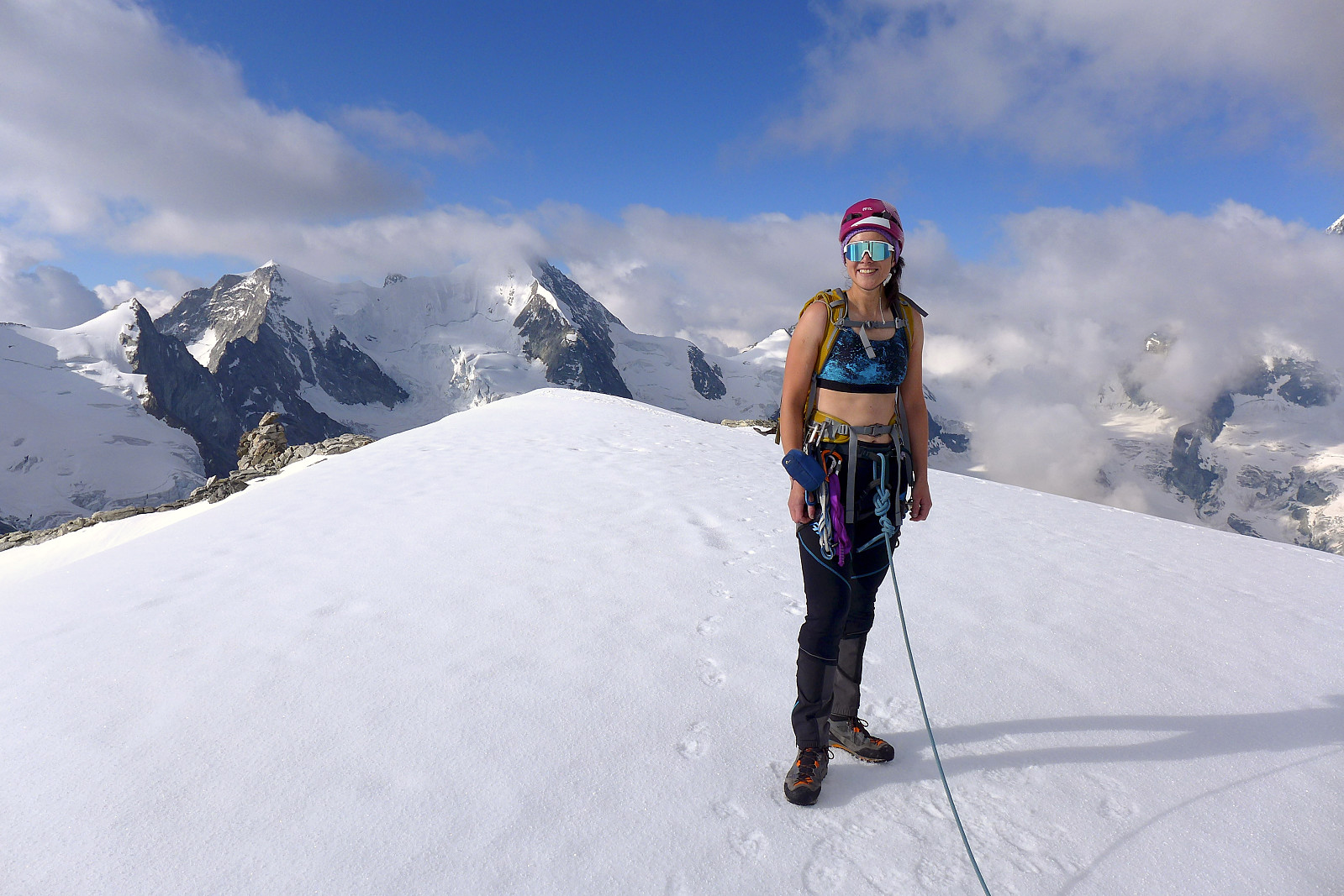
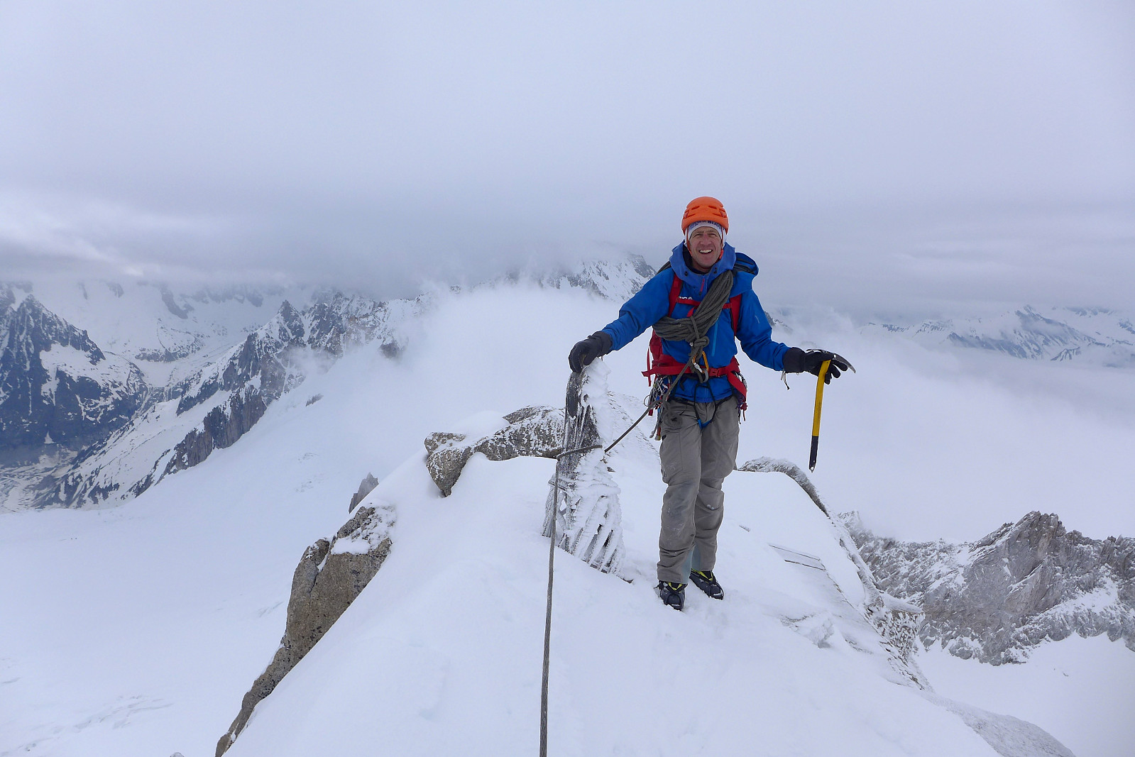
Lyskamm traverse
- Datum:
- 02.07.2021
- Tourcharakter:
- Hochtour
- Tourlänge:
- 11:28h
- Entfernung:
- 26,7km
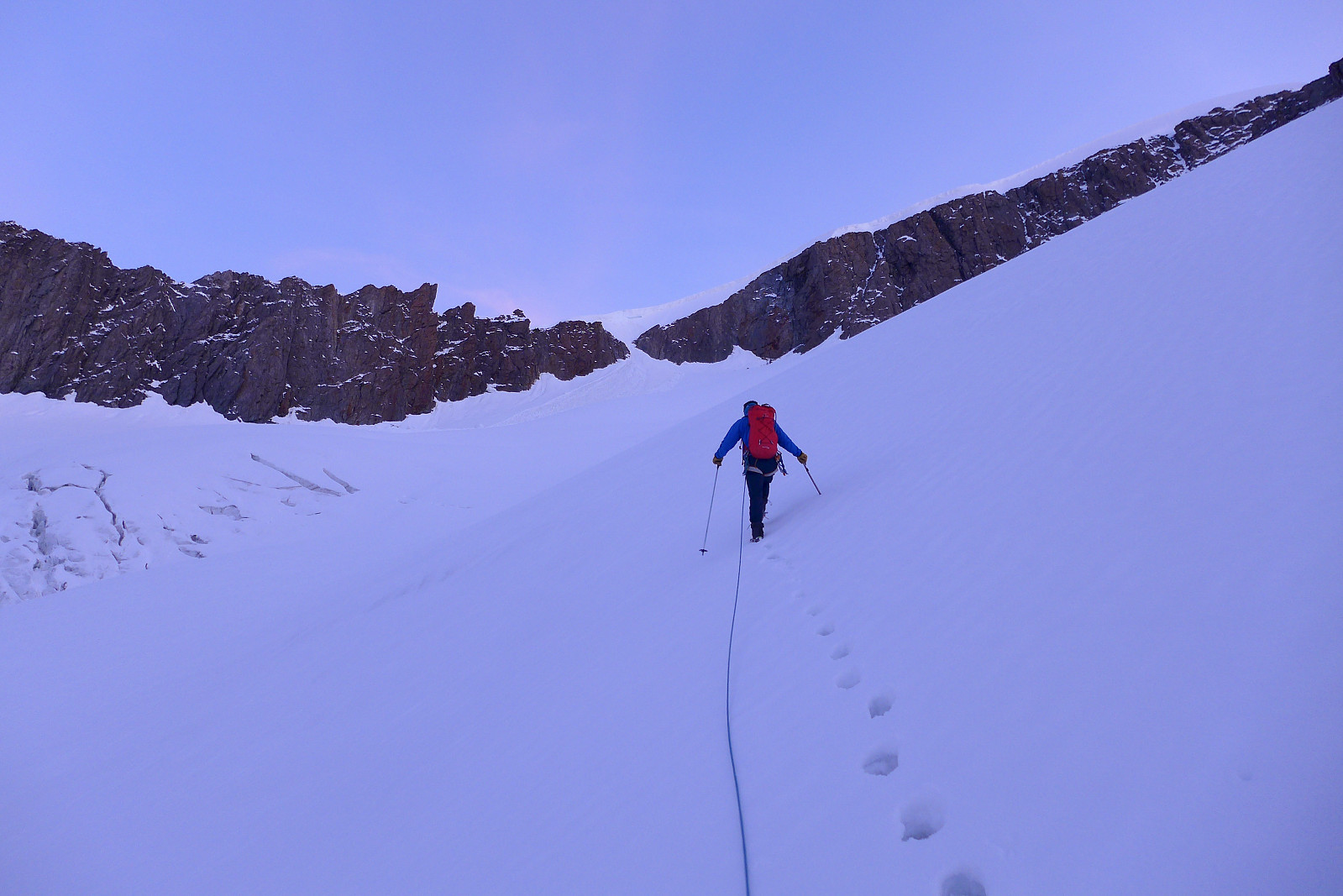
 I first came to know about the traverse of Lyskamm during a trip to the Alps in July 2003. The original itinerary for the week had been to climb Castor, Pollux, Lyskamm and the Dufourspitze via the Margherita hut and Zumsteinspitze. In the end the traverse of Lyskamm never happened because the guide I was then climbing with decided it was too windy that day, and we ended up ascending Il Naso (the Nose of Lyskamm) and Vincent Pyramid instead. In hindsight I don’t think I had sufficient alpine mountaineering experience to do the traverse, which is basically a 2km narrow and exposed snow ridge so it was perhaps just a well that we didn’t do it that day. However, since then it has been high on my wishlist of routes to do in the Alps but for some reason or another there has never been the right >>>
Castor
- Datum:
- 01.07.2021
- Tourcharakter:
- Hochtour
- Tourlänge:
- 4:07h
- Entfernung:
- 11,7km
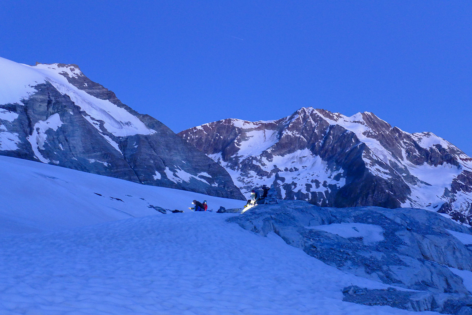
 Did a short ascent of Castor en route to the Quintino Sella hut, with the main plan being to traverse Lyskamm the next day. Didn't get fully fog-free views from the top, but still nice to re-visit this peak again after 18 years since my first time!
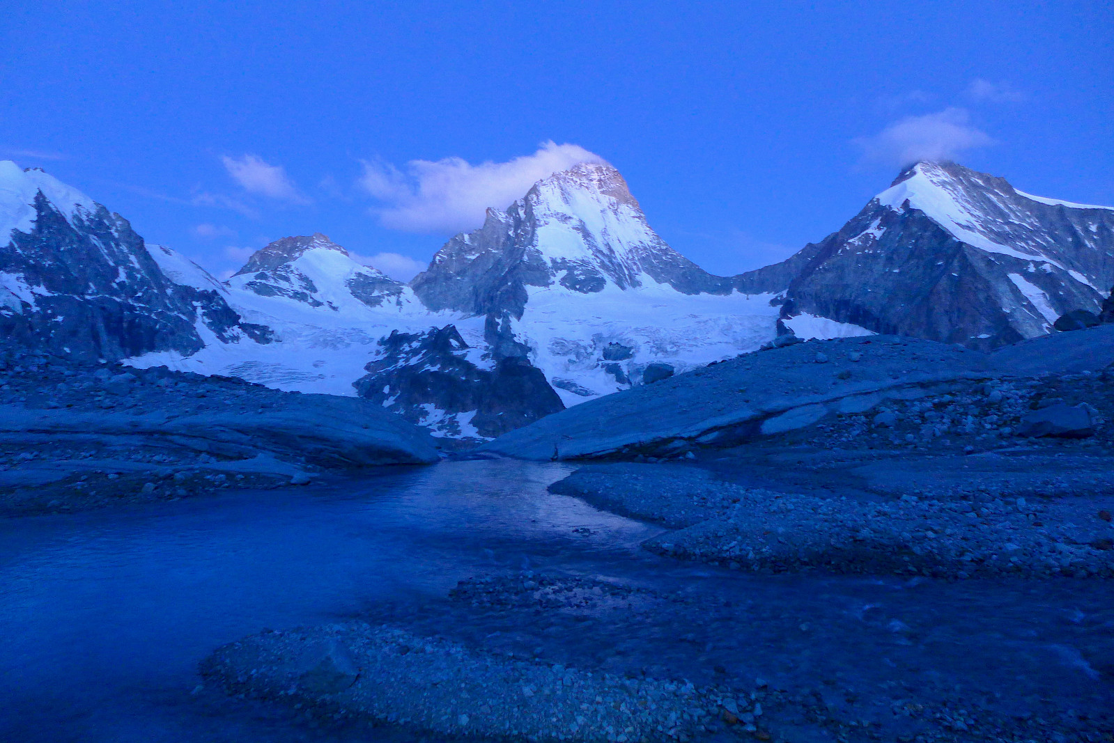
Piz Bernina - Biancograt
- Datum:
- 28.06.2021
- Tourcharakter:
- Hochtour
- Tourlänge:
- 8:10h
- Entfernung:
- 13,0km
 After a week spent in Zermatt doing various acclimatization hikes, I relocated to the Chemin des Etoiles, a chalet in Evolene which has been (and probably will continue to be!) my annual summer holiday base for the last five years. Anyway, it was great to be back in familiar surroundings again, though the chalet was pretty quiet this week with only 4 of us staying there. I’d been keeping an eye on the weather forecast for several 4000m-peaks I had on my wishlist for this summer, but it looked like the best weather would be further east in Switzerland for the start of this week. I’d not been up Piz Bernina, and the Biancograt was one of the routes I’d wanted to do for a number of years, so it seemed like a good option to start with. Did a quick check with Graham, the guide who I’d be >>>
Blanc de Moming
- Datum:
- 14.07.2020
- Tourcharakter:
- Hochtour
- Tourlänge:
- 5:32h
- Entfernung:
- 8,0km
 Blanc de Moming, another mid-3000er easily accessed from the Grand Mountet hut was decided to be the objective for our second day. Initially we had thought to have the Besso-Blanc de Moming traverse as an option, which I was more keen to do since it was more interesting, but since the weather forecast had changed a bit when we woke up, we decided to go conservative and choose the easier of the two in case we needed to make a rapid retreat. I’d had a better night’s sleep at least and we took breakfast a little later this morning, leaving the hut just before dawn. The southwest ridge of Blanc de Moming was to be our route up, and this was basically gained by following the same path up the moraine ridge behind the hut and following it up to the col we’d ended the Mammouth traverse at the >>>
Trifthorn
- Datum:
- 13.07.2020
- Tourcharakter:
- Hochtour
- Tourlänge:
- 5:17h
- Entfernung:
- 7,6km
 Summer holidays 2020 was supposed to have been spent first in Peru and then in the Alps, but since corona decided to put an end to the Peru plans, I was determined that it wouldn’t stop the yearly trip to the Alps. With the infection rates in Switzerland having dropped to pretty low levels by the end of June I decided I would travel down anyway even before the Norwegian government decided to allow travel to mainland Europe without having to quarantine on return. After having had to rebook flights several times it was a relief to actually make it into Geneva, though the journey itself was very nice. Empty airports and 25% full flights, arriving on average 15 minutes early at each airport I had to change at is not something to complain about! Initially I had planned to spend a week in the Saas >>>
Pollux
- Datum:
- 14.05.2019
- Tourcharakter:
- Hochtour
 After having a chilled out weekend in Chamonix after our trip up the Dufourspitze I’d decided to stay for an extra few days in the Alps to make the most of the sunny weather that had been forecasted for the coming week, though I’d missed the fact that there were strong winds up high of around 70-80kph as well. Anyway since Rob and Simon were off to make an attempt on Mont Blanc, I was going to meet up with guide Thor Husted who was originally from Taos in New Mexico but had been living and working in Chamonix for a good part of the past 2 decades. We had a brief chat about possible objectives - I was at first keen to do an ascent of the Dom though after having taken into consideration the forecasted winds for tuesday morning, this didn’t seem particularly likely. The choice was mainly >>>
Gastlosen traverse
- Datum:
- 12.08.2018
- Tourcharakter:
- Hochtour
- Tourlänge:
- 6:00h
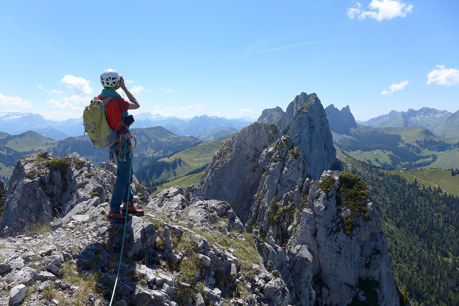 The start of the second week in the Alps started off sunny and warm again and initially the plan had been to drive over to Zermatt, climb Pollux and sleep at the Ayas hut, then do the Breithorn traverse the next morning if the weather was good enough. Unfortunately the weather forecast changed and now there was only going to be good weather on the Sunday, so it seemed a bit pointless to spend 100 Swiss francs on the Klein Matterhorn lift just for a day trip to Pollux. So the backup plan was to drive to the north side of the Rhone valley and do the Gastlosen traverse, which is an impressive row of jagged limestone peaks that seem to jump out of the green rolling hillside from nowhere. This week I was climbing with John, another British mountain guide and keen rock climber originally from Ireland >>>
La Tour Ronde
- Datum:
- 21.05.2018
- Tourcharakter:
- Hochtour
- Tourlänge:
- 5:00h
 De siste to dagene på tur i Alpene skulle opprinnelig blitt tilbrakt på en bestigning av Dom, det høyeste fjell som ligger helt i Sveits. Pga for mye snø under Domhytta ble planen byttet ut med en bestigning av Dufourspitze i stedet, men til slutt ble det Plan C siden værmeldinga for denne delen av Alpene var langt dårligere enn for Chamonixområdet. Så den nye planen var å sove i Chamonix, ta heisen opp til Helbronnerstasjonen på den italienske siden av Mont Blanc og så finne på noe i området rundt Torinohytta. Etter flere netter med søvnmangel gledet jeg meg til å sove lenge (endelig?) etter å ha kommet tilbake fra Saas Fee og forhåpentligvis føler meg i bedre form på siste turen. Rob hentet meg rundt kl.8 og vi kjørte til Courmayeur via Mont Blanc-tunnelen. Det tok ikke >>>

