Archiv - Nach Datum
Archiv - Nach Aktivität
-
Andere Tour (5)
- Expedition (5)
-
Andere Wintertour (5)
- Schneeschuhtour (5)
-
Fußtour (507)
- Bergtour (205)
- Hochtour (47)
- Jogging (4)
- Spaziergang (55)
- Wanderung (196)
-
Klettern (43)
- Alpinklettern (31)
- Eisklettern (3)
- Klettersteig (1)
- Mixed-Klettern (1)
- Sportklettern (3)
-
Skitour (449)
- Langlauf (2)
- Randonnée/Telemark (441)
- Tourenskilauf (4)
Peakbookfreunde


Vengsøytraversen i midnattsola
- Datum:
- 24.07.2023
- Tourcharakter:
- Wanderung
- Tourlänge:
- 7:00h
- Entfernung:
- 12,2km
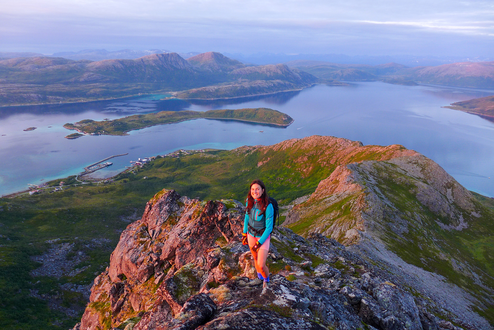 Det hadde vært 10 år siden sist jeg gikk Vengsøytraversen i midnattsola for første gang og jeg fikk veldig lyst til å gå den igjen nå som sommerværet i Nord Norge var på sitt beste siden omtrent 2014 (??!). Agathe, som jeg hadde blitt kjent med i vår, var også gira på å være med så vi avtalte å treffes etter jobb på en helt vanlig mandag for å rekke ferga fra Belvika kl17.10. Vi fant ut at det var gratis å ta bilen på ferga, så vi bestemte oss for å utnytte muligheten til å ta med telt og andre luksus ting selv om vi ikke skulle ligge i telt veldig lenge. Parkerte bilen ved grendehuset og tuslet vestover langs veien til vi kom til starten av stien som ligger på østsiden av Storelva. Etter en veldig tørr og varm sommer var bakken blitt helt knustørr, inkludert myrpartiet >>>
Aiguille Blanche de Peuterey
- Datum:
- 07.07.2023
- Tourcharakter:
- Alpinklettern
- Tourlänge:
- 12:33h
- Entfernung:
- 12,0km
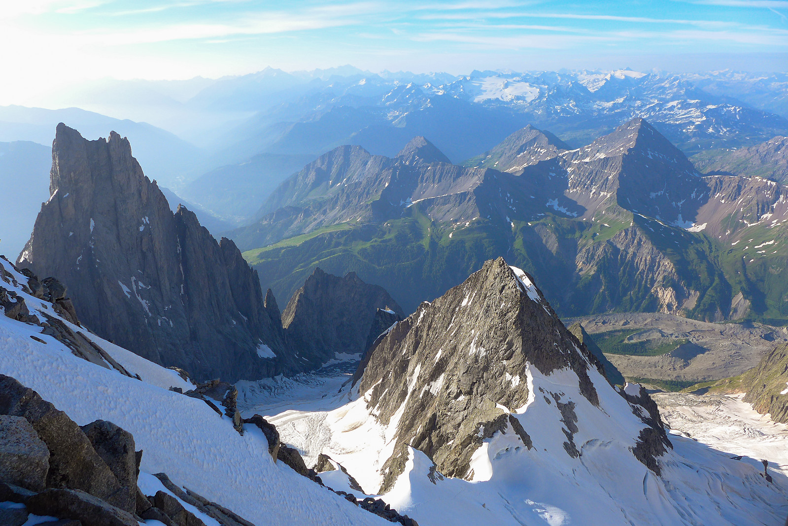 The Aiguille Blanche de Peuterey. I remember first hearing about this peak, which is located on the italian side of Mont Blanc, around 5 years ago when Tim was telling me about the time he’d guided it with one of his colleagues. It sounded like a proper adventure just to get to it and an overall cool outing with its reputation as being one of the trickier 4000ers. As things turned out, it was also the last 4000er I had to do, so it seemed quite fitting to have saved the best until last ;-) Up until this point it felt like I’d been quite fortunate with the weather and really great snow conditions this year, and the remainder of my final holiday week looked like it would give us good enough weather for an attempt at the Aiguille Blanche. After descending the Dom we had an easy tuesday and drove >>>
Dom
- Datum:
- 03.07.2023
- Tourcharakter:
- Hochtour
- Tourlänge:
- 13:38h
- Entfernung:
- 16,1km
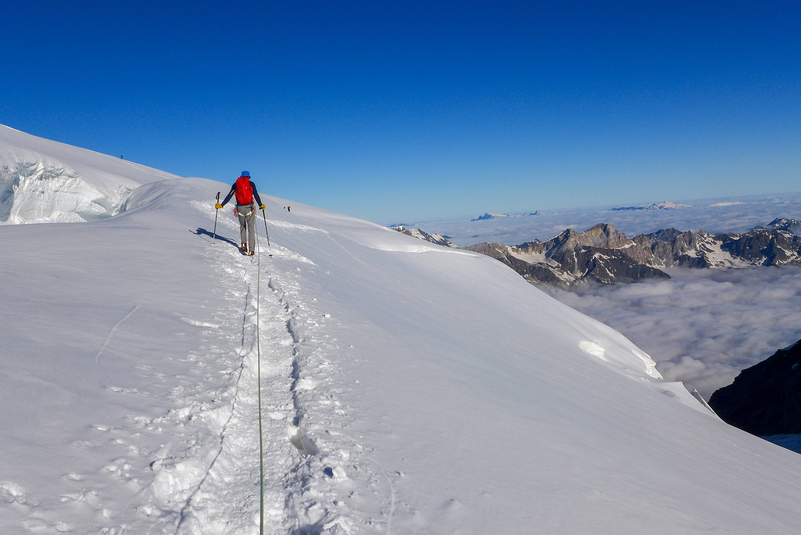 Following a couple of days of bad weather, it looked like we would be getting a couple of days of good weather again for the final week of the holiday. As I now only had two more summits to go to complete the 50 principal 4000m peaks of the Alps it was basically a toss up between the Dom and the Aiguille Blanche de Peuterey. I’d been following the weather forecast for the respective peaks rather closely and had come to the conclusion that the weather would be better further east at the start of the this final week, with apparently more sun and less wind forecasted for the Dom than on for example the Tour Ronde, which was the closest peak I could find to the Aiguille Blanche de Peuterey in the meteoblue database. I’d earlier hoped that the Taschhorn-Dom traverse would be a possibility this >>>

