Arkiv - dato
Arkiv - aktivitet
-
Annen tur (5)
- Ekspedisjon (5)
-
Annen vintertur (5)
- Trugetur (5)
- Fottur (506)
-
Klatring (43)
- Alpin klatring (31)
- Isklatring (3)
- Miksklatring (1)
- Sportsklatring (3)
- Via ferrata (1)
-
Skitur (441)
- Fjellskitur (4)
- Langrennstur (2)
- Randonnée/Telemark (433)
"Peakbookvenner"


Ferieavslutning
- Dato:
- 26.07.2019
- Turtype:
- Spasertur
- Turlengde:
- 2:37t
- Distanse:
- 9,7km
 Restitusjonstur etter 2 uker med 4000m topper. Altfor varmt vær!
Weisshorn
- Dato:
- 25.07.2019
- Turtype:
- Alpin klatring
- Turlengde:
- 9:54t
- Distanse:
- 8,2km
 The Weisshorn has been on my list of peaks I’ve wanted to climb for a while, mainly because it’s big, requires a bit of effort to reach and beautiful. It stands out from its neighbouring peaks and is hard to miss from any angle. And to quote the late Martin Moran in his 4000m peaks guidebook, “The lofty pyramid of the Weisshorn is considered to be the finest of all the Alpine peaks by many connoisseurs who disdain the public glories of the Matterhorn and who ignore the greater quality and variety of climbs on Mont Blanc”. I guess this is not too bad a description of my attitude… Anyway, with a reputation such as this it would be hard to not want to climb it at some point :)
Due to the weather forecast for Friday having been changed to somewhat less stable weather, it seemed like the >>>
The Weisshorn has been on my list of peaks I’ve wanted to climb for a while, mainly because it’s big, requires a bit of effort to reach and beautiful. It stands out from its neighbouring peaks and is hard to miss from any angle. And to quote the late Martin Moran in his 4000m peaks guidebook, “The lofty pyramid of the Weisshorn is considered to be the finest of all the Alpine peaks by many connoisseurs who disdain the public glories of the Matterhorn and who ignore the greater quality and variety of climbs on Mont Blanc”. I guess this is not too bad a description of my attitude… Anyway, with a reputation such as this it would be hard to not want to climb it at some point :)
Due to the weather forecast for Friday having been changed to somewhat less stable weather, it seemed like the >>>
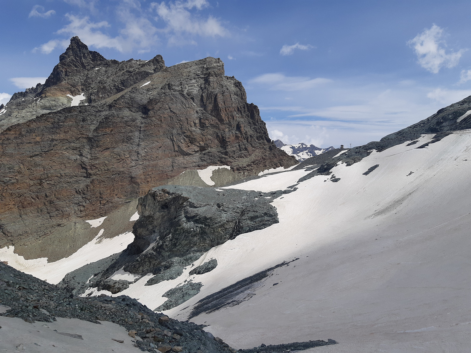
Lenzspitze - Nadelhorn traverse
- Dato:
- 23.07.2019
- Turtype:
- Alpin klatring
- Turlengde:
- 8:00t
- Distanse:
- 5,8km
 With a pretty good looking weather forecast for the week after we’d come down from the Dent d’Herens there didn’t seem to be any reason to stop ticking off some good quality 4000m peak ridge traverses. So after having taking a rest day in Evolene the next plan on my «wishlist» was to climb the east-northeast ridge of the Lenzspitze and continue the traverse to the Nadelhorn, returning down its easy northeast ridge. Tim had done the northeast face of the Lenzspitze before and the traverse to the Nadelhorn but not the east-northeast ridge so he was psyched for giving it a go (generally he’s psyched for most things regardless of whether he’s done it before or not though)! We left Evolene again relatively early for the drive over to Saas Fee and parked up just outside the town. The >>>
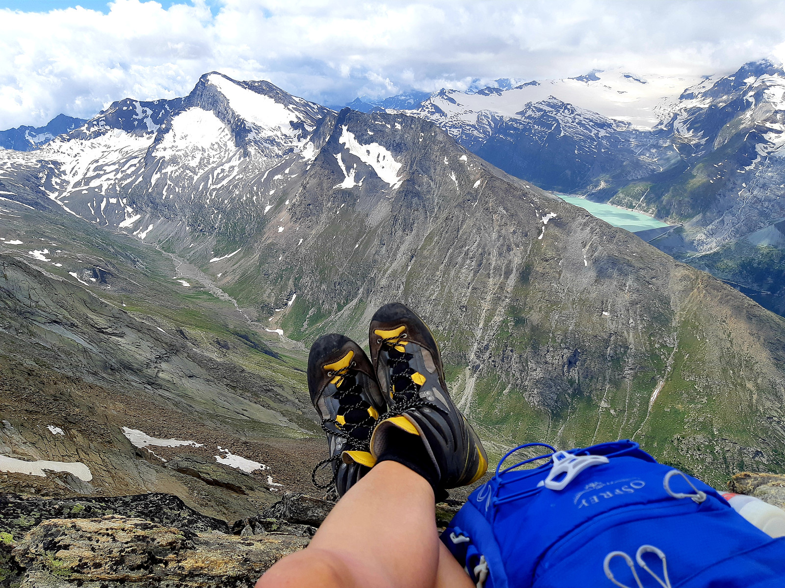
Dent d'Hérens
- Dato:
- 20.07.2019
- Turtype:
- Alpin klatring
- Turlengde:
- 8:35t
- Distanse:
- 21,0km
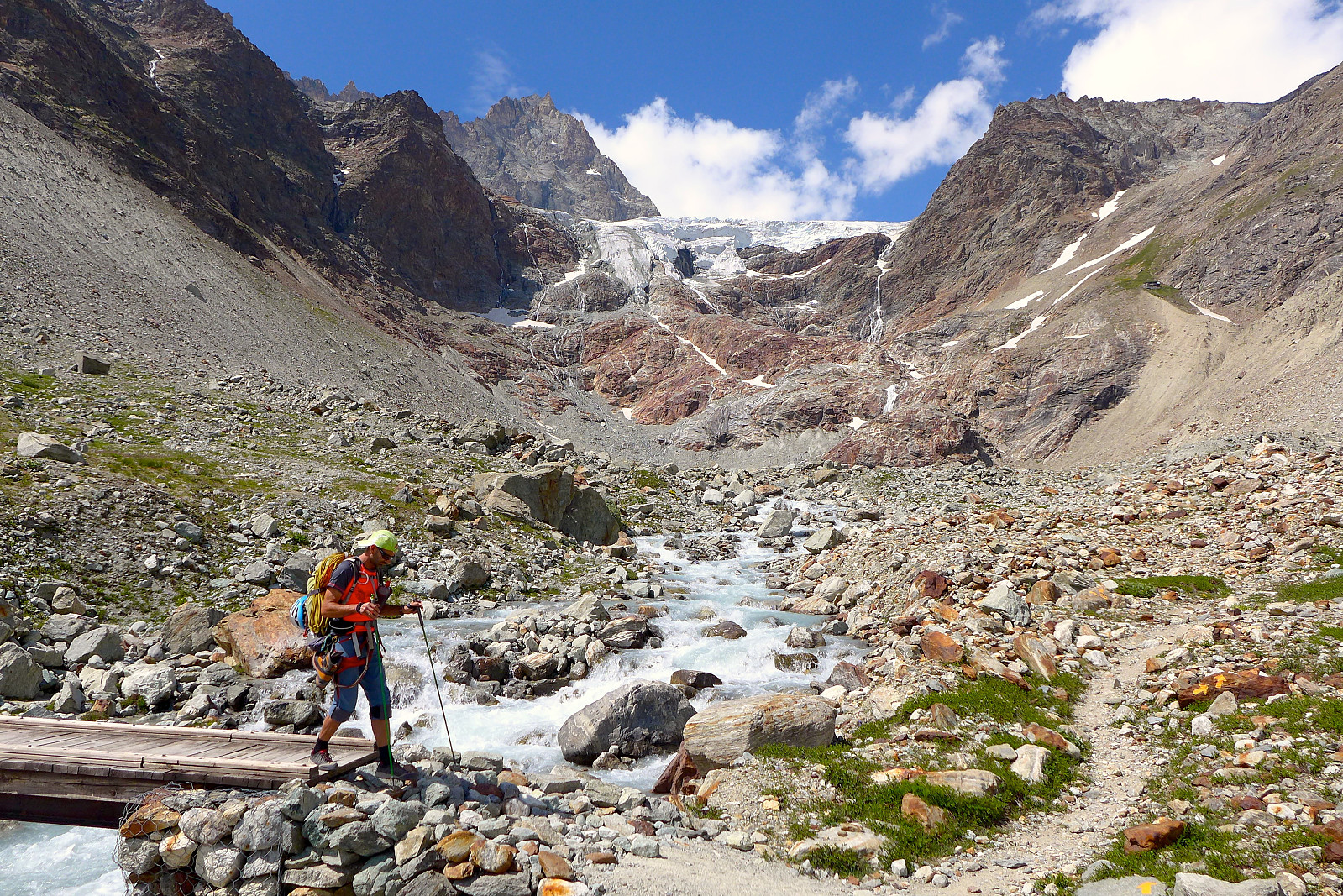 After returning to Courmayeur from the Torino hut the plan was to stay somewhere in Italy for the night so we could head straight to the Dent d’Herens the following day. We’d initially planned to book some beds at the Prarayer refuge which is about 1 hour along the walk in to the Aosta refuge, but we instead opted to go all the way back to Evolene since most people were away at huts so the chalet would be empty and quiet!! It turned out to be a good choice, at least for me since I woke up the next day feeling very well rested and ready for the 3-hour drive back into Italy and up to the Lago di Place Moulin where the long walk in began. It was another warm and sunny day, in contrast to the clouds that meteoblue had forecasted, so I was somewhat dreading having to do a long walk up to the >>>
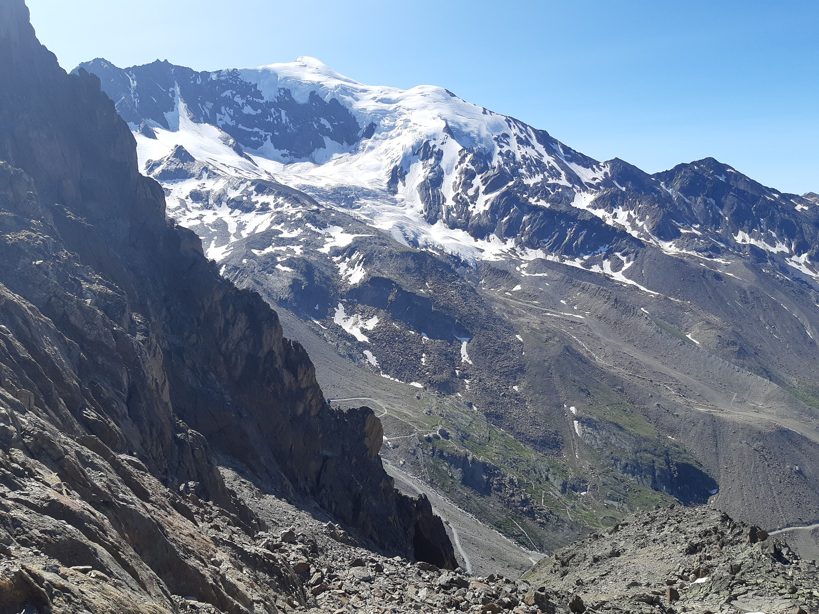
Dôme & Aiguille de Rochefort
- Dato:
- 18.07.2019
- Turtype:
- Alpin klatring
- Turlengde:
- 10:05t
- Distanse:
- 8,6km
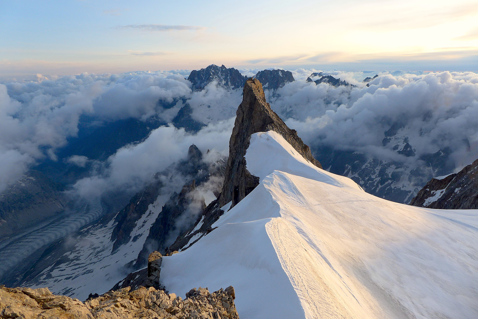 After coming back to Evolene from Saas Almagell there was a bit of a swap with guides so for the remainder of the 10 days I was going to be climbing again with Tim Neill whom I’d had a great week with in 2018. First on the plan was to make a new attempt to do the Rochefort traverse over Aiguilles de Rochefort and Dome de Rochefort – and fortunately there were beds available at the Torino hut for the following night when we wanted to get up there. The drive from Evolene to Courmayeaur took a couple of hours via the Grand St. Bernard pass and driving around through Aosta and finally northward to Courmayeur where we did a quick shopping trip at a local supermarket. Having gotten used to grocery shopping at Norwegian and Swiss prices, Italy seemed super cheap!
We then hopped onto the Skyway >>>
After coming back to Evolene from Saas Almagell there was a bit of a swap with guides so for the remainder of the 10 days I was going to be climbing again with Tim Neill whom I’d had a great week with in 2018. First on the plan was to make a new attempt to do the Rochefort traverse over Aiguilles de Rochefort and Dome de Rochefort – and fortunately there were beds available at the Torino hut for the following night when we wanted to get up there. The drive from Evolene to Courmayeaur took a couple of hours via the Grand St. Bernard pass and driving around through Aosta and finally northward to Courmayeur where we did a quick shopping trip at a local supermarket. Having gotten used to grocery shopping at Norwegian and Swiss prices, Italy seemed super cheap!
We then hopped onto the Skyway >>>
Weissmies
- Dato:
- 16.07.2019
- Turtype:
- Alpin klatring
- Turlengde:
- 6:00t
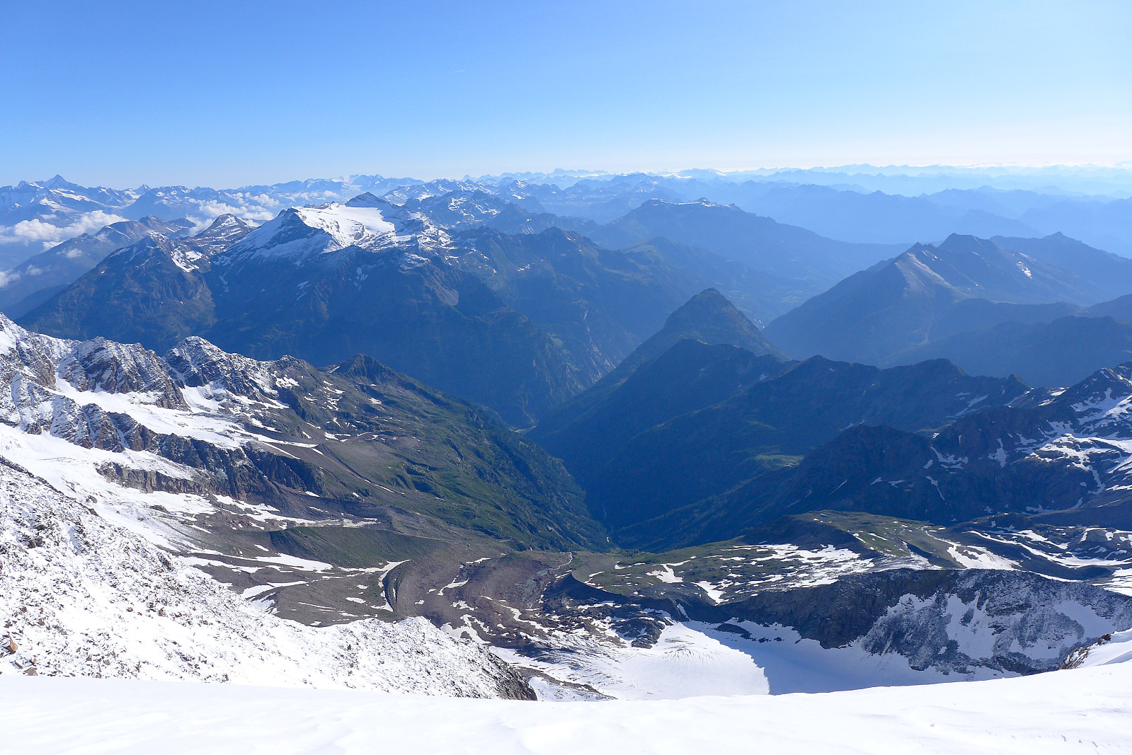 Back in the Alps again for my 10th summer visit, and like the previous 3 years with a base again in Evolene. I felt semi-acclimatised after having spent a few days hiking up to 3200m in the Saas valley the week before and since I’d arranged to have 1:1 guiding this year I was keen to tick off a few more of the 4000m peaks. For the first trip I was climbing with guide Graham Frost who I’d done the Dent Blanche with back in 2016 and initially I’d suggested heading over to the Torino hut to start with the Rochefort Arete since both the Aiguille de Rochefort and Dome de Rochefort were relatively low 4000ers and easy to access. However, since the Torino hut was fully booked and it had dumped it down with new snow on the first night we ended up joining guides Tim and Jon who were working for >>>
Almagellerhorn
- Dato:
- 12.07.2019
- Turtype:
- Fottur
- Turlengde:
- 3:40t
- Distanse:
- 7,0km
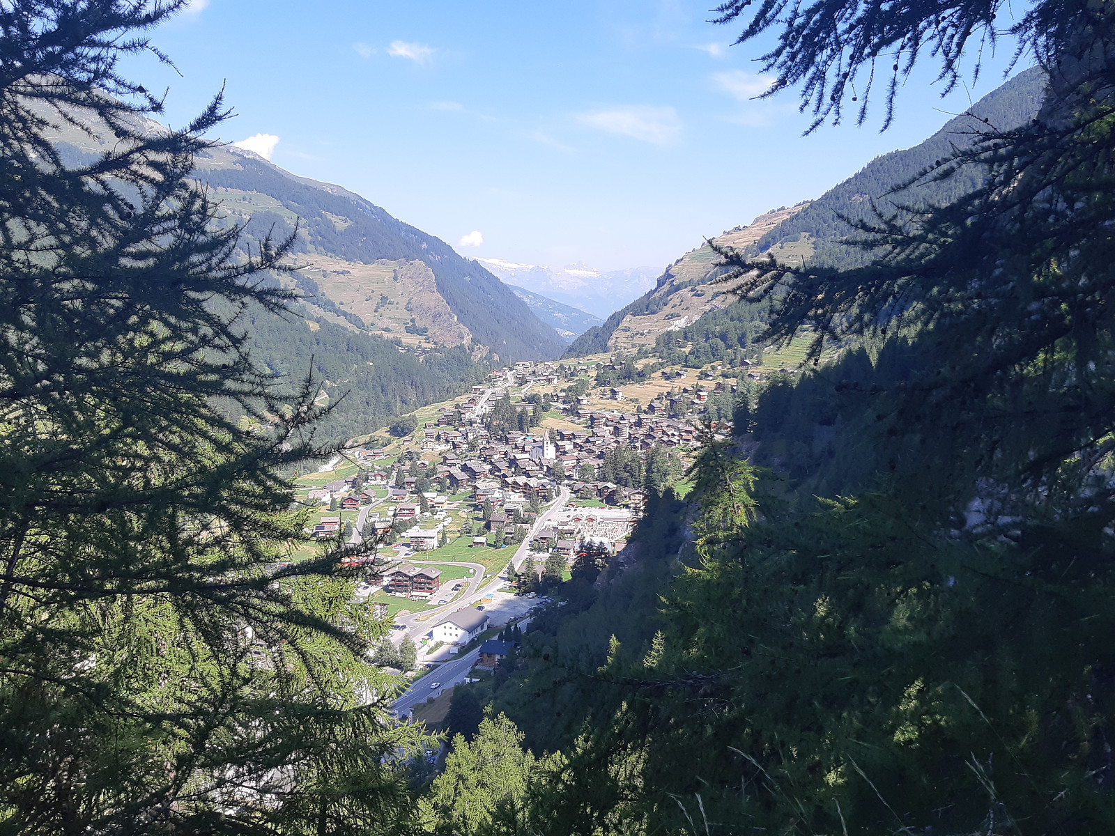
 Fortsetter med temaet "hornbestigning i Saas-dalen" og bestemte meg for en tur til Almagellerhorn i dag. Gjorde litt research på nett på forhånd og fant ut at det finnes en lett via ferrata ca halvveis opp. Var litt usikker på om jeg skulle trenge noe utstyr men pakket sele og noen slynger og karabiner i tilfelle jeg syntes det så litt krevende ut og ville være sikret til noe. Fint vær igjen i dag og noe småkjølig i dalen da jeg tok bussen til Saas Almagell, men sola varmet godt etterhvert. Gikk opp til heisen "Heidbodme" for å jukse litt og spare ca.500hm i motbakke og fikk begynne turen fra 2400moh. Fulgte en fin og slak sti som går frem og tilbake opp fjellet i typisk Sveitsisk stil, så det var en rolig start på turen. Stien deler seg etter noen hundre hm >>>
Mittaghorn
- Dato:
- 11.07.2019
- Turtype:
- Fottur
- Turlengde:
- 4:05t
- Distanse:
- 11,3km
 Ny dag og en ny horn som måtte bestiges. Denne gangen tok jeg heisen opp til Felskinn og fulgte stien et lite stykke mot Britanniahytte, før den delte seg og jeg gikk nedover mot østsiden av Egginer og Mittaghorn. Det var bra med skilting, som det alltid er når man går i fjellet i Sveits og det tok ca en time for å komme ned til starten av stien som går bratt opp østflanken av Mittaghorn. Derfra er det kun 1,3km og 520hm opp til toppen og det var ganske grei utsikt hele veien, men ikke noe fantastisk. Tok en 15 minutters pause her før jeg gikk tilbake samme vei, først ned til 2600moh og så opp ca.3000moh igjen. Fin og rolig tur og ganske behagelig temperatur da det var noe mer skyet i dag.
Jegihorn
- Dato:
- 10.07.2019
- Turtype:
- Fottur
- Turlengde:
- 2:31t
- Distanse:
- 5,6km
 Første dag på tur i Saas-dalen og det var en nydelig varm dag. Fikk utnyttet min "Citizens Pass" som gjør at man får bruke de fleste heiser gratis når man bor på en av de overnattingsstedene i Saas Grund/Saas Fee. Tok heisen opp til Kreuzboden og fulgte blå/hvit merking opp mot Jegihorn. På ca. 2700moh deler stien seg slik at den høyre stien går opp mot via ferrataen og den venstre fører man opp mot klatreveggen og stien som går rundt. Gikk i rolig tempo og tok flere små pauser underveis for å ta bilder, men det var litt under 1,5t opp alikevel. Flott utsikt mot mange av de 4000m toppene på andre siden av dalen bl.a. Strahlhorn, Allalinhorn, Alphubel, Taschhorn, Dom, Lenzspitze, Nadelhorn….. og så Lagginhorn og Weissmies som var i nærheten. Fin og kort morgentur >>>
Buren
- Dato:
- 08.07.2019
- Turtype:
- Fjelltur
- Turlengde:
- 2:12t
- Distanse:
- 7,2km
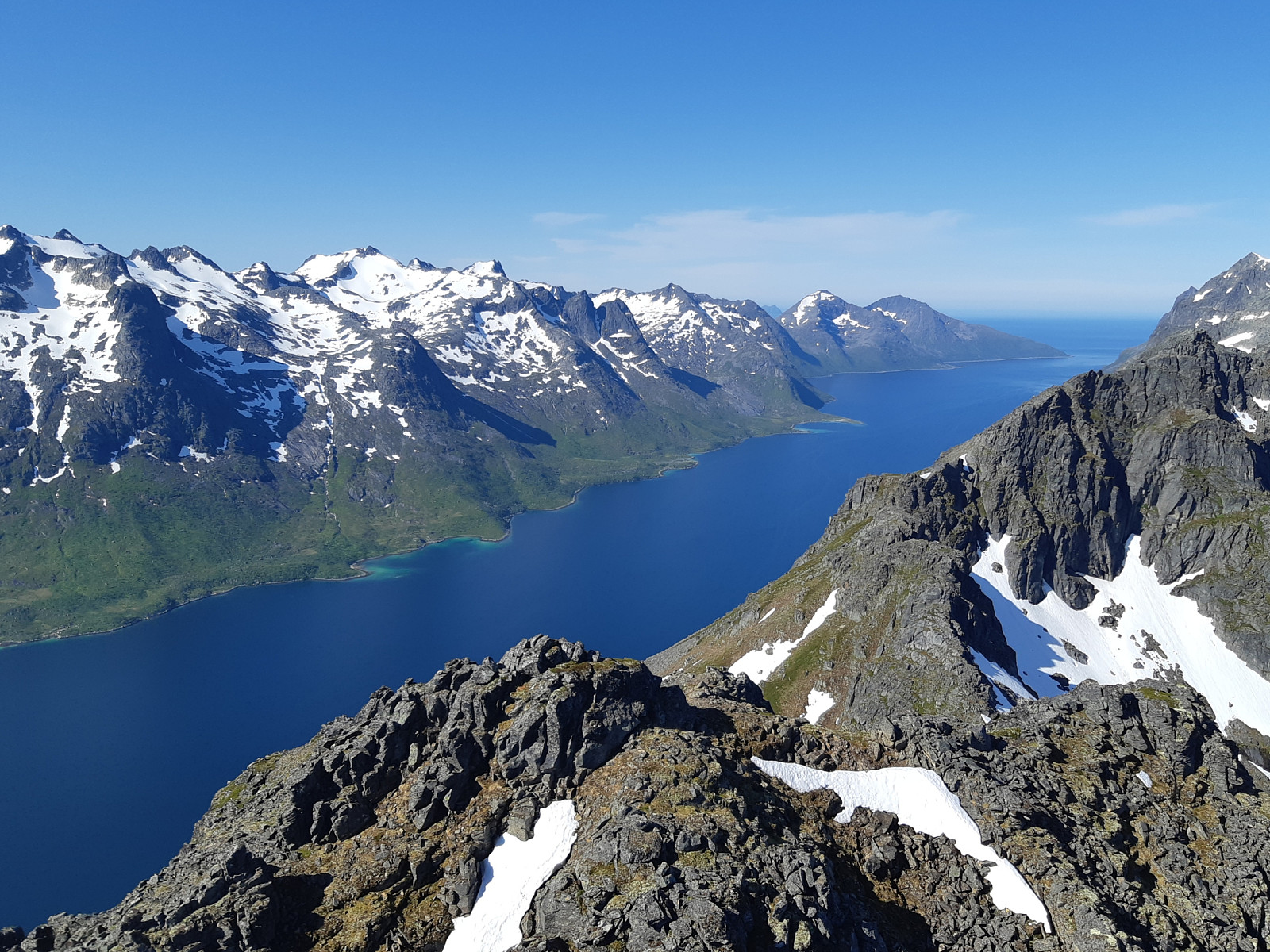 Gikk en liten morgentur før flyreise på ettermiddagen. Nydelig start på dagen :)

