Archiv - Nach Datum
Archiv - Nach Aktivität
-
Andere Tour (5)
- Expedition (5)
-
Andere Wintertour (5)
- Schneeschuhtour (5)
-
Fußtour (507)
- Bergtour (205)
- Hochtour (47)
- Jogging (4)
- Spaziergang (55)
- Wanderung (196)
-
Klettern (43)
- Alpinklettern (31)
- Eisklettern (3)
- Klettersteig (1)
- Mixed-Klettern (1)
- Sportklettern (3)
-
Skitour (449)
- Langlauf (2)
- Randonnée/Telemark (441)
- Tourenskilauf (4)
Peakbookfreunde


Segla
- Datum:
- 17.06.2012
- Tourcharakter:
- Bergtour
- Tourlänge:
- 3:00h
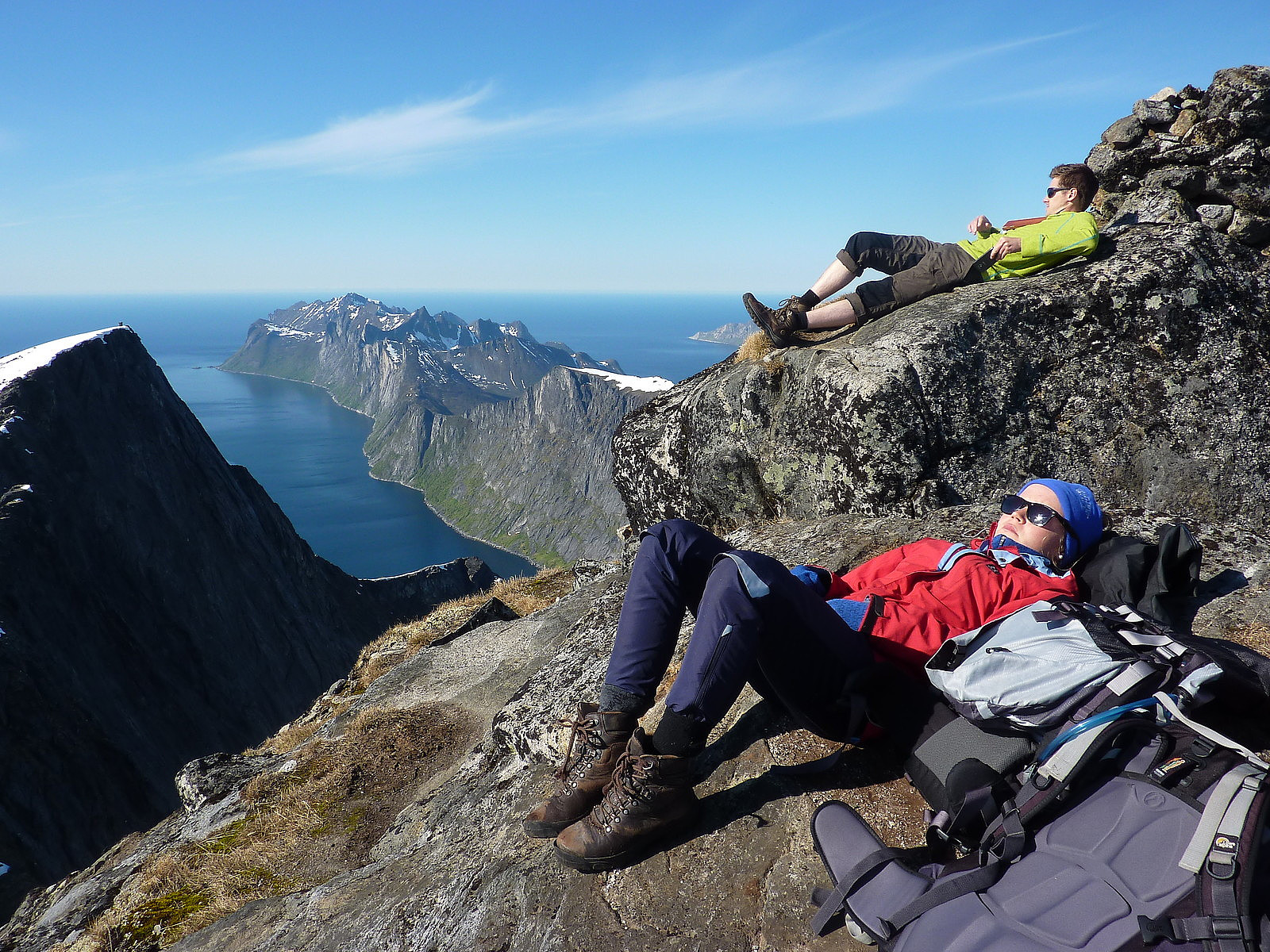
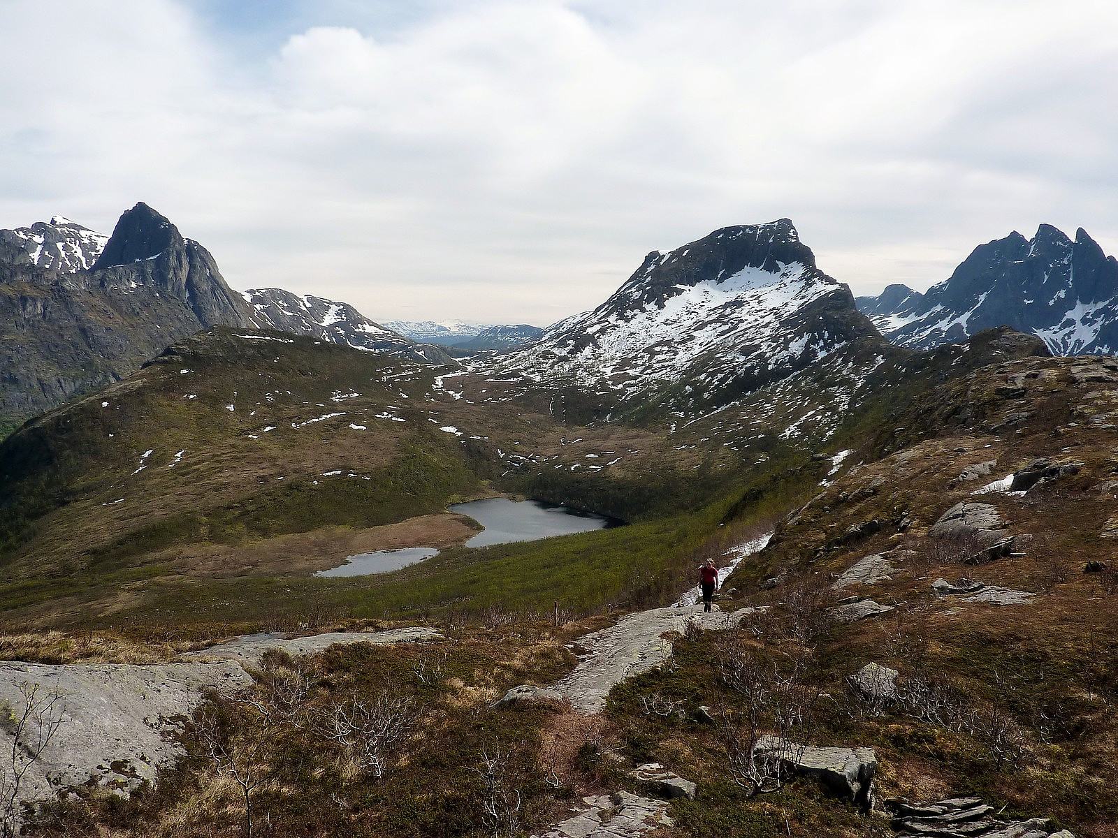 Segla is a beautifully-crafted peak along the east side of Mefjord. Its all in the name. You can't help but be mesmerized by its distinctive shape when seen from one of the other nearby mountains. For me, my first encounter with this stunner was on Breidtinden on the day before we went on the hike up Segla. So anyway, this was going to be our Sunday afternoon stroll in the mountains on the second day of the very excellent weekend trip to Senja with the fjellsportgruppa i Troms. It all started with a very laid back start, pulling back the zipper on the tent door and being greeted to the most wonderful sight of the beach at Ersfjord. It was all a bit too good to be true, and my spirits were only marginally dampened by the fact I had to drink instant coffee on this morning because I didn't have >>>
Breidtind
- Datum:
- 16.06.2012
- Tourcharakter:
- Wanderung
- Tourlänge:
- 6:00h
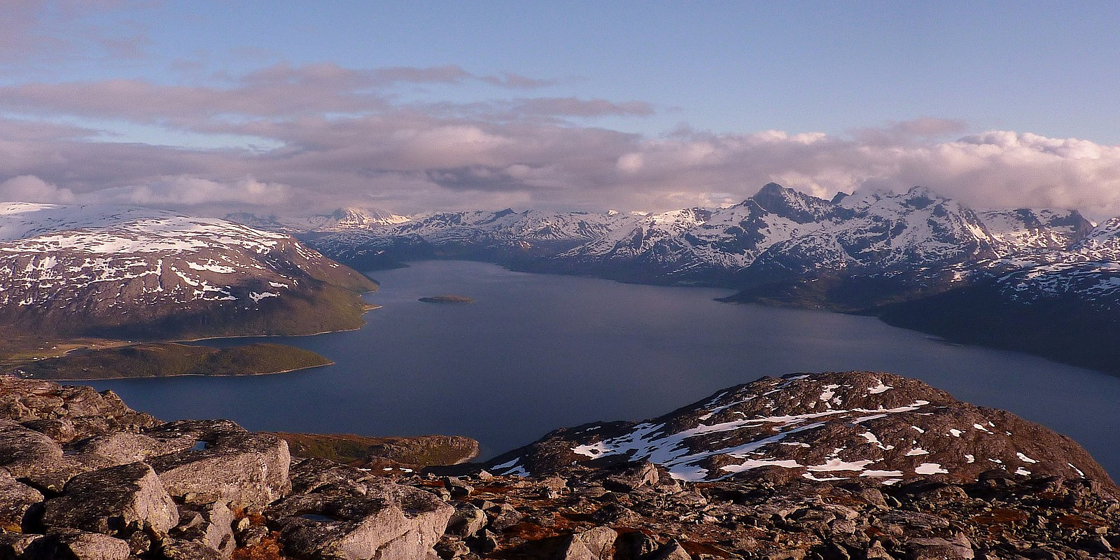
 Today marked the first day of an incredible weekend in the mountains on Senja, and what better company to spend it with than the fjellsportgruppa i Troms? The weekend kicked off with a relatively early start meeting up at ICA Langnes to split into 3 cars. Yngve and Fredrik were both leading the trip together, and on first meeting them I already had the impression that this was going to be a trip with a lot of laughs and good humour. I was not wrong. Other than them, there were two other guys - Gregers and Werner, and two other girls joining in Tromsø, a Czech PhD student called Ilona and a just-graduated student named Solveig who had just finished her Bachelor studies up on Svalbard and was 'passing through' Tromsø on her way back down to Oslo for the summer.
Us girls got together in my car >>>
Today marked the first day of an incredible weekend in the mountains on Senja, and what better company to spend it with than the fjellsportgruppa i Troms? The weekend kicked off with a relatively early start meeting up at ICA Langnes to split into 3 cars. Yngve and Fredrik were both leading the trip together, and on first meeting them I already had the impression that this was going to be a trip with a lot of laughs and good humour. I was not wrong. Other than them, there were two other guys - Gregers and Werner, and two other girls joining in Tromsø, a Czech PhD student called Ilona and a just-graduated student named Solveig who had just finished her Bachelor studies up on Svalbard and was 'passing through' Tromsø on her way back down to Oslo for the summer.
Us girls got together in my car >>>
Nordtinden
- Datum:
- 13.06.2012
 This evening my friends Lene Østvand and Mona Kaupang were joining me on a fellestur to Nordtinden, organised by Ti på Topp. It wasn't such promising weather when we started to leave Tromsø, and the mountains on Kvaløya were looking decidedly damp! But in honesty, I think I was the more pessimistic one of the three, and both Lene and Mona seemed quite upbeat about a good trip being on the cards. As we drove up on the Rv58 along the east side of Storkjølen though, a slightly brief but heavy shower of rain dispersed the hopes a little. But it got better, after passing through the tunnel and driving toward Skulsfjord, where we were meeting the rest of the group, we could actually see some patches of broken cloud and some mountains again. So hope was still there! We were supposed to be meeting >>>
Store Russetinden
- Datum:
- 10.06.2012
- Tourcharakter:
- Wanderung
- Tourlänge:
- 7:00h
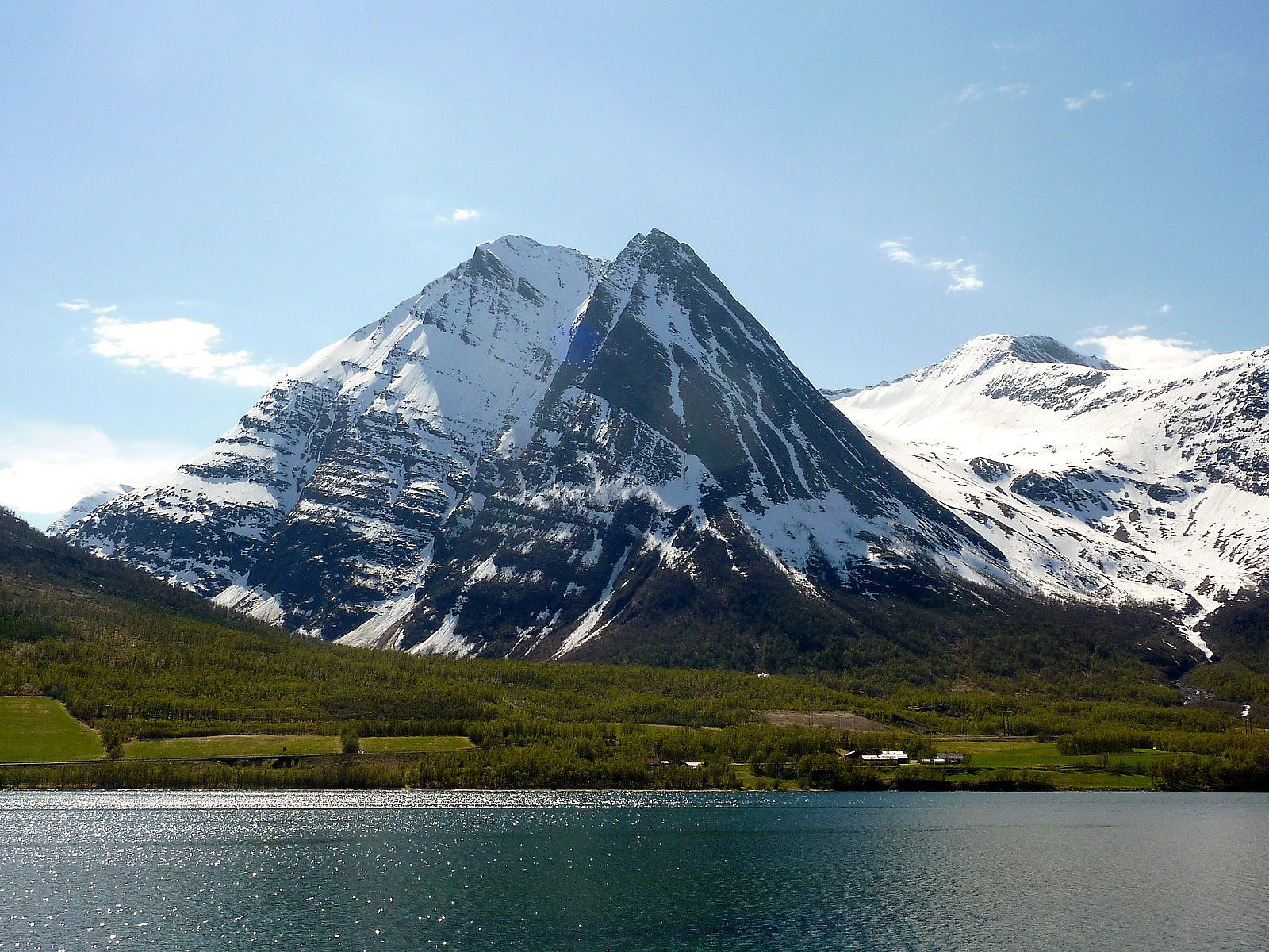 Fjellsportgruppa in Tromso arranged this trip to Store Russetinden, the first hike of the year to begin the summer season. I was very excited to not only be joining a group of new people and have their company, but also to be making an ascent of one of the most beautiful mountains I've ever seen from the E8. So we met up at Nansenplass at 0900 and had a short briefing from the turleder Harald before making the road trip down to Nordkjosbotn in a convoy of 4 cars. I had in my car 3 other girls; Mona from Trondheim, Maja from Denmark and Lena who was from the Balsfjord area (quite a local!). We had a nice chat while driving through a sunlit Ramfjord, and then through Lavangsdalen toward Balsfjord. All the familiar mountains were starting to come into view for me, but the difference was on this >>>
Skamtinden
- Datum:
- 08.06.2012
- Tourcharakter:
- Bergtour
- Tourlänge:
- 4:00h
- Entfernung:
- 5,0km
 This was a really great evening trip after work, one that nearly didn't happen because it had been a bit of a rainy day and I was thinking to postpone the hike. Fortunately, neither Ane or myself decided to call each other in the end and we met up as planned, at the K1 car park. We took my car out onto Kvaloya and took the road around the northern side of the island towards Tromvik. Up until then the road surface had some bumps but then between Tromvik and Rekvik it turned to gravel instead, so it took a long time just to drive those few kiometres further to Rekvik, where we were starting the hike from.
So, straight out of the car it was cool but not cold, and it was straight up the mountain from there. It was a well-marked trail through the forest on the lower part of Skamtinden, which helped >>>
This was a really great evening trip after work, one that nearly didn't happen because it had been a bit of a rainy day and I was thinking to postpone the hike. Fortunately, neither Ane or myself decided to call each other in the end and we met up as planned, at the K1 car park. We took my car out onto Kvaloya and took the road around the northern side of the island towards Tromvik. Up until then the road surface had some bumps but then between Tromvik and Rekvik it turned to gravel instead, so it took a long time just to drive those few kiometres further to Rekvik, where we were starting the hike from.
So, straight out of the car it was cool but not cold, and it was straight up the mountain from there. It was a well-marked trail through the forest on the lower part of Skamtinden, which helped >>>

