Archiv - Nach Datum
Archiv - Nach Aktivität
-
Andere Tour (5)
- Expedition (5)
-
Andere Wintertour (5)
- Schneeschuhtour (5)
-
Fußtour (507)
- Bergtour (205)
- Hochtour (47)
- Jogging (4)
- Spaziergang (55)
- Wanderung (196)
-
Klettern (43)
- Alpinklettern (31)
- Eisklettern (3)
- Klettersteig (1)
- Mixed-Klettern (1)
- Sportklettern (3)
-
Skitour (449)
- Langlauf (2)
- Randonnée/Telemark (441)
- Tourenskilauf (4)
Peakbookfreunde


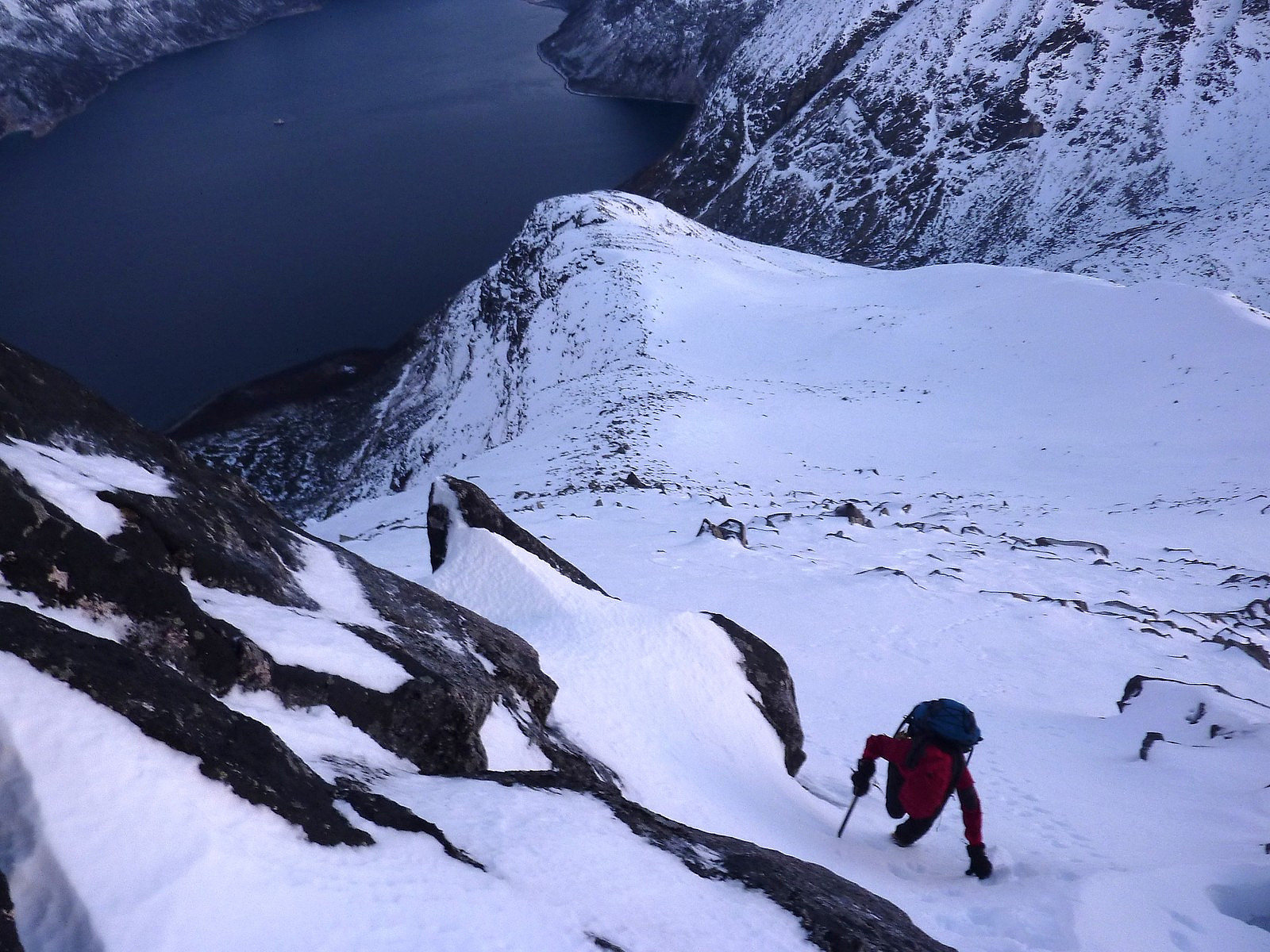
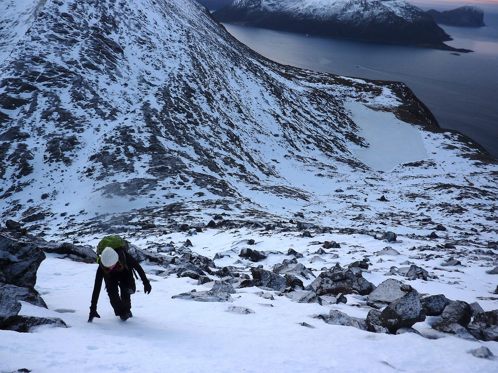
Stormheimfjellet surprises
- Datum:
- 31.12.2012
- Tourcharakter:
- Skitour
- Tourlänge:
- 5:00h
- Entfernung:
- 13,0km
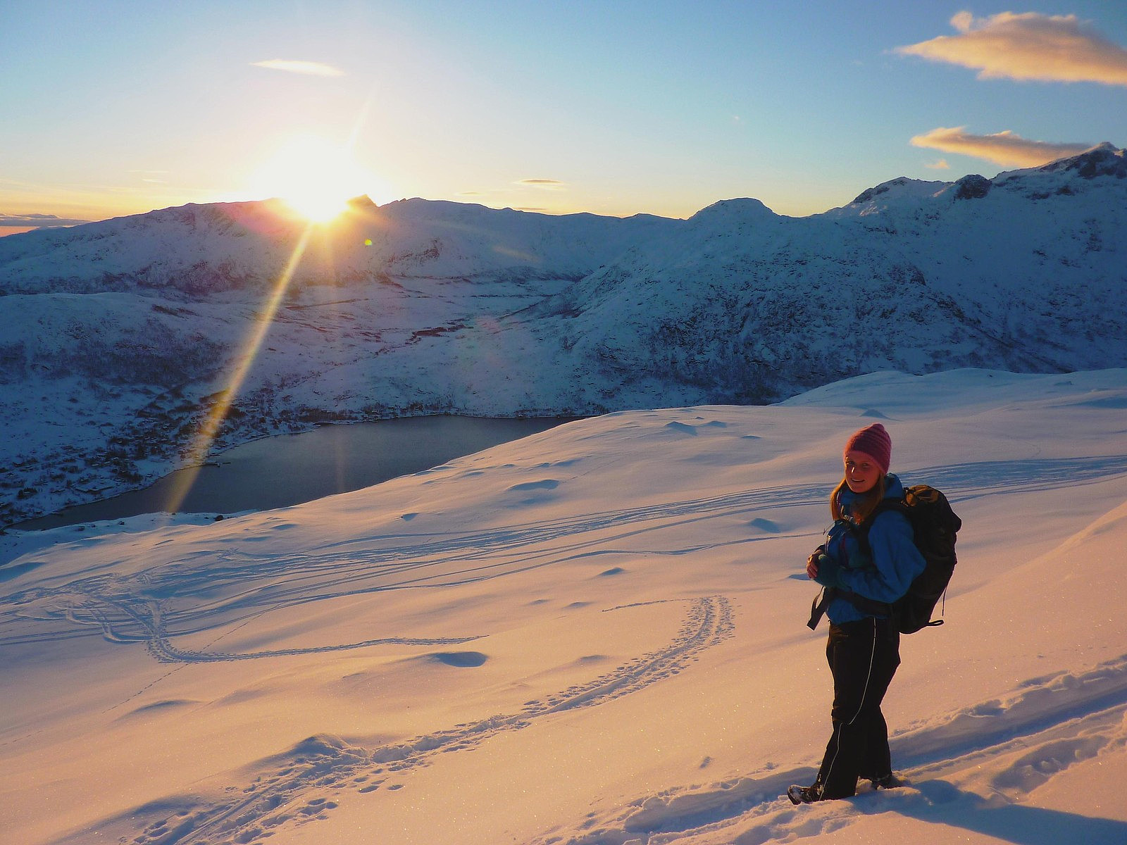
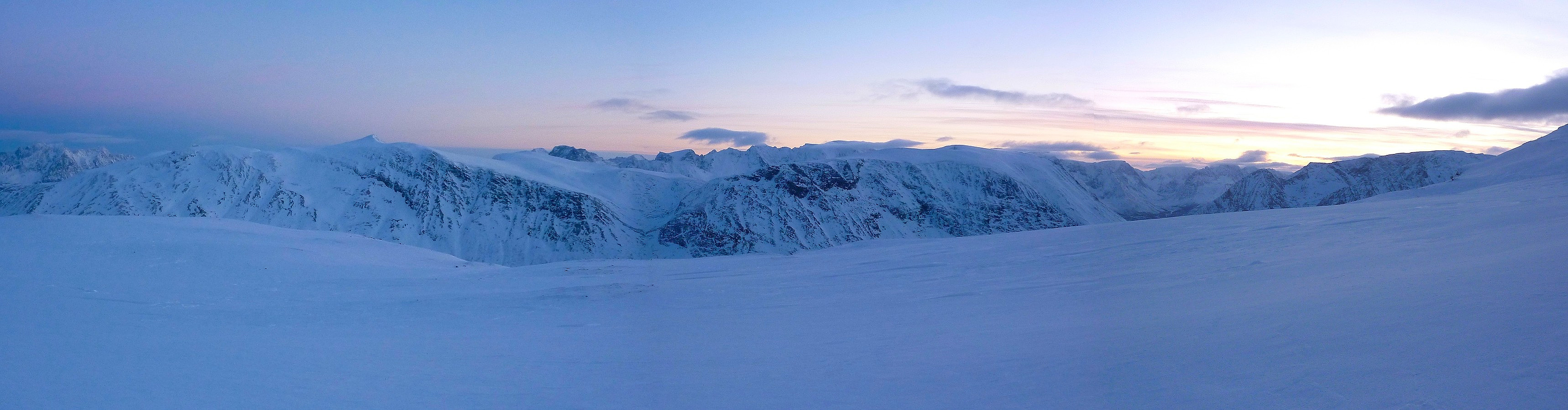 Last day of the year. And Tromsø was blessed with super weather; it was dry, with almost clear skies and even tropically warm – 4 degrees in Tromsdalen! So how should it be used? Well, we (my friend Aline and I) decided that it was really about time we actually climbed a proper mountain, after having been on so many short trips on Kvaløya. Stormheimfjellet was one of those mountains I had not bothered to take a second glance at until now, the main reason for dismissing it being that it looked like a bit of a boring mountain to hike up, with its long and broad back. But that was before I got myself a pair of skis. With its long and gently-rising ridge of 6,5km from road to the north top, this mountain suddenly jumped out on the map as a peak which demanded our time for a visit. The only >>>
Botnfjellet
- Datum:
- 29.12.2012
- Tourcharakter:
- Skitour
- Tourlänge:
- 3:30h
- Entfernung:
- 9,0km
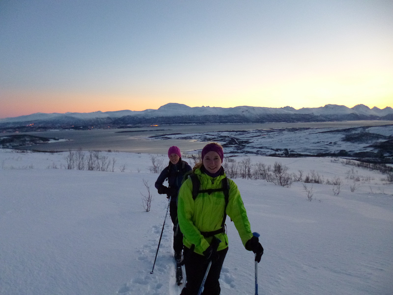 Today I was on another trip with Aline and Christian, but not for a hike this time - this would be our first proper ski trip of this winter! With both me and Aline being quite new to skiing, we sought out some of the classic beginner-trips around Tromsø before we finally decided on going to Lille Blåmann. Not only was it really close to drive to, but the starting point in Håkøybotn didn't exactly prove hard to find either; there were already a chain of 4 or 5 other vehicles parked up at the bottom of the route. So that saved us some time looking around! In addition to that time-saver, we of course had the sheer luxury of following beautifully carved-out ski tracks which had been made rather efficiently by the skiers ahead of us. This was really beginning to seem like the perfect convenience-trip! >>>
Juledagstur til Durmålstinden
- Datum:
- 25.12.2012
- Tourcharakter:
- Wanderung
- Tourlänge:
- 4:30h
- Entfernung:
- 9,0km
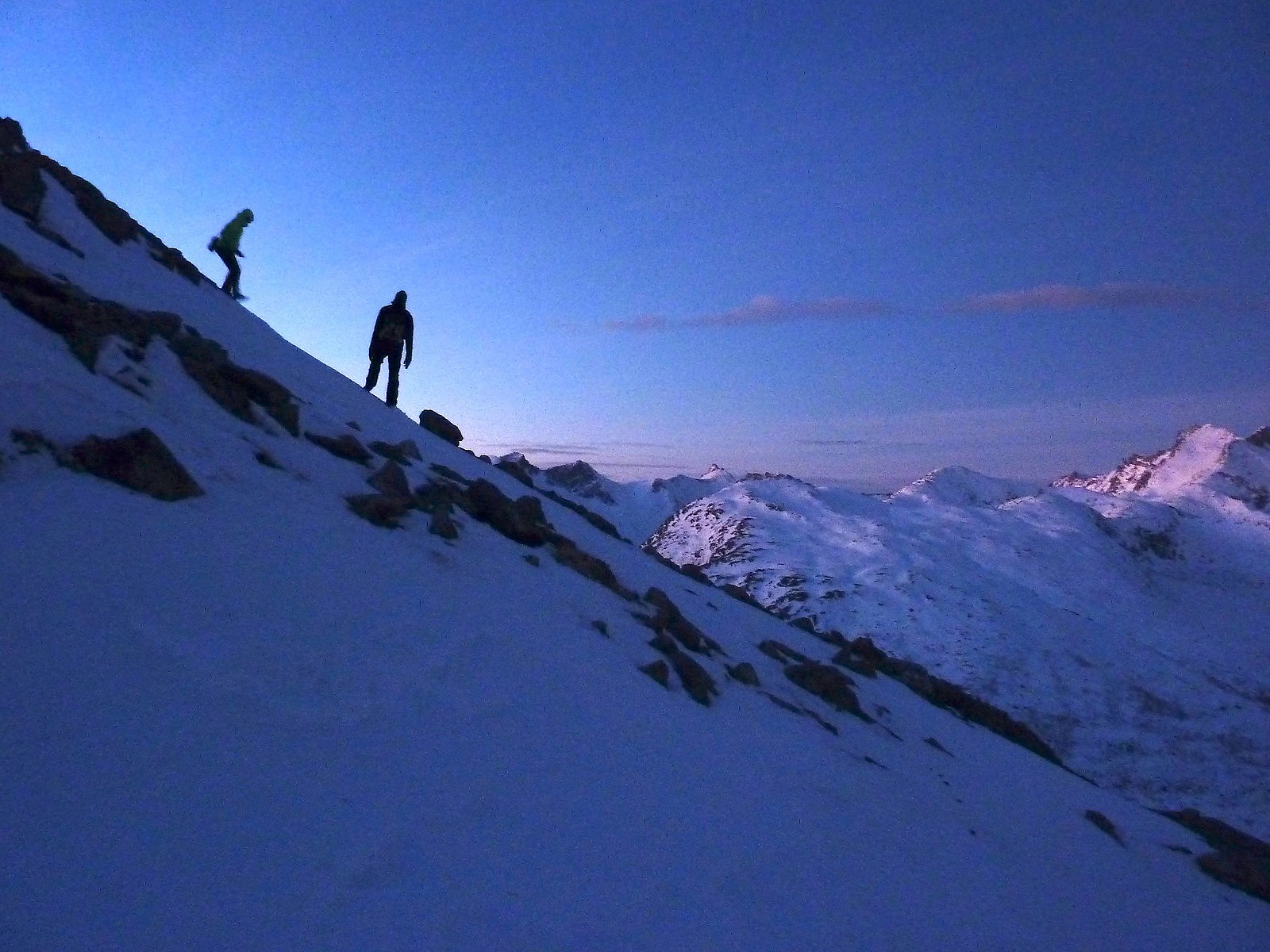 Oh, bummer. Already 6.30am on Christmas Day. I so wanted to sleep for longer but deep down knew I was going to have to drag myself out of bed if I wanted to have any chance of collecting my friends for a trip to Durmålstinden at 9.00. I didn't honestly feel in the mood for hiking at that point, but trips always seem to start off this way at this time of year. Fortunately I didn't have the guts to send my friend an sms with an excuse for not going out and at 8.45 I left home and drove to the Coop on Stakkevollan to meet with Aline and her boyfriend Christian. We drove to Kattfjord and were at the parkeringsplass within about 1/2 hour.
The only disappointment was that as we approached the mountain, it was becoming increasingly cloudy and it looked like the chances of a nice mountain view were >>>
Oh, bummer. Already 6.30am on Christmas Day. I so wanted to sleep for longer but deep down knew I was going to have to drag myself out of bed if I wanted to have any chance of collecting my friends for a trip to Durmålstinden at 9.00. I didn't honestly feel in the mood for hiking at that point, but trips always seem to start off this way at this time of year. Fortunately I didn't have the guts to send my friend an sms with an excuse for not going out and at 8.45 I left home and drove to the Coop on Stakkevollan to meet with Aline and her boyfriend Christian. We drove to Kattfjord and were at the parkeringsplass within about 1/2 hour.
The only disappointment was that as we approached the mountain, it was becoming increasingly cloudy and it looked like the chances of a nice mountain view were >>>
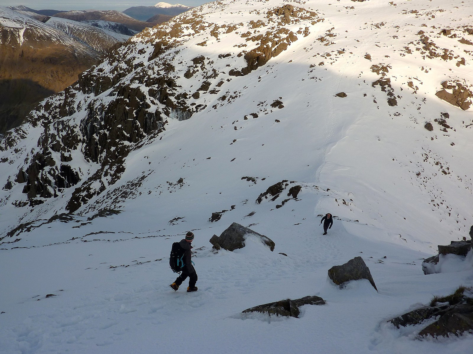
Kjølen igjen
- Datum:
- 22.12.2012
- Tourcharakter:
- Bergtour
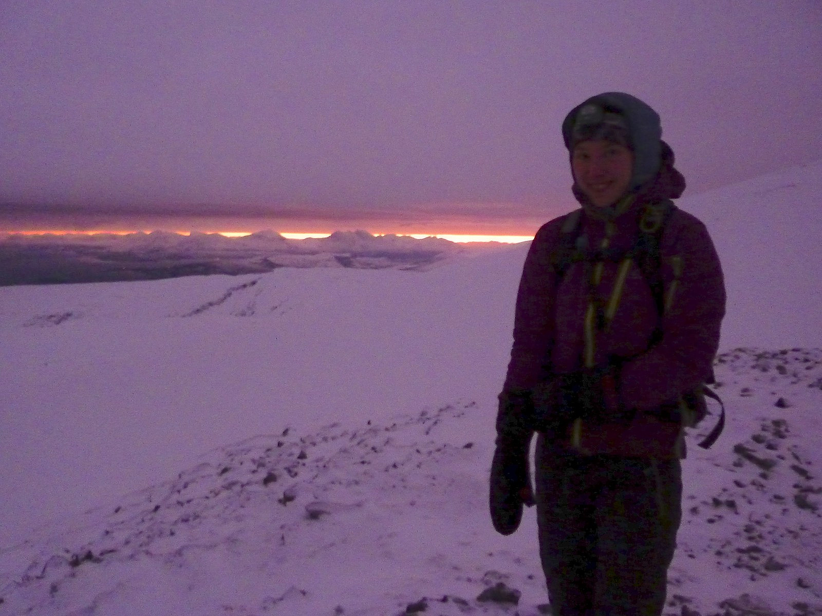 Etter at himmelen hadde blitt klar og veldig fargerik den hele uka, forventet vi det samme i dag. Dessverre var vi ikke så heldig. Jeg og Hanneke fikk likevel en fin tur til Storkjølen. Kjørte bilen til Finnvikvatnet og parkerte ved siden av veien, siden vi var usikker på om den vanlige parkeringsplassen var brøytet . Krysset Finnvikvatnet til fots pga at det var frosset og isen virket ganske solid. Etter hvert fikk vi en lett tur opp vestlige siden av Storkjølen med hardt snø og røde ti-på-topp staver som vi forsøkte å følge så best som mulig. Det var vindig hele veien opp, og så vi var glade da vi fant den DNT hytta som var åpent! Det var kjempekoselig innenfor hytta, og vi brukte mer enn 30 minutter på å spise lunsj og blir varmere igjen. Fikk vakre utsikt av lyset mot sør >>>
The Coledale classic
- Datum:
- 13.12.2012
- Tourcharakter:
- Bergtour
- Tourlänge:
- 5:00h
- Entfernung:
- 16,0km
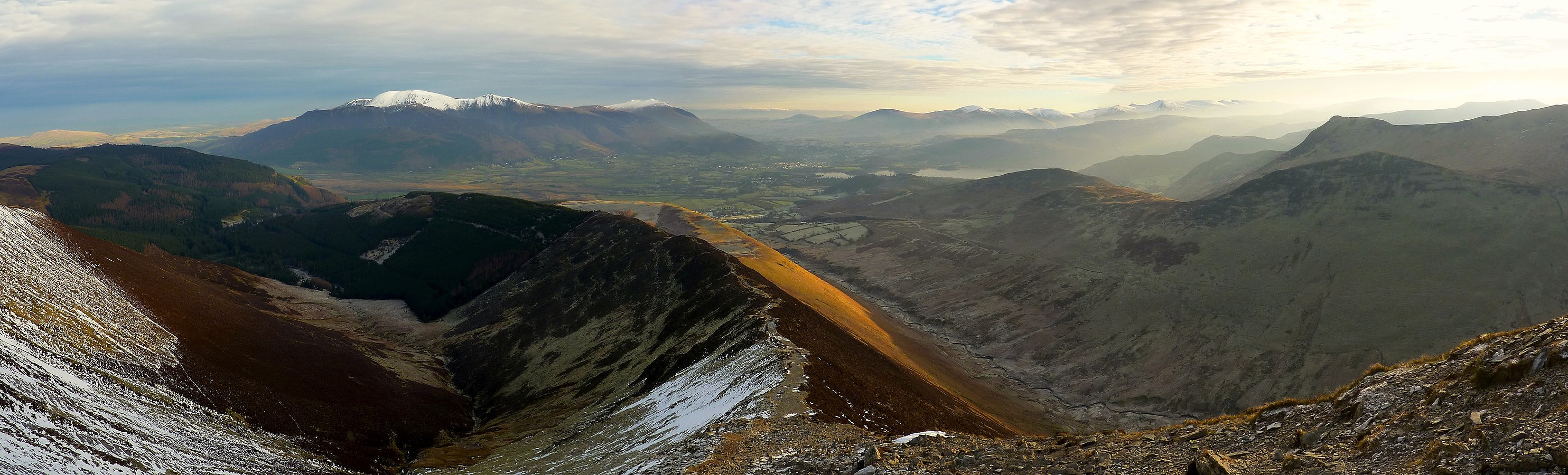 Only one day after I thought I'd had the best welcome back to Lakeland, I was treated to yet another cracking day out on the fells with more unbelievably good weather and views which were very pleasing on the eye! There were of course so many of my favourite routes I could have chosen to do, but this hike was a bit closer to the youth hostel I was staying at and quite conveniently had a free parking place at the start of the route. I first did the route 11 years ago and on all occasions I have been back and repeated it, it has never failed to bring a smile to the face even though it isn't much of a strenuous walk. It takes in 6 tops in a 16km circuit around Coledale which lies a few miles outside of Keswick in the northern end of the Lake District. There are several other tops which can be >>>
Scafell Pike
- Datum:
- 12.12.2012
- Tourcharakter:
- Wanderung
- Entfernung:
- 12,0km
 There isn't anything quite as pleasing as a good hike in familiar surroundings, with superb weather and solid snow. Quite surprisingly this trip satisfied all three criteria (not something which often happens in this corner of England) and made it a very enjoyable day out in the UK hills again. After a quiet night spent in the Borrowdale youth hostel, my friend Sue and I headed for Scafell Pike with the intention of going up the Corridor route which goes around the north-western side of the mountain. In the summer time Scafell Pike usually has a reputation for attracting big crowds and it doesn't end up being the nicest experience. But today we were really fortunate and saw very few other hikers, maybe half a dozen close to the summit but none on our route up!
The approach toward Styhead Tarn >>>
There isn't anything quite as pleasing as a good hike in familiar surroundings, with superb weather and solid snow. Quite surprisingly this trip satisfied all three criteria (not something which often happens in this corner of England) and made it a very enjoyable day out in the UK hills again. After a quiet night spent in the Borrowdale youth hostel, my friend Sue and I headed for Scafell Pike with the intention of going up the Corridor route which goes around the north-western side of the mountain. In the summer time Scafell Pike usually has a reputation for attracting big crowds and it doesn't end up being the nicest experience. But today we were really fortunate and saw very few other hikers, maybe half a dozen close to the summit but none on our route up!
The approach toward Styhead Tarn >>>
Breitinden (Kattfjord)
- Datum:
- 01.12.2012
- Tourcharakter:
- Wanderung
- Tourlänge:
- 4:30h
 På denne turen fikk jeg med ei venninne jeg kjente fra norskkurs. Det var meldt fint vær igjen i helga og så skulle det bli tur. Men nå var det egentlig mørketida og det var ikke så mange timer med daglys. Så vi bestemte oss for å dra ut på en kortere tur i dag og Breitinden ble turmålet. Fjellet ligger på nordvestkanten Kvaløya. Da skulle vi få nydelig lys med god utsikt mot ’soloppgangen’ og ’solnedgangen’. Kjøretiden var like under enn 1 time fra Tromsø og da vi kom frem til Vasstrand som var utgangspunktet for turen, fikk vi en kraftig bris i tillegg til omtrent 8 minusgrader. Det var ikke verst, men det føltes forholdsvis kjølig da vi kom oss ut av den varme bilen i begynnelsen av turen!
Ruten oppover fjellet var veldig lett å finne siden det var bra sikt, og jeg >>>
På denne turen fikk jeg med ei venninne jeg kjente fra norskkurs. Det var meldt fint vær igjen i helga og så skulle det bli tur. Men nå var det egentlig mørketida og det var ikke så mange timer med daglys. Så vi bestemte oss for å dra ut på en kortere tur i dag og Breitinden ble turmålet. Fjellet ligger på nordvestkanten Kvaløya. Da skulle vi få nydelig lys med god utsikt mot ’soloppgangen’ og ’solnedgangen’. Kjøretiden var like under enn 1 time fra Tromsø og da vi kom frem til Vasstrand som var utgangspunktet for turen, fikk vi en kraftig bris i tillegg til omtrent 8 minusgrader. Det var ikke verst, men det føltes forholdsvis kjølig da vi kom oss ut av den varme bilen i begynnelsen av turen!
Ruten oppover fjellet var veldig lett å finne siden det var bra sikt, og jeg >>>
Tromtinden
- Datum:
- 25.11.2012
- Tourcharakter:
- Bergtour
- Tourlänge:
- 4:00h
 Med så korte dager nå, bestemte vi (både Aline og jeg) oss at vi ville gå på en liten tur i dag. Og Aline hadde likevel litt eksamenslesing å gjøre i tillegg til turen og derfor hadde ikke så mye lyst til å bruke hele dagen for å være ut på tur. Siden været var også helt flott, visste jeg om et fint fjell som vi kunne bestige: Tromtinden. Det er et fjell på kun 636m, men kanskje den beste fordelen er at du får en fin utsikt mot havet og de nydelige fjellene rundt hele Kvaløya. Vi var ikke skuffet at snøforholdene ikke var ideelle for en skitur. Snøen var perfekt hard for å gi oss en lett fottur. Vi sank ikke ned gjennom snøen og det hjalp oss veldig på ruten oppover. Noen steder var snøen egentlig isete og siden det var bare jeg som tok stegjern med på turen, følte >>>
Gråtinden
- Datum:
- 17.11.2012
- Tourlänge:
- 4:30h
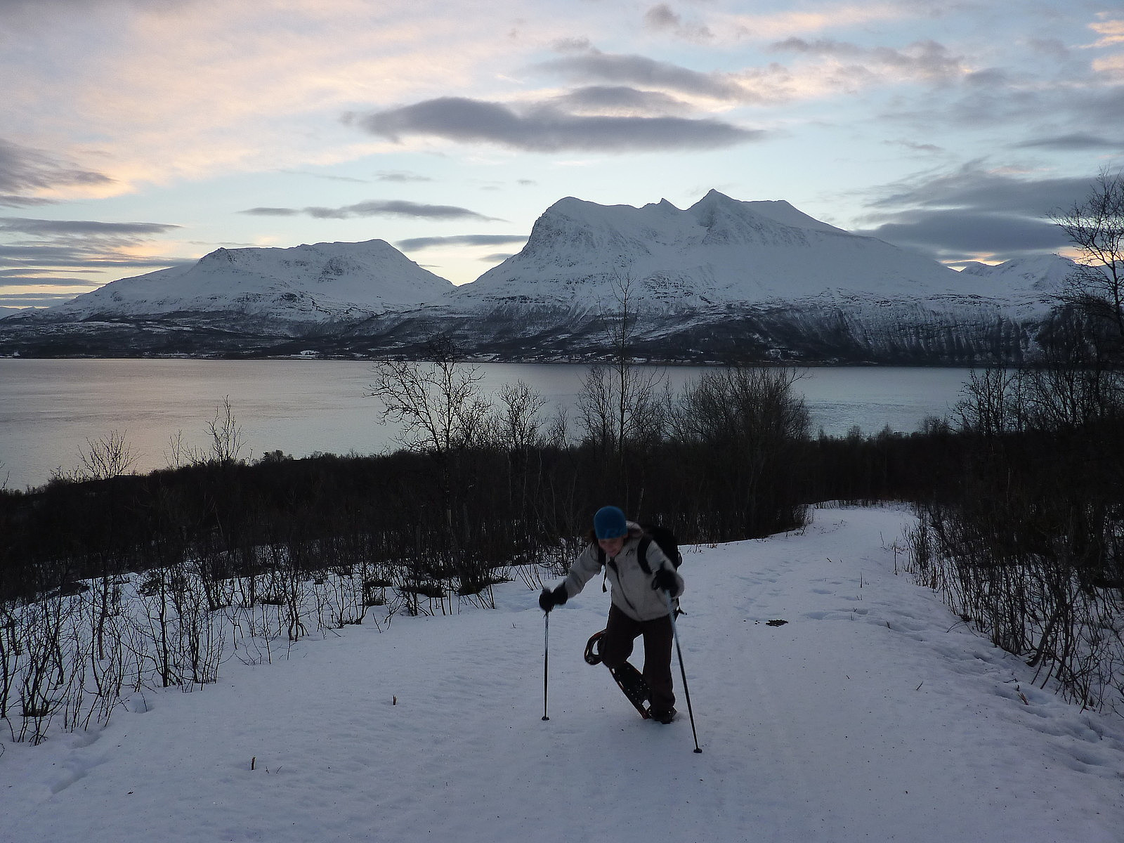 I had my sister with me on this trip, since she had decided it would be nice to spend some time with me for my birthday and also wanted to experience some winter hiking in the mountains here. I had only a pair of fjellski which I wanted to try and use again, but I managed to get hold of a pair of snowshoes, which I thought would probably work just as well for a mountain trip. Since I am no expert skier yet, I suggested that we visit Gråtinden, since I could see from my map that it was not a steep mountain (not until the last part to the top anyway which we could take off skis for). As things turned out, we found out soon after leaving the car that snow conditions were not exactly ideal for skiing anyway, and snow shoes probably were the best option! The problem was that the warm and wet week >>>
Buren
- Datum:
- 11.11.2012
- Tourcharakter:
- Wanderung
- Tourlänge:
- 4:30h
 Jeg og Siv tenkte å ta en 'kort' tur til Buren på Kvaløya da hun måtte være tilbake i Tromsø før kl.14. Men det viste seg å ta lenger tid enn først antatt. Vi trodde at vi ikke kom til å gå i mye snø, og vi bestemte oss for å gå til fots istedenfor på ski. Vi kjørte til Kaldfjord og videre i retning Tromvik, til vi kom frem til parkeringsplassen ved siden av veien på Susannajorda. Klokka var omtrent 10 før vi startet turen.
Heldig med været var vi også. Det kjentes ganske mildt ut og jeg tror temperaturen faktisk var +2 grader! Med strålende sol og en utrolig flott blå himmel var det i utgangspunkt en perfekt start på turen. Men, ikke fortere enn vi hadde startet å følge skisporene opp fjellsiden, fant vi ut at det var mye mer snø enn vi hadde forventet. Til å begynne >>>
Jeg og Siv tenkte å ta en 'kort' tur til Buren på Kvaløya da hun måtte være tilbake i Tromsø før kl.14. Men det viste seg å ta lenger tid enn først antatt. Vi trodde at vi ikke kom til å gå i mye snø, og vi bestemte oss for å gå til fots istedenfor på ski. Vi kjørte til Kaldfjord og videre i retning Tromvik, til vi kom frem til parkeringsplassen ved siden av veien på Susannajorda. Klokka var omtrent 10 før vi startet turen.
Heldig med været var vi også. Det kjentes ganske mildt ut og jeg tror temperaturen faktisk var +2 grader! Med strålende sol og en utrolig flott blå himmel var det i utgangspunkt en perfekt start på turen. Men, ikke fortere enn vi hadde startet å følge skisporene opp fjellsiden, fant vi ut at det var mye mer snø enn vi hadde forventet. Til å begynne >>>

