Archive - Date
Archive - Activity
-
Climbing (43)
- Alpine climbing (31)
- Ice climbing (3)
- Mixed climbing (1)
- Sport climbing (3)
- Via ferrata (1)
-
Other trip (5)
- Expedition (5)
-
Other winter trip (5)
- Snowshoe trip (5)
-
Ski trip (449)
- Backcountry skiing (4)
- Cross-country skiing (2)
- Randonnée/Telemark (441)
-
Trip by foot (507)
- Alpine trip (47)
- Hike (196)
- Hillwalk (205)
- Jogging (4)
- Walk (55)
Peakbook-Friends


Island Peak
- Date:
- 19.11.2008
- Characteristic:
- Hike
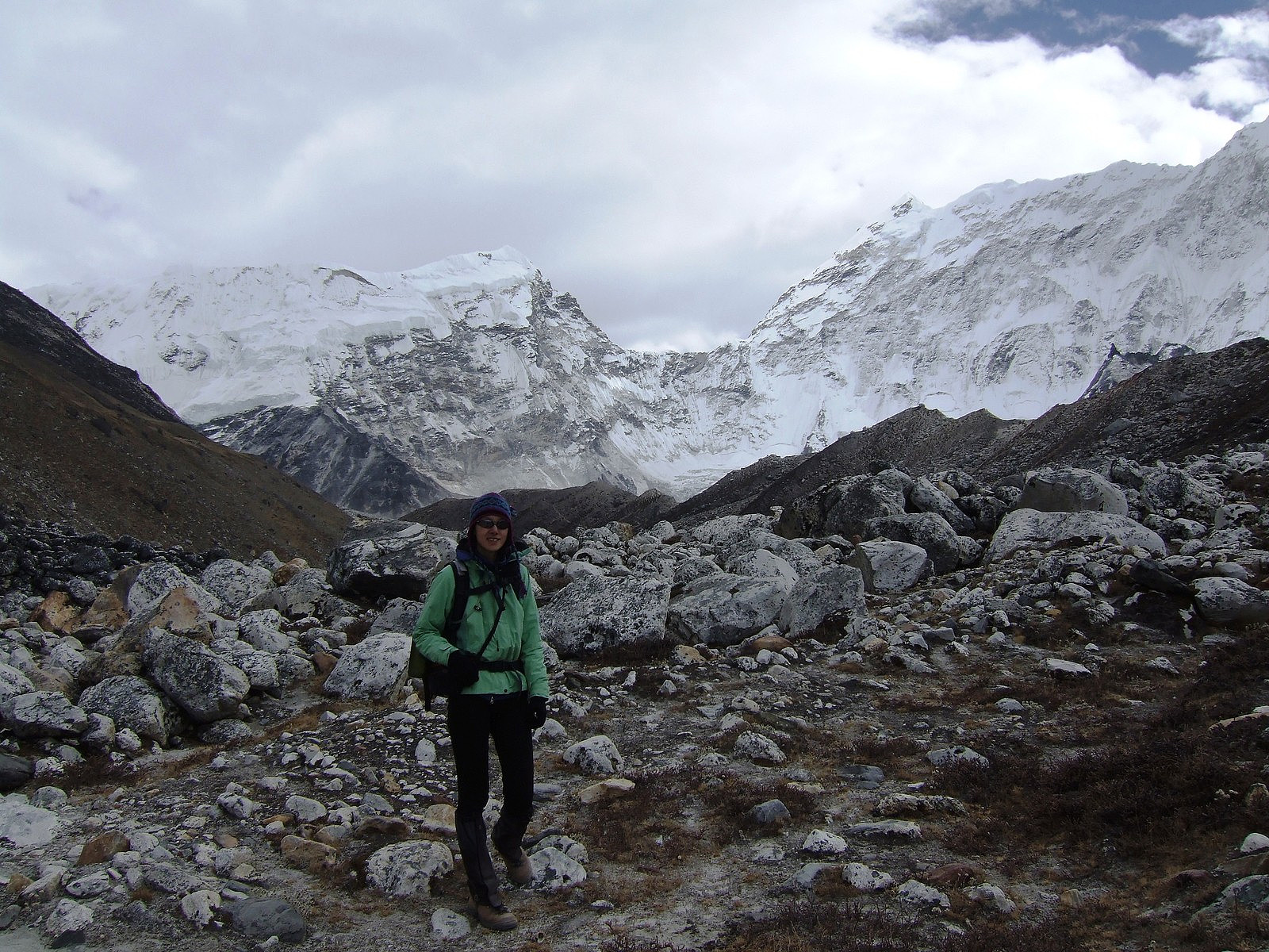 After the exceptionally fantastic ascent of Lobuche East on my birthday, we had just one more peak to complete the 4-week trip around the Khumbu region of Nepal: Island Peak.
Wednesday, 19th November 2008: Chukung to Island Peak BC
After sleeping like a log for a decent 10 (or maybe even 11) hours, we began our journey to Island Peak Base Camp from the tea house in Chukhung under increasingly overcast skies, so it didn’t feel as warm as the previous day. It was a short 3-hour walk, which was immensely busy with climbing groups in comparison to the BC for Lobuche East . Once we arrived there was a luxurious mess tent waiting for us to dive into for hot drinks and lunch! It was kitted out with big, roomy chairs and a table laden with a huge selection of instant hot drinks :-) Amongst the selection of hot drinks were >>>
After the exceptionally fantastic ascent of Lobuche East on my birthday, we had just one more peak to complete the 4-week trip around the Khumbu region of Nepal: Island Peak.
Wednesday, 19th November 2008: Chukung to Island Peak BC
After sleeping like a log for a decent 10 (or maybe even 11) hours, we began our journey to Island Peak Base Camp from the tea house in Chukhung under increasingly overcast skies, so it didn’t feel as warm as the previous day. It was a short 3-hour walk, which was immensely busy with climbing groups in comparison to the BC for Lobuche East . Once we arrived there was a luxurious mess tent waiting for us to dive into for hot drinks and lunch! It was kitted out with big, roomy chairs and a table laden with a huge selection of instant hot drinks :-) Amongst the selection of hot drinks were >>>
Lobuche East
- Date:
- 17.11.2008
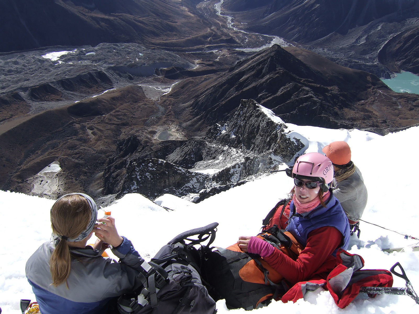 Lobuche East was a memorable summit of a 4-week trip in Nepal. I joined a trip organised by a UK-based company (Adventure Peaks), it involved a lots of ups and downs (both physical and in the psychological sense!), much laughing and of course, spectacular views. But for me Lobuche East was the highlight of the trip because the ascent coincided with my 25th birthday .-)
Sunday, 16th November 2008
Our approach walk to Lobuche East base camp was from Lobuche village, which was on the other side of the mountain. We had spent 2 days at Lobuche village after walking from Dzonghla, which was where we had stayed after our descent from the Cho La Pass. So to get back to the base camp, we were effectively retracing our steps from 2 days earlier, but not going as far back as Dzonghla. The base camp was >>>
Lobuche East was a memorable summit of a 4-week trip in Nepal. I joined a trip organised by a UK-based company (Adventure Peaks), it involved a lots of ups and downs (both physical and in the psychological sense!), much laughing and of course, spectacular views. But for me Lobuche East was the highlight of the trip because the ascent coincided with my 25th birthday .-)
Sunday, 16th November 2008
Our approach walk to Lobuche East base camp was from Lobuche village, which was on the other side of the mountain. We had spent 2 days at Lobuche village after walking from Dzonghla, which was where we had stayed after our descent from the Cho La Pass. So to get back to the base camp, we were effectively retracing our steps from 2 days earlier, but not going as far back as Dzonghla. The base camp was >>>
Ben Nevis via South Castle Gully
- Date:
- 15.03.2008
- Characteristic:
- Alpine trip
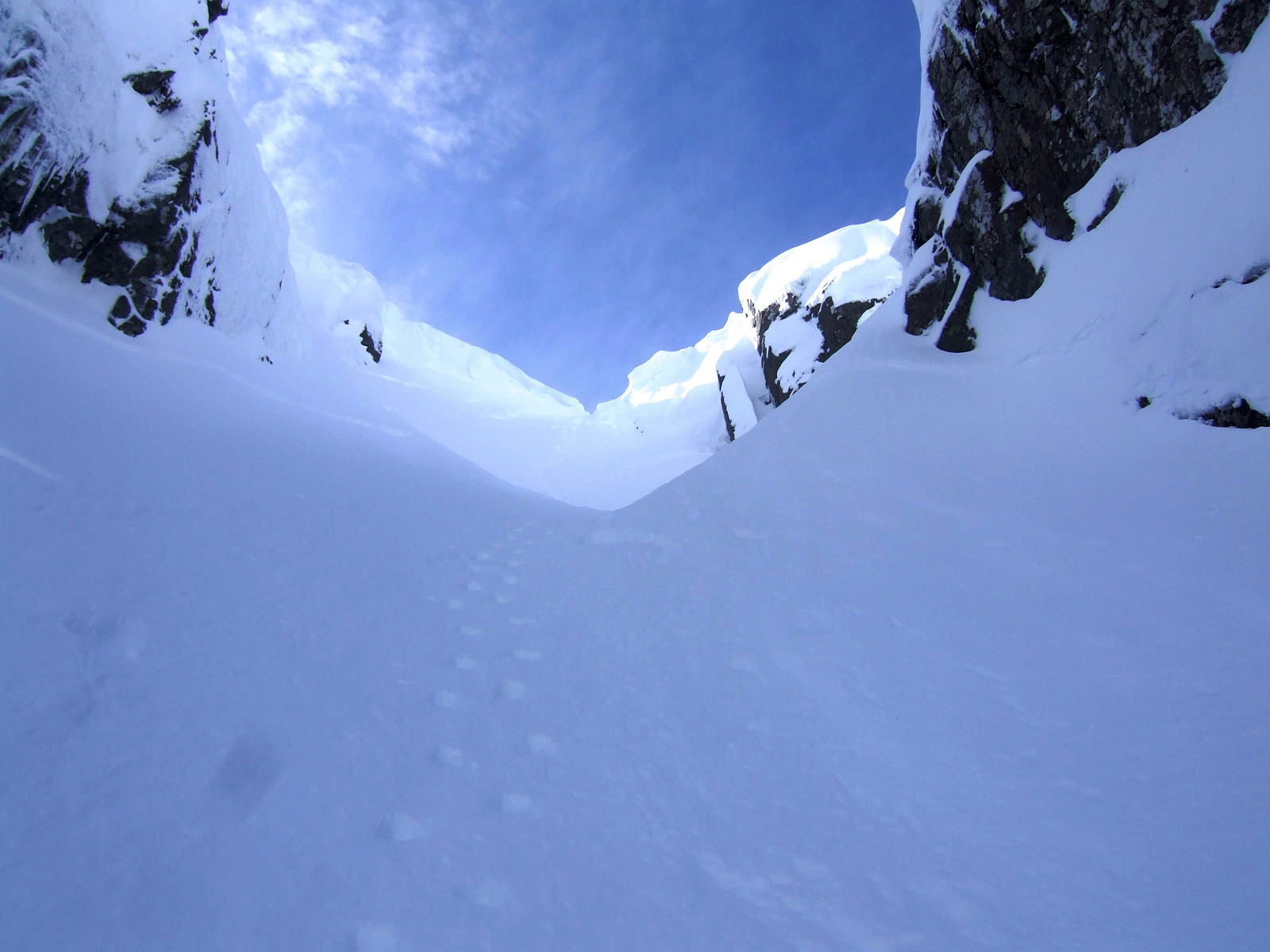 En gammel tur opp Ben Nevis med Joanne og Pete. Gikk opp South Castle Gully (II) og ned Number 4 Gully (I) på nordsiden av fjellet. Fin vårtur men snøen i renna var ikke helt solid og vi gikk opp i taulag opp uten å sikre ruten. Det blåste godt da vi kom opp til platået men jeg har ellers veldig få minner uten bildene!
Aonach Eagach traverse
- Date:
- 28.02.2008
- Characteristic:
- Alpine trip
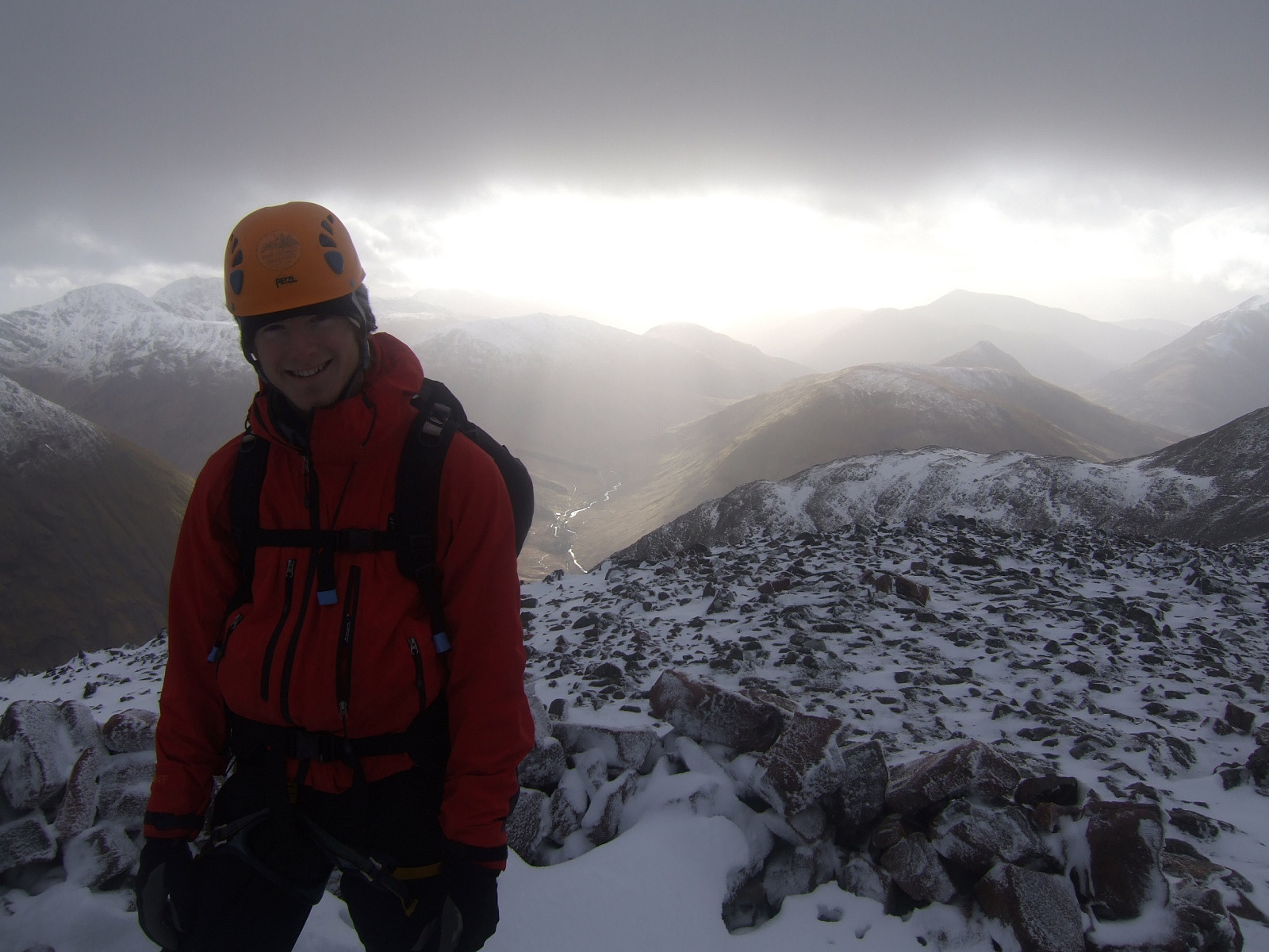 Glencoe's finest ridge traverse done in winter conditions with my university climbing friend Tim while on a long weekend trip in Scotland. I regret not having written a report straight after but the photos can speak for themselves!
Langdale to Scafell round
- Date:
- 16.02.2008
- Characteristic:
- Hillwalk
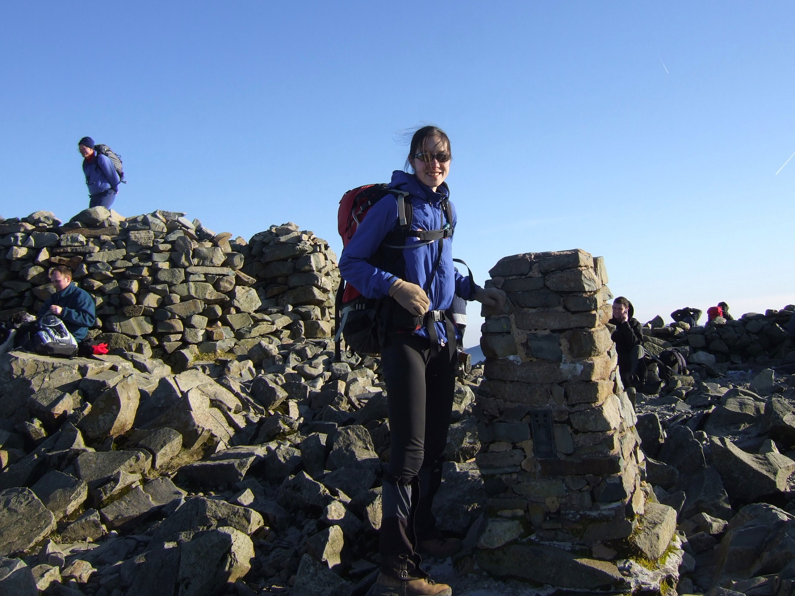 A classic all-time favourite of mine, done in perfect spring-like weather with crystal clear blue skies and warm enough to wear a t shirt without a jacket on top. I started the hike at 11am from Great Langdale, hoping to be 'late enough' on top of Scafell Pike to see a sunset without having to wait around on the top for too long. Bow Fell was busy with many people having lunch when I got there, enjoying the gorgeous views over Great Moss and the hazy layer of sunshine below the summits.
It was nice to be in the company of other enthusiastic hikers and even though some people might prefer to have a mountain to themselves, I think a dozen other hillwalkers in good spirits is better than no one at all. From Bow Fell I took the usual descent northwards and across to Esk Pike, enjoying the views >>>
A classic all-time favourite of mine, done in perfect spring-like weather with crystal clear blue skies and warm enough to wear a t shirt without a jacket on top. I started the hike at 11am from Great Langdale, hoping to be 'late enough' on top of Scafell Pike to see a sunset without having to wait around on the top for too long. Bow Fell was busy with many people having lunch when I got there, enjoying the gorgeous views over Great Moss and the hazy layer of sunshine below the summits.
It was nice to be in the company of other enthusiastic hikers and even though some people might prefer to have a mountain to themselves, I think a dozen other hillwalkers in good spirits is better than no one at all. From Bow Fell I took the usual descent northwards and across to Esk Pike, enjoying the views >>>
Grasmere to Swirls via Helvellyn
- Date:
- 10.02.2008
- Characteristic:
- Hillwalk
- Duration:
- 4:00h
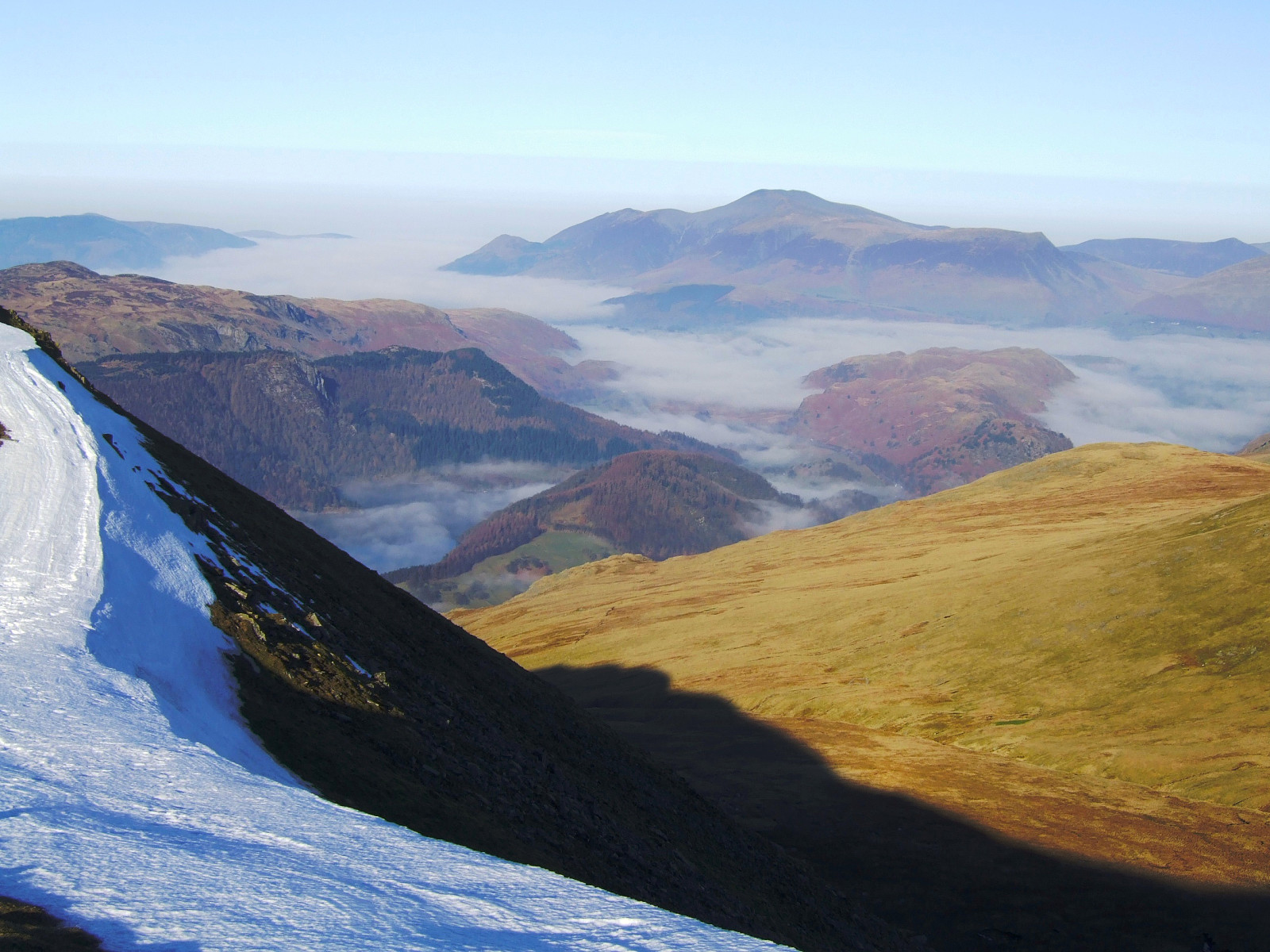 This was a rather straightforward but satisfyingly scenic route from Grasmere in a northerly direction. Since I had a bus to catch before midday, I left the youth hostel at about 7.30am, well on schedule, and made the route into a bit of a time trial by attempting to complete it in as fast a time as possible.
It basically follows the A591 northwards for a while until the foot of the valley starts that leads up to Grisedale Tarn from the south (and not the valley going up here from Dunmail Raise). From Grisedale Tarn it was a bit of hard slog up Dollywagon Pike with a heavy rucksack to carry, but after that there is very little more ascent to make to pass over both Nethermost Pike and Helvellyn. Great views all to myself at the summit, since I arrived there at about 9.30am on a Monday morning >>>
This was a rather straightforward but satisfyingly scenic route from Grasmere in a northerly direction. Since I had a bus to catch before midday, I left the youth hostel at about 7.30am, well on schedule, and made the route into a bit of a time trial by attempting to complete it in as fast a time as possible.
It basically follows the A591 northwards for a while until the foot of the valley starts that leads up to Grisedale Tarn from the south (and not the valley going up here from Dunmail Raise). From Grisedale Tarn it was a bit of hard slog up Dollywagon Pike with a heavy rucksack to carry, but after that there is very little more ascent to make to pass over both Nethermost Pike and Helvellyn. Great views all to myself at the summit, since I arrived there at about 9.30am on a Monday morning >>>
Grasmere circuit
- Date:
- 09.02.2008
It was a misty start to the day, but we took a nice little route from the Grasmere youth hostel, up onto the low ridge above the Langdale valley, following Silver How all the way up to Sergeant Man. It was actually a rather pleasant day after we walked above the cloud line. Then we had uninterrupted sunshine and a beautiful blanket of cloud all below us while enjoying some late morning snacks at the top. From here we walked across High Raise and over Greenup Edge but descending down the Wythburn route by mistake. We eventually had to do a big job in locating something looking like a path, but not very successfully finding one! So it was very wet underfoot as a result and somewhat an adventure too, leaving us with only a very short time to spare before catching the bus to the train station for >>>

