
Zinalrothorn (20.07.2020)

| Startsted | Rothorn hut (3184moh) |
|---|---|
| Turtype | Alpin klatring |
| Turlengde | 7t 45min |
| Distanse | 7,1km |
| Høydemeter | 1112m |
| GPS |
|
| Bestigninger | Zinalrothorn (4221moh) | 20.07.2020 |
|---|
The Zinalrothorn is a pretty cool looking peak, though I personally think its a bit dependent on which angle you see it from. Definitely awesome when viewed from the Ober Gabelhorn though :-) Like last year, I had 10 (fun) days of climbing with British mountain guide Tim Neill to look forward to and the Zinalrothorn seemed like a good option to start off with since neither of us were really well acclimatized to 4000m yet. I was a bit worried that I would have de-acclimatised after a few days of easy hiking in the Saas valley and not really going above 3300m, so it was probably good to be starting with a peak which didn’t have a massive summit day although the walk-in to the Rothorn hut was relatively long. Since I’d expected there to be reduced capacity at the alpine huts this summer, I made a booking at the hut about a month and a half in advance, so it was pure luck that the days we would be climbing there turned out to have a good weather forecast... In fact, since the weather forecast looked to be pretty OK for more or less the whole week, we decided to spend 5 days over in the Zermatt/Saas valleys to make the most of it.
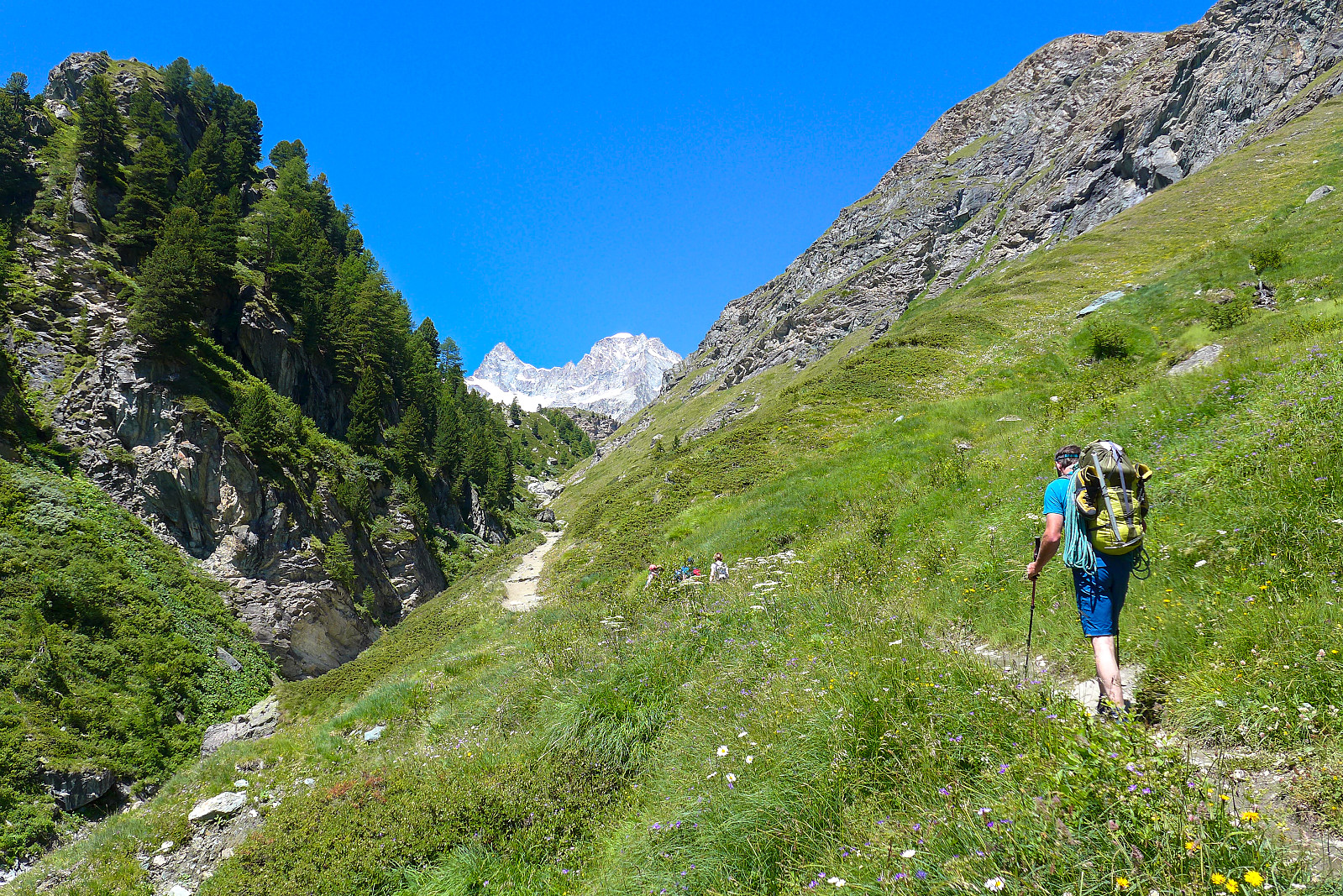
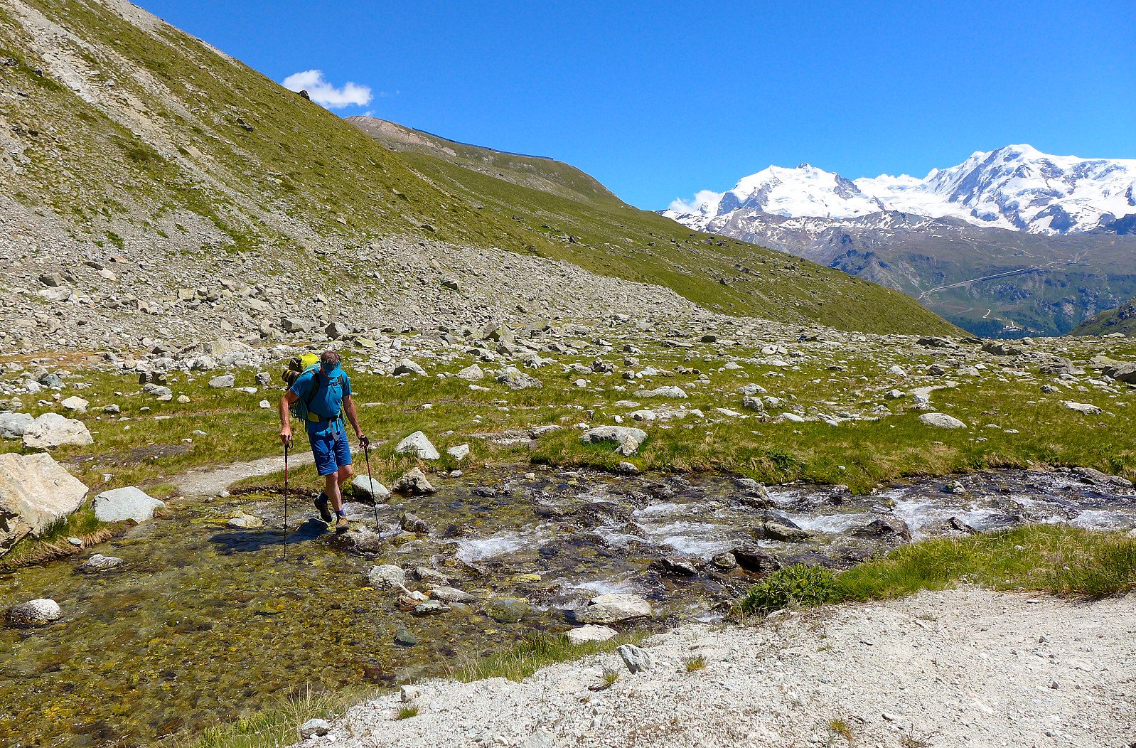
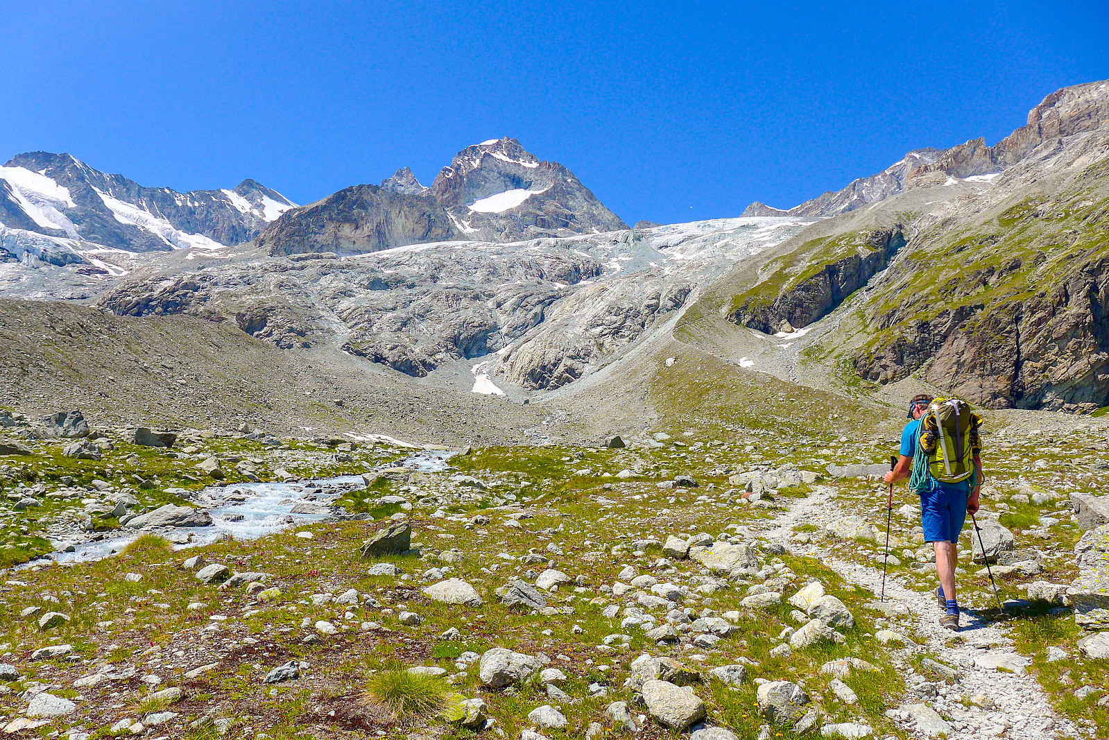
We drove over to Tasch from Evolene earlyish on the Sunday morning and parked at one of the taxi car parks before getting a ride up to Zermatt. It was set to be a hot day! We left some overnight stuff at the Hotel Weisshorn in the centre of town before making our way up the path going northwest up the Triftbach. Weighed down by heavy rucksacks full with climbing gear, we walked mega slowly up the zig-zagging trail, which was initially pleasant in the trees with a bit of shade. Last time I was there was in 2018 when I’d gone up to the Rothorn hut to climb the Ober Gabelhorn, so I had a fairly idea of how far up the hut was from Zermatt (9km, 1570m according to Strava). Anyway, the slow steady pace and good conversation we had going ensured that the walking wasn’t overly hard work and not too far from the Trift hotel, at a junction where the path split at around 2450m and around halfway in terms of ascent, we stopped to take a lunch break. I had sort of hoped that the hut would not be particularly busy, but judging by the number of people who were walking with climbing packs in both directions, it seemed like the hut wasn’t exactly going to feel deserted that night. Anyway, we carried on our way up the valley with the grand views of both the Gabelhorn and Trift glaciers surging down to our left, eventually crossing a stream just before the final eternal moraine ridge leading up to the Rothorn hut. The path was pretty dusty after several days of warm and dry weather, so when the wind started to pick up a bit the dust got plucked off the path and became easily airborne. We arrived around 3.30pm and were greeted by the sight of more than a dozen climbers sunning themselves on the terrace outside the hut. I was quite glad to get inside and out of the sun for a drink! We were fortunate to be allocated beds in a dormitory with only two other Dutch girls, so I had high hopes of getting some sleep that night :-) The only slight issue was that we were supposed to bring sleeping bags (not just liners) as one of the Covid measures, and this we had not known about. Lucky we found some extra blankets lying around else it could have potentially been a very chilly night!
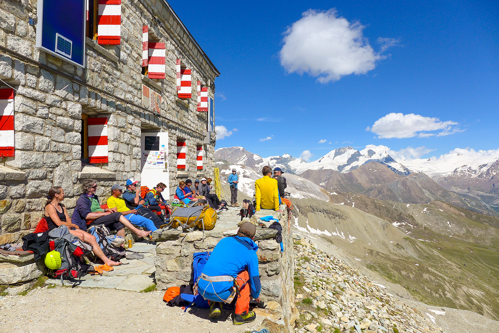
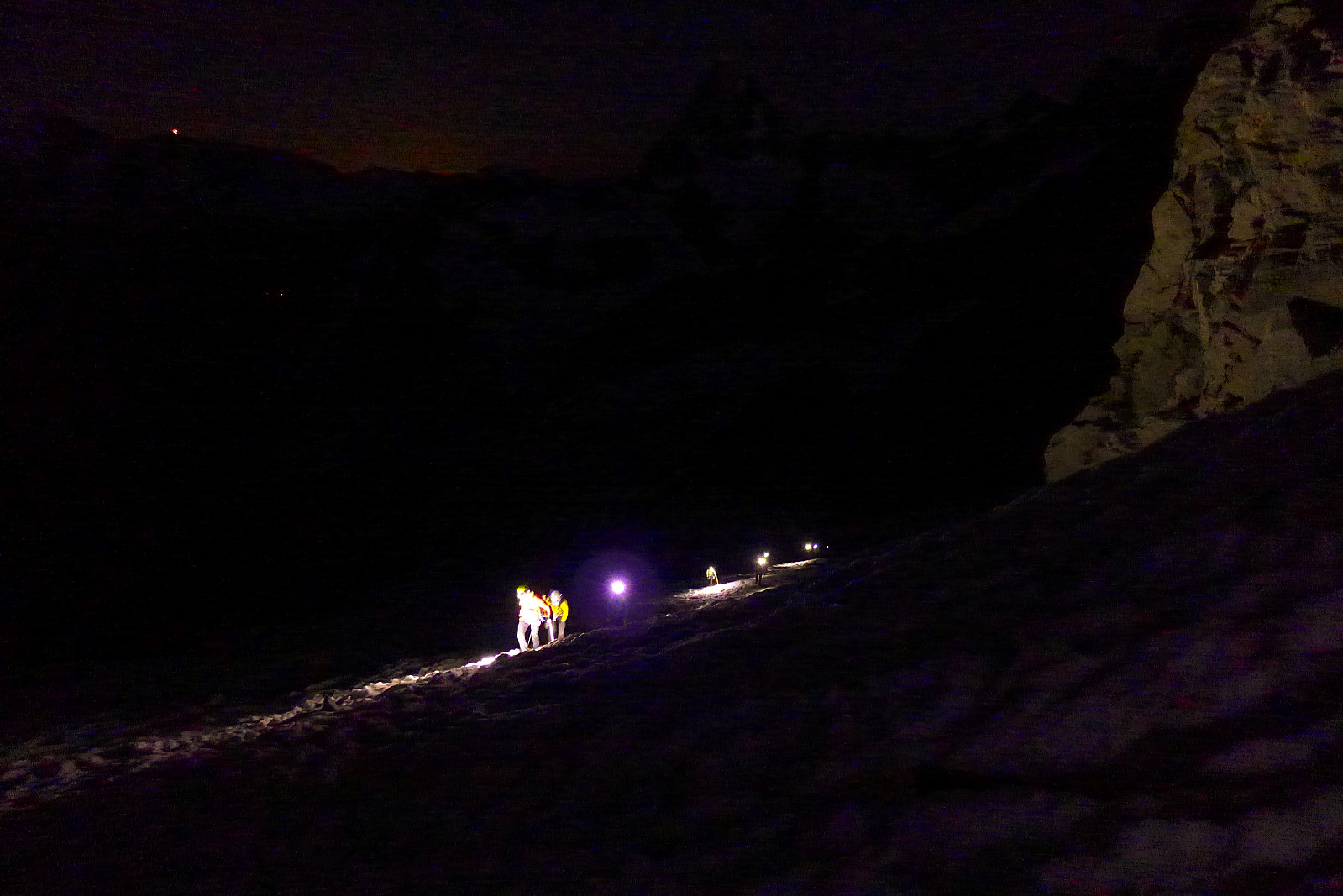
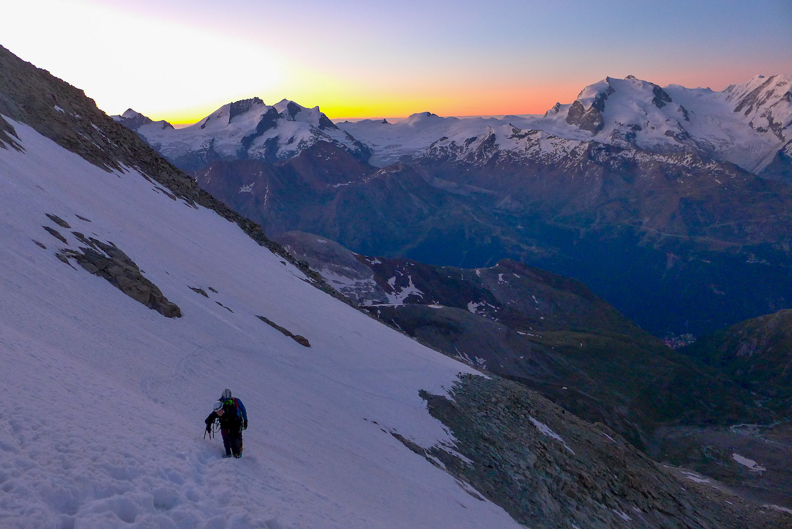
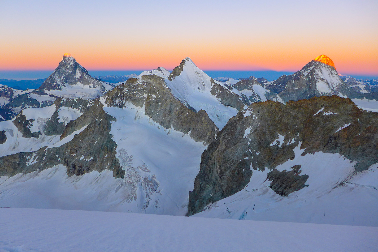
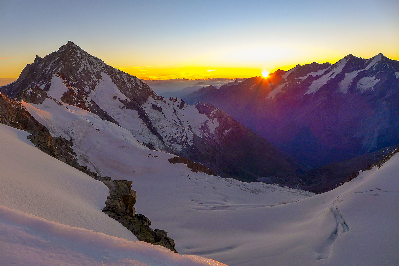
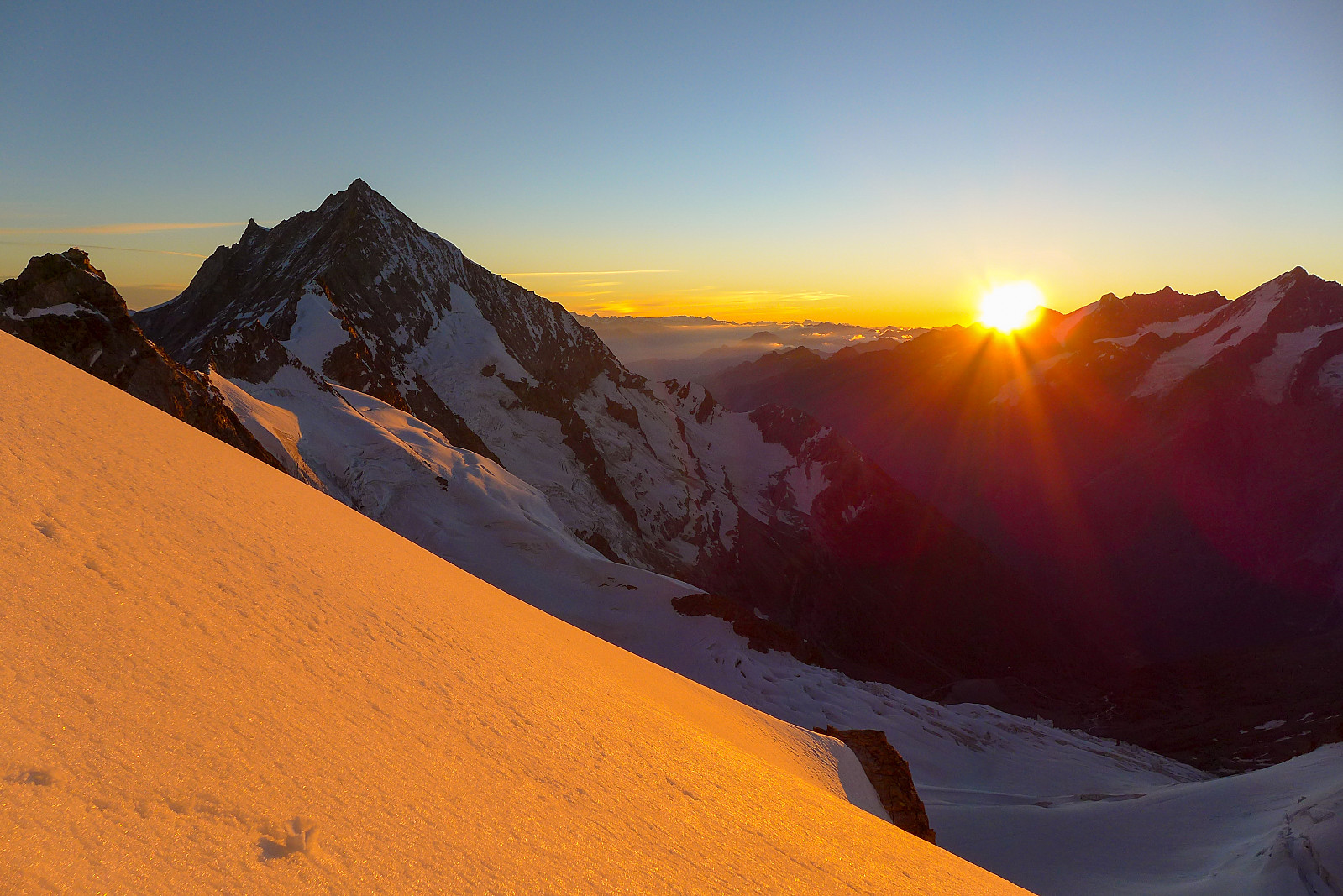
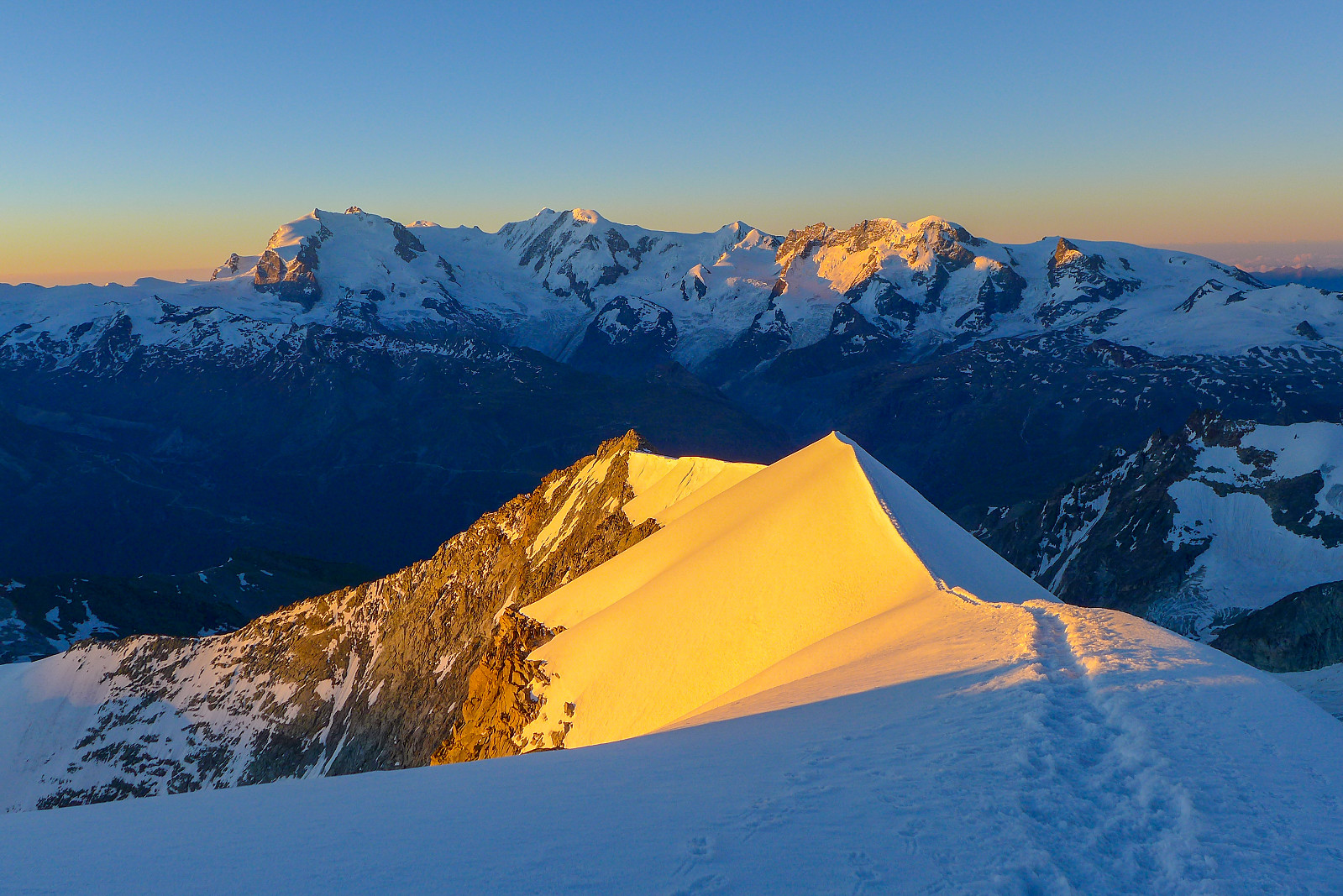
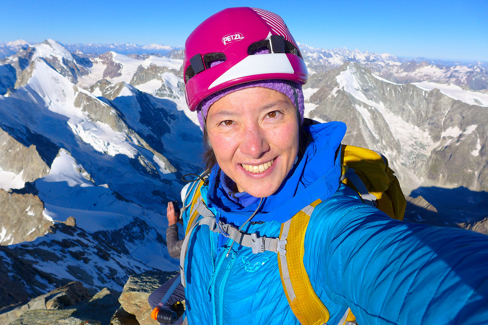
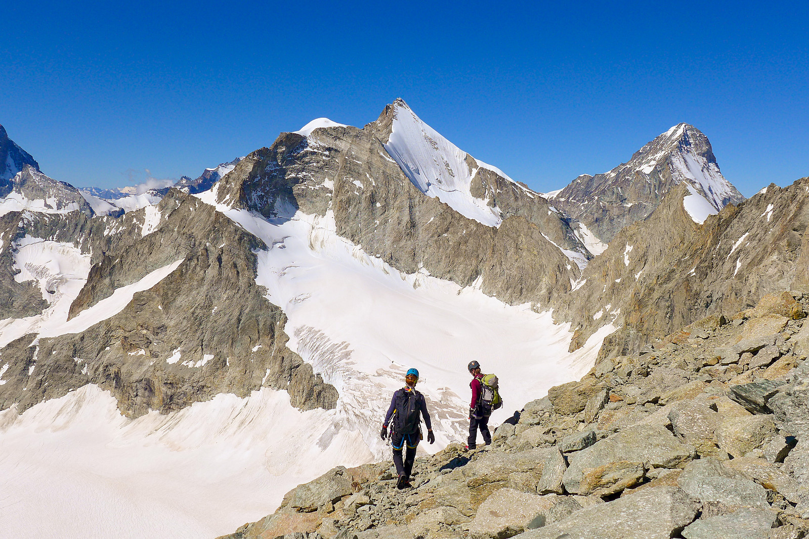
Breakfast was arranged for 3am, so most people were in bed by around 8.30pm. Slept pretty OK although I was a bit slow to get going in the morning. After a final toilet visit (which I was glad to say goodbye to after the one night there) we were ready to go soon after 3.30am. Quite a lot of climbers were planning to do the same route, so there was no shortage of headtorches creeping slowly up the lower end of the Rothorn glacier. The initial rise from the hut was quite easy angled and even though the snow was solid it was generally OK to walk without crampons. But eventually it steepened up enough that skittering around on hard snow was becoming a waste of energy and we put them on for the short distance up to a rock band where the route ascended via a steep chimney formation. That was straightforward enough and above this we continued over loose-ish easy ground across to a snowy traverse which was well tracked. The steps were so big that with some careful footwork we could sneek across without having to put the crampons back on again. An ice axe was essential though! At the other side of the snowfield, the route followed a vague, broad ridge which was mainly made up of boulders. By now climbers had spread out a bit and it was a bit more relaxing to not have people close behind which always seems to stress me out. Anyway, by the time we’d reached the upper part of the ridge, where it meets snow again, dawn had broken and we were treated to a stunning panorama of 4000ers in the moonlit sky as we put on crampons on again for the snowy slog up to the upper section of the mountain. The Matterhorn, Ober Gabelhorn and Dent Blanche pierced the horizon behind us and just as we reached the elegant snow ridge separating the Triftgletscher from the Hohlichtgletscher, a stunning set of orange, pink and purple hues slowly began to filtrate through the sky. It was stunning to watch as the first rays of sun hit the Dent Blanche and pop up from behind the northern end of the Nadelgrat peaks to light up the snow slopes in front of the Weisshorn. Needless to say, we spent a good 10-15 minutes standing around, watching, taking many pictures and me exclaiming ooh and aah countless times as if I’d never seen anything like an amazing sunrise before. In my defence though, the last time I did see a proper nice sunrise like this was probably in February when we actually got a clear morning at a not-too-unsocial time of day, so that was at least 5 months ago…….
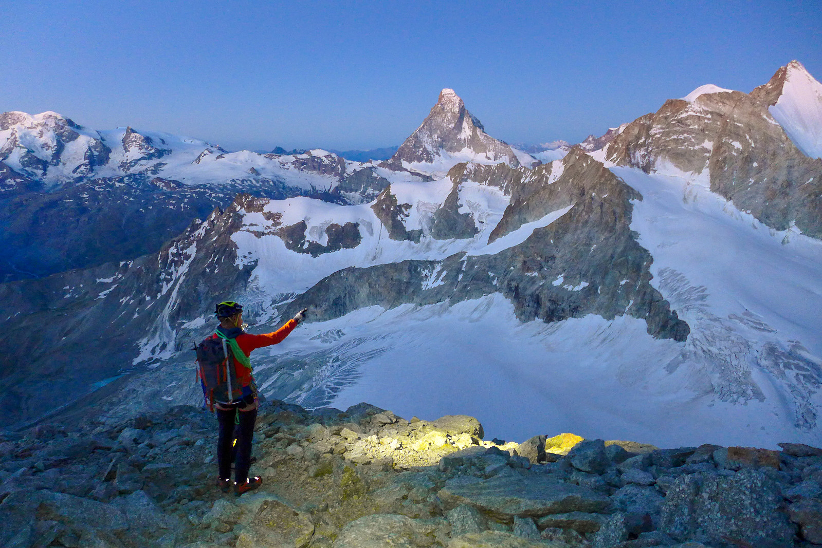
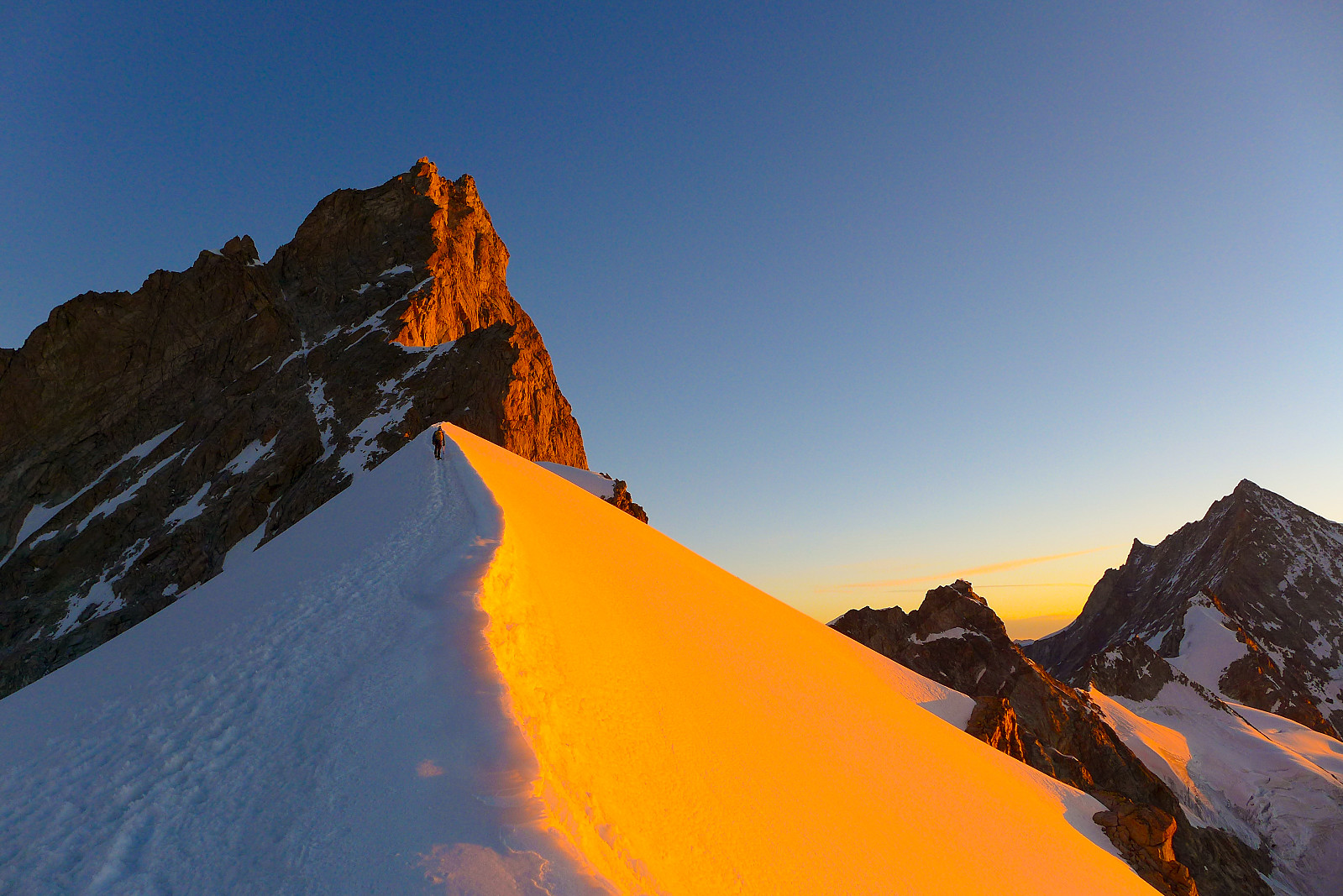
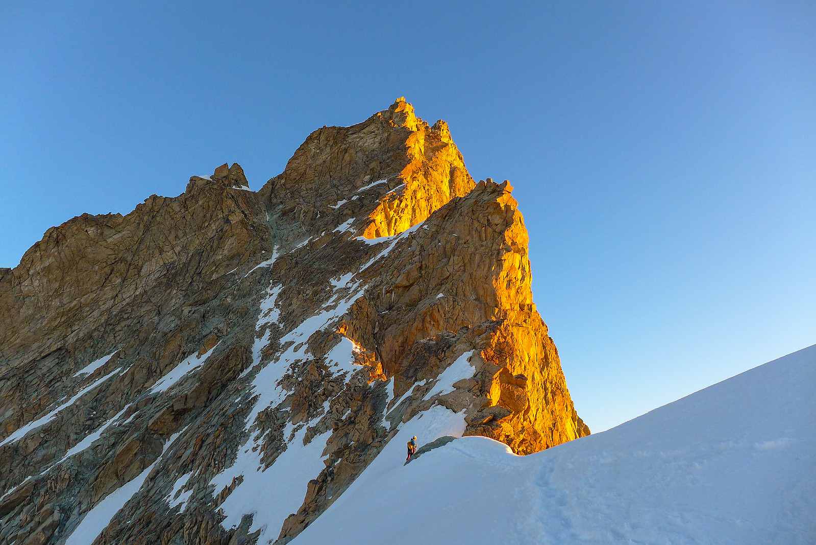
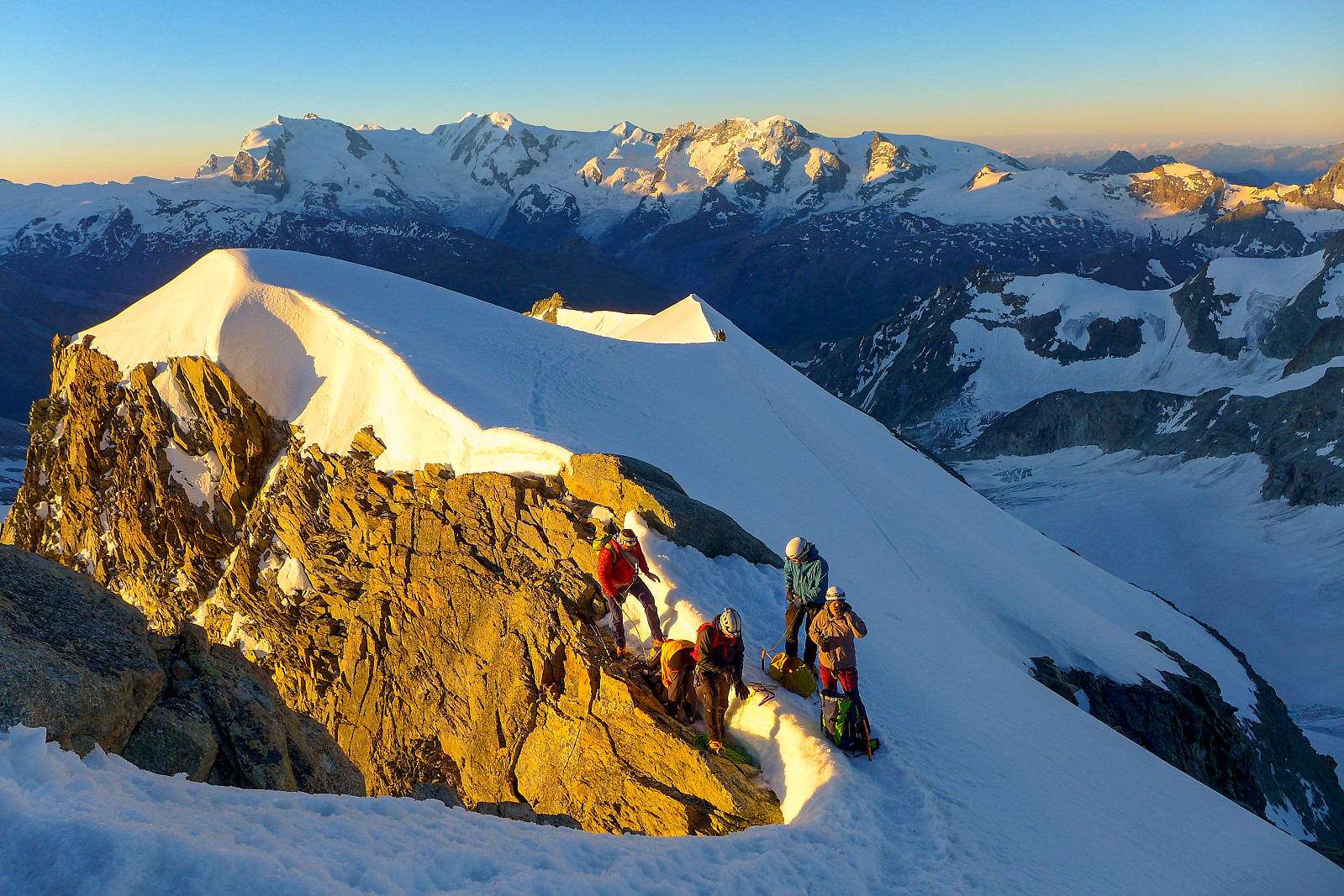
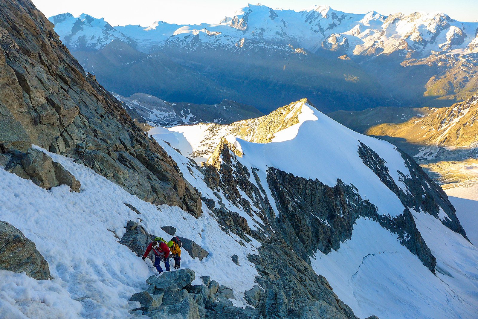
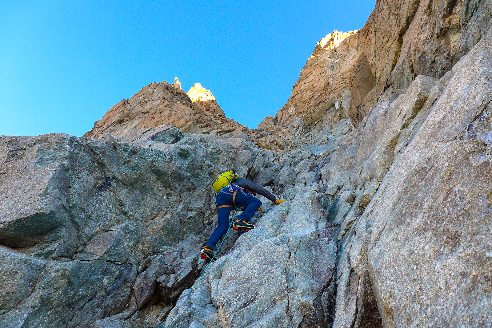
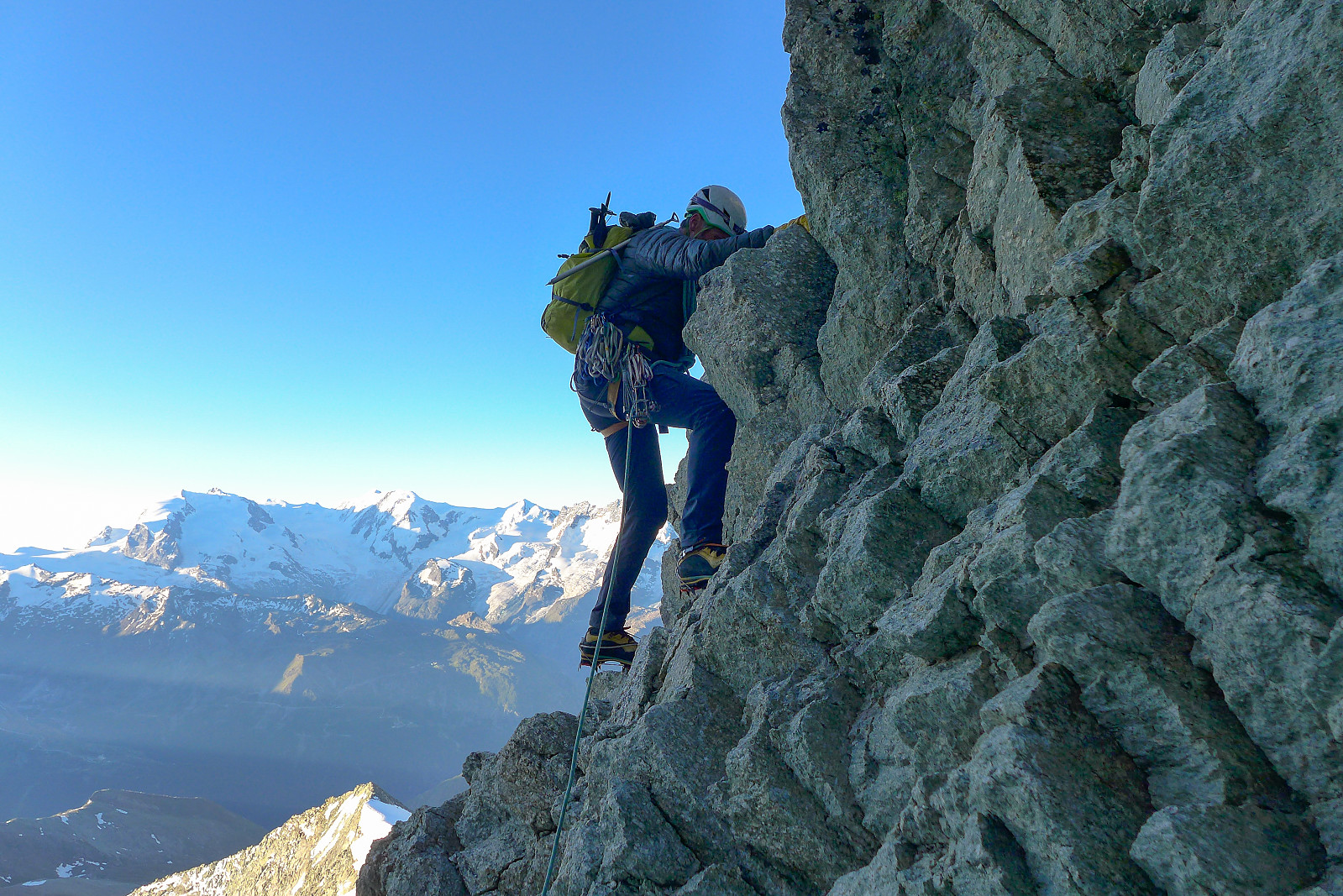
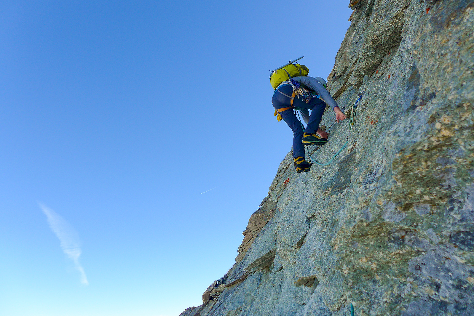
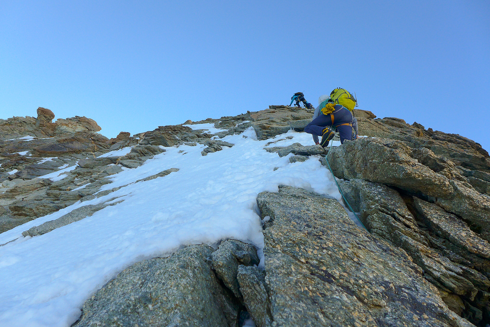
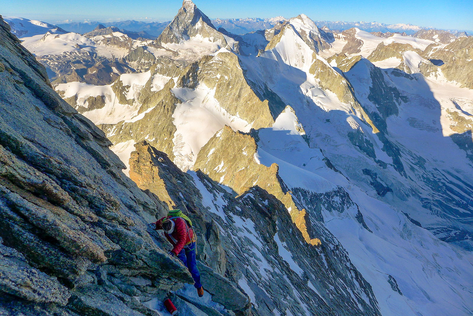
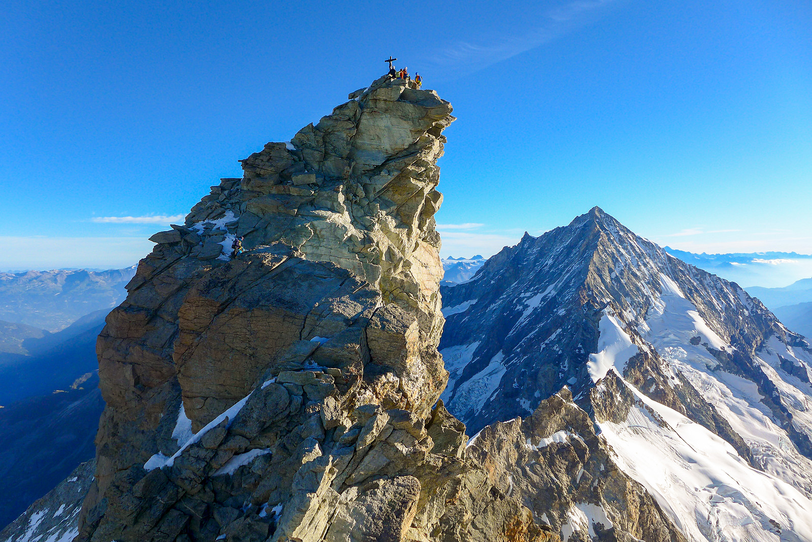
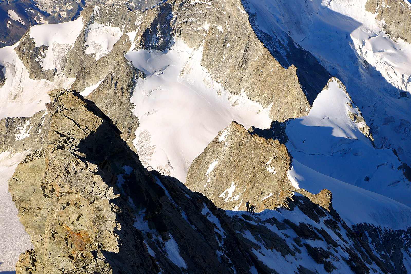
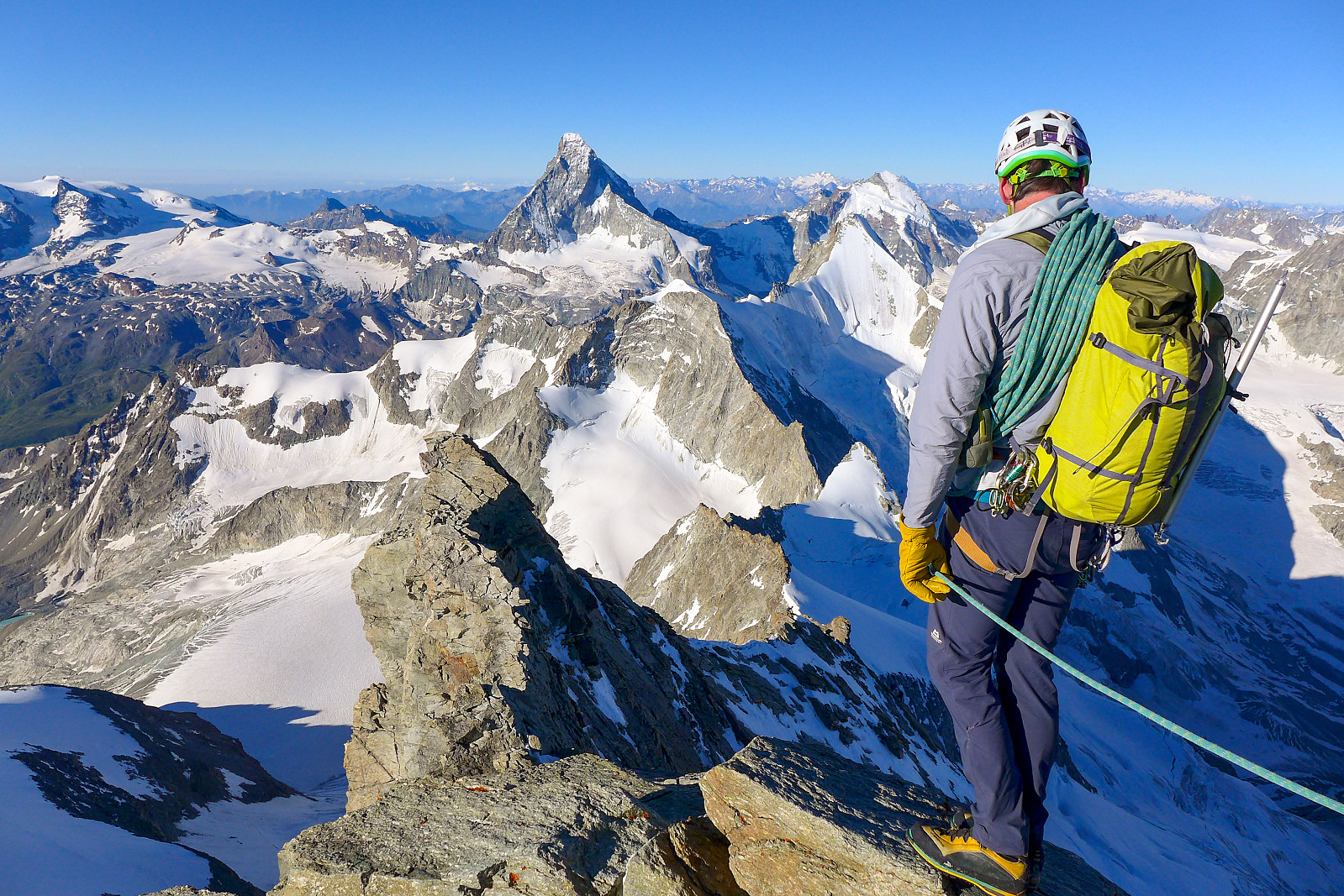
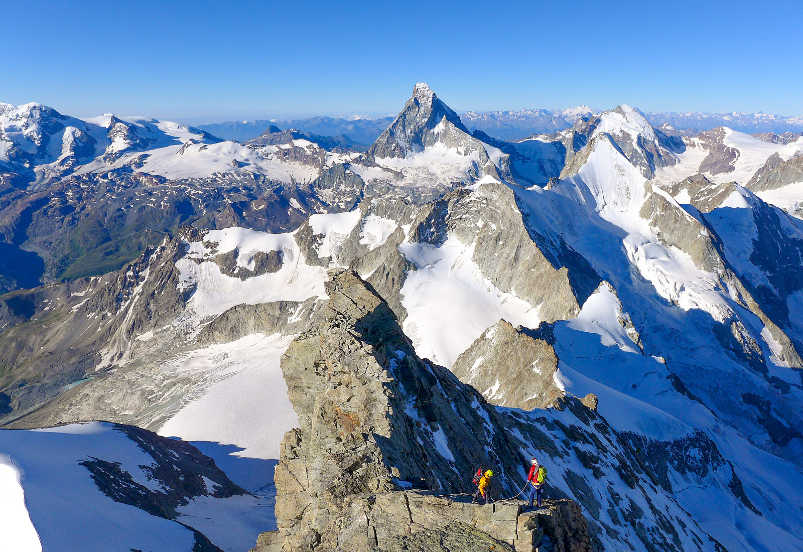
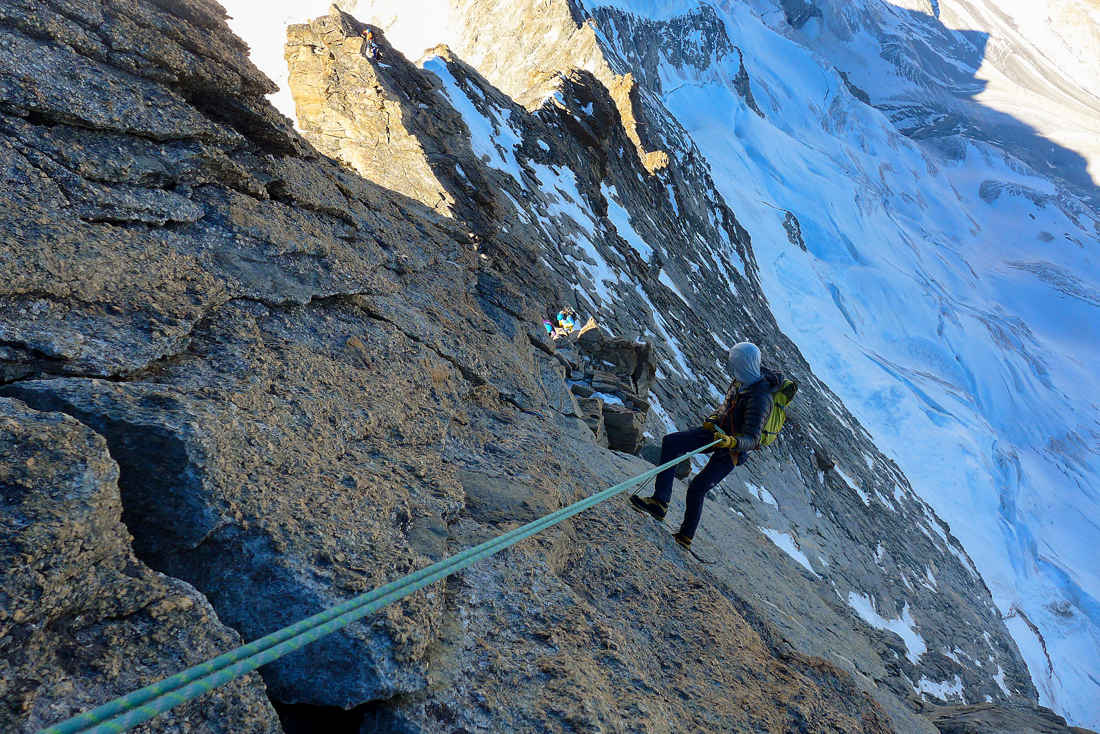
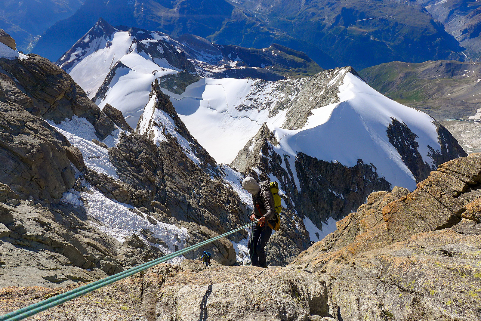
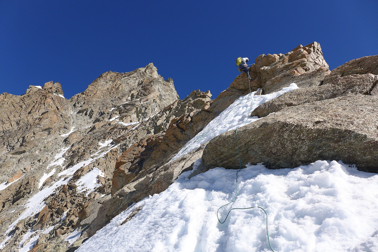
Well, after the amazing display of colours we continued on our way up to the start of the climbing proper. A section of mixed conditions had to be crossed first which was awkward in places, and led us up an icy gully. Thankfully we got out of that gully at some point, took off crampons and continued up the ridge to the left overlooking the gully. Easy climbing/scrambling took us up to a notch in the ridge where the southeast and southwest ridge routes met and from there we also got blasted by an icy wind from the northwest. A couple of short pitches on the crest of the ridge followed, but then we had to cross over into the shady west side of the crest to cross the Biner slab (named after a climber I think, nothing to do with carabiners), which turned out to be much easier than it looked from below. From here the route continued straight up to gain the crest again and weaved its way around the sunny side and traversing some exposed ground before re-joining the crest for the final crossing and climb up to the summit. It was a pretty cool view from just below and across from the main summit! By this time there were already several teams on their way back, so there was a bit of waiting around in places to let people past, but people were generally being considerate. On the summit we met again the two Dutch girls who were a lot more acclimatized than us after having traversed Lyskamm and the Ober Gabelhorn earlier in the week! Views were pretty incredible in every direction, but maybe moreso as we looked straight across the SW ridge in the direction of the Matterhorn. Climbers were scattered along the ridge and made good objectives for a photo :-) It was still a bit chilly in the early morning sun though, so we didn’t spend an eternity on the summit, probably not more than about 15 minutes; then we began the descent carefully back down the ridge, over the foresummit and around the sunny, exposed side, then back down the somewhat slabby part of the ridge directly above the Biner slab. Here there were a series of abseil posts which meant we could just cruise back down past the Biner slab without having to downclimb the entire ridge back down to the notch in the ridge where the SE ridge and the SW ridge routes met. Climbing teams going in both directions made it a bit time-consuming, but once past the notch (and back in the sun!) the teams got a bit more spread out again. A couple more abseils later and we were reversing the traverse across mixed ground to reach the start of the snow ridge and the easy(ish) ground to descend back down to the hut. Only the downclimbing in the narrow chimney above the Rothorn glacier presented probably the most awkward part of the descent of the whole route as footholds were hard to see from above. Nevertheless, a bit of care and concentration got us safely back down to the glacier and a straightforward descent over friendly sun-softened snow got us efficiently back to the hut by about 11.15am. What a great start to the week!
After having a good drink and re-packing rucksacks again we started the hot and long 1600m descent back down to Zermatt, which took around 2h 45 with a short stop along the way. The knees were feeling a bit stiff after descending the 2600m from the summit of the Zinalrothorn!

| Starttidspunkt | 20.07.2020 03:42 (UTC+01:00 ST) |
| Sluttidspunkt | 20.07.2020 11:27 (UTC+01:00 ST) |
| Totaltid | 7t 45min |
| Bevegelsestid | 5t 46min |
| Pausetid | 1t 58min |
| Snittfart totalt | 0,9km/t |
| Snittfart bevegelsestid | 1,2km/t |
| Distanse | 7,1km |
| Høydemeter | 1111m |


Kommentarer