Archive - Date
Archive - Activity
-
Bike trip (107)
- Bike trip - mixed (25)
- Bike trip - road (82)
-
Drive (9)
- Car drive (9)
-
Other trip (3)
- Kayaking (3)
-
Ski trip (109)
- Backcountry skiing (65)
- Cross-country skiing (44)
- Trip by foot (1747)
Collected lists
-
Utvalgte topper og turmål i Bergen
(332/333)
 99%
99% -
Alle topper i Bergen
(379/386)
98%
-
Kvam ≥ 100m pf.
(41/44)
93%
-
Opptur Hordaland
(143/159)
89%
-
Voss ≥ 100m pf.
(86/98)
87%
-
Stasjoner på Bergensbanen
(28/36)
77%
-
Hordaland ≥ 100m pf.
(593/863)
68%
-
Ulvik ≥ 100m pf.
(26/38)
68%
-
Jondal ≥ 100m pf.
(15/23)
65%
-
Dagsturhyttene i Vestland
(33/61)
54%
-
Sunnhordland PF >= 100m
(100/186)
53%
-
DNT-hytter i Hordaland
(22/45)
48%
-
Hordaland: Hardanger PF>=100m
(170/359)
47%
-
Kvinnherad ≥ 100m pf.
(36/79)
45%
-
Sogndal ≥ 100m pf.
(23/81)
28%
-
DNT-hytter i Sogn og Fjordane
(8/47)
17%
-
Eidfjord ≥ 100m pf.
(6/42)
14%
-
Etne ≥ 100m pf.
(7/51)
13%
-
Ullensvang ≥ 100m pf.
(19/153)
12%
-
Opptur i Sogn og Fjordane peaks
(17/177)
9%

Vossamarsjen 2021 + Skorane, Nansenbu and Torfinnshorgi
- Date:
- 21.08.2021
- Characteristic:
- Hillwalk
- Duration:
- 7:19h
- Distance:
- 27.7km
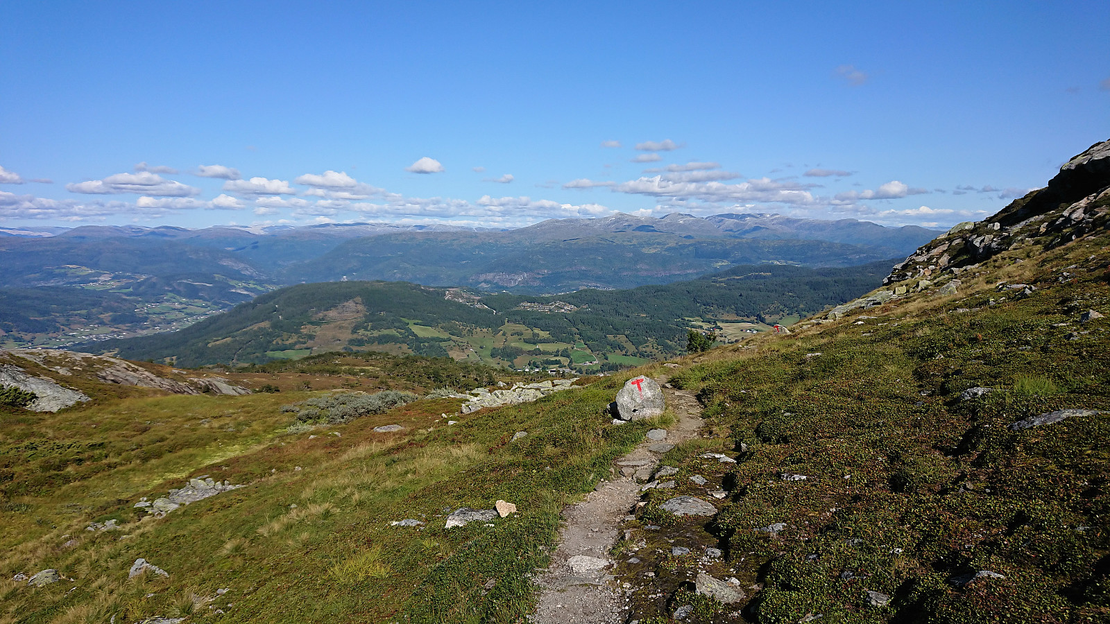 Vossamarsjen is a yearly hike organized by the Norwegian Trekking Association , or more specifically Voss Utferdslag , starting from Hodnaberg and following the T-marked trail via Torfinnsheim , Timaglaset , Gråsidetoppen and Roset , before ending up at Gjelle. My plan was to take advantage of the joint bus transportation from/to Voss and follow most of the official Vossamarsjen route, but also make a couple of minor detours to along the way.
I therefore got up at 05:00 on a Saturday morning for the first train to Voss. After waiting close to 45-minutes for the next (and last) organized bus ride, we all finally left Voss just after 09:00. Note that due to roadwork close to Narheim, the earlier buses had all gone via Bergsdalen, but we thankfully got to skip this longer detour by instead walking past the roadwork and hopping on a second bus on the other side.
At 09:45 we arrived at the parking lot at Hodnaberg >>>
Vossamarsjen is a yearly hike organized by the Norwegian Trekking Association , or more specifically Voss Utferdslag , starting from Hodnaberg and following the T-marked trail via Torfinnsheim , Timaglaset , Gråsidetoppen and Roset , before ending up at Gjelle. My plan was to take advantage of the joint bus transportation from/to Voss and follow most of the official Vossamarsjen route, but also make a couple of minor detours to along the way.
I therefore got up at 05:00 on a Saturday morning for the first train to Voss. After waiting close to 45-minutes for the next (and last) organized bus ride, we all finally left Voss just after 09:00. Note that due to roadwork close to Narheim, the earlier buses had all gone via Bergsdalen, but we thankfully got to skip this longer detour by instead walking past the roadwork and hopping on a second bus on the other side.
At 09:45 we arrived at the parking lot at Hodnaberg >>>
Lønahorgi from Hangurstoppen
- Date:
- 08.08.2021
- Characteristic:
- Hillwalk
- Duration:
- 6:10h
- Distance:
- 21.9km
 A visit of Lønahorgi had been on my agenda for a while. So I decided to make the most out of my last day of summer vacation and hopped on an early morning train to Voss. Here I decided on "cheating" by taking the cable car (see Voss Gondol ) to the top of Hangur , and thus for once started a hike with descending from the first minor peak of the hike. In fact, this was so unusual that I almost missed the sign for the trail to Lønahorgi, as it does a minor detour via Valbergstjørni and eastern side of Slettafjellet . The advantage compared to the more direct route via Trodalstølen is that one pretty much stays at the same altitude.
The trail was marked with red T's and easy to follow, and I quickly connected with the tractor road coming up from Trodalstølen. From here on the trail partly followed the road and partly made >>>
A visit of Lønahorgi had been on my agenda for a while. So I decided to make the most out of my last day of summer vacation and hopped on an early morning train to Voss. Here I decided on "cheating" by taking the cable car (see Voss Gondol ) to the top of Hangur , and thus for once started a hike with descending from the first minor peak of the hike. In fact, this was so unusual that I almost missed the sign for the trail to Lønahorgi, as it does a minor detour via Valbergstjørni and eastern side of Slettafjellet . The advantage compared to the more direct route via Trodalstølen is that one pretty much stays at the same altitude.
The trail was marked with red T's and easy to follow, and I quickly connected with the tractor road coming up from Trodalstølen. From here on the trail partly followed the road and partly made >>>
Horn, Volafjellet and Tvarafjellet from Bulken
- Date:
- 27.06.2021
- Characteristic:
- Hillwalk
- Duration:
- 10:32h
- Distance:
- 37.2km
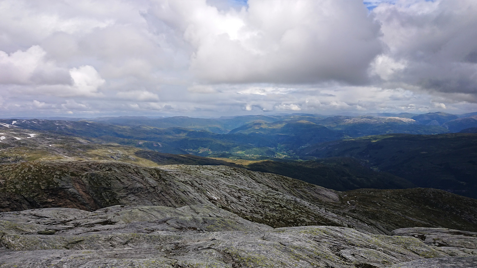
 I started by taking the train to Bulken and from there following the paved and later gravel road up to Tverrlii p-plass . Here the road turned into a nice unmarked trail that brought me up to Listred . The map here indicated a trail continuing north, but I did not see any traces of it. In any case, I crossed the river and instead headed off-trail towards Horn . Note that while I crossed south of the bridge, as there was very little water in the river, the bridge had been upgraded since Knut Sverre 's visit more than five years ago when it was more of a "build you own bridge" concept. ;)
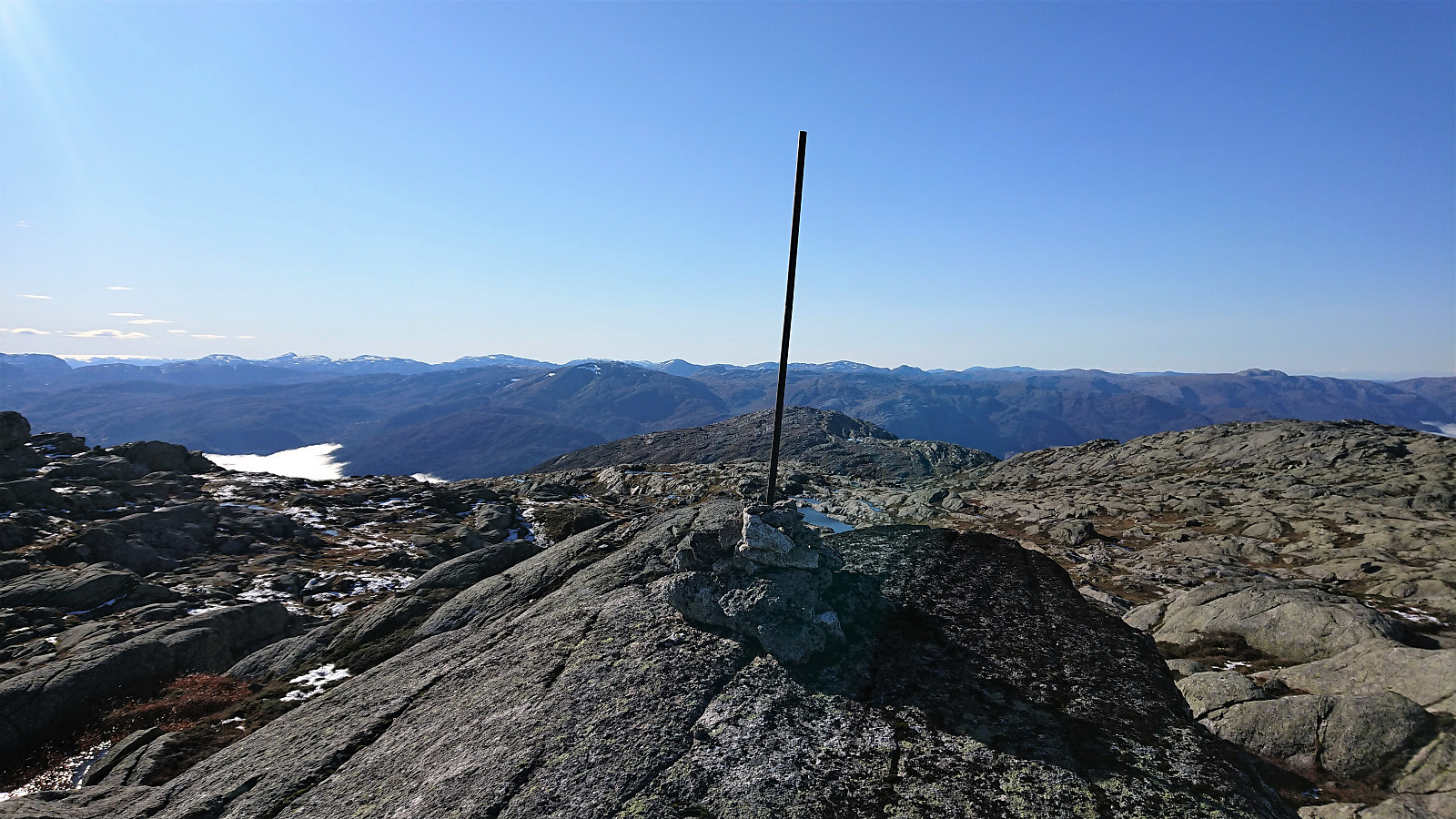
When getting closer to the summit I came across a weak trail marked with small cairns (maybe coming up from Vestbygdi/Nyestølen?), but it seemed to disappear when approaching the summit. Before heading to the summit, I made a quick visit of the large cairn to the west . Excellent views from both >>>
I started by taking the train to Bulken and from there following the paved and later gravel road up to Tverrlii p-plass . Here the road turned into a nice unmarked trail that brought me up to Listred . The map here indicated a trail continuing north, but I did not see any traces of it. In any case, I crossed the river and instead headed off-trail towards Horn . Note that while I crossed south of the bridge, as there was very little water in the river, the bridge had been upgraded since Knut Sverre 's visit more than five years ago when it was more of a "build you own bridge" concept. ;)
When getting closer to the summit I came across a weak trail marked with small cairns (maybe coming up from Vestbygdi/Nyestølen?), but it seemed to disappear when approaching the summit. Before heading to the summit, I made a quick visit of the large cairn to the west . Excellent views from both >>>
Skiing: Steinskvanndalen
- Date:
- 11.04.2021
- Characteristic:
- Backcountry skiing
- Duration:
- 4:04h
- Distance:
- 14.6km
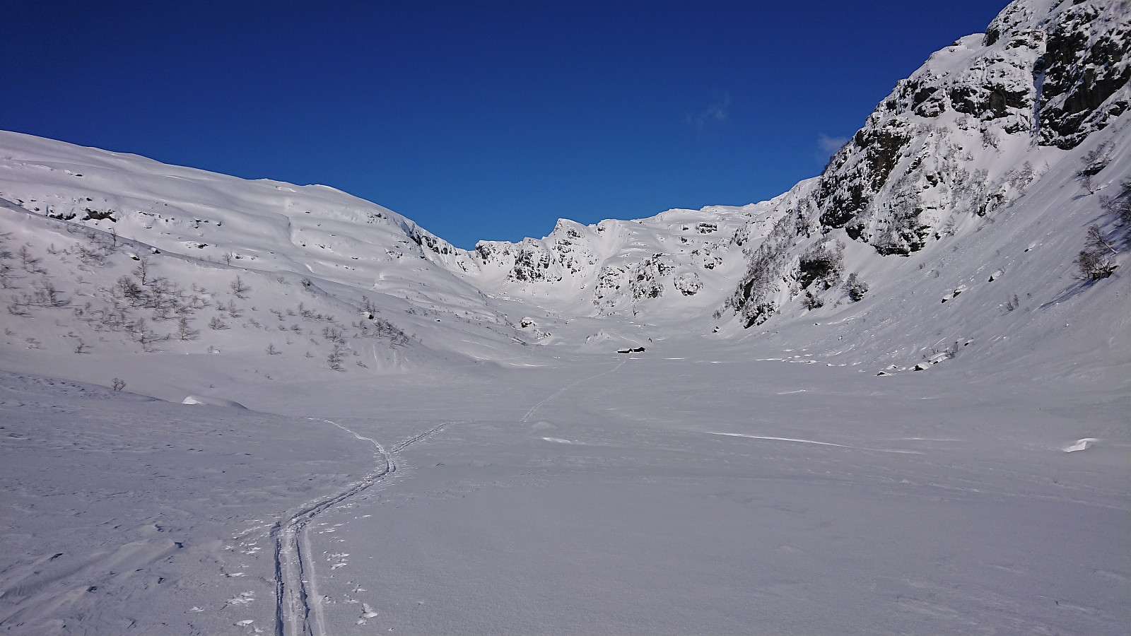
 More or less a repeat of our skiing trip in Steinskvanndalen just over a year ago . (Although this time struggling much less with trying to find out where to start skiing from.) Overall excellent conditions for skiing, with freshly made ski trails that could be followed all the way to Øvre Kvanndalsvatnet. Before starting our descent, we made a short off-trail detour in relatively deep snow to the summit of Rundehaugen (the only reason why this trip is labeled backcountry skiing and not cross-country skiing), which provided great views towards the bigger surrounding mountains and a good place to enjoy our lunch. In summary, once again an excellent trip in an area that can be highly recommended for skiing!
Budalshovden from Evanger
- Date:
- 11.10.2020
- Characteristic:
- Hillwalk
- Duration:
- 5:58h
- Distance:
- 19.2km
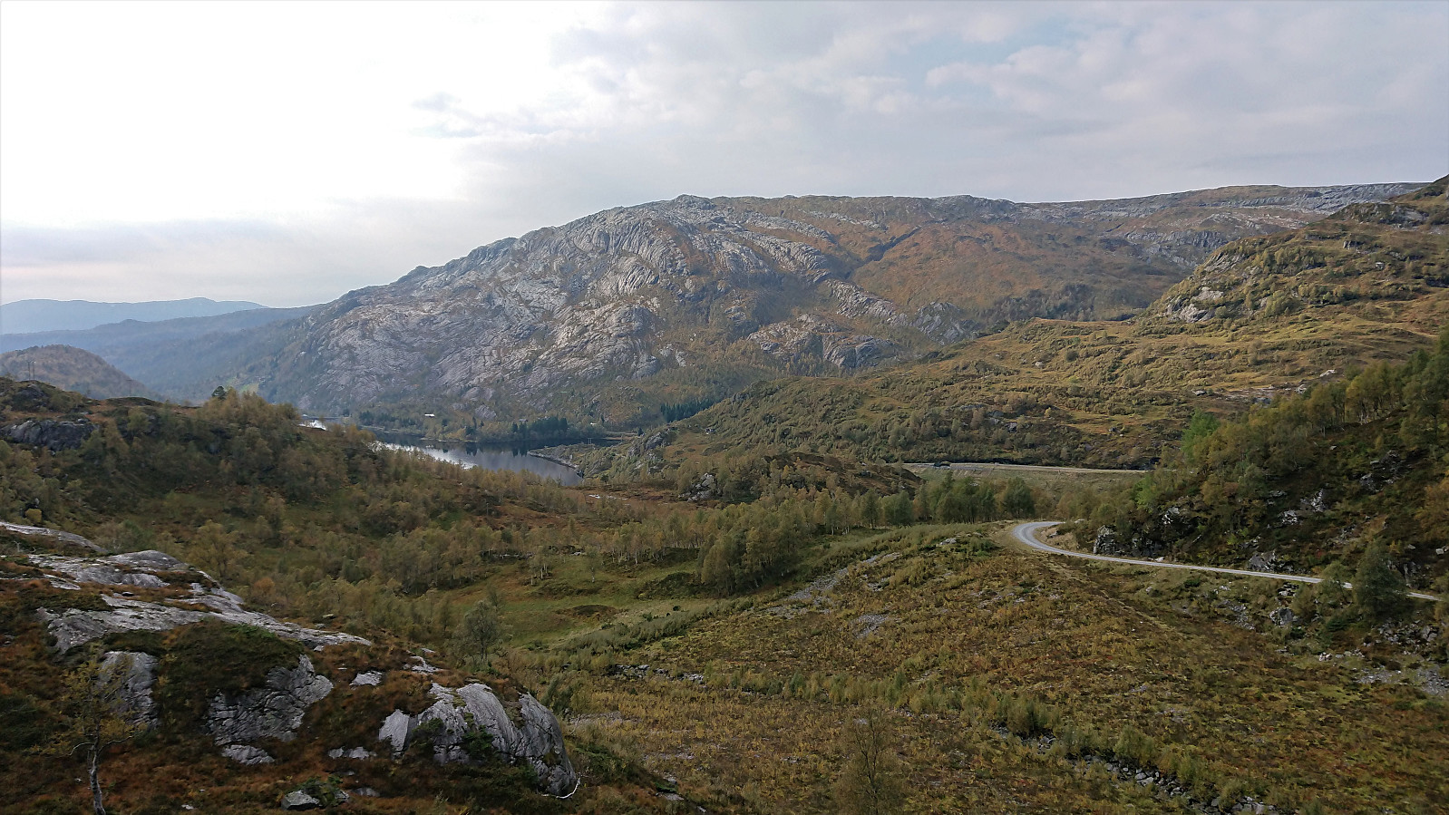
 I started by taking the train to Evanger and in increasingly thicker fog followed the paved road up to Elge. Thankfully the fog started lifting, or more precisely I had climbed above it, shortly after I headed northeast on a service road when the road forked east of Elge. The service road had the usual warning sign of low quality, but as far as I could tell the quality of the gravel road was much better than the sign seemed to indicate.
After 4-5 km (from Evanger), I arrived at the marked trailhead for Skorset . (As I discovered on the descent, there are actually two trailheads only 15-20 meters from each other. The two trails quickly merge though.) The trail itself was not marked, but it was overall of good quality and easy to follow. Some of the potentially slippery sections under wet or icy conditions >>>
I started by taking the train to Evanger and in increasingly thicker fog followed the paved road up to Elge. Thankfully the fog started lifting, or more precisely I had climbed above it, shortly after I headed northeast on a service road when the road forked east of Elge. The service road had the usual warning sign of low quality, but as far as I could tell the quality of the gravel road was much better than the sign seemed to indicate.
After 4-5 km (from Evanger), I arrived at the marked trailhead for Skorset . (As I discovered on the descent, there are actually two trailheads only 15-20 meters from each other. The two trails quickly merge though.) The trail itself was not marked, but it was overall of good quality and easy to follow. Some of the potentially slippery sections under wet or icy conditions >>>
Bjørnaknausen and Gråhorga from Kvitingsvatnet
- Date:
- 27.09.2020
- Characteristic:
- Hillwalk
- Duration:
- 5:59h
- Distance:
- 21.1km
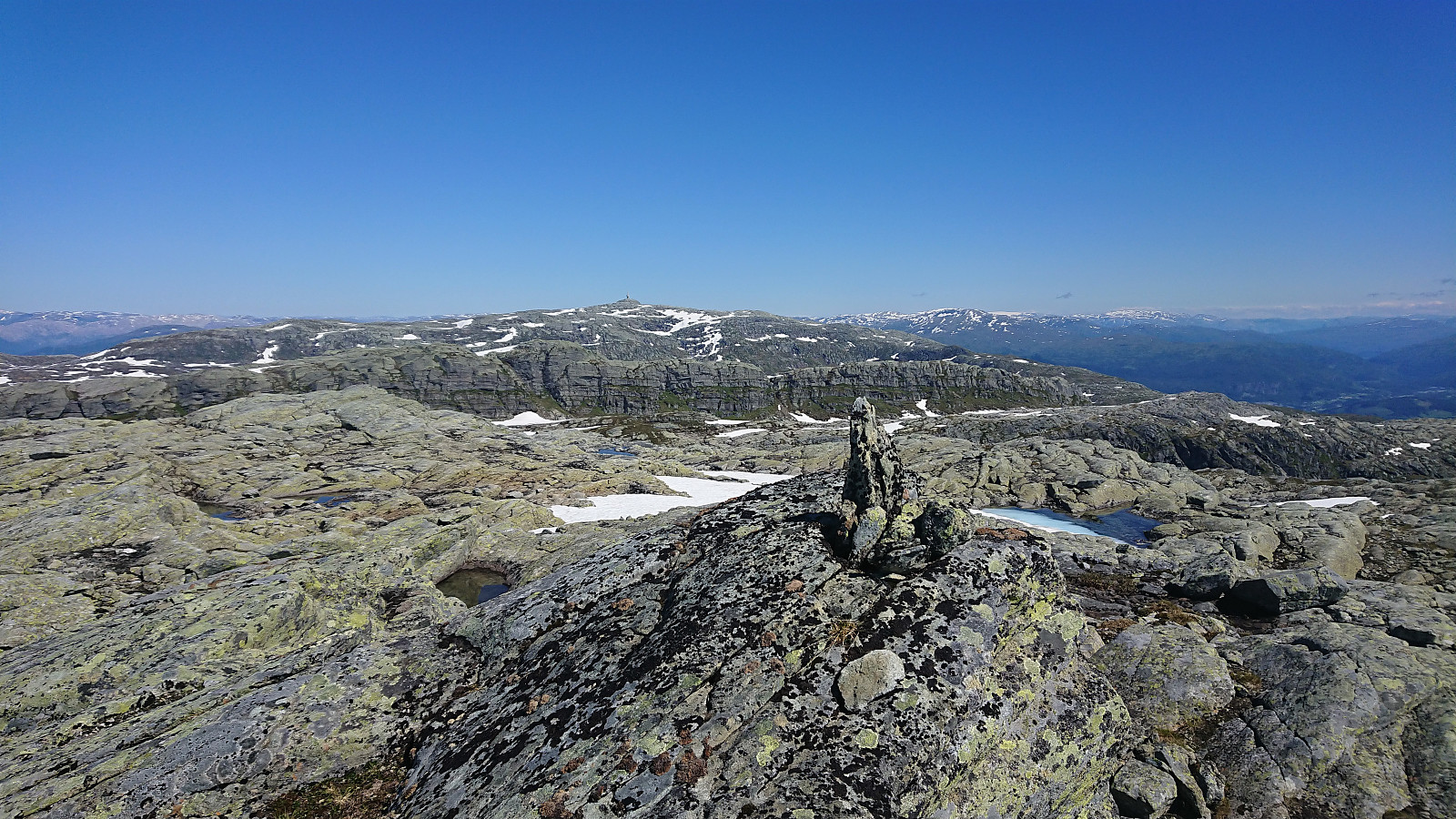
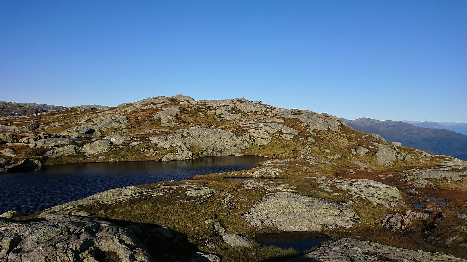
 We parked at Kvitingen p-plass and, after paying the 50 kr parking fee, followed the gravel road towards Holmavatnet. When reaching the last bend in the road before the road’s final climb to the large dam at Holmavatnet, we left the road and instead followed the marked trail for Vending , Høgabu and Gullhorgabu . The trail was marked with red T's and overall easy to follow.
Upon reaching Trongasmogtjørna, the trail forked and we continued northeast on the trail to Vending. We did not stay on this trail for very long though, leaving it at the top of Austra Trongasmoget and from there heading off-trail to the summit of Bjørnaknausen . The summit was reached without any difficulties, and after a couple of pictures we returned to the trail along more or less the same route.
After a quick bite, I continued on my own to the summit of the nearby Gråhorga . Given >>>
We parked at Kvitingen p-plass and, after paying the 50 kr parking fee, followed the gravel road towards Holmavatnet. When reaching the last bend in the road before the road’s final climb to the large dam at Holmavatnet, we left the road and instead followed the marked trail for Vending , Høgabu and Gullhorgabu . The trail was marked with red T's and overall easy to follow.
Upon reaching Trongasmogtjørna, the trail forked and we continued northeast on the trail to Vending. We did not stay on this trail for very long though, leaving it at the top of Austra Trongasmoget and from there heading off-trail to the summit of Bjørnaknausen . The summit was reached without any difficulties, and after a couple of pictures we returned to the trail along more or less the same route.
After a quick bite, I continued on my own to the summit of the nearby Gråhorga . Given >>>
Geitafjellet from Tokagjelet
- Date:
- 16.09.2020
- Characteristic:
- Hillwalk
- Duration:
- 3:12h
- Distance:
- 10.3km
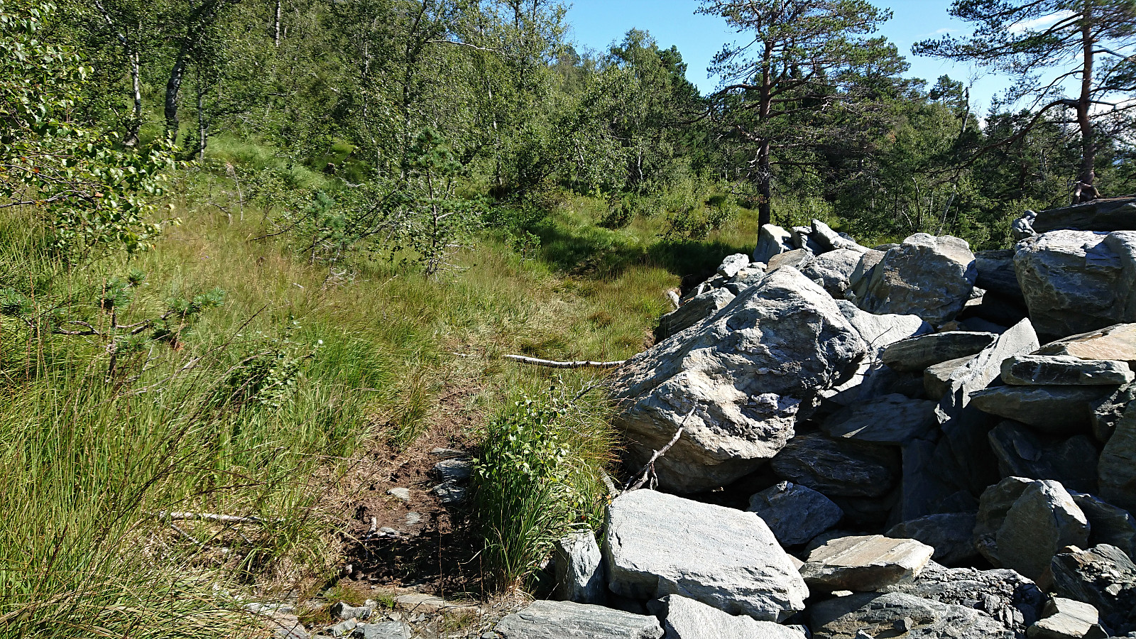
 I started by taking the bus to the eastern end of Langvotnevatnet (bus stop called Tokagjelet), and from there followed the gravel road up to Byrkjesete. Here I continued on the trail towards Myklavatnet, but not long after entering Klypet I left the main trail and instead headed east on another trail marked "Alkleiv - Stuasete - Norheim". Did not stay on this weaker trail for long though and soon left it to head off-trail towards the summit of Geitafjellet which was reached without any difficulties.
The views from the summit were even better than expected, with an excellent overview of Norheimsund with Folgefonna in the background. Strong winds made me cut my stay short however and I did not wait long before descending along more or less the same route. The only difference being that I at the beginning >>>
I started by taking the bus to the eastern end of Langvotnevatnet (bus stop called Tokagjelet), and from there followed the gravel road up to Byrkjesete. Here I continued on the trail towards Myklavatnet, but not long after entering Klypet I left the main trail and instead headed east on another trail marked "Alkleiv - Stuasete - Norheim". Did not stay on this weaker trail for long though and soon left it to head off-trail towards the summit of Geitafjellet which was reached without any difficulties.
The views from the summit were even better than expected, with an excellent overview of Norheimsund with Folgefonna in the background. Strong winds made me cut my stay short however and I did not wait long before descending along more or less the same route. The only difference being that I at the beginning >>>
Botnanuten from Furedalen
- Date:
- 29.08.2020
- Characteristic:
- Hillwalk
- Duration:
- 4:48h
- Distance:
- 17.2km
 We started from a parking lot next to a cabin my sister and her family were renting for the weekend. After first walking north along the main road for a couple hundred meters, we continued on the gravel road around Kvinnhovden, before taking a wet shortcut to reach Aktiven Skiheis .
Next, the bridge across Kvennelvi was crossed and after a short stretch on a trail, we followed the gravel road at Øvre Kvernaskogen until it came to an end. Here a weak and wet trail started, that soon connected with the slightly better old trail heading to Byrkjesete. At Byrkjesete, we continued on the unmarked trail up to Storebotnen and up to Sunnvoredalvatnet.
From Sunnvoredalvatnet I continued on my own for a short off-trail detour to the summit of Botnanuten . There were some steep sections to avoid, but overall the ascent was straightforward. >>>
We started from a parking lot next to a cabin my sister and her family were renting for the weekend. After first walking north along the main road for a couple hundred meters, we continued on the gravel road around Kvinnhovden, before taking a wet shortcut to reach Aktiven Skiheis .
Next, the bridge across Kvennelvi was crossed and after a short stretch on a trail, we followed the gravel road at Øvre Kvernaskogen until it came to an end. Here a weak and wet trail started, that soon connected with the slightly better old trail heading to Byrkjesete. At Byrkjesete, we continued on the unmarked trail up to Storebotnen and up to Sunnvoredalvatnet.
From Sunnvoredalvatnet I continued on my own for a short off-trail detour to the summit of Botnanuten . There were some steep sections to avoid, but overall the ascent was straightforward. >>>
Skiing: Steinskvanndalen
- Date:
- 13.03.2020
- Characteristic:
- Cross-country skiing
- Duration:
- 3:49h
- Distance:
- 16.3km
 With all meetings suddenly cancelled due to the Coronavirus, I decided to instead make use of the perfect weather for a skiing trip in Steinskvanndalen, an area I had previously only visited in the summer. We parked at Løkjentunet, paid the 100 kr fee via Vipps, and from there walked a short stretch along the main road to Kvernavollen. After some initial struggles, we finally connected with the marked ski trail to Steinskvanndalen and could enjoy freshly laid ski tracks.
We continued north to Øvre Kvanndalsvatnet (the last stretch without any tracks), before turning back and reconnecting with the marked ski trail, which we then followed for a roundtrip, finally taking us back to the main road. Again, we struggled to find the best route towards the main road, first making a detour in the wrong >>>
With all meetings suddenly cancelled due to the Coronavirus, I decided to instead make use of the perfect weather for a skiing trip in Steinskvanndalen, an area I had previously only visited in the summer. We parked at Løkjentunet, paid the 100 kr fee via Vipps, and from there walked a short stretch along the main road to Kvernavollen. After some initial struggles, we finally connected with the marked ski trail to Steinskvanndalen and could enjoy freshly laid ski tracks.
We continued north to Øvre Kvanndalsvatnet (the last stretch without any tracks), before turning back and reconnecting with the marked ski trail, which we then followed for a roundtrip, finally taking us back to the main road. Again, we struggled to find the best route towards the main road, first making a detour in the wrong >>>
Bergstadfjellet from Evanger
- Date:
- 23.11.2019
- Characteristic:
- Hillwalk
- Duration:
- 4:28h
- Distance:
- 16.0km
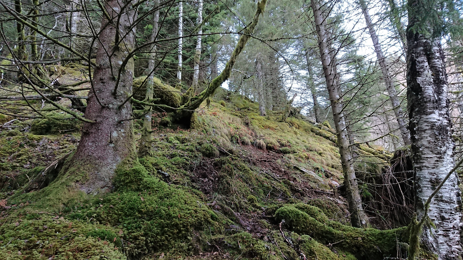 Started by taking the train to Evanger and walking along Teigdalsvegen to Forvene. The road was covered by ice soon after passing Fadnes, but by walking close to the edge of the road, and paying close attention, snow chains were not needed. Upon reaching the short tractor road at Forvene, I left the main road and started searching for a trailhead. Did not find any, so I simply started up the steep ridge, assuming I would come across it later on.
A trail/deer track was shortly discovered. I would put it more in the latter category though, but it did make it easier to progress up the surprisingly steep ascent. The ridge was covered by trees, but these could easily be avoided. Thus there was nothing of the bush war I had mentally prepared for.
At around 200 meters the trail turned much less steep, >>>
Started by taking the train to Evanger and walking along Teigdalsvegen to Forvene. The road was covered by ice soon after passing Fadnes, but by walking close to the edge of the road, and paying close attention, snow chains were not needed. Upon reaching the short tractor road at Forvene, I left the main road and started searching for a trailhead. Did not find any, so I simply started up the steep ridge, assuming I would come across it later on.
A trail/deer track was shortly discovered. I would put it more in the latter category though, but it did make it easier to progress up the surprisingly steep ascent. The ridge was covered by trees, but these could easily be avoided. Thus there was nothing of the bush war I had mentally prepared for.
At around 200 meters the trail turned much less steep, >>>
