Archiv - Nach Datum
Archiv - Nach Aktivität
-
Andere Tour (3)
- Kayaking (3)
-
Fahrradtour (107)
- Fahrradtour Straße (82)
- Fahrradtour gemischt (25)
-
Fahrzeugtour (9)
- Autotour (9)
-
Fußtour (1747)
- Bergtour (1034)
- Jogging (1)
- Spaziergang (52)
- Wanderung (660)
-
Skitour (109)
- Langlauf (44)
- Tourenskilauf (65)
Gesammelte Listen
-
Utvalgte topper og turmål i Bergen
(332/333)
 99%
99% -
Alle topper i Bergen
(379/386)
98%
-
Kvam ≥ 100m pf.
(41/44)
93%
-
Opptur Hordaland
(143/159)
89%
-
Voss ≥ 100m pf.
(86/98)
87%
-
Stasjoner på Bergensbanen
(28/36)
77%
-
Hordaland ≥ 100m pf.
(593/863)
68%
-
Ulvik ≥ 100m pf.
(26/38)
68%
-
Jondal ≥ 100m pf.
(15/23)
65%
-
Dagsturhyttene i Vestland
(33/61)
54%
-
Sunnhordland PF >= 100m
(100/186)
53%
-
DNT-hytter i Hordaland
(22/45)
48%
-
Hordaland: Hardanger PF>=100m
(170/359)
47%
-
Kvinnherad ≥ 100m pf.
(36/79)
45%
-
Sogndal ≥ 100m pf.
(23/81)
28%
-
DNT-hytter i Sogn og Fjordane
(8/47)
17%
-
Eidfjord ≥ 100m pf.
(6/42)
14%
-
Etne ≥ 100m pf.
(7/51)
13%
-
Ullensvang ≥ 100m pf.
(19/153)
12%
-
Opptur i Sogn og Fjordane peaks
(17/177)
9%

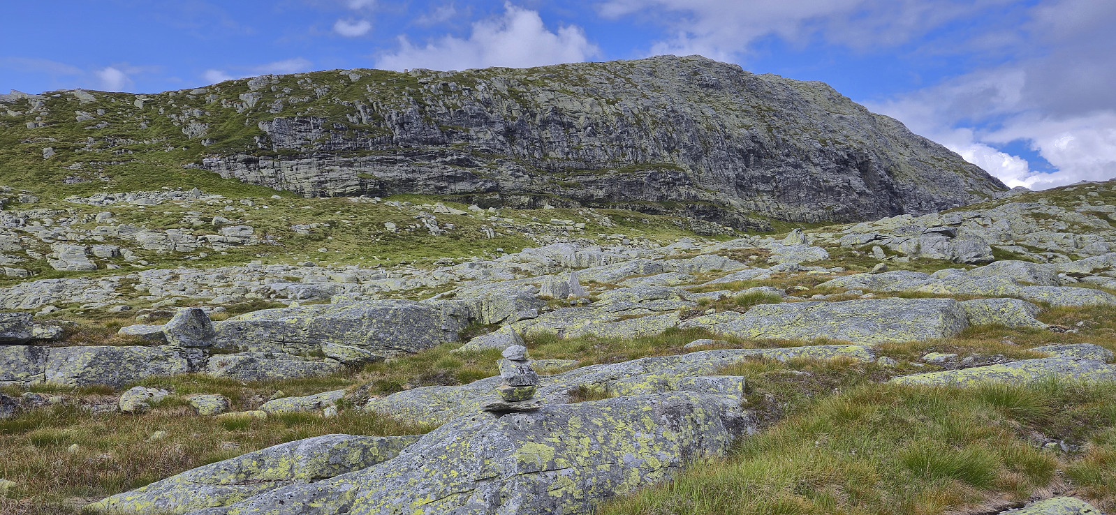
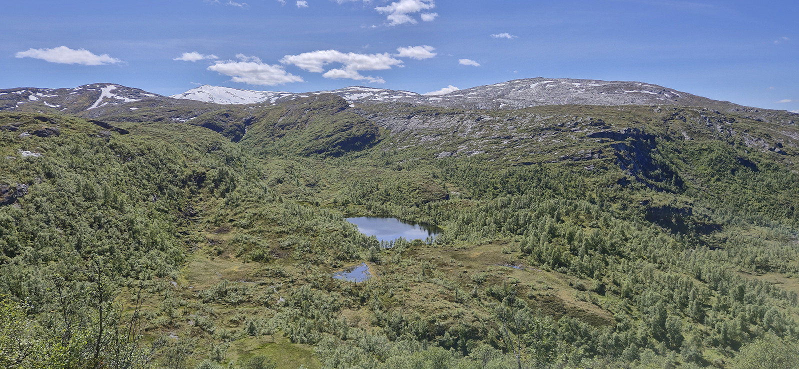
Gjetingsdalen to Årvik via Grønhaug and Storahorga
- Datum:
- 30.08.2025
- Tourcharakter:
- Bergtour
- Tourlänge:
- 7:32h
- Entfernung:
- 16,2km
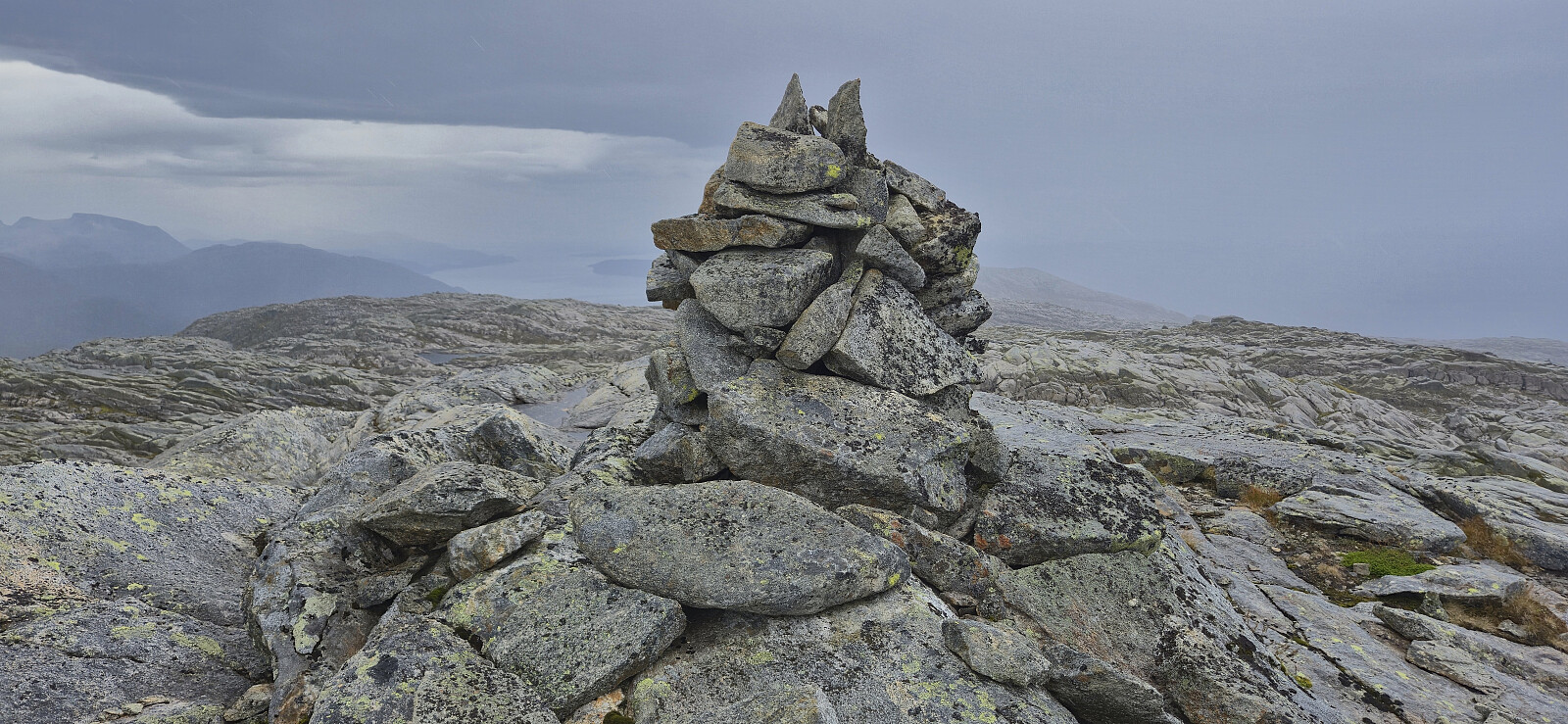 Warning: The trail this hike seemingly follows down to Årvik does not exist! Instead there is a steep off-trail descent. Read the report carefully.
Petter picked up me and Kjell in Ytre Sandviken shortly after seven on a Saturday morning for a joint drive to Tørvikbygd and the ferry to Jondal. From Jondal we drove the short distance south to Gjetingsdalen, paid the 60 kr toll fee and continued up to the small parking lot at the end of the gravel road.
We started by following a trail to Norddalen and from there continued on a much weaker trail, although marked by orange paint, up towards Isdalsvatnet. The trail markers were overall easy to follow however the trail itself was very weak at best. Shortly after passing the small lake south of Isdalsvatnet we in any case had to abandon the markers as they turned southeast and presumably >>>
Warning: The trail this hike seemingly follows down to Årvik does not exist! Instead there is a steep off-trail descent. Read the report carefully.
Petter picked up me and Kjell in Ytre Sandviken shortly after seven on a Saturday morning for a joint drive to Tørvikbygd and the ferry to Jondal. From Jondal we drove the short distance south to Gjetingsdalen, paid the 60 kr toll fee and continued up to the small parking lot at the end of the gravel road.
We started by following a trail to Norddalen and from there continued on a much weaker trail, although marked by orange paint, up towards Isdalsvatnet. The trail markers were overall easy to follow however the trail itself was very weak at best. Shortly after passing the small lake south of Isdalsvatnet we in any case had to abandon the markers as they turned southeast and presumably >>>
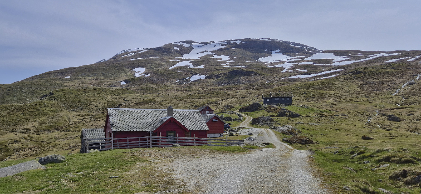
Øvsthusnipa and Vest for Stangahøgdi from Fyre
- Datum:
- 23.08.2025
- Tourcharakter:
- Bergtour
- Tourlänge:
- 6:12h
- Entfernung:
- 15,7km
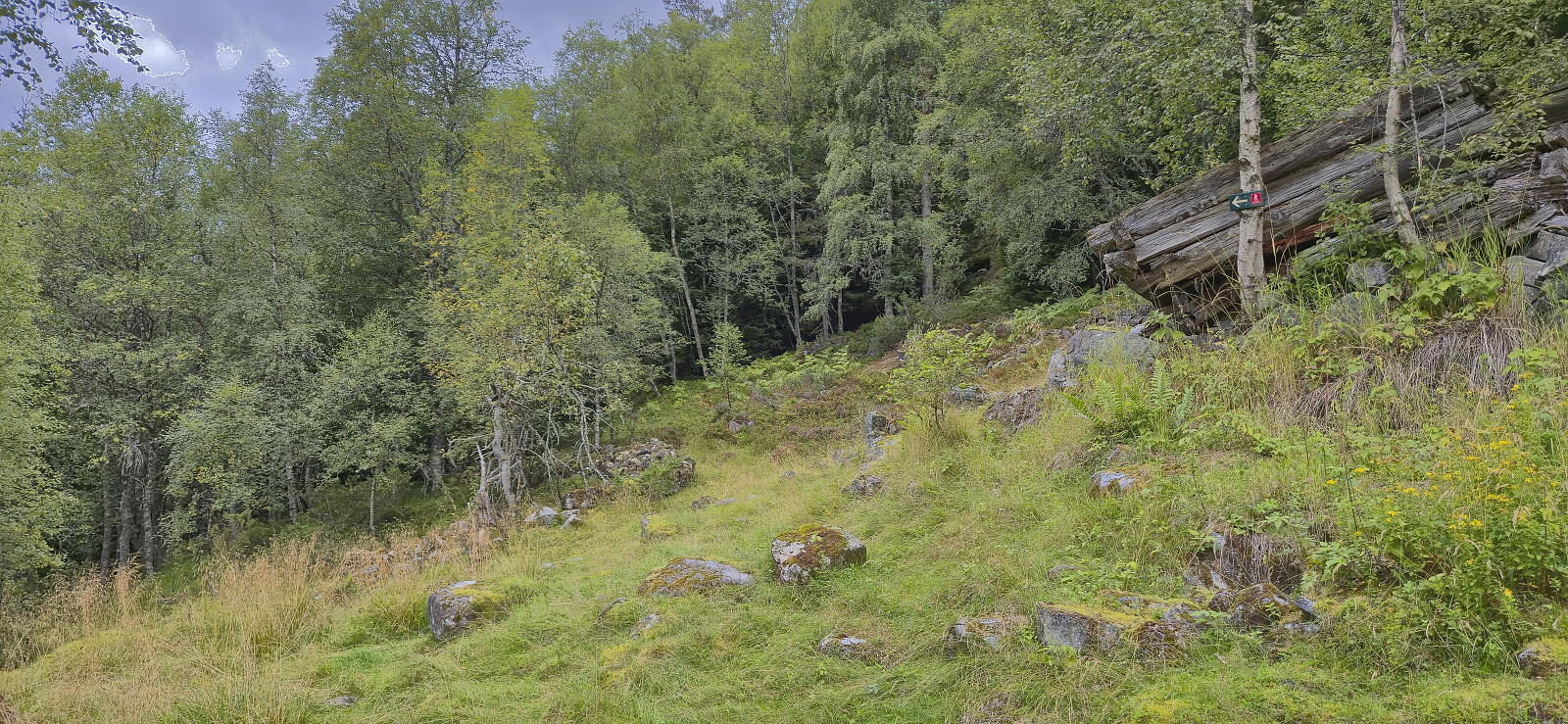 For the second weekend in a row I took the train to Voss, but where I last Sunday continued on an almost empty bus towards Ulvik I today got on one out of a total of four buses packed with tourists heading to Gudvangen. That was not my plan though and I instead got off at the last stop before Stalheim. (Tip: ask the driver to let you off before the bus takes its detour to Stalheim, as apparently there is an extended stop there.)
After getting off the bus I briefly walked south along the main road on a separate cycling and walking path, crossed the road and continued on the gravel road to Fyre where I located the marked trailhead next to the parking lot . A tractor road took me up to the start of the marked trail to Grindaflethytta . I however only stayed on this trail until Øvsthus, where I left the main trail and continued on a marked trail towards Stalheimsnipa .
When getting to >>>
For the second weekend in a row I took the train to Voss, but where I last Sunday continued on an almost empty bus towards Ulvik I today got on one out of a total of four buses packed with tourists heading to Gudvangen. That was not my plan though and I instead got off at the last stop before Stalheim. (Tip: ask the driver to let you off before the bus takes its detour to Stalheim, as apparently there is an extended stop there.)
After getting off the bus I briefly walked south along the main road on a separate cycling and walking path, crossed the road and continued on the gravel road to Fyre where I located the marked trailhead next to the parking lot . A tractor road took me up to the start of the marked trail to Grindaflethytta . I however only stayed on this trail until Øvsthus, where I left the main trail and continued on a marked trail towards Stalheimsnipa .
When getting to >>>
Solsævatnet to Ljosandbotn via Skorafjellet and Mjølfjellet
- Datum:
- 17.08.2025
- Tourcharakter:
- Bergtour
- Tourlänge:
- 8:00h
- Entfernung:
- 20,4km
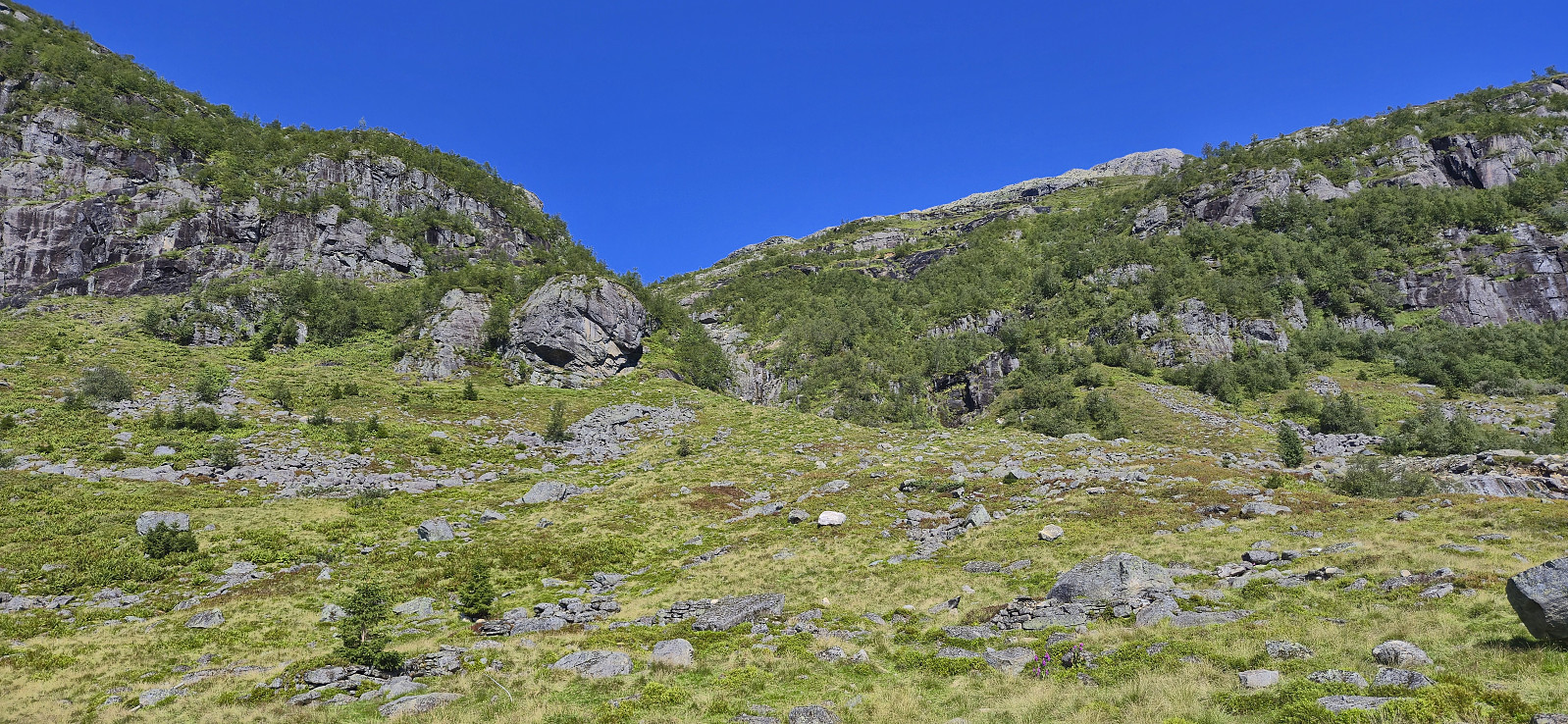 On a Sunday in mid-August where the warm summer weather made a comeback, I hopped on a train Voss and from there continued by bus to Ulsberg, where I for the second time had to help the bus driver locate the bus stop (see my hike to Kjerringafjellet and Kvasshovden ). After getting off the bus, I first followed the gravel road to Solsævatnet and then continued on the unmarked trail via Rubbelii to Nedre Skor. This was overall straightforward with the main challenge being to spot the trail between the numerous tall ferns doing their best to hide it.
I think I made a wrong turn after crossing the stream west of Rubbelii though, descending to the lake instead of continuing upwards. I therefore shortly ended up on a much weaker trail before reconnecting with the main trail. (Note that there is also a trail going around the lake. So be sure >>>
On a Sunday in mid-August where the warm summer weather made a comeback, I hopped on a train Voss and from there continued by bus to Ulsberg, where I for the second time had to help the bus driver locate the bus stop (see my hike to Kjerringafjellet and Kvasshovden ). After getting off the bus, I first followed the gravel road to Solsævatnet and then continued on the unmarked trail via Rubbelii to Nedre Skor. This was overall straightforward with the main challenge being to spot the trail between the numerous tall ferns doing their best to hide it.
I think I made a wrong turn after crossing the stream west of Rubbelii though, descending to the lake instead of continuing upwards. I therefore shortly ended up on a much weaker trail before reconnecting with the main trail. (Note that there is also a trail going around the lake. So be sure >>>
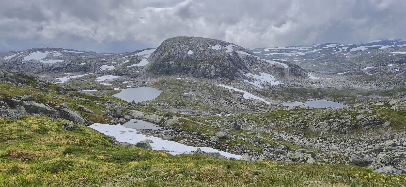
Folgefonna to Jondal via Storafjellet and Grytingsfjellet
- Datum:
- 02.08.2025
- Tourcharakter:
- Bergtour
- Tourlänge:
- 6:58h
- Entfernung:
- 23,8km
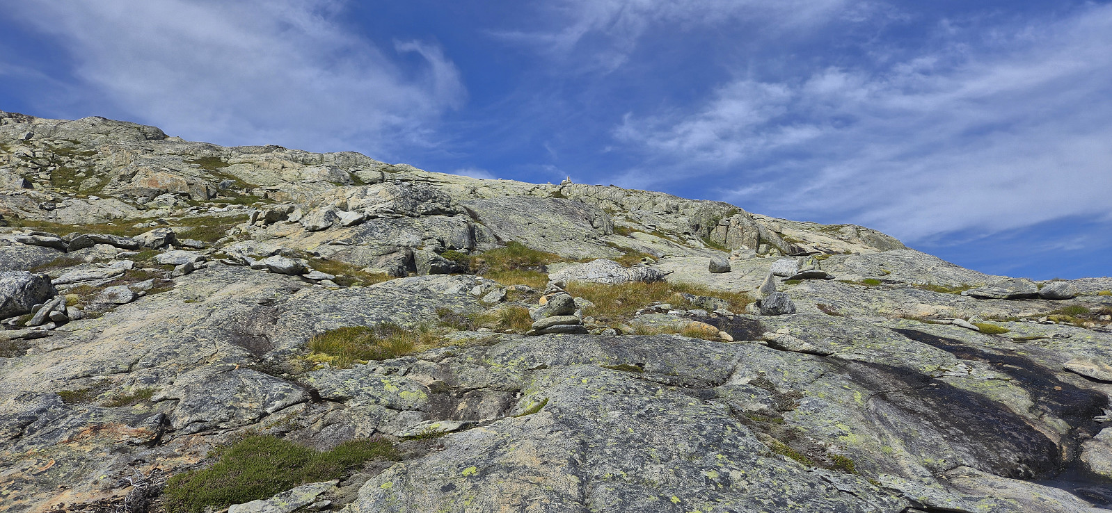 I started my journey by taking the bus to Norheimsund, the passenger ferry to Herand and finally a second bus via Jondal up to Folgefonna Skisenter . From the parking lot at the ski center I returned along the paved road down to Hestadalen p-plass . Here I continued on a trail marked with red T's towards Breidsete before shortly starting my off-trail ascent to Storafjellet . Or so I thought. Very quickly I however came across another trail marked with small cairns that led me all the way to the summit, hence it ought to be possible to stay on a trail all the way from the paved road.
After a short break at the summit to take in the excellent views, I continued northwest to Grytingsfjellet . No trails or cairns marking the way here as far as I could tell. Lots of minor ups and downs and one or two steeper sections that had to be carefully navigated, but with one exception, >>>
I started my journey by taking the bus to Norheimsund, the passenger ferry to Herand and finally a second bus via Jondal up to Folgefonna Skisenter . From the parking lot at the ski center I returned along the paved road down to Hestadalen p-plass . Here I continued on a trail marked with red T's towards Breidsete before shortly starting my off-trail ascent to Storafjellet . Or so I thought. Very quickly I however came across another trail marked with small cairns that led me all the way to the summit, hence it ought to be possible to stay on a trail all the way from the paved road.
After a short break at the summit to take in the excellent views, I continued northwest to Grytingsfjellet . No trails or cairns marking the way here as far as I could tell. Lots of minor ups and downs and one or two steeper sections that had to be carefully navigated, but with one exception, >>>
Hyvingen, Grånakken and Giljafjell from Ålvik
- Datum:
- 27.07.2025
- Tourcharakter:
- Bergtour
- Tourlänge:
- 7:48h
- Entfernung:
- 24,4km
 Started by taking the train to Voss and from there continued by bus to Ålvik. Here I easily located the marked trailhead and proceeded to follow the marked trail towards Roaldsdalen. The first part was quite steep and potentially difficult if wet or icy, although there were rope-based railings for extra safety. No need for these today though. As I continued north at the first forking of the trail at Krossfuru, the terrain turned much less steep and I could enjoy a nice walk along Dalselvi until the trail forked again and began winding its way up to Oskarborg and Toppen.
The trail to Oskarborg was often rather weak, especially at this time of the year when partially hidden by the tall grasses, however, with a few exceptions, the red markers were easy to follow. For extra safety, given that the trail >>>
Started by taking the train to Voss and from there continued by bus to Ålvik. Here I easily located the marked trailhead and proceeded to follow the marked trail towards Roaldsdalen. The first part was quite steep and potentially difficult if wet or icy, although there were rope-based railings for extra safety. No need for these today though. As I continued north at the first forking of the trail at Krossfuru, the terrain turned much less steep and I could enjoy a nice walk along Dalselvi until the trail forked again and began winding its way up to Oskarborg and Toppen.
The trail to Oskarborg was often rather weak, especially at this time of the year when partially hidden by the tall grasses, however, with a few exceptions, the red markers were easy to follow. For extra safety, given that the trail >>>
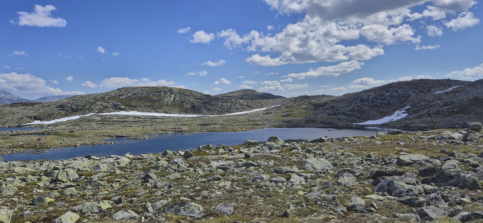
Vestre Låghellerhøgdene, Storhaugane and Søre Grøndalsnuten
- Datum:
- 25.07.2025
- Tourcharakter:
- Bergtour
- Tourlänge:
- 7:08h
- Entfernung:
- 23,0km
 After getting off the train at Hallingskeid , I continued southeast along Rallarvegen with the goal to cross the river via a bridge between Låghellervatnet and Høghellervatnet that I had spotted on the map. However, upon arriving it became clear that this crossing was not going to happen. All that was left of the bridge were the two supporting wires. There was nothing to do but continue east to find another place to cross.
North of Låghellerbotnen I left the gravel road and after fording a small stream I could finally start my ascent to Vestre Låghellerhøgdene . The off-trail ascent to the summit was straightforward. I made sure to visit both competing highest points, with the eastern one being ever so slightly higher (maybe only 1 cm?) while the western one contained the remains of a fallen down trig marker.
I turned my attention >>>
After getting off the train at Hallingskeid , I continued southeast along Rallarvegen with the goal to cross the river via a bridge between Låghellervatnet and Høghellervatnet that I had spotted on the map. However, upon arriving it became clear that this crossing was not going to happen. All that was left of the bridge were the two supporting wires. There was nothing to do but continue east to find another place to cross.
North of Låghellerbotnen I left the gravel road and after fording a small stream I could finally start my ascent to Vestre Låghellerhøgdene . The off-trail ascent to the summit was straightforward. I made sure to visit both competing highest points, with the eastern one being ever so slightly higher (maybe only 1 cm?) while the western one contained the remains of a fallen down trig marker.
I turned my attention >>>
Storetunga and Vetle Hansbunuten from Finse
- Datum:
- 17.07.2025
- Tourcharakter:
- Bergtour
- Tourlänge:
- 5:49h
- Entfernung:
- 20,0km
 On yet another very warm day, I decided to escape some of the heat by heading up to Finse to visit two relatively recent additions to the Hordaland ≥ 100m pf. list , both of which had been upgraded due to more accurate LiDAR data more accurate data. First up was Storetunga . After getting off the train at Finse, I headed southeast along Rallarvegen before later leaving the gravel road and heading off-trail towards the summit. Besides some enjoying undergrowth early on, the terrain was generally easy to travers and the summit was reached without any difficulties.
After a break next to the summit cairn to take in the excellent views, I returned along the same route to Rallarvegen before crossing the river along a small bridge underneath the larger railroad bridge and starting my ascent of Vetle Hansbunuten . There were a couple of small cairns in the area around the bridge >>>
On yet another very warm day, I decided to escape some of the heat by heading up to Finse to visit two relatively recent additions to the Hordaland ≥ 100m pf. list , both of which had been upgraded due to more accurate LiDAR data more accurate data. First up was Storetunga . After getting off the train at Finse, I headed southeast along Rallarvegen before later leaving the gravel road and heading off-trail towards the summit. Besides some enjoying undergrowth early on, the terrain was generally easy to travers and the summit was reached without any difficulties.
After a break next to the summit cairn to take in the excellent views, I returned along the same route to Rallarvegen before crossing the river along a small bridge underneath the larger railroad bridge and starting my ascent of Vetle Hansbunuten . There were a couple of small cairns in the area around the bridge >>>
Storegreggen, Simlenuten, Pyttafjellet and Gråeggi
- Datum:
- 02.07.2025
- Tourcharakter:
- Bergtour
- Tourlänge:
- 12:17h
- Entfernung:
- 28,0km
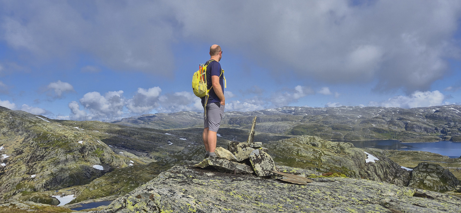 When a single day of great weather showed up in the middle of the week, with what seemed like a rather wet weekend to come, I decided to take the day off and easily managed to convince Endre to do the same. He picked me up at my place shortly after seven and together we drove towards Ålvik to have a go at a hike we had been talking about for some time, namely a single hike that included all of the four summits neatly lined up east of Fyksesund.
After paying the 60 kr for the toll road we continued up to the parking lot at the end of the winding gravel road, which to our surprise was almost full but thankfully had room for one more car. The great weather we had been hoping for was however late to the party and a low-hanging cloud cover hid most of the views as we left the parking lot. The night before >>>
When a single day of great weather showed up in the middle of the week, with what seemed like a rather wet weekend to come, I decided to take the day off and easily managed to convince Endre to do the same. He picked me up at my place shortly after seven and together we drove towards Ålvik to have a go at a hike we had been talking about for some time, namely a single hike that included all of the four summits neatly lined up east of Fyksesund.
After paying the 60 kr for the toll road we continued up to the parking lot at the end of the winding gravel road, which to our surprise was almost full but thankfully had room for one more car. The great weather we had been hoping for was however late to the party and a low-hanging cloud cover hid most of the views as we left the parking lot. The night before >>>
Blyfjell and Torvedalshytta from Grøndalsvatnet
- Datum:
- 21.06.2025
- Tourcharakter:
- Bergtour
- Tourlänge:
- 5:31h
- Entfernung:
- 14,8km
 For a while I had been looking into how to get to the northeastern end of Eksingedalen via public transportations to ascend the final two peaks I had left in this area, and while doable, it seemed to require a long walk to either Evanger or Myrkdalen/Vinje at the end of the hike. When Endre suggested a joint trip to Eksingedalen I was therefore quick to say yes, and we came up with a plan covering all of the peaks we had left between us.
After the roughly two-hour drive from Bergen, Endre dropped me off at the parking lot south of Grøndalsvatnet before returning west for this ascents of Eggane , Blåvasshorgi , Sørvest for Hundeggi and Storhaug , while I continued northeast towards Blyfjell . The off-trail ascent was relatively easy, however my chosen route was not the best and included more ups and downs than necessary. There were also lots of sections of exposed mountainside that would >>>
For a while I had been looking into how to get to the northeastern end of Eksingedalen via public transportations to ascend the final two peaks I had left in this area, and while doable, it seemed to require a long walk to either Evanger or Myrkdalen/Vinje at the end of the hike. When Endre suggested a joint trip to Eksingedalen I was therefore quick to say yes, and we came up with a plan covering all of the peaks we had left between us.
After the roughly two-hour drive from Bergen, Endre dropped me off at the parking lot south of Grøndalsvatnet before returning west for this ascents of Eggane , Blåvasshorgi , Sørvest for Hundeggi and Storhaug , while I continued northeast towards Blyfjell . The off-trail ascent was relatively easy, however my chosen route was not the best and included more ups and downs than necessary. There were also lots of sections of exposed mountainside that would >>>
Larsfonnberget from Oppheim
- Datum:
- 14.06.2025
- Tourcharakter:
- Bergtour
- Tourlänge:
- 7:02h
- Entfernung:
- 21,8km
 Started by taking the train to Voss and continued by bus to Oppheim. I then followed Oppheimsdalsvegen all the way to Kvanndalen. Walking along the gravel road was a bit boring at the start but soon the views opened up and it was actually quite enjoyable. I had expected there to be snow for the final off-trail ascent to Larsfonnberget but there were only a couple of patches that could not be avoided. The summit itself was completely free of snow and provided excellent views.
After a short stop, I returned to the gravel road via a slightly different route including detours to Geitaberget and Høgafjellet before passing by Turtene . The map indicated trails however I did not see much of these and largely found my own way. From Turtene I followed the gravel road back to Oppheim, where I had a look at the discontinued ski lift before getting on the bus to Voss and finally the >>>
Started by taking the train to Voss and continued by bus to Oppheim. I then followed Oppheimsdalsvegen all the way to Kvanndalen. Walking along the gravel road was a bit boring at the start but soon the views opened up and it was actually quite enjoyable. I had expected there to be snow for the final off-trail ascent to Larsfonnberget but there were only a couple of patches that could not be avoided. The summit itself was completely free of snow and provided excellent views.
After a short stop, I returned to the gravel road via a slightly different route including detours to Geitaberget and Høgafjellet before passing by Turtene . The map indicated trails however I did not see much of these and largely found my own way. From Turtene I followed the gravel road back to Oppheim, where I had a look at the discontinued ski lift before getting on the bus to Voss and finally the >>>
