Archive - Date
Archive - Activity
-
Bike trip (107)
- Bike trip - mixed (25)
- Bike trip - road (82)
-
Drive (9)
- Car drive (9)
-
Other trip (3)
- Kayaking (3)
-
Ski trip (109)
- Backcountry skiing (65)
- Cross-country skiing (44)
- Trip by foot (1747)
Collected lists
-
Utvalgte topper og turmål i Bergen
(332/333)
 99%
99% -
Alle topper i Bergen
(379/386)
98%
-
Kvam ≥ 100m pf.
(41/44)
93%
-
Opptur Hordaland
(143/159)
89%
-
Voss ≥ 100m pf.
(86/98)
87%
-
Stasjoner på Bergensbanen
(28/36)
77%
-
Hordaland ≥ 100m pf.
(593/863)
68%
-
Ulvik ≥ 100m pf.
(26/38)
68%
-
Jondal ≥ 100m pf.
(15/23)
65%
-
Dagsturhyttene i Vestland
(33/61)
54%
-
Sunnhordland PF >= 100m
(100/186)
53%
-
DNT-hytter i Hordaland
(22/45)
48%
-
Hordaland: Hardanger PF>=100m
(170/359)
47%
-
Kvinnherad ≥ 100m pf.
(36/79)
45%
-
Sogndal ≥ 100m pf.
(23/81)
28%
-
DNT-hytter i Sogn og Fjordane
(8/47)
17%
-
Eidfjord ≥ 100m pf.
(6/42)
14%
-
Etne ≥ 100m pf.
(7/51)
13%
-
Ullensvang ≥ 100m pf.
(19/153)
12%
-
Opptur i Sogn og Fjordane peaks
(17/177)
9%

Ruklehaugnuten and Solnuten
- Date:
- 21.04.2024
- Characteristic:
- Backcountry skiing
- Duration:
- 11:54h
- Distance:
- 31.9km
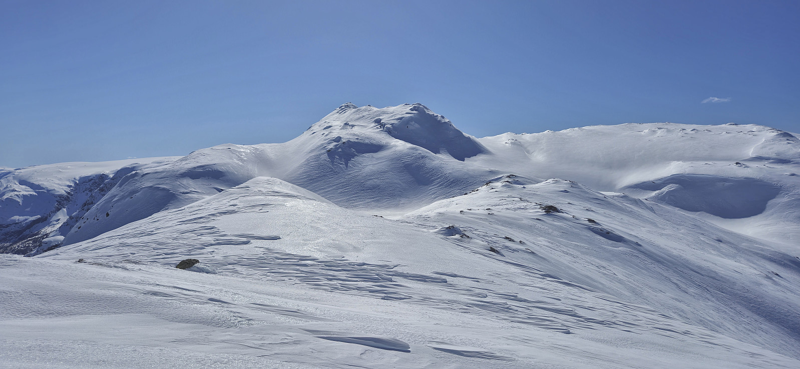 Petter picked me up at my place at 06:20 for our drive to Tørvikbygd and the first ferry to Jondal. After the short ferry crossing we continued northeast to Herand and Åsleitet where we planned to follow a gravel road up to the parking lot at Vårhaug. We had however not driven many meters on the Grimevegen toll road before we arrived at a locked gate where a local farmer in a tractor told us that the road was closed during the winter. We therefore had no choice but to return to the start of the gravel road and park there.
But just as we were beginning to dread having to carry the skis up the steep extra vertical meters, the farmer returned and asked if we wanted a lift! We of course quickly said yes and hurriedly got ready, placed our gear and ourselves at the back of the tractor and off we went, trying to hold on >>>
Petter picked me up at my place at 06:20 for our drive to Tørvikbygd and the first ferry to Jondal. After the short ferry crossing we continued northeast to Herand and Åsleitet where we planned to follow a gravel road up to the parking lot at Vårhaug. We had however not driven many meters on the Grimevegen toll road before we arrived at a locked gate where a local farmer in a tractor told us that the road was closed during the winter. We therefore had no choice but to return to the start of the gravel road and park there.
But just as we were beginning to dread having to carry the skis up the steep extra vertical meters, the farmer returned and asked if we wanted a lift! We of course quickly said yes and hurriedly got ready, placed our gear and ourselves at the back of the tractor and off we went, trying to hold on >>>
Midtfjell from Sjusete
- Date:
- 16.03.2024
- Characteristic:
- Backcountry skiing
- Duration:
- 5:00h
- Distance:
- 13.3km
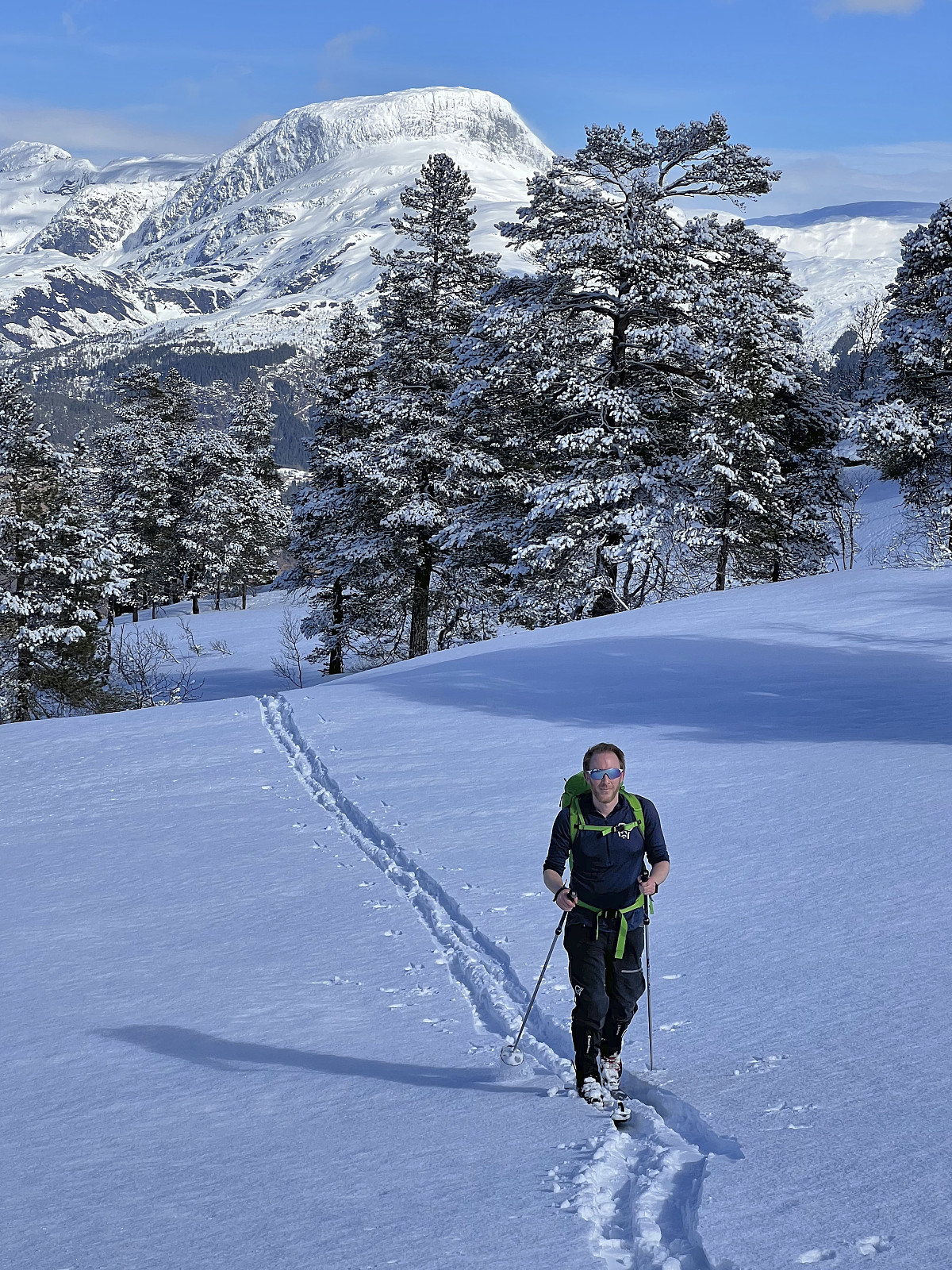 Inspired by an external trip report at tinderangel.no describing what looked like a very nice skiing trip from Sjusete to Midtfjell , Endre and I once more drove from Bergen in the direction of Voss but this time headed for Ulvik and the winter parking lot at Sjusete . As we approached the center of Ulvik we left the main road and instead followed a narrow gravel road southwest up from Vambheim. This included passing through an open gate just north of Gjerdet, but whether this gate is always open remains unknown.
Done with this one potential hurdle we continued up to the parking lot at Sjusete, noticing that the gravel road was rather icy towards the end but hoping that this would improve before the descent later in the day. Plenty of space at the parking lot, in fact we were the only car and, expect for coming across a fresh scooter trail during the descent, we did not see any >>>
Inspired by an external trip report at tinderangel.no describing what looked like a very nice skiing trip from Sjusete to Midtfjell , Endre and I once more drove from Bergen in the direction of Voss but this time headed for Ulvik and the winter parking lot at Sjusete . As we approached the center of Ulvik we left the main road and instead followed a narrow gravel road southwest up from Vambheim. This included passing through an open gate just north of Gjerdet, but whether this gate is always open remains unknown.
Done with this one potential hurdle we continued up to the parking lot at Sjusete, noticing that the gravel road was rather icy towards the end but hoping that this would improve before the descent later in the day. Plenty of space at the parking lot, in fact we were the only car and, expect for coming across a fresh scooter trail during the descent, we did not see any >>>
Five summits southeast of Grindaflethytta from Brandset
- Date:
- 09.03.2024
- Characteristic:
- Backcountry skiing
- Duration:
- 11:29h
- Distance:
- 41.4km
 In order to make the most out of the excellent weather, and due to road work at Dalseide, Endre picked me up at my place just before six in the morning and together we drove to Brandset at Voss, only having to wait around ten minutes before we could pass through Dalseidtunnelen at 07:00. We arrived at the parking lot at Brandset around 08:30 and it did not take long before we were ready to start skiing.
We started by following the icy road into Bjørndalen before leaving the scooter trails behind and making our own way up towards Bjørndalsvatnet. Below roughly 1100 meters the snow was very hard, more ice than snow, but higher up the conditions gradually improved and we therefore had pretty good skiing conditions for the majority of the trip.
After a short break west of Bjørndalsvatnet we completed the final ascent to the >>>
In order to make the most out of the excellent weather, and due to road work at Dalseide, Endre picked me up at my place just before six in the morning and together we drove to Brandset at Voss, only having to wait around ten minutes before we could pass through Dalseidtunnelen at 07:00. We arrived at the parking lot at Brandset around 08:30 and it did not take long before we were ready to start skiing.
We started by following the icy road into Bjørndalen before leaving the scooter trails behind and making our own way up towards Bjørndalsvatnet. Below roughly 1100 meters the snow was very hard, more ice than snow, but higher up the conditions gradually improved and we therefore had pretty good skiing conditions for the majority of the trip.
After a short break west of Bjørndalsvatnet we completed the final ascent to the >>>
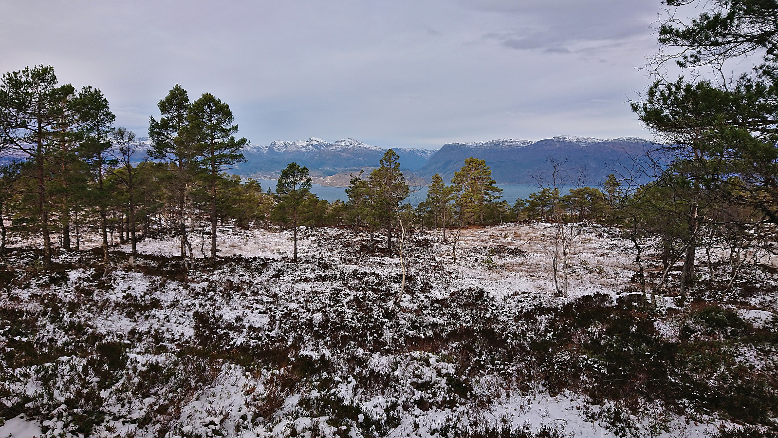
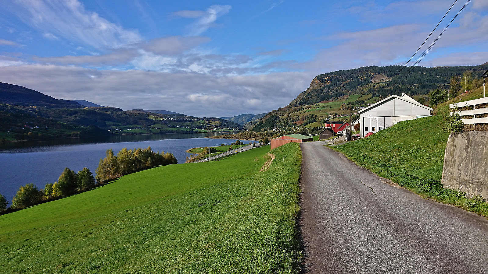
Fagerlifjellet from Gjetingsdalen
- Date:
- 26.11.2023
- Characteristic:
- Hillwalk
- Duration:
- 3:30h
- Distance:
- 5.6km
 For the second Sunday in a row, Petter and I returned to Jondal. This time our goal was to ascend Fagerlifjellet from Gjetingsdalen. After taking the ferry from Tørvikbygd to Jondal, we therefore continued south to Maurangerfjorden which we then proceeded to follow southwest to Gjetingsdalen. Here we quickly realized that there was a lot more snow than expected, but thankfully just below the amount that would have made it difficult for us to park at the open space close to the planned trailhead.
After parking the car, we walked up the smaller road to Nedre Øyjorda, passed through a gate and continued up to Øvre Øyjorda. So far there had been some fairly recent footprints in the snow. We assumed that these would stop at Øvre Øyjorda, but luckily they continued across a small bridge just to the east and then >>>
For the second Sunday in a row, Petter and I returned to Jondal. This time our goal was to ascend Fagerlifjellet from Gjetingsdalen. After taking the ferry from Tørvikbygd to Jondal, we therefore continued south to Maurangerfjorden which we then proceeded to follow southwest to Gjetingsdalen. Here we quickly realized that there was a lot more snow than expected, but thankfully just below the amount that would have made it difficult for us to park at the open space close to the planned trailhead.
After parking the car, we walked up the smaller road to Nedre Øyjorda, passed through a gate and continued up to Øvre Øyjorda. So far there had been some fairly recent footprints in the snow. We assumed that these would stop at Øvre Øyjorda, but luckily they continued across a small bridge just to the east and then >>>
Teglbu
- Date:
- 19.11.2023
- Characteristic:
- Hillwalk
- Duration:
- 0:33h
- Distance:
- 2.3km
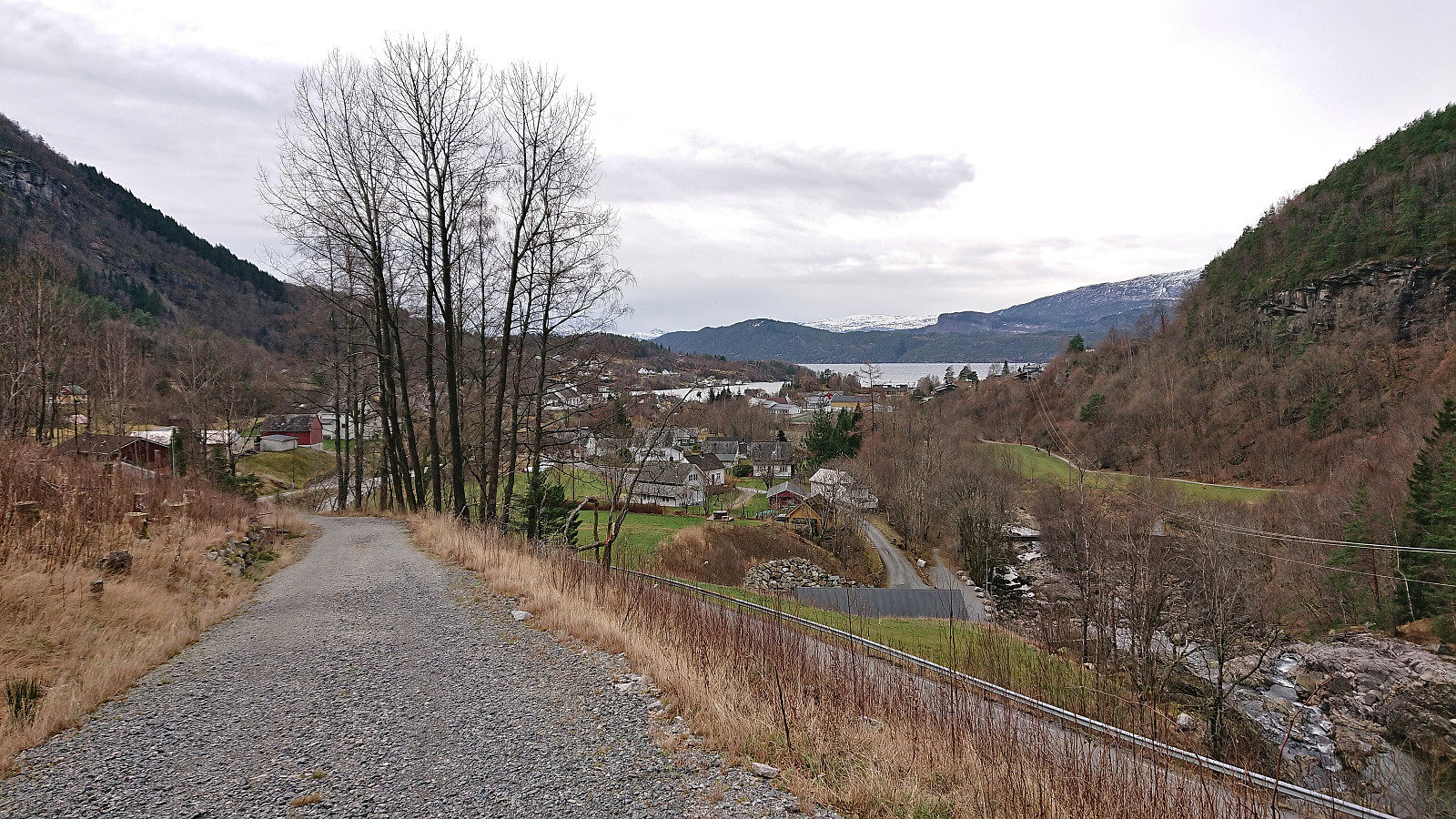 Upon completing our hike to Gaddane and Hædna , we still had plenty of time before the ferry. I therefore decided to add a visit of Teglbu . So while Petter drove directly to Jondal, I was dropped off at the marked trailhead north of Teglhaugen. From there I could easily follow the marked trail to Teglbu. Before descending, I also made sure to visit the much better vantage point just west of the cabin which provided a nice overview of Jondal.
Given that I had ferry to catch, and had to move fast, I ended up losing the marked trail at the start of the descent. Basically, I turned right (west/northwest) too quickly. And while I probably could have descended via this route as well, I concluded that I still had the time to search for the proper trail and it did not take long before I was back on track.
The proper trail was steepish >>>
Upon completing our hike to Gaddane and Hædna , we still had plenty of time before the ferry. I therefore decided to add a visit of Teglbu . So while Petter drove directly to Jondal, I was dropped off at the marked trailhead north of Teglhaugen. From there I could easily follow the marked trail to Teglbu. Before descending, I also made sure to visit the much better vantage point just west of the cabin which provided a nice overview of Jondal.
Given that I had ferry to catch, and had to move fast, I ended up losing the marked trail at the start of the descent. Basically, I turned right (west/northwest) too quickly. And while I probably could have descended via this route as well, I concluded that I still had the time to search for the proper trail and it did not take long before I was back on track.
The proper trail was steepish >>>
Gaddane and Hædna
- Date:
- 19.11.2023
- Characteristic:
- Hillwalk
- Duration:
- 2:37h
- Distance:
- 4.7km
 Petter picked me up at my place at 07:00 and together we drove the roughly 1.5 hours to Tørvikbygd, arriving around 20 minutes before the ferry was to depart to Jondal. After a short and windy ferry ride we followed the road east to Espeland where we turned northeast towards Vassendvatnet. This road was a toll road and we paid the 60 kr via Vipps before continuing to a parking lot at around 350 meters above sea level . As this parking lot mainly seems to be used as a starting point for skiing trips in the winter, we had it all to ourselves.
We parked the car and briefly followed the road northeast before turning north and heading off-trail in the direction of the summit of Gaddane . There was a marked trail in the valley called Djupadalen between the two summits, however as following it would result in a bit of detour we instead opted for the more direct >>>
Petter picked me up at my place at 07:00 and together we drove the roughly 1.5 hours to Tørvikbygd, arriving around 20 minutes before the ferry was to depart to Jondal. After a short and windy ferry ride we followed the road east to Espeland where we turned northeast towards Vassendvatnet. This road was a toll road and we paid the 60 kr via Vipps before continuing to a parking lot at around 350 meters above sea level . As this parking lot mainly seems to be used as a starting point for skiing trips in the winter, we had it all to ourselves.
We parked the car and briefly followed the road northeast before turning north and heading off-trail in the direction of the summit of Gaddane . There was a marked trail in the valley called Djupadalen between the two summits, however as following it would result in a bit of detour we instead opted for the more direct >>>
Kongsberg and Kristinuten
- Date:
- 27.10.2023
- Characteristic:
- Hillwalk
- Duration:
- 6:29h
- Distance:
- 19.1km
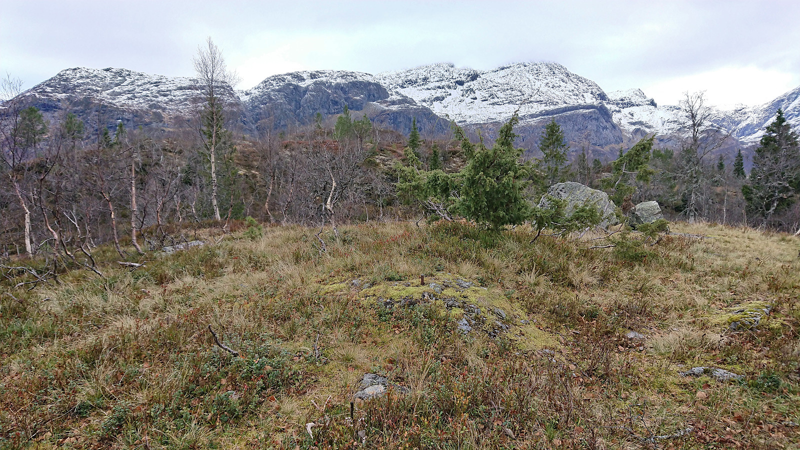 Given the excellent Friday weather forecast, and other engagements during the upcoming weekend, I decided to take the Friday off and go hiking in Ulvik. Once more I took the train to Voss (once again with bus-for-train between Bergen and Arna). Here I switched (back) to bus and headed for Ulvik, getting off at Sølva (just two stops after where I began my hike to Kjerringafjellet and Kvasshovden the previous weekend).
The bus stop was right next to the start of the tractor road that I could pretty much follow all the way to the summit of Kongsberg . I only left the tractor road towards the very end to instead continue on an unmarked trail to a vantage point just south of the summit with spectacular views across Ulvik. From there a weaker trail could be followed to the highest point less than 150 meters further north.
Ascending Kongsberg >>>
Given the excellent Friday weather forecast, and other engagements during the upcoming weekend, I decided to take the Friday off and go hiking in Ulvik. Once more I took the train to Voss (once again with bus-for-train between Bergen and Arna). Here I switched (back) to bus and headed for Ulvik, getting off at Sølva (just two stops after where I began my hike to Kjerringafjellet and Kvasshovden the previous weekend).
The bus stop was right next to the start of the tractor road that I could pretty much follow all the way to the summit of Kongsberg . I only left the tractor road towards the very end to instead continue on an unmarked trail to a vantage point just south of the summit with spectacular views across Ulvik. From there a weaker trail could be followed to the highest point less than 150 meters further north.
Ascending Kongsberg >>>
Kjerringafjellet and Kvasshovden
- Date:
- 22.10.2023
- Characteristic:
- Hillwalk
- Duration:
- 7:06h
- Distance:
- 17.6km
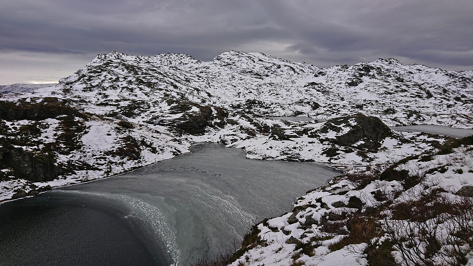 After several days of strong wind from the east, the weather finally improved enough to allow for proper mountain hiking. I therefore got up early Sunday morning and took the train to Voss (or to be more correct, bus-for-train to Arna and then train to Voss). Here I switched back to bus and continued in the direction of Ulvik. My plan was partially follow in the footsteps of Knut Sverre and Astrid based on their trip report from 2015 indicating a trail to Kvasshovden via Grostøl, mainly as this would save me almost 300 vertical meters compared to starting from the fjord at Ulvik.
In advance I had figured out that the closest bus stop to the wanted trailhead was called Ulsberg, which would leave less than 600 meters to the start of a tractor road I had located on the map. This was apparently not a very commonly used bus stop though. Proven by the >>>
After several days of strong wind from the east, the weather finally improved enough to allow for proper mountain hiking. I therefore got up early Sunday morning and took the train to Voss (or to be more correct, bus-for-train to Arna and then train to Voss). Here I switched back to bus and continued in the direction of Ulvik. My plan was partially follow in the footsteps of Knut Sverre and Astrid based on their trip report from 2015 indicating a trail to Kvasshovden via Grostøl, mainly as this would save me almost 300 vertical meters compared to starting from the fjord at Ulvik.
In advance I had figured out that the closest bus stop to the wanted trailhead was called Ulsberg, which would leave less than 600 meters to the start of a tractor road I had located on the map. This was apparently not a very commonly used bus stop though. Proven by the >>>
Vossavangen to Seimsgrend
- Date:
- 08.10.2023
- Characteristic:
- Hike
- Duration:
- 2:15h
- Distance:
- 11.9km
 Still low on energy after a week on the couch due to the flu, I decided to go for something less ambitious than usual on a Sunday. The main goal being to visit my only remaining train stop between Bergen and Ljosandbotn (see the Stasjoner på Bergensbanen list ), namely Seimsgrend haldeplass . I took the train to Voss and from there simply followed a combination of cycling/walking paths and smaller roads with limited traffic east to Bulken . Here I crossed the river via the bridge and briefly continued along the main road to Hamlagrø. An increase in the amount of traffic and the lack of a sidewalk made this the least enjoyable part of the hike. Thankfully it only lasted for less than 1 km before I could leave the main road and start descending on the smaller gravel road to Seim. The train stop at Seim/Seimsgrend was easily located and I only had to wait around 15 minutes >>>
Skjervsfossen and Olavstølsnuten
- Date:
- 01.10.2023
- Characteristic:
- Hillwalk
- Duration:
- 5:31h
- Distance:
- 19.9km
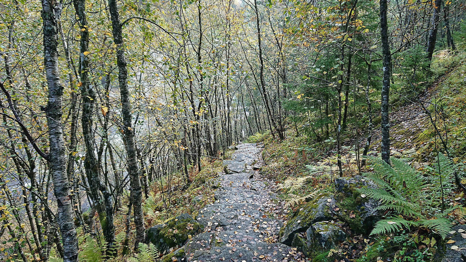 I started by taking the train to Voss and then the bus towards Granvin. The plan was to get off at Moo and start hiking from there. But even though both the online timetable and the information screen on the bus indicated that this should be ok, the bus driver had other ideas and was almost on his way into Tunsbergtunnelen before I managed to press the stop button just in time to get off at the final stop before the tunnel. (The same thing happened last year as well , hence it is probably a good idea to ask the driver in advance whether the bus is going through the tunnel or not.)
After crossing the main road I continued northeast along a separate walking and cycling path that I later learned was the old route of the decommissioned Hardangerbanen , a local train route from Granvin to Voss. The walking and cycling path however ended >>>
I started by taking the train to Voss and then the bus towards Granvin. The plan was to get off at Moo and start hiking from there. But even though both the online timetable and the information screen on the bus indicated that this should be ok, the bus driver had other ideas and was almost on his way into Tunsbergtunnelen before I managed to press the stop button just in time to get off at the final stop before the tunnel. (The same thing happened last year as well , hence it is probably a good idea to ask the driver in advance whether the bus is going through the tunnel or not.)
After crossing the main road I continued northeast along a separate walking and cycling path that I later learned was the old route of the decommissioned Hardangerbanen , a local train route from Granvin to Voss. The walking and cycling path however ended >>>
