Arkiv - dato
Arkiv - aktivitet
-
Annen tur (3)
- Kajakkpadling (3)
- Fottur (1836)
-
Kjøretur (9)
- Biltur (9)
-
Skitur (112)
- Fjellskitur (66)
- Langrennstur (46)
-
Sykkeltur (108)
- Blandet sykling (25)
- Gatesykling (83)
Lister jeg samler etter
- Utvalgte topper og turmål i Bergen
- Alle topper i Bergen
- Voss ≥ 100m pf.
- Opptur Hordaland
- Stasjoner på Bergensbanen
- Ulvik ≥ 100m pf.
- Hordaland ≥ 100m pf.
- Mjølfjell PF > 100m
- Jondal ≥ 100m pf.
- Sunnhordland PF >= 100m
- Dagsturhyttene i Vestland
- Hordaland: Hardanger PF>=100m
- DNT-hytter i Hordaland
- Kvinnherad ≥ 100m pf.
- Sogndal ≥ 100m pf.
- Vik i Sogn ≥ 100m pf.
- Gulen ≥ 100m pf.
- DNT-hytter i Sogn og Fjordane
- Eidfjord ≥ 100m pf.
- Sogn - Sør for Sognefjorden PF>=100m
Cycling along Barsnesfjorden
- Dato:
- 13.07.2023
- Turtype:
- Gatesykling
- Turlengde:
- 0:48t
- Distanse:
- 4,4km
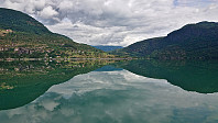 Short cycling trip along Barsnesfjorden.
(Note that the road this hike follows is private, i.e. no cars allowed. There are however a couple of parking spaces down by the small wharf along Barsnesfjorden just before the road turns west and starts climbing slightly towards the crossroads at Barsnes.)
Cycling along Barsnesfjorden
- Dato:
- 10.07.2023
- Turtype:
- Gatesykling
- Turlengde:
- 0:41t
- Distanse:
- 4,5km
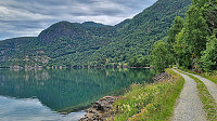 Short cycling trip along Barsnesfjorden.
(Note that the road this hike follows is private, i.e. no cars allowed. There are however a couple of parking spaces down by the small wharf along Barsnesfjorden just before the road turns west and starts climbing slightly towards the crossroads at Barsnes.)
Cycling: Fjordstien and Stedjeberget
- Dato:
- 09.07.2023
- Turtype:
- Gatesykling
- Turlengde:
- 1:37t
- Distanse:
- 15,1km
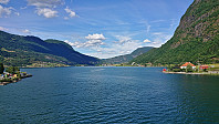 Short afternoon cycling trip along Fjordstien and out to Stedjeberget turpostkasse .
Cycling: Lagunen to Lønborg
- Dato:
- 17.06.2023
- Turtype:
- Gatesykling
- Turlengde:
- 1:21t
- Distanse:
- 20,7km
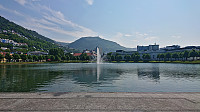 After the cycling trip at Austevoll , and the short bus ride from Krokeide to Lagunen, I cycled home to Lønborg via the standard cycling routes.
Cycling at Austevoll
- Dato:
- 17.06.2023
- Turtype:
- Gatesykling
- Turlengde:
- 5:15t
- Distanse:
- 53,2km
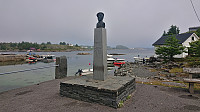 A return to Austevoll to visit Adlesi . Once again I took the high-speed passenger ferry from Strandkaien, but this time bringing my bike and getting off at Hufthammar. From there I cycled south to the western trailhead for Loddo .
I stayed on separate cycling/walking paths until leaving road 546 at the roundabout south of Storebø. After that I had to share the road with slightly more traffic than I had hoped for. I left the bike behind at the final fork in the trail up to Loddo and continued on foot to the summit . Back at the bike, I benefitted from having cycled up to around 100 meters above sea level and thus quickly descended to the main road.
With the main goal of the day out of the way, I decided to explore more of Austevoll and headed northwest to Storakalsøy and Kalve, enjoying excellent views along the way. No cycling/walking paths after crossing >>>
Cycling: Skjeggedalsfjellet and Litlefjellet
- Dato:
- 10.06.2023
- Turtype:
- Gatesykling
- Turlengde:
- 7:01t
- Distanse:
- 24,3km
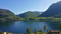 After getting off the bus at Masfjorden ( after first cycling to Knarvik ), it was time for the second stage of my plan: cycling northeast to Andvika and then north to Lund/Skjeggedalen. I started at 09:25 and arrived at the start of the tractor road up to Skjeggedalen about an hour later after a very enjoyable ride along the fjord. The road was paved until shortly after Ådnekvamme where it turned into a single-lane gravel road that probably does not see too many cars. My initial plan had been to cycle all the way to the final house in Skjeggedalen, but the quality of tractor road up from the fjord made me change my mind and instead leave the bike behind and continued on foot for the ascent to Skjeggedalsfjellet .
Back at the bike, I returned to Andvika from where I started the ascent to Litlefjellet . First, along a paved road that later turned into a gravel road. At Storevatnet I forked >>>
Cycling: Lønborg - Knarvik - Lønborg
- Dato:
- 10.06.2023
- Turtype:
- Gatesykling
- Turlengde:
- 14:01t
- Distanse:
- 50,5km
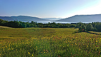 As the first part of my three-stage plan to ascend Skjeggedalsfjellet and Litlefjellet in Masfjorden I got up early Saturday morning and was out the door and on my bike cycling to Knarvik shortly after 06:00. This enabled me to catch the first bus from Knarvik to Ostereidet for the connecting bus to Masfjordnes. In fact, it turned out to be the same bus, hence I did not have to load and unload my bike at Ostereidet. The bus was of a slightly older model with less room than usual for bikes and trolleys, however, as I was the only passenger for the whole ride this was fortunately not an issue.
At 09:25 I got off the bus at Masfjordnes, the final stop of this particular bus, and cycled northeast towards Andvika. Given the long bus ride in the middle of the trip, I made a separate report for the cycling in Masfjorden . There are also separate trip reports for the ascents >>>
Cycling: Våge - Reksteren - Våge
- Dato:
- 07.05.2023
- Turtype:
- Gatesykling
- Turlengde:
- 7:01t
- Distanse:
- 40,8km
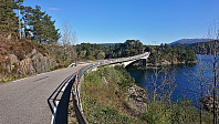 After last year's excellent trip where I cycled from Våge to Reksteren to ascend Gjøvågsfjellet , I decided to repeat the success and return to Reksteren for the two summits I had not had the time to ascend last time, namely Vardafjellet and Dalstuva . Again, I first cycled to the Bergen city center, brought the bike with me on the bus to Halhjem, and from there took the ferry to Våge. Here I started the GPS and followed the same route as the year before, although now thankfully only to Smievoll and Frøkjedalsvatnet (and not (almost) all the way to Gjøvåg). Here I left the bike behind and continued north on the trail along the lake. See the separate trip report for the ascents of Vardafjellet and Dalstuva .
Upon later returning to the bike, I cycled back the same way, making it to Våge with almost 30 minutes to spare before the ferry. After the break on the ferry, it was time for the bus ride back to Bergen, which last time >>>
Fyllingsdalstunnelen - the world's longest cycling tunnel!
- Dato:
- 21.04.2023
- Turtype:
- Gatesykling
- Turlengde:
- 2:57t
- Distanse:
- 32,9km
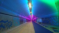 Started the weekend early to join my dad in trying out the new Fyllingsdalstunnelen, the world's longest cycling tunnel, which opened less than a week ago. It provides a 3 km shortcut to Fyllingsdalen underneath Løvstakken. We also tried the other new related cycling paths alongside Store Lungegårdsvannet and the new (much shorter) cycling tunnel at Kronstad/Årstad, and included a short trip around Orrtuvatnet before returning more or less the same way.
Cycling: Miklastofa and Reksteren
- Dato:
- 10.09.2022
- Turtype:
- Gatesykling
- Turlengde:
- 5:58t
- Distanse:
- 65,3km
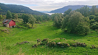 The northwestern part of Tysnes called Reksteren is not most easily accessible, at least not without a car. Cycling all the way there from Bergen is also quite far. I therefore started by bringing the bike with me on the bus to Halhjem and from there taking the ferry to Våge. After turning on the GPS tracking I then followed the roads towards Reksteren and Gjøvåg. On the way I made a quick visit of Miklastofa via the gravel road on the west side of Kyrkjevatnet. Note that southern part of this gravel road was not yet included on the map, but it did continue all the way to Uggdalseidet where there was a small parking lot and signs pointing to Miklastofa (no signs from the north).
As I got closer to Reksteren the roads gradually got narrower, but the road quality was overall very good and with the limited >>>


