Archive - Date
Archive - Activity
-
Bike trip (96)
- Bike trip - mixed (21)
- Bike trip - road (75)
-
Drive (6)
- Car drive (6)
-
Other trip (2)
- Kayaking (2)
-
Ski trip (94)
- Backcountry skiing (55)
- Cross-country skiing (39)
- Trip by foot (1467)
Collected lists
-
Utvalgte topper og turmål i Bergen
(298/305)
 97%
97% -
Alle topper i Bergen
(332/349)
95%
-
Øytopper Hordaland
(25/27)
92%
-
Vaksdal ≥ 100m pf.
(58/63)
92%
-
Søyler (fastmerker) i Bergen
(90/100)
90%
-
Nordhordland PF >= 100m
(197/221)
89%
-
Fitjar ≥ 100m pf.
(6/7)
85%
-
Opptur Hordaland
(132/159)
83%
-
Modalen ≥ 100m pf.
(23/30)
76%
-
Masfjorden ≥ 100m pf.
(42/55)
76%
-
Hordaland ≥ 500m pf.
(22/30)
73%
-
Kvam ≥ 100m pf.
(32/44)
72%
-
Stasjoner på Bergensbanen
(26/36)
72%
-
Voss ≥ 100m pf.
(65/97)
67%
-
Hordaland ≥ 100m pf.
(496/863)
57%
-
Dagsturhyttene i Vestland
(31/60)
51%
-
Sunnhordland PF >= 100m
(82/187)
43%
-
DNT-hytter i Hordaland
(18/45)
40%
-
Kvinnherad ≥ 100m pf.
(25/79)
31%
-
Hordaland: Hardanger PF>=100m
(112/357)
31%

Steinafjell and NV av Juklavatnet
- Date:
- 27.04.2024
- Characteristic:
- Backcountry skiing
- Duration:
- 4:59h
- Distance:
- 14.6km
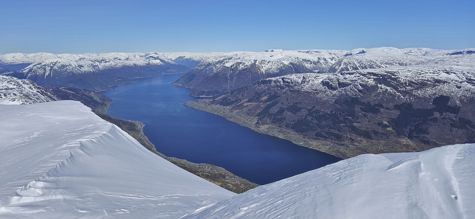
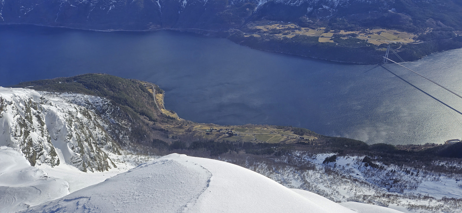
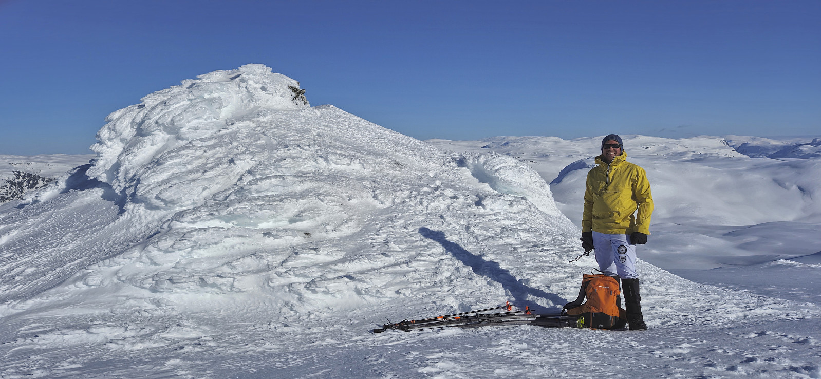
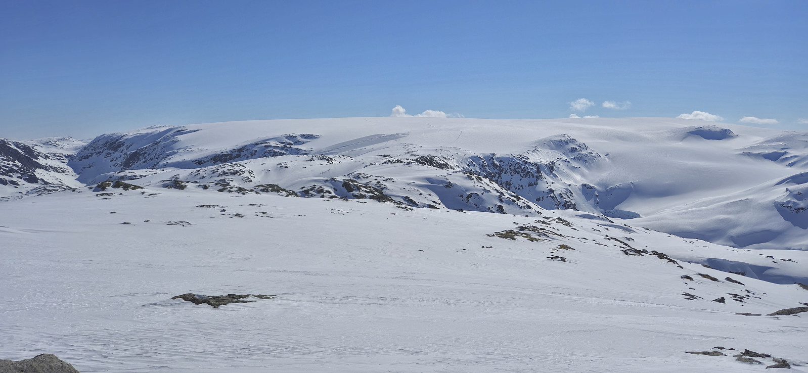 For the second weekend in a row, Petter and I returned to Jondal to go skiing. This time the plan was to drive up to FONNA Glacier Ski Resort and start our trip from there. However, due to the final part of the road up to ski resort still being covered by snow, we did not take any chances with our summer tires and instead parked at Hestadalen p-plass .
The skis came on immediately after leaving the parking lot and we made good progress up to the unnamed 1084 lake east of Svartaberget. From there we ascended steeply up Svartavassberget before the terrain levelled off as we approached the summit of Steinafjell , which we reached without any issues after roughly 1.5 hours of skiing.
From Steinafjell we wanted to make an attempt at finding a safe route to NV av Juklavatnet . Both of us had in advance arrived at pretty much the same suggested route. The question was whether >>>
For the second weekend in a row, Petter and I returned to Jondal to go skiing. This time the plan was to drive up to FONNA Glacier Ski Resort and start our trip from there. However, due to the final part of the road up to ski resort still being covered by snow, we did not take any chances with our summer tires and instead parked at Hestadalen p-plass .
The skis came on immediately after leaving the parking lot and we made good progress up to the unnamed 1084 lake east of Svartaberget. From there we ascended steeply up Svartavassberget before the terrain levelled off as we approached the summit of Steinafjell , which we reached without any issues after roughly 1.5 hours of skiing.
From Steinafjell we wanted to make an attempt at finding a safe route to NV av Juklavatnet . Both of us had in advance arrived at pretty much the same suggested route. The question was whether >>>
Ruklehaugnuten and Solnuten
- Date:
- 21.04.2024
- Characteristic:
- Backcountry skiing
- Duration:
- 11:54h
- Distance:
- 31.9km
 Petter picked me up at my place at 06:20 for our drive to Tørvikbygd and the first ferry to Jondal. After the short ferry crossing we continued northeast to Herand and Åsleitet where we planned to follow a gravel road up to the parking lot at Vårhaug. We had however not driven many meters on the Grimevegen toll road before we arrived at a locked gate where a local farmer in a tractor told us that the road was closed during the winter. We therefore had no choice but to return to the start of the gravel road and park there.
But just as we were beginning to dread having to carry the skis up the steep extra vertical meters, the farmer returned and asked if we wanted a lift! We of course quickly said yes and hurriedly got ready, placed our gear and ourselves at the back of the tractor and off we went, trying to hold on >>>
Petter picked me up at my place at 06:20 for our drive to Tørvikbygd and the first ferry to Jondal. After the short ferry crossing we continued northeast to Herand and Åsleitet where we planned to follow a gravel road up to the parking lot at Vårhaug. We had however not driven many meters on the Grimevegen toll road before we arrived at a locked gate where a local farmer in a tractor told us that the road was closed during the winter. We therefore had no choice but to return to the start of the gravel road and park there.
But just as we were beginning to dread having to carry the skis up the steep extra vertical meters, the farmer returned and asked if we wanted a lift! We of course quickly said yes and hurriedly got ready, placed our gear and ourselves at the back of the tractor and off we went, trying to hold on >>>
Midtfjell from Sjusete
- Date:
- 16.03.2024
- Characteristic:
- Backcountry skiing
- Duration:
- 5:00h
- Distance:
- 13.3km
 Inspired by an external trip report at tinderangel.no describing what looked like a very nice skiing trip from Sjusete to Midtfjell , Endre and I once more drove from Bergen in the direction of Voss but this time headed for Ulvik and the winter parking lot at Sjusete . As we approached the center of Ulvik we left the main road and instead followed a narrow gravel road southwest up from Vambheim. This included passing through an open gate just north of Gjerdet, but whether this gate is always open remains unknown.
Done with this one potential hurdle we continued up to the parking lot at Sjusete, noticing that the gravel road was rather icy towards the end but hoping that this would improve before the descent later in the day. Plenty of space at the parking lot, in fact we were the only car and, expect for coming across a fresh scooter trail during the descent, we did not see any >>>
Inspired by an external trip report at tinderangel.no describing what looked like a very nice skiing trip from Sjusete to Midtfjell , Endre and I once more drove from Bergen in the direction of Voss but this time headed for Ulvik and the winter parking lot at Sjusete . As we approached the center of Ulvik we left the main road and instead followed a narrow gravel road southwest up from Vambheim. This included passing through an open gate just north of Gjerdet, but whether this gate is always open remains unknown.
Done with this one potential hurdle we continued up to the parking lot at Sjusete, noticing that the gravel road was rather icy towards the end but hoping that this would improve before the descent later in the day. Plenty of space at the parking lot, in fact we were the only car and, expect for coming across a fresh scooter trail during the descent, we did not see any >>>
Five summits southeast of Grindaflethytta from Brandset
- Date:
- 09.03.2024
- Characteristic:
- Backcountry skiing
- Duration:
- 11:29h
- Distance:
- 41.4km
 In order to make the most out of the excellent weather, and due to road work at Dalseide, Endre picked me up at my place just before six in the morning and together we drove to Brandset at Voss, only having to wait around ten minutes before we could pass through Dalseidtunnelen at 07:00. We arrived at the parking lot at Brandset around 08:30 and it did not take long before we were ready to start skiing.
We started by following the icy road into Bjørndalen before leaving the scooter trails behind and making our own way up towards Bjørndalsvatnet. Below roughly 1100 meters the snow was very hard, more ice than snow, but higher up the conditions gradually improved and we therefore had pretty good skiing conditions for the majority of the trip.
After a short break west of Bjørndalsvatnet we completed the final ascent to the >>>
In order to make the most out of the excellent weather, and due to road work at Dalseide, Endre picked me up at my place just before six in the morning and together we drove to Brandset at Voss, only having to wait around ten minutes before we could pass through Dalseidtunnelen at 07:00. We arrived at the parking lot at Brandset around 08:30 and it did not take long before we were ready to start skiing.
We started by following the icy road into Bjørndalen before leaving the scooter trails behind and making our own way up towards Bjørndalsvatnet. Below roughly 1100 meters the snow was very hard, more ice than snow, but higher up the conditions gradually improved and we therefore had pretty good skiing conditions for the majority of the trip.
After a short break west of Bjørndalsvatnet we completed the final ascent to the >>>
Skiing across Vidden after dark
- Date:
- 19.01.2024
- Characteristic:
- Backcountry skiing
- Duration:
- 4:53h
- Distance:
- 21.1km
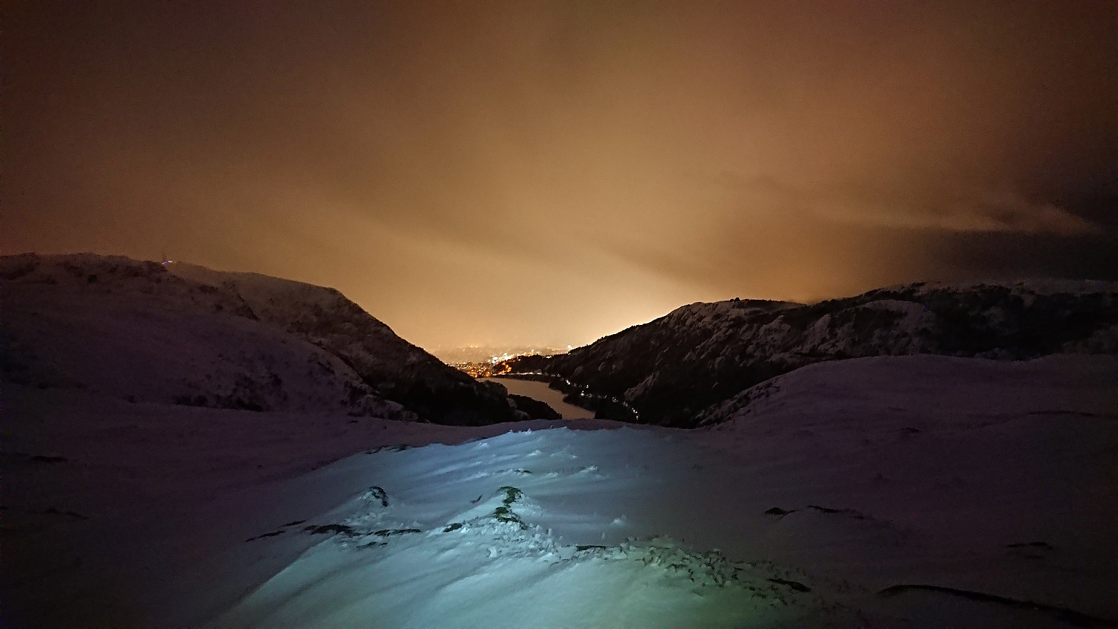 Started the weekend early to take advantage of the recent massive snowfall before it would start raining heavily during the next couple of days. After taking the cable car (230 kr) to the top of Ulriken (or more correctly to Ulriken Vest ), I put on the skis and headed towards Turnerhytten . The visibility was not the best and I constantly had to consider whether my plan to ski across Vidden would be doable after all. At Turnerhytten the visibility gradually improved and I decided to at least continue to Byfjellenes høyeste punkt before deciding. When getting there the visibility had thankfully further improved. Encouraged by also seeing other skiers I decided to continue.
Shortly after passing Skjulet I connected with the trails of the other skiers and could then easily follow these all the way to Borgaskaret. It would probably have been possible >>>
Started the weekend early to take advantage of the recent massive snowfall before it would start raining heavily during the next couple of days. After taking the cable car (230 kr) to the top of Ulriken (or more correctly to Ulriken Vest ), I put on the skis and headed towards Turnerhytten . The visibility was not the best and I constantly had to consider whether my plan to ski across Vidden would be doable after all. At Turnerhytten the visibility gradually improved and I decided to at least continue to Byfjellenes høyeste punkt before deciding. When getting there the visibility had thankfully further improved. Encouraged by also seeing other skiers I decided to continue.
Shortly after passing Skjulet I connected with the trails of the other skiers and could then easily follow these all the way to Borgaskaret. It would probably have been possible >>>
Skiing: Mjølfjell to Skiple
- Date:
- 20.05.2023
- Characteristic:
- Backcountry skiing
- Duration:
- 10:12h
- Distance:
- 33.3km
 After last weekend's successful skiing trip to Øykjafonn and Skipanuten I decided to have another go, but this time on my own and starting from Mjølfjell. I again took the early morning train from Bergen and arrived at Mjølfjell train station just before nine. From the station I followed the gravel road north into Rjonaddalen, where I carried the skis for the first 2 km, before putting them on a continuing beside the road where there was just enough snow left.
I soon left the road for a shortcut to reconnect with the road up to Grodjuvet. This road normally continues all the way to the bridge across Grodjyvo , but today the road was soon hidden underneath the snow. By then it was too late to cross the partially open river and I instead continued north until I could safely cross via the mentioned bridge and start the ascent to Grodjuvenuten .
After passing on the northern side of Skyttargluggane, all that remained >>>
After last weekend's successful skiing trip to Øykjafonn and Skipanuten I decided to have another go, but this time on my own and starting from Mjølfjell. I again took the early morning train from Bergen and arrived at Mjølfjell train station just before nine. From the station I followed the gravel road north into Rjonaddalen, where I carried the skis for the first 2 km, before putting them on a continuing beside the road where there was just enough snow left.
I soon left the road for a shortcut to reconnect with the road up to Grodjuvet. This road normally continues all the way to the bridge across Grodjyvo , but today the road was soon hidden underneath the snow. By then it was too late to cross the partially open river and I instead continued north until I could safely cross via the mentioned bridge and start the ascent to Grodjuvenuten .
After passing on the northern side of Skyttargluggane, all that remained >>>
Øykjafonn and Skipanuten from Upsete
- Date:
- 13.05.2023
- Characteristic:
- Backcountry skiing
- Duration:
- 6:07h
- Distance:
- 20.5km
 When petter (Petter Bjørstad) asked if I wanted to go hiking or skiing this weekend I of course said yes, and we settled on a skiing trip to Øykjafonn and Skipanuten . After taking an early train from Bergen we arrived at Upsete stasjon shortly after nine, and after finding a way to safely get to the other side of the train tracks we started the 750 vertical meters ascent to Øykjafonn.
After crossing the river coming down from Gangsdalsvatnet via a snow bridge we pretty much followed the ridge south all the way to the summit. Still plenty of snow, although there were also times when we had to navigate around areas where the snow had already disappeared. Excellent panoramic views from the large summit cairn.
Next, we removed the climbing skins and continued south towards Skipanuten. The descent to the small lake between the two summits was overall straightforward >>>
When petter (Petter Bjørstad) asked if I wanted to go hiking or skiing this weekend I of course said yes, and we settled on a skiing trip to Øykjafonn and Skipanuten . After taking an early train from Bergen we arrived at Upsete stasjon shortly after nine, and after finding a way to safely get to the other side of the train tracks we started the 750 vertical meters ascent to Øykjafonn.
After crossing the river coming down from Gangsdalsvatnet via a snow bridge we pretty much followed the ridge south all the way to the summit. Still plenty of snow, although there were also times when we had to navigate around areas where the snow had already disappeared. Excellent panoramic views from the large summit cairn.
Next, we removed the climbing skins and continued south towards Skipanuten. The descent to the small lake between the two summits was overall straightforward >>>
Klevanuten and Rjoandeggi
- Date:
- 22.04.2023
- Characteristic:
- Backcountry skiing
- Duration:
- 5:24h
- Distance:
- 17.3km
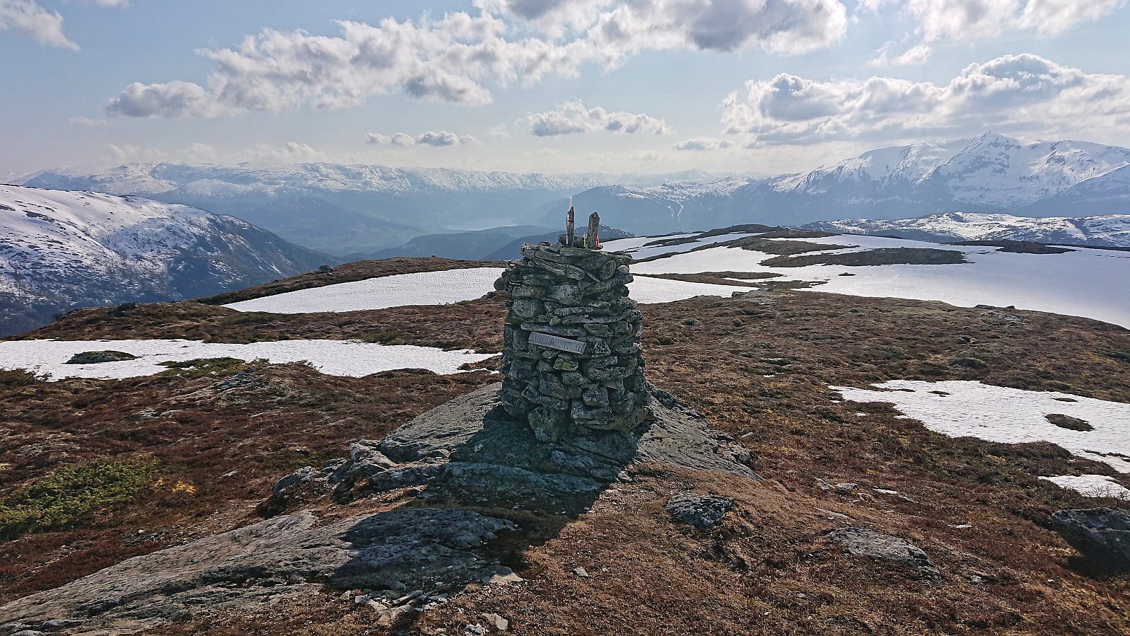
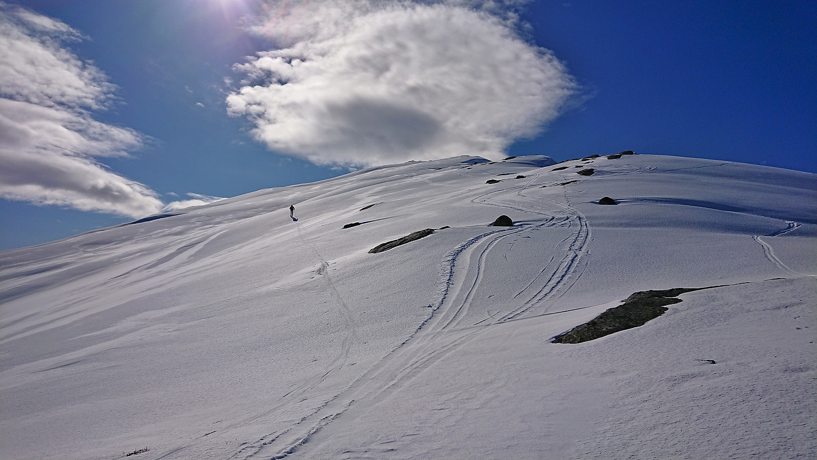
 On a perfect Saturday for skiing, I took the train to Ljosandbotn and followed the marked route up Ljosanddalen to Borgarebuvotni, making a minor detour to visit Appelsintreet . From Borgarebuvotni I continued north before ascending Klevanuten from the northeast. After a short break at the summit I descended into Klevaskaret and ascended to the northern end of Rjoandeggi which I then proceeded to follow south to the highest point . Sunshine and no wind made for an excellent location for my late lunch break.
I continued south along the ridge to Søre Rjoandeggi . Overall straightforward, however there were lots of rocks and even larger areas without any snow that had to be properly navigated. After another extended break, all that remained was the very nice descent to the train station. Even though I had tried to take it slow, and include lots of breaks, I still >>>
On a perfect Saturday for skiing, I took the train to Ljosandbotn and followed the marked route up Ljosanddalen to Borgarebuvotni, making a minor detour to visit Appelsintreet . From Borgarebuvotni I continued north before ascending Klevanuten from the northeast. After a short break at the summit I descended into Klevaskaret and ascended to the northern end of Rjoandeggi which I then proceeded to follow south to the highest point . Sunshine and no wind made for an excellent location for my late lunch break.
I continued south along the ridge to Søre Rjoandeggi . Overall straightforward, however there were lots of rocks and even larger areas without any snow that had to be properly navigated. After another extended break, all that remained was the very nice descent to the train station. Even though I had tried to take it slow, and include lots of breaks, I still >>>
Finnbunuten from Kari Traa-trekket
- Date:
- 29.03.2023
- Characteristic:
- Backcountry skiing
- Duration:
- 1:59h
- Distance:
- 7.6km
 Given the excellent weather, we decided to take the day off and go skiing in Myrkdalen. Several of my colleagues initially wanted to join, but for different reasons, and due to one last minute cancellation, only three of us were on the 08:29 train from Bergen to Voss. We had bought something called a SkiBillett , which included the trains to/from Voss, the ski bus to/from Myrkdalen (which is free anyway) and a one day lift pass, saving around 300 kr per person compared to buying these items separately.
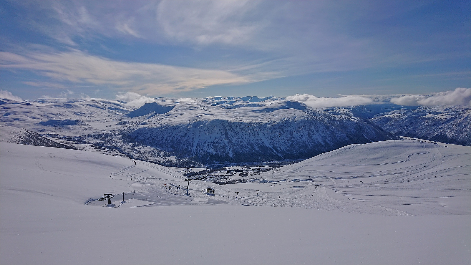
After arriving at Myrkdalen, two of us decided to first make an ascent of Finnbunuten . We started by taking the chair lift "Myrkdalsekspressen" from just outside the hotel and, after a short descent, continued on the T-bar lift "Kari Traa-trekket". Here the GPS was turned on and we headed off-trail >>>
Given the excellent weather, we decided to take the day off and go skiing in Myrkdalen. Several of my colleagues initially wanted to join, but for different reasons, and due to one last minute cancellation, only three of us were on the 08:29 train from Bergen to Voss. We had bought something called a SkiBillett , which included the trains to/from Voss, the ski bus to/from Myrkdalen (which is free anyway) and a one day lift pass, saving around 300 kr per person compared to buying these items separately.
After arriving at Myrkdalen, two of us decided to first make an ascent of Finnbunuten . We started by taking the chair lift "Myrkdalsekspressen" from just outside the hotel and, after a short descent, continued on the T-bar lift "Kari Traa-trekket". Here the GPS was turned on and we headed off-trail >>>
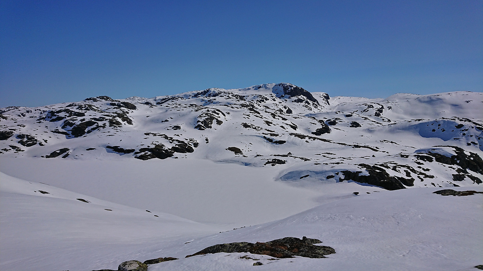
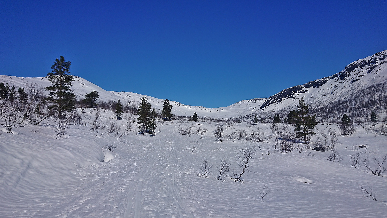
Blåvasshorgi, Kringdalsnipa and Hatlekinni
- Date:
- 26.03.2023
- Characteristic:
- Backcountry skiing
- Duration:
- 6:10h
- Distance:
- 19.6km
 I had initially only planed to go skiing on the Saturday , but when Fjellsamleren (Endre Myrdal Olsen) texted me and asked if I wanted to go skiing on Sunday as well, it only required a quick look at the excellent weather forecast to change my mind. We decided on having a go at the toll road up to Geilane as this should give us easy access to both Blåvasshorgi and Kringdalsnipa , with an added bonus of Hatlekinni for Endre ( which I had already visited once before ).
After paying the 50 kr toll via Vipps at Horvei/Horveid, we followed the steep gravel road to the upper parking lot at Rørgostølen. As expected this parking lot was mainly a private parking lot but there were a couple of guest spots as well.
We quickly put on the climbing skins and could then start skiing direction from the car. The snow was quite hard and icy at the start but as we got higher up this greatly improved and from there on we had near perfect snow conditions for the rest of the >>>
I had initially only planed to go skiing on the Saturday , but when Fjellsamleren (Endre Myrdal Olsen) texted me and asked if I wanted to go skiing on Sunday as well, it only required a quick look at the excellent weather forecast to change my mind. We decided on having a go at the toll road up to Geilane as this should give us easy access to both Blåvasshorgi and Kringdalsnipa , with an added bonus of Hatlekinni for Endre ( which I had already visited once before ).
After paying the 50 kr toll via Vipps at Horvei/Horveid, we followed the steep gravel road to the upper parking lot at Rørgostølen. As expected this parking lot was mainly a private parking lot but there were a couple of guest spots as well.
We quickly put on the climbing skins and could then start skiing direction from the car. The snow was quite hard and icy at the start but as we got higher up this greatly improved and from there on we had near perfect snow conditions for the rest of the >>>
