Archive - Date
Archive - Activity
-
Bike trip (111)
- Bike trip - mixed (25)
- Bike trip - road (86)
-
Drive (9)
- Car drive (9)
-
Other trip (3)
- Kayaking (3)
-
Ski trip (116)
- Backcountry skiing (69)
- Cross-country skiing (47)
- Trip by foot (1897)
Collected lists
-
Utvalgte topper og turmål i Bergen
(349/351)
 99%
99% -
Alle topper i Bergen
(393/400)
98%
-
Voss ≥ 100m pf.
(96/98)
97%
-
Opptur Hordaland
(144/159)
90%
-
Stasjoner på Bergensbanen
(33/40)
82%
-
Ulvik ≥ 100m pf.
(30/38)
78%
-
Hordaland ≥ 100m pf.
(624/863)
72%
-
Mjølfjell PF > 100m
(21/31)
67%
-
Jondal ≥ 100m pf.
(15/23)
65%
-
Dagsturhyttene i Vestland
(36/61)
59%
-
Sunnhordland PF >= 100m
(105/186)
56%
-
Hordaland: Hardanger PF>=100m
(196/359)
54%
-
DNT-hytter i Hordaland
(23/45)
51%
-
Kvinnherad ≥ 100m pf.
(40/79)
50%
-
Eidfjord ≥ 100m pf.
(13/42)
30%
-
Sogndal ≥ 100m pf.
(23/81)
28%
-
Gulen ≥ 100m pf.
(15/54)
27%
-
Vik i Sogn ≥ 100m pf.
(10/46)
21%
-
Sogn - Sør for Sognefjorden PF>=100m
(31/159)
19%
-
DNT-hytter i Sogn og Fjordane
(8/47)
17%

Raudhaugane, Luranuten and Ramnabergnuten from Finse
- Date:
- 01.05.2026
- Characteristic:
- Backcountry skiing
- Duration:
- 9:12h
- Distance:
- 37.5km
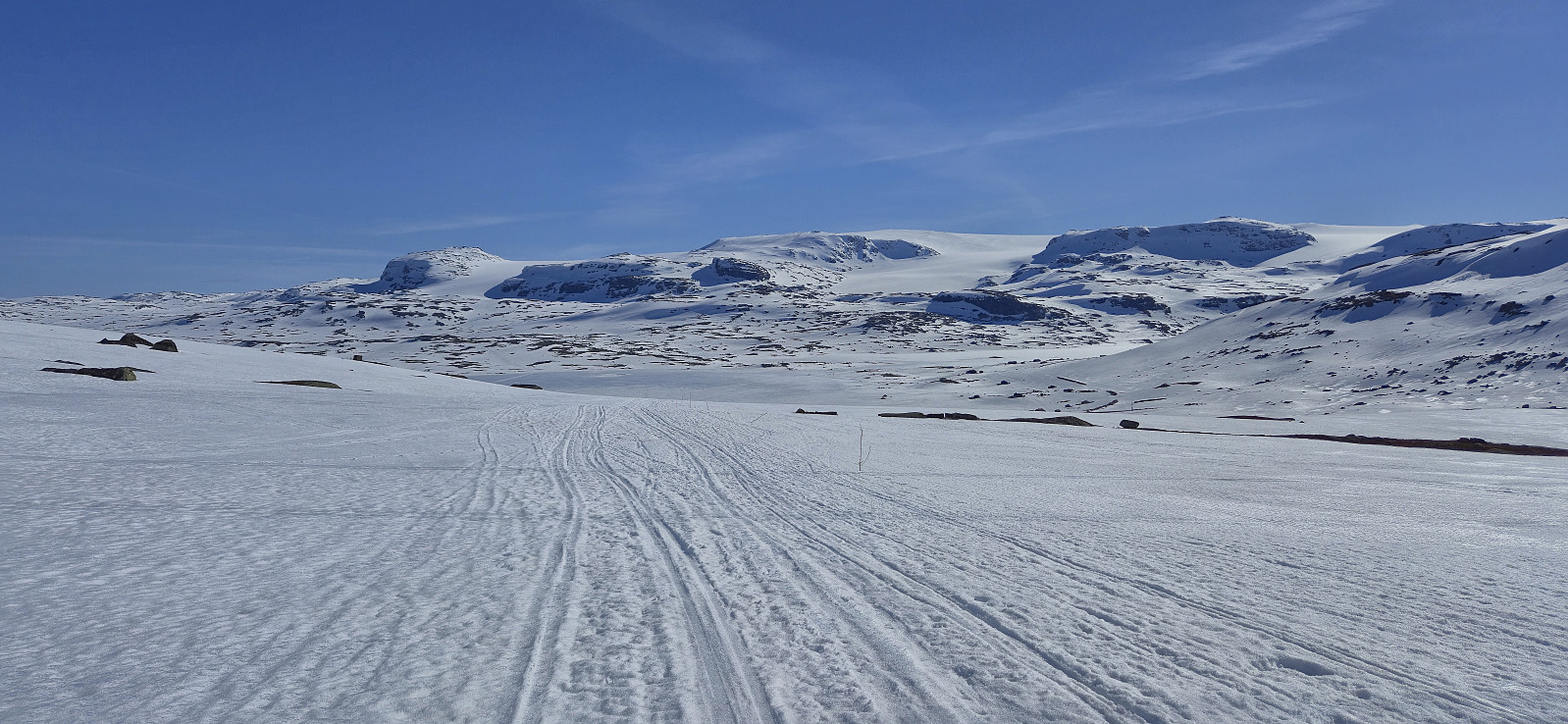
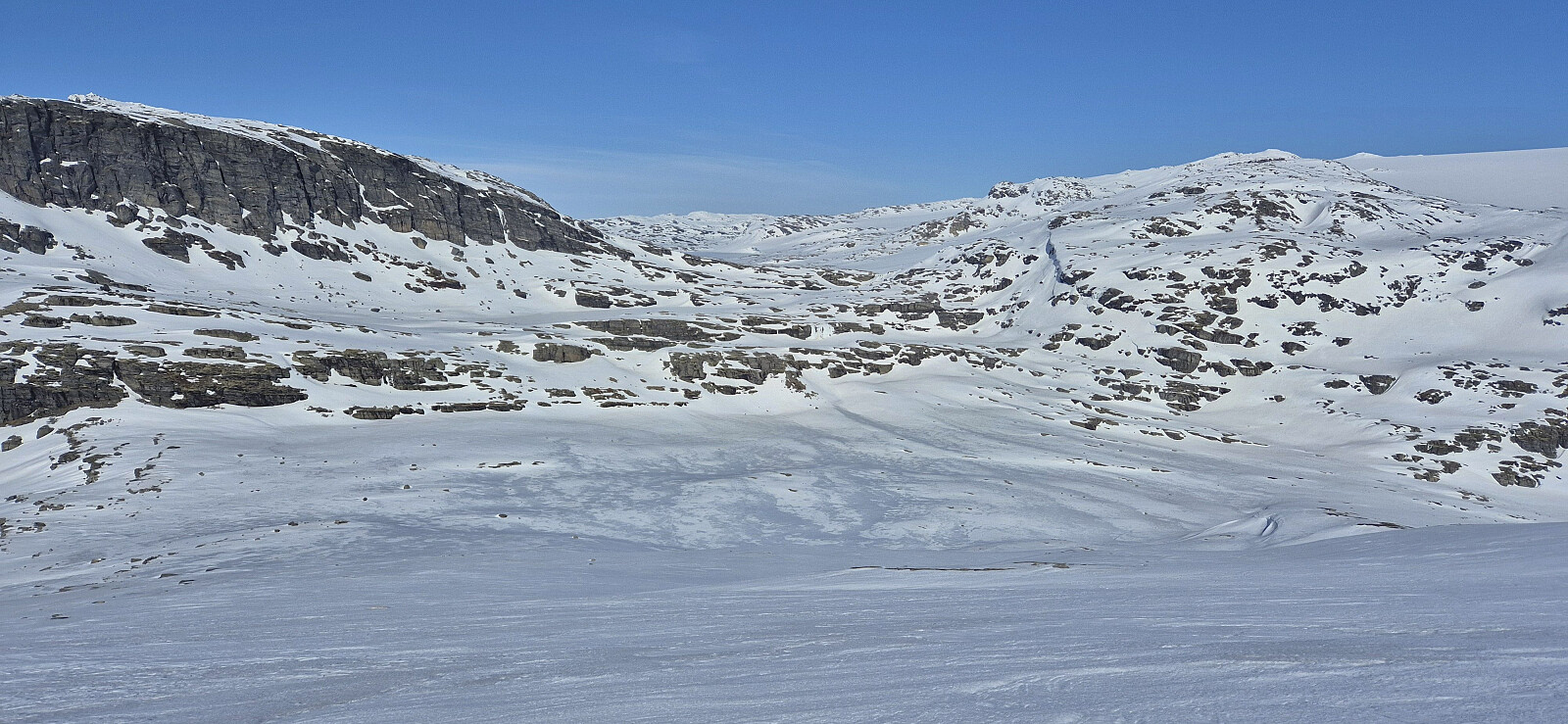 After cancelling several skiing trips at Finse over the previous weekends due to bad weather, it was finally time to put the plan into motion. Initially, I had only intended to ascend Ramnabergnuten , but when Petter also wanted to join, we extended the trip given that he had already visited Ramnabergnuten. This also turned out to be a good thing, given that Vy cancelled several trains at the last minute and thus would have left us with way too much time if only visiting one peak.
We started out from Finse shortly before eleven and partly followed the marked route for the roundtrip across Hardangerjøkulen and partly Petter's winter route to Demmevasshytta , which he has used every December for more than 20 years as a tour guide to the "julebord" at Demmevasshytta for DNT fjellsport Bergen .
Upon arriving at the lake northeast of Ramnabergnuten, we left the >>>
After cancelling several skiing trips at Finse over the previous weekends due to bad weather, it was finally time to put the plan into motion. Initially, I had only intended to ascend Ramnabergnuten , but when Petter also wanted to join, we extended the trip given that he had already visited Ramnabergnuten. This also turned out to be a good thing, given that Vy cancelled several trains at the last minute and thus would have left us with way too much time if only visiting one peak.
We started out from Finse shortly before eleven and partly followed the marked route for the roundtrip across Hardangerjøkulen and partly Petter's winter route to Demmevasshytta , which he has used every December for more than 20 years as a tour guide to the "julebord" at Demmevasshytta for DNT fjellsport Bergen .
Upon arriving at the lake northeast of Ramnabergnuten, we left the >>>
Helleberget from Rindabotn
- Date:
- 03.04.2026
- Characteristic:
- Backcountry skiing
- Duration:
- 2:18h
- Distance:
- 9.2km
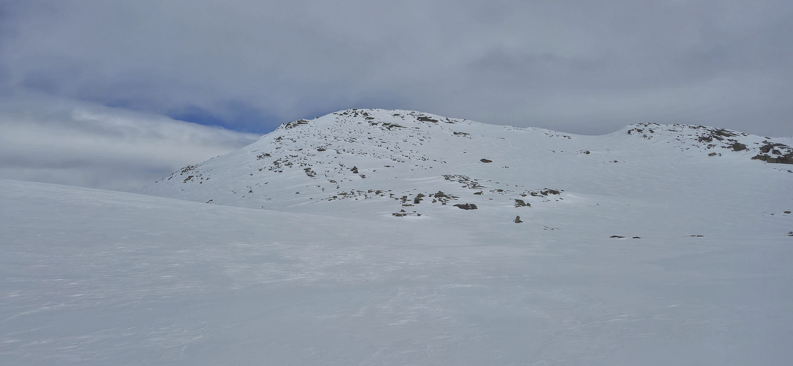
 Solo skiing trip from Rindabotn to Helleberget . A lot more snow than last year but quite hard and icy. Combined with the sun disappearing just as I was about to start my descent, resulting in very flat light, the trip back to the parking lot was not the most enjoyable.
Store Bjoreinuten, Fagernuten and Vetle Allgarden
- Date:
- 07.03.2026
- Characteristic:
- Backcountry skiing
- Duration:
- 5:10h
- Distance:
- 17.8km
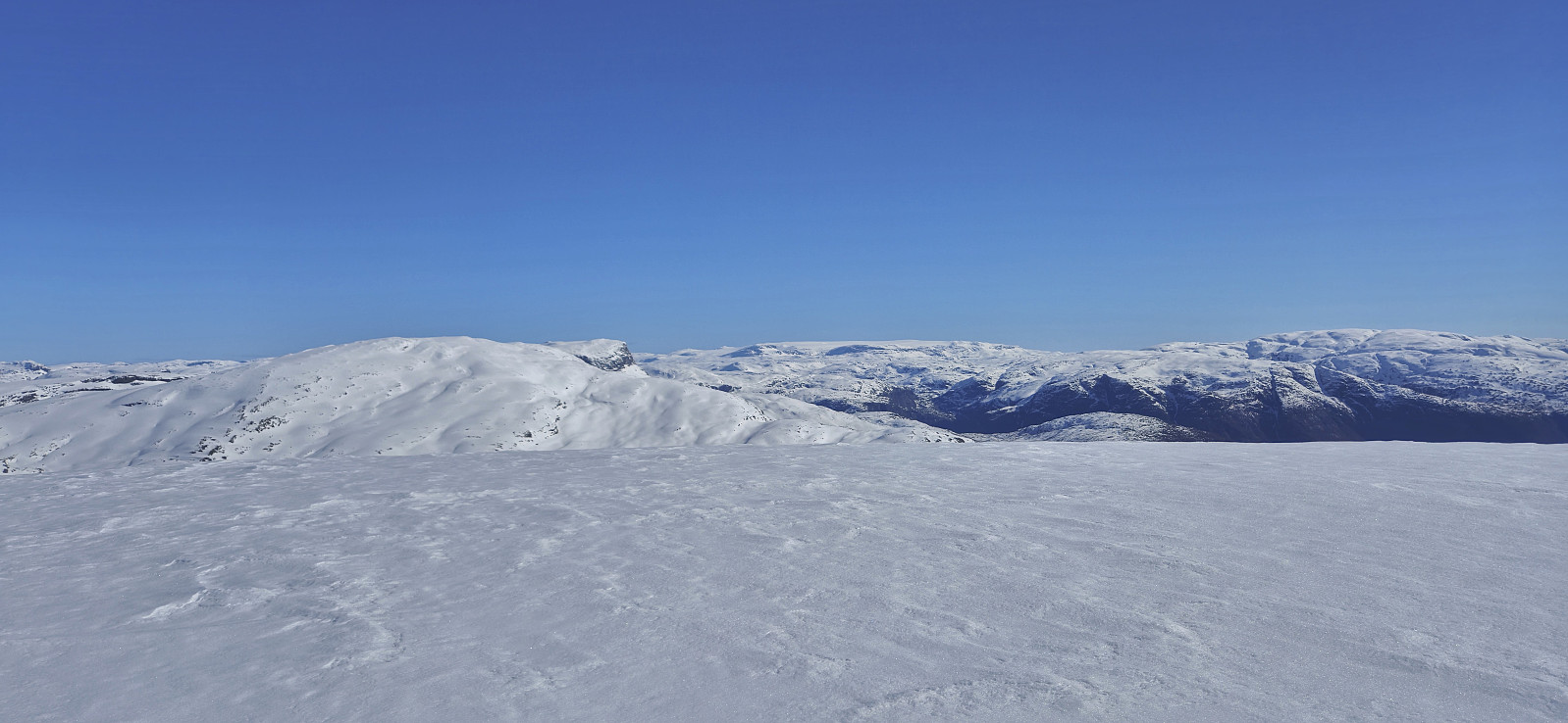
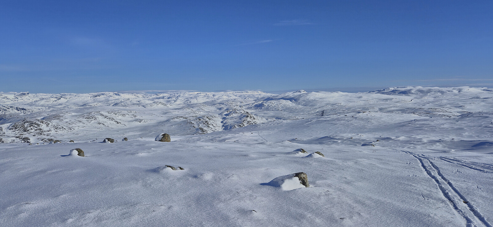 After a long drive from Bergen, most of it in very dense fog, we could finally leave the poor visibility behind shortly after beginning the ascent from Eidfjord and when parking the car next to the road north of Store Bjoreinuten the sun was shining from an almost cloudless sky. After crossing Bjoreio we easily made our way to the highest point of Store Bjoreinuten, passing by the old northwestern summit marked by a small cairn on the way.
Next, we headed more or less directly southwest towards Fagernuten , rounded the summit on the eastern side and made the final ascent from the south. After a short break next the cairn, we descended northeast into the valley between Fagernuten and Store Allgarden before turning north and passing by Drøllstøl on our way to Vetle Allgarden .
The ascent to Vetle Allgarden was a mixed bag. It started with a minor struggle >>>
After a long drive from Bergen, most of it in very dense fog, we could finally leave the poor visibility behind shortly after beginning the ascent from Eidfjord and when parking the car next to the road north of Store Bjoreinuten the sun was shining from an almost cloudless sky. After crossing Bjoreio we easily made our way to the highest point of Store Bjoreinuten, passing by the old northwestern summit marked by a small cairn on the way.
Next, we headed more or less directly southwest towards Fagernuten , rounded the summit on the eastern side and made the final ascent from the south. After a short break next the cairn, we descended northeast into the valley between Fagernuten and Store Allgarden before turning north and passing by Drøllstøl on our way to Vetle Allgarden .
The ascent to Vetle Allgarden was a mixed bag. It started with a minor struggle >>>
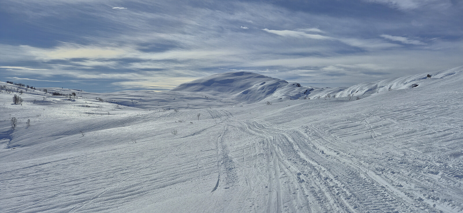
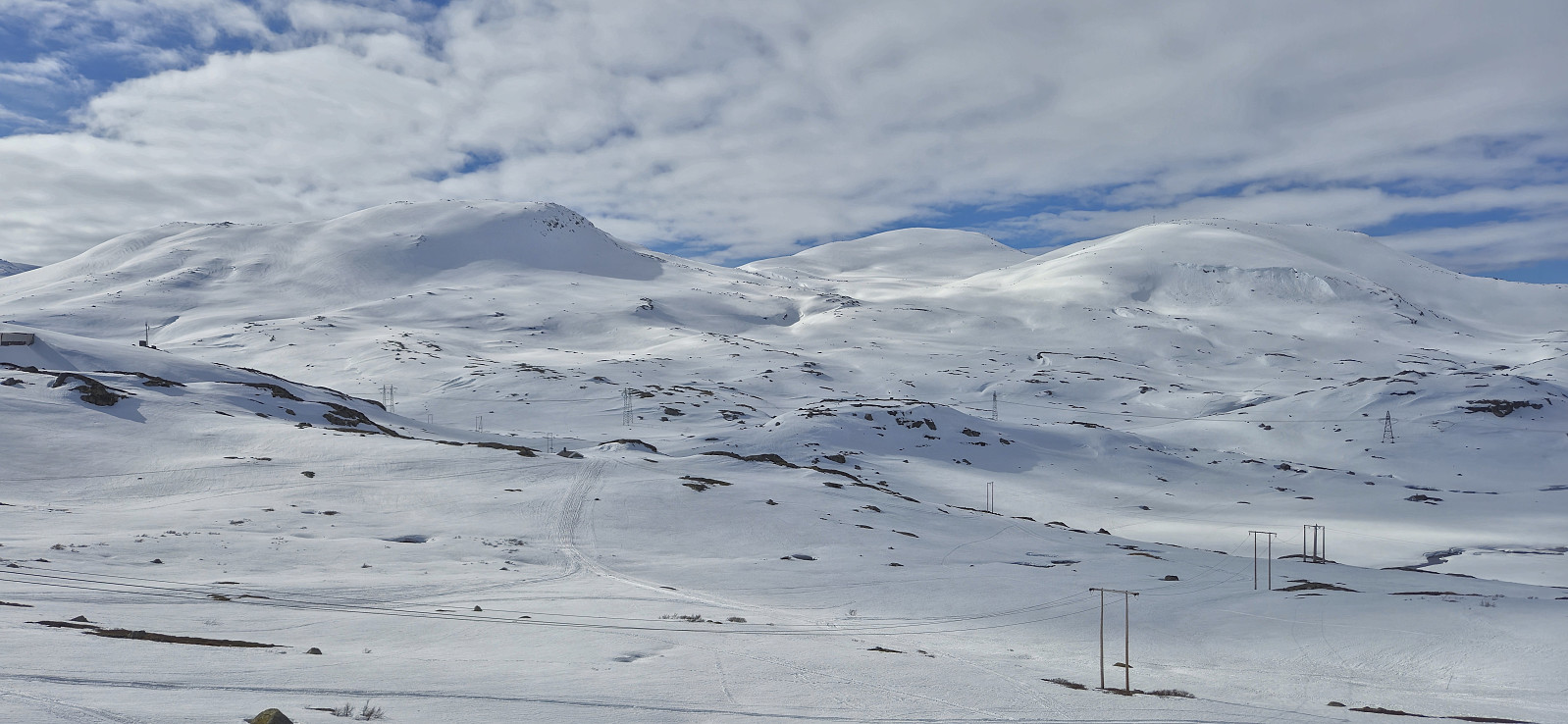
Valanipa and Sopandefjellet
- Date:
- 17.01.2026
- Characteristic:
- Backcountry skiing
- Duration:
- 4:46h
- Distance:
- 14.8km
 Endre picked me up at my place shortly after seven and together we drove the around 2.5 hours to Vikafjellet. The drive however took slightly longer than usual given that the ventilation system in Endre's car did not work properly and we therefore had to make the occasional stop to manually remove excess moisture from the inside of the windshield. To make things worse, starting from Evanger the man-made fog inside the car was matched by an increasingly dense natural fog outside. Together with snow-covered roads this was not the best combination, but by taking it slow we managed to get to the parking lot at Fosse without any real issues.
As if planned, the fog magically disappeared just minutes before we arrived at the parking lot and we could see the first pinkish rays of sunlight hitting the surrounding mountain tops. >>>
Endre picked me up at my place shortly after seven and together we drove the around 2.5 hours to Vikafjellet. The drive however took slightly longer than usual given that the ventilation system in Endre's car did not work properly and we therefore had to make the occasional stop to manually remove excess moisture from the inside of the windshield. To make things worse, starting from Evanger the man-made fog inside the car was matched by an increasingly dense natural fog outside. Together with snow-covered roads this was not the best combination, but by taking it slow we managed to get to the parking lot at Fosse without any real issues.
As if planned, the fog magically disappeared just minutes before we arrived at the parking lot and we could see the first pinkish rays of sunlight hitting the surrounding mountain tops. >>>
Skiing: Vargabreen from Finse
- Date:
- 10.05.2025
- Characteristic:
- Backcountry skiing
- Duration:
- 6:43h
- Distance:
- 24.7km
 Three weeks after my ascents of Flakavassnutane and Såtehjallane I was back at Finse for what would most likely be the last skiing trip of the season. After safely crossing to the other side of the train tracks, I started on the marked winter route towards Geiterygghytta before later turning west in Såtedalen and briefly following the marked winter route to Hallingskeid. The final off-trail ascent to the highest point at Vargabreen was straightforward and it was easy to find a route that avoided all of the steeper areas.
After a lunch break at the summit I made the short detour north to the only slightly lower northern summit before turning back and descending along the same route. A descent that turned out a bit more complicated than expected given that I at the top had discovered that the soles of my ski boots, which were only two years old, were in the process of detaching from the rest of the >>>
Three weeks after my ascents of Flakavassnutane and Såtehjallane I was back at Finse for what would most likely be the last skiing trip of the season. After safely crossing to the other side of the train tracks, I started on the marked winter route towards Geiterygghytta before later turning west in Såtedalen and briefly following the marked winter route to Hallingskeid. The final off-trail ascent to the highest point at Vargabreen was straightforward and it was easy to find a route that avoided all of the steeper areas.
After a lunch break at the summit I made the short detour north to the only slightly lower northern summit before turning back and descending along the same route. A descent that turned out a bit more complicated than expected given that I at the top had discovered that the soles of my ski boots, which were only two years old, were in the process of detaching from the rest of the >>>
Skiing: Flakavassnutane and Såtehjallane from Finse
- Date:
- 20.04.2025
- Characteristic:
- Backcountry skiing
- Duration:
- 5:04h
- Distance:
- 18.9km
 Two days after my skiing trip from Hallingskeid to Nyrjuven I was back on the train from Bergen but this time taking the train one stop further and getting off at Finse . After safely crossing the train tracks I put on the skis and started on the marked winter route to Klemsbu . Around 1 km before the cabin I however left the marked route and headed more directly northeast towards Flakavassnutane .
South of the summit I shortly reconnected with the marked route before finding my own way to the top, arriving at the large cairn without any difficulties. Excellent views from the summit, even though the sunshine promised by the weather forecast never materialized. A cold wind resulted in a short stay and after a couple of pictures I descended along the same route before following the marked route west to Klemsbu.
I had initially considered to also include Vargabreen on today's trip >>>
Two days after my skiing trip from Hallingskeid to Nyrjuven I was back on the train from Bergen but this time taking the train one stop further and getting off at Finse . After safely crossing the train tracks I put on the skis and started on the marked winter route to Klemsbu . Around 1 km before the cabin I however left the marked route and headed more directly northeast towards Flakavassnutane .
South of the summit I shortly reconnected with the marked route before finding my own way to the top, arriving at the large cairn without any difficulties. Excellent views from the summit, even though the sunshine promised by the weather forecast never materialized. A cold wind resulted in a short stay and after a couple of pictures I descended along the same route before following the marked route west to Klemsbu.
I had initially considered to also include Vargabreen on today's trip >>>
Skiing: Nyrjuven/Osaskavlen from Hallingskeid
- Date:
- 18.04.2025
- Characteristic:
- Backcountry skiing
- Duration:
- 4:56h
- Distance:
- 16.4km
 After spending the first half of Easter in Sogndal, I was now back in Bergen and after a night at home I got up early to take the train to Hallingskeid with the plan to ski to Nyrjuven/Osaskavlen . The sun was shining when the train arrived at Hallingskeid and I could put on the skis immediately after exiting the station from where I headed towards the bridge across Moldo .
Given the issues I had had with the missing summer bridge during my recent attempt to cross the river south of Mjølfjell (which I later learnt opened just three days later…), I had in advance made sure that the bridge would in fact be there this time around , and could therefore easily cross to the other side.
Safely across the river, I continued west along Buadalen where I pretty much followed the marked summer route to Osa/Rembesdalsseter until getting to the unnamed 1272 lake southwest of Daurmålsvatnet. From there it was simply a matter of navigating more or less directly west >>>
After spending the first half of Easter in Sogndal, I was now back in Bergen and after a night at home I got up early to take the train to Hallingskeid with the plan to ski to Nyrjuven/Osaskavlen . The sun was shining when the train arrived at Hallingskeid and I could put on the skis immediately after exiting the station from where I headed towards the bridge across Moldo .
Given the issues I had had with the missing summer bridge during my recent attempt to cross the river south of Mjølfjell (which I later learnt opened just three days later…), I had in advance made sure that the bridge would in fact be there this time around , and could therefore easily cross to the other side.
Safely across the river, I continued west along Buadalen where I pretty much followed the marked summer route to Osa/Rembesdalsseter until getting to the unnamed 1272 lake southwest of Daurmålsvatnet. From there it was simply a matter of navigating more or less directly west >>>
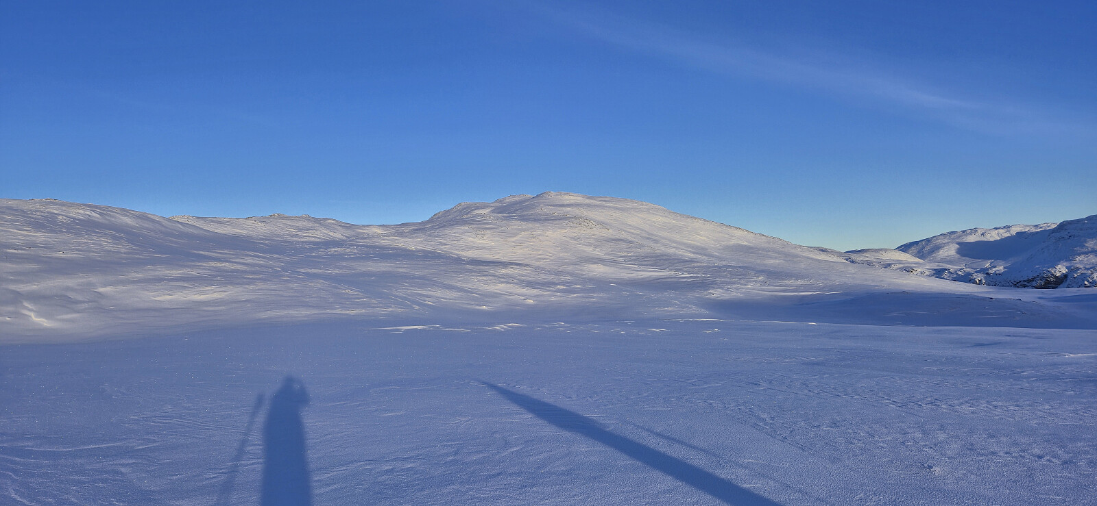
Helleberget
- Date:
- 15.04.2025
- Characteristic:
- Backcountry skiing
- Duration:
- 3:10h
- Distance:
- 9.3km
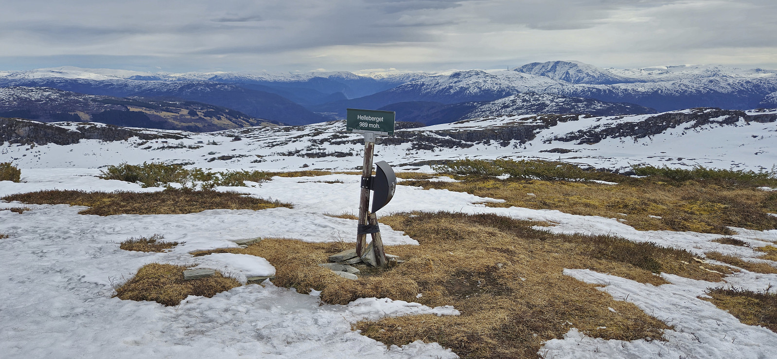 Even though the snow was rapidly melting we managed to keep the skis on all the way from Rindabotn to the summit. Limited snow at the summit and almost no snow for the final part of the descent back to the parking lot.
Skiing: Nordbotnnuten from Mjølfjell
- Date:
- 05.04.2025
- Characteristic:
- Backcountry skiing
- Duration:
- 9:31h
- Distance:
- 25.5km
 I got up early Saturday morning to catch the first train from Bergen to Mjølfjell where I arrived at 09:00. My plan had been to walk south from the station and cross the river via the bridge to Urlandsstølen to start my ascent to Nordbotnnuten . When getting there I however quickly realized that this would not be possible. The bridge had been taken down for the winter ! I therefore had to come up with an alternative plan to get to the other side.
I found two options: the bridge to Hagen (around 1.5 km walk to the southwest) or the bridge at Hellene (around 2 km walk to the east). While the former was a shorter walk and definitely included a permanent bridge, I still decided on Hellene as the terrain from there to Rundavatnet (to connect with my planned ascent route to Nordbotnnuten) looked easier. Upon arriving at Hellene I was therefore very happy to find that this bridge was >>>
I got up early Saturday morning to catch the first train from Bergen to Mjølfjell where I arrived at 09:00. My plan had been to walk south from the station and cross the river via the bridge to Urlandsstølen to start my ascent to Nordbotnnuten . When getting there I however quickly realized that this would not be possible. The bridge had been taken down for the winter ! I therefore had to come up with an alternative plan to get to the other side.
I found two options: the bridge to Hagen (around 1.5 km walk to the southwest) or the bridge at Hellene (around 2 km walk to the east). While the former was a shorter walk and definitely included a permanent bridge, I still decided on Hellene as the terrain from there to Rundavatnet (to connect with my planned ascent route to Nordbotnnuten) looked easier. Upon arriving at Hellene I was therefore very happy to find that this bridge was >>>
Sør for Meinsperro
- Date:
- 09.02.2025
- Characteristic:
- Backcountry skiing
- Duration:
- 3:14h
- Distance:
- 7.6km
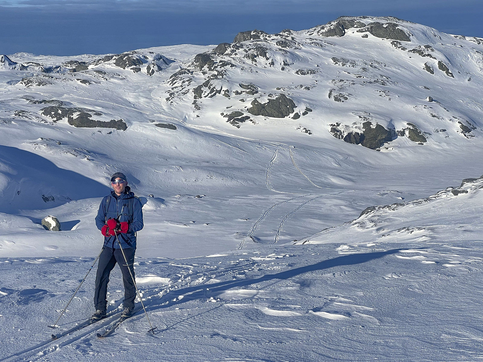 A short backcountry skiing trip with Endre where we started from the parking lot outside Stordalen Fjellstove and from there followed a marked trail towards Rusta (and Gygrebotnen). At first we had to carry the skis but at just below 700 meters we put them on and kept them on until the summit area at Sør for Meinsperro . The skiing conditions can best be described as highly variable but also with several quite nice sections.
We had initially considered continuing to Årsdalsryggen via Fjellvassbu but quickly concluded that this would take too long under the current conditions. After a couple of pictures we therefore returned more or less the same way but managed to keep the skis on for a bit longer than the point where we put them on during the ascent. Towards the end we also followed a wrong set of footprints but still easily found our way back to the parking lot.
A short backcountry skiing trip with Endre where we started from the parking lot outside Stordalen Fjellstove and from there followed a marked trail towards Rusta (and Gygrebotnen). At first we had to carry the skis but at just below 700 meters we put them on and kept them on until the summit area at Sør for Meinsperro . The skiing conditions can best be described as highly variable but also with several quite nice sections.
We had initially considered continuing to Årsdalsryggen via Fjellvassbu but quickly concluded that this would take too long under the current conditions. After a couple of pictures we therefore returned more or less the same way but managed to keep the skis on for a bit longer than the point where we put them on during the ascent. Towards the end we also followed a wrong set of footprints but still easily found our way back to the parking lot.
