Arkiv - dato
Arkiv - aktivitet
-
Annen tur (3)
- Kajakkpadling (3)
- Fottur (1897)
-
Kjøretur (9)
- Biltur (9)
-
Skitur (116)
- Fjellskitur (69)
- Langrennstur (47)
-
Sykkeltur (111)
- Blandet sykling (25)
- Gatesykling (86)
Lister jeg samler etter
-
Utvalgte topper og turmål i Bergen
(349/351)
 99%
99% -
Alle topper i Bergen
(393/400)
98%
-
Voss ≥ 100m pf.
(96/98)
97%
-
Opptur Hordaland
(144/159)
90%
-
Stasjoner på Bergensbanen
(33/40)
82%
-
Ulvik ≥ 100m pf.
(30/38)
78%
-
Hordaland ≥ 100m pf.
(624/863)
72%
-
Mjølfjell PF > 100m
(21/31)
67%
-
Jondal ≥ 100m pf.
(15/23)
65%
-
Dagsturhyttene i Vestland
(36/61)
59%
-
Sunnhordland PF >= 100m
(105/186)
56%
-
Hordaland: Hardanger PF>=100m
(196/359)
54%
-
DNT-hytter i Hordaland
(23/45)
51%
-
Kvinnherad ≥ 100m pf.
(40/79)
50%
-
Eidfjord ≥ 100m pf.
(13/42)
30%
-
Sogndal ≥ 100m pf.
(23/81)
28%
-
Gulen ≥ 100m pf.
(15/54)
27%
-
Vik i Sogn ≥ 100m pf.
(10/46)
21%
-
Sogn - Sør for Sognefjorden PF>=100m
(31/159)
19%
-
DNT-hytter i Sogn og Fjordane
(8/47)
17%

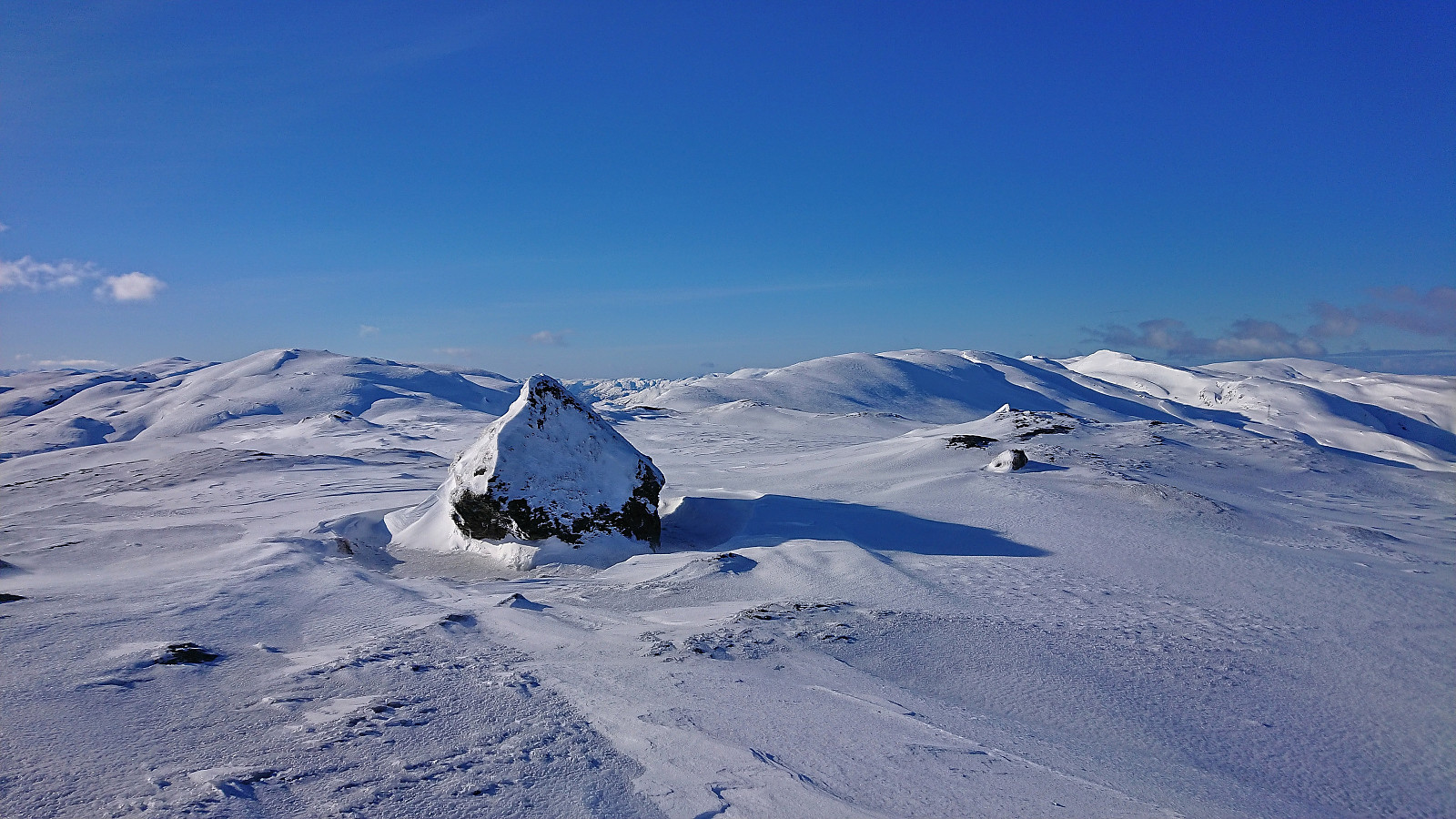
Øykjafonn and Skipanuten from Upsete
- Dato:
- 13.05.2023
- Turtype:
- Fjellskitur
- Turlengde:
- 6:07t
- Distanse:
- 20,5km
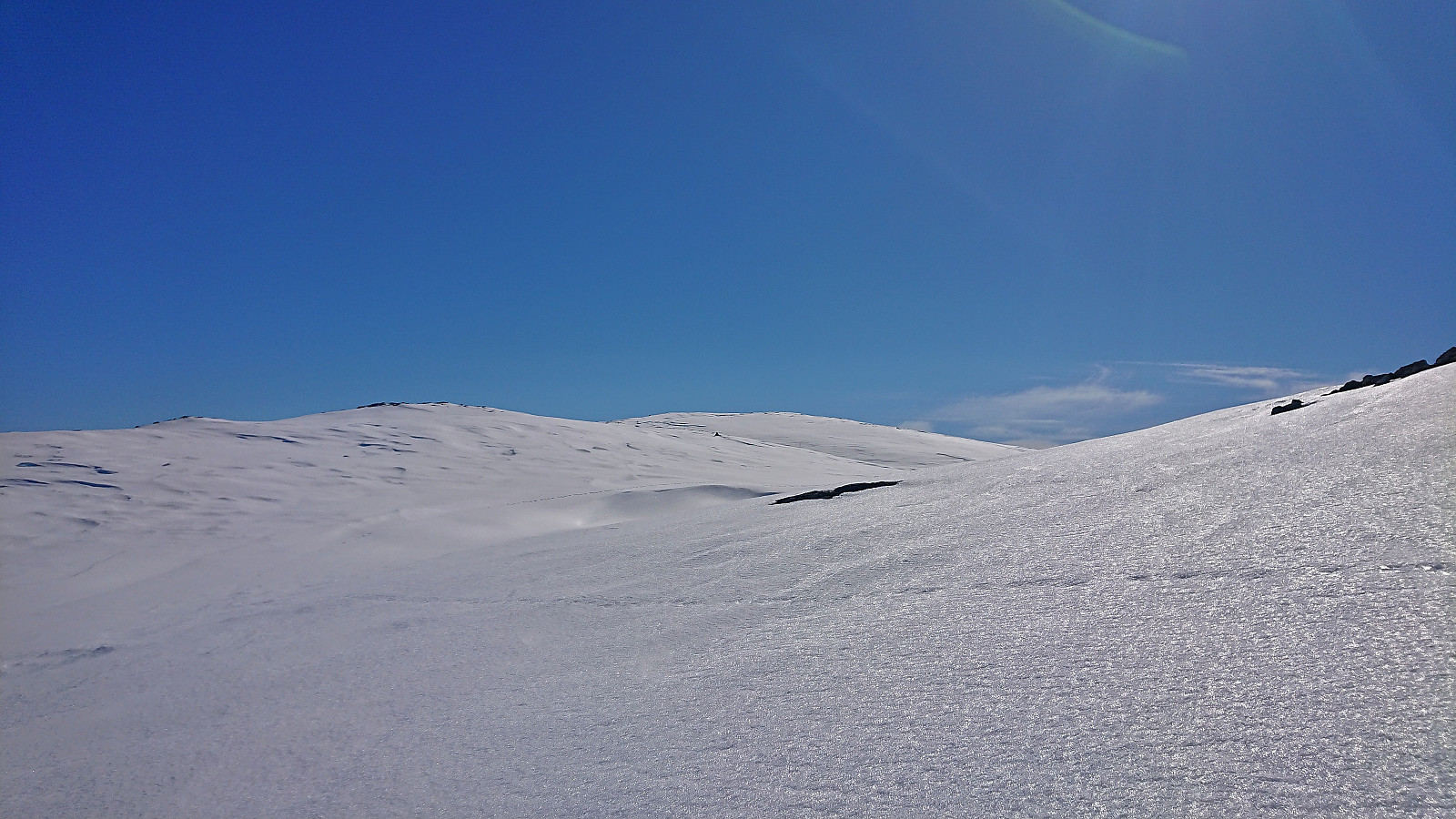
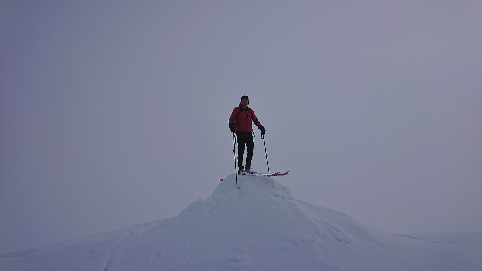
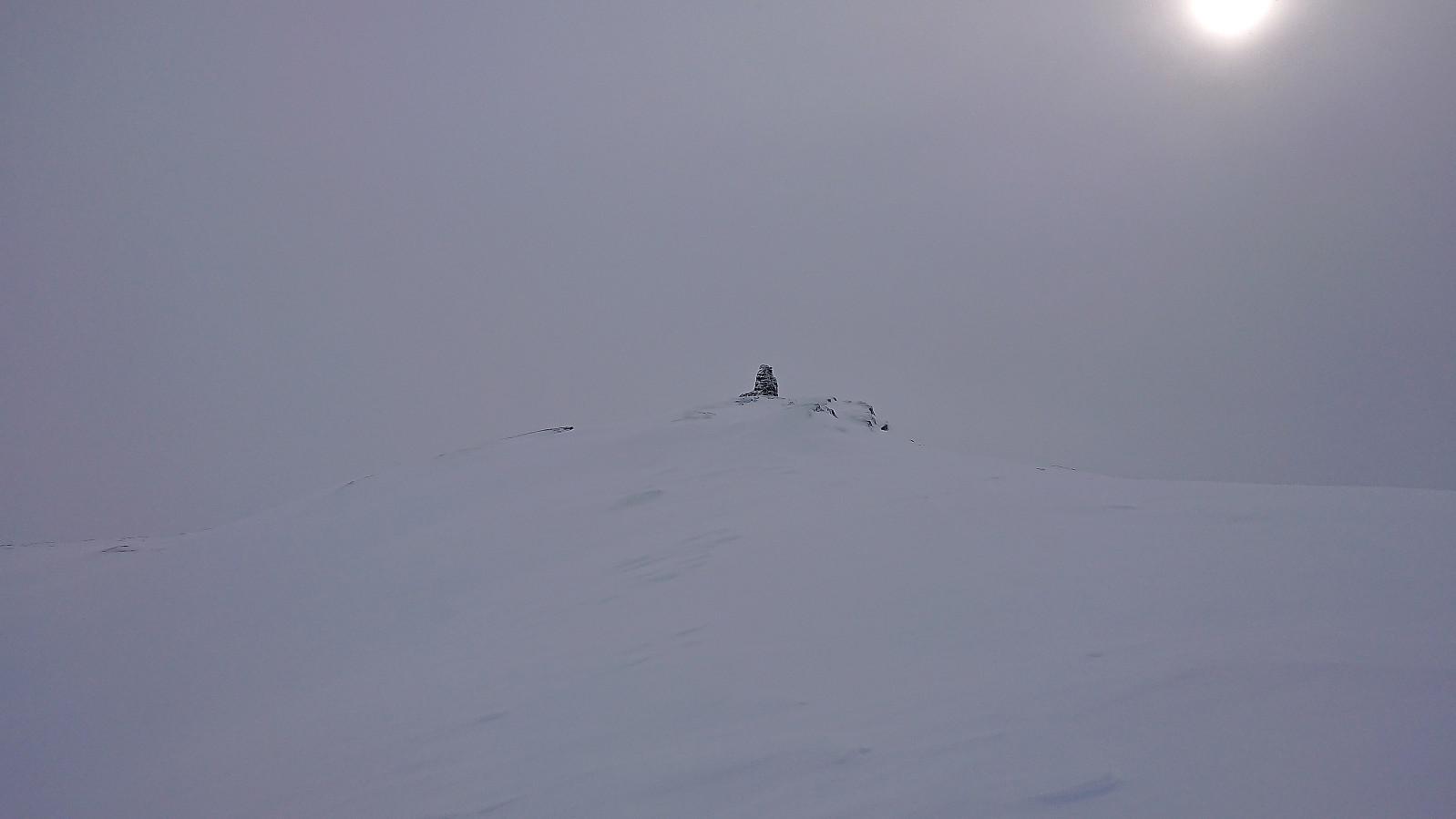
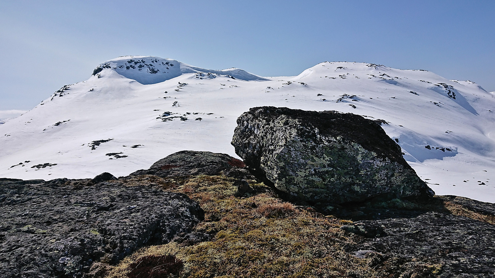 When petter (Petter Bjørstad) asked if I wanted to go hiking or skiing this weekend I of course said yes, and we settled on a skiing trip to Øykjafonn and Skipanuten . After taking an early train from Bergen we arrived at Upsete stasjon shortly after nine, and after finding a way to safely get to the other side of the train tracks we started the 750 vertical meters ascent to Øykjafonn.
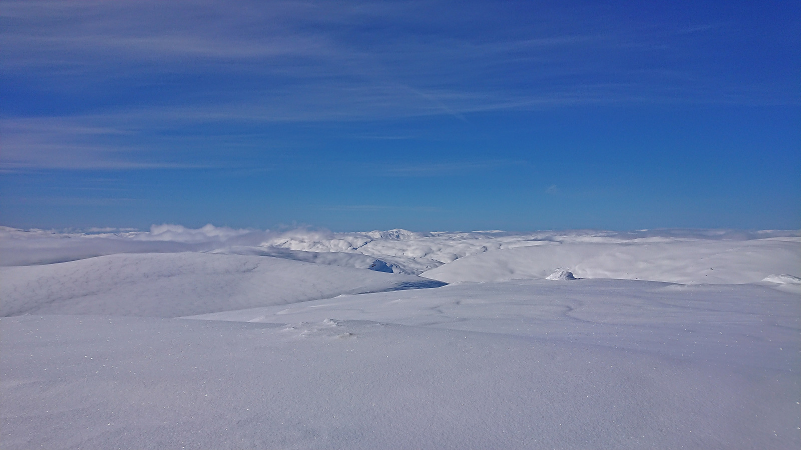
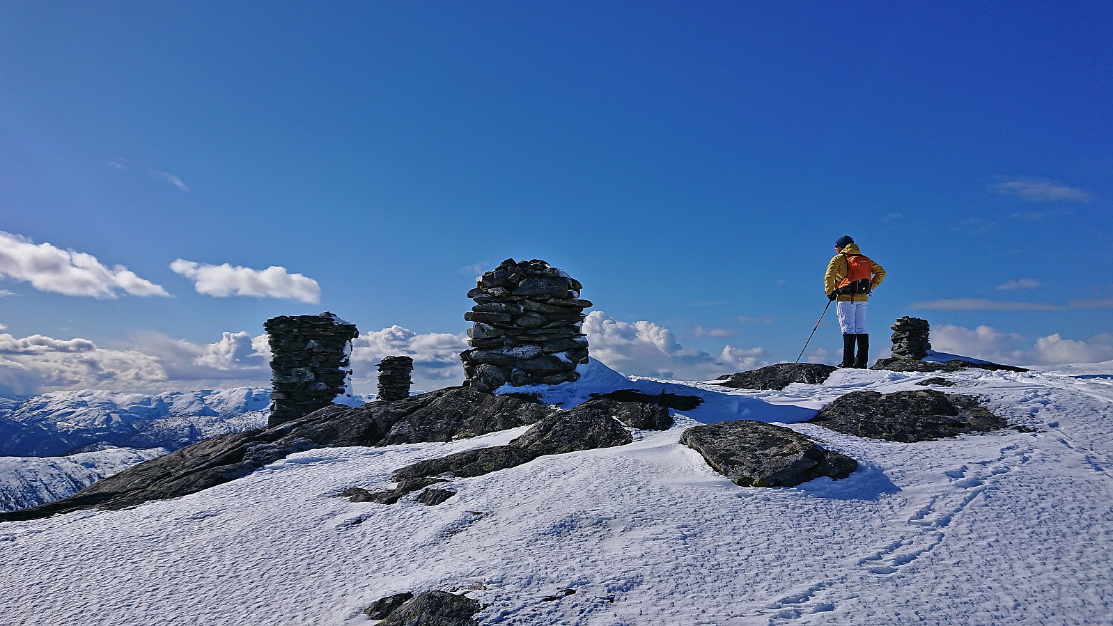
After crossing the river coming down from Gangsdalsvatnet via a snow bridge we pretty much followed the ridge south all the way to the summit. Still plenty of snow, although there were also times when we had to navigate around areas where the snow had already disappeared. Excellent panoramic views from the large summit cairn.
Next, we removed the climbing skins and continued south towards Skipanuten. The descent to the small lake between the two summits was overall straightforward >>>
When petter (Petter Bjørstad) asked if I wanted to go hiking or skiing this weekend I of course said yes, and we settled on a skiing trip to Øykjafonn and Skipanuten . After taking an early train from Bergen we arrived at Upsete stasjon shortly after nine, and after finding a way to safely get to the other side of the train tracks we started the 750 vertical meters ascent to Øykjafonn.
After crossing the river coming down from Gangsdalsvatnet via a snow bridge we pretty much followed the ridge south all the way to the summit. Still plenty of snow, although there were also times when we had to navigate around areas where the snow had already disappeared. Excellent panoramic views from the large summit cairn.
Next, we removed the climbing skins and continued south towards Skipanuten. The descent to the small lake between the two summits was overall straightforward >>>
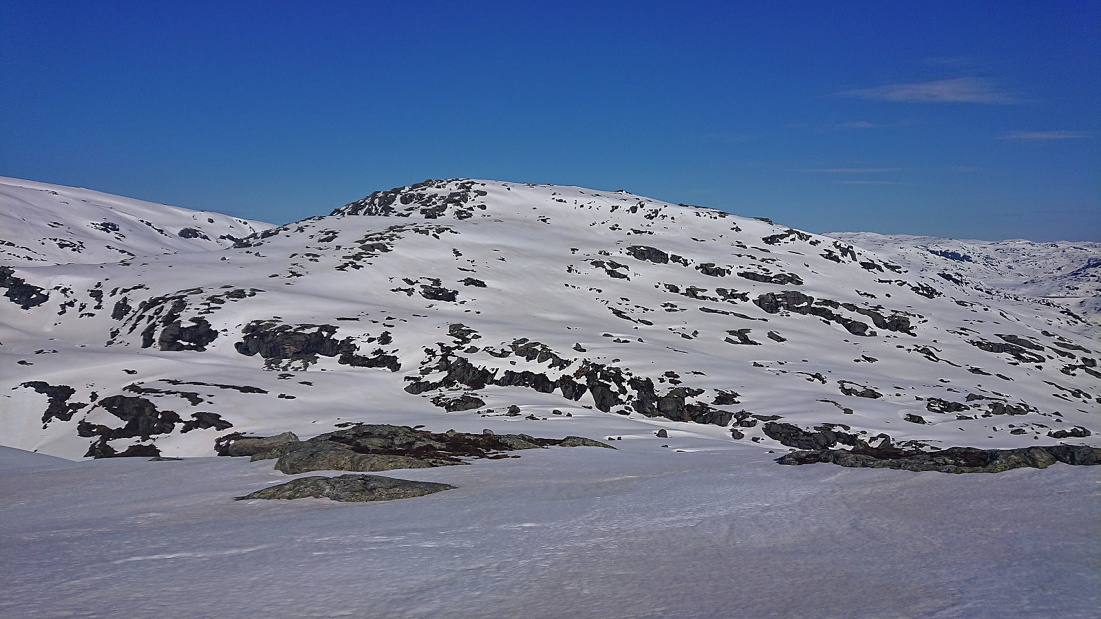
Klevanuten and Rjoandeggi
- Dato:
- 22.04.2023
- Turtype:
- Fjellskitur
- Turlengde:
- 5:24t
- Distanse:
- 17,3km
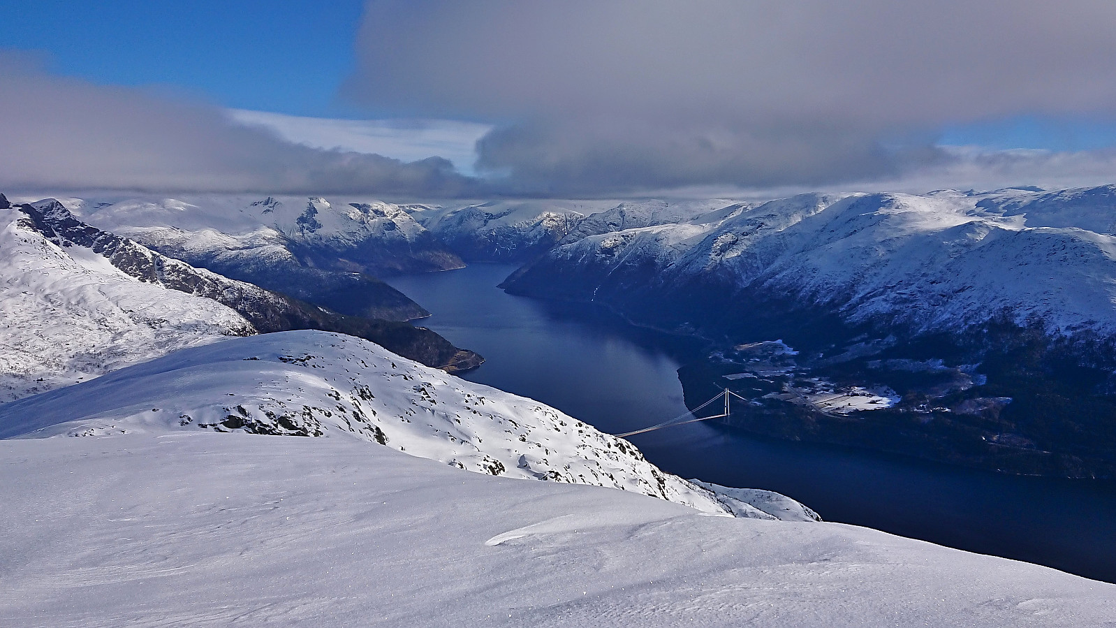
 On a perfect Saturday for skiing, I took the train to Ljosandbotn and followed the marked route up Ljosanddalen to Borgarebuvotni, making a minor detour to visit Appelsintreet . From Borgarebuvotni I continued north before ascending Klevanuten from the northeast. After a short break at the summit I descended into Klevaskaret and ascended to the northern end of Rjoandeggi which I then proceeded to follow south to the highest point . Sunshine and no wind made for an excellent location for my late lunch break.
I continued south along the ridge to Søre Rjoandeggi . Overall straightforward, however there were lots of rocks and even larger areas without any snow that had to be properly navigated. After another extended break, all that remained was the very nice descent to the train station. Even though I had tried to take it slow, and include lots of breaks, I still >>>
On a perfect Saturday for skiing, I took the train to Ljosandbotn and followed the marked route up Ljosanddalen to Borgarebuvotni, making a minor detour to visit Appelsintreet . From Borgarebuvotni I continued north before ascending Klevanuten from the northeast. After a short break at the summit I descended into Klevaskaret and ascended to the northern end of Rjoandeggi which I then proceeded to follow south to the highest point . Sunshine and no wind made for an excellent location for my late lunch break.
I continued south along the ridge to Søre Rjoandeggi . Overall straightforward, however there were lots of rocks and even larger areas without any snow that had to be properly navigated. After another extended break, all that remained was the very nice descent to the train station. Even though I had tried to take it slow, and include lots of breaks, I still >>>
Finnbunuten from Kari Traa-trekket
- Dato:
- 29.03.2023
- Turtype:
- Fjellskitur
- Turlengde:
- 1:59t
- Distanse:
- 7,6km
 Given the excellent weather, we decided to take the day off and go skiing in Myrkdalen. Several of my colleagues initially wanted to join, but for different reasons, and due to one last minute cancellation, only three of us were on the 08:29 train from Bergen to Voss. We had bought something called a SkiBillett , which included the trains to/from Voss, the ski bus to/from Myrkdalen (which is free anyway) and a one day lift pass, saving around 300 kr per person compared to buying these items separately.
After arriving at Myrkdalen, two of us decided to first make an ascent of Finnbunuten . We started by taking the chair lift "Myrkdalsekspressen" from just outside the hotel and, after a short descent, continued on the T-bar lift "Kari Traa-trekket". Here the GPS was turned on and we headed off-trail >>>
Given the excellent weather, we decided to take the day off and go skiing in Myrkdalen. Several of my colleagues initially wanted to join, but for different reasons, and due to one last minute cancellation, only three of us were on the 08:29 train from Bergen to Voss. We had bought something called a SkiBillett , which included the trains to/from Voss, the ski bus to/from Myrkdalen (which is free anyway) and a one day lift pass, saving around 300 kr per person compared to buying these items separately.
After arriving at Myrkdalen, two of us decided to first make an ascent of Finnbunuten . We started by taking the chair lift "Myrkdalsekspressen" from just outside the hotel and, after a short descent, continued on the T-bar lift "Kari Traa-trekket". Here the GPS was turned on and we headed off-trail >>>
Blåvasshorgi, Kringdalsnipa and Hatlekinni
- Dato:
- 26.03.2023
- Turtype:
- Fjellskitur
- Turlengde:
- 6:10t
- Distanse:
- 19,6km
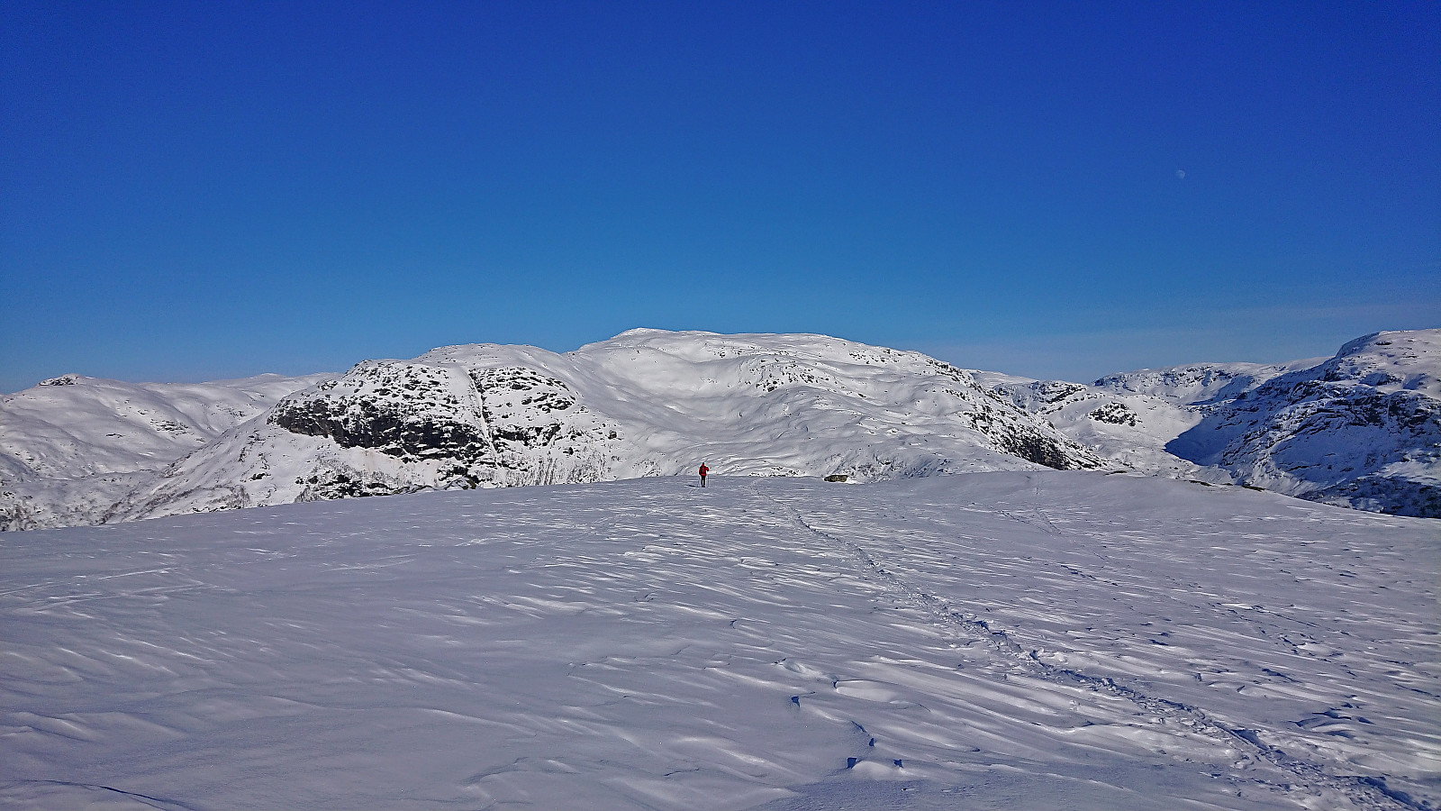
 I had initially only planed to go skiing on the Saturday , but when Fjellsamleren (Endre Myrdal Olsen) texted me and asked if I wanted to go skiing on Sunday as well, it only required a quick look at the excellent weather forecast to change my mind. We decided on having a go at the toll road up to Geilane as this should give us easy access to both Blåvasshorgi and Kringdalsnipa , with an added bonus of Hatlekinni for Endre ( which I had already visited once before ).
After paying the 50 kr toll via Vipps at Horvei/Horveid, we followed the steep gravel road to the upper parking lot at Rørgostølen. As expected this parking lot was mainly a private parking lot but there were a couple of guest spots as well.
We quickly put on the climbing skins and could then start skiing directly from the car. The snow was quite hard and icy at the start but as we got higher up this greatly improved and from there on we had near perfect snow conditions for the rest of the >>>
I had initially only planed to go skiing on the Saturday , but when Fjellsamleren (Endre Myrdal Olsen) texted me and asked if I wanted to go skiing on Sunday as well, it only required a quick look at the excellent weather forecast to change my mind. We decided on having a go at the toll road up to Geilane as this should give us easy access to both Blåvasshorgi and Kringdalsnipa , with an added bonus of Hatlekinni for Endre ( which I had already visited once before ).
After paying the 50 kr toll via Vipps at Horvei/Horveid, we followed the steep gravel road to the upper parking lot at Rørgostølen. As expected this parking lot was mainly a private parking lot but there were a couple of guest spots as well.
We quickly put on the climbing skins and could then start skiing directly from the car. The snow was quite hard and icy at the start but as we got higher up this greatly improved and from there on we had near perfect snow conditions for the rest of the >>>
Valafjellet and Åsknappen
- Dato:
- 25.03.2023
- Turtype:
- Fjellskitur
- Turlengde:
- 4:42t
- Distanse:
- 16,8km
 For my first trip with petter (Petter Bjørstad) in over half a year, we settled on two summits north of Oppheimsvatnet: Valafjellet and Åsknappen . We had hoped to gain some elevation by driving up the toll road in Oppheimsdalen , but when all of the parking lots early on were marked as private (also confirmed by a local driving a tractor), we abandoned this plan and returned to the start of the toll road where there was room for a couple of cars outside of the private parking areas.
Here we put on the climbing skins and started skiing directly from the car. We quickly realized that we would not have been able to drive much further anyway, as the road was soon covered by more snow than we would have been able to drive through.
When the road forked right for the third time, we left the road up Oppheimsdalen and turned east, following another road until getting to >>>
For my first trip with petter (Petter Bjørstad) in over half a year, we settled on two summits north of Oppheimsvatnet: Valafjellet and Åsknappen . We had hoped to gain some elevation by driving up the toll road in Oppheimsdalen , but when all of the parking lots early on were marked as private (also confirmed by a local driving a tractor), we abandoned this plan and returned to the start of the toll road where there was room for a couple of cars outside of the private parking areas.
Here we put on the climbing skins and started skiing directly from the car. We quickly realized that we would not have been able to drive much further anyway, as the road was soon covered by more snow than we would have been able to drive through.
When the road forked right for the third time, we left the road up Oppheimsdalen and turned east, following another road until getting to >>>
Blåsåta and Kjerringfjellet
- Dato:
- 12.03.2023
- Turtype:
- Fjellskitur
- Turlengde:
- 6:17t
- Distanse:
- 17,0km
 For the second Sunday in a row I was back at Voss on a skiing trip organized by Voss Utferdslag (part of the Norwegian Trekking Association ). In other words, yet another early morning with the train from Bergen at 07:07. At Voss I met up with the others around 09:00 and we car-pooled to Bergesvatnet. Here we parked at Moseheia p-plass before starting our ascent up Bergsskaret just after 10:00.
The visibility would sadly be quite limited throughout most of the trip with a sun that was visible behind the clouds but refused to properly show itself, but overall the visibility was more than good enough to see where we were heading. To more than make up for this though, the ground was covered with at least 20 centimeters of fresh snow.
After later turning east across Flatafjellet, the terrain levelled off and we soon stopped for a quick lunch break before completing the >>>
For the second Sunday in a row I was back at Voss on a skiing trip organized by Voss Utferdslag (part of the Norwegian Trekking Association ). In other words, yet another early morning with the train from Bergen at 07:07. At Voss I met up with the others around 09:00 and we car-pooled to Bergesvatnet. Here we parked at Moseheia p-plass before starting our ascent up Bergsskaret just after 10:00.
The visibility would sadly be quite limited throughout most of the trip with a sun that was visible behind the clouds but refused to properly show itself, but overall the visibility was more than good enough to see where we were heading. To more than make up for this though, the ground was covered with at least 20 centimeters of fresh snow.
After later turning east across Flatafjellet, the terrain levelled off and we soon stopped for a quick lunch break before completing the >>>
Ingebjørgfjellet from Tveitavegen
- Dato:
- 05.03.2023
- Turtype:
- Fjellskitur
- Turlengde:
- 5:46t
- Distanse:
- 15,7km
 Sunday skiing trip to Ingebjørgfjellet organized by the Norwegian Trekking Association , or more specifically Voss Utferdslag . The initial plan had also included Oksen , but given difficult conditions in the valley between the two summits, and the overall length of such a combined trip, the plan had in advance been reduced to just Ingebjørgfjellet.
After getting up at 05:30 in the morning, I was on the train from Bergen to Voss at 07:07. At Voss I met up with the others around 09:00 and we all car-pooled to the start of the trip at the crossroads of Tveitavegen and Stokkselvegen above Granvin. In the summer it is possible to pay a toll and drive up to Stokksel, but today this was not really an option as this road was, at least at the start, very icy.
We therefore put on the climbing skins by the cars and proceeded to carry the skis over the first icy stretch before >>>
Sunday skiing trip to Ingebjørgfjellet organized by the Norwegian Trekking Association , or more specifically Voss Utferdslag . The initial plan had also included Oksen , but given difficult conditions in the valley between the two summits, and the overall length of such a combined trip, the plan had in advance been reduced to just Ingebjørgfjellet.
After getting up at 05:30 in the morning, I was on the train from Bergen to Voss at 07:07. At Voss I met up with the others around 09:00 and we all car-pooled to the start of the trip at the crossroads of Tveitavegen and Stokkselvegen above Granvin. In the summer it is possible to pay a toll and drive up to Stokksel, but today this was not really an option as this road was, at least at the start, very icy.
We therefore put on the climbing skins by the cars and proceeded to carry the skis over the first icy stretch before >>>
Olav Nygards bu and Nåmdalsfjellet
- Dato:
- 02.03.2023
- Turtype:
- Fjellskitur
- Turlengde:
- 3:15t
- Distanse:
- 8,6km
 Given the near perfect weather, I took one day of "vinterferie" to go skiing. I convinced my dad to join and together we drove to Modalen and Øvre Helland. Here we left the paved road and continued along a good-quality gravel road up to Steinavatnet p-plass . After a very short climb of only a couple of meters, and less than 150 meters of skiing, we arrived at the ice-covered Steinavatnet, which provided very easy access to Olav Nygards bu .
We then turned west and headed for the ridge to Nåmdalsfjellet . Lots of traces of earlier skiers, however there did not seem to be a fixed summit route. The direction was in any case obvious and there were no steep areas to avoid. It therefore did not take long before we arrived at the summit where we could enjoy the views to the surrounding mountains.
After spending the whole trip in the warm >>>
Given the near perfect weather, I took one day of "vinterferie" to go skiing. I convinced my dad to join and together we drove to Modalen and Øvre Helland. Here we left the paved road and continued along a good-quality gravel road up to Steinavatnet p-plass . After a very short climb of only a couple of meters, and less than 150 meters of skiing, we arrived at the ice-covered Steinavatnet, which provided very easy access to Olav Nygards bu .
We then turned west and headed for the ridge to Nåmdalsfjellet . Lots of traces of earlier skiers, however there did not seem to be a fixed summit route. The direction was in any case obvious and there were no steep areas to avoid. It therefore did not take long before we arrived at the summit where we could enjoy the views to the surrounding mountains.
After spending the whole trip in the warm >>>
Five summits west of Vinningsleitet
- Dato:
- 25.02.2023
- Turtype:
- Fjellskitur
- Turlengde:
- 9:28t
- Distanse:
- 24,3km
 When Endre suggested a skiing trip to the five summits east of Vinningsleitet, I of course quickly said yes. (Bonus tip: see this external trip report for a similar skiing trip.) He picked me up early Saturday morning for the drive to Vinningsleitet. We arrived at the small parking lot around 10:00 and were ready to start skiing shortly after. First up was Nonhaugen , which was easily accessed by ascending directly from the parking lot, except for a short descent into the valley between Nonhaugen and Ørnahaugen , and it did not take long before we were standing at the summit.
Throughout the trip there would be a strong and cold wind from north/northeast. It was however mainly coming at us from the side and overall did not present much of an issue. The snow conditions were on the other hand more heavily affected, thus the conditions varied greatly, from packed >>>
When Endre suggested a skiing trip to the five summits east of Vinningsleitet, I of course quickly said yes. (Bonus tip: see this external trip report for a similar skiing trip.) He picked me up early Saturday morning for the drive to Vinningsleitet. We arrived at the small parking lot around 10:00 and were ready to start skiing shortly after. First up was Nonhaugen , which was easily accessed by ascending directly from the parking lot, except for a short descent into the valley between Nonhaugen and Ørnahaugen , and it did not take long before we were standing at the summit.
Throughout the trip there would be a strong and cold wind from north/northeast. It was however mainly coming at us from the side and overall did not present much of an issue. The snow conditions were on the other hand more heavily affected, thus the conditions varied greatly, from packed >>>
Five summits west and one east of Norddalen
- Dato:
- 24.04.2022
- Turtype:
- Fjellskitur
- Turlengde:
- 8:12t
- Distanse:
- 28,8km
 After spending Saturday at Varaldsøy with petter (Petter Bjørstad) , we agreed to also take full advantage of the perfect weather forecast for the following Sunday. Petter therefore picked me up at 07:00 for a drive to Norddalen where the plan was to make use of the excellent skiing conditions to visit as many peaks as possible, mainly on the west side of the valley. Upon arriving, the sun was shining from a cloudless blue sky and there was next to no wind. Plenty of snow still in the area and after finding parking next to the road, the skis could be put on as soon as we left the road.
We first followed the valley on the west side of the river, before finding a safe and straightforward ascent to the summit of Eggane . From there we struggled a bit to find the best route down to Martastølen, as there were a couple of steep >>>
After spending Saturday at Varaldsøy with petter (Petter Bjørstad) , we agreed to also take full advantage of the perfect weather forecast for the following Sunday. Petter therefore picked me up at 07:00 for a drive to Norddalen where the plan was to make use of the excellent skiing conditions to visit as many peaks as possible, mainly on the west side of the valley. Upon arriving, the sun was shining from a cloudless blue sky and there was next to no wind. Plenty of snow still in the area and after finding parking next to the road, the skis could be put on as soon as we left the road.
We first followed the valley on the west side of the river, before finding a safe and straightforward ascent to the summit of Eggane . From there we struggled a bit to find the best route down to Martastølen, as there were a couple of steep >>>
