Archive - Date
Archive - Activity
-
Bike trip (116)
- Bike trip - mixed (28)
- Bike trip - road (88)
-
Drive (9)
- Car drive (9)
-
Other trip (3)
- Kayaking (3)
-
Ski trip (116)
- Backcountry skiing (69)
- Cross-country skiing (47)
- Trip by foot (1911)
Collected lists
-
Utvalgte topper og turmål i Bergen
(351/352)
 99%
99% -
Alle topper i Bergen
(395/400)
98%
-
Voss ≥ 100m pf.
(96/98)
97%
-
Opptur Hordaland
(144/159)
90%
-
Stasjoner på Bergensbanen
(33/40)
82%
-
Ulvik ≥ 100m pf.
(30/38)
78%
-
Hordaland ≥ 100m pf.
(625/863)
72%
-
Mjølfjell PF > 100m
(21/31)
67%
-
Jondal ≥ 100m pf.
(15/23)
65%
-
Dagsturhyttene i Vestland
(38/62)
61%
-
Sunnhordland PF >= 100m
(106/186)
56%
-
Hordaland: Hardanger PF>=100m
(196/359)
54%
-
DNT-hytter i Hordaland
(25/46)
54%
-
Kvinnherad ≥ 100m pf.
(41/79)
51%
-
Eidfjord ≥ 100m pf.
(13/42)
30%
-
Sogndal ≥ 100m pf.
(23/81)
28%
-
Gulen ≥ 100m pf.
(15/54)
27%
-
Vik i Sogn ≥ 100m pf.
(10/46)
21%
-
Sogn - Sør for Sognefjorden PF>=100m
(31/159)
19%
-
DNT-hytter i Sogn og Fjordane
(8/47)
17%

Fløyfjellet and Fjellveien
- Date:
- 10.11.2024
- Characteristic:
- Hillwalk
- Duration:
- 1:45h
- Distance:
- 6.6km
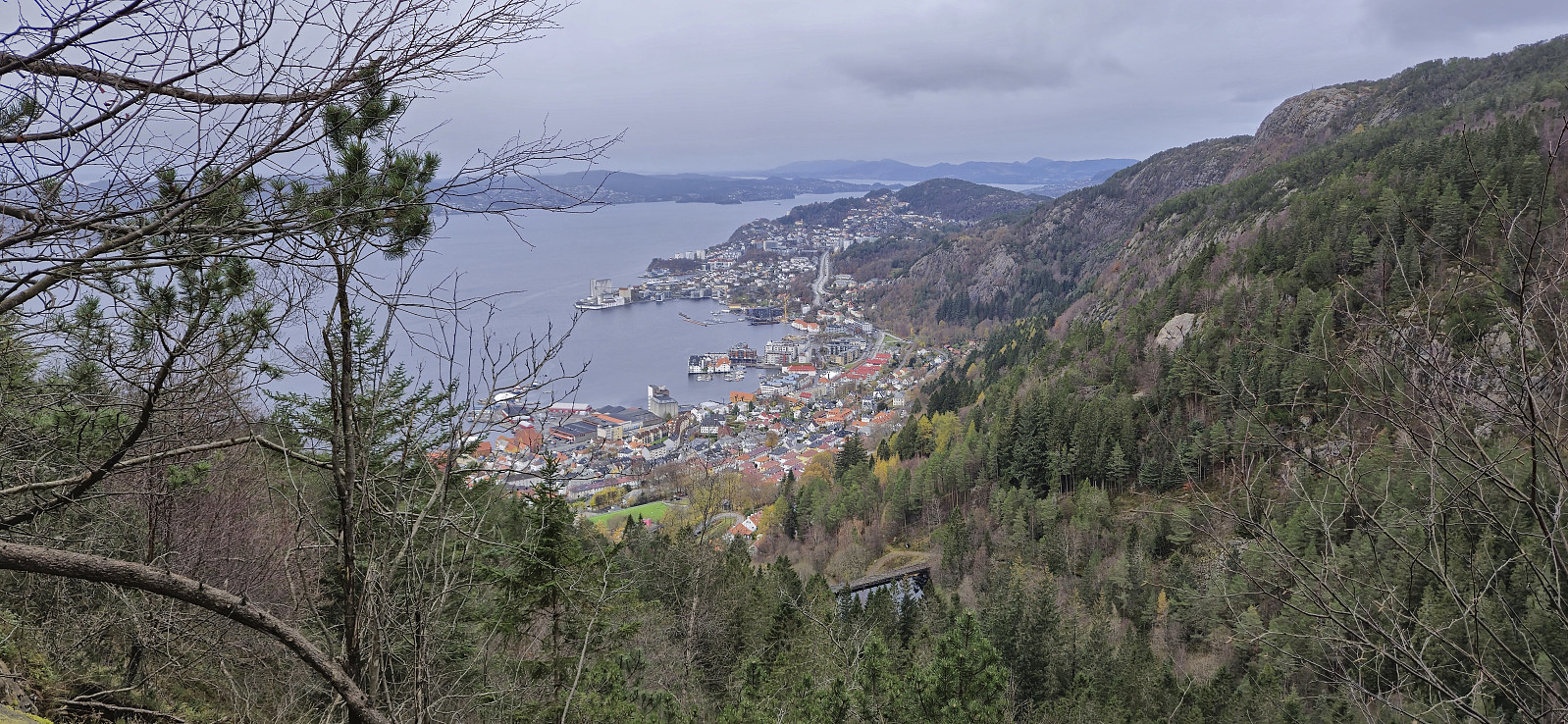
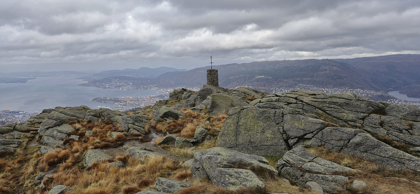
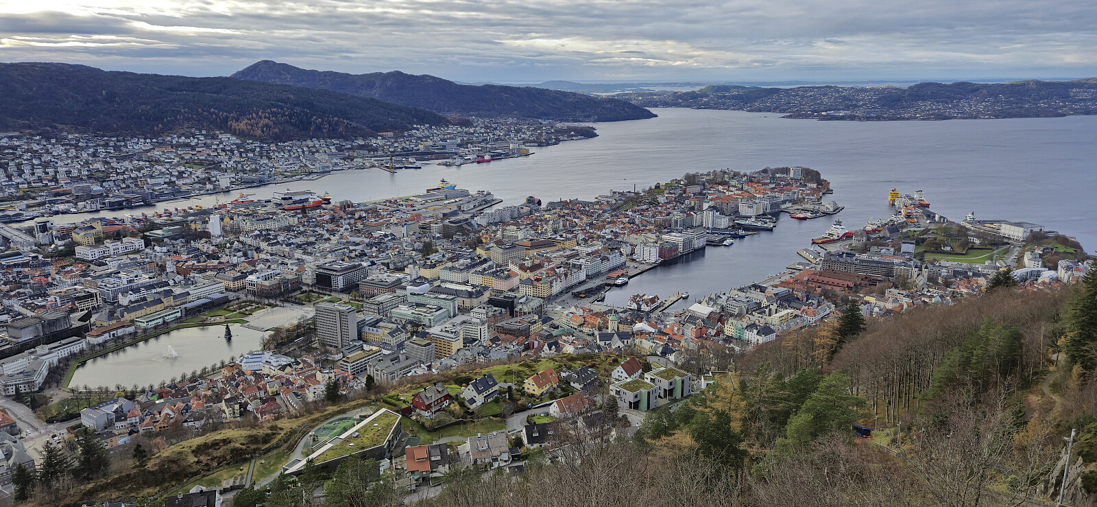 A return to Fløyfjellet to try out a (for me) new trail I had come across in connection with last weekend's shortcut up from Skredderdalen . After ascending from Vågen via Fløyen to Fløyfjellet, I therefore followed the above-mentioned trail down the valley north/northeast of Fløyfjellet where I at the end connected with the gravel road in Skredderdalen. Overall a positive discovery and a trail that I will probably use again in the future. The hike was concluded by following Fjellveien north to Munkebotn, from where I took the bus home to Lønborg.
Jordalsnuten from Jordalstunnelen
- Date:
- 09.11.2024
- Characteristic:
- Hillwalk
- Duration:
- 2:31h
- Distance:
- 4.6km
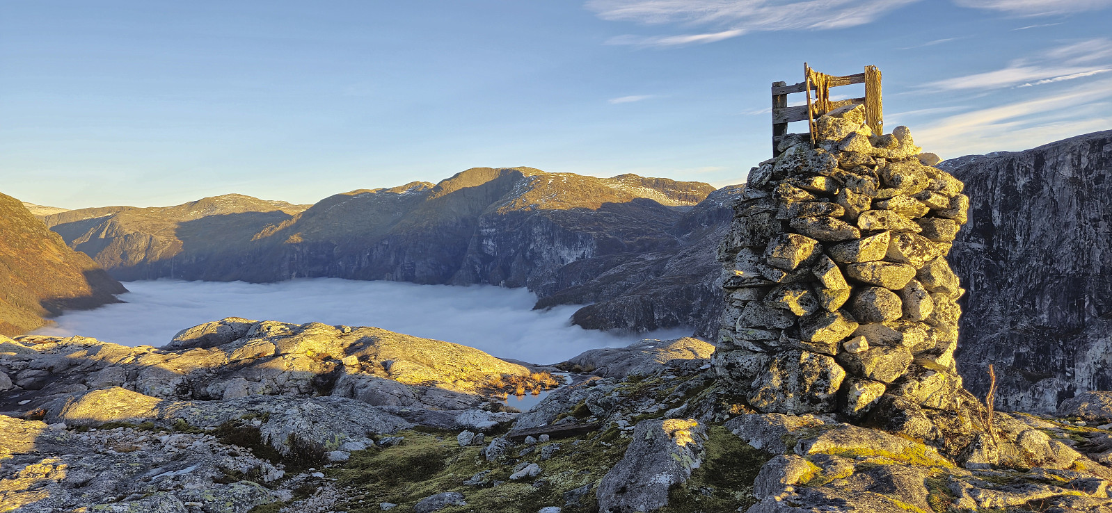 After the hike to Kjøroldenuten and Nosafjellet , Petter and I drove the short distance south to the top of Jordalstunnelen. Here we found parking next to the road and followed a similar shortcut as other hikers have done in order to quickly connect with the trail to Jordalsnuten . This included a short off-trail ascent starting from just west of the tunnel opening but it did not take long before we located the trail which could then easily be followed all the way to Hyllandsskaret .
While we had started out in quite dense fog, we climbed out of the fog long before getting to Hyllandsskaret and could thus enjoy the spectacular views. The views were of course made even more special by the dense fog covering the valleys below us. From there, the final distance to the summit was straightforward for more outstanding views. After lots of pictures we returned the same way >>>
After the hike to Kjøroldenuten and Nosafjellet , Petter and I drove the short distance south to the top of Jordalstunnelen. Here we found parking next to the road and followed a similar shortcut as other hikers have done in order to quickly connect with the trail to Jordalsnuten . This included a short off-trail ascent starting from just west of the tunnel opening but it did not take long before we located the trail which could then easily be followed all the way to Hyllandsskaret .
While we had started out in quite dense fog, we climbed out of the fog long before getting to Hyllandsskaret and could thus enjoy the spectacular views. The views were of course made even more special by the dense fog covering the valleys below us. From there, the final distance to the summit was straightforward for more outstanding views. After lots of pictures we returned the same way >>>
Kjøroldenuten and Nosafjellet from Fresvikjordalen
- Date:
- 09.11.2024
- Characteristic:
- Hillwalk
- Duration:
- 3:55h
- Distance:
- 9.5km
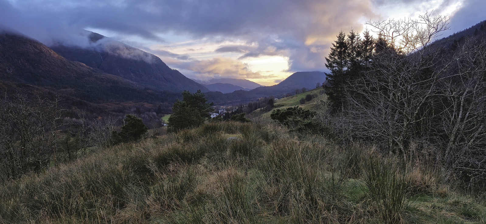
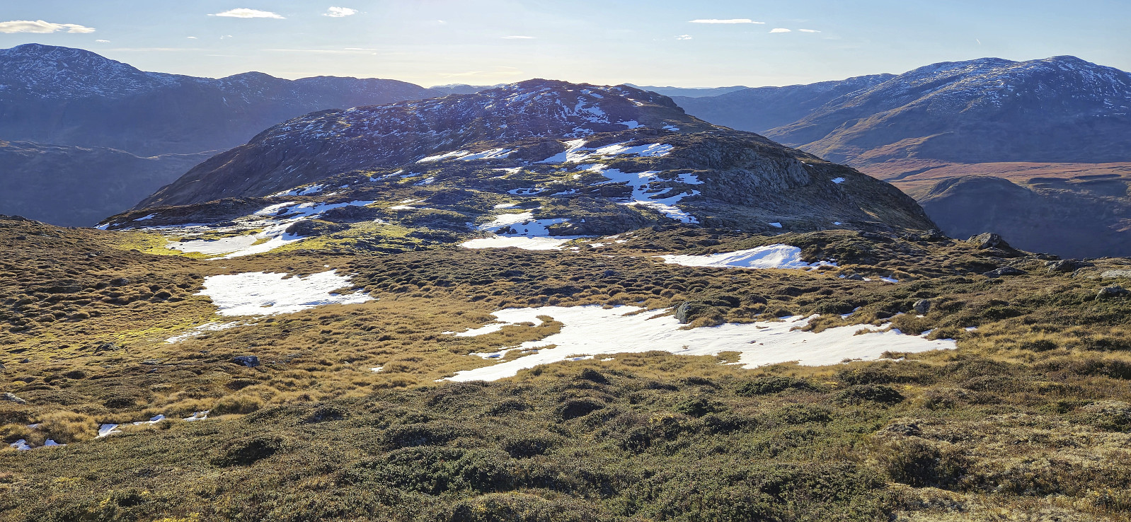 For the first hike with Petter in half a year, we drove to Jordalen in Voss/Vik to visit three summits that none us had yet ascended. First up was Kjøroldenuten . In order to get as close to the summit as possible, we paid the 50 kr road toll and continued up to Nedstedalen in Fresvikjordalen. Here we found parking next to the road and had easy access to the other side of the river via a bridge I had located on the map .
After crossing the bridge we simply made our own way to the valley south of Kjøroldenuten and from there completed the short remaining ascent to the summit. This last part was steeper but did not present any real challenges. We however did not stay long before turning the attention to our next goal: Nosafjellet .
Following the ridge south from Kjøroldenuten towards Nosafjellet included some up and down but was overall straightforward. The only challenge >>>
For the first hike with Petter in half a year, we drove to Jordalen in Voss/Vik to visit three summits that none us had yet ascended. First up was Kjøroldenuten . In order to get as close to the summit as possible, we paid the 50 kr road toll and continued up to Nedstedalen in Fresvikjordalen. Here we found parking next to the road and had easy access to the other side of the river via a bridge I had located on the map .
After crossing the bridge we simply made our own way to the valley south of Kjøroldenuten and from there completed the short remaining ascent to the summit. This last part was steeper but did not present any real challenges. We however did not stay long before turning the attention to our next goal: Nosafjellet .
Following the ridge south from Kjøroldenuten towards Nosafjellet included some up and down but was overall straightforward. The only challenge >>>
Blåmanen in dense fog after dark
- Date:
- 05.11.2024
- Characteristic:
- Hillwalk
- Duration:
- 4:02h
- Distance:
- 11.7km
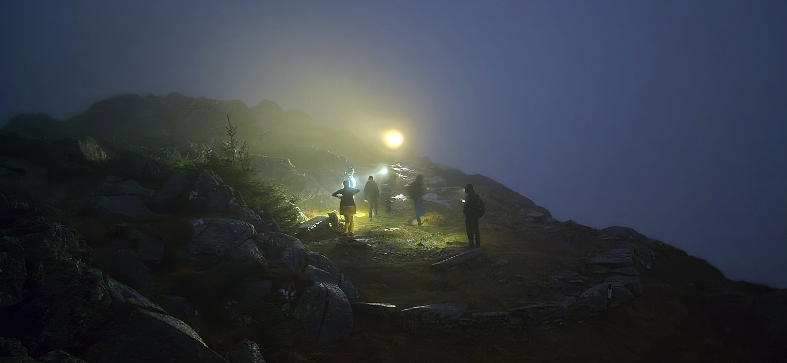 A hike after work with three colleagues where the plan was to visit both Blåmanen and Rundemanen , but given the dense and wet fog we decided to leave Rundemanen for a future trip and instead turned back at Blåmanen Vest .
Fløyfjellet from Skredderdalen
- Date:
- 02.11.2024
- Characteristic:
- Hillwalk
- Duration:
- 3:15h
- Distance:
- 12.9km
 On a gray Saturday I opted for a local hike including an ascent from Skredderdalen to Fløyfjellet - a route I had not used in a while. From Fløyfjellet I continued via Bjørnebu to Brushytten before trying a relatively new shortcut north of Brushytten called Rognebærstien, followed by a walk along the ridge between Nedre and Midtre Stemmedalen. The hike was then concluded by walking home to Lønborg.
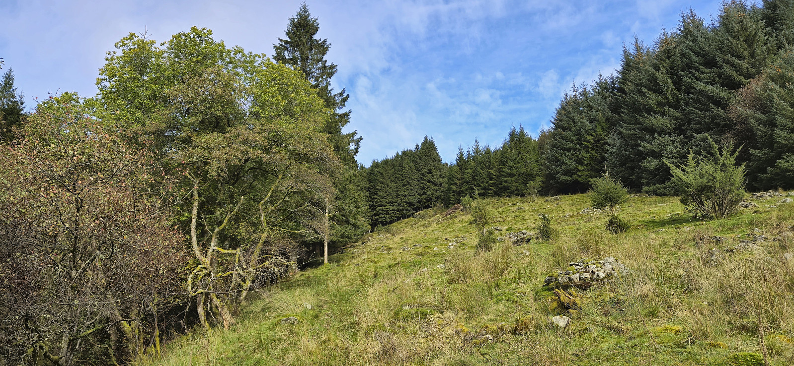
Kongshaugen i Samdalen
- Date:
- 28.10.2024
- Characteristic:
- Hillwalk
- Duration:
- 0:45h
- Distance:
- 3.4km
 A long detour on the way home from work for a quick visit of Kongshaugen i Samdalen - yet another minor peak on the Alle topper i Bergen list. I got off the bus at Samdal and from there briefly followed the road north in the direction of Bontveit before finding an opening in the barbed wire fence and could then easily complete the short remaining off-trail distance to the summit. The area seemed to be used for grazing animals, most likely horses(?), but thankfully I did not see any this evening. After a couple of pictures, I descended the same way and, given that I still had 35 minutes until the return bus, continued northeast to Hausdal for a closer look at a rather unstable bridge I had seen in an earlier trip report from Helwig . The bridge had not been repaired and to me it seemed safer to instead wade across the river just downstream of the bridge.
Rislikampen
- Date:
- 27.10.2024
- Characteristic:
- Hillwalk
- Duration:
- 1:26h
- Distance:
- 3.4km
 Inspired by a recent trip report by Bull , I decided to check out Rislikampen as a potential new addition to the Alle topper i Bergen list. After taking the bus (or rather bus, train and bus) I got off at Søylen from where I started on the trail to Furedalsvatnet. I quickly left this trail though and instead continued on a weak and wet trail towards Rislikampen. The trailhead itself was unmarked and if it had not been for Bull's report I do not think I even would have considered it as the start of a proper trail.
Thankfully, the trail soon turned less weak, and especially the part where it headed northeast to the Rislikampen ridge was very easy to follow. Here the trail however pretty much disappeared and I was left finding my own way for the rest of the ascent. But as the direction was pretty obvious now anyway the summit was still reached without >>>
Inspired by a recent trip report by Bull , I decided to check out Rislikampen as a potential new addition to the Alle topper i Bergen list. After taking the bus (or rather bus, train and bus) I got off at Søylen from where I started on the trail to Furedalsvatnet. I quickly left this trail though and instead continued on a weak and wet trail towards Rislikampen. The trailhead itself was unmarked and if it had not been for Bull's report I do not think I even would have considered it as the start of a proper trail.
Thankfully, the trail soon turned less weak, and especially the part where it headed northeast to the Rislikampen ridge was very easy to follow. Here the trail however pretty much disappeared and I was left finding my own way for the rest of the ascent. But as the direction was pretty obvious now anyway the summit was still reached without >>>
Sandviksfjellet via half of Stoltzekleiven
- Date:
- 26.10.2024
- Characteristic:
- Hillwalk
- Duration:
- 2:01h
- Distance:
- 8.1km
 An alternative ascent to Sandviksfjellet where I started on the route up Stoltzekleiven but left the trail around the halfway point. Here I instead followed a weaker and wetter trail southeast underneath the overhead powerlines before later turning north towards the summit when connecting with the trail coming up from Skredderdalen.
Løvstakken from Søndre Skogveien
- Date:
- 24.10.2024
- Characteristic:
- Hillwalk
- Duration:
- 3:00h
- Distance:
- 7.4km
 Left work early for a windy hike across Løvstakken with a colleague.
The GPS had some issues along the way, hence some of the measurements are clearly wrong.
Left work early for a windy hike across Løvstakken with a colleague.
The GPS had some issues along the way, hence some of the measurements are clearly wrong.
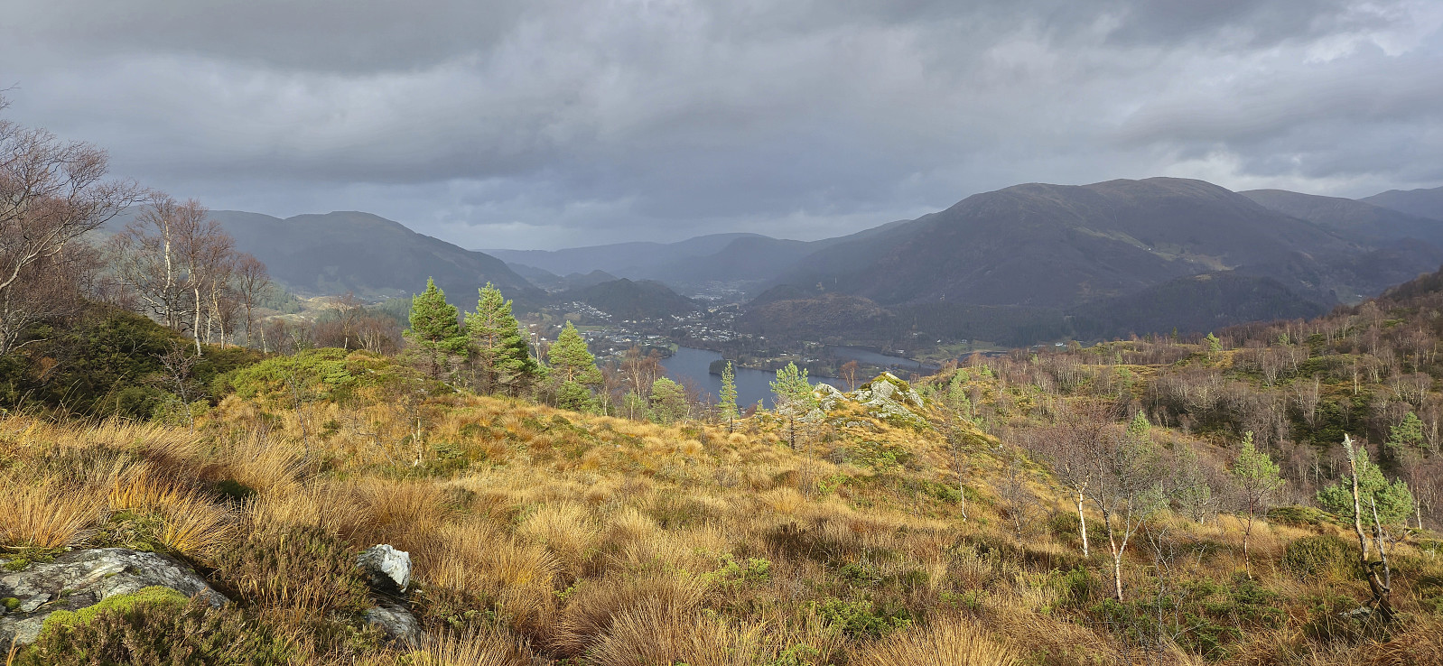
Lone to Flaktveit via Kvitnosa
- Date:
- 29.09.2024
- Characteristic:
- Hillwalk
- Duration:
- 5:21h
- Distance:
- 14.6km
 Sunday hike with my dad with the main objective of visiting the trig marker at Kvitnosa . We started by taking the bus to Lone (or rather bus, train and bus) and then followed the road to Borgo. Most hikers here probably take the marked route up to Borgaskaret, but we instead started searching for the trail to Gjøken . Our first attempt ended up on the wrong side of an electric fence, before we, after a bit of backtracking, passed through a gate and could finally begin the ascent.
The trail indicated on the map was however not really there and instead it seemed like we were in a field used for grazing cattle. So far we did not see any cattle though and assumed that they had been brought indoors for the winter. After later passing through a second gate, this one open, the weak trail soon pretty much disappeared and we were left >>>
Sunday hike with my dad with the main objective of visiting the trig marker at Kvitnosa . We started by taking the bus to Lone (or rather bus, train and bus) and then followed the road to Borgo. Most hikers here probably take the marked route up to Borgaskaret, but we instead started searching for the trail to Gjøken . Our first attempt ended up on the wrong side of an electric fence, before we, after a bit of backtracking, passed through a gate and could finally begin the ascent.
The trail indicated on the map was however not really there and instead it seemed like we were in a field used for grazing cattle. So far we did not see any cattle though and assumed that they had been brought indoors for the winter. After later passing through a second gate, this one open, the weak trail soon pretty much disappeared and we were left >>>
