Arkiv - dato
Arkiv - aktivitet
-
Annen tur (3)
- Kajakkpadling (3)
- Fottur (1769)
-
Kjøretur (9)
- Biltur (9)
-
Skitur (109)
- Fjellskitur (65)
- Langrennstur (44)
-
Sykkeltur (108)
- Blandet sykling (25)
- Gatesykling (83)
Lister jeg samler etter
-
Voss ≥ 100m pf.
(96/98)
 97%
97% -
Opptur Hordaland
(143/159)
89%
-
Stasjoner på Bergensbanen
(31/40)
77%
-
Ulvik ≥ 100m pf.
(28/38)
73%
-
Hordaland ≥ 100m pf.
(610/863)
70%
-
Mjølfjell PF > 100m
(21/31)
67%
-
Jondal ≥ 100m pf.
(15/23)
65%
-
Sunnhordland PF >= 100m
(104/186)
55%
-
Dagsturhyttene i Vestland
(33/61)
54%
-
Hordaland: Hardanger PF>=100m
(183/359)
50%
-
Kvinnherad ≥ 100m pf.
(40/79)
50%
-
DNT-hytter i Hordaland
(22/45)
48%
-
Sogndal ≥ 100m pf.
(23/81)
28%
-
Vik i Sogn ≥ 100m pf.
(8/46)
17%
-
DNT-hytter i Sogn og Fjordane
(8/47)
17%
-
Eidfjord ≥ 100m pf.
(6/42)
14%
-
Etne ≥ 100m pf.
(7/51)
13%
-
Ullensvang ≥ 100m pf.
(19/153)
12%
-
Sogn - Sør for Sognefjorden PF>=100m
(17/159)
10%
-
Opptur-topper i Sogn og Fjordane
(17/177)
9%

Solvornnipa from Barsnesfjorden
- Dato:
- 20.05.2018
- Turtype:
- Fjelltur
- Turlengde:
- 4:35t
- Distanse:
- 12,0km
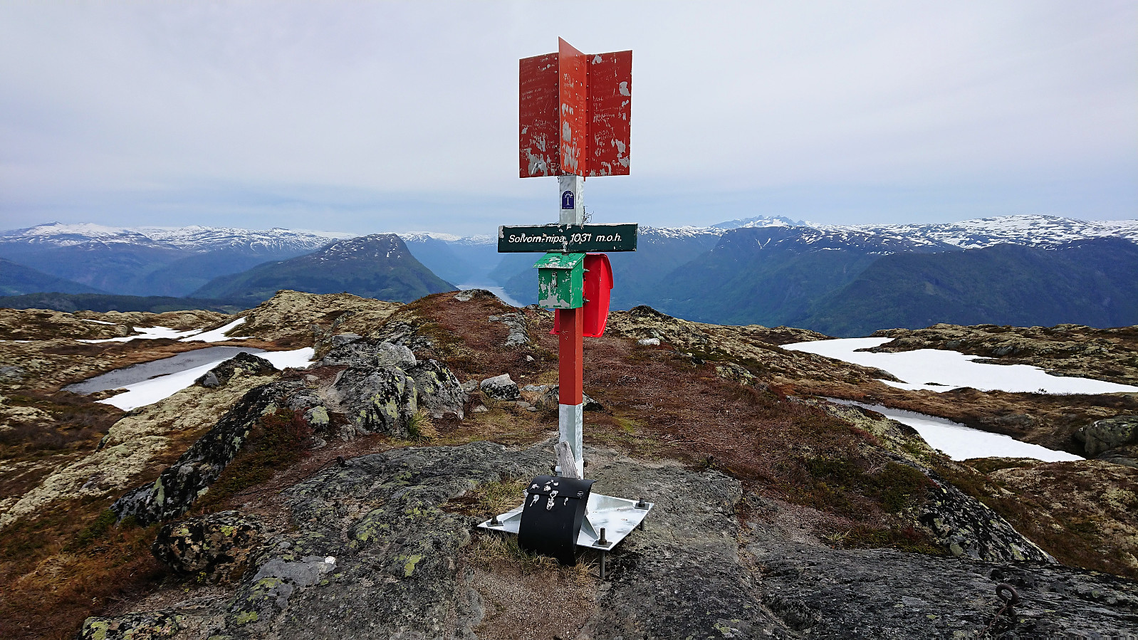 Started from the private parking lot at the end of the gravel road on the south side of Barsnesfjorden. Followed the marked trail via Dal and Helgasete all the way to Solvornnipa . The trail was overall easy to follow and most of the snow was gone, except for 3-4 short stretches close to the summit. A slight haze made for slightly reduced views. After a quick lunch at the summit, I returned via the same route.
Note that the road to where the trail starts is private, i.e. no cars allowed. There are however a couple of parking spaces down by the small wharf along Barsnesfjorden just before the road turns west and starts climbing slightly towards the crossroads at Barsnes.
Started from the private parking lot at the end of the gravel road on the south side of Barsnesfjorden. Followed the marked trail via Dal and Helgasete all the way to Solvornnipa . The trail was overall easy to follow and most of the snow was gone, except for 3-4 short stretches close to the summit. A slight haze made for slightly reduced views. After a quick lunch at the summit, I returned via the same route.
Note that the road to where the trail starts is private, i.e. no cars allowed. There are however a couple of parking spaces down by the small wharf along Barsnesfjorden just before the road turns west and starts climbing slightly towards the crossroads at Barsnes.
Flot
- Dato:
- 19.05.2018
- Turtype:
- Fjelltur
- Turlengde:
- 1:10t
- Distanse:
- 3,7km
 Short hike to Flot following the marked trail on the ascent and the tractor road down to Barsnesfjorden on the descent.
Note that there is no parking where the trail starts. There are however a couple of parking spaces down by the small wharf along Barsnesfjorden just before the road turns west and starts climbing slightly towards the crossroads at Barsnes.
Short hike to Flot following the marked trail on the ascent and the tractor road down to Barsnesfjorden on the descent.
Note that there is no parking where the trail starts. There are however a couple of parking spaces down by the small wharf along Barsnesfjorden just before the road turns west and starts climbing slightly towards the crossroads at Barsnes.
Havstadfjellet
- Dato:
- 18.05.2018
- Turtype:
- Fottur
- Turlengde:
- 2:07t
- Distanse:
- 8,6km
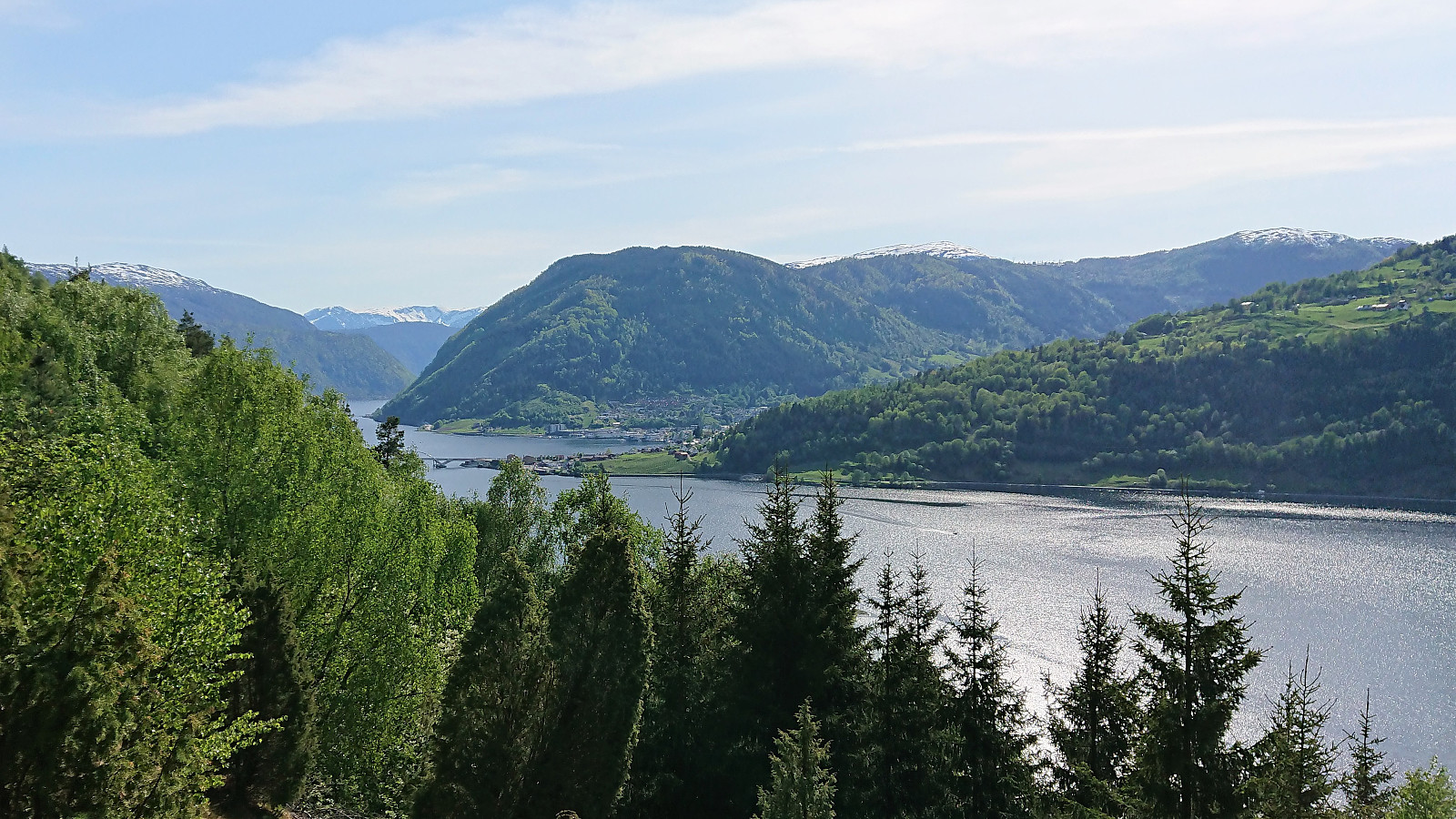
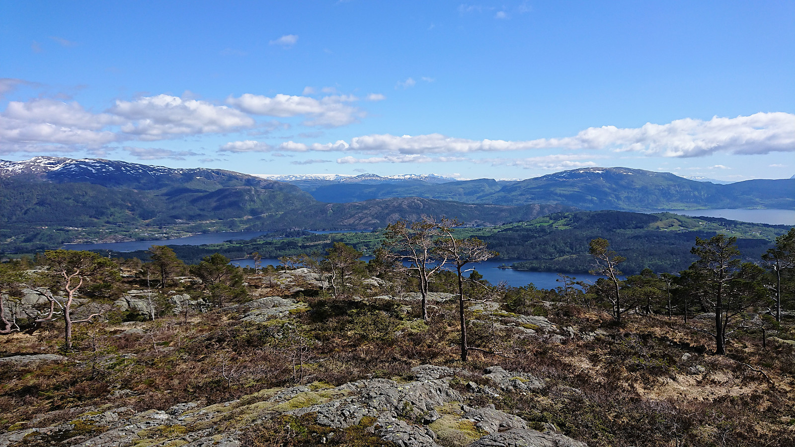
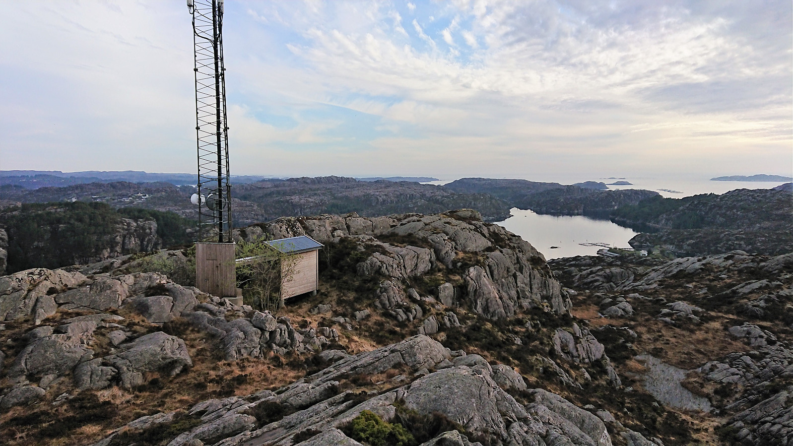
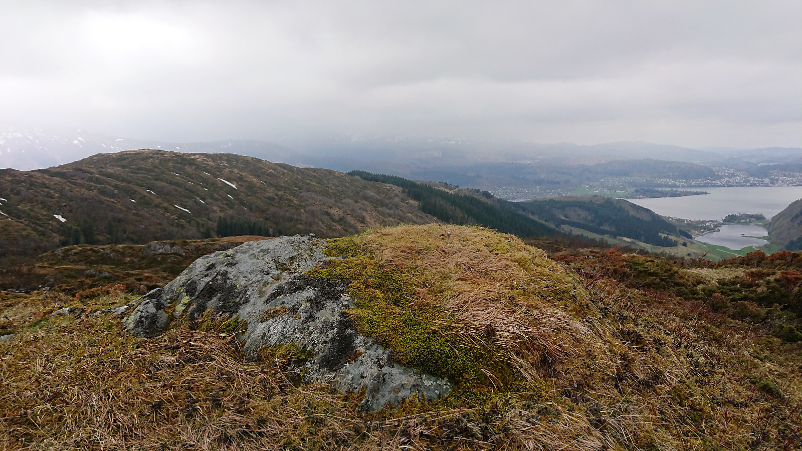
 I was dropped off at Havstad and from there found the shortest route to the start of the gravel road to Havstadfjellet. The gravel road quickly became very steep, much steeper than expected, and, besides two or three short stretches, it pretty much stayed that way all the way to the top. By far the steepest gravel road I've hiked. As I progressed upwards the views continued to expand, ending in a spectacular 360-degree view from the summit, especially nice at this time of the year with snow at the top of the mountains.
After numerous pictures, I started my descent to Bruland, now on a more regular gravel road, but still with excellent views along the way. Towards the end I came across, and almost stepped on, a viper positioned in the middle of the road. The second viper I've almost stepped on >>>
I was dropped off at Havstad and from there found the shortest route to the start of the gravel road to Havstadfjellet. The gravel road quickly became very steep, much steeper than expected, and, besides two or three short stretches, it pretty much stayed that way all the way to the top. By far the steepest gravel road I've hiked. As I progressed upwards the views continued to expand, ending in a spectacular 360-degree view from the summit, especially nice at this time of the year with snow at the top of the mountains.
After numerous pictures, I started my descent to Bruland, now on a more regular gravel road, but still with excellent views along the way. Towards the end I came across, and almost stepped on, a viper positioned in the middle of the road. The second viper I've almost stepped on >>>
Stedjeåsen
- Dato:
- 17.05.2018
- Turtype:
- Fjelltur
- Turlengde:
- 2:32t
- Distanse:
- 7,7km
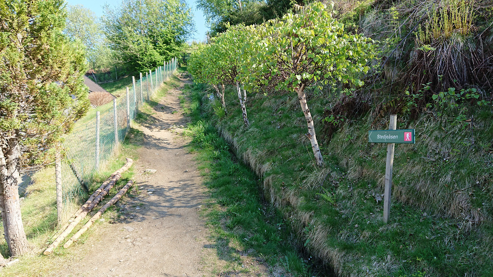 Short hike from the center of Sogndal to Stedjeåsen and back, along the nice marked trail. This time also visiting the highest point, which provided very limited views and can probably be skipped by most hikers. Note that there are no trails from the visitor register to the highest point.
Skausnøya, Fjellsbøheia, Selifjellet and Grimstadfjellet
- Dato:
- 13.05.2018
- Turtype:
- Fjelltur
- Turlengde:
- 5:23t
- Distanse:
- 15,2km
 Started by taking the bus to Våge and trying to locate the trailhead for Skausnøya . My path was however immediately blocked by a logging area and huge stacks of logs. As I did not want to enter the backyard of the only house at the end of the short road, and given that I did not know how large the logging area would be, I decided to look for an alternative path, after first looking around for other hikers or locals to ask for directions.
I ended up with a roughly 1 km detour via a tractor road coming down from the north, with half of that distance being along the main road, before finally connecting with the trail. Only to notice that I had been less than 100 meters from where the trail started on the opposite side of the stacked logs. And given that my detour actually took me through the logging area >>>
Started by taking the bus to Våge and trying to locate the trailhead for Skausnøya . My path was however immediately blocked by a logging area and huge stacks of logs. As I did not want to enter the backyard of the only house at the end of the short road, and given that I did not know how large the logging area would be, I decided to look for an alternative path, after first looking around for other hikers or locals to ask for directions.
I ended up with a roughly 1 km detour via a tractor road coming down from the north, with half of that distance being along the main road, before finally connecting with the trail. Only to notice that I had been less than 100 meters from where the trail started on the opposite side of the stacked logs. And given that my detour actually took me through the logging area >>>
Gråfjellet and Strandafjellet
- Dato:
- 11.05.2018
- Turtype:
- Fjelltur
- Turlengde:
- 4:26t
- Distanse:
- 11,8km
 Started by taking the bus to Lønningdal (note: no buses at weekends or evenings) and walked north along Øvredalsvegen before crossing the bridge east towards Gråfjellet . The road soon turned into a tractor road, which I followed until a fairly new sign indicated the trailhead for Gråfjellet. The trail was marked with white and/or yellow ribbons, although the ribbons were sometimes easier to see than the trail. And after not too long, I could see neither ribbons nor trail. Had to give up and simply head the way I thought the trail ought to go. And sure enough, within not too long the marked trail reappeared, and I found myself looking up at Nulten (not sure if the 'l' is a typo?, but that is what was on the map).
I quickly lost the trail again though, and instead made my own way to Nulten and the cairn >>>
Started by taking the bus to Lønningdal (note: no buses at weekends or evenings) and walked north along Øvredalsvegen before crossing the bridge east towards Gråfjellet . The road soon turned into a tractor road, which I followed until a fairly new sign indicated the trailhead for Gråfjellet. The trail was marked with white and/or yellow ribbons, although the ribbons were sometimes easier to see than the trail. And after not too long, I could see neither ribbons nor trail. Had to give up and simply head the way I thought the trail ought to go. And sure enough, within not too long the marked trail reappeared, and I found myself looking up at Nulten (not sure if the 'l' is a typo?, but that is what was on the map).
I quickly lost the trail again though, and instead made my own way to Nulten and the cairn >>>
Ulskebjørnen and Stallane
- Dato:
- 09.05.2018
- Turtype:
- Fjelltur
- Turlengde:
- 3:09t
- Distanse:
- 12,8km
 Started from Ervikveien and walked along the road to Vinddalen where the steep trail for Ulskebjørnen starts. Both the trailhead and the trail itself is marked, but one has to pay attention in order to not miss the initial exit. The trail is overall easy to follow, although the quality is variable with a couple of muddy areas. After a short break at the summit, I followed the trail down to Stallane , which started out quite steep before levelling off in the mid-section. Clearly this route is more heavily used and probably the recommended option if visiting Ulskebjørnen. At Stallane I continued southeast along a very nice trail/road and quickly arrived in Jordalen. The hike was then concluded by walking along the roads to Lønborg.
Storafjellet and Ørnhaugen
- Dato:
- 07.05.2018
- Turtype:
- Fjelltur
- Turlengde:
- 2:42t
- Distanse:
- 7,0km
 Started by taking the bus to Lokøyna (bus stop "Lokøyna kryss nord"), which happens to be exactly where the trail for the rather ironically named Storafjellet begins. I guess the name refers to it being the tallest peak at Lokøyna, if at only 68 meters above sea level.
The trailhead did have an information sign, but it was quite deteriorated and fallen to the ground. Not much need for the information though, as the start of the trail was clearly indicated with a small wooden bridge, of which there were several on the way to the summit.
We managed to leave the main trail a bit too early though, taking what looked like a weaker trail/shortcut heading north. This trail however quickly disappeared and we had to make our own way to the summit. But we soon reconnected with the main trail and another >>>
Started by taking the bus to Lokøyna (bus stop "Lokøyna kryss nord"), which happens to be exactly where the trail for the rather ironically named Storafjellet begins. I guess the name refers to it being the tallest peak at Lokøyna, if at only 68 meters above sea level.
The trailhead did have an information sign, but it was quite deteriorated and fallen to the ground. Not much need for the information though, as the start of the trail was clearly indicated with a small wooden bridge, of which there were several on the way to the summit.
We managed to leave the main trail a bit too early though, taking what looked like a weaker trail/shortcut heading north. This trail however quickly disappeared and we had to make our own way to the summit. But we soon reconnected with the main trail and another >>>
Furukammen and Hellen festning
- Dato:
- 06.05.2018
- Turtype:
- Fottur
- Turlengde:
- 1:04t
- Distanse:
- 4,7km
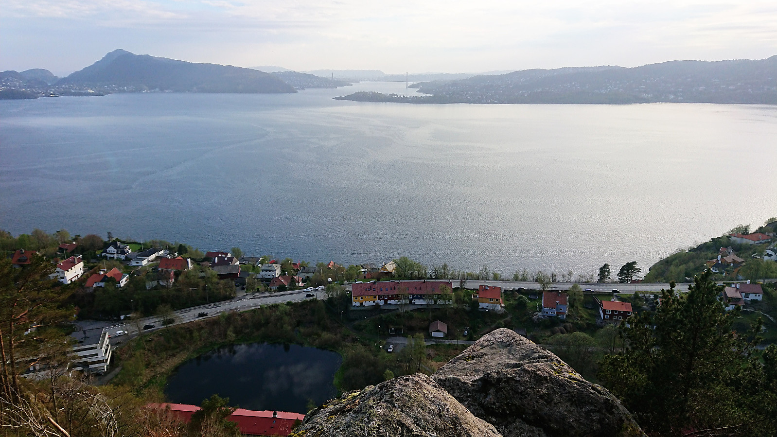 Short local hike across Furukammen and Hellen festning .
Hoklane, Hæddena and Orrkleivhaugen
- Dato:
- 05.05.2018
- Turtype:
- Fjelltur
- Turlengde:
- 4:30t
- Distanse:
- 11,9km
 Hoklane
Started by taking the bus to Blom (bus stop "Blom sør") and easily located the information sign indicating the start of the trail. However I still ended up missing my exit and made a short detour in the direction of Havrå before realizing my mistake. (Basically one has to take the first left up towards the small yellow house.)
The nice trail/road took me up to the small barn indicated on the map, but here the trail also more or less disappeared. But by continuing upwards in the direction the map said the trail ought to be, the trail soon became much clearer, and I arrived at a crossroads where it was possible to follow a tractor road in the direction of Såtefjellet . This was not my goal today, so I rather continued north along the trail.
But once again I missed my exit and had to backtrack >>>
Hoklane
Started by taking the bus to Blom (bus stop "Blom sør") and easily located the information sign indicating the start of the trail. However I still ended up missing my exit and made a short detour in the direction of Havrå before realizing my mistake. (Basically one has to take the first left up towards the small yellow house.)
The nice trail/road took me up to the small barn indicated on the map, but here the trail also more or less disappeared. But by continuing upwards in the direction the map said the trail ought to be, the trail soon became much clearer, and I arrived at a crossroads where it was possible to follow a tractor road in the direction of Såtefjellet . This was not my goal today, so I rather continued north along the trail.
But once again I missed my exit and had to backtrack >>>
