Archive - Date
Archive - Activity
-
Bike trip (111)
- Bike trip - mixed (25)
- Bike trip - road (86)
-
Drive (9)
- Car drive (9)
-
Other trip (3)
- Kayaking (3)
-
Ski trip (116)
- Backcountry skiing (69)
- Cross-country skiing (47)
- Trip by foot (1897)
Collected lists
-
Utvalgte topper og turmål i Bergen
(349/351)
 99%
99% -
Alle topper i Bergen
(393/400)
98%
-
Voss ≥ 100m pf.
(96/98)
97%
-
Opptur Hordaland
(144/159)
90%
-
Stasjoner på Bergensbanen
(33/40)
82%
-
Ulvik ≥ 100m pf.
(30/38)
78%
-
Hordaland ≥ 100m pf.
(624/863)
72%
-
Mjølfjell PF > 100m
(21/31)
67%
-
Jondal ≥ 100m pf.
(15/23)
65%
-
Dagsturhyttene i Vestland
(36/61)
59%
-
Sunnhordland PF >= 100m
(105/186)
56%
-
Hordaland: Hardanger PF>=100m
(196/359)
54%
-
DNT-hytter i Hordaland
(23/45)
51%
-
Kvinnherad ≥ 100m pf.
(40/79)
50%
-
Eidfjord ≥ 100m pf.
(13/42)
30%
-
Sogndal ≥ 100m pf.
(23/81)
28%
-
Gulen ≥ 100m pf.
(15/54)
27%
-
Vik i Sogn ≥ 100m pf.
(10/46)
21%
-
Sogn - Sør for Sognefjorden PF>=100m
(31/159)
19%
-
DNT-hytter i Sogn og Fjordane
(8/47)
17%

Husafjellet and Storenipa
- Date:
- 14.12.2019
- Characteristic:
- Hillwalk
- Duration:
- 2:25h
- Distance:
- 9.0km
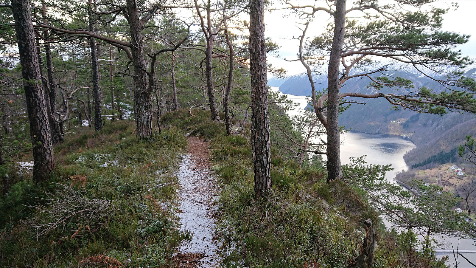
 After visiting Sverrestuven and Middagshaugen , me and Endre ( Fjellsamleren (Endre Myrdal Olsen) ) concluded our trip by following in the footsteps of elbow (Vegard Magnussen) for our visits to Husafjellet and Storenipa . We started from the small parking lot in Straumsdalen , and from there followed the gravel road south.
Shortly before getting to the U-turn, Endre got bored of following the road and wanted to head more directly towards the summit. We therefore decided to split up and see who would make it to the summit first. Endre climbed up to the east while I continued along the road for another 100 meters or so before starting my own ascent (not requiring any climbing).
I left the road shortly after coming across a warning sign for a shooting range up ahead, and quickly located a deer track that I could more or less follow all the way to the summit, thus making the ascent a lot easier than expected. Endre had of course reached >>>
After visiting Sverrestuven and Middagshaugen , me and Endre ( Fjellsamleren (Endre Myrdal Olsen) ) concluded our trip by following in the footsteps of elbow (Vegard Magnussen) for our visits to Husafjellet and Storenipa . We started from the small parking lot in Straumsdalen , and from there followed the gravel road south.
Shortly before getting to the U-turn, Endre got bored of following the road and wanted to head more directly towards the summit. We therefore decided to split up and see who would make it to the summit first. Endre climbed up to the east while I continued along the road for another 100 meters or so before starting my own ascent (not requiring any climbing).
I left the road shortly after coming across a warning sign for a shooting range up ahead, and quickly located a deer track that I could more or less follow all the way to the summit, thus making the ascent a lot easier than expected. Endre had of course reached >>>
Middagshaugen
- Date:
- 14.12.2019
- Characteristic:
- Hillwalk
- Duration:
- 1:06h
- Distance:
- 3.0km
 After out visit to Sverrestuven , Endre ( Fjellsamleren (Endre Myrdal Olsen) ) and me continued to Middagshaugen , parking next to the road at Bjørkheim and at the start of the marked trail. The trail (first red markers, later blue) could easily be followed all the way to the summit, which was itself unmarked.
Excellent views from the summit, but the views were even better 100 meters to the south , where there was also a visitor register, clearly the main goal for most hikers. For the descent we followed the same trail back down to the car, concluding an excellent short hike that can be highly recommended.
After out visit to Sverrestuven , Endre ( Fjellsamleren (Endre Myrdal Olsen) ) and me continued to Middagshaugen , parking next to the road at Bjørkheim and at the start of the marked trail. The trail (first red markers, later blue) could easily be followed all the way to the summit, which was itself unmarked.
Excellent views from the summit, but the views were even better 100 meters to the south , where there was also a visitor register, clearly the main goal for most hikers. For the descent we followed the same trail back down to the car, concluding an excellent short hike that can be highly recommended.
Sverrestuven
- Date:
- 14.12.2019
- Characteristic:
- Hillwalk
- Duration:
- 1:02h
- Distance:
- 2.0km
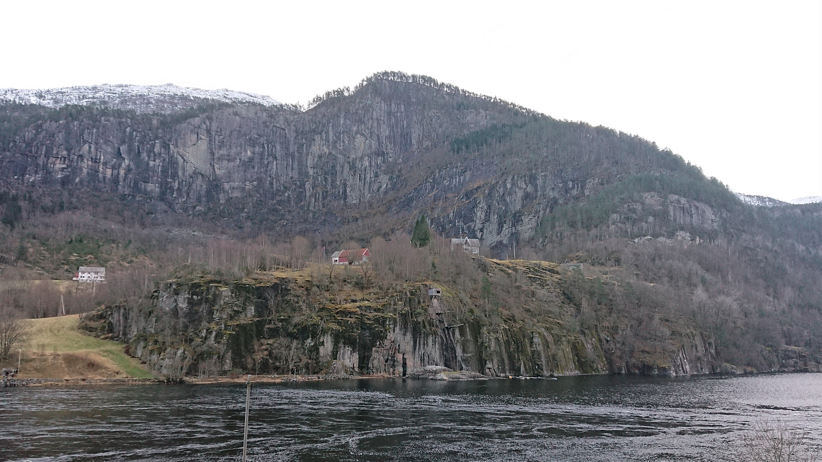
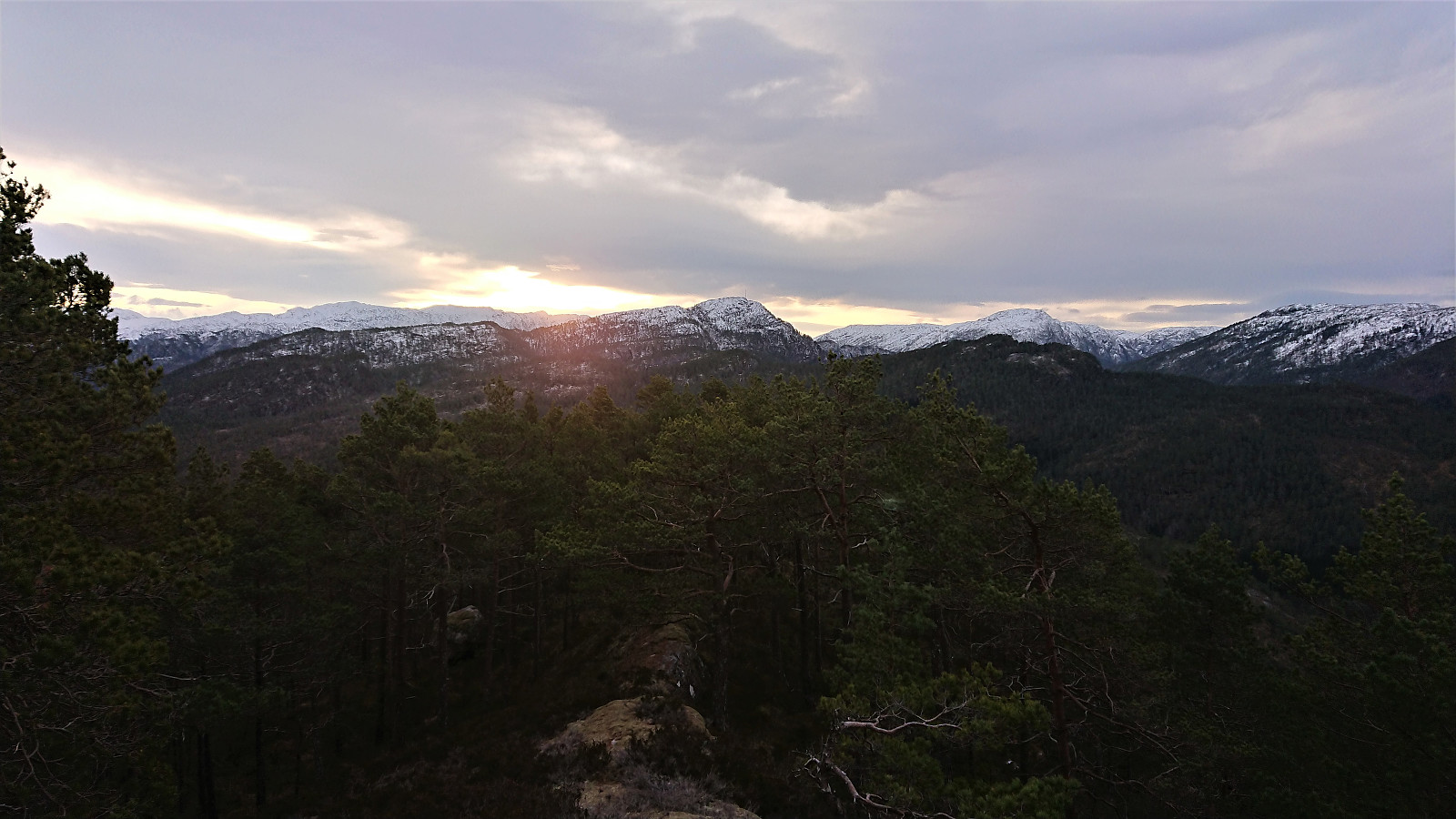 Time for another Saturday of hiking with Endre ( Fjellsamleren (Endre Myrdal Olsen) ), this time to four small peaks in the Stamnes area. First up: Sverrestuven . We parked at Sverrestuven P-lomme øst and made our own way towards the summit. No trails as far as we could tell, but some deer tracks. At first very steep, even requiring some light climbing for the first 100 meters from the road, but from there on reaching the summit was straightforward.
Surprisingly good views from the summit. Most notably down towards Gammersviki and the mountains to the east. But decent views both south and north could be obtained close to the highest point as well. From the summit we followed more or less the same route back down to the car, but I made a small detour at the end to see if there was anything left of the building indicated on the map. I did not find anything, but did >>>
Time for another Saturday of hiking with Endre ( Fjellsamleren (Endre Myrdal Olsen) ), this time to four small peaks in the Stamnes area. First up: Sverrestuven . We parked at Sverrestuven P-lomme øst and made our own way towards the summit. No trails as far as we could tell, but some deer tracks. At first very steep, even requiring some light climbing for the first 100 meters from the road, but from there on reaching the summit was straightforward.
Surprisingly good views from the summit. Most notably down towards Gammersviki and the mountains to the east. But decent views both south and north could be obtained close to the highest point as well. From the summit we followed more or less the same route back down to the car, but I made a small detour at the end to see if there was anything left of the building indicated on the map. I did not find anything, but did >>>
Hellen festning and Furukammen
- Date:
- 08.12.2019
- Characteristic:
- Hike
- Duration:
- 0:49h
- Distance:
- 4.2km
 Passing by Hellen festning and Furukammen on my way from Lønborg to Øyjorden. Same route on the return later on (but without GPS tracking).
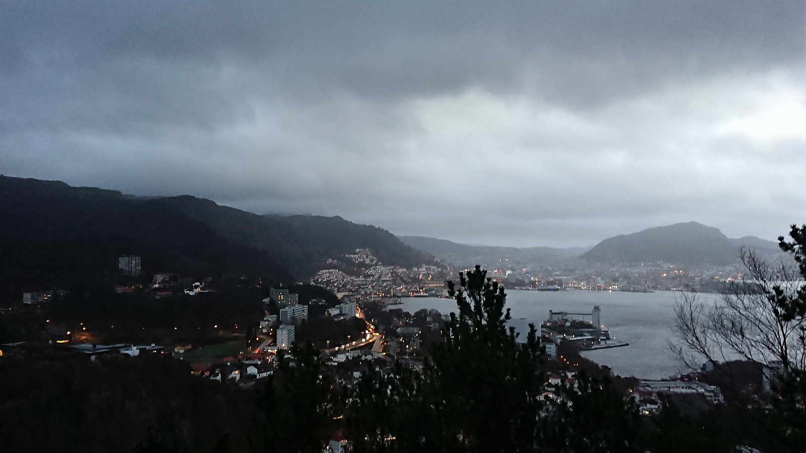
Stoltzekleiven
- Date:
- 07.12.2019
- Characteristic:
- Hillwalk
- Duration:
- 1:33h
- Distance:
- 7.3km
 The goal was to make it up Stoltzen in less than 16 minutes, which I just missed (16:11). I blame it on the snow/ice covering the last part of the ascent. But at least I was around 20 seconds faster than last time. On my way home I came across an interesting two-story building southwest of Ørneberget NV .
Across Hellen festning
- Date:
- 01.12.2019
- Characteristic:
- Hike
- Duration:
- 0:32h
- Distance:
- 3.1km
 Short local hike across Hellen festning on an overall gray and rainy day.
Teiglandsnuten, Vestrefjellet and Ilefjellet from Våge
- Date:
- 30.11.2019
- Characteristic:
- Hillwalk
- Duration:
- 4:45h
- Distance:
- 15.8km
 Teiglandsnuten
Started by taking the bus to Haljem and then the ferry to Våge. Upon arriving at Våge I followed the roads to Ve, where I easily located the marked trailhead for Teiglandsnuten . Turned out that I could just as well have followed the road to Lande directly, but there was not much of a difference between the two options anyway.
The gravel road soon turned into a marked trail. However at some point I seem to have left the trail indicated on the information sign at the start of the hike, as I ended up approaching the summit of Teiglandsnuten from the south, not from the north as shown on the sign. I did follow a trail though, so this option can also be recommended. Excellent views from the summit, which also included a visitor register.
Vestrefjellet
My plan was now to follow the ridge south to >>>
Teiglandsnuten
Started by taking the bus to Haljem and then the ferry to Våge. Upon arriving at Våge I followed the roads to Ve, where I easily located the marked trailhead for Teiglandsnuten . Turned out that I could just as well have followed the road to Lande directly, but there was not much of a difference between the two options anyway.
The gravel road soon turned into a marked trail. However at some point I seem to have left the trail indicated on the information sign at the start of the hike, as I ended up approaching the summit of Teiglandsnuten from the south, not from the north as shown on the sign. I did follow a trail though, so this option can also be recommended. Excellent views from the summit, which also included a visitor register.
Vestrefjellet
My plan was now to follow the ridge south to >>>
Across Hellen festning
- Date:
- 27.11.2019
- Characteristic:
- Hike
- Duration:
- 0:33h
- Distance:
- 3.1km
 Short local evening hike across Hellen festning.
Nordnes
- Date:
- 24.11.2019
- Characteristic:
- Walk
- Duration:
- 1:26h
- Distance:
- 7.1km
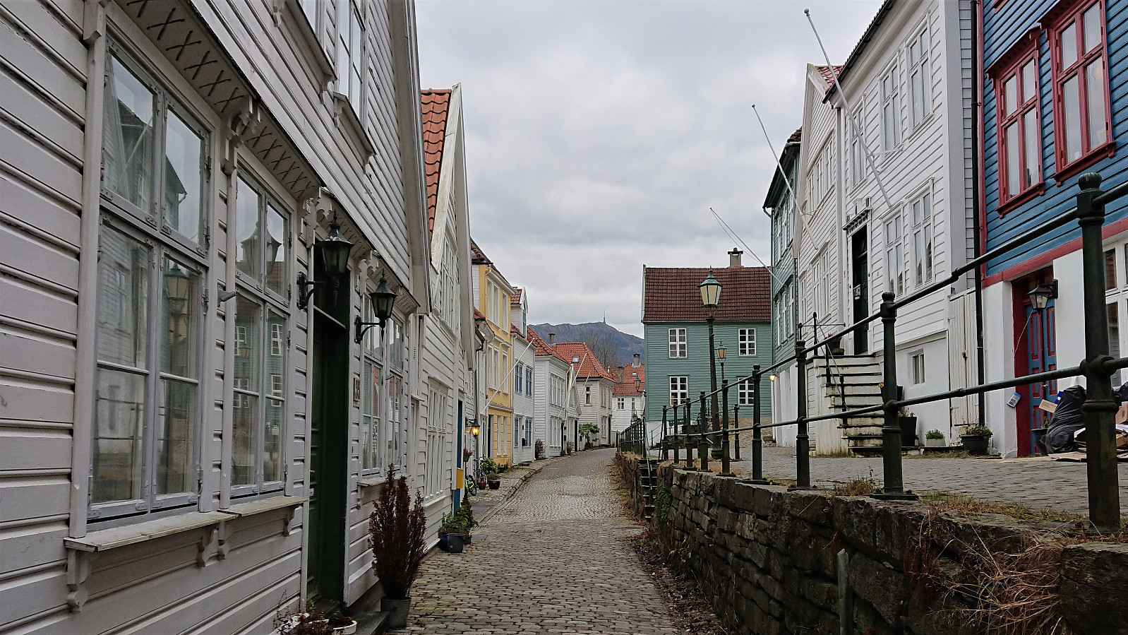 Decided to stay below the snow and ice today and instead took a walk at Nordnes.
Bergstadfjellet from Evanger
- Date:
- 23.11.2019
- Characteristic:
- Hillwalk
- Duration:
- 4:28h
- Distance:
- 16.0km
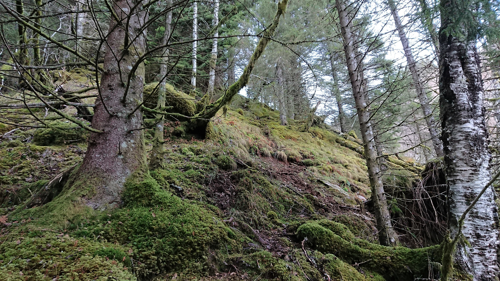 Started by taking the train to Evanger and walking along Teigdalsvegen to Forvene. The road was covered by ice soon after passing Fadnes, but by walking close to the edge of the road, and paying close attention, snow chains were not needed. Upon reaching the short tractor road at Forvene, I left the main road and started searching for a trailhead. Did not find any, so I simply started up the steep ridge, assuming I would come across it later on.
A trail/deer track was shortly discovered. I would put it more in the latter category though, but it did make it easier to progress up the surprisingly steep ascent. The ridge was covered by trees, but these could easily be avoided. Thus there was nothing of the bush war I had mentally prepared for.
At around 200 meters the trail turned much less steep, >>>
Started by taking the train to Evanger and walking along Teigdalsvegen to Forvene. The road was covered by ice soon after passing Fadnes, but by walking close to the edge of the road, and paying close attention, snow chains were not needed. Upon reaching the short tractor road at Forvene, I left the main road and started searching for a trailhead. Did not find any, so I simply started up the steep ridge, assuming I would come across it later on.
A trail/deer track was shortly discovered. I would put it more in the latter category though, but it did make it easier to progress up the surprisingly steep ascent. The ridge was covered by trees, but these could easily be avoided. Thus there was nothing of the bush war I had mentally prepared for.
At around 200 meters the trail turned much less steep, >>>
