Archiv - Nach Datum
Archiv - Nach Aktivität
-
Andere Tour (3)
- Kayaking (3)
-
Fahrradtour (111)
- Fahrradtour Straße (86)
- Fahrradtour gemischt (25)
-
Fahrzeugtour (9)
- Autotour (9)
-
Fußtour (1897)
- Bergtour (1120)
- Jogging (1)
- Spaziergang (60)
- Wanderung (716)
-
Skitour (116)
- Langlauf (47)
- Tourenskilauf (69)
Gesammelte Listen
-
Utvalgte topper og turmål i Bergen
(349/351)
 99%
99% -
Alle topper i Bergen
(393/400)
98%
-
Voss ≥ 100m pf.
(96/98)
97%
-
Opptur Hordaland
(144/159)
90%
-
Stasjoner på Bergensbanen
(33/40)
82%
-
Ulvik ≥ 100m pf.
(30/38)
78%
-
Hordaland ≥ 100m pf.
(624/863)
72%
-
Mjølfjell PF > 100m
(21/31)
67%
-
Jondal ≥ 100m pf.
(15/23)
65%
-
Dagsturhyttene i Vestland
(36/61)
59%
-
Sunnhordland PF >= 100m
(105/186)
56%
-
Hordaland: Hardanger PF>=100m
(196/359)
54%
-
DNT-hytter i Hordaland
(23/45)
51%
-
Kvinnherad ≥ 100m pf.
(40/79)
50%
-
Eidfjord ≥ 100m pf.
(13/42)
30%
-
Sogndal ≥ 100m pf.
(23/81)
28%
-
Gulen ≥ 100m pf.
(15/54)
27%
-
Vik i Sogn ≥ 100m pf.
(10/46)
21%
-
Sogn - Sør for Sognefjorden PF>=100m
(31/159)
19%
-
DNT-hytter i Sogn og Fjordane
(8/47)
17%

Kongsfjellet via boat from Bergen
- Datum:
- 12.05.2019
- Tourcharakter:
- Bergtour
- Tourlänge:
- 2:28h
- Entfernung:
- 6,3km
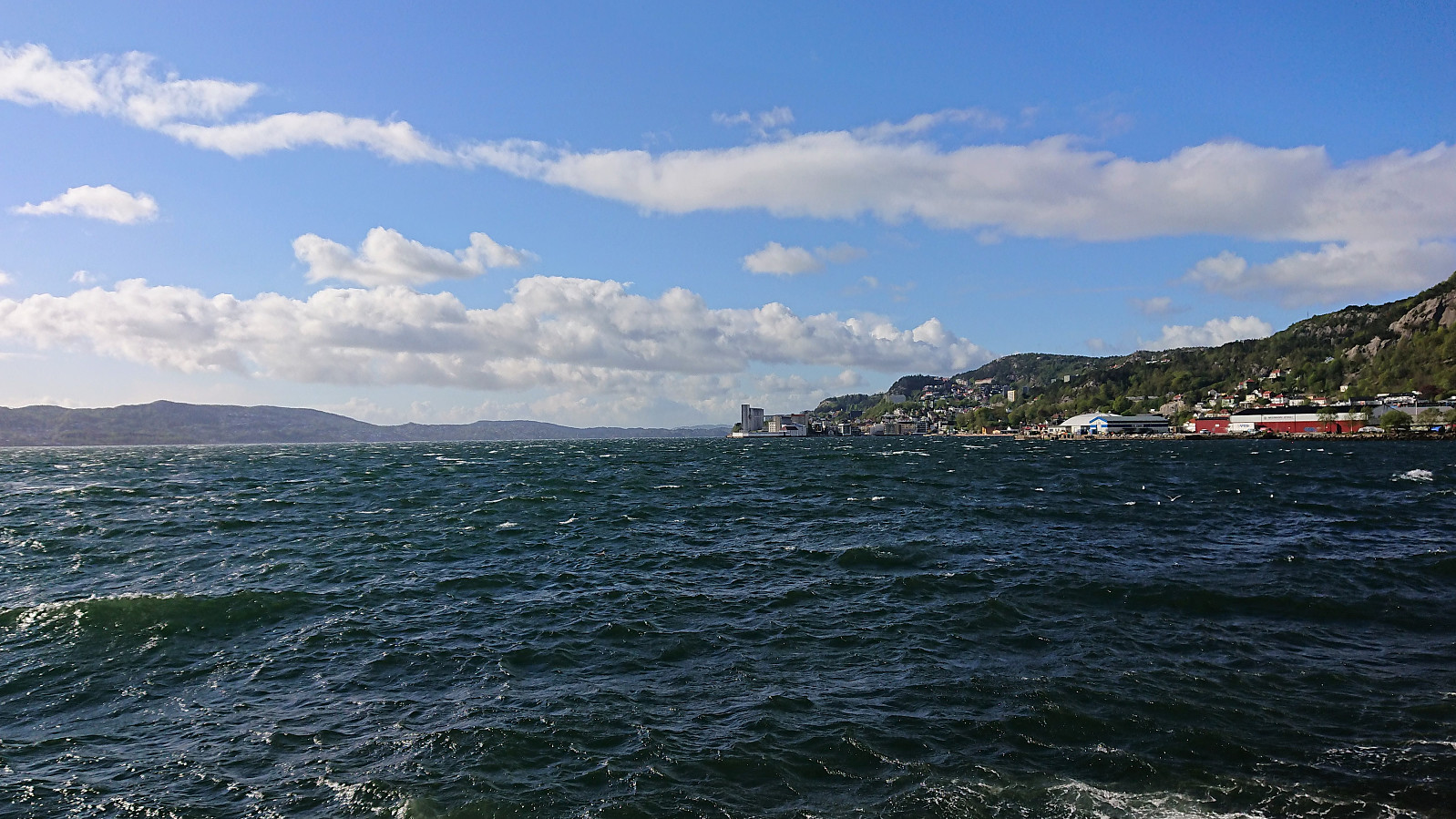
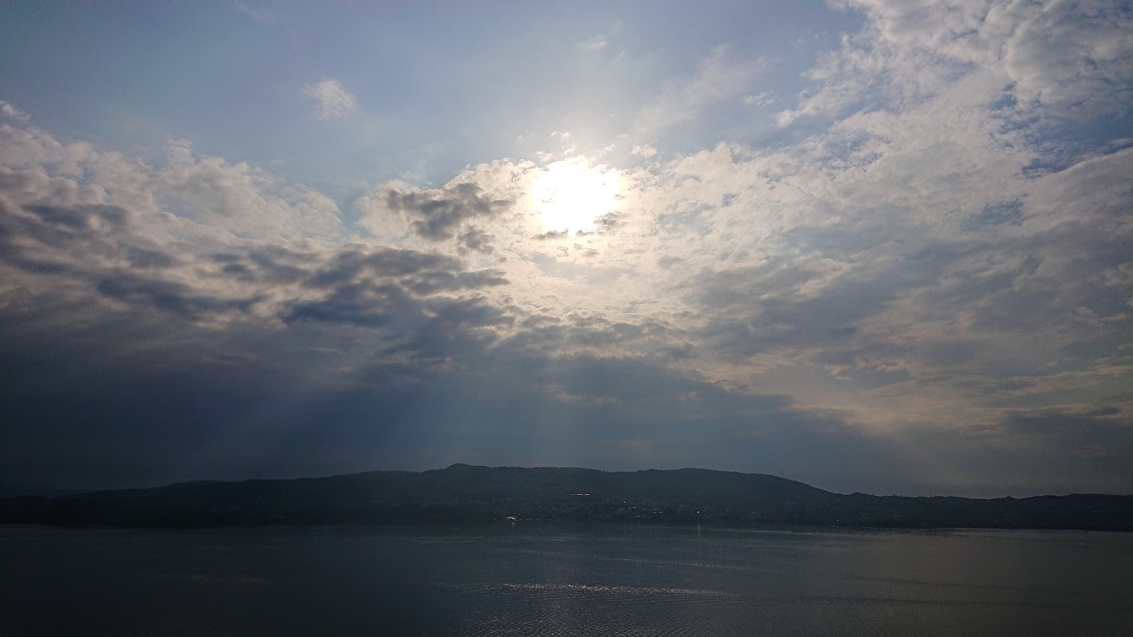
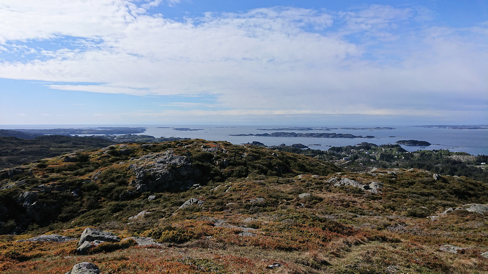 The trip started by taking the boat from Strandkaiterminalen in Bergen to Bekkjarvik, which took around one hour and provided excellent views along the way. Shortly after disembarking, we came across a hiking sign for "Kongsen", which we assumed was short for Kongsfjellet . Did not see any additional signs though, except for a sign for Kongskleiva (which we did not follow, but which we will come back to later), but soon arrived at the football field north of Kongsfjellet where we easily located the trailhead, marked with the familiar blue "N" for "Nordsjøløypa".
From there on it was straightforward to follow the trail all the way to Kongsfjellet, enjoying the rapidly improving views. The summit itself provided excellent views in all directions. We still had plenty of time >>>
The trip started by taking the boat from Strandkaiterminalen in Bergen to Bekkjarvik, which took around one hour and provided excellent views along the way. Shortly after disembarking, we came across a hiking sign for "Kongsen", which we assumed was short for Kongsfjellet . Did not see any additional signs though, except for a sign for Kongskleiva (which we did not follow, but which we will come back to later), but soon arrived at the football field north of Kongsfjellet where we easily located the trailhead, marked with the familiar blue "N" for "Nordsjøløypa".
From there on it was straightforward to follow the trail all the way to Kongsfjellet, enjoying the rapidly improving views. The summit itself provided excellent views in all directions. We still had plenty of time >>>
Dyrskarfjellet and Rundesteinen
- Datum:
- 11.05.2019
- Tourcharakter:
- Bergtour
- Tourlänge:
- 3:12h
- Entfernung:
- 9,8km
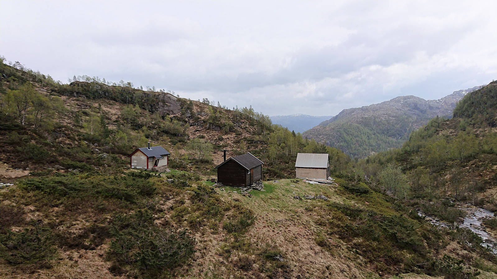
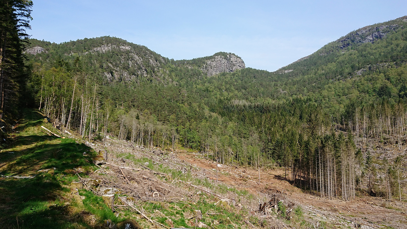
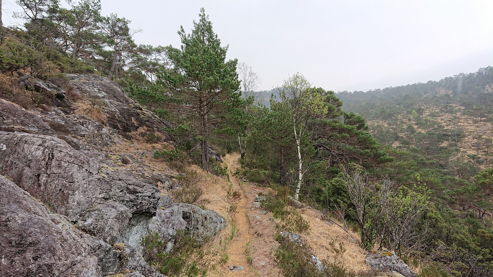
 Started by taking the bus to Store-Aurdal (bus stop called "Urdal (Lindås)") and from there followed the gravel road north, making sure to avoid the demolition site of Husafjellet and instead continued on the forest road slightly further to the east. I soon left Husafjellet behind and started looking for the tractor road east of Dyrskarfjellet that should simplify my ascent. I was a bit too eager though, ending up leaving the road too early, but shortly connected with the actual tractor road.
The tractor road was easy to follow, but clearly not very heavily used, and at times looked more like a trail than a road. From where the road/trail finally came to an end, it was however pretty straightforward to proceed to the summit. Although there were a couple of steep sections that had to be avoided. The summit >>>
Started by taking the bus to Store-Aurdal (bus stop called "Urdal (Lindås)") and from there followed the gravel road north, making sure to avoid the demolition site of Husafjellet and instead continued on the forest road slightly further to the east. I soon left Husafjellet behind and started looking for the tractor road east of Dyrskarfjellet that should simplify my ascent. I was a bit too eager though, ending up leaving the road too early, but shortly connected with the actual tractor road.
The tractor road was easy to follow, but clearly not very heavily used, and at times looked more like a trail than a road. From where the road/trail finally came to an end, it was however pretty straightforward to proceed to the summit. Although there were a couple of steep sections that had to be avoided. The summit >>>
Ørneberget
- Datum:
- 07.05.2019
- Tourcharakter:
- Bergtour
- Tourlänge:
- 1:09h
- Entfernung:
- 5,5km
 Short local evening hike.
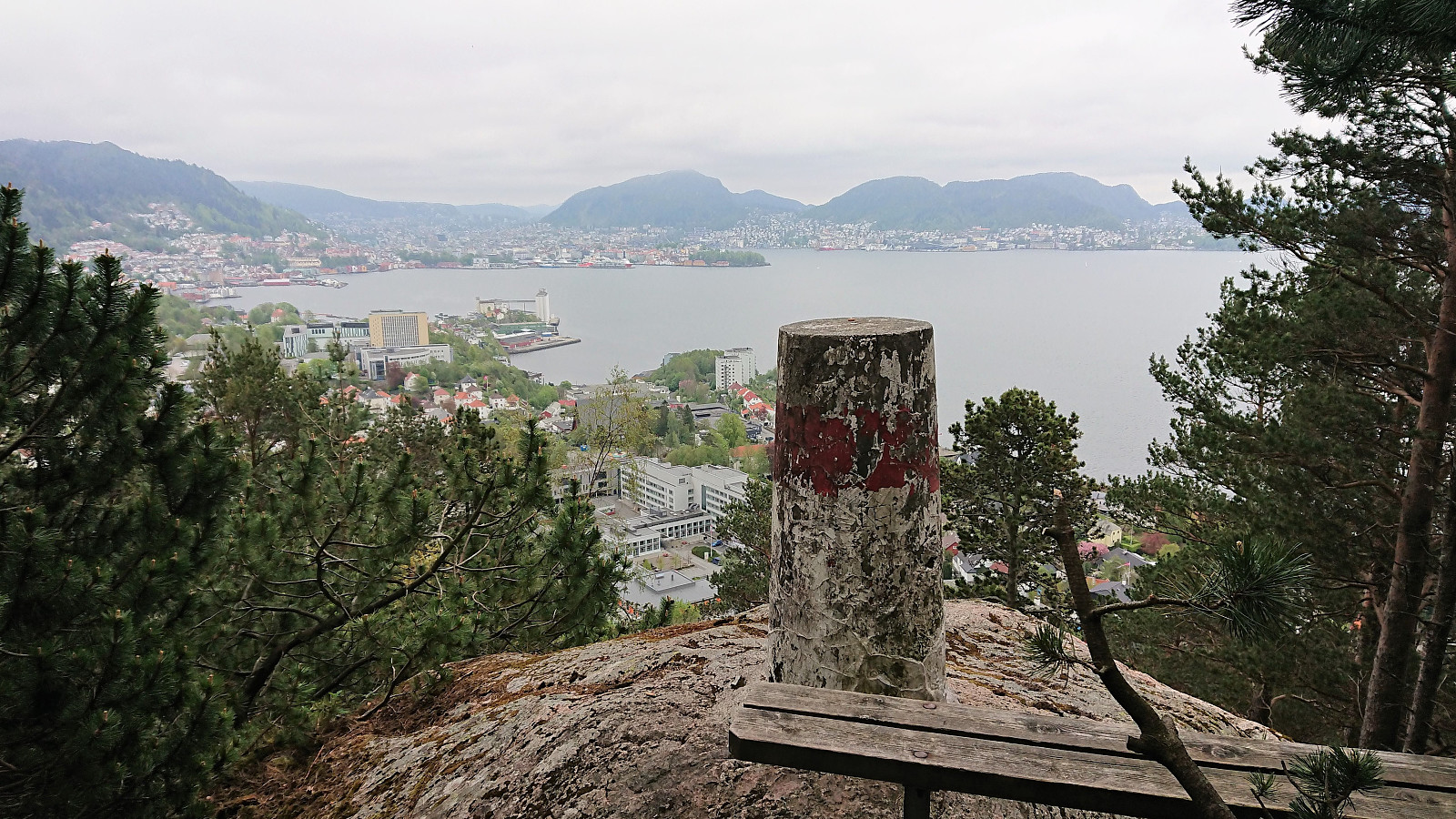
Lønborg - Strandkaien - Sandvikstorget
- Datum:
- 05.05.2019
- Tourcharakter:
- Wanderung
- Tourlänge:
- 2:31h
- Entfernung:
- 11,3km
 Local hike from Lønborg to Strandkaien and back to Sandvikstorget for the bus back home.
Hemningsfjellet from Eikefet
- Datum:
- 04.05.2019
- Tourcharakter:
- Bergtour
- Tourlänge:
- 3:25h
- Entfernung:
- 11,5km
 Took the bus to Eikefet and from there followed the road north to Eikemo, where the trailhead was easily located just before the road was about to cross Eikefetelva for a second time. The trail was unmarked but easy to follow and more or less followed the river all the way up to Eikemosætra via Sætre . The bridge used to cross the river, named Sæterbrua , was also of good quality.
Upon arriving at Eikemosætra, I decided to continue north to Båtevatnet, on the off chance that I'd come across an unknown trail to Hemningsfjellet . But even the trail to Båtevatnet soon turned very weak, and I could not see any trails going east. Heading straight for the summit from Båtevatnet without a trail was not really an option either, as the terrain seemed too steep. I therefore doubled back, getting almost to Eikemosætra, before starting my final >>>
Took the bus to Eikefet and from there followed the road north to Eikemo, where the trailhead was easily located just before the road was about to cross Eikefetelva for a second time. The trail was unmarked but easy to follow and more or less followed the river all the way up to Eikemosætra via Sætre . The bridge used to cross the river, named Sæterbrua , was also of good quality.
Upon arriving at Eikemosætra, I decided to continue north to Båtevatnet, on the off chance that I'd come across an unknown trail to Hemningsfjellet . But even the trail to Båtevatnet soon turned very weak, and I could not see any trails going east. Heading straight for the summit from Båtevatnet without a trail was not really an option either, as the terrain seemed too steep. I therefore doubled back, getting almost to Eikemosætra, before starting my final >>>
Marineholmen to Ludebryggen
- Datum:
- 02.05.2019
- Tourcharakter:
- Spaziergang
- Tourlänge:
- 0:45h
- Entfernung:
- 4,3km
 Another short walk on the way home from work.
Hellen festning and Furukammen
- Datum:
- 01.05.2019
- Tourcharakter:
- Wanderung
- Tourlänge:
- 1:41h
- Entfernung:
- 5,3km
 Short local hike across Hellen festning and Furukammen.
Skarsnuten, Vardafjellet, Grytefjellet and Beljaråsen
- Datum:
- 30.04.2019
- Tourcharakter:
- Bergtour
- Tourlänge:
- 5:47h
- Entfernung:
- 16,6km
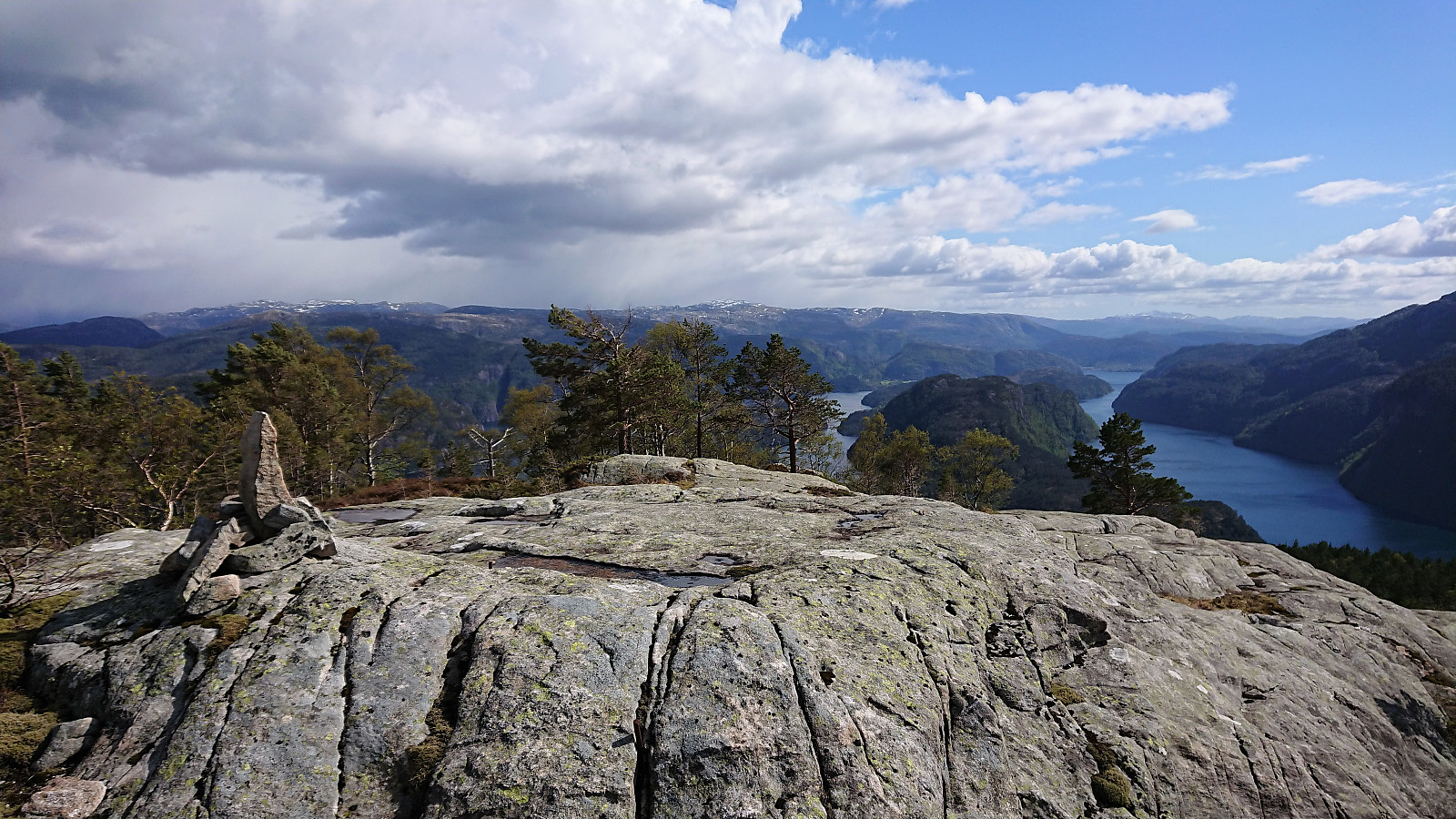
 Another meeting ending at Solstrand, another hike beginning in Fusa. But this time I was lucky enough to catch a ride with a colleague and fellow Peakbooker HHauser (Helwig Hauser) . So when the rest of our colleagues got on the bus back to Bergen, we instead headed for the ferry to Venjaneset and onwards to the parking lot for Skarsnuten , all in perfect hiking weather.
From the parking lot we initially followed the gravel road north, but soon switched to the parallel tractor road. The idea being that it would probably not be too difficult to make a shortcut up the valley east of Skarsnuten, and thus get a more interesting hike. This turned out even easier than expected, given that shortly after the tractor road ended we came across a trail marked with white plastic ribbons, which ended up taking us all the way to the summit >>>
Another meeting ending at Solstrand, another hike beginning in Fusa. But this time I was lucky enough to catch a ride with a colleague and fellow Peakbooker HHauser (Helwig Hauser) . So when the rest of our colleagues got on the bus back to Bergen, we instead headed for the ferry to Venjaneset and onwards to the parking lot for Skarsnuten , all in perfect hiking weather.
From the parking lot we initially followed the gravel road north, but soon switched to the parallel tractor road. The idea being that it would probably not be too difficult to make a shortcut up the valley east of Skarsnuten, and thus get a more interesting hike. This turned out even easier than expected, given that shortly after the tractor road ended we came across a trail marked with white plastic ribbons, which ended up taking us all the way to the summit >>>
Across Hellen festning
- Datum:
- 28.04.2019
- Tourcharakter:
- Wanderung
- Tourlänge:
- 0:36h
- Entfernung:
- 3,7km
 Short local hike across Hellen festning.
Osen, Spåkefjellet and Beitelen
- Datum:
- 27.04.2019
- Tourcharakter:
- Bergtour
- Tourlänge:
- 2:22h
- Entfernung:
- 8,7km
 Started by taking the bus to Ytre Arna and walking along the roads up to the marked trailhead at the end of Mons Slettens vei. Here there was also a trail coming up from the north, hence there is most likely a shortcut up from Ytre Arna I did not know about. Within minutes I arrived at the Lavvo indicated on the sign, and as soon as I left it behind, I could see the small hill that was the main goal of today’s hike: Osen .
While it would probably not have been very difficult to head directly for the summit, I decided to stay on the trail, taking me almost south of the hill, before a new sign marked the trail towards Osen. On the way to the summit I made a quick visit to Osen utsiktspunkt , providing an excellent overview of Gaupås. The views from the summit itself were also pretty good, with unusual views towards Sjurstonipa , >>>
Started by taking the bus to Ytre Arna and walking along the roads up to the marked trailhead at the end of Mons Slettens vei. Here there was also a trail coming up from the north, hence there is most likely a shortcut up from Ytre Arna I did not know about. Within minutes I arrived at the Lavvo indicated on the sign, and as soon as I left it behind, I could see the small hill that was the main goal of today’s hike: Osen .
While it would probably not have been very difficult to head directly for the summit, I decided to stay on the trail, taking me almost south of the hill, before a new sign marked the trail towards Osen. On the way to the summit I made a quick visit to Osen utsiktspunkt , providing an excellent overview of Gaupås. The views from the summit itself were also pretty good, with unusual views towards Sjurstonipa , >>>
