Archive - Date
Archive - Activity
-
Climbing (3)
- Alpine climbing (3)
-
Ski trip (36)
- Backcountry skiing (2)
- Randonnée/Telemark (34)
- Trip by foot (8)
Peakbook-Friends


Favourite trips


Pas de Chevre - Aiguilles des Grands Montets
- Date:
- 23.03.2000
- Characteristic:
- Randonnée/Telemark
Glacier Ronde from Aiguille du Midi
- Date:
- 19.04.1999
- Characteristic:
- Randonnée/Telemark
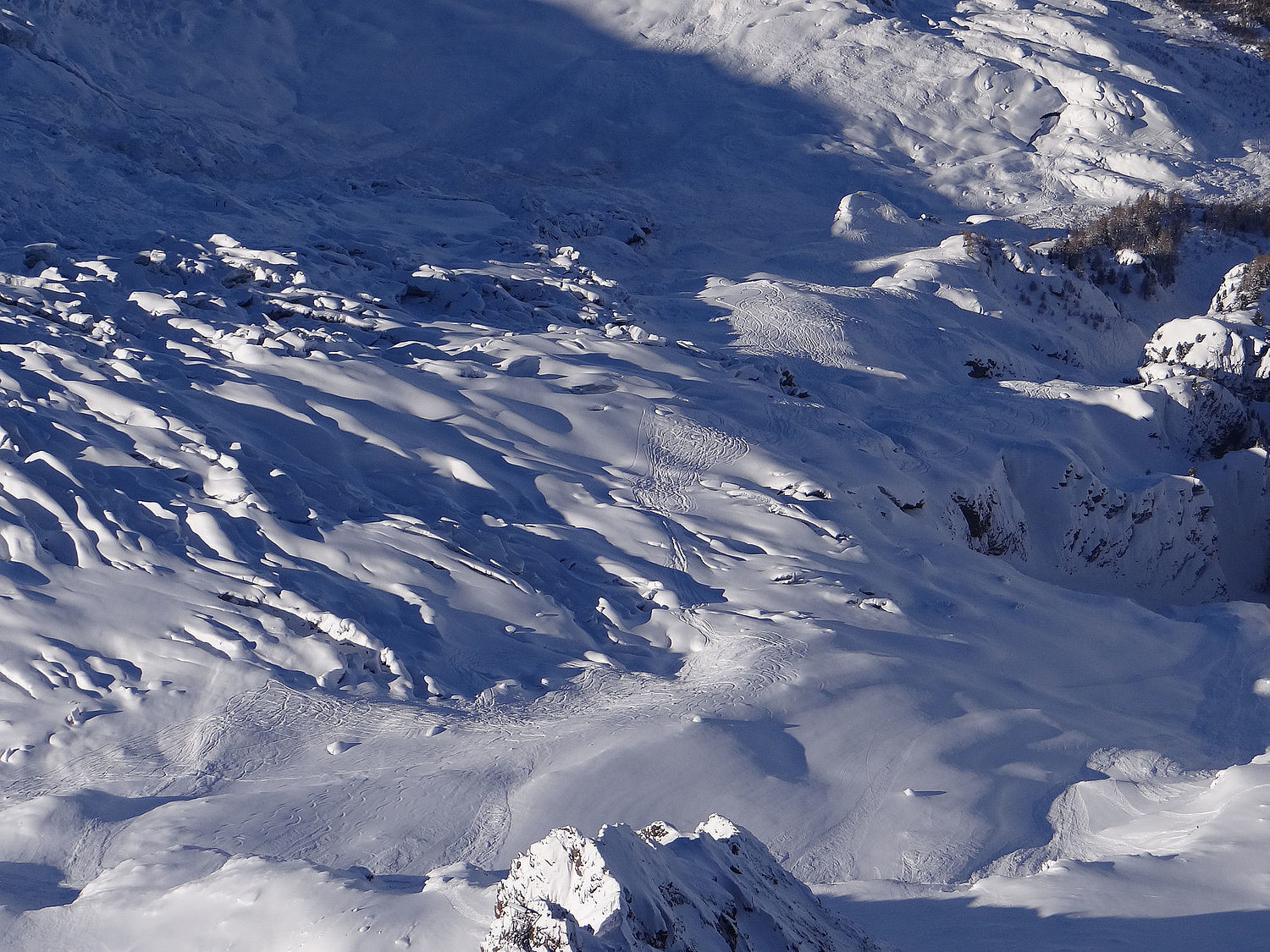 A ski descent from Aiguille du Midi to Chamonix (no. 2 in the photo). You take the lift to Aiguille du Midi (3842m) and ski towards the Cosmiques hut. In F. Damilano's guide "Snow, Ice and Mixed vol II" it is route no. 169 - the "SW couloir". A descent taking 3-4 hours where you may ski to the Plan de l'Aiguille (2317m). Descent grade 5.1/E3/TD-/S5.
Mont Blanc - Grand Mulet route.
- Date:
- 15.04.1999
- Characteristic:
- Randonnée/Telemark
 A winter ski ascent/descent of the Mont Blanc (4808m) via the classical route and the Grand Mulet hut. You spend two nights at the Grand Mulet hut at 3000m.
Day one: Take the lift from Chamonix to Plan de l'Aiguille at 2300 m and then walk/ski to the Grand Mulet Hut at 3000m. Eat and rest at the hut to early next morning.
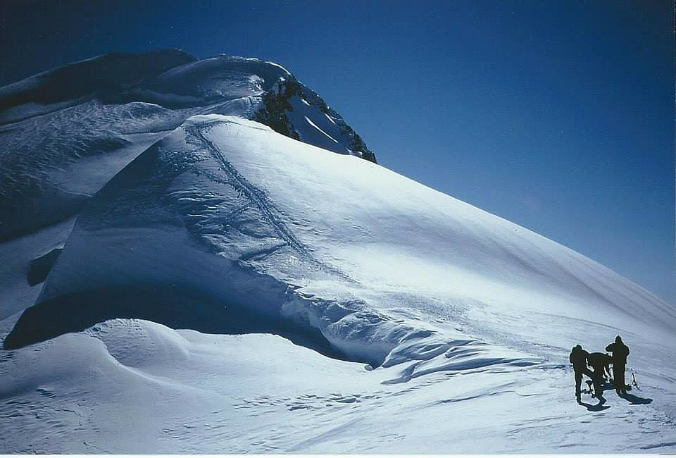
A view toward the "North ridge of the Dome de Gouter" from the Grand Mulet hut below. The classical route goes below the ridge and the seracs in the left of the photo. There is a safer and more difficult route up the ridge.
Day two: Early start to avoid crevasse fall and avalanche. The Bossons Glacier is crevassed and you use ropes and ice axes to cross the glacier. You start early in the morning to avoid snow and ice avalances. When the sun melts the snow there is >>>
A winter ski ascent/descent of the Mont Blanc (4808m) via the classical route and the Grand Mulet hut. You spend two nights at the Grand Mulet hut at 3000m.
Day one: Take the lift from Chamonix to Plan de l'Aiguille at 2300 m and then walk/ski to the Grand Mulet Hut at 3000m. Eat and rest at the hut to early next morning.
A view toward the "North ridge of the Dome de Gouter" from the Grand Mulet hut below. The classical route goes below the ridge and the seracs in the left of the photo. There is a safer and more difficult route up the ridge.
Day two: Early start to avoid crevasse fall and avalanche. The Bossons Glacier is crevassed and you use ropes and ice axes to cross the glacier. You start early in the morning to avoid snow and ice avalances. When the sun melts the snow there is >>>

