
Kletten from Strandvik (18.05.2024)

Written by HHauser (Helwig Hauser)

| Start point | Strandvik (30m) |
|---|---|
| Endpoint | Strandvik (30m) |
| Characteristic | Walk |
| Duration | 0h 30min |
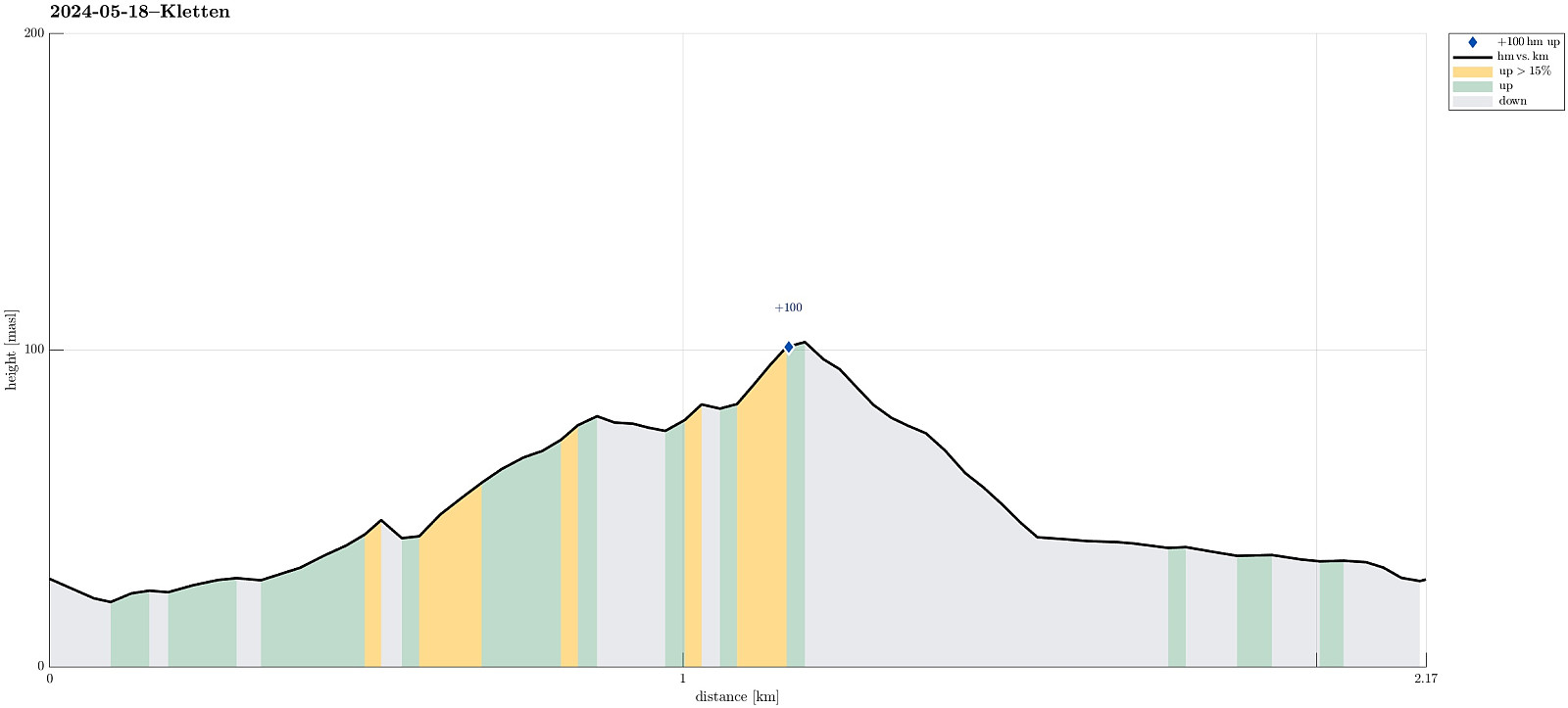
| Distance | 2.2km |
| Vertical meters | 108m |
| GPS |
|
| Ascents | Kletten (108m) | 18.05.2024 |
|---|
Trip Summary
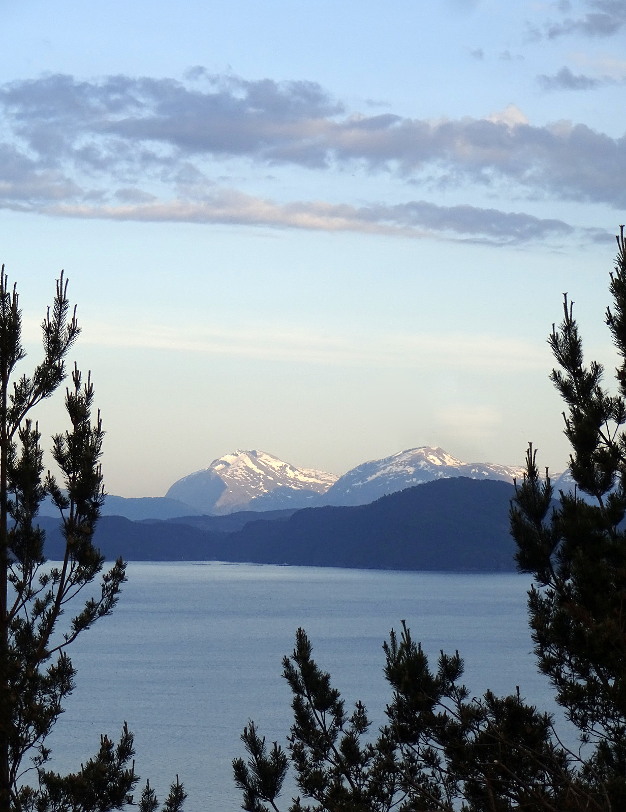
The evening was nice and with plenty of daylight still to use it was just fine with a short round up to Kletten before calling it a day. :-) The plan was to approach Kletten from the east (from Strandvik) and doing so was (almost) straight-forward. Only once, at the very end of Strandvikvegen at house 529, a bit of back-tracking was needed to reconnect with the trail (that is starting a bit further north). Then, instead of going up to Kletten at once, I first surrounded Kletten via Klettaltanen in its south, before eventually ascending to Kletten (then from its west). After crossing over Kletten, I then descended northwards to Strandvikvegen, which I then followed back to Strandvik. Quite nice that one can see Melderskin and Englafjellet from Kletten! :-)
Photos
Selected photos are available as Google photo album.
Useful Resources
See also the related FB-page Hiking around Bergen, Norway.


User comments