
Bekhilderen south of Telavåg (24.09.2023)

Written by HHauser (Helwig Hauser)

| Start point | Telavågvegen (40m) |
|---|---|
| Endpoint | Telavågvegen (40m) |
| Characteristic | Hike |
| Duration | 3h 00min |
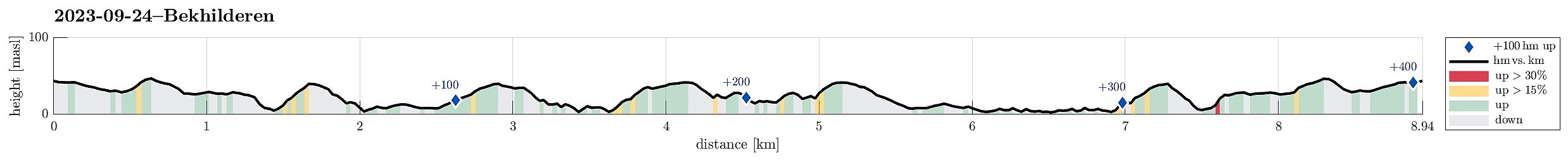
| Distance | 9.0km |
| Vertical meters | 404m |
| GPS |
|
| Visits of other PBEs | Bekhilderen (5m) | 24.09.2023 |
|---|
Trip Summary
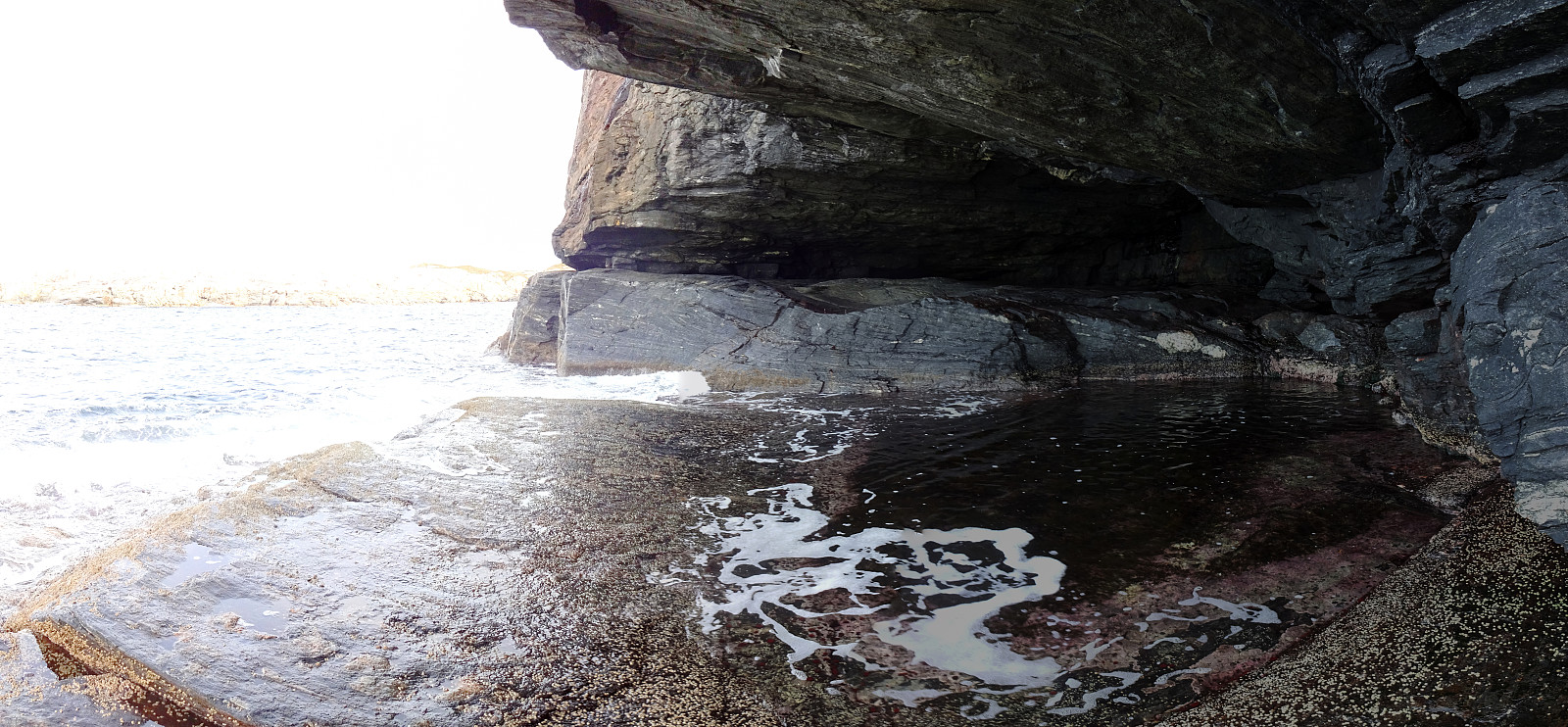
Between the rain, and also taking the tide schedule into account, late Sunday morning offered a promising opportunity to visit Bekhilderen in the south of Telavåg. While approaching Telavåg with the car, we found a convenient spot at the side of Telavågvegen to park the car (just some 200 meters south of the sports arena of Telavåg. From there, we walked first along Selstøsjøen and then Håvarden. If you watch out for them, you can actually see small blue markers (Nordsjøløypa), leading the way. Before reaching house #33 at Håvarden, one then follows the gravel road towards the southeast. At the end of this (short) gravel road, one comes down to the inner parts of Selstøvågen and only a few meters towards the east, one then finds Selstøkverna, an old, renovated mill. After taking a look at this old mill, we then continued across the moderate heights south of Selstøvågen towards the point between Grunnevågen and Sandvikvatnet, where some wooden constructions help to get over to the other side (without getting all wet). Once on the other side, it's then gently up (this time mostly in western direction, first, before turning southwest soon). At about the highest point, one finds a sign showing the trail to Bekhilderen (mostly in western direction, again, and out towards the coast). After following trail for only a few meters, one starts the descent towards Båarvågen and Bekhilderen. The landscape there is wild and impressive, with large rocks as if some giants had played with them. Once below the main cliff, the marked trail leads northwards (towards the grotto). When eventually getting close to the grotto, one clearly understands, why one needs to choose a time of low tide when visiting Bekhilderen -- at high tide, it's clearly highly risky to make an attempt towards the grotto (not recommended!) and one could not reach it with dry feet anyway. At low tide, however, it's fully possible to get to it (and also to get into it, even though it seems that there's always some water in this grotto). After exploring Bekhilderen, we first returned to the split point (up the hill). From there, we made a short detour (via Sauhaugen) towards the south. Since we expected some more rain to come, however, we did not make it all the way to Terneset (or Tenneset), but turned around relatively short after passing Sauhaugen. On our way back to the car, we included a short exploration of Sandvikvatnet (in the east of Grunnevågen), also, as this really is a very nice spot. After making it back to the car in still dry conditions, we briefly stopped by Nordsjøfartsmuseet (just a few hundred meters up the road) and enjoyed a cup of coffee there. All in all, it is concluded that Bekhilderen is clearly worth a visit (planning well so that one gets there at low tide is important, though).
Photos
Selected photos are available as Google photo album.
Useful Resources
See also the related FB-page Hiking around Bergen, Norway.
Web page UT.no from the Norwegian Trekking Association recommends a similar hike.


User comments