
Drangsfjellet with Høgelikampen (31.08.2019)

Written by HHauser (Helwig Hauser)

| Start point | Drangsvegen (55m) |
|---|---|
| Endpoint | Drangsvegen (55m) |
| Characteristic | Hillwalk |
| Duration | 3h 00min |
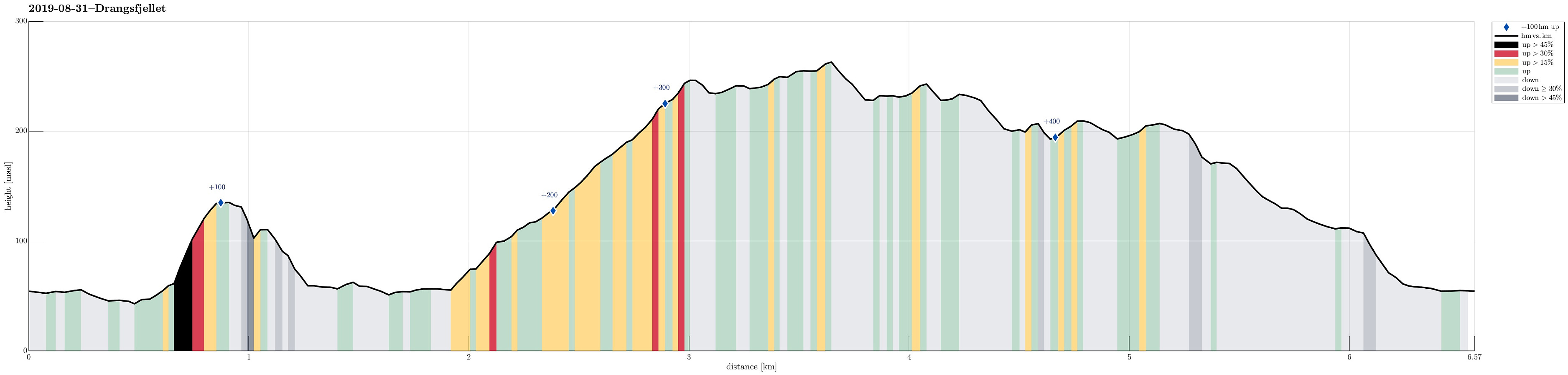
| Distance | 6.6km |
| Vertical meters | 434m |
| GPS |
|
| Ascents | Fjærhovda (140m) | 31.08.2019 |
|---|---|---|
| Høgelikampen (266m) | 31.08.2019 | |
| Skifteshaugen (250m) | 31.08.2019 | |
| Visits of other PBEs | Fjærhovda utsiktspunkt (135m) | 31.08.2019 |
| Sør for Høgelikampen (234m) | 31.08.2019 |
Trip Summary
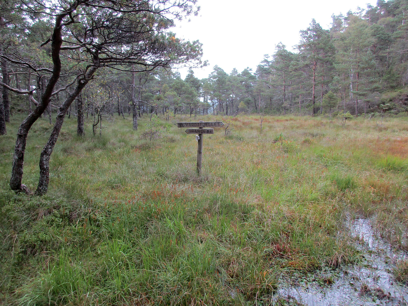
We left Bergen towards the south, passing by Fana and driving over Fanafjellet (road #5158). Near Sørstraumen, where road #5156 leaves to the left (in eastern direction), leading to Lyseklosteret before continuing towards Ulven, we turned right, following along the coast of Seiasundet. South of Søvik, where the road leads away from the sea, we then took a sharp turn to the right (towards Drange). Before getting to Drange (and just before getting to Langavatnet), we parked the car right next to the road. Instead of starting our hike into the forest from there, however, we first followed the road a bit further (to Indre Drange, actually). There, we found a good place to leave the road and start our first ascent (up to Fjærhovda). While it was not difficult to find our way up there, one needs to be very optimistic to detect any trail there. :-) The top of Fjærhovda isn't very interesting, in the middle of the forest, but only a few meters further in southwestern direction, one finds a nice place from which one has a good view to Lysefjorden. From Fjærhovda, we then descended in southwestern direction (towards Langavatnet). Once there, we walked along this small (but lengthy) lake (on its northwestern side) in order to find a good spot for crossing over to the other side. And indeed, at the southwestern end of Langavatnet, a construction of big stones is ideally suited for crossing the water with dry shoes! :-) A bit further, however, where we wanted to cross the water that comes down from Mørkatjørna, we had to understand that this would not be possible without getting really wet shoes and feet. After trying and then giving in, we instead continued further towards Mørkatjørna first (in southern direction). Shortly before reaching Mørkatjørna then, we found a good spot for getting over to the other side. After then stepping up in the forest for a short stretch, we connected to the forest road that we had intended to reach. Following this forest road further upwards, we proceeded swiftly into the direction of Høgelikampen (there's one point at about 120mosl, where one needs to choose the left option for proceeding further upwards). At about 175mosl, we somehow decided that we wanted proceed off-trail through the forest and a bit later we arrived at Skifteshaugen. Continuing over this little top, we then came by Tyskarhytto (or what is left of it), before we found the path which leads to Høgelikampen. From there, we first descended in southwestern direction in order to get to the forest road that would bring us to a nice vista point, south of Høgelikampen. From there, one has a really nice view down to Skeisosen. While the original plan had been to also include Vardafjellet (in the northeast of Høgelikampen), we paid tribute to the progressed time and decided to cut short this hike and head back to the car "directly". To get back rather soon, we thought that passing by Hovlandsvatnet on its western side (between Høgelikampen and Vardafjellet) and crossing over Setret to then descend down to Drangsvegen would be best. Following this plan, we managed to get back "in time". All in all, this hike proved to be mostly a forest-hike with a few (but nice) locations with views.
Photos
Selected photos are available as Google photo album.
Useful Resources
See also the related FB-page Hiking around Bergen, Norway.
Web page UT.no from the Norwegian Trekking Association recommends a different hike up Høgelikampen.


User comments