
Tveitafjellet (01.01.2019)

Written by HHauser (Helwig Hauser)

| Start point | Eide (10m) |
|---|---|
| Endpoint | Eide (10m) |
| Characteristic | Hillwalk |
| Duration | 1h 30min |
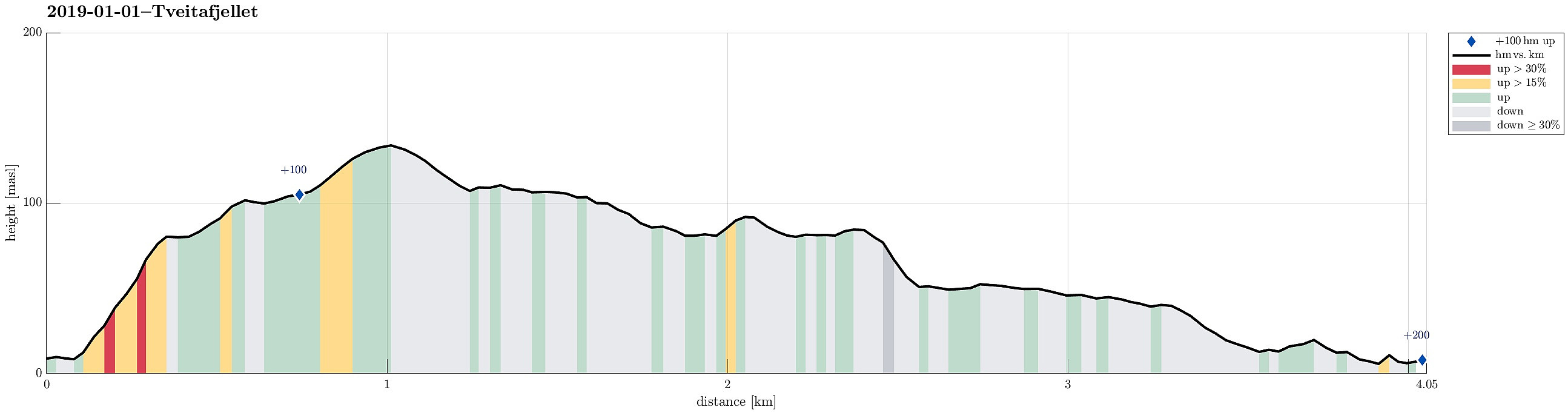
| Distance | 4.1km |
| Vertical meters | 203m |
| GPS |
|
| Ascents | Tveitafjellet (138m) | 01.01.2019 |
|---|
Trip Summary
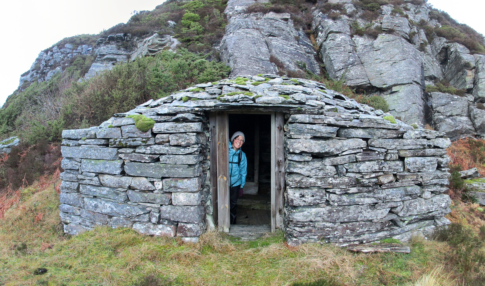
In order to get some fresh air, we disregarded the unfavorable weather conditions (rather strong storm, intermixed with some precipitation) and headed towards Sotra. The bridge (Sotrabrua) was guarded on both sides, because of the strong winds, but we could still cross over. On Sotra, we continued along road #555 towards Fjell and from there further south, coming by Dala and Hammarsland. At Tveita, we then started to look out for a spot, where we could park, but continued to Eide just a bit further south to actually find a suitable place along the road. Sine we had planned to go up Tveitafjellet first, we first walked a bit back along the road (in northern direction) until we found a good spot to enter Eidesdalen, just southwest of Tveitafjellet. Only a few steps into this valley, however, we immediately saw an opportunity to ascend further up and towards Tveitafjellet on the left (northeast). We met the ridge that leads further up to Tveitafjellet at the point, where also the power line crosses over. There, we crossed a fence and continued our ascent to Tveitafjellet. Once on the ridge, we really experienced some very strong winds and we had to take care not to be blown over! Once a bit further up, the ridge flattens out quite a bit, making the further ascent nice and easy (even though there isn't really any path across this ridge). Even though Tveitafjellet is not very high, it still has an impressive flank on its southwestern side, offering some nice views along the way. After crossing over the top of Tveitafjellet, we continued along the steep western side in southeastern direction. One goal was to get a nice view over Djupeskarvatnet, exploiting the steep sides of these heights there. There thus crossed over Orkedalen and continued on the heights as long as possible. Indeed, the southern-most point there gives some nice over view of Djupeskaret and Djupeskarvatnet. :-) We then descended in eastern direction, getting to the upper entry to Djupeskaret. Originally, we had planned to continue further south (via Eidesbrota), thus first continuing around a small lake northeast of Djupeskaret, but when we started to ascend the north-south going ridge on the east of this small lake, we found ourselves in the middle of an impressive snow storm! Since daylight time was getting short aready and our progress through the terrain (without any path) was slower than expected, we decided to cut our hike short and aim for a path that would bring us back to our car before dark. The straight-forward solution was to go back around the little lake and down through Djupeskaret, since we expected to find a proper path on the other, western side of Djupeskarvatnet. This indeed was the case and we followed this path back to Eide (in northwestern direction), passing by a few impressive stone huts (in very good condition!). At about the time of sunset, we arrived back at our car and thought that this hike was still nice and entertaining (with all the weather and some nice views!), even though we had to cut it short.
Photos
Selected photos are available as Google photo album.
Useful Resources
See also the related FB-page Hiking around Bergen, Norway.


User comments