
Rondslottet (10.07.2025)


| Start point | Spranget (1,100m) |
|---|---|
| Endpoint | Spranget (1,100m) |
| Characteristic | Jogging |
| Duration | 5h 00min |
| Distance | 24.0km |
| Vertical meters | 1,300m |
| GPS |
|
| Ascents | Rondslottet (2,178m) | 10.07.2025 |
|---|---|---|
| Vinjeronden (2,045m) | 10.07.2025 |
Being based in Vågåmo meant that we were essentially equidistant to Rondane and Jotunheimen, and up until this point, we'd spent most of our days exploring Jotunheimen. Fancying a change in terrain, we opted for a trip up Rondslottet. A heatwave had began to brew, it was bright, clear but oppressively hot. We'd observed that the afternoons tended to bring patchy cloud and secretly wished for the sun to go in today.
We drove from Vågåmo to Spranget, ascending through the forrest and onto open fell where the (now very much full) carpark is located. It is 6km from Spranget to Rondvassbu (where the climb officially starts) and this would ordinarily make for a long day out if it weren't for the bike-hire service offered by the DNT cabin. Here at Spranget you can hire a mountain bike for the 6km journey for the price of 150NOK per person, one way. We both considered this quite expensive, considering the equivalent service at Glitterheim is 100NOK, but did notice that the bikes were in significantly better condition than those at Glitterheim.
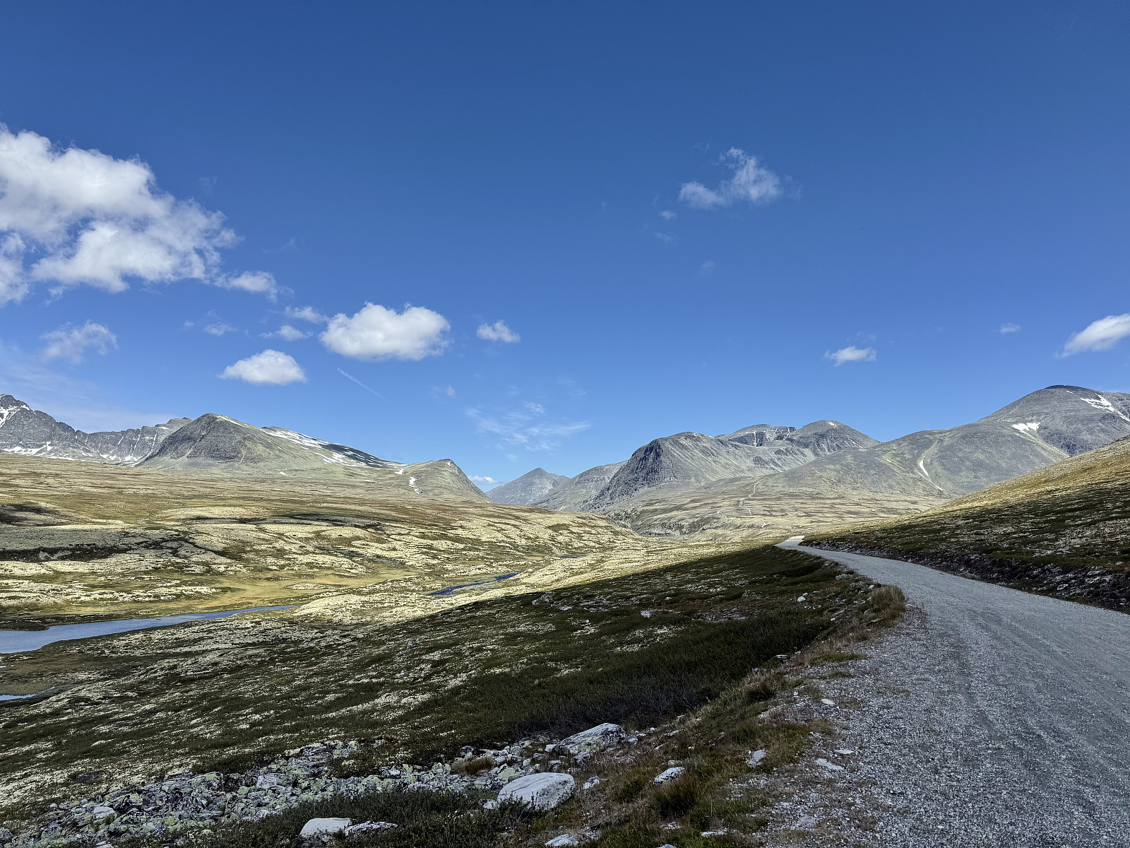
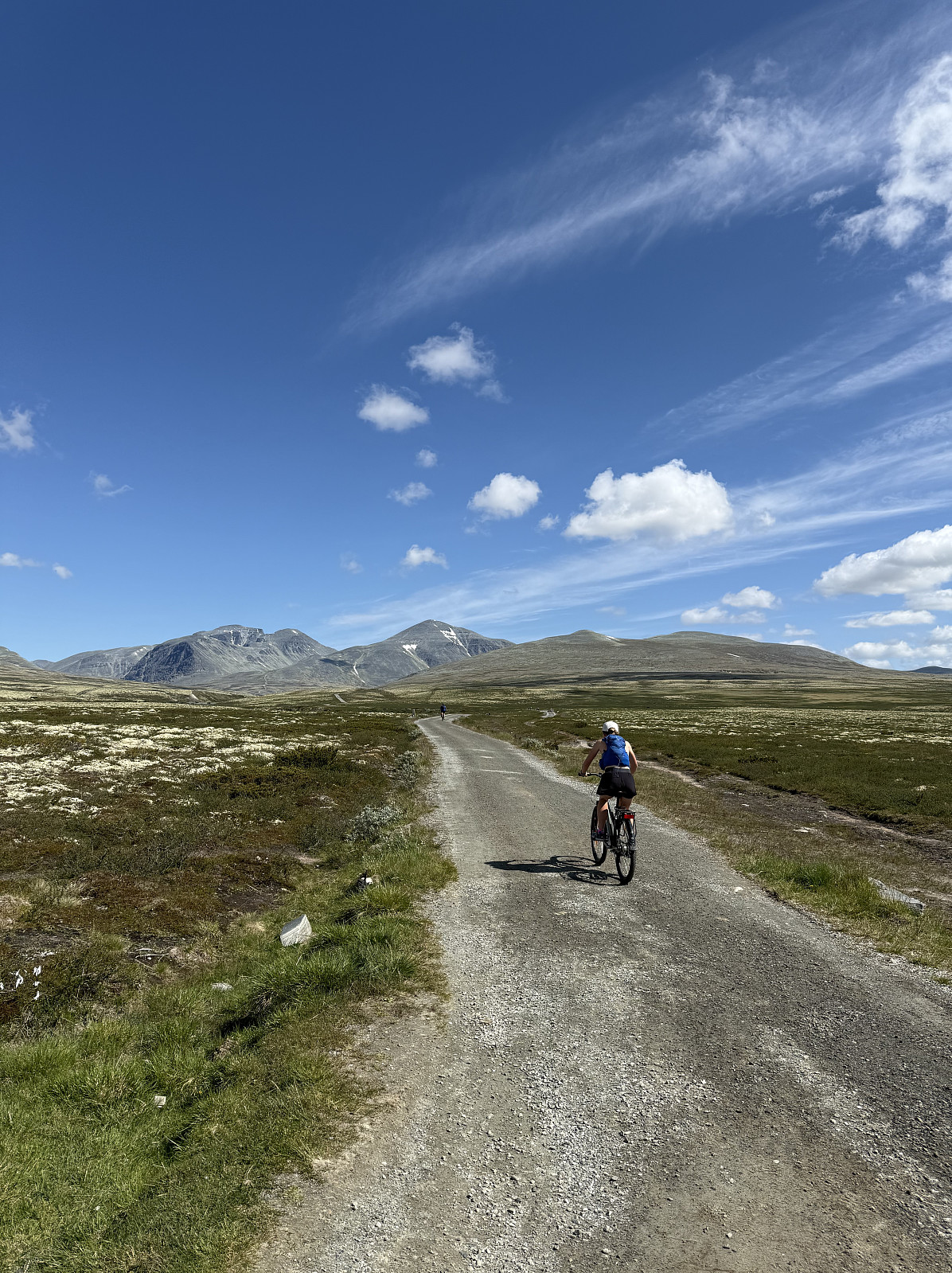
Opting to take the bicycle journey, we set off. The 6km gravel road traverses an open plateau with wide open views into Rondane. Rondslottet, Vinjeronden and Storronden form a rocky massif that we both thought to be reminiscent of something from the Scottish highlands. Indeed, if you account for the fact that we were currently at approximately 1000m asl, then the relative sizes of the mountains were akin to Ben Nevis, which is climbed for sea level. It wasn't just scale that reminded us of Scotland, but also the barren, rocky landscape and apparent lack of snow compared to Jotunheimen. We enjoyed the short ride towards the mountain, which remains in sight throughout. There was a steady stream of hikers on the road, many carrying large backpacks indicating a multi-day outing; we couldn't believe how busy it was!
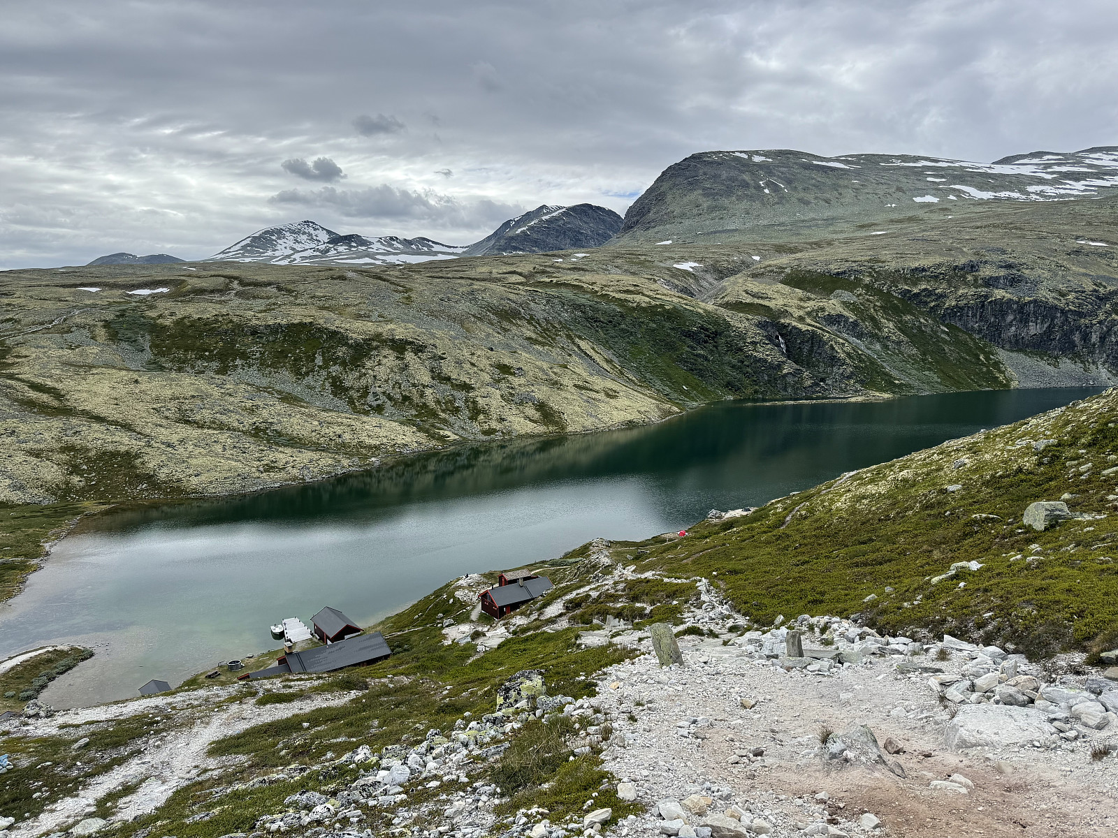
Arriving at Rondvassbu, we parked and payed for our bikes before taking a quick look at Rondvatnet and its green-ish hue (algae?). The previous few days on tricker Jotunheimen terrain had been slow, and my legs fancied a workout, so Alice and I decided to take on the climb up Rondslottet separately, agreeing to reunite at the summit.
A well-trodden trail leaves Rondvassbu, steep for 100m before continuing at a more relaxed gradient for 3.5km or so, the latter half being essentially flat. At around 1km in, the path diverges, with the left fork leading up Vinjeronden and the right fork up Storronden. Despite the easier grade, I pushed to maintain a steady pace and the hot sun did its best to make this more of a challenge. 2km in and I had arrived a 'hidden valley' with steep crags to each side. The ground here was flat, scattered with boulders and a light jog made for easier passage.
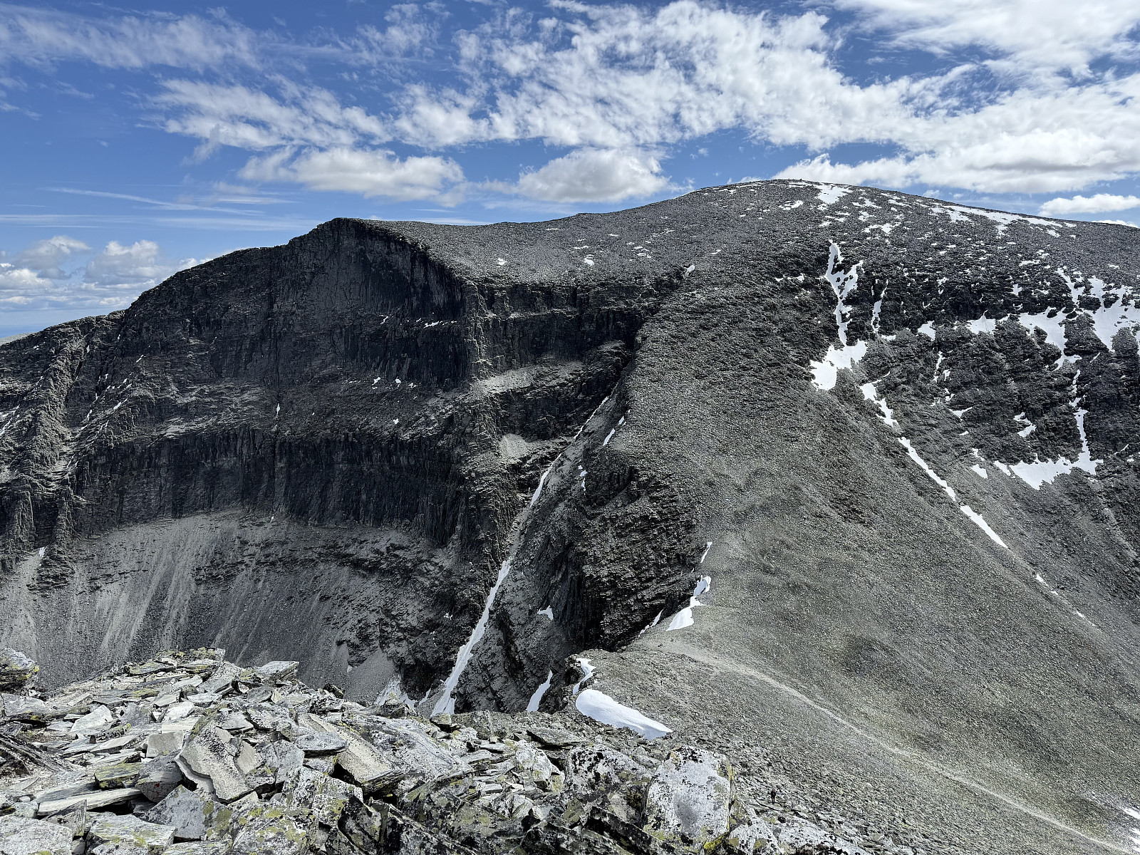
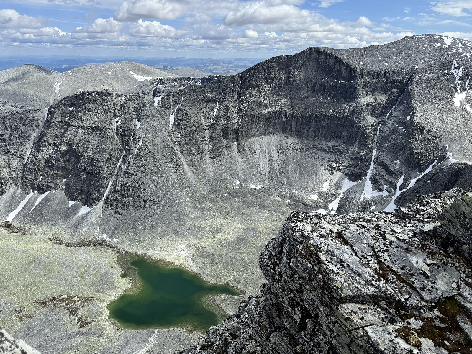
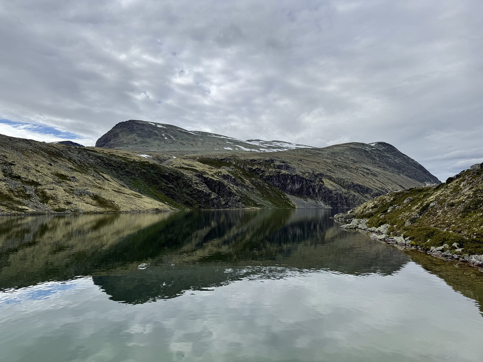
At the head of the valley is a steep path that zig-zags up looser rock towards the col between Vinjeronden and Storronden. I passed quite a few hikers carrying large bags, which looked to be arduous on the steep terrain. Arriving at the col, I peeked over to see some small tarns with the same green-ish hue as Rondvatnet, contrasting nicely against the grey rock. Taking the right turn, I pushed towards Vinjeronden.
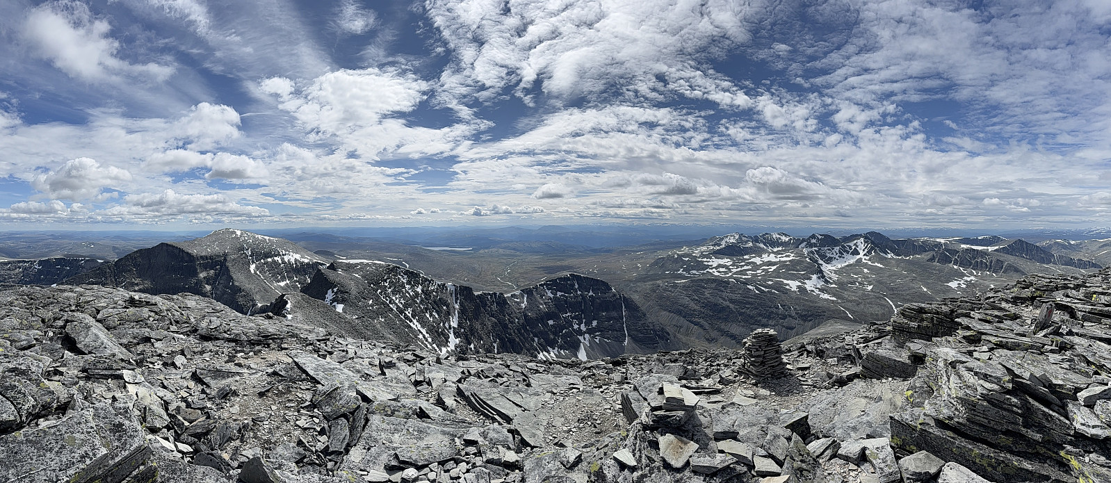
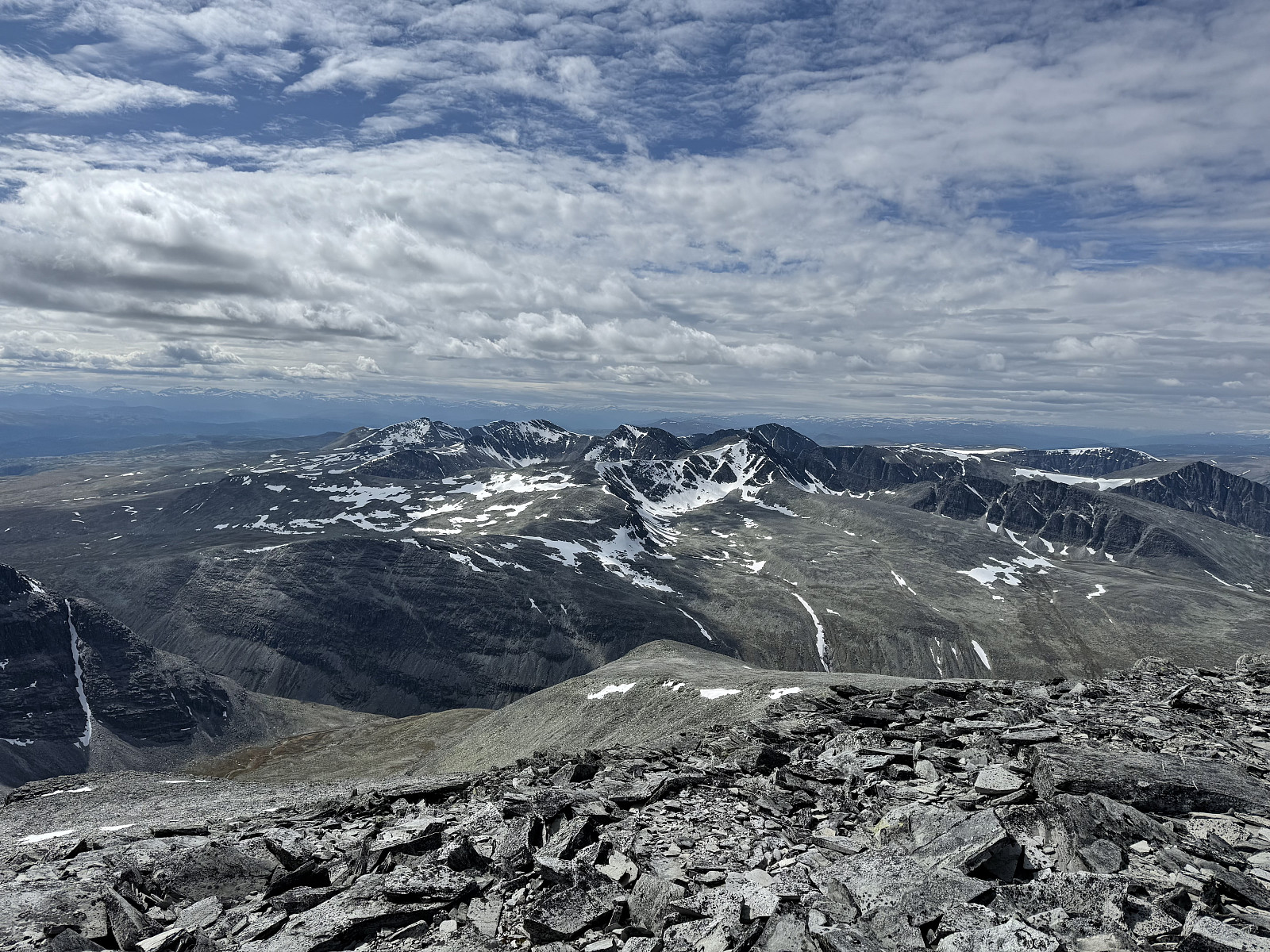
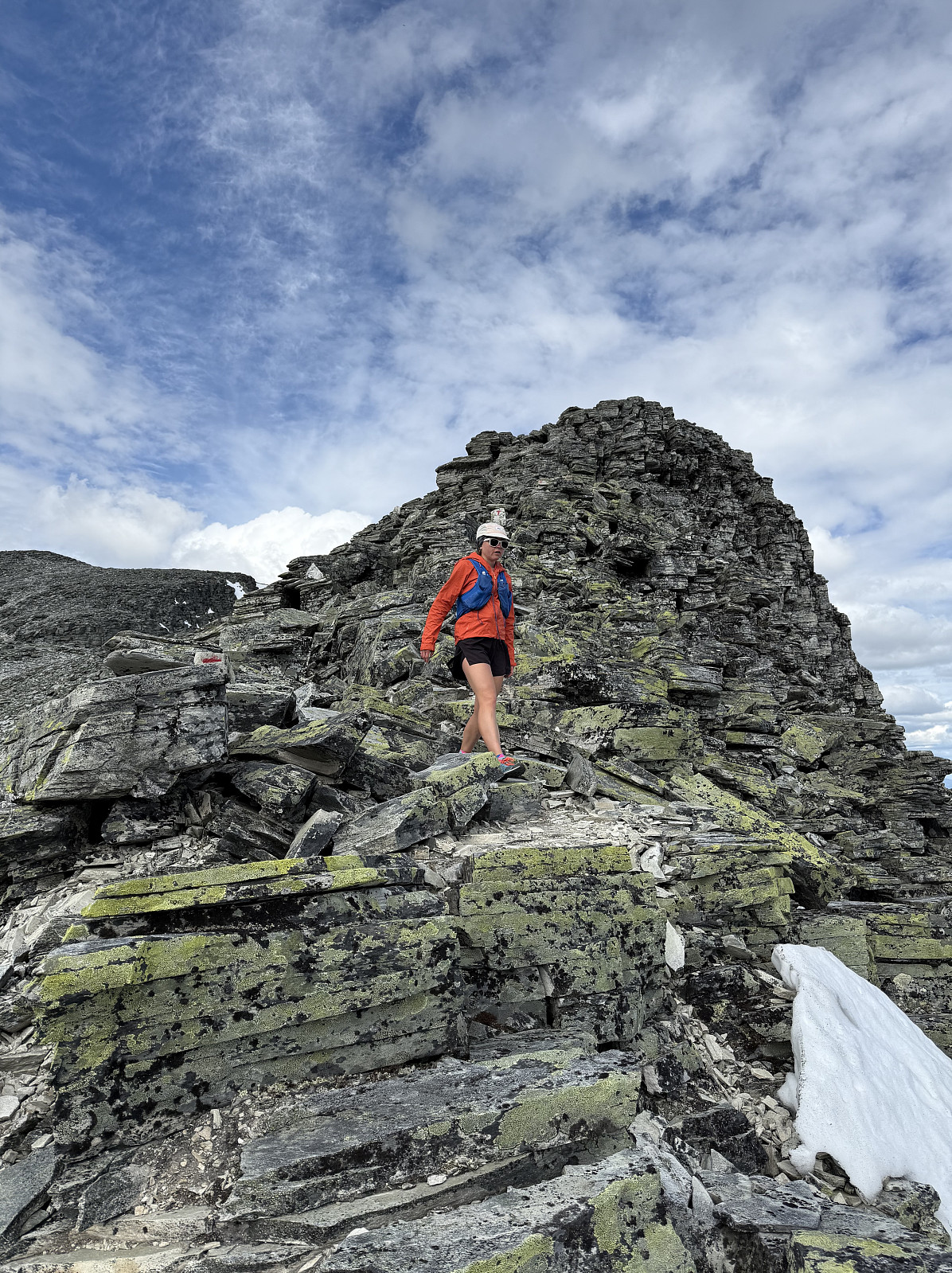
The final 400m of climbing to the summit of Vinjeronden made for an exciting workout. The rocks become larger and more sturdy; trail markings are there to direct you in the correct direction as you must scramble your own route over the boulders and to the summit. It had quickly became a full-body workout. I popped out at the summit of Vinjeronden and could see the (what looked to be fairly short) transverse across to Rondslottet. Views across to the rest of Rondane opened up and clouds began to dot the distant sky.
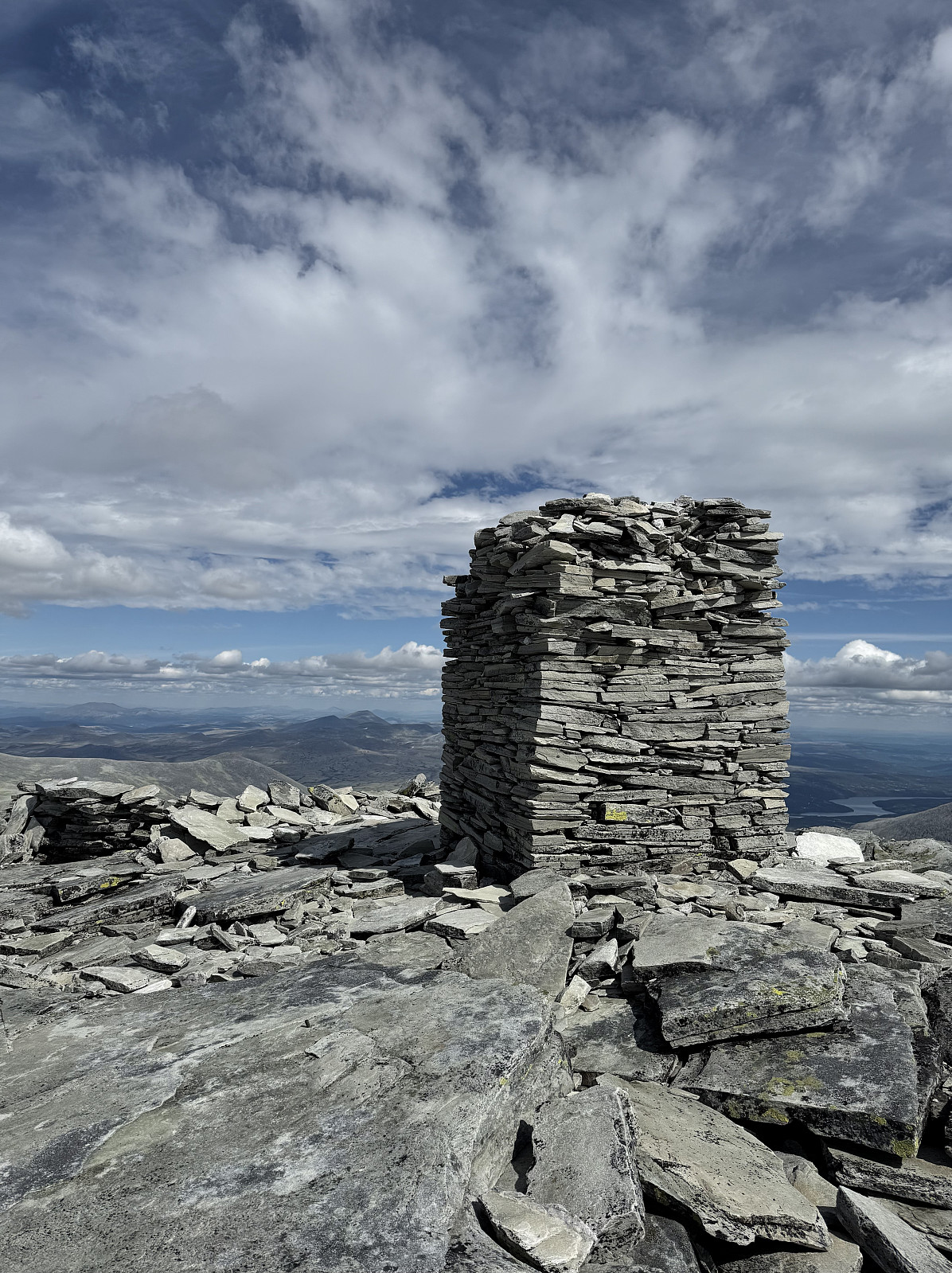
I enjoyed the initial jog down to the col between Vinjeronden and Rondslottet before exerting a final effort to the summit. Quite a few Norwegians had (in Norwegian) asked me my time, to which I had to (embarrassingly) explain that I spoke only English, and this seemed to surprise them. Approximately 1h35m later, I arrived at the huge cairn that marks the summit of Rondslottet, relishing the euphoria that comes from a sufferfest up a mountain.
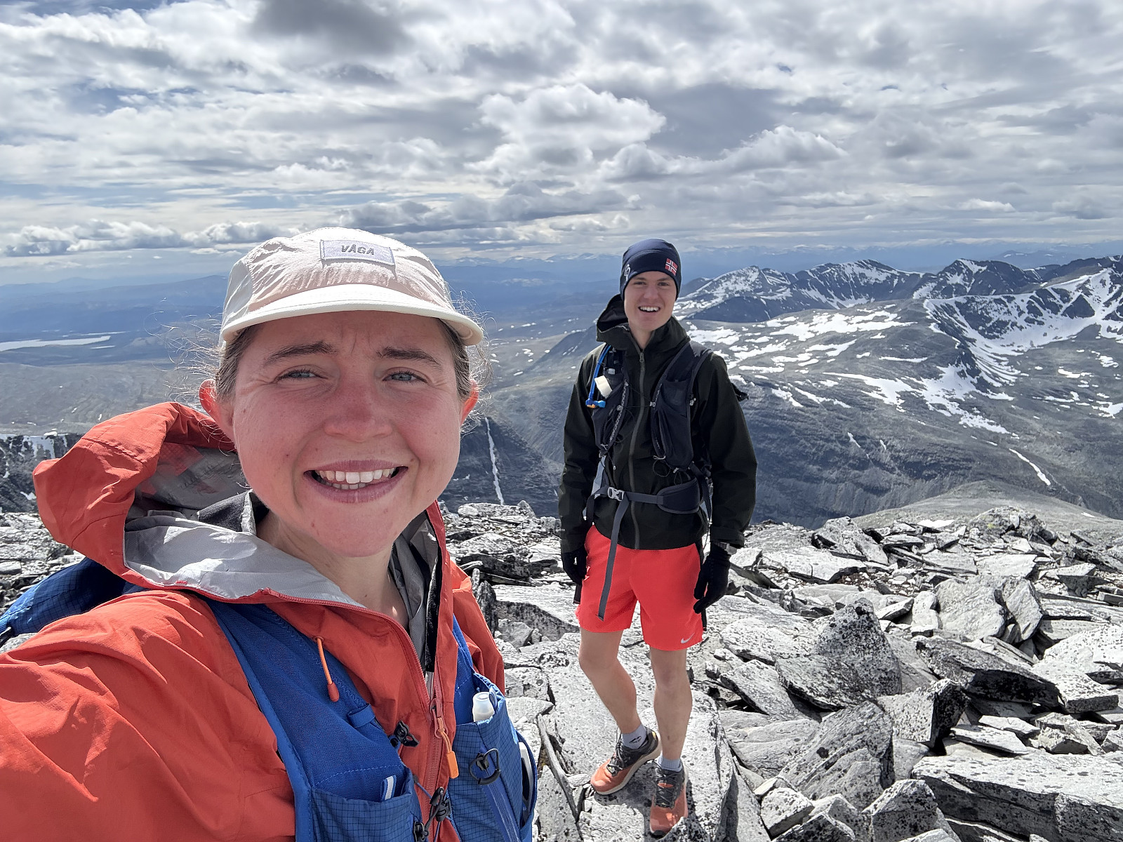
I changed, keeping myself warm. The views were phenomenal. A postcard view towards the other 2000m peaks of Rondane occupies the foreground; the background a panorama of the snow-capped peaks of Jotunheimen and Dovre. The patchy cloud and sun worked together to make these more picturesque. Having not eaten anything since breakfast back in Vågåmo, I absorbed some dried mango (quickly becoming a favourite fell food). Alice arrived 30m later, though the time had seemed to fly by.
We ate our lunch together on the summit, though I was becoming cold, so we quickly left and retraced our steps down the mountain together. Adopting a slower pace, we were both more observant of the interesting geology that formed these mountains. As we made our way down towards the col between Vinjeronden and Storronden, I suggested to Alice that we climb the 400m or so to bag Storronden (only half joking...) but she wasn't so impressed with the idea. We took a relaxed walk down to Rondvassbu, taking longer to descend than Alice had to ascend.
We hired bikes once more and pedalled the 6km back to the car at Spranget (the return ride feels blisteringly fast for it is mostly downhill); quite satisfied with our multi-modal adventure.


User comments