Archive - Date
Archive - Activity
-
Bike trip (110)
- Bike trip - mixed (25)
- Bike trip - road (85)
-
Drive (9)
- Car drive (9)
-
Other trip (3)
- Kayaking (3)
-
Ski trip (116)
- Backcountry skiing (69)
- Cross-country skiing (47)
- Trip by foot (1894)
Collected lists
-
Utvalgte topper og turmål i Bergen
(349/350)
 99%
99% -
Alle topper i Bergen
(393/398)
98%
-
Voss ≥ 100m pf.
(96/98)
97%
-
Opptur Hordaland
(144/159)
90%
-
Stasjoner på Bergensbanen
(33/40)
82%
-
Ulvik ≥ 100m pf.
(28/38)
73%
-
Hordaland ≥ 100m pf.
(622/863)
72%
-
Mjølfjell PF > 100m
(21/31)
67%
-
Jondal ≥ 100m pf.
(15/23)
65%
-
Dagsturhyttene i Vestland
(36/61)
59%
-
Sunnhordland PF >= 100m
(105/186)
56%
-
Hordaland: Hardanger PF>=100m
(194/359)
54%
-
DNT-hytter i Hordaland
(23/45)
51%
-
Kvinnherad ≥ 100m pf.
(40/79)
50%
-
Eidfjord ≥ 100m pf.
(13/42)
30%
-
Sogndal ≥ 100m pf.
(23/81)
28%
-
Gulen ≥ 100m pf.
(15/54)
27%
-
Vik i Sogn ≥ 100m pf.
(10/46)
21%
-
Sogn - Sør for Sognefjorden PF>=100m
(31/159)
19%
-
DNT-hytter i Sogn og Fjordane
(8/47)
17%

Nesheimsnipa from Bergo
- Date:
- 31.07.2022
- Characteristic:
- Hillwalk
- Duration:
- 2:51h
- Distance:
- 7.8km
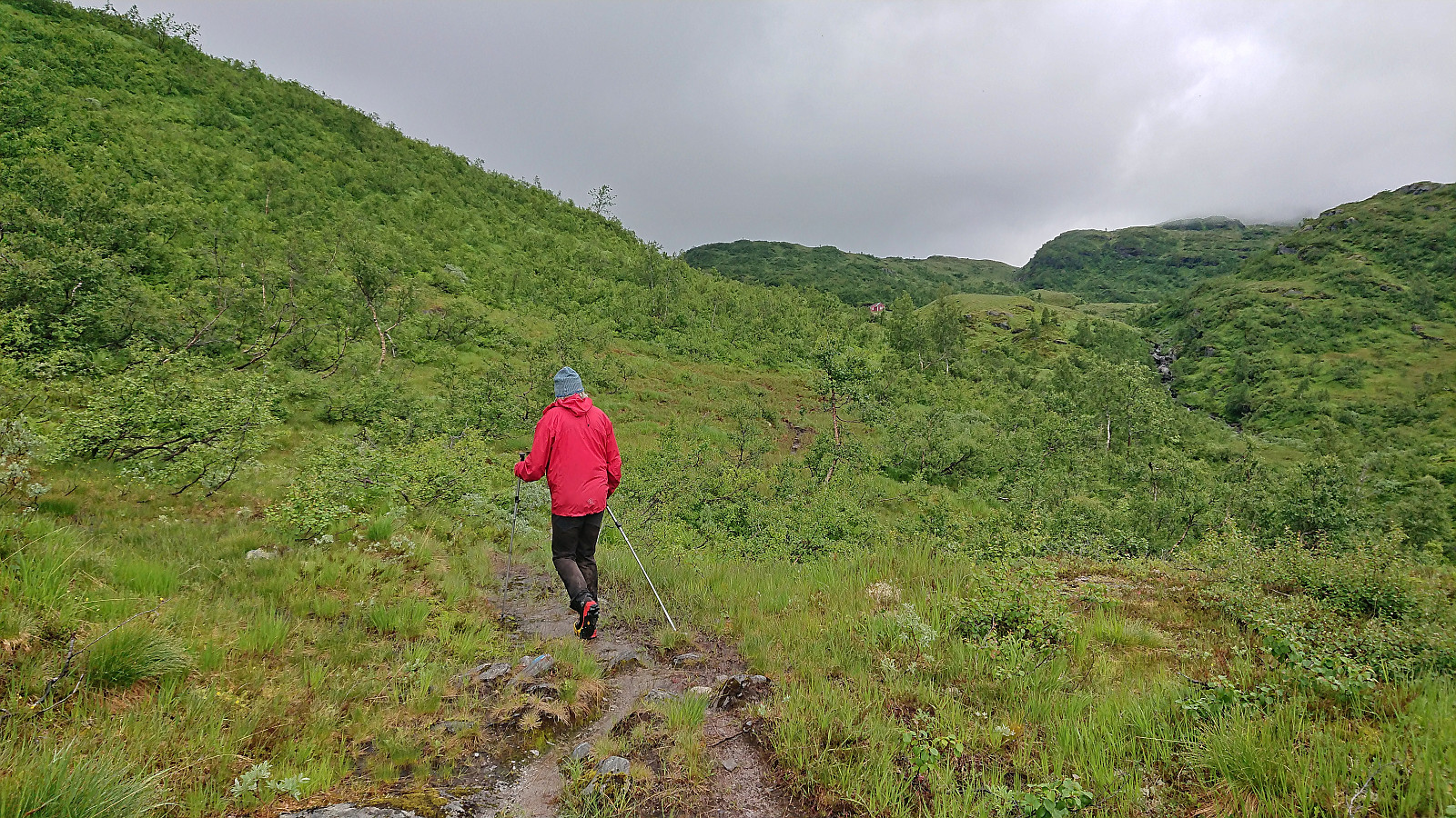
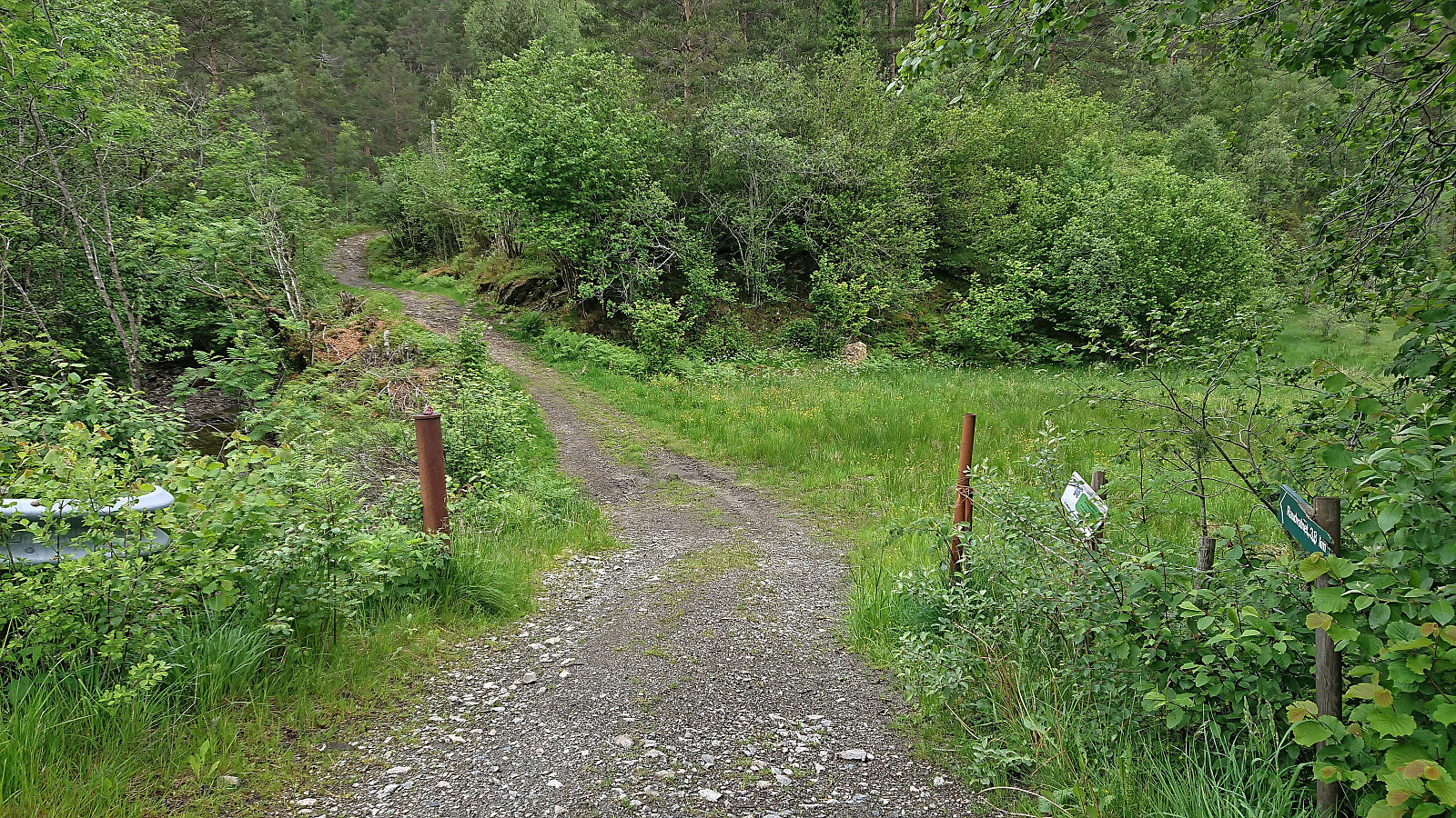
 After our visit of Storhaug , me and Petter drove the short distance to Bergo, where I had come across information that there was supposed to be a marked trail that would take us all the way to the top of Nesheimsnipa , or Blånipa as it is also referred to. This trail is also being used as part of an uphill race called Gygrakjeften Opp . Finally, I noticed that Vaksdal turlag was organizing a hike to Nesheimsnipa using the same trail a couple of weeks later. Hence the trail could not be all that bad.
We therefore parked at a small parking lot next to Eksingsdalen skule opposite a football field. From there we walked less than 200 meters west along the road to the unmarked trailhead (or rather on closer inspection there was one partly hidden blue trail marker, but no sign). Here we started up the short tractor road, followed the outskirts of the field north and passed through a gate where the marked trail began. The trail was >>>
After our visit of Storhaug , me and Petter drove the short distance to Bergo, where I had come across information that there was supposed to be a marked trail that would take us all the way to the top of Nesheimsnipa , or Blånipa as it is also referred to. This trail is also being used as part of an uphill race called Gygrakjeften Opp . Finally, I noticed that Vaksdal turlag was organizing a hike to Nesheimsnipa using the same trail a couple of weeks later. Hence the trail could not be all that bad.
We therefore parked at a small parking lot next to Eksingsdalen skule opposite a football field. From there we walked less than 200 meters west along the road to the unmarked trailhead (or rather on closer inspection there was one partly hidden blue trail marker, but no sign). Here we started up the short tractor road, followed the outskirts of the field north and passed through a gate where the marked trail began. The trail was >>>
Storhaug via Trefallstølen
- Date:
- 31.07.2022
- Characteristic:
- Hillwalk
- Duration:
- 1:49h
- Distance:
- 5.0km
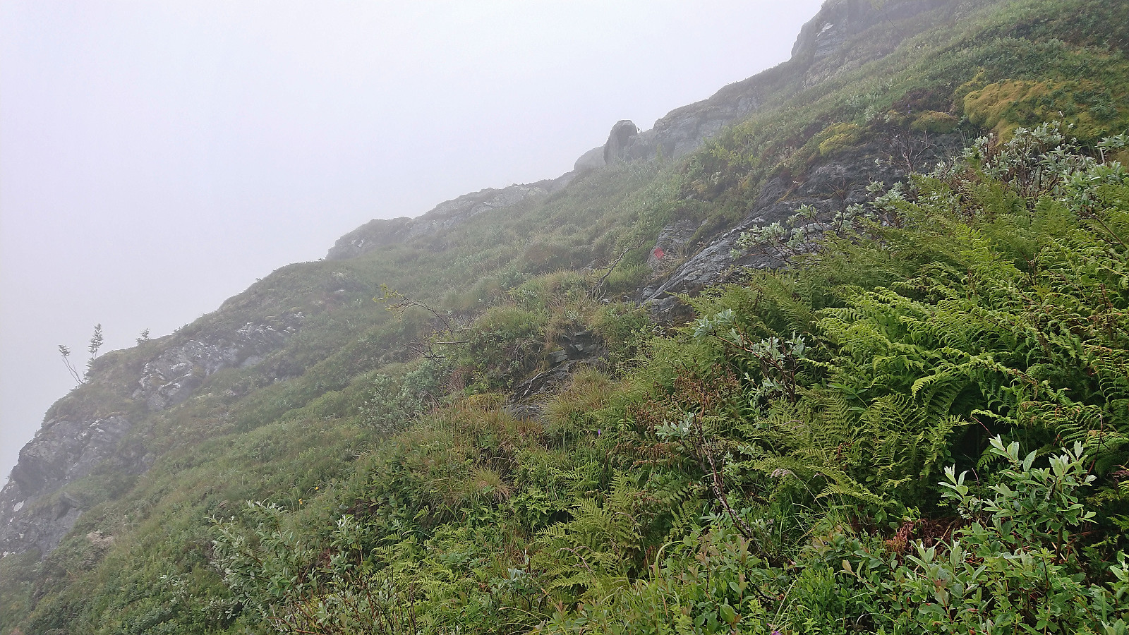
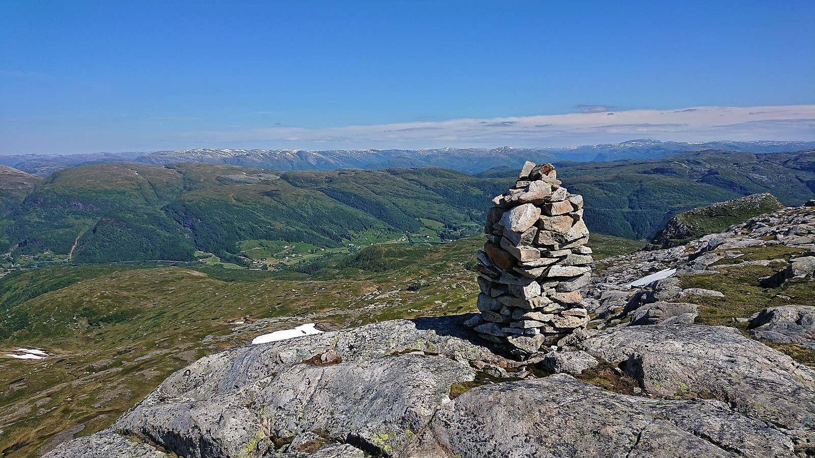
 A return to Trefall in Eksingedalen with Petter , this time to visit the final three summits Petter had left in Vaksdal. First up was Storhaug , a peak we had passed close by on two previous occasions but not had the time to ascend. We found parking next to the road just across the bridge from the marked trailhead and followed the steep marked trail up to Trefallstølen . Here we turned west and headed off-trail into the thickening fog in the direction of the summit. The large cairn was reached without any issues, although due to the fog we cannot comment much with regards to the views. We did however spot what appeared to be a slightly higher small hill just to the south of the cairn, and later checks via hoydedata.no indeed confirmed that this spot was a tiny bit higher. It was also marked by a metal trig bolt. Satisfied >>>
Hornafjellet and Nipekråni
- Date:
- 22.07.2022
- Characteristic:
- Hillwalk
- Duration:
- 6:57h
- Distance:
- 15.8km
 Another day of hiking with Petter , this time using Mo as our starting point. We had initially thought to first ascend to Mostølen via the trail from Mo. But after coming across a recommendation by Nordhordland Turlag to rather use the marked trail starting from the northern end of Modalstunnelen, and describing the trail from Mo as steep and unstable, we changed our plans and went for this alternative route instead.
We parked just outside the tunnel and easily located the marked trailhead about 150 meters to the northwest. While the trailhead was indicated by a total of three different signs, the start of the trail itself was however much more modest. This would nevertheless soon improve as the trail started winding its way up the steep ascent between the trees. Further up the trail again turned weak at times, especially when crossing wet areas, but there were most >>>
Another day of hiking with Petter , this time using Mo as our starting point. We had initially thought to first ascend to Mostølen via the trail from Mo. But after coming across a recommendation by Nordhordland Turlag to rather use the marked trail starting from the northern end of Modalstunnelen, and describing the trail from Mo as steep and unstable, we changed our plans and went for this alternative route instead.
We parked just outside the tunnel and easily located the marked trailhead about 150 meters to the northwest. While the trailhead was indicated by a total of three different signs, the start of the trail itself was however much more modest. This would nevertheless soon improve as the trail started winding its way up the steep ascent between the trees. Further up the trail again turned weak at times, especially when crossing wet areas, but there were most >>>
Askjellfjellet
- Date:
- 19.07.2022
- Characteristic:
- Hillwalk
- Duration:
- 1:33h
- Distance:
- 5.2km
 After our visits of Sørdalsfjellet, Hornafjellet and Gavlafjellet , Petter and I drove the short distance to Skjerjavatnet where we parked at a gravel-covered area right next to the road. Petter immediately started his ascent of Askjellfjellet while I first changed into shorts and sneakers as the until now rather unstable weather finally had decided to stay warm and sunny. We therefore followed slightly different ascent routes and did meet up until almost at the summit. In any case, it was more or less a matter of simply following the ridge until arriving at the large cairn, and with no difficult sections to speak of. After the mandatory summit pictures, we returned together along more or less the same route as I had used for my ascent, thus concluding an excellent day of hiking in Modalen with a total of four new summits added to the list of visited summits >>>
Gråfjellet, Høgabu and Bergsbukken (from Lid to Vaksdal)
- Date:
- 01.07.2022
- Characteristic:
- Hillwalk
- Duration:
- 8:49h
- Distance:
- 28.3km
 On what looked like it would be the last sunny and warm day for a while, I took the advice of the weather man on the morning radio and took the Friday off to go hiking. Started by taking the train to Dale and the bus to Bergsdalen where I got off at the bus stop called "Lid aust". This put me directly at the start of the marked trail to Høgabu which I then proceeded to follow.
For the first part of the ascent I was escorted by a squadron of buzzing flies, but thankfully they gave up their pursuit as I climbed above the tree line, partly due to a cool breeze from the southwest. On my way to Høgabu I had initially planned to ascend Gråfjellet from the northeast via Storaskaret as there is supposed to be a weak trail crossing the ridge of Gråfjellet. However, as I did not locate the start of this trail, >>>
On what looked like it would be the last sunny and warm day for a while, I took the advice of the weather man on the morning radio and took the Friday off to go hiking. Started by taking the train to Dale and the bus to Bergsdalen where I got off at the bus stop called "Lid aust". This put me directly at the start of the marked trail to Høgabu which I then proceeded to follow.
For the first part of the ascent I was escorted by a squadron of buzzing flies, but thankfully they gave up their pursuit as I climbed above the tree line, partly due to a cool breeze from the southwest. On my way to Høgabu I had initially planned to ascend Gråfjellet from the northeast via Storaskaret as there is supposed to be a weak trail crossing the ridge of Gråfjellet. However, as I did not locate the start of this trail, >>>
Raudnipa and Trollabotshaugen from Raunekleiv
- Date:
- 16.06.2022
- Characteristic:
- Hillwalk
- Duration:
- 4:17h
- Distance:
- 15.6km
 Given that I would be spending all of Friday and Saturday indoors organizing a conference, I left work early the day before and got on a bus to Raunekleiv. The plan was to revisit Raudnipa , but this time ascending from the south via Raudvatnet and also include a visit of Trollabotshaugen , a minor summit on the Alle topper i Bergen list. After a short detour along a smaller road to avoid a tunnel, the marked trailhead was located next to Raunekleiva parkering . As a side note, check out the picture used for the PB-element for the parking lot. Note how it seems to be without an entrance. ;)
I followed the marked route to Raudvatnet - a tractor road that soon turned into a trail. The vertical meters were relatively evenly spread out, resulting in an ascent without any steep sections. At Raudvatnet, I followed the trail on the east side of the lake. This is most >>>
Given that I would be spending all of Friday and Saturday indoors organizing a conference, I left work early the day before and got on a bus to Raunekleiv. The plan was to revisit Raudnipa , but this time ascending from the south via Raudvatnet and also include a visit of Trollabotshaugen , a minor summit on the Alle topper i Bergen list. After a short detour along a smaller road to avoid a tunnel, the marked trailhead was located next to Raunekleiva parkering . As a side note, check out the picture used for the PB-element for the parking lot. Note how it seems to be without an entrance. ;)
I followed the marked route to Raudvatnet - a tractor road that soon turned into a trail. The vertical meters were relatively evenly spread out, resulting in an ascent without any steep sections. At Raudvatnet, I followed the trail on the east side of the lake. This is most >>>
Fjordsyn from Agnavika
- Date:
- 08.05.2022
- Characteristic:
- Hike
- Duration:
- 1:13h
- Distance:
- 2.9km
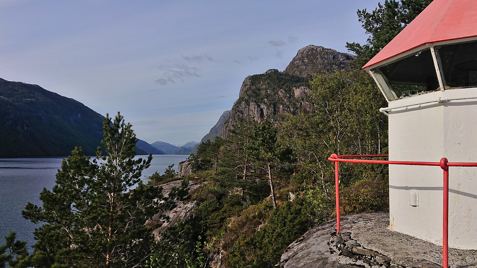 On the way home from Sogndal, Sigjoern (Sigbjørn Holm) , Marthine and I, decided to make a short stop at Stanghelle to enjoy the excellent weather for a visit of Fjordsyn . We parked at the parking lot in Agnavika . It was however also possible to park along the road even closer to the trailhead. The marked trail was more varied than expected but straightforward to follow and we quickly arrived at very nice location of Fjordsyn, with Veafjorden and Osterøy to the west and Storafjellet looming in the background to the north. From the small lighthouse just southwest of the cabin we could even spot Solaråsen in the distance. After a short break we returned along the same route and completed the drive home to Bergen.
Five summits west and one east of Norddalen
- Date:
- 24.04.2022
- Characteristic:
- Backcountry skiing
- Duration:
- 8:12h
- Distance:
- 28.8km
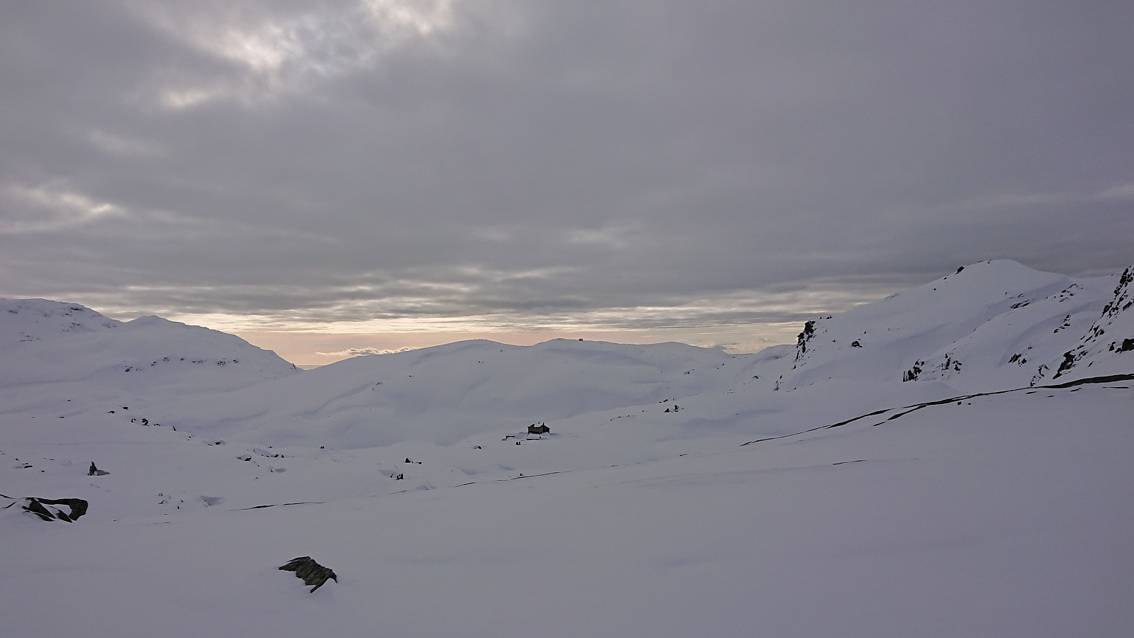
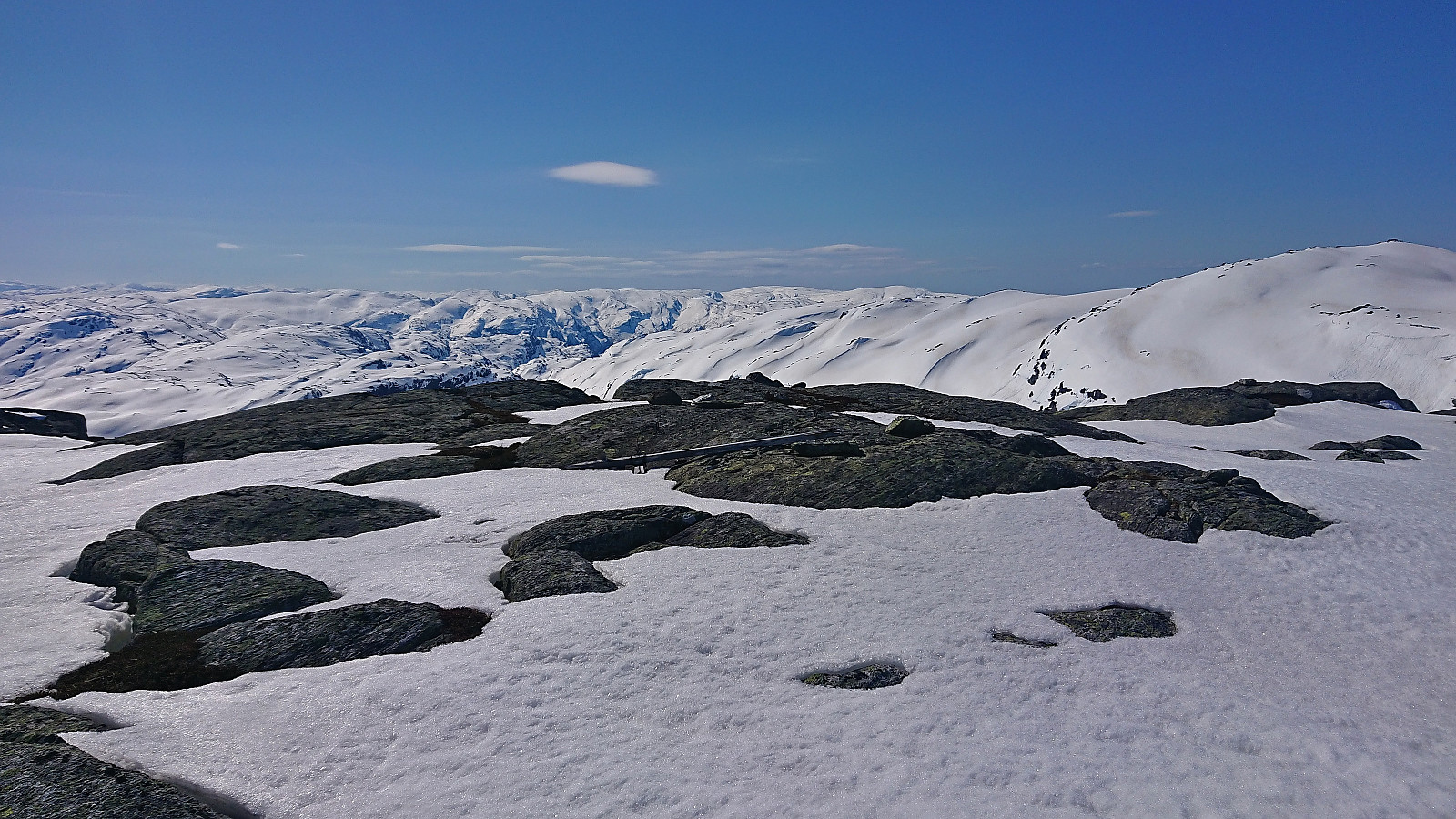 After spending Saturday at Varaldsøy with petter (Petter Bjørstad) , we agreed to also take full advantage of the perfect weather forecast for the following Sunday. Petter therefore picked me up at 07:00 for a drive to Norddalen where the plan was to make use of the excellent skiing conditions to visit as many peaks as possible, mainly on the west side of the valley. Upon arriving, the sun was shining from a cloudless blue sky and there was next to no wind. Plenty of snow still in the area and after finding parking next to the road, the skis could be put on as soon as we left the road.
We first followed the valley on the west side of the river, before finding a safe and straightforward ascent to the summit of Eggane . From there we struggled a bit to find the best route down to Martastølen, as there were a couple of steep >>>
After spending Saturday at Varaldsøy with petter (Petter Bjørstad) , we agreed to also take full advantage of the perfect weather forecast for the following Sunday. Petter therefore picked me up at 07:00 for a drive to Norddalen where the plan was to make use of the excellent skiing conditions to visit as many peaks as possible, mainly on the west side of the valley. Upon arriving, the sun was shining from a cloudless blue sky and there was next to no wind. Plenty of snow still in the area and after finding parking next to the road, the skis could be put on as soon as we left the road.
We first followed the valley on the west side of the river, before finding a safe and straightforward ascent to the summit of Eggane . From there we struggled a bit to find the best route down to Martastølen, as there were a couple of steep >>>
Småbrekkebukken from Småbrekkene
- Date:
- 06.03.2022
- Characteristic:
- Backcountry skiing
- Duration:
- 5:42h
- Distance:
- 16.9km
 For more than a year, Småbrekkebukken had been my last remaining summit on the Samnanger ≥ 100m pf. list . So when The Norwegian Trekking Association (DNT) , or more specifically Voss Utferdslag , organized a guided skiing trip, I was of course among the first to sign up.
After taking the train to Voss, I joined the others at Holbergsplass, from where we carpooled to Småbrekkene to start the real trip. We initially followed the marked trail/road towards Gullhorgabu , but after a short break northeast of Småbrekkebukken, we had left the marked trail and instead continued up the valley northwest of the summit.
Here we came across an area where most of the snow had been removed by strong winds, and we therefore had to backtrack a bit to find a slightly different route than planned. This however did not present any real issues and after a large U-turn to avoid the steepest areas we soon arrived at the summit, which >>>
For more than a year, Småbrekkebukken had been my last remaining summit on the Samnanger ≥ 100m pf. list . So when The Norwegian Trekking Association (DNT) , or more specifically Voss Utferdslag , organized a guided skiing trip, I was of course among the first to sign up.
After taking the train to Voss, I joined the others at Holbergsplass, from where we carpooled to Småbrekkene to start the real trip. We initially followed the marked trail/road towards Gullhorgabu , but after a short break northeast of Småbrekkebukken, we had left the marked trail and instead continued up the valley northwest of the summit.
Here we came across an area where most of the snow had been removed by strong winds, and we therefore had to backtrack a bit to find a slightly different route than planned. This however did not present any real issues and after a large U-turn to avoid the steepest areas we soon arrived at the summit, which >>>
Toppfjellet from Eide
- Date:
- 23.10.2021
- Characteristic:
- Hillwalk
- Duration:
- 4:42h
- Distance:
- 10.9km
 It is not often that one gets to be among the first three registered visits for a summit on the Hordaland ≥ 100m pf. list, but given that Toppfjellet in Modalen only had two previous visits this should be possible. The most recent visit was by Runemb (Rune Blomberg) back in 2013, and thanks to his report I did not have to plan much to find the best route.
After taking the train to Dale and then the bus to Eide, I located the marked trailhead and started on a trail marked with a combination of red paint and red plastic tubes. Note that while the trailhead was marked, it may not be the easiest to spot from the main road. There were however signs for both Eidsstølen and Brørvik within the first couple of meters. While the route was clearly marked, the trail itself was often more difficult to spot. The fact that the trail was soon covered by snow did not help either of course. >>>
It is not often that one gets to be among the first three registered visits for a summit on the Hordaland ≥ 100m pf. list, but given that Toppfjellet in Modalen only had two previous visits this should be possible. The most recent visit was by Runemb (Rune Blomberg) back in 2013, and thanks to his report I did not have to plan much to find the best route.
After taking the train to Dale and then the bus to Eide, I located the marked trailhead and started on a trail marked with a combination of red paint and red plastic tubes. Note that while the trailhead was marked, it may not be the easiest to spot from the main road. There were however signs for both Eidsstølen and Brørvik within the first couple of meters. While the route was clearly marked, the trail itself was often more difficult to spot. The fact that the trail was soon covered by snow did not help either of course. >>>
