Archive - Date
Archive - Activity
-
Bike trip (106)
- Bike trip - mixed (25)
- Bike trip - road (81)
-
Drive (9)
- Car drive (9)
-
Other trip (3)
- Kayaking (3)
-
Ski trip (109)
- Backcountry skiing (65)
- Cross-country skiing (44)
- Trip by foot (1735)
Collected lists
-
Utvalgte topper og turmål i Bergen
(330/331)
 99%
99% -
Alle topper i Bergen
(378/385)
98%
-
Kvam ≥ 100m pf.
(41/44)
93%
-
Opptur Hordaland
(143/159)
89%
-
Voss ≥ 100m pf.
(84/98)
85%
-
Stasjoner på Bergensbanen
(28/36)
77%
-
Hordaland ≥ 100m pf.
(585/863)
67%
-
Ulvik ≥ 100m pf.
(24/38)
63%
-
Dagsturhyttene i Vestland
(33/61)
54%
-
Sunnhordland PF >= 100m
(99/186)
53%
-
DNT-hytter i Hordaland
(22/45)
48%
-
Jondal ≥ 100m pf.
(11/23)
47%
-
Hordaland: Hardanger PF>=100m
(162/359)
45%
-
Kvinnherad ≥ 100m pf.
(35/79)
44%
-
Sogndal ≥ 100m pf.
(23/81)
28%
-
DNT-hytter i Sogn og Fjordane
(8/47)
17%
-
Eidfjord ≥ 100m pf.
(6/42)
14%
-
Etne ≥ 100m pf.
(7/51)
13%
-
Ullensvang ≥ 100m pf.
(15/153)
9%
-
Opptur i Sogn og Fjordane peaks
(17/177)
9%

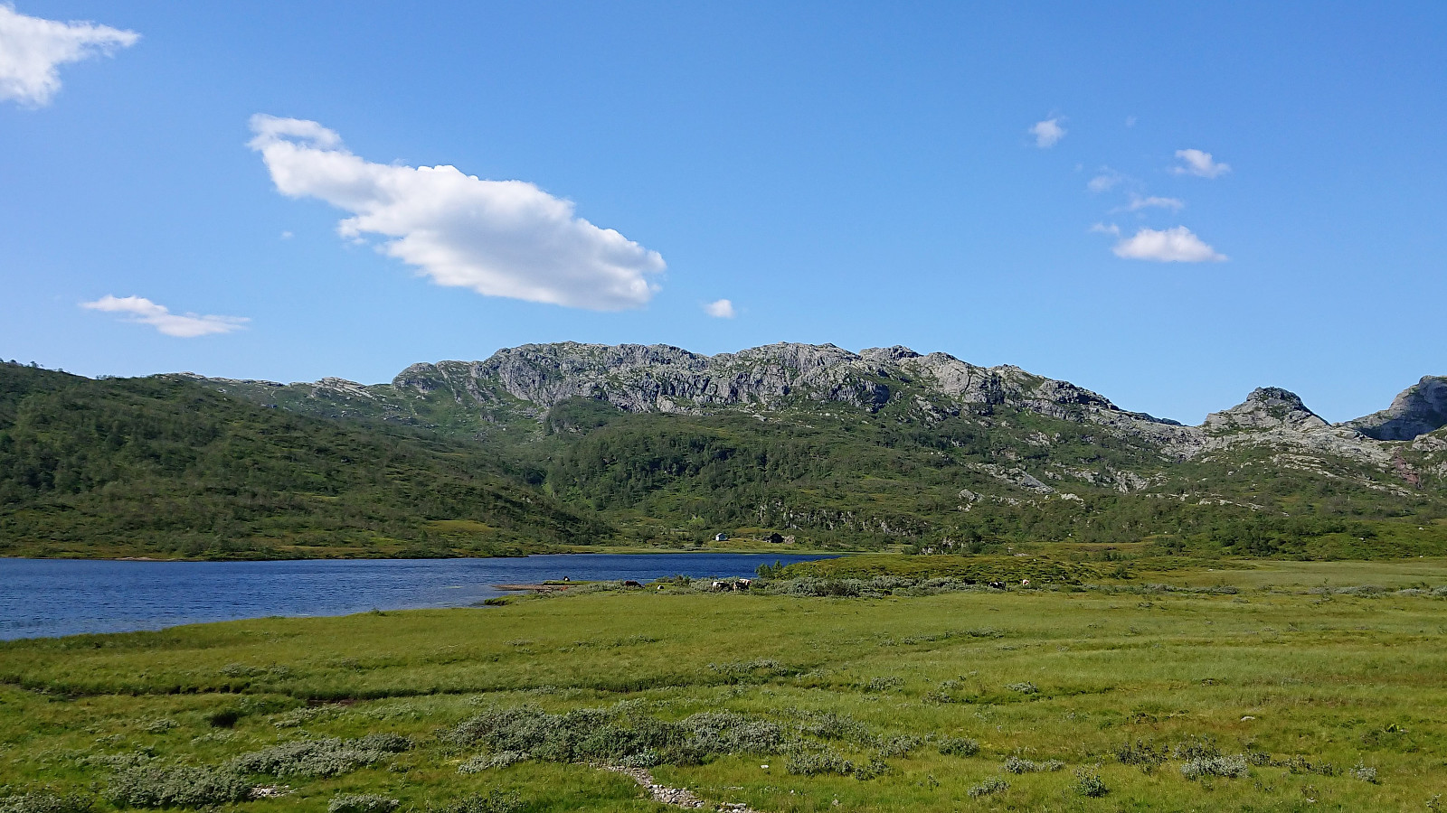
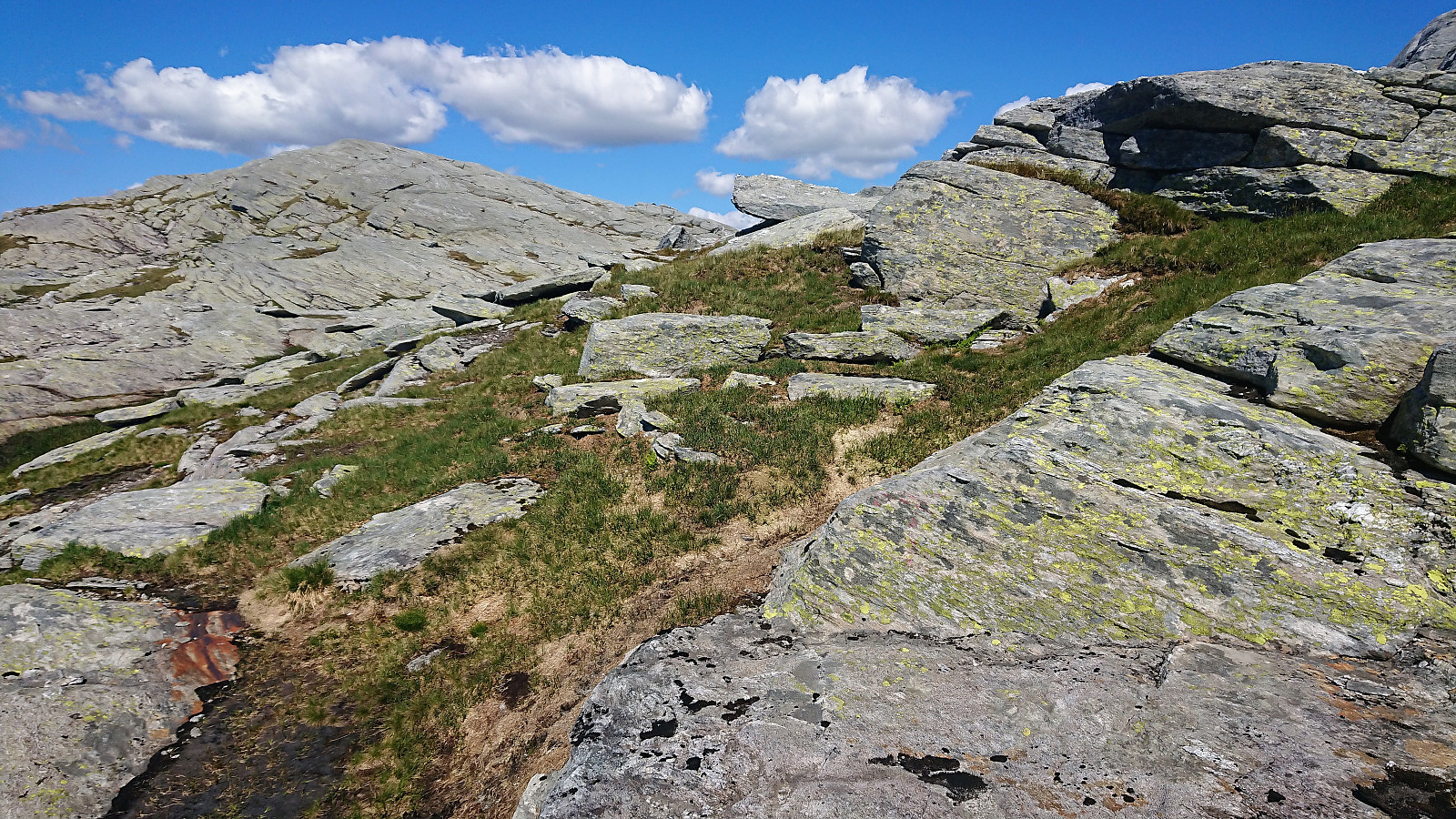
Botnanuten from Furedalen
- Date:
- 29.08.2020
- Characteristic:
- Hillwalk
- Duration:
- 4:48h
- Distance:
- 17.2km
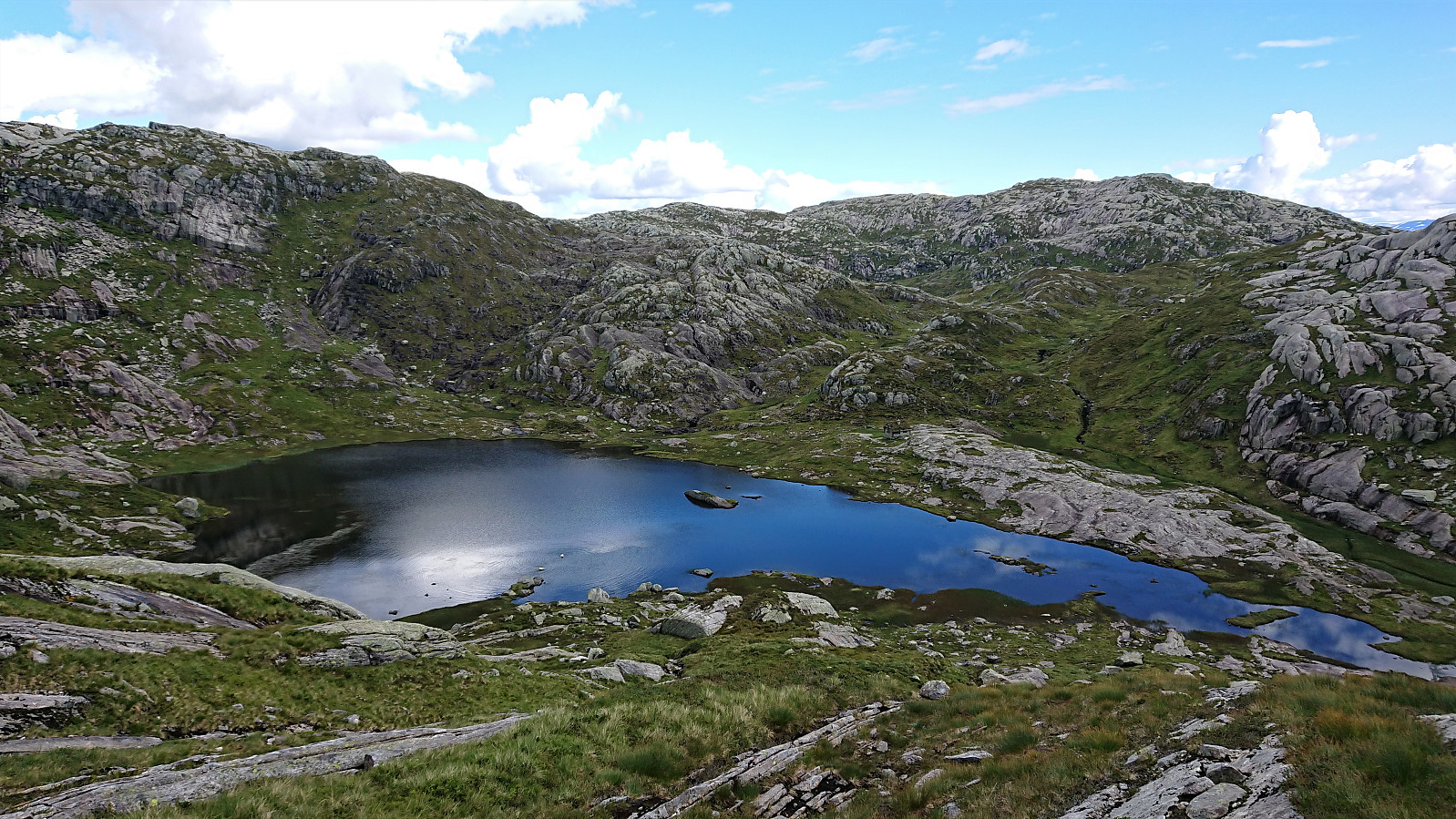 We started from a parking lot next to a cabin my sister and her family were renting for the weekend. After first walking north along the main road for a couple hundred meters, we continued on the gravel road around Kvinnhovden, before taking a wet shortcut to reach Aktiven Skiheis .
Next, the bridge across Kvennelvi was crossed and after a short stretch on a trail, we followed the gravel road at Øvre Kvernaskogen until it came to an end. Here a weak and wet trail started, that soon connected with the slightly better old trail heading to Byrkjesete. At Byrkjesete, we continued on the unmarked trail up to Storebotnen and up to Sunnvoredalvatnet.
From Sunnvoredalvatnet I continued on my own for a short off-trail detour to the summit of Botnanuten . There were some steep sections to avoid, but overall the ascent was straightforward. >>>
We started from a parking lot next to a cabin my sister and her family were renting for the weekend. After first walking north along the main road for a couple hundred meters, we continued on the gravel road around Kvinnhovden, before taking a wet shortcut to reach Aktiven Skiheis .
Next, the bridge across Kvennelvi was crossed and after a short stretch on a trail, we followed the gravel road at Øvre Kvernaskogen until it came to an end. Here a weak and wet trail started, that soon connected with the slightly better old trail heading to Byrkjesete. At Byrkjesete, we continued on the unmarked trail up to Storebotnen and up to Sunnvoredalvatnet.
From Sunnvoredalvatnet I continued on my own for a short off-trail detour to the summit of Botnanuten . There were some steep sections to avoid, but overall the ascent was straightforward. >>>
Skiing: Steinskvanndalen
- Date:
- 13.03.2020
- Characteristic:
- Cross-country skiing
- Duration:
- 3:49h
- Distance:
- 16.3km
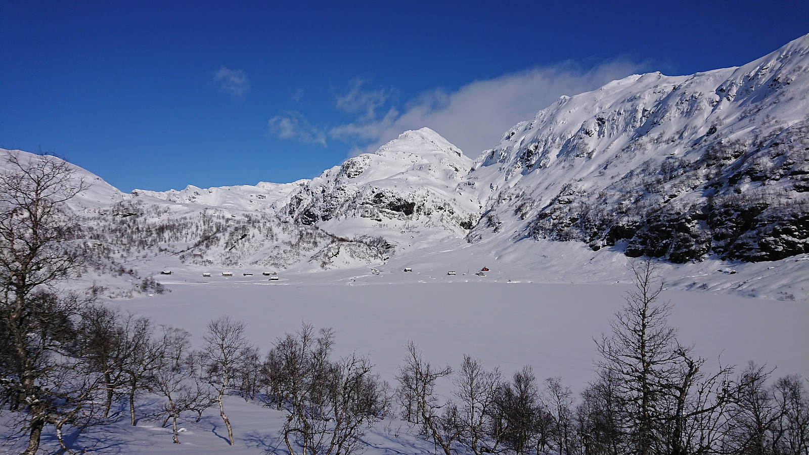 With all meetings suddenly cancelled due to the Coronavirus, I decided to instead make use of the perfect weather for a skiing trip in Steinskvanndalen, an area I had previously only visited in the summer. We parked at Løkjentunet, paid the 100 kr fee via Vipps, and from there walked a short stretch along the main road to Kvernavollen. After some initial struggles, we finally connected with the marked ski trail to Steinskvanndalen and could enjoy freshly laid ski tracks.
We continued north to Øvre Kvanndalsvatnet (the last stretch without any tracks), before turning back and reconnecting with the marked ski trail, which we then followed for a roundtrip, finally taking us back to the main road. Again, we struggled to find the best route towards the main road, first making a detour in the wrong >>>
With all meetings suddenly cancelled due to the Coronavirus, I decided to instead make use of the perfect weather for a skiing trip in Steinskvanndalen, an area I had previously only visited in the summer. We parked at Løkjentunet, paid the 100 kr fee via Vipps, and from there walked a short stretch along the main road to Kvernavollen. After some initial struggles, we finally connected with the marked ski trail to Steinskvanndalen and could enjoy freshly laid ski tracks.
We continued north to Øvre Kvanndalsvatnet (the last stretch without any tracks), before turning back and reconnecting with the marked ski trail, which we then followed for a roundtrip, finally taking us back to the main road. Again, we struggled to find the best route towards the main road, first making a detour in the wrong >>>
Hellestveitåsen and Seberg
- Date:
- 27.10.2019
- Characteristic:
- Hike
- Duration:
- 0:30h
- Distance:
- 1.9km
 Before returning to Bergen (after our hike to Skrott and Geitafjellet ), me and Endre ( Fjellsamleren (Endre Myrdal Olsen) ) decided to make a short detour to Hellestveitåsen , aiming to also reach the viewpoint at Seberg before it got too dark. An initial attempt to continue driving along the gravel road beyond Hellestveit Gard was quickly abandoned. We therefore parked next to the farm, hoping nobody would mind, and followed the gravel road towards the summit.
When the road ended, a trail took us up to a gate leading into a spruce forest. The forest was relatively dense and provided next to no views, but we had little trouble walking in between the trees. Locating the highest point was more challenging, as there were several similar options to choose from. After visiting all of the most likely candidates we returned to the gravel road, ready for some hopefully much better >>>
Before returning to Bergen (after our hike to Skrott and Geitafjellet ), me and Endre ( Fjellsamleren (Endre Myrdal Olsen) ) decided to make a short detour to Hellestveitåsen , aiming to also reach the viewpoint at Seberg before it got too dark. An initial attempt to continue driving along the gravel road beyond Hellestveit Gard was quickly abandoned. We therefore parked next to the farm, hoping nobody would mind, and followed the gravel road towards the summit.
When the road ended, a trail took us up to a gate leading into a spruce forest. The forest was relatively dense and provided next to no views, but we had little trouble walking in between the trees. Locating the highest point was more challenging, as there were several similar options to choose from. After visiting all of the most likely candidates we returned to the gravel road, ready for some hopefully much better >>>
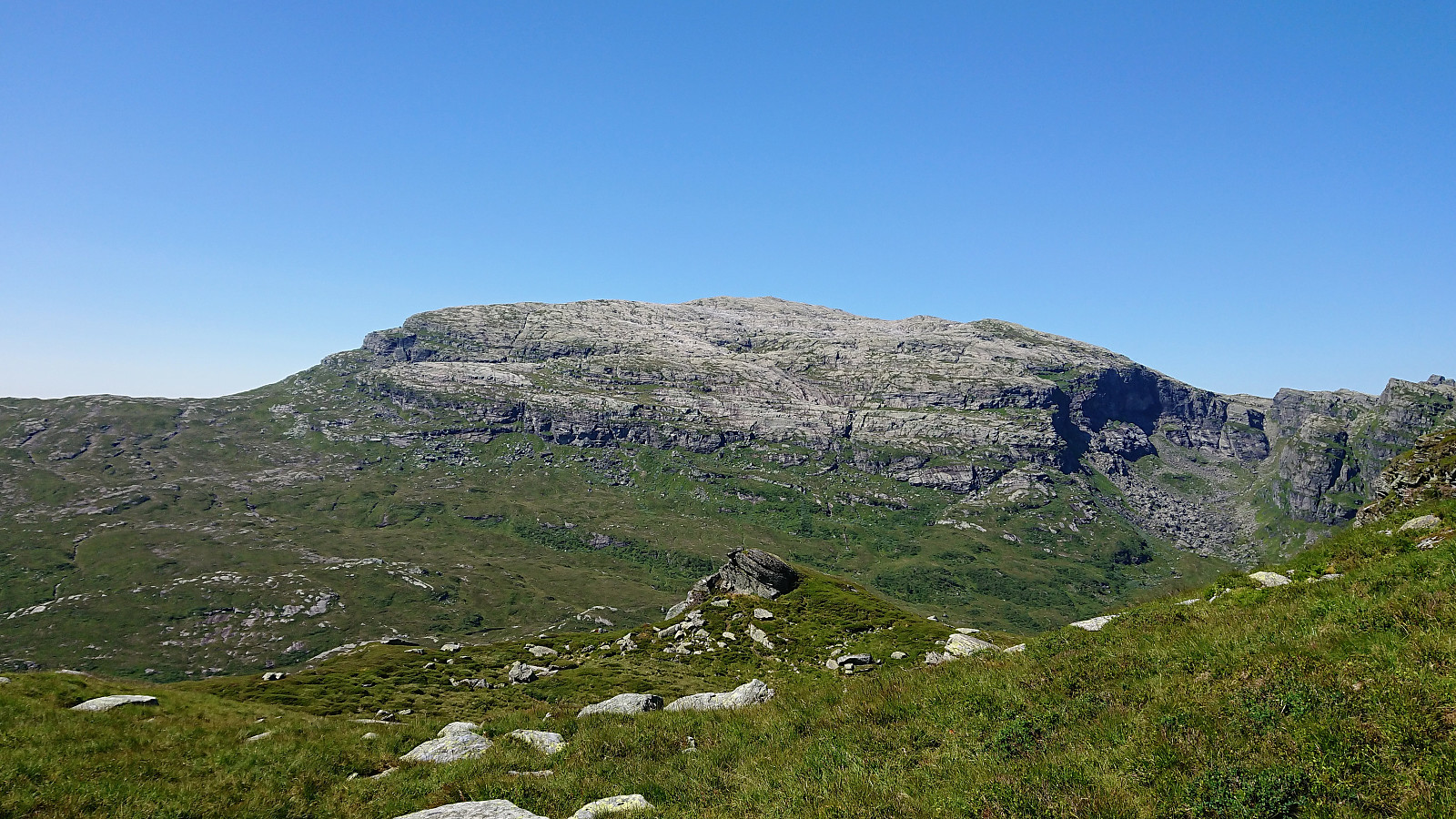
Skrott, Glynt and Geitafjellet
- Date:
- 27.10.2019
- Characteristic:
- Hillwalk
- Duration:
- 6:49h
- Distance:
- 15.4km
 On what would turn out to be a perfect late October day for hiking, me and Endre ( Fjellsamleren (Endre Myrdal Olsen) ) drove early from Bergen to Fitjadalen, were we started our ascent from the parking lot just after nine, following the marked trail. At about 600 meters we came across the first real snow, and from there on the amount continued to increase the further up we got.
There were some partially hidden footprints in the snow, most likely from the day before, but we were the first hikers this morning, and thus had to make our own path (following the red T’s) up the mountainside. The progress was therefore slower than expected, as we kept sinking deeper and deeper into the snow.
At the cabin southwest of Skrott we left the main trail to Breidablik and instead followed the cairns towards the summit. Here there were no footprints at all, >>>
On what would turn out to be a perfect late October day for hiking, me and Endre ( Fjellsamleren (Endre Myrdal Olsen) ) drove early from Bergen to Fitjadalen, were we started our ascent from the parking lot just after nine, following the marked trail. At about 600 meters we came across the first real snow, and from there on the amount continued to increase the further up we got.
There were some partially hidden footprints in the snow, most likely from the day before, but we were the first hikers this morning, and thus had to make our own path (following the red T’s) up the mountainside. The progress was therefore slower than expected, as we kept sinking deeper and deeper into the snow.
At the cabin southwest of Skrott we left the main trail to Breidablik and instead followed the cairns towards the summit. Here there were no footprints at all, >>>
Grøet, Flæfjellet and Storafjellet (Roundtrip)
- Date:
- 27.07.2019
- Characteristic:
- Hillwalk
- Duration:
- 4:55h
- Distance:
- 16.5km
 Started by taking the bus to Eikedalen (bus stop called Eikedalen Skisenter) and walked along the road up to the start of the ski slopes. From there I followed a steep tractor road west and later north, taking me almost all the way to the summit of Grøet . The final off-road stretch to the summit was straightforward. By now the light breeze had picked up quite a bit, which was very welcome on this warm summer day, with temperatures even this high probably being above 25.
I made a short detour north for better views down to Kvitingvatnet, before turning east to Flæfjellet , soon coming across a trail/animal track that I could easily follow all the way to the summit. I did make another short detour south just before reaching the summit though, just to be able to look down into Eikedalen.
At Flæfjellet I enjoyed >>>
Started by taking the bus to Eikedalen (bus stop called Eikedalen Skisenter) and walked along the road up to the start of the ski slopes. From there I followed a steep tractor road west and later north, taking me almost all the way to the summit of Grøet . The final off-road stretch to the summit was straightforward. By now the light breeze had picked up quite a bit, which was very welcome on this warm summer day, with temperatures even this high probably being above 25.
I made a short detour north for better views down to Kvitingvatnet, before turning east to Flæfjellet , soon coming across a trail/animal track that I could easily follow all the way to the summit. I did make another short detour south just before reaching the summit though, just to be able to look down into Eikedalen.
At Flæfjellet I enjoyed >>>
Fotasperrnuten
- Date:
- 13.07.2019
- Characteristic:
- Hillwalk
- Duration:
- 5:30h
- Distance:
- 14.3km
 When the initial plan to drive to Øystese for a visit to Skrott did not work out, we changed plans and instead hopped on a bus to Steinskvanndalen (bus stop called Kvernavollen) for an ascent of Fotasperrnuten . The walk along the gravel road up to the beautiful Steinskvanndalsvatnet was quickly completed and we then started searching for the marked trailhead. We walked a bit too far though and ended up making our own way up the field.
We soon came across the marked trail, which from there on, with some minor exceptions when getting close to the summit, was easy to follow. Note that there were some steep areas when heading up Fotasperrdalen, or more specifically a steep drop on the right-hand side of the trail, so this particular part of the trail may not be to everyone's liking. But as soon as this stretch was >>>
When the initial plan to drive to Øystese for a visit to Skrott did not work out, we changed plans and instead hopped on a bus to Steinskvanndalen (bus stop called Kvernavollen) for an ascent of Fotasperrnuten . The walk along the gravel road up to the beautiful Steinskvanndalsvatnet was quickly completed and we then started searching for the marked trailhead. We walked a bit too far though and ended up making our own way up the field.
We soon came across the marked trail, which from there on, with some minor exceptions when getting close to the summit, was easy to follow. Note that there were some steep areas when heading up Fotasperrdalen, or more specifically a steep drop on the right-hand side of the trail, so this particular part of the trail may not be to everyone's liking. But as soon as this stretch was >>>
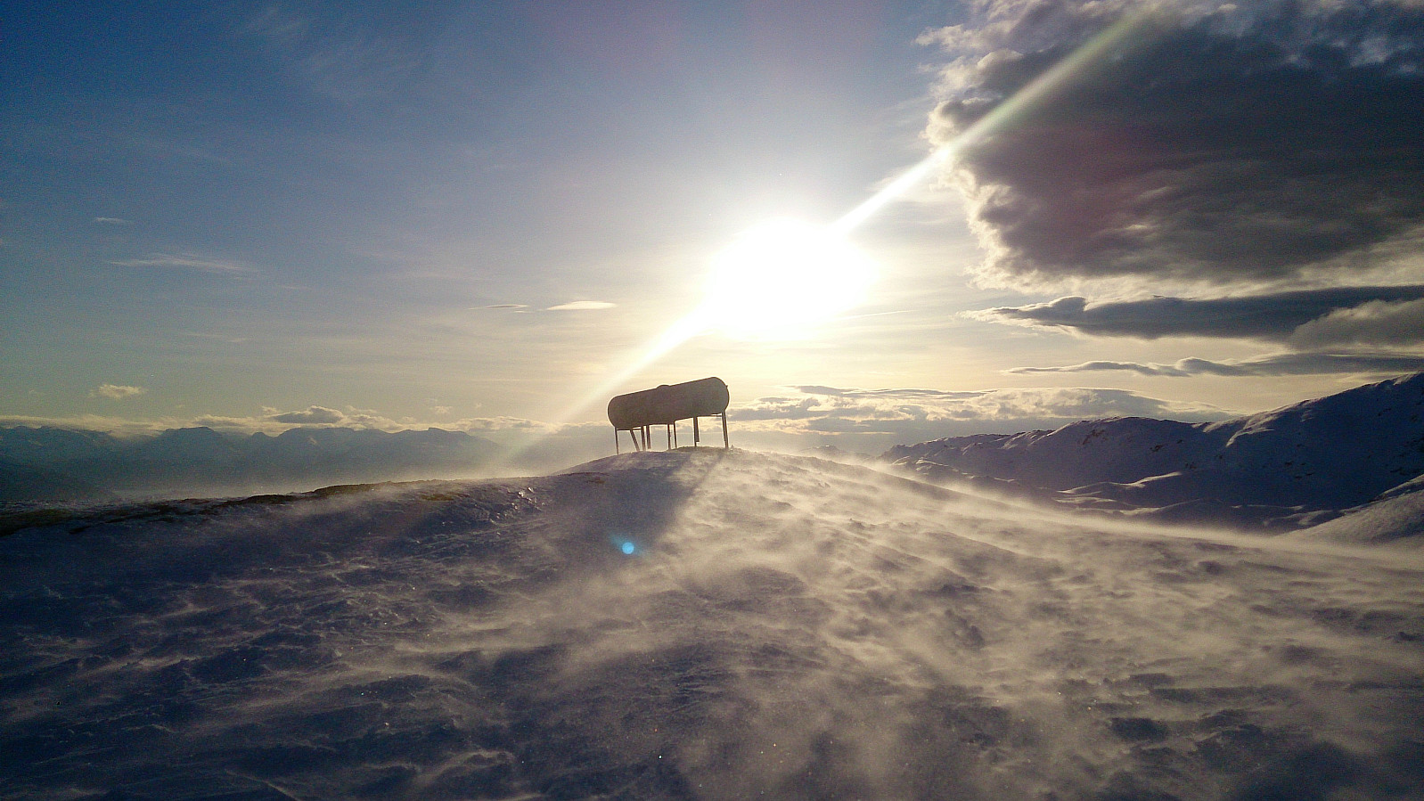
Fuglafjellet from Hamlagrøvatnet
- Date:
- 24.02.2019
- Characteristic:
- Backcountry skiing
- Duration:
- 9:16h
- Distance:
- 27.8km
 We parked at the small parking lot east of Vesletjørni and from there followed the marked trail towards Vending . Not the best skiing conditions, icy and with lots of areas already running low on snow, and with next to no wind and the sun peeking through the clouds it felt more like Easter than the late February the calendar was indicating.
After passing east of Vending, we skied down to the small cabin in Fugladalen, where we had a quick lunch before starting the climb up to Fossavatnet. From Fossavatnet we followed the river up to Øvre Fugladalsvatnet, thus avoiding the steepest sections at the bottom of the valley up from Fossavatnet. Note that one should be careful with regards to the snow conditions when heading up this relatively narrow gorge. Very low risk for avalanches this Sunday though, >>>
We parked at the small parking lot east of Vesletjørni and from there followed the marked trail towards Vending . Not the best skiing conditions, icy and with lots of areas already running low on snow, and with next to no wind and the sun peeking through the clouds it felt more like Easter than the late February the calendar was indicating.
After passing east of Vending, we skied down to the small cabin in Fugladalen, where we had a quick lunch before starting the climb up to Fossavatnet. From Fossavatnet we followed the river up to Øvre Fugladalsvatnet, thus avoiding the steepest sections at the bottom of the valley up from Fossavatnet. Note that one should be careful with regards to the snow conditions when heading up this relatively narrow gorge. Very low risk for avalanches this Sunday though, >>>
Byrkjefjellet and Iendafjellet
- Date:
- 19.08.2018
- Characteristic:
- Hillwalk
- Duration:
- 5:47h
- Distance:
- 16.8km
 Byrkjefjellet
Started by taking the bus to Kvamskogen and getting off at the bus stop Wallemtunet. From there I followed the gravel road northwest, looking for one of the many trailheads indicated on the map. As far as I could see there were no marked trails for Byrkjefjellet (or any other locations for that matter) and the ones I looked at were all equally wet. This did however greatly improve as the trail turned north. Here it also connected with another trail coming up from the south (which I decided to try on the descent).
From here, the trail was overall easy to follow until reaching the small cairn southeast of the 996 hill south of the summit, which provided very nice views. The summit itself was however further north, and, as far as I could tell, blocked by a cliff. I knew there was supposed to be >>>
Byrkjefjellet
Started by taking the bus to Kvamskogen and getting off at the bus stop Wallemtunet. From there I followed the gravel road northwest, looking for one of the many trailheads indicated on the map. As far as I could see there were no marked trails for Byrkjefjellet (or any other locations for that matter) and the ones I looked at were all equally wet. This did however greatly improve as the trail turned north. Here it also connected with another trail coming up from the south (which I decided to try on the descent).
From here, the trail was overall easy to follow until reaching the small cairn southeast of the 996 hill south of the summit, which provided very nice views. The summit itself was however further north, and, as far as I could tell, blocked by a cliff. I knew there was supposed to be >>>
Tveitakvitingen and Høganovi
- Date:
- 10.07.2018
- Characteristic:
- Hillwalk
- Duration:
- 6:35h
- Distance:
- 23.0km
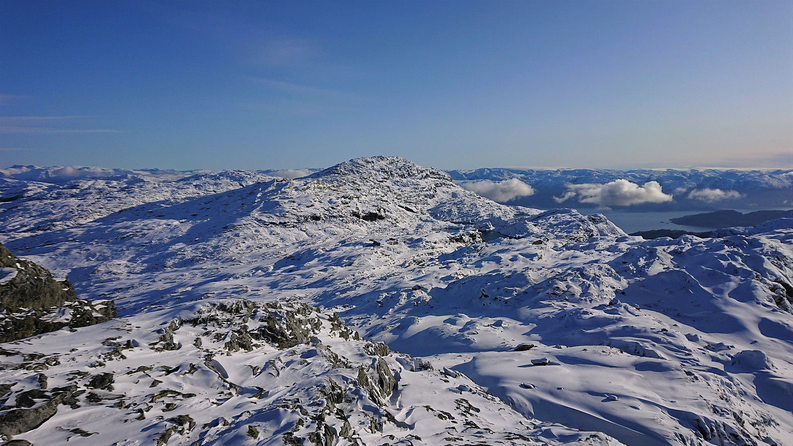
 Såta, Gråskorvenuten and Gråfjellet
Started by taking the bus to Furedalen and from there following the gravel road, and later trail, south. Made quick visits to Såta , Gråskorvenuten and Gråfjellet before starting my final ascent towards Tveitakvitingen .
Tveitakvitingen
Until this point the trail was easy to follow (with the exception of the lack of trails to/from Gråskorvenuten and Gråfjellet), but while there were markers (red painted dots and arrows) for the last stretch towards Tveitakvitingen as well, these were frequently hidden beneath the snow and thus knowing exactly where the trail was supposed to be was a bit more difficult. The summit provided excellent 360 degrees views, but is more of a highest point at a large plateau than a single peak, which was a bit disappointing.
Høganovi
From the summit I returned more or less >>>
Såta, Gråskorvenuten and Gråfjellet
Started by taking the bus to Furedalen and from there following the gravel road, and later trail, south. Made quick visits to Såta , Gråskorvenuten and Gråfjellet before starting my final ascent towards Tveitakvitingen .
Tveitakvitingen
Until this point the trail was easy to follow (with the exception of the lack of trails to/from Gråskorvenuten and Gråfjellet), but while there were markers (red painted dots and arrows) for the last stretch towards Tveitakvitingen as well, these were frequently hidden beneath the snow and thus knowing exactly where the trail was supposed to be was a bit more difficult. The summit provided excellent 360 degrees views, but is more of a highest point at a large plateau than a single peak, which was a bit disappointing.
Høganovi
From the summit I returned more or less >>>
Såta, Kvamskogen
- Date:
- 14.01.2018
- Characteristic:
- Backcountry skiing
- Duration:
- 3:23h
- Distance:
- 12.1km
 First skiing trip of 2018. Started from the parking lot at Furedalen and followed the standard skiing route to Såta . Very strong winds at the summit so we did not stay long before starting our descent.
First heading east and then south across Breiarusti on the way down to Furedalen. Not the best skiing conditions but overall a very nice trip.
First skiing trip of 2018. Started from the parking lot at Furedalen and followed the standard skiing route to Såta . Very strong winds at the summit so we did not stay long before starting our descent.
First heading east and then south across Breiarusti on the way down to Furedalen. Not the best skiing conditions but overall a very nice trip.
