Archive - Date
Archive - Activity
-
Bike trip (108)
- Bike trip - mixed (25)
- Bike trip - road (83)
-
Drive (9)
- Car drive (9)
-
Other trip (3)
- Kayaking (3)
-
Ski trip (112)
- Backcountry skiing (66)
- Cross-country skiing (46)
- Trip by foot (1834)
Collected lists
- Utvalgte topper og turmål i Bergen
- Alle topper i Bergen
- Voss ≥ 100m pf.
- Opptur Hordaland
- Stasjoner på Bergensbanen
- Ulvik ≥ 100m pf.
- Hordaland ≥ 100m pf.
- Mjølfjell PF > 100m
- Jondal ≥ 100m pf.
- Sunnhordland PF >= 100m
- Dagsturhyttene i Vestland
- Hordaland: Hardanger PF>=100m
- DNT-hytter i Hordaland
- Kvinnherad ≥ 100m pf.
- Sogndal ≥ 100m pf.
- Vik i Sogn ≥ 100m pf.
- Gulen ≥ 100m pf.
- DNT-hytter i Sogn og Fjordane
- Eidfjord ≥ 100m pf.
- Sogn - Sør for Sognefjorden PF>=100m
Across Hellen festning
- Date:
- 17.12.2022
- Characteristic:
- Hike
- Duration:
- 0:39h
- Distance:
- 3.2km
Across Hellen festning
- Date:
- 12.12.2022
- Characteristic:
- Hike
- Duration:
- 0:34h
- Distance:
- 3.1km
 Early break from the home office for a short walk before sunset.
Hellemyrstien and Hellen festning
- Date:
- 10.12.2022
- Characteristic:
- Hike
- Duration:
- 2:11h
- Distance:
- 6.0km
Across Hellen festning
- Date:
- 02.12.2022
- Characteristic:
- Hike
- Duration:
- 0:39h
- Distance:
- 3.4km
Starefossen to Lønborg
- Date:
- 27.11.2022
- Characteristic:
- Hike
- Duration:
- 2:22h
- Distance:
- 10.4km
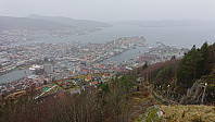 A wet Sunday with strong winds from the south. But by taking the bus to Starefossen I had the wind from behind for most of the hike home to Lønbørg.
Across Hellen festning
- Date:
- 21.11.2022
- Characteristic:
- Hike
- Duration:
- 0:34h
- Distance:
- 3.2km
Fjellveien and Hellen festning
- Date:
- 20.11.2022
- Characteristic:
- Hike
- Duration:
- 2:14h
- Distance:
- 8.5km
Sandviksbatteriet, Hellemyrstien and Hellen festning
- Date:
- 12.11.2022
- Characteristic:
- Hike
- Duration:
- 1:25h
- Distance:
- 6.7km
Hellemyrstien and Hellen festning
- Date:
- 06.11.2022
- Characteristic:
- Hike
- Duration:
- 2:13h
- Distance:
- 6.7km
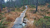 Short local hike on a gray Sunday, including an exploration (on foot) of the mountain bike tracks north of Langevatnet with my two nephews.
Across Hellen festning
- Date:
- 05.11.2022
- Characteristic:
- Hike
- Duration:
- 0:35h
- Distance:
- 3.2km


