Archive - Date
Archive - Activity
-
Bike trip (108)
- Bike trip - mixed (25)
- Bike trip - road (83)
-
Drive (9)
- Car drive (9)
-
Other trip (3)
- Kayaking (3)
-
Ski trip (115)
- Backcountry skiing (68)
- Cross-country skiing (47)
- Trip by foot (1870)
Collected lists
-
Utvalgte topper og turmål i Bergen
(346/347)
 99%
99% -
Alle topper i Bergen
(391/398)
98%
-
Voss ≥ 100m pf.
(96/98)
97%
-
Opptur Hordaland
(144/159)
90%
-
Stasjoner på Bergensbanen
(31/40)
77%
-
Ulvik ≥ 100m pf.
(28/38)
73%
-
Hordaland ≥ 100m pf.
(619/863)
71%
-
Mjølfjell PF > 100m
(21/31)
67%
-
Jondal ≥ 100m pf.
(15/23)
65%
-
Dagsturhyttene i Vestland
(36/61)
59%
-
Sunnhordland PF >= 100m
(105/186)
56%
-
Hordaland: Hardanger PF>=100m
(191/359)
53%
-
DNT-hytter i Hordaland
(23/45)
51%
-
Kvinnherad ≥ 100m pf.
(40/79)
50%
-
Sogndal ≥ 100m pf.
(23/81)
28%
-
Gulen ≥ 100m pf.
(14/54)
25%
-
Eidfjord ≥ 100m pf.
(10/42)
23%
-
Vik i Sogn ≥ 100m pf.
(10/46)
21%
-
Sogn - Sør for Sognefjorden PF>=100m
(30/159)
18%
-
DNT-hytter i Sogn og Fjordane
(8/47)
17%

Across Hellen festning
- Date:
- 17.04.2026
- Characteristic:
- Hike
- Duration:
- 0:38h
- Distance:
- 3.2km
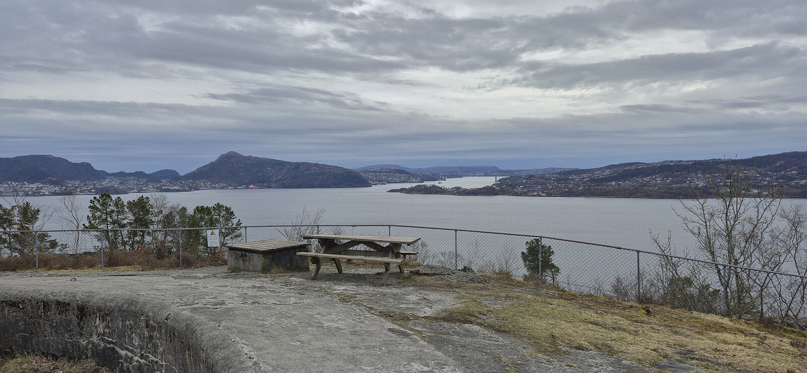 Short local evening hike.
Oppstemten and Landåseggen
- Date:
- 15.04.2026
- Characteristic:
- Hillwalk
- Duration:
- 1:43h
- Distance:
- 6.2km
 Short hike before heading home from work.
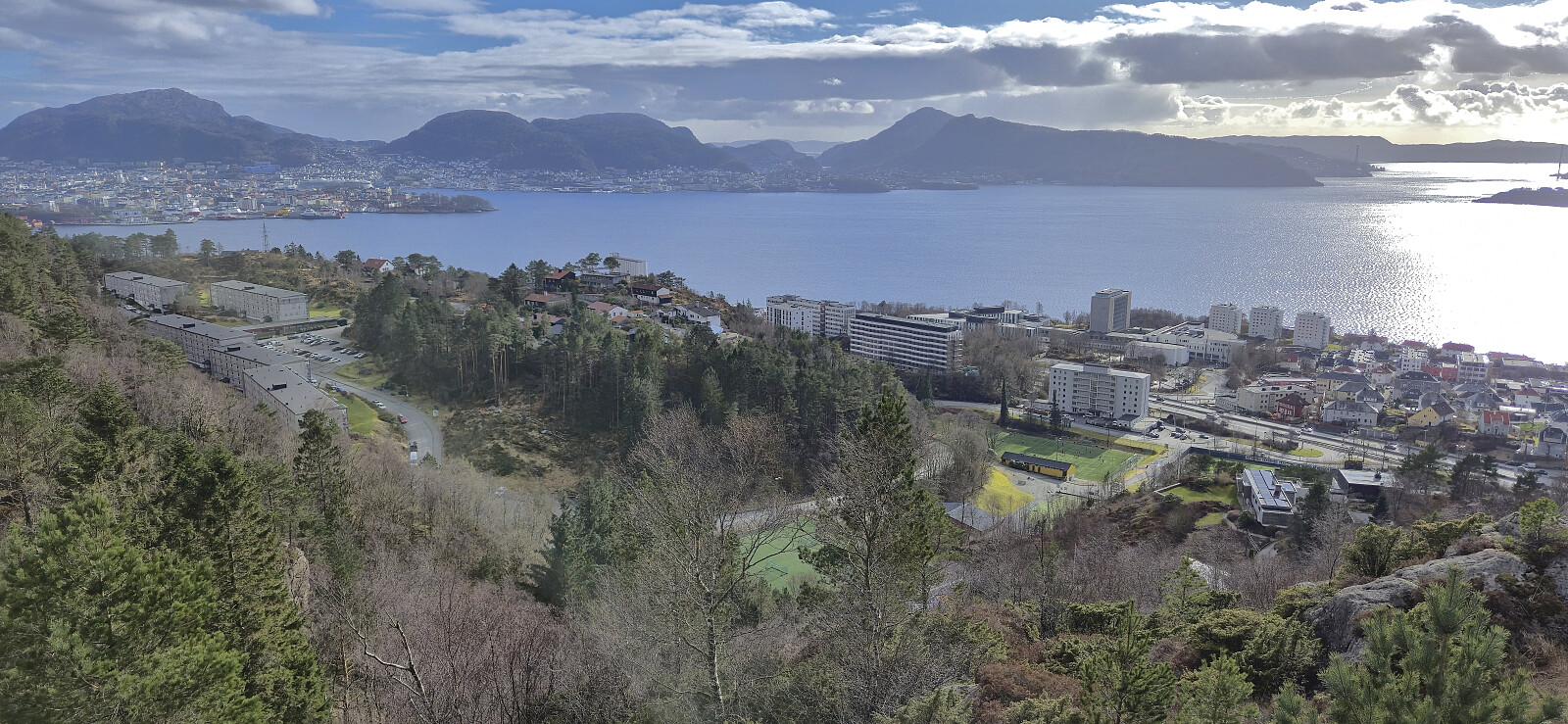
Sandviksfjellet
- Date:
- 12.04.2026
- Characteristic:
- Hillwalk
- Duration:
- 3:58h
- Distance:
- 10.4km
 Local Sunday hike that turned longer than expected when meeting up with my dad and joining him instead of heading more directly home.
Litlåsfjellet from Leirvåg fergekai
- Date:
- 11.04.2026
- Characteristic:
- Hike
- Duration:
- 1:00h
- Distance:
- 5.1km
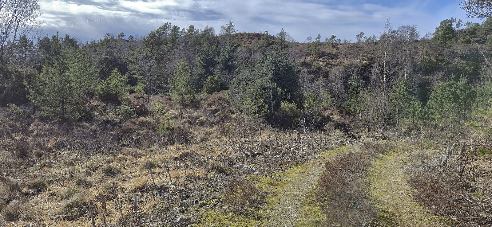
 Short bonus hike after my trip to Brattelifjellet, Storeholten and Mosedotten in Gulen and the ferry ride from Sløvågen given that I had around an hour to kill at Leirvågen before the bus back to Bergen. The goal was to visit the highest point in Austrheim, namely Litlåsfjellet . This was easily achieved as there was a gravel road pretty much all the way to the summit. There were even tire marks across the highest point as a result of recent logging activity.
Brattelifjellet, Storeholten and Mosedotten
- Date:
- 11.04.2026
- Characteristic:
- Hillwalk
- Duration:
- 5:35h
- Distance:
- 15.3km
 I started by taking the bus and ferry from Bergen to Sløvågen. Here I was picked up by a minibus heading for Mjømna. Note that you must call the company the day before for this bus to show up (see skyss.no ). Given that I was the only passenger, the bus driver made a short detour into Merkesdalen, saving me around 800 meters of walking along the paved road. After thanking the driver, I continued on foot towards the marked trailhead for Brattelifjellet at Svardalen.
Thanks to Lise Grønbukt 's trip report I easily located the marked trail to Brattelifjellet and followed it without too much trouble all the way to the large summit cairn. But while the trail was marked with both blue markers and the occasional cairn, the trail itself was often quite weak. I lost it a couple of times and it could benefit from at least a couple of additional markers >>>
I started by taking the bus and ferry from Bergen to Sløvågen. Here I was picked up by a minibus heading for Mjømna. Note that you must call the company the day before for this bus to show up (see skyss.no ). Given that I was the only passenger, the bus driver made a short detour into Merkesdalen, saving me around 800 meters of walking along the paved road. After thanking the driver, I continued on foot towards the marked trailhead for Brattelifjellet at Svardalen.
Thanks to Lise Grønbukt 's trip report I easily located the marked trail to Brattelifjellet and followed it without too much trouble all the way to the large summit cairn. But while the trail was marked with both blue markers and the occasional cairn, the trail itself was often quite weak. I lost it a couple of times and it could benefit from at least a couple of additional markers >>>
Across Hellen festning
- Date:
- 08.04.2026
- Characteristic:
- Hike
- Duration:
- 0:36h
- Distance:
- 3.2km
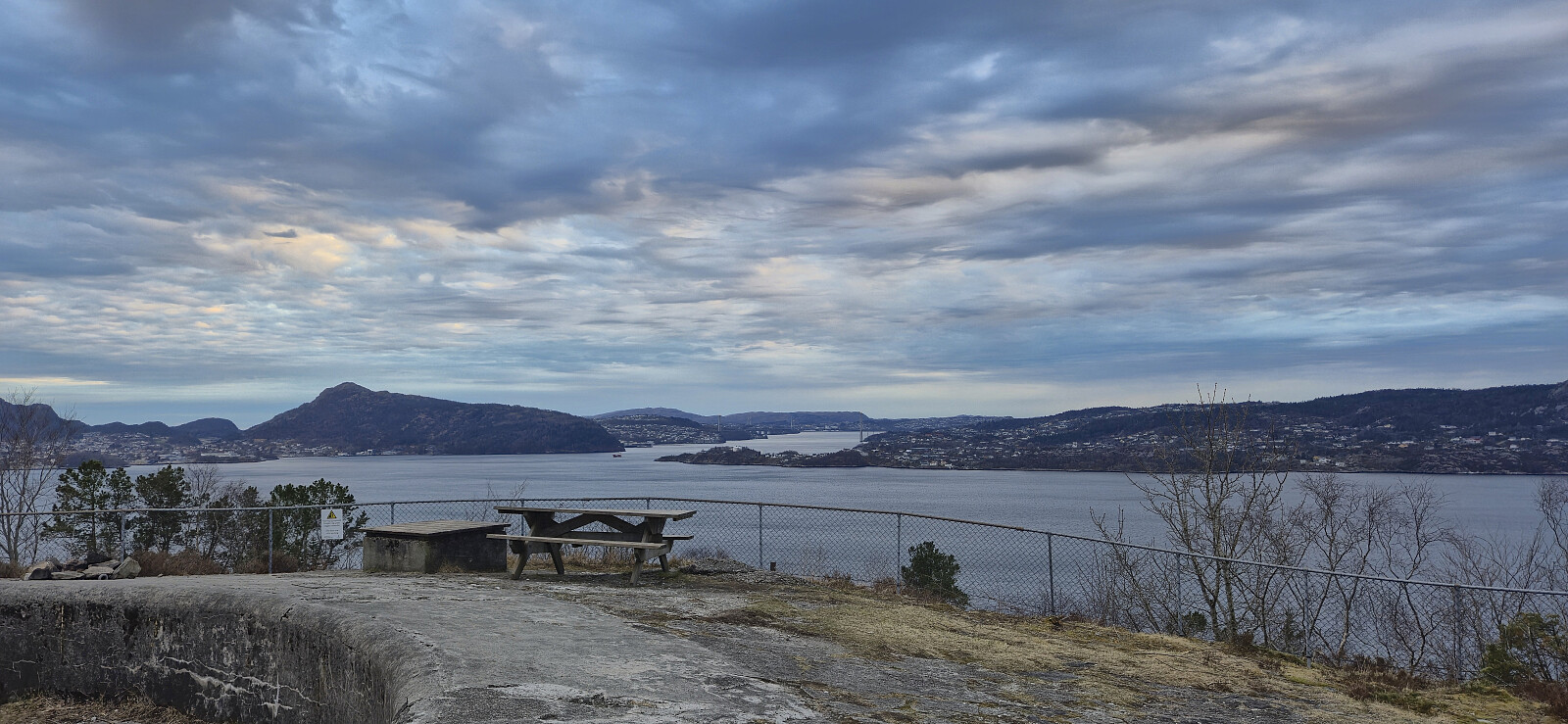 Short local evening hike.
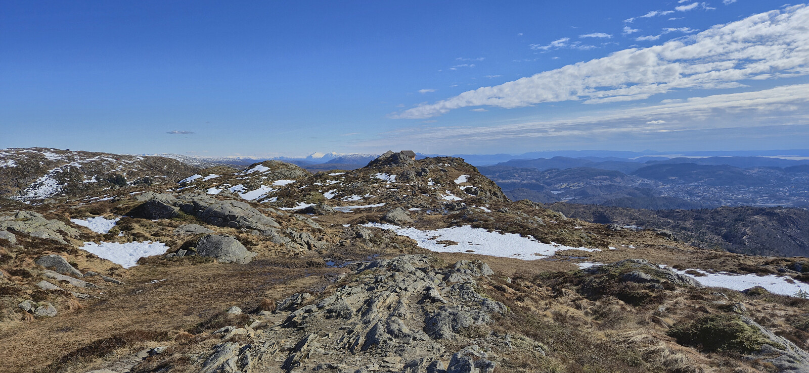
Ørneberget NV, Ørneberget and Hellen festning
- Date:
- 07.04.2026
- Characteristic:
- Hillwalk
- Duration:
- 1:08h
- Distance:
- 4.5km
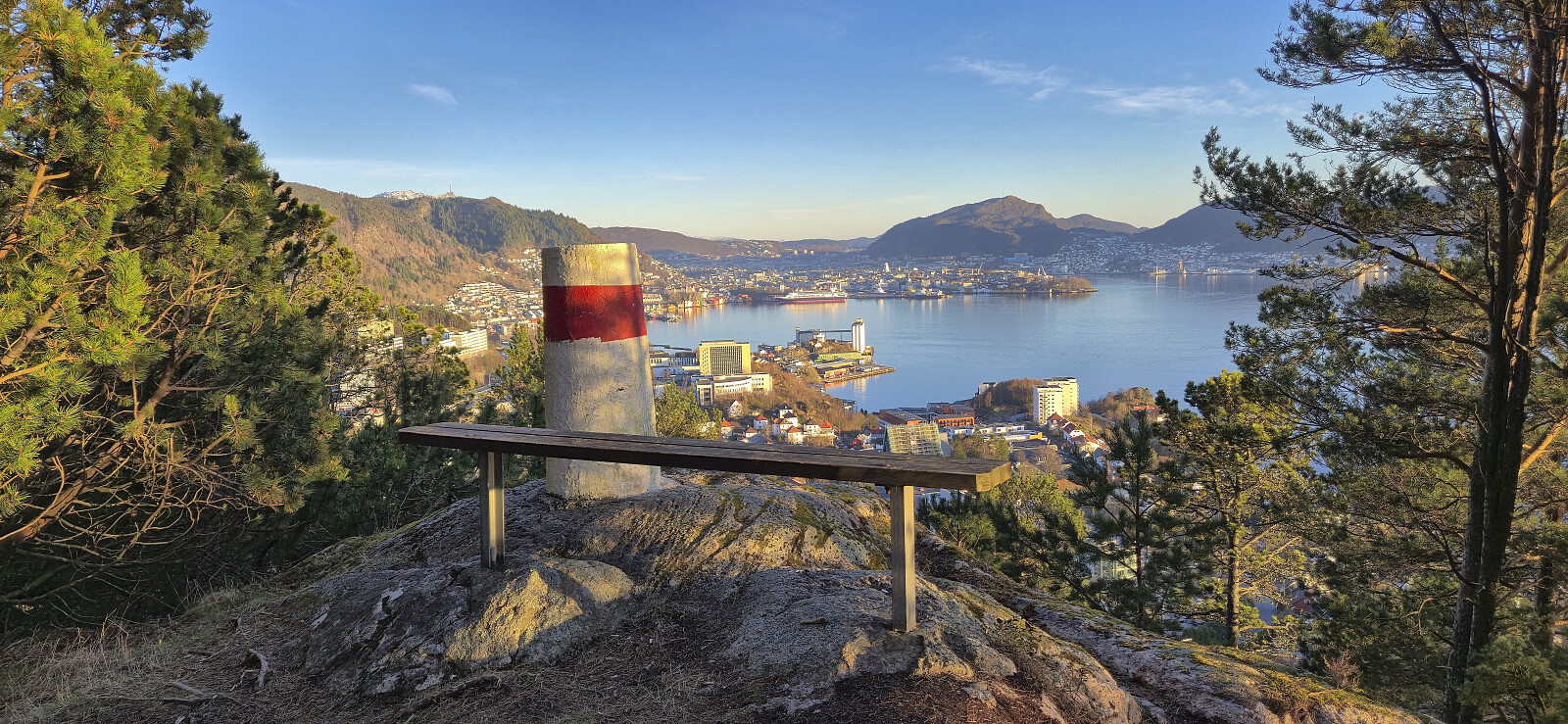 Short local evening hike after work.
Ørneberget, Rognåsen and Hellen festning
- Date:
- 06.04.2026
- Characteristic:
- Hillwalk
- Duration:
- 1:38h
- Distance:
- 6.7km
 Short local hike after returning to Bergen from Sogndal the day before.
Barsnesfjorden
- Date:
- 01.04.2026
- Characteristic:
- Hike
- Duration:
- 0:51h
- Distance:
- 4.4km
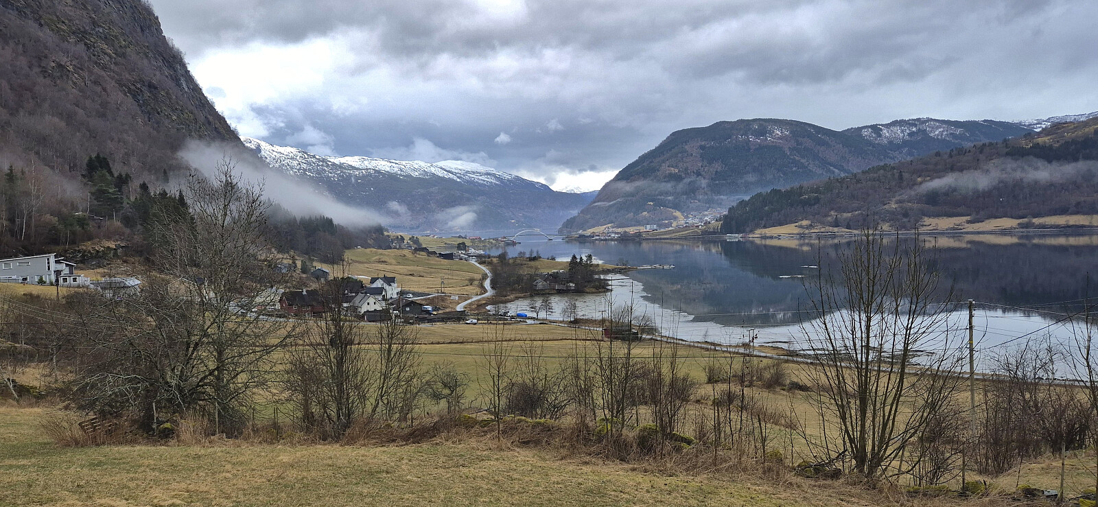 Short walk along Barsnesfjorden after a morning visit from a plumber to replace a pipe at the cabin that had burst during the cold winter.
(Note that the road this hike follows is private, i.e. no cars allowed. There are however a couple of parking spaces down by the small wharf along Barsnesfjorden just before the road turns west and starts climbing slightly towards the crossroads at Barsnes.)
Short walk along Barsnesfjorden after a morning visit from a plumber to replace a pipe at the cabin that had burst during the cold winter.
(Note that the road this hike follows is private, i.e. no cars allowed. There are however a couple of parking spaces down by the small wharf along Barsnesfjorden just before the road turns west and starts climbing slightly towards the crossroads at Barsnes.)
Mjølkeflathytta
- Date:
- 31.03.2026
- Characteristic:
- Hillwalk
- Duration:
- 0:46h
- Distance:
- 2.4km
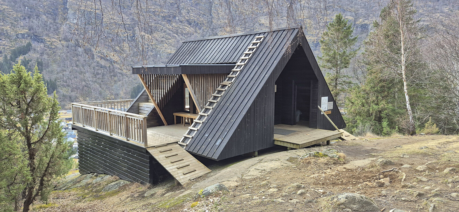 Short stop in Lærdal to visit Mjølkeflathytta when driving from Bergen to Sogndal for Easter. I got dropped off at the marked trailhead at Stødno and proceeded to follow the marked trail southwest to the cabin. The trail was easy to follow but might be more tricky under wet and in particular icy conditions. From the cabin I continued west along the trail until arriving at the bridge across Lærdalselvi. The sidewalk along the bridge then easily took me across the river where I was picked up for the remainder of the drive to Sogndal. Overall, a nice short hike with good views.
