Archive - Date
Archive - Activity
-
Bike trip (108)
- Bike trip - mixed (25)
- Bike trip - road (83)
-
Drive (9)
- Car drive (9)
-
Other trip (3)
- Kayaking (3)
-
Ski trip (109)
- Backcountry skiing (65)
- Cross-country skiing (44)
- Trip by foot (1768)
Collected lists
-
Voss ≥ 100m pf.
(93/98)
 94%
94% -
Kvam ≥ 100m pf.
(41/44)
93%
-
Opptur Hordaland
(143/159)
89%
-
Stasjoner på Bergensbanen
(31/40)
77%
-
Ulvik ≥ 100m pf.
(28/38)
73%
-
Hordaland ≥ 100m pf.
(606/863)
70%
-
Mjølfjell PF > 100m
(21/31)
67%
-
Jondal ≥ 100m pf.
(15/23)
65%
-
Sunnhordland PF >= 100m
(104/186)
55%
-
Dagsturhyttene i Vestland
(33/61)
54%
-
Kvinnherad ≥ 100m pf.
(40/79)
50%
-
Hordaland: Hardanger PF>=100m
(179/359)
49%
-
DNT-hytter i Hordaland
(22/45)
48%
-
Sogndal ≥ 100m pf.
(23/81)
28%
-
Vik i Sogn ≥ 100m pf.
(8/46)
17%
-
DNT-hytter i Sogn og Fjordane
(8/47)
17%
-
Eidfjord ≥ 100m pf.
(6/42)
14%
-
Etne ≥ 100m pf.
(7/51)
13%
-
Ullensvang ≥ 100m pf.
(19/153)
12%
-
Sogn - Sør for Sognefjorden PF>=100m
(17/159)
10%

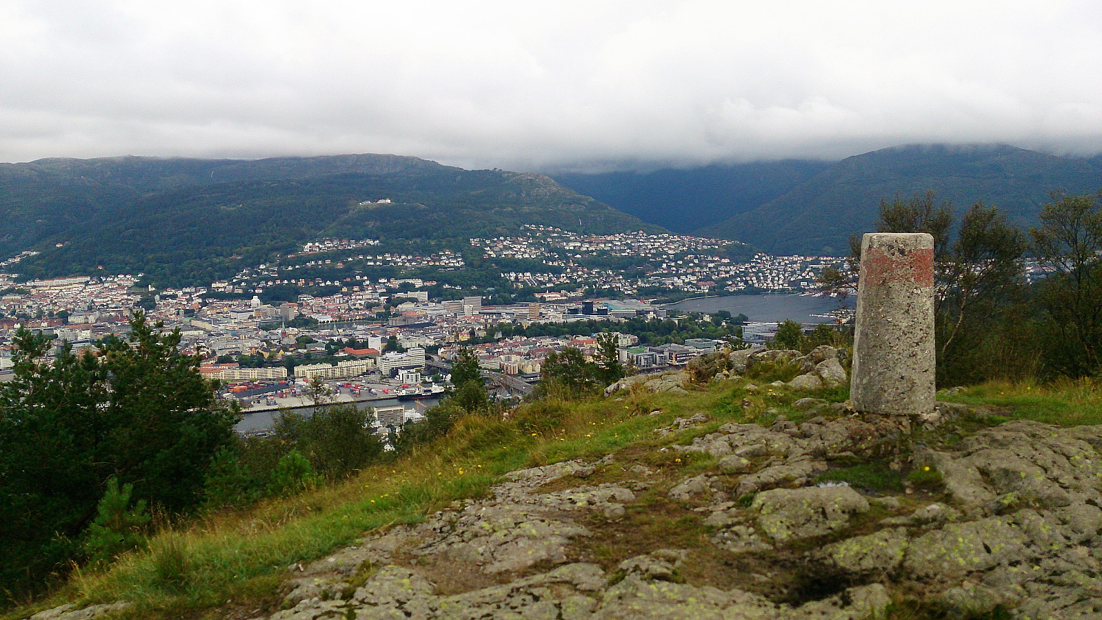
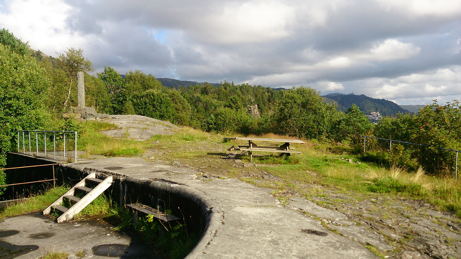
Ørneberget and Hellen festning
- Date:
- 23.08.2017
- Characteristic:
- Hillwalk
- Duration:
- 1:29h
- Distance:
- 6.4km
 Short local hike across Ørneberget and Hellen festning .
Melkeplassen to Holen
- Date:
- 20.08.2017
- Characteristic:
- Hillwalk
- Duration:
- 1:40h
- Distance:
- 4.4km
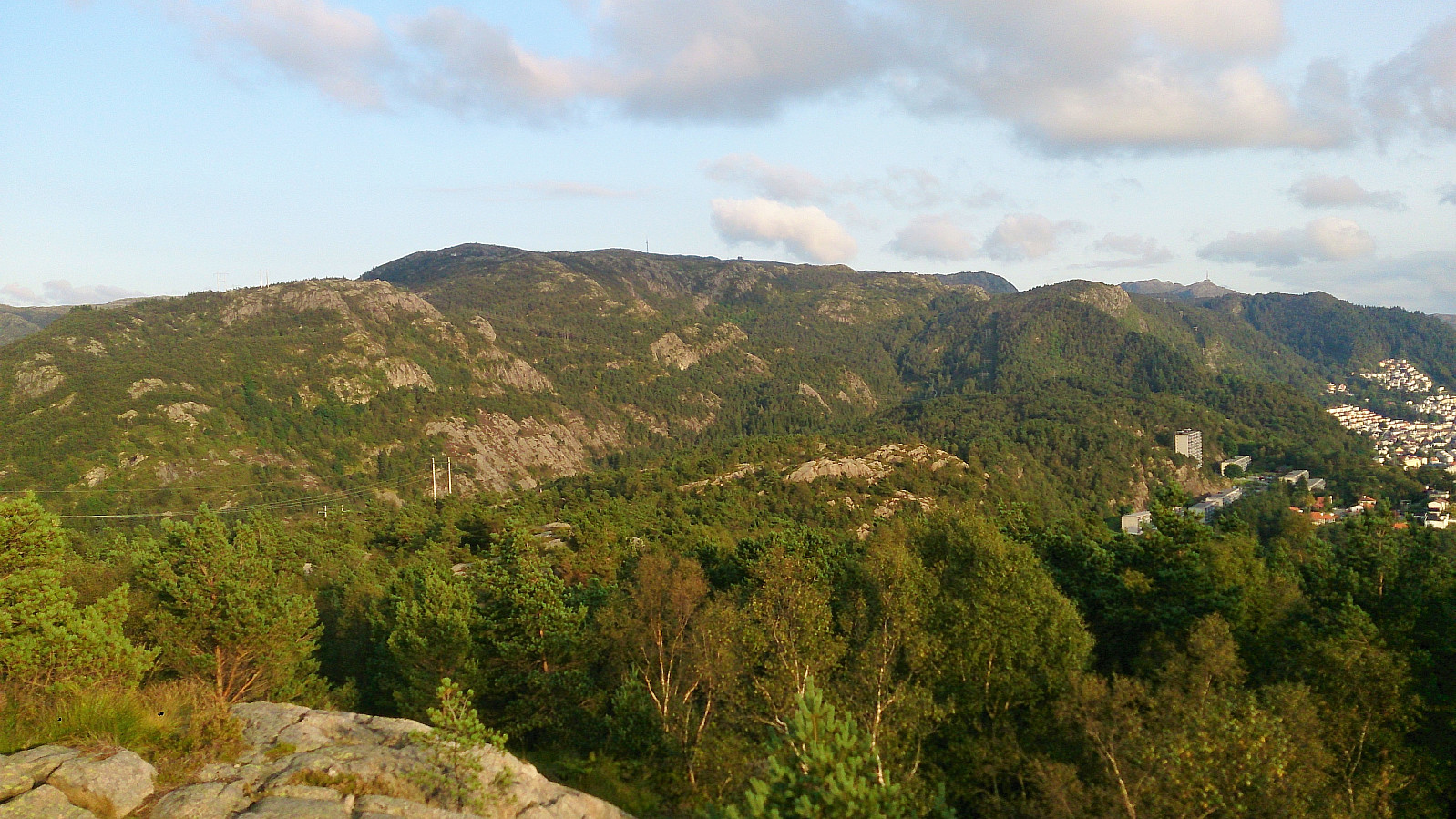
 Started from Melkeplassen and from there followed the standard trail towards Damsgårdsfjellet , with a quick stop at Olsokfjellet on the way. From the summit I continued north to the trig marker at Damsgårdsfjellet , then west to Holafjellet , before ending the hike by following the trail north to Holen for the bus back to the city center. Nice views from Olsokfjellet and Damsgårdsfjellet. The views from the trig marker at Damsgårdsfjellet were also worth a visit. Holafjellet was less interesting, with limited views from the summit, but the trail from Holafjellet down to Holen was an interesting alternative descent with nice views along the way.
Sangoltshornet and Storaskjenet from Skogsskiftet terminal
- Date:
- 18.08.2017
- Characteristic:
- Hillwalk
- Duration:
- 4:17h
- Distance:
- 15.0km
 Sangoltshornet
Started by taking the bus to Skogsskiftet terminal and walking southeast on Skogevegen and later Austre Sundvegen, before following Skogsvågvegen northeast until reaching Sangoltsvegen, which I then followed south until reaching the trailhead.
At the trailhead I had two options: either continue southeast (which was marked "Hødne") or turn west (which was unmarked). I chose the latter, assuming that this was the shortest route, but quickly started regretting my choice as the trail ended up being extremely wet, feeling more like a river than a trail at times.
Perhaps the trail would have been slightly better if it had not rained heavily the day before, but given the terrain I expect my experience was not unique. The trail did get better towards the summit of Sangoltshornet though.
The >>>
Sangoltshornet
Started by taking the bus to Skogsskiftet terminal and walking southeast on Skogevegen and later Austre Sundvegen, before following Skogsvågvegen northeast until reaching Sangoltsvegen, which I then followed south until reaching the trailhead.
At the trailhead I had two options: either continue southeast (which was marked "Hødne") or turn west (which was unmarked). I chose the latter, assuming that this was the shortest route, but quickly started regretting my choice as the trail ended up being extremely wet, feeling more like a river than a trail at times.
Perhaps the trail would have been slightly better if it had not rained heavily the day before, but given the terrain I expect my experience was not unique. The trail did get better towards the summit of Sangoltshornet though.
The >>>
Ørneberget and Kvitebjørnen
- Date:
- 16.08.2017
- Characteristic:
- Hillwalk
- Duration:
- 3:53h
- Distance:
- 13.8km
 Started by walking up Lønborglien and then across Ørneberget (aka Eidsvågfjellet) on the way to Munkebotsvatnet, from where I followed the trail to Sandvikshytten and Dræggehytten before arriving at Kvitebjørnen with stops at Emanuel Mohns utsikt and Lavet .
From Lavet I took a rather wet shortcut down to Storevatnet and back down to Munkebotsvatnet, before concluding the hike with a visit to Furekammen on the way back to Lønborg.
Started by walking up Lønborglien and then across Ørneberget (aka Eidsvågfjellet) on the way to Munkebotsvatnet, from where I followed the trail to Sandvikshytten and Dræggehytten before arriving at Kvitebjørnen with stops at Emanuel Mohns utsikt and Lavet .
From Lavet I took a rather wet shortcut down to Storevatnet and back down to Munkebotsvatnet, before concluding the hike with a visit to Furekammen on the way back to Lønborg.
Hellen Festning
- Date:
- 13.08.2017
- Characteristic:
- Hike
- Duration:
- 0:43h
- Distance:
- 3.6km
 Short local hike across Hellen Festning.
Togga
- Date:
- 05.08.2017
- Characteristic:
- Hillwalk
- Duration:
- 2:38h
- Distance:
- 5.0km
 Started from the large parking lot at Gunvordalen and followed the marked trail to the summit. The trail was slightly steeper than expected, but did not contain any difficult sections. However, we had to be a bit careful on the way down as it had started raining and the trail got quite slippery.
Sadly the rain was also accompanied with quite dense fog, resulting in next to no views from the summit. Clearly a hike to repeat in better weather.
Started from the large parking lot at Gunvordalen and followed the marked trail to the summit. The trail was slightly steeper than expected, but did not contain any difficult sections. However, we had to be a bit careful on the way down as it had started raining and the trail got quite slippery.
Sadly the rain was also accompanied with quite dense fog, resulting in next to no views from the summit. Clearly a hike to repeat in better weather.
Søre Gråbrørne
- Date:
- 01.08.2017
- Characteristic:
- Hillwalk
- Duration:
- 3:06h
- Distance:
- 11.7km
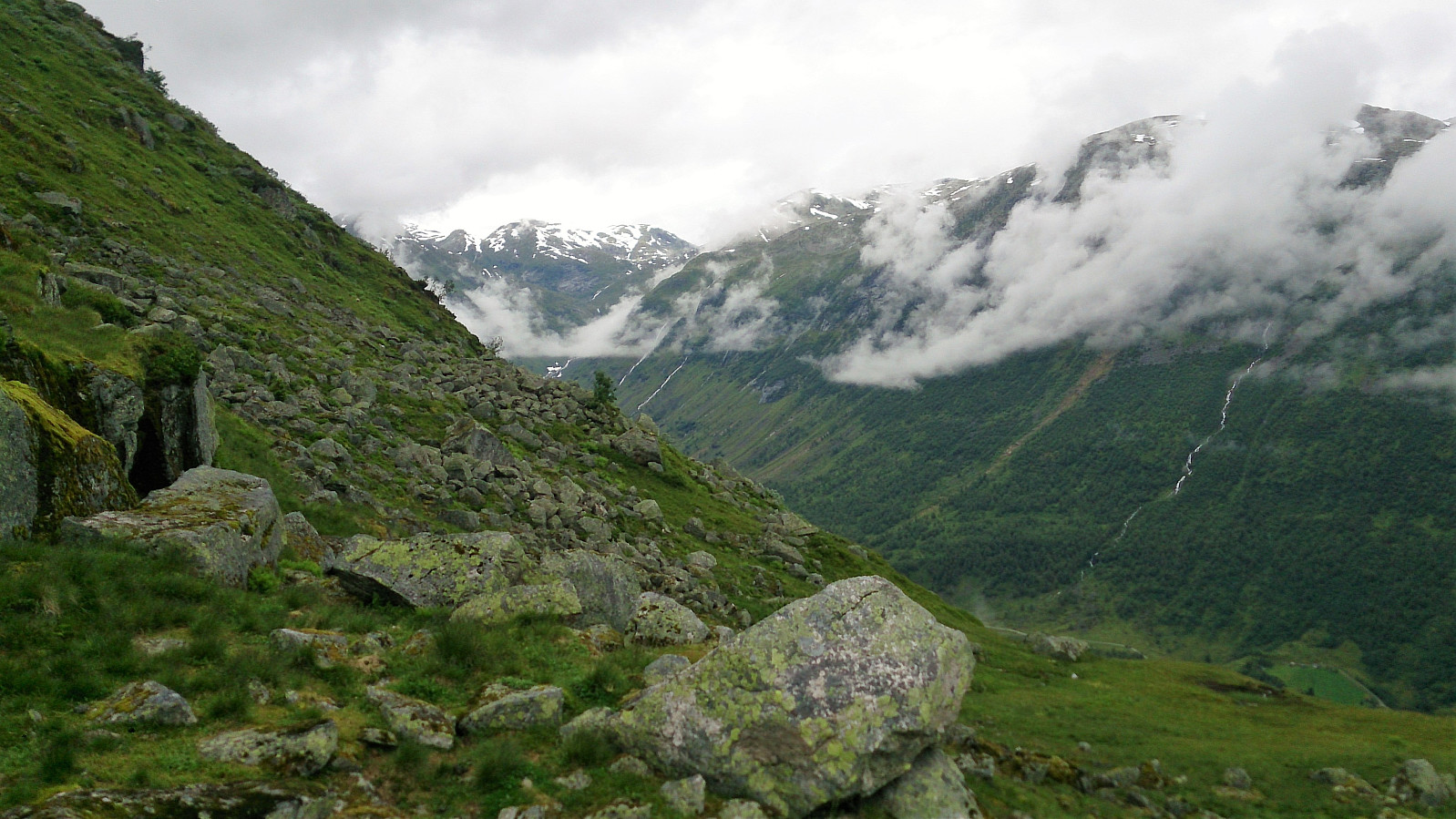
 We started from the Amlaholten parking lot and from there followed the marked gravel road to Svartahol, before continuing on trails towards Søre Gråbrørne . The trails did not completely match what was indicated on the map, but it was fairly easy to arrive at the gravel road going over Turrlifjellet. We crossed the gravel road and continued on the unmarked trail towards Søre Gråbrørne. The summit itself provided limited views, but by continuing north along the trail we arrived at a cairn for some truly spectacular views! From the cairn we doubled back to the gravel road, which we then followed around Turrlifjellet until reconnecting with the first gravel road at Svartaholsbakkane and finally back to the parking lot.
Overall, a great hike with spectacular views that can be highly recommended!
We started from the Amlaholten parking lot and from there followed the marked gravel road to Svartahol, before continuing on trails towards Søre Gråbrørne . The trails did not completely match what was indicated on the map, but it was fairly easy to arrive at the gravel road going over Turrlifjellet. We crossed the gravel road and continued on the unmarked trail towards Søre Gråbrørne. The summit itself provided limited views, but by continuing north along the trail we arrived at a cairn for some truly spectacular views! From the cairn we doubled back to the gravel road, which we then followed around Turrlifjellet until reconnecting with the first gravel road at Svartaholsbakkane and finally back to the parking lot.
Overall, a great hike with spectacular views that can be highly recommended!
England to Åberge
- Date:
- 30.07.2017
- Characteristic:
- Hillwalk
- Duration:
- 4:57h
- Distance:
- 12.6km
 Englandshovden
Started from England and followed the gravel road up to Ølnesstølen before making my own way towards Englandshovden . Tried to follow various trails that were indicated on the map, but these all more or less disappeared or turned into animal tracks. The summit itself provided limited views, but the surrounding area was very nice and the views were better when moving away from the summit.
Vetle Hovden
From the top of Englandshovden I continued south to connect with the trail towards Imesdal, which could then easily be followed down to Imesdal and onwards to Vetle Hovden . No trail to the summit of Vetle Hovden, but it was straightforward to arrive at the summit. Again the views from the summit itself were limited (though not as limited as from Englandshovden). I therefore headed southeast for 100 meters or >>>
Englandshovden
Started from England and followed the gravel road up to Ølnesstølen before making my own way towards Englandshovden . Tried to follow various trails that were indicated on the map, but these all more or less disappeared or turned into animal tracks. The summit itself provided limited views, but the surrounding area was very nice and the views were better when moving away from the summit.
Vetle Hovden
From the top of Englandshovden I continued south to connect with the trail towards Imesdal, which could then easily be followed down to Imesdal and onwards to Vetle Hovden . No trail to the summit of Vetle Hovden, but it was straightforward to arrive at the summit. Again the views from the summit itself were limited (though not as limited as from Englandshovden). I therefore headed southeast for 100 meters or >>>
Kongevegen - from Barsnesfjorden to Hafslovatnet
- Date:
- 29.07.2017
- Characteristic:
- Hike
- Duration:
- 3:24h
- Distance:
- 9.4km
 We found a parking spot by Årøyelvi and from there walked back to the bridge crossing the river. From three followed the marked trail to Okleviki until we could see Hafslovatnet, before taking the same trail back to the car, with the exception of a quick detour to Orrabruhaugen (no trails).
Not the most exciting hike, but not too bad either. The best part was perhaps the walk along the river at the start of the hike. Too bad the rest of the river runs inside the mountain as it is now used for generating electricity.
We found a parking spot by Årøyelvi and from there walked back to the bridge crossing the river. From three followed the marked trail to Okleviki until we could see Hafslovatnet, before taking the same trail back to the car, with the exception of a quick detour to Orrabruhaugen (no trails).
Not the most exciting hike, but not too bad either. The best part was perhaps the walk along the river at the start of the hike. Too bad the rest of the river runs inside the mountain as it is now used for generating electricity.
Slakkafjellet
- Date:
- 27.07.2017
- Characteristic:
- Hillwalk
- Duration:
- 2:27h
- Distance:
- 7.3km
 The hike started from Fv 212/Asbjørnhaugen and followed the marked trail all the way to the summit of Slakkafjellet . The trail partly followed the gravel road, but mainly took shortcuts until finally leaving the road behind when heading for the summit.
The trail was easy to follow, but the last stretch towards the summit had several wet areas, and the fact that it had been raining earlier in the day did not help. The views from the summit were better than expected, with nice views in all directions.
From the summit I tried to follow a trail southeast towards the gravel road, but I quickly lost the trail, and decided to instead head back to the same trail I had used on the ascent. Upon reaching the gravel road, I mainly followed it back down to the start of the hike, instead of taking the shortcuts.
Overall, >>>
The hike started from Fv 212/Asbjørnhaugen and followed the marked trail all the way to the summit of Slakkafjellet . The trail partly followed the gravel road, but mainly took shortcuts until finally leaving the road behind when heading for the summit.
The trail was easy to follow, but the last stretch towards the summit had several wet areas, and the fact that it had been raining earlier in the day did not help. The views from the summit were better than expected, with nice views in all directions.
From the summit I tried to follow a trail southeast towards the gravel road, but I quickly lost the trail, and decided to instead head back to the same trail I had used on the ascent. Upon reaching the gravel road, I mainly followed it back down to the start of the hike, instead of taking the shortcuts.
Overall, >>>
