Archive - Date
Archive - Activity
-
Bike trip (108)
- Bike trip - mixed (25)
- Bike trip - road (83)
-
Drive (9)
- Car drive (9)
-
Other trip (3)
- Kayaking (3)
-
Ski trip (109)
- Backcountry skiing (65)
- Cross-country skiing (44)
- Trip by foot (1770)
Collected lists
-
Voss ≥ 100m pf.
(96/98)
 97%
97% -
Opptur Hordaland
(143/159)
89%
-
Stasjoner på Bergensbanen
(31/40)
77%
-
Ulvik ≥ 100m pf.
(28/38)
73%
-
Hordaland ≥ 100m pf.
(610/863)
70%
-
Mjølfjell PF > 100m
(21/31)
67%
-
Jondal ≥ 100m pf.
(15/23)
65%
-
Sunnhordland PF >= 100m
(104/186)
55%
-
Dagsturhyttene i Vestland
(33/61)
54%
-
Hordaland: Hardanger PF>=100m
(183/359)
50%
-
Kvinnherad ≥ 100m pf.
(40/79)
50%
-
DNT-hytter i Hordaland
(22/45)
48%
-
Sogndal ≥ 100m pf.
(23/81)
28%
-
Vik i Sogn ≥ 100m pf.
(8/46)
17%
-
DNT-hytter i Sogn og Fjordane
(8/47)
17%
-
Eidfjord ≥ 100m pf.
(6/42)
14%
-
Etne ≥ 100m pf.
(7/51)
13%
-
Ullensvang ≥ 100m pf.
(19/153)
12%
-
Sogn - Sør for Sognefjorden PF>=100m
(17/159)
10%
-
Opptur i Sogn og Fjordane peaks
(17/177)
9%

Hellen festning and Ørneberget
- Date:
- 11.07.2019
- Characteristic:
- Hillwalk
- Duration:
- 1:53h
- Distance:
- 8.2km
 Local evening hike after work.
Totlandsfjellet
- Date:
- 09.07.2019
- Characteristic:
- Hillwalk
- Duration:
- 2:20h
- Distance:
- 6.3km
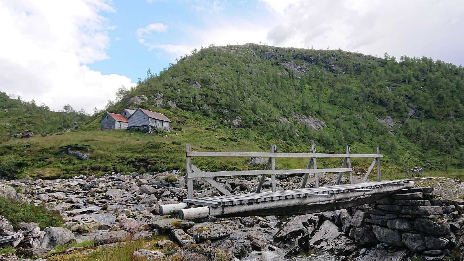
 I managed to convince two colleagues to go hiking and we decided on Totlandsfjellet in Samnanger. After reading up on previous PB-reports our plan was to drive all the way to the small parking lot next to Svensdalstjørna and start our hike from there. We were therefore rather surprised when coming across a locked gate immediately after turning left (west) into Svensdalen from Høysetetjørna. The gate looked fairly new, so probably it had not been there to stop earlier visitors to Totlandsfjellet?
Luckily it was easy to find alternative parking by the main road at Høysetetjørna, and it was only about 800 meters along a gravel road from there to the planned start of the hike anyway. The gravel road was quickly covered and we shortly arrived at the northwestern end of Svensdalstjørna. After crossing the small stream we located the weak unmarked trail, heading >>>
I managed to convince two colleagues to go hiking and we decided on Totlandsfjellet in Samnanger. After reading up on previous PB-reports our plan was to drive all the way to the small parking lot next to Svensdalstjørna and start our hike from there. We were therefore rather surprised when coming across a locked gate immediately after turning left (west) into Svensdalen from Høysetetjørna. The gate looked fairly new, so probably it had not been there to stop earlier visitors to Totlandsfjellet?
Luckily it was easy to find alternative parking by the main road at Høysetetjørna, and it was only about 800 meters along a gravel road from there to the planned start of the hike anyway. The gravel road was quickly covered and we shortly arrived at the northwestern end of Svensdalstjørna. After crossing the small stream we located the weak unmarked trail, heading >>>
Hellen festning, Furukammen and Hellemyrstien
- Date:
- 08.07.2019
- Characteristic:
- Hike
- Duration:
- 1:13h
- Distance:
- 7.1km
 Local evening hike after work.
Stoltzekleiven
- Date:
- 07.07.2019
- Characteristic:
- Hillwalk
- Duration:
- 1:22h
- Distance:
- 7.0km
 First time up Stoltzen in a while. Made it to the top in 16 minutes and 28 seconds.
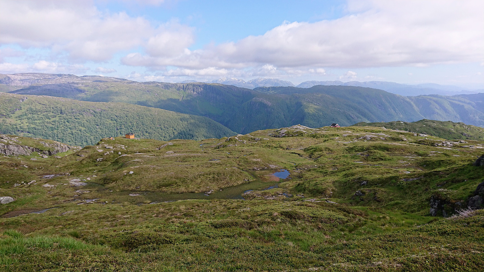
Storlifjellet and Husafjellet - Roundtrip
- Date:
- 06.07.2019
- Characteristic:
- Hillwalk
- Duration:
- 3:07h
- Distance:
- 9.9km
 Today's hike had two goals. The primary being to ascend Storlifjellet from Gamlesæter, and the secondary, if time permitted, to turn the hike into a roundtrip via Eiterdalen . The latter inspired by arntfla (Arnt Flatmo) 's external trip report .
Started by taking the bus to Gamlesæter (see bus tip below) and followed the gravel road up to Nymark. From there I continuing along the tractor road until it came to an end. After reading the previous PB-reports for Storlifjellet, it seemed clear that the terrain from this point onward required that a fairly specific route was followed. So in order to not waste lots of time trying to find my own alternative route, I more or less followed in knutsverre (Knut S. Andersen) 's footsteps (although I guess GeirL (Geir Lie) should get the credit for providing the first GPS tracks along the same route .).
Combined with the numerous deer tracks also showing the way, this made what would probably otherwise have been >>>
Today's hike had two goals. The primary being to ascend Storlifjellet from Gamlesæter, and the secondary, if time permitted, to turn the hike into a roundtrip via Eiterdalen . The latter inspired by arntfla (Arnt Flatmo) 's external trip report .
Started by taking the bus to Gamlesæter (see bus tip below) and followed the gravel road up to Nymark. From there I continuing along the tractor road until it came to an end. After reading the previous PB-reports for Storlifjellet, it seemed clear that the terrain from this point onward required that a fairly specific route was followed. So in order to not waste lots of time trying to find my own alternative route, I more or less followed in knutsverre (Knut S. Andersen) 's footsteps (although I guess GeirL (Geir Lie) should get the credit for providing the first GPS tracks along the same route .).
Combined with the numerous deer tracks also showing the way, this made what would probably otherwise have been >>>
Haukeland sykehus to Lønborg
- Date:
- 04.07.2019
- Characteristic:
- Hike
- Duration:
- 1:59h
- Distance:
- 11.0km
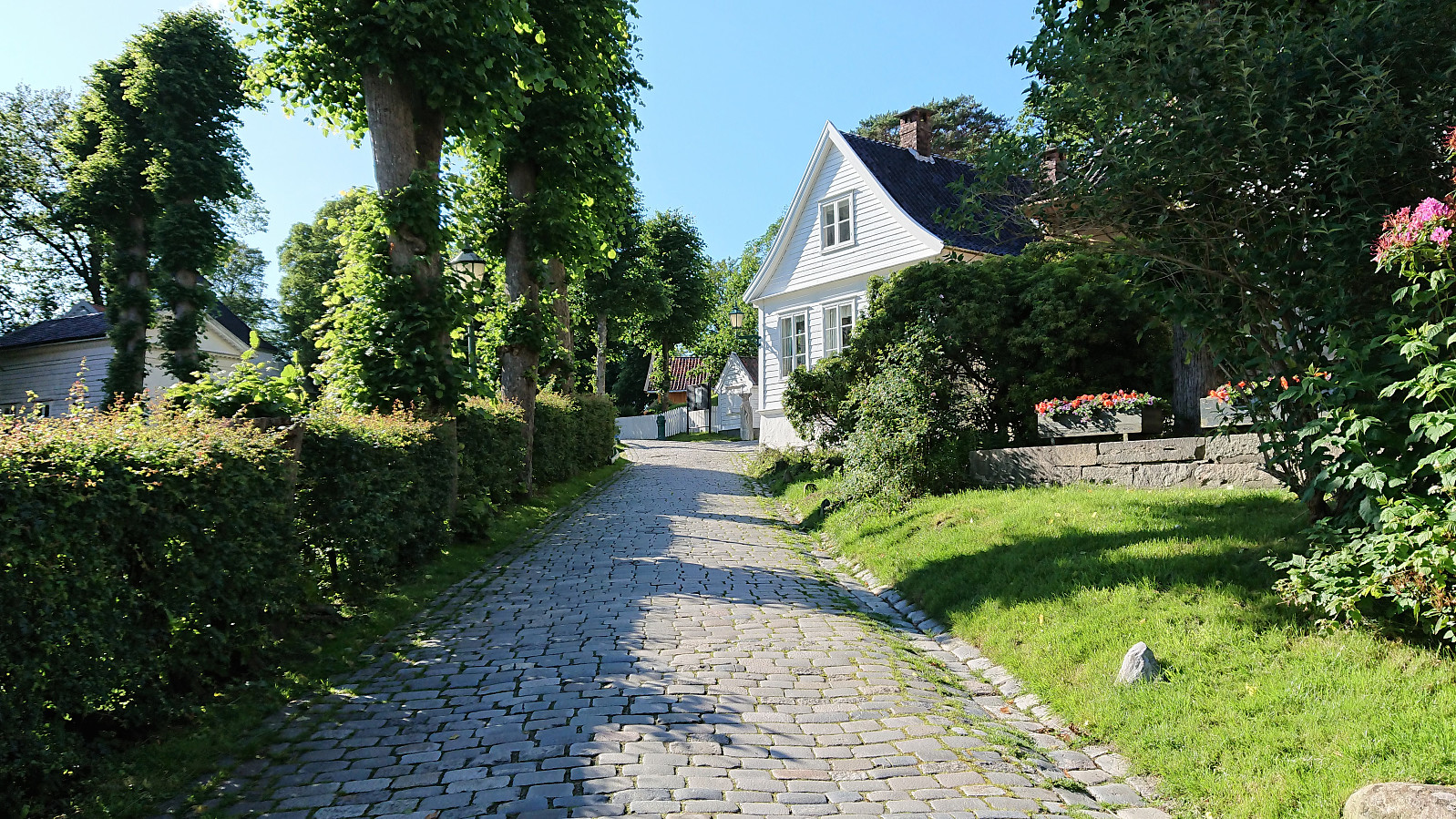 Walk home from work.
Across Hellen festning
- Date:
- 30.06.2019
- Characteristic:
- Hike
- Duration:
- 0:32h
- Distance:
- 3.1km
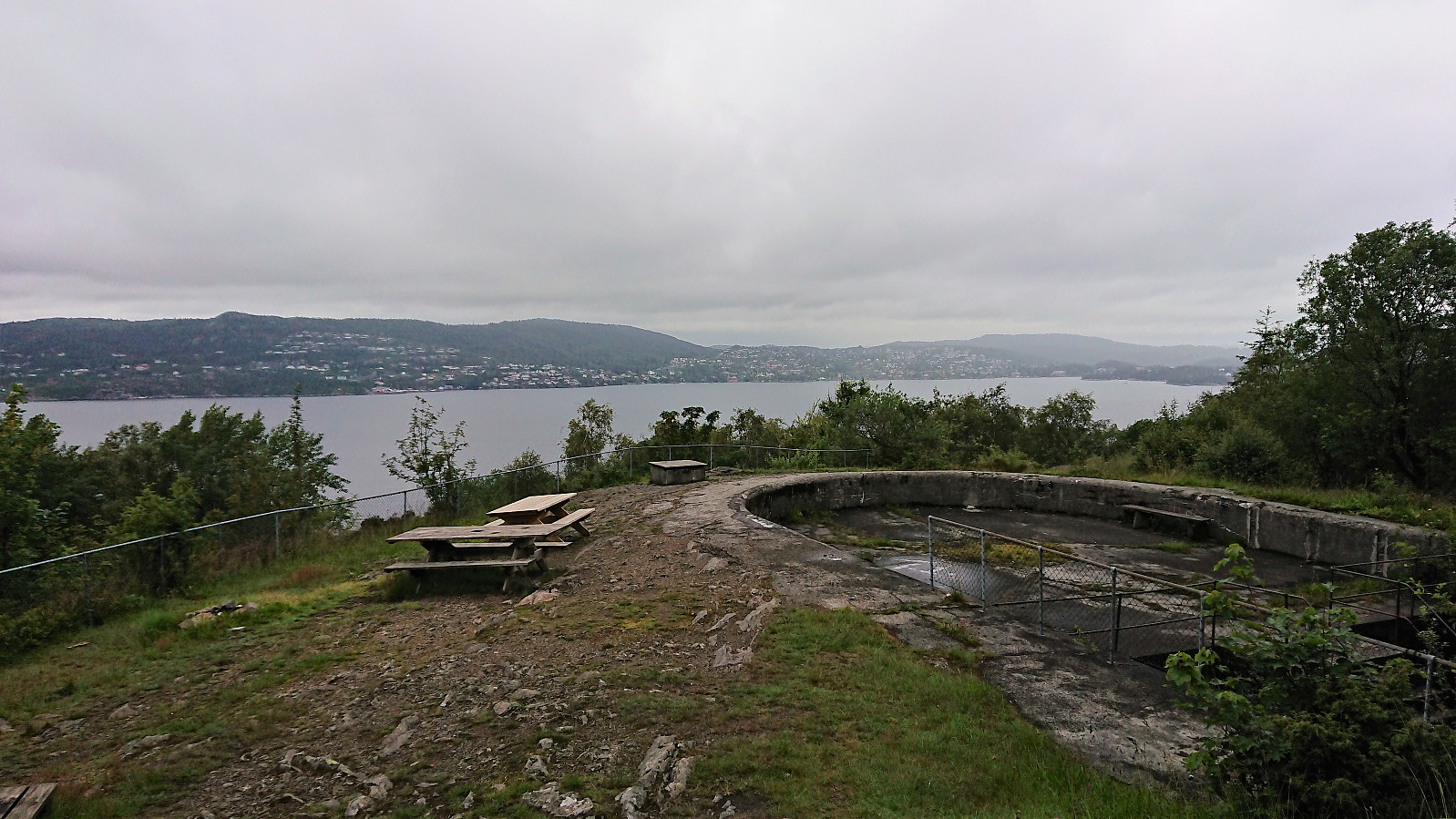 Short local hike across Hellen festning.
Øyanovi, Storafjellet and Gløvret (Storfossen to Vaksdal)
- Date:
- 27.06.2019
- Characteristic:
- Hillwalk
- Duration:
- 9:15h
- Distance:
- 21.3km
 We started by taking the train to Dale and from there the connecting bus up to Storfossen/Storfossdammen. After crossing along the top of the dam, we followed the marked (but clearly not very heavily used) trail up Øyaskaret. Did not see any trails in the direction of Øyanovi , but when reaching the top of Øyaskaret it was straightforward to make progress towards the summit.
Note that the best views from Øyanovi were not obtained at the summit itself, but rather 100 meters further north (now added as a separate PB element ). For our return to the marked trail, we made a shortcut heading more directly south, but it would probably have been just as fast, due to the terrain, to rather retrace our steps to where we left the trail earlier on.
We then followed the marked trail towards Møyadalsnubben , but missed our exit and had to turn back >>>
We started by taking the train to Dale and from there the connecting bus up to Storfossen/Storfossdammen. After crossing along the top of the dam, we followed the marked (but clearly not very heavily used) trail up Øyaskaret. Did not see any trails in the direction of Øyanovi , but when reaching the top of Øyaskaret it was straightforward to make progress towards the summit.
Note that the best views from Øyanovi were not obtained at the summit itself, but rather 100 meters further north (now added as a separate PB element ). For our return to the marked trail, we made a shortcut heading more directly south, but it would probably have been just as fast, due to the terrain, to rather retrace our steps to where we left the trail earlier on.
We then followed the marked trail towards Møyadalsnubben , but missed our exit and had to turn back >>>
Våkendalen
- Date:
- 23.06.2019
- Characteristic:
- Hillwalk
- Duration:
- 3:57h
- Distance:
- 17.9km
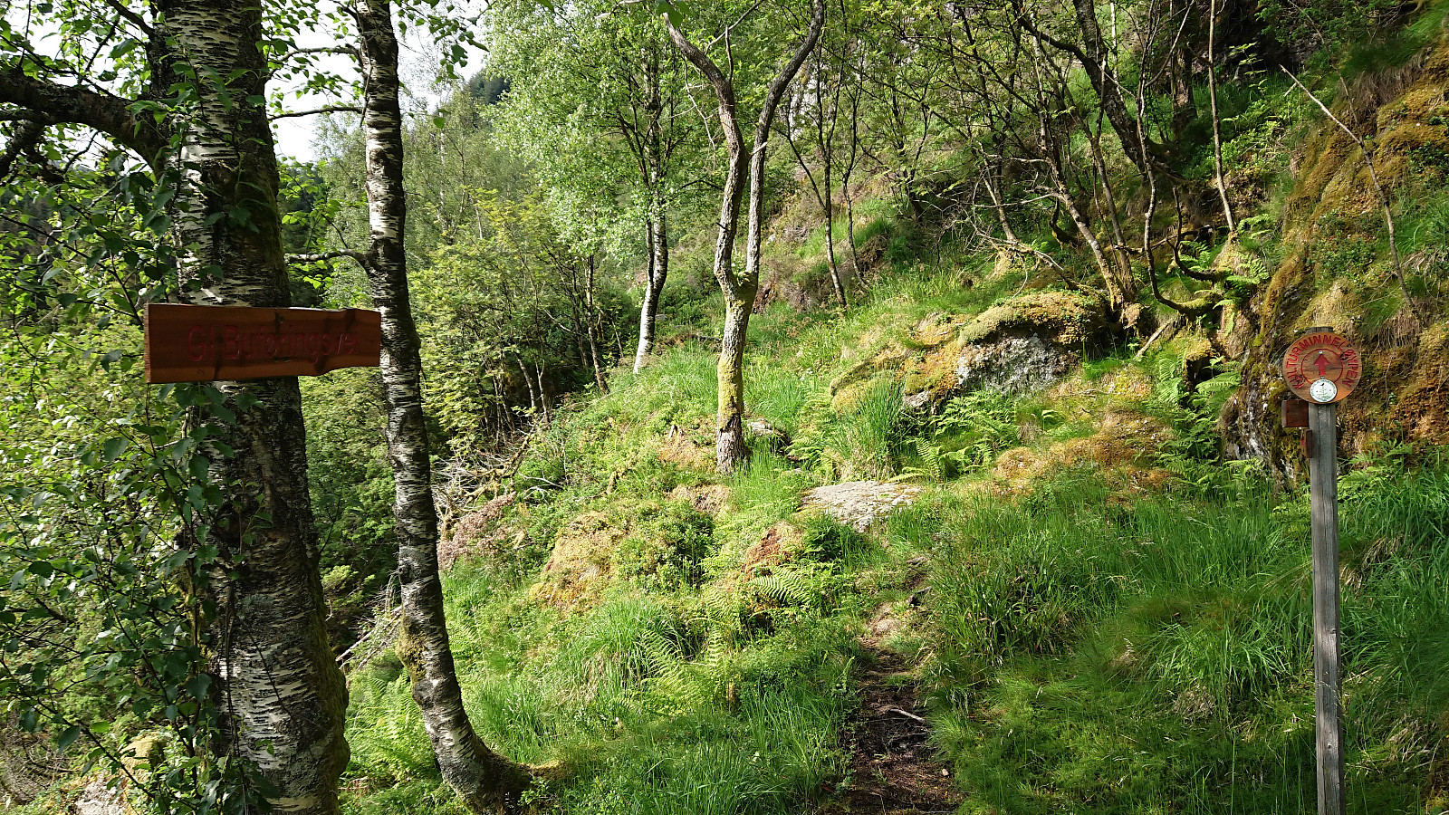 It was already late afternoon when it finally stopped raining and too late to visit any new peaks. I therefore settled on a new trail instead and hopped on a bus to Årstadveien. Upon reaching the northern end of Svartediket I left the main road and followed the trail up to Hardbakkedalen. Just before the trail enters the upper part of Hardbakkedalen, I turned left (north) for the new trail of the day: Buføringsvegen. My hope was that I would discover a new route up to Langelivatnet, or if this did not work out, end up somewhere below Tarlebøvatnet.
The trailhead was marked, but the trail itself did not seem very frequently used. It was however overall easy to follow and I soon arrived at the ruins at Hardbakkhaugen , where an information sign, mainly about the small farm, also mentioned that there used >>>
It was already late afternoon when it finally stopped raining and too late to visit any new peaks. I therefore settled on a new trail instead and hopped on a bus to Årstadveien. Upon reaching the northern end of Svartediket I left the main road and followed the trail up to Hardbakkedalen. Just before the trail enters the upper part of Hardbakkedalen, I turned left (north) for the new trail of the day: Buføringsvegen. My hope was that I would discover a new route up to Langelivatnet, or if this did not work out, end up somewhere below Tarlebøvatnet.
The trailhead was marked, but the trail itself did not seem very frequently used. It was however overall easy to follow and I soon arrived at the ruins at Hardbakkhaugen , where an information sign, mainly about the small farm, also mentioned that there used >>>
Øvre Lønborg and Hellen festning
- Date:
- 20.06.2019
- Characteristic:
- Hike
- Duration:
- 0:40h
- Distance:
- 3.6km
 Short local hike in very light rain.
