Archive - Date
Archive - Activity
-
Bike trip (108)
- Bike trip - mixed (25)
- Bike trip - road (83)
-
Drive (9)
- Car drive (9)
-
Other trip (3)
- Kayaking (3)
-
Ski trip (109)
- Backcountry skiing (65)
- Cross-country skiing (44)
- Trip by foot (1770)
Collected lists
-
Voss ≥ 100m pf.
(96/98)
 97%
97% -
Opptur Hordaland
(143/159)
89%
-
Stasjoner på Bergensbanen
(31/40)
77%
-
Ulvik ≥ 100m pf.
(28/38)
73%
-
Hordaland ≥ 100m pf.
(610/863)
70%
-
Mjølfjell PF > 100m
(21/31)
67%
-
Jondal ≥ 100m pf.
(15/23)
65%
-
Sunnhordland PF >= 100m
(104/186)
55%
-
Dagsturhyttene i Vestland
(33/61)
54%
-
Hordaland: Hardanger PF>=100m
(183/359)
50%
-
Kvinnherad ≥ 100m pf.
(40/79)
50%
-
DNT-hytter i Hordaland
(22/45)
48%
-
Sogndal ≥ 100m pf.
(23/81)
28%
-
Vik i Sogn ≥ 100m pf.
(8/46)
17%
-
DNT-hytter i Sogn og Fjordane
(8/47)
17%
-
Eidfjord ≥ 100m pf.
(6/42)
14%
-
Etne ≥ 100m pf.
(7/51)
13%
-
Ullensvang ≥ 100m pf.
(19/153)
12%
-
Sogn - Sør for Sognefjorden PF>=100m
(17/159)
10%
-
Opptur i Sogn og Fjordane peaks
(17/177)
9%

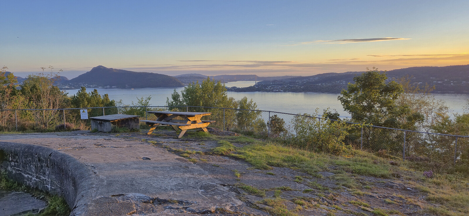
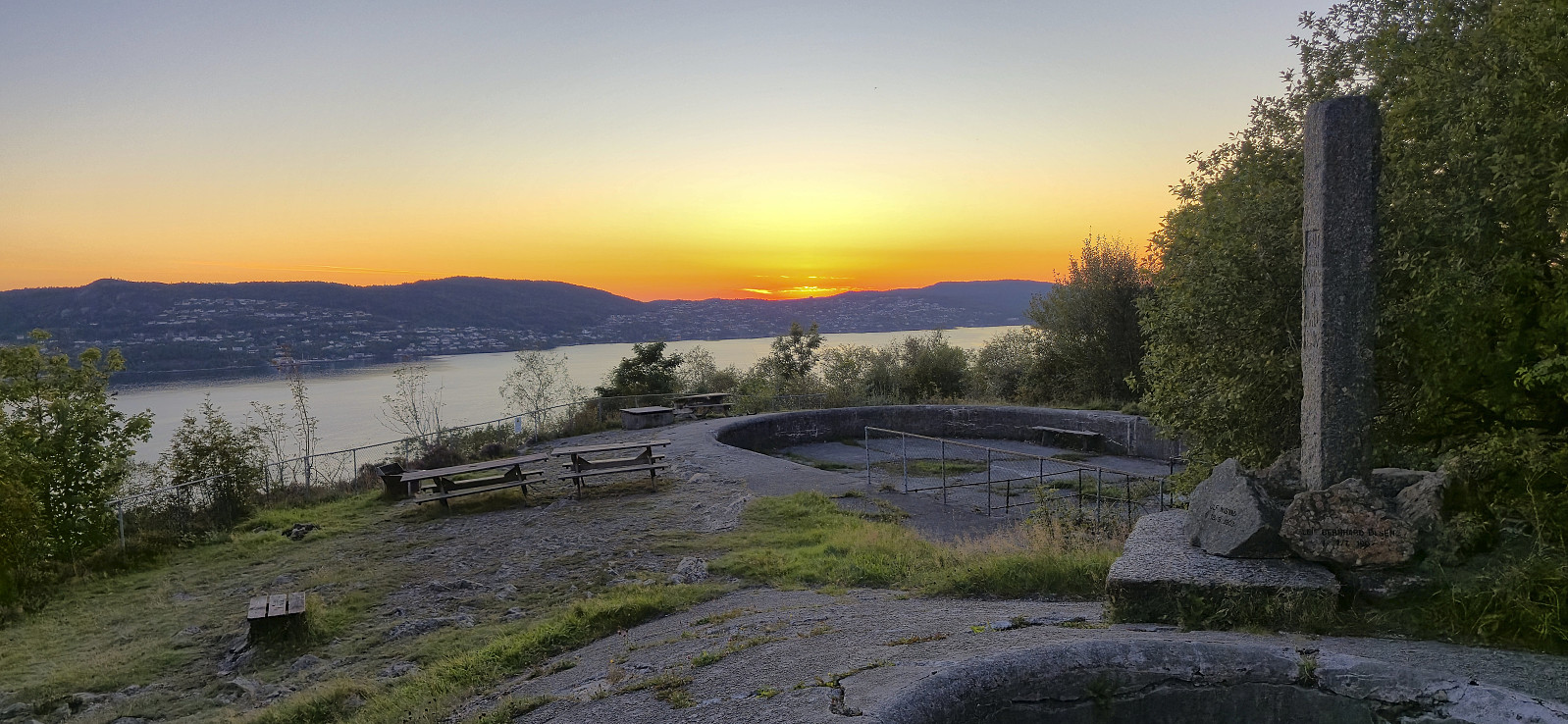
Across Hellen festning
- Date:
- 09.09.2025
- Characteristic:
- Hike
- Duration:
- 0:38h
- Distance:
- 3.2km
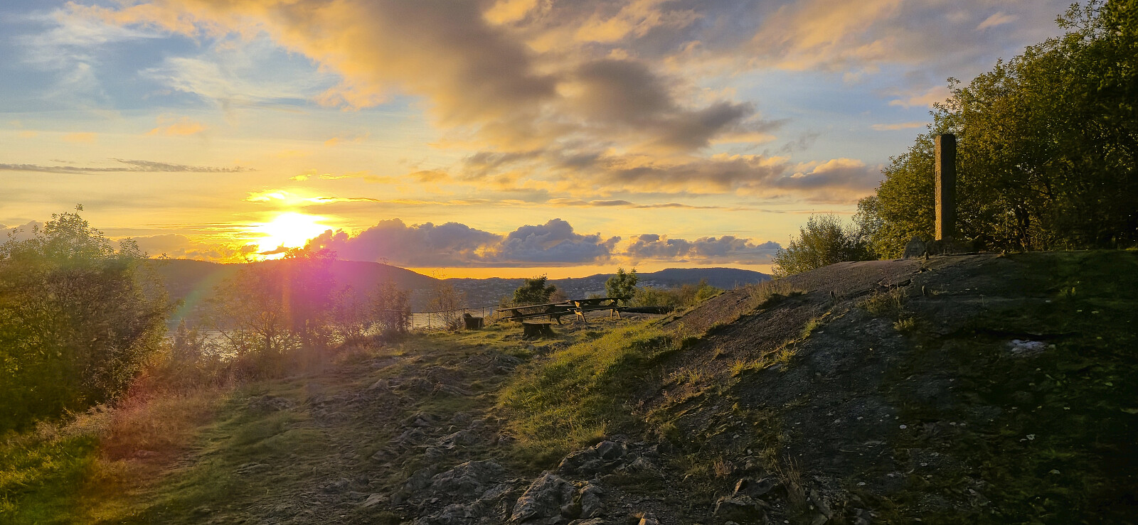 Short local evening hike around sunset.
Austdalsnuten
- Date:
- 07.09.2025
- Characteristic:
- Hillwalk
- Duration:
- 8:46h
- Distance:
- 17.5km
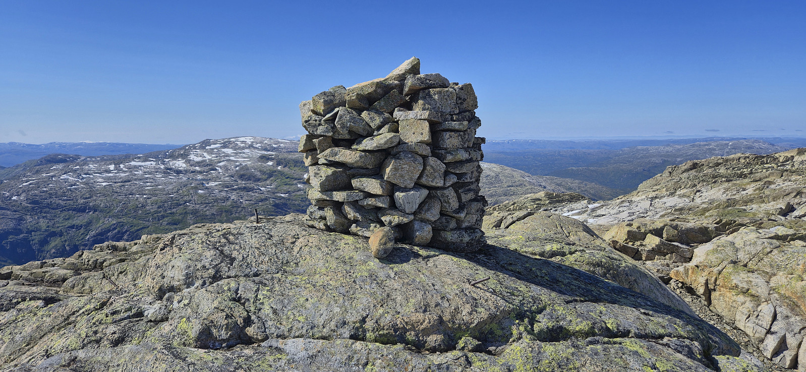
 Sunday hike to Austdalsnuten organized by Voss Utferdslag . After catching a very early train from Bergen, I caught up with the other hikers at Voss shortly before 08:00 for the roughly 1.5-hour bus ride to Austdalsvatnet. When getting off the bus we were at over 1000 meters above sea level and only 1.3 km from the summit, but given the terrain, including Austdalsvatnet blocking our way, we had to do a rather long detour before starting the real ascent from the south.
On our way to the smaller lakes south of Austdalsnuten we partly followed a route used by the local farmers when transporting their sheep to their summer grazing areas. There were even small cairns showing the way but these were not always easy to spot and we thus made good use of our local guide. The clue seemed to be to be patient and ascend high enough >>>
Sunday hike to Austdalsnuten organized by Voss Utferdslag . After catching a very early train from Bergen, I caught up with the other hikers at Voss shortly before 08:00 for the roughly 1.5-hour bus ride to Austdalsvatnet. When getting off the bus we were at over 1000 meters above sea level and only 1.3 km from the summit, but given the terrain, including Austdalsvatnet blocking our way, we had to do a rather long detour before starting the real ascent from the south.
On our way to the smaller lakes south of Austdalsnuten we partly followed a route used by the local farmers when transporting their sheep to their summer grazing areas. There were even small cairns showing the way but these were not always easy to spot and we thus made good use of our local guide. The clue seemed to be to be patient and ascend high enough >>>
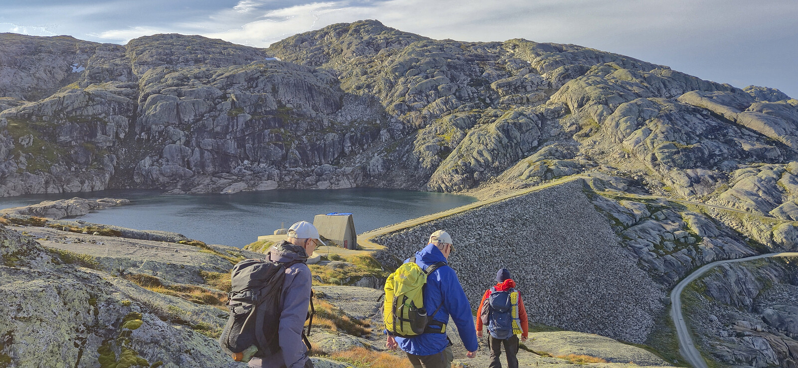
Gjetingsdalen to Årvik via Grønhaug and Storahorga
- Date:
- 30.08.2025
- Characteristic:
- Hillwalk
- Duration:
- 7:32h
- Distance:
- 16.2km
 Warning: The trail this hike seemingly follows down to Årvik does not exist! Instead there is a steep off-trail descent. Read the report carefully.
Petter picked up me and Kjell in Ytre Sandviken shortly after seven on a Saturday morning for a joint drive to Tørvikbygd and the ferry to Jondal. From Jondal we drove the short distance south to Gjetingsdalen, paid the 60 kr toll fee and continued up to the small parking lot at the end of the gravel road.
We started by following a trail to Norddalen and from there continued on a much weaker trail, although marked by orange paint, up towards Isdalsvatnet. The trail markers were overall easy to follow however the trail itself was very weak at best. Shortly after passing the small lake south of Isdalsvatnet we in any case had to abandon the markers as they turned southeast and presumably >>>
Warning: The trail this hike seemingly follows down to Årvik does not exist! Instead there is a steep off-trail descent. Read the report carefully.
Petter picked up me and Kjell in Ytre Sandviken shortly after seven on a Saturday morning for a joint drive to Tørvikbygd and the ferry to Jondal. From Jondal we drove the short distance south to Gjetingsdalen, paid the 60 kr toll fee and continued up to the small parking lot at the end of the gravel road.
We started by following a trail to Norddalen and from there continued on a much weaker trail, although marked by orange paint, up towards Isdalsvatnet. The trail markers were overall easy to follow however the trail itself was very weak at best. Shortly after passing the small lake south of Isdalsvatnet we in any case had to abandon the markers as they turned southeast and presumably >>>
Across Hellen festning
- Date:
- 29.08.2025
- Characteristic:
- Hike
- Duration:
- 0:37h
- Distance:
- 3.2km
 Short local evening hike around sunset.
Across Hellen festning
- Date:
- 25.08.2025
- Characteristic:
- Hike
- Duration:
- 0:42h
- Distance:
- 3.2km
 Short local evening hike.
Fløysvingene and Skredderdalen
- Date:
- 24.08.2025
- Characteristic:
- Hillwalk
- Duration:
- 2:51h
- Distance:
- 7.9km
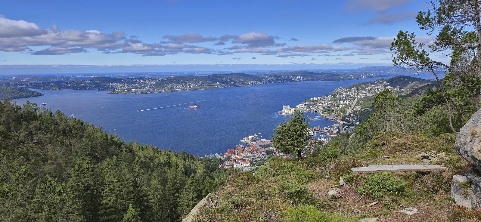 Sunday hike at Fløyen with the goal to identify a viewpoint we had come across in a picture included in the annual report from Bergens Skog- og Træplantningsselskap . After taking the bus to the city center I walked up to Fløyen via Fløysvingene where I met my parents. They had arrived via Fløibanen and together we continued to the lower part of "lysløypen" where it did not take long before we found the spot the picture had been taken. It provided an excellent view and could be reached in two ways, with the shorter option via a trail from the gravel road to the southeast being the easiest. We proceeded to descended via Skredderdalen to Mulen. Here I continued on my own to Munkebotn and then took the bus back to Lønborg.
Øvsthusnipa and Vest for Stangahøgdi from Fyre
- Date:
- 23.08.2025
- Characteristic:
- Hillwalk
- Duration:
- 6:12h
- Distance:
- 15.7km
 For the second weekend in a row I took the train to Voss, but where I last Sunday continued on an almost empty bus towards Ulvik I today got on one out of a total of four buses packed with tourists heading to Gudvangen. That was not my plan though and I instead got off at the last stop before Stalheim. (Tip: ask the driver to let you off before the bus takes its detour to Stalheim, as apparently there is an extended stop there.)
After getting off the bus I briefly walked south along the main road on a separate cycling and walking path, crossed the road and continued on the gravel road to Fyre where I located the marked trailhead next to the parking lot . A tractor road took me up to the start of the marked trail to Grindaflethytta . I however only stayed on this trail until Øvsthus, where I left the main trail and continued on a marked trail towards Stalheimsnipa .
When getting to >>>
For the second weekend in a row I took the train to Voss, but where I last Sunday continued on an almost empty bus towards Ulvik I today got on one out of a total of four buses packed with tourists heading to Gudvangen. That was not my plan though and I instead got off at the last stop before Stalheim. (Tip: ask the driver to let you off before the bus takes its detour to Stalheim, as apparently there is an extended stop there.)
After getting off the bus I briefly walked south along the main road on a separate cycling and walking path, crossed the road and continued on the gravel road to Fyre where I located the marked trailhead next to the parking lot . A tractor road took me up to the start of the marked trail to Grindaflethytta . I however only stayed on this trail until Øvsthus, where I left the main trail and continued on a marked trail towards Stalheimsnipa .
When getting to >>>
Across Hellen festning
- Date:
- 20.08.2025
- Characteristic:
- Hike
- Duration:
- 0:36h
- Distance:
- 3.2km
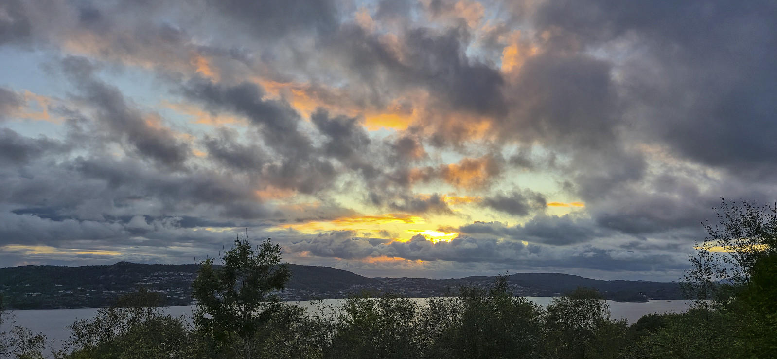 Short local evening hike around sunset.
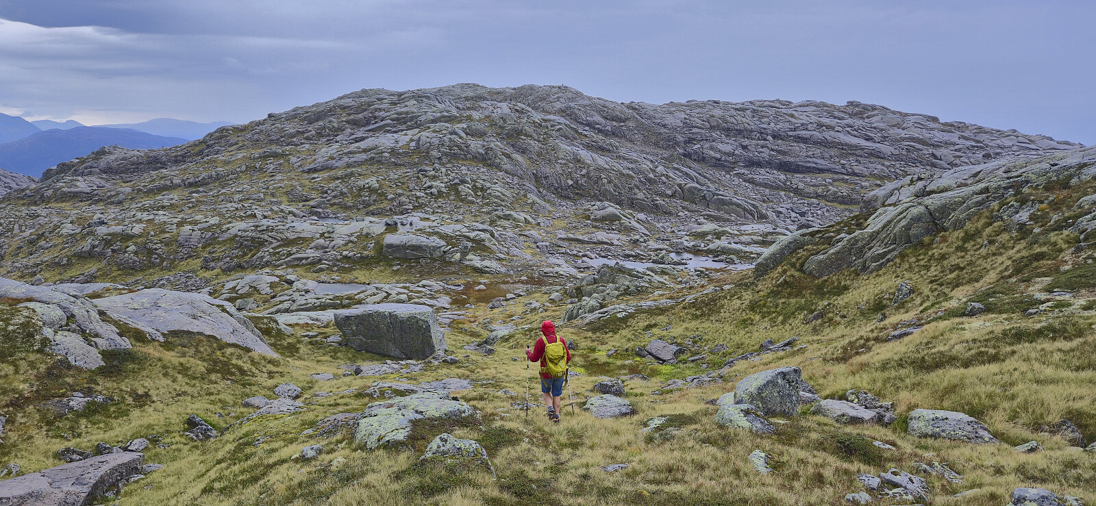
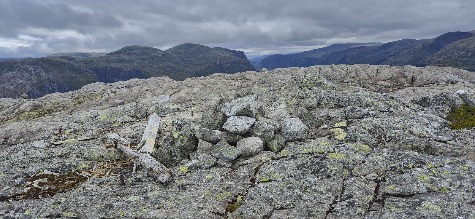
Solsævatnet to Ljosandbotn via Skorafjellet and Mjølfjellet
- Date:
- 17.08.2025
- Characteristic:
- Hillwalk
- Duration:
- 8:00h
- Distance:
- 20.4km
 On a Sunday in mid-August where the warm summer weather made a comeback, I hopped on a train Voss and from there continued by bus to Ulsberg, where I for the second time had to help the bus driver locate the bus stop (see my hike to Kjerringafjellet and Kvasshovden ). After getting off the bus, I first followed the gravel road to Solsævatnet and then continued on the unmarked trail via Rubbelii to Nedre Skor. This was overall straightforward with the main challenge being to spot the trail between the numerous tall ferns doing their best to hide it.
I think I made a wrong turn after crossing the stream west of Rubbelii though, descending to the lake instead of continuing upwards. I therefore shortly ended up on a much weaker trail before reconnecting with the main trail. (Note that there is also a trail going around the lake. So be sure >>>
On a Sunday in mid-August where the warm summer weather made a comeback, I hopped on a train Voss and from there continued by bus to Ulsberg, where I for the second time had to help the bus driver locate the bus stop (see my hike to Kjerringafjellet and Kvasshovden ). After getting off the bus, I first followed the gravel road to Solsævatnet and then continued on the unmarked trail via Rubbelii to Nedre Skor. This was overall straightforward with the main challenge being to spot the trail between the numerous tall ferns doing their best to hide it.
I think I made a wrong turn after crossing the stream west of Rubbelii though, descending to the lake instead of continuing upwards. I therefore shortly ended up on a much weaker trail before reconnecting with the main trail. (Note that there is also a trail going around the lake. So be sure >>>
Across Hellen festning
- Date:
- 16.08.2025
- Characteristic:
- Hike
- Duration:
- 0:38h
- Distance:
- 3.2km
 Short local Saturday hike.
