Archive - Date
Archive - Activity
-
Bike trip (108)
- Bike trip - mixed (25)
- Bike trip - road (83)
-
Drive (9)
- Car drive (9)
-
Other trip (3)
- Kayaking (3)
-
Ski trip (112)
- Backcountry skiing (66)
- Cross-country skiing (46)
- Trip by foot (1836)
Collected lists
- Utvalgte topper og turmål i Bergen
- Alle topper i Bergen
- Voss ≥ 100m pf.
- Opptur Hordaland
- Stasjoner på Bergensbanen
- Ulvik ≥ 100m pf.
- Hordaland ≥ 100m pf.
- Mjølfjell PF > 100m
- Jondal ≥ 100m pf.
- Sunnhordland PF >= 100m
- Dagsturhyttene i Vestland
- Hordaland: Hardanger PF>=100m
- DNT-hytter i Hordaland
- Kvinnherad ≥ 100m pf.
- Sogndal ≥ 100m pf.
- Vik i Sogn ≥ 100m pf.
- Gulen ≥ 100m pf.
- DNT-hytter i Sogn og Fjordane
- Eidfjord ≥ 100m pf.
- Sogn - Sør for Sognefjorden PF>=100m
Åsheimveten from Åsheim
- Date:
- 16.04.2023
- Characteristic:
- Hillwalk
- Duration:
- 1:44h
- Distance:
- 3.5km
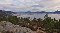
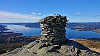 After our visit of Kossdalssvingane we decided to add a short bonus hike to Åsheimveten before returning to Bergen. We first drove the short distance from Hosanger Montessoriskule up to Åsheimveten p-plass , thus gaining around 200 meters vertical elevation for free. After paying the 20 kr parking fee via Vipps, we followed a very nice trail all the way to the summit, which, as for my previous visit back in 2018 , provided excellent panoramic views. From the summit we returned along the same route back to the car, and thus concluded a great day of hiking at Osterøy!
Kossdalssvingane
- Date:
- 16.04.2023
- Characteristic:
- Hike
- Duration:
- 2:16h
- Distance:
- 8.1km
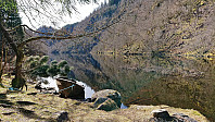 A return to Osterøy for a visit of Kossdalssvingane . We parked outside Hosanger Montessoriskule and started on the indicated roundtrip around Holevatnet before heading southeast along Kossdalsvatnet to arrive at the bottom of the very impressive Kossdalssvingane. After ascending to the top of the 17 steep hairpin turns we continued southeast to the upper parking lot before returning the same way, however this time following the gravel road on the west side of Holevatnet and completing our roundtrip. In summary, an excellent short hike that can be very highly recommended!
Nukane and Austefjellet
- Date:
- 15.04.2023
- Characteristic:
- Hillwalk
- Duration:
- 1:43h
- Distance:
- 5.7km
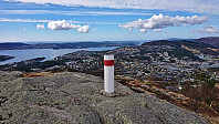 A revisit of Nukane via (for me) new trails with the main objective of passing by the trig marker at Austefjellet .
Across Hellen festning
- Date:
- 14.04.2023
- Characteristic:
- Hike
- Duration:
- 0:37h
- Distance:
- 3.2km
Ørneberget and Hellen festning
- Date:
- 13.04.2023
- Characteristic:
- Hillwalk
- Duration:
- 1:03h
- Distance:
- 4.4km
Storasåta på Liland
- Date:
- 10.04.2023
- Characteristic:
- Hike
- Duration:
- 0:23h
- Distance:
- 1.7km
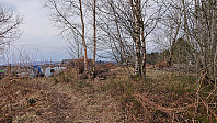 Still low on energy, but at least I managed to find a new location to explore without requiring a long walk.
Recovery, day 4: Hellemyrstien
- Date:
- 09.04.2023
- Characteristic:
- Hike
- Duration:
- 1:31h
- Distance:
- 7.7km
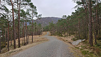 Decided to go for a slightly longer hike along Hellemyrstien on a gray Sunday, making it home before the proper rain showers started.
Recovery, day 3: Ørneberget and Hellen festning
- Date:
- 08.04.2023
- Characteristic:
- Hillwalk
- Duration:
- 1:02h
- Distance:
- 4.2km
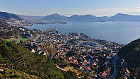 With the excellent weather, I ventured slightly further today, including a visit of Ørneberget . Still low on energy, but at least I was not getting worse.
Recovery, day 2: Across Hellen festning
- Date:
- 07.04.2023
- Characteristic:
- Hike
- Duration:
- 0:52h
- Distance:
- 3.8km
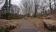 Perhaps an ever so slight improvement. At least the short walk across Hellen festning was not as though as the day before. It was still more than far enough though.
Recovery, day 1: Across Hellen festning
- Date:
- 06.04.2023
- Characteristic:
- Hike
- Duration:
- 0:41h
- Distance:
- 3.1km
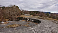 Halfway through my Saturday hike in Sveio , it became clear that something was just not right. I did not have the normal energy level and even this relatively short hike was much harder than it ought to be. The flu-like symptoms increased during the evening and by the Sunday morning there was no doubt: this Easter holiday would not turn out as planed... Days of skiing in Sogndal were instead replaced by long days on the couch interspersed with nights of little to no quality sleep. The complete loss of smell and taste did not help either. Only after 4.5 days did I managed to muster enough energy to just barely push myself across Hellen festning.


