Archive - Date
Archive - Activity
-
Bike trip (111)
- Bike trip - mixed (25)
- Bike trip - road (86)
-
Drive (9)
- Car drive (9)
-
Other trip (3)
- Kayaking (3)
-
Ski trip (116)
- Backcountry skiing (69)
- Cross-country skiing (47)
- Trip by foot (1897)
Collected lists
-
Utvalgte topper og turmål i Bergen
(349/351)
 99%
99% -
Alle topper i Bergen
(393/400)
98%
-
Voss ≥ 100m pf.
(96/98)
97%
-
Opptur Hordaland
(144/159)
90%
-
Stasjoner på Bergensbanen
(33/40)
82%
-
Ulvik ≥ 100m pf.
(30/38)
78%
-
Hordaland ≥ 100m pf.
(624/863)
72%
-
Mjølfjell PF > 100m
(21/31)
67%
-
Jondal ≥ 100m pf.
(15/23)
65%
-
Dagsturhyttene i Vestland
(36/61)
59%
-
Sunnhordland PF >= 100m
(105/186)
56%
-
Hordaland: Hardanger PF>=100m
(196/359)
54%
-
DNT-hytter i Hordaland
(23/45)
51%
-
Kvinnherad ≥ 100m pf.
(40/79)
50%
-
Eidfjord ≥ 100m pf.
(13/42)
30%
-
Sogndal ≥ 100m pf.
(23/81)
28%
-
Gulen ≥ 100m pf.
(15/54)
27%
-
Vik i Sogn ≥ 100m pf.
(10/46)
21%
-
Sogn - Sør for Sognefjorden PF>=100m
(31/159)
19%
-
DNT-hytter i Sogn og Fjordane
(8/47)
17%

Gravdalshorga from Gravdal
- Date:
- 31.10.2021
- Characteristic:
- Hillwalk
- Duration:
- 3:57h
- Distance:
- 10.2km
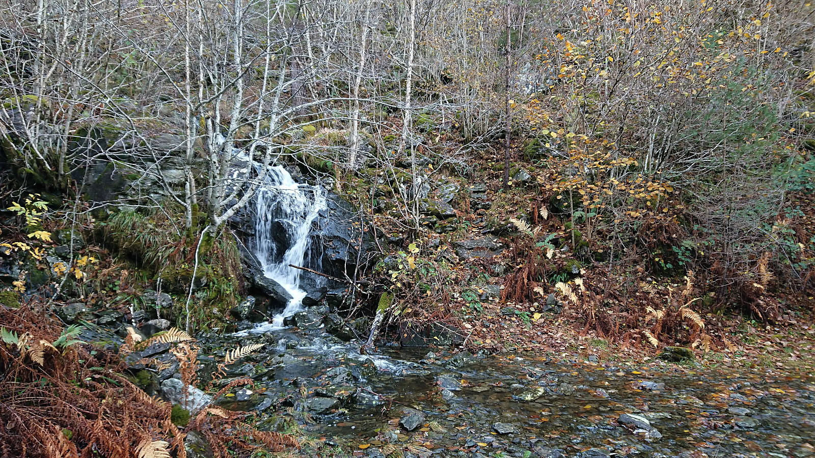 I started by taking the bus from Bergen to Gravdal and got off at the bus stop called "Gravdal sør, Kvam". From there I pretty much followed in the footsteps of previous PB-hikers to Gravdalshorga , and could thus take advantage of their efforts at finding the best route.
After passing the last houses at the end of Gravdalsvegen, I continued on a tractor road taking me to an unmarked trail following the river up to the unnamed cabin at the northeastern end of Sakresvatn. While the trailhead was unmarked, the trail itself was relatively easy to follow.
As I arrived at the cabin, I however noticed that this was an unnecessary detour and that I should rather have stayed on the south side of the stream (see the return route). But after finding a place to cross the stream I was shortly back on track >>>
I started by taking the bus from Bergen to Gravdal and got off at the bus stop called "Gravdal sør, Kvam". From there I pretty much followed in the footsteps of previous PB-hikers to Gravdalshorga , and could thus take advantage of their efforts at finding the best route.
After passing the last houses at the end of Gravdalsvegen, I continued on a tractor road taking me to an unmarked trail following the river up to the unnamed cabin at the northeastern end of Sakresvatn. While the trailhead was unmarked, the trail itself was relatively easy to follow.
As I arrived at the cabin, I however noticed that this was an unnecessary detour and that I should rather have stayed on the south side of the stream (see the return route). But after finding a place to cross the stream I was shortly back on track >>>
Fjellveien, Fløyen and Brushytten
- Date:
- 30.10.2021
- Characteristic:
- Hike
- Duration:
- 2:52h
- Distance:
- 14.5km
 Saturday hike from Munkebotn to Lønborg via Fjellveien, Fløyen and Brushytten.
Hellen festning and Furukammen
- Date:
- 29.10.2021
- Characteristic:
- Hike
- Duration:
- 1:16h
- Distance:
- 4.9km
 Short local hike after work.
Ørneberget and Furukammen
- Date:
- 27.10.2021
- Characteristic:
- Hillwalk
- Duration:
- 0:52h
- Distance:
- 4.0km
 Short local hike after work.
Hellen festning and Furukammen
- Date:
- 24.10.2021
- Characteristic:
- Hike
- Duration:
- 1:20h
- Distance:
- 4.5km
 Short local hike on a gray and wet Sunday.
Toppfjellet from Eide
- Date:
- 23.10.2021
- Characteristic:
- Hillwalk
- Duration:
- 4:42h
- Distance:
- 10.9km
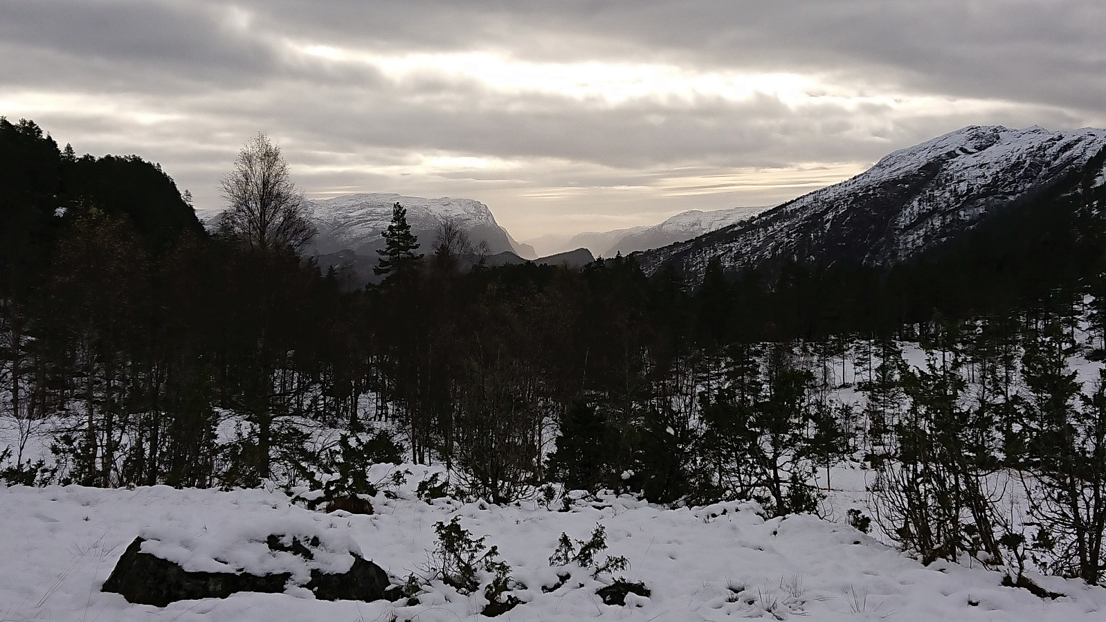 It is not often that one gets to be among the first three registered visits for a summit on the Hordaland ≥ 100m pf. list, but given that Toppfjellet in Modalen only had two previous visits this should be possible. The most recent visit was by Runemb (Rune Blomberg) back in 2013, and thanks to his report I did not have to plan much to find the best route.
After taking the train to Dale and then the bus to Eide, I located the marked trailhead and started on a trail marked with a combination of red paint and red plastic tubes. Note that while the trailhead was marked, it may not be the easiest to spot from the main road. There were however signs for both Eidsstølen and Brørvik within the first couple of meters. While the route was clearly marked, the trail itself was often more difficult to spot. The fact that the trail was soon covered by snow did not help either of course. >>>
It is not often that one gets to be among the first three registered visits for a summit on the Hordaland ≥ 100m pf. list, but given that Toppfjellet in Modalen only had two previous visits this should be possible. The most recent visit was by Runemb (Rune Blomberg) back in 2013, and thanks to his report I did not have to plan much to find the best route.
After taking the train to Dale and then the bus to Eide, I located the marked trailhead and started on a trail marked with a combination of red paint and red plastic tubes. Note that while the trailhead was marked, it may not be the easiest to spot from the main road. There were however signs for both Eidsstølen and Brørvik within the first couple of meters. While the route was clearly marked, the trail itself was often more difficult to spot. The fact that the trail was soon covered by snow did not help either of course. >>>
Klyvsnolten and Lauvhovden
- Date:
- 19.10.2021
- Characteristic:
- Hillwalk
- Duration:
- 3:02h
- Distance:
- 8.2km
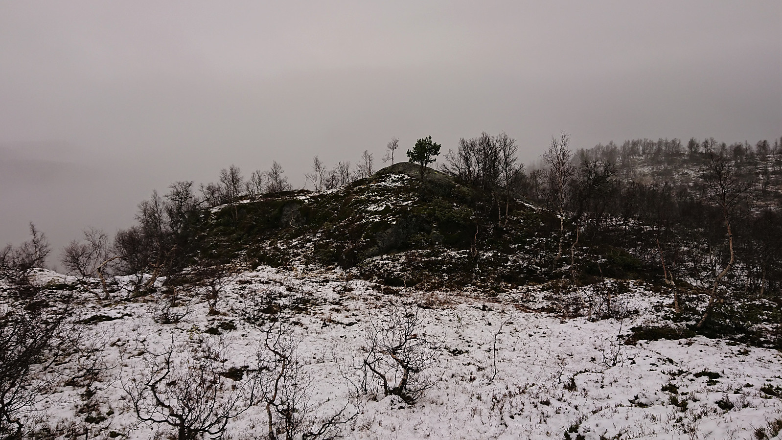 After a two-day meeting at Voss ended after lunch, I managed to convince my colleague HHauser (Helwig Hauser) to go hiking even though the weather forecast looked less than promising. Prepared to get pretty wet and not expecting much in terms of views along the way, we settled on a roundtrip including both Klyvsnolten and Lauvhovden .
We parked besides the gravel road up to Øvre Klyve, returned to the main road and followed it east for 400 meters before heading up a tractor road that Helwig had found when studying the map back at the hotel. The plan was to follow this tractor road until it ended and from there reach a trail stub indicated on the map south of Klyvesnolten.
The tractor road, which seemingly had not been used in a long time, actually continued further than what is indicated on the map, and when it came to an end there was >>>
After a two-day meeting at Voss ended after lunch, I managed to convince my colleague HHauser (Helwig Hauser) to go hiking even though the weather forecast looked less than promising. Prepared to get pretty wet and not expecting much in terms of views along the way, we settled on a roundtrip including both Klyvsnolten and Lauvhovden .
We parked besides the gravel road up to Øvre Klyve, returned to the main road and followed it east for 400 meters before heading up a tractor road that Helwig had found when studying the map back at the hotel. The plan was to follow this tractor road until it ended and from there reach a trail stub indicated on the map south of Klyvesnolten.
The tractor road, which seemingly had not been used in a long time, actually continued further than what is indicated on the map, and when it came to an end there was >>>
Kattnakken, Mehammarsåto and Grønafjellet
- Date:
- 17.10.2021
- Characteristic:
- Hillwalk
- Duration:
- 6:39h
- Distance:
- 22.3km
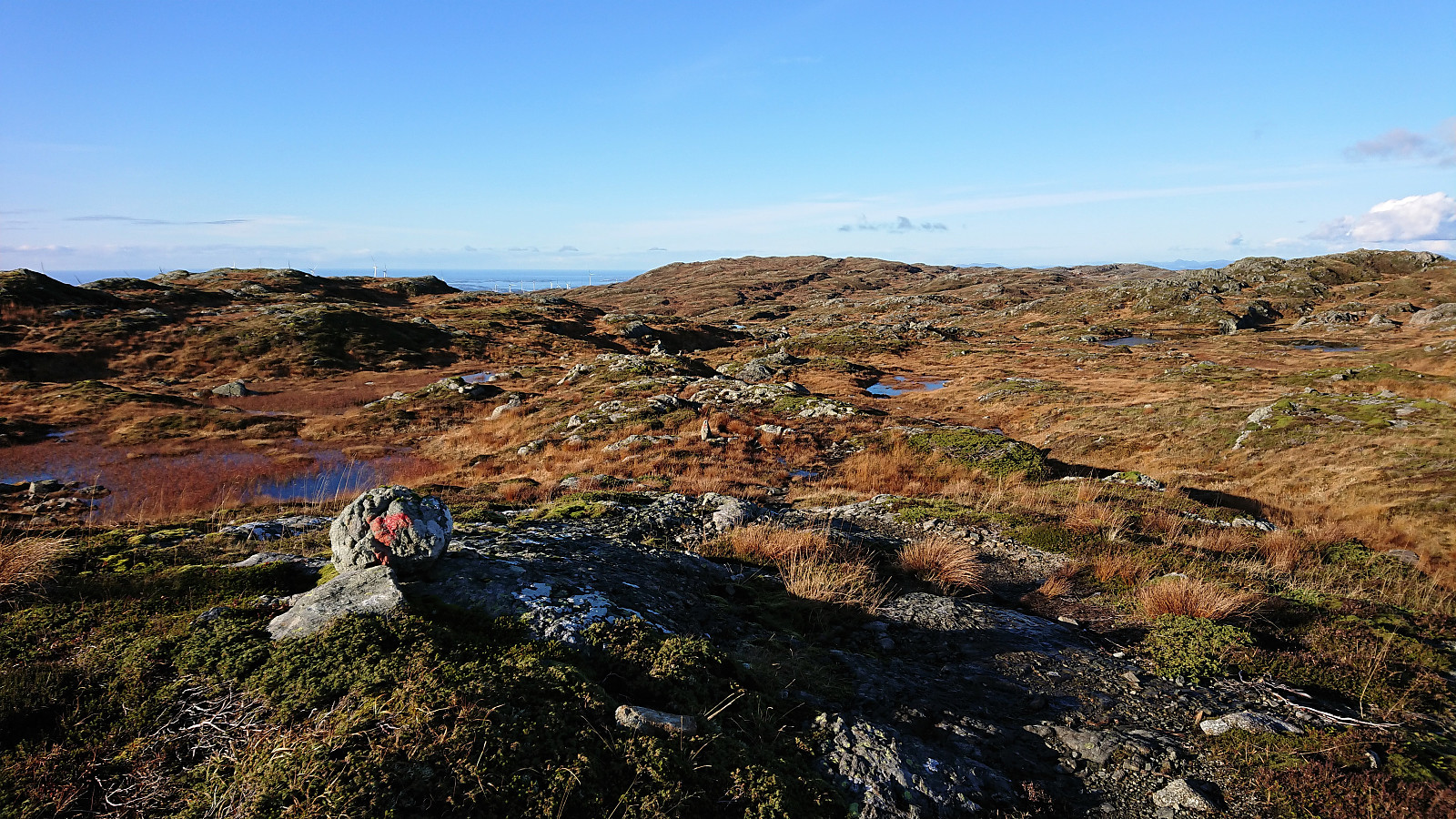 I started by taking the express bus to Stord and getting off at the bus stop called Børtveit (Bortveit on the map). I then proceeded to follow the gravel road up to Svartavatnet where I inspected the map and found a possible shortcut to Kattnakken from the northeast. The plan was to continue southeast along the trail starting from north of Svartavatnet and then follow the overhanging power lines towards the summit. However, I initially missed the trailhead and continued a bit too far on the gravel road. But after an off-trail shortcut I managed to connect with the trail, which was even marked with occasional red markers and I even spotted a red T. It did not seem like a very heavily used trail though.
Shortly after passing underneath the power lines I turned southwest and headed off-trail in the direction >>>
I started by taking the express bus to Stord and getting off at the bus stop called Børtveit (Bortveit on the map). I then proceeded to follow the gravel road up to Svartavatnet where I inspected the map and found a possible shortcut to Kattnakken from the northeast. The plan was to continue southeast along the trail starting from north of Svartavatnet and then follow the overhanging power lines towards the summit. However, I initially missed the trailhead and continued a bit too far on the gravel road. But after an off-trail shortcut I managed to connect with the trail, which was even marked with occasional red markers and I even spotted a red T. It did not seem like a very heavily used trail though.
Shortly after passing underneath the power lines I turned southwest and headed off-trail in the direction >>>
Vardehaugen, Bjørnhaugen and Vadmyra
- Date:
- 16.10.2021
- Characteristic:
- Hike
- Duration:
- 1:44h
- Distance:
- 6.5km
 Yet another short hike to visit new peaks on the Alle topper i Bergen list. First up was Vardehaugen , which was easily accessible via a trail from the north. Limited views from the summit, but Bildøybakken could be spotted in the distance. When continuing south along the trail across the summit, I also came across a metal trig marker on a slightly smaller hill. This trail later turned into a narrow gravel road before connecting with the wider gravel road east of Vardevatnet.
I proceeded to follow the gravel roads until getting just north of Bjørnhaugen . Here I passed through a gate and continued on a trail which later turned into an animal track taking me all the way to the summit. Bjørnhaugen consisted of two small hills in which the northern one was slightly higher and contained a small metal trig marker. The best views were however achieved >>>
Yet another short hike to visit new peaks on the Alle topper i Bergen list. First up was Vardehaugen , which was easily accessible via a trail from the north. Limited views from the summit, but Bildøybakken could be spotted in the distance. When continuing south along the trail across the summit, I also came across a metal trig marker on a slightly smaller hill. This trail later turned into a narrow gravel road before connecting with the wider gravel road east of Vardevatnet.
I proceeded to follow the gravel roads until getting just north of Bjørnhaugen . Here I passed through a gate and continued on a trail which later turned into an animal track taking me all the way to the summit. Bjørnhaugen consisted of two small hills in which the northern one was slightly higher and contained a small metal trig marker. The best views were however achieved >>>
Across Hellen festning
- Date:
- 14.10.2021
- Characteristic:
- Hike
- Duration:
- 0:34h
- Distance:
- 3.1km
 Wet and windy local evening hike.
