Archive - Date
Archive - Activity
-
Bike trip (111)
- Bike trip - mixed (25)
- Bike trip - road (86)
-
Drive (9)
- Car drive (9)
-
Other trip (3)
- Kayaking (3)
-
Ski trip (116)
- Backcountry skiing (69)
- Cross-country skiing (47)
- Trip by foot (1898)
Collected lists
-
Utvalgte topper og turmål i Bergen
(349/351)
 99%
99% -
Alle topper i Bergen
(393/400)
98%
-
Voss ≥ 100m pf.
(96/98)
97%
-
Opptur Hordaland
(144/159)
90%
-
Stasjoner på Bergensbanen
(33/40)
82%
-
Ulvik ≥ 100m pf.
(30/38)
78%
-
Hordaland ≥ 100m pf.
(624/863)
72%
-
Mjølfjell PF > 100m
(21/31)
67%
-
Jondal ≥ 100m pf.
(15/23)
65%
-
Dagsturhyttene i Vestland
(36/61)
59%
-
Sunnhordland PF >= 100m
(105/186)
56%
-
Hordaland: Hardanger PF>=100m
(196/359)
54%
-
DNT-hytter i Hordaland
(23/45)
51%
-
Kvinnherad ≥ 100m pf.
(40/79)
50%
-
Eidfjord ≥ 100m pf.
(13/42)
30%
-
Sogndal ≥ 100m pf.
(23/81)
28%
-
Gulen ≥ 100m pf.
(15/54)
27%
-
Vik i Sogn ≥ 100m pf.
(10/46)
21%
-
Sogn - Sør for Sognefjorden PF>=100m
(31/159)
19%
-
DNT-hytter i Sogn og Fjordane
(8/47)
17%

Bergåsen and Berfjordfjellet
- Date:
- 03.05.2018
- Characteristic:
- Hillwalk
- Duration:
- 1:20h
- Distance:
- 3.5km
 After the visit to Skardsveten we drove to Bergås for the second goal of the day: Bergåsen . We found parking by the side of the road, but had to ask a local farmer to locate the unmarked trailhead. But even then we managed to take a wrong turn at the very start. This was however quickly corrected and we soon found ourselves on a marked trail.
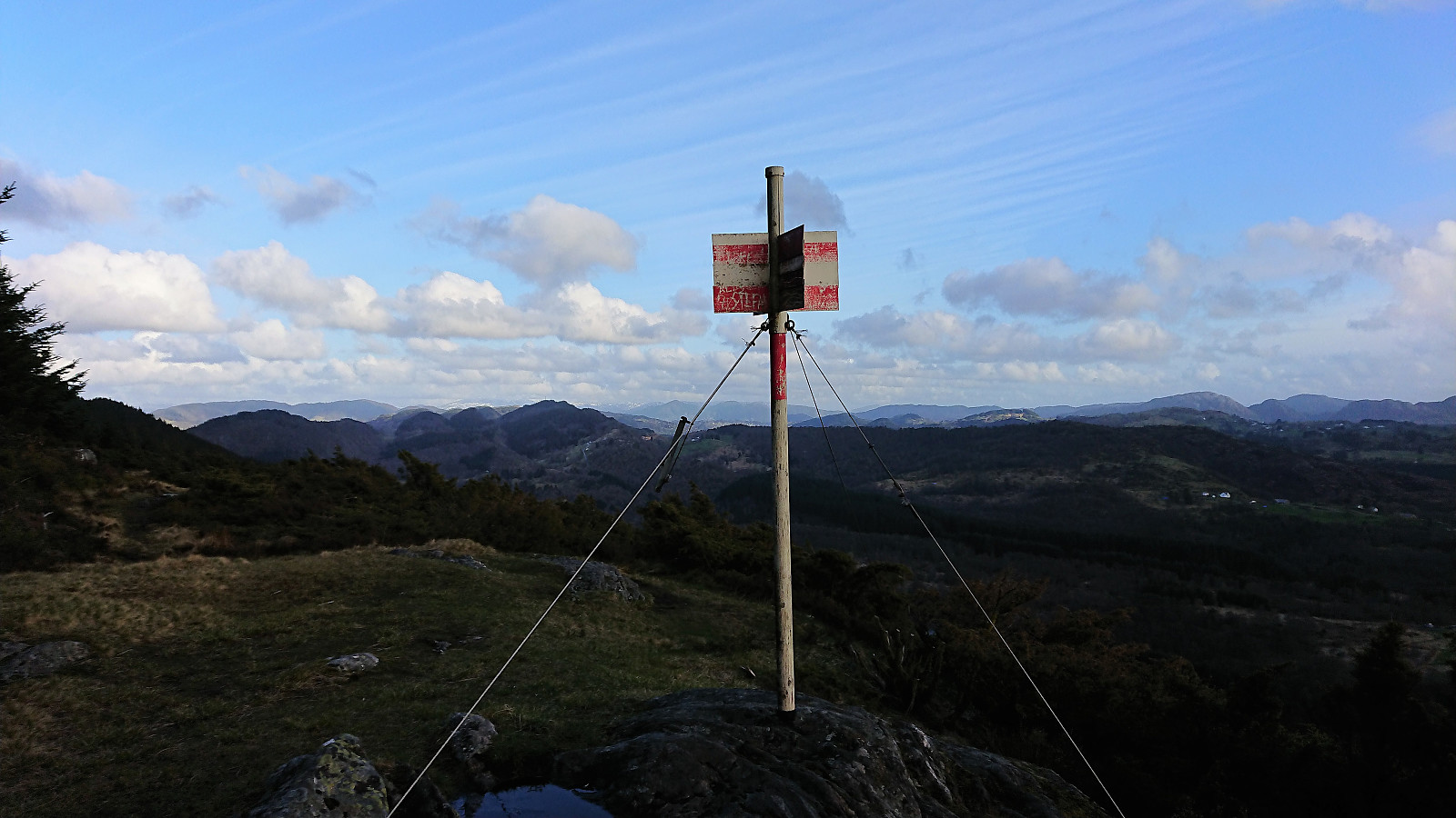
The summit itself provided very limited views. But thanks to Kjell's recent report we continued northwest along the ridge for better views. And shortly after leaving the summit the views opened up, and we could enjoy spectacular views towards Radøy and Holsnøy. The trail itself was also very nice and this extra hike can be very highly recommended. We turned back at the trig marker (now added as a separate PB element), although the trail continued across the top.
The farmer we talked to at the >>>
After the visit to Skardsveten we drove to Bergås for the second goal of the day: Bergåsen . We found parking by the side of the road, but had to ask a local farmer to locate the unmarked trailhead. But even then we managed to take a wrong turn at the very start. This was however quickly corrected and we soon found ourselves on a marked trail.
The summit itself provided very limited views. But thanks to Kjell's recent report we continued northwest along the ridge for better views. And shortly after leaving the summit the views opened up, and we could enjoy spectacular views towards Radøy and Holsnøy. The trail itself was also very nice and this extra hike can be very highly recommended. We turned back at the trig marker (now added as a separate PB element), although the trail continued across the top.
The farmer we talked to at the >>>
Skardsveten
- Date:
- 03.05.2018
- Characteristic:
- Hillwalk
- Duration:
- 0:47h
- Distance:
- 1.6km
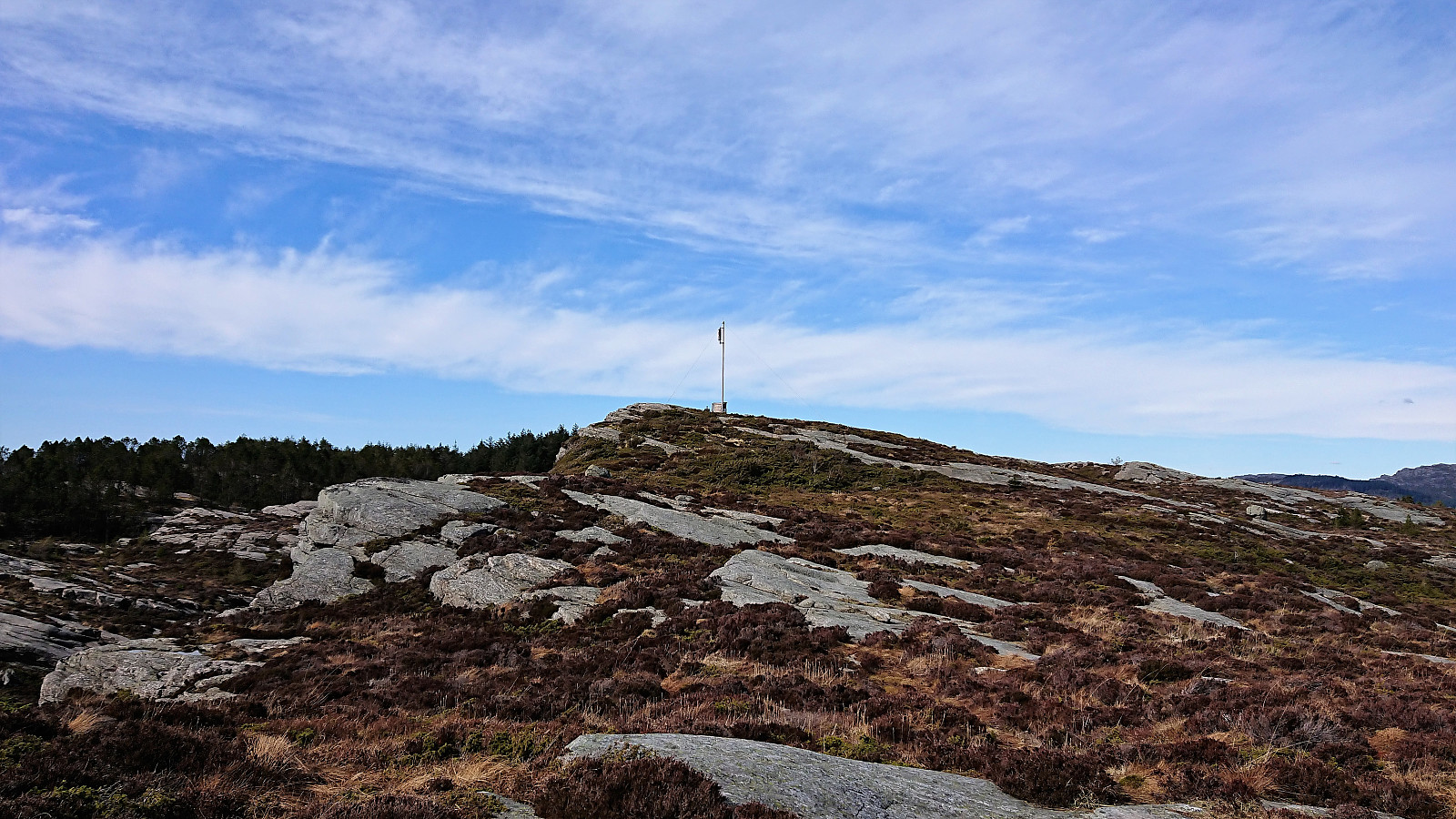
 We parked at the small parking lot (room for 2-3 cars, unless filled with heaps of gravel as it was today) and followed the marked route to the summit. Started out in dense forest with the occasional viewpoint, but opened up more towards the end. Nice views from the summit area. It was a bit windy, so we did not stay long before returning to the car via the same route.
Sælsfjellet
- Date:
- 30.04.2018
- Characteristic:
- Hillwalk
- Duration:
- 1:20h
- Distance:
- 3.5km
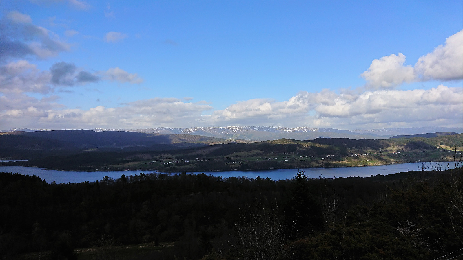
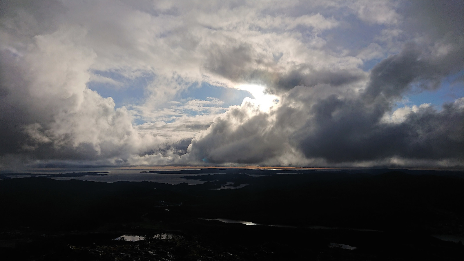
 Started by taking the bus to Sælsvika (bus stop "Sæle snuplass", i.e. the final bus stop) and after enjoying the excellent views across the harbor towards Folgefonna we walked back along the road to locate the trail towards Sælsfjellet . Thanks to Kjell's recent trip report we quickly located the trailhead and shortly arrived at the southern summit indicated by an antenna.
The highest point (if ever so slightly) is however a small cairn about 100 meters further north. The trail did continue in this direction, but turned right (east) before reaching the cairn. Excellent views all around, both towards the sea and towards the snow-covered mountains to the southeast. Highly recommended!
After taking lots of pictures (in total my colleague ended up just shy of 200...) we returned to the road and followed it northwest to Hummelsund >>>
Started by taking the bus to Sælsvika (bus stop "Sæle snuplass", i.e. the final bus stop) and after enjoying the excellent views across the harbor towards Folgefonna we walked back along the road to locate the trail towards Sælsfjellet . Thanks to Kjell's recent trip report we quickly located the trailhead and shortly arrived at the southern summit indicated by an antenna.
The highest point (if ever so slightly) is however a small cairn about 100 meters further north. The trail did continue in this direction, but turned right (east) before reaching the cairn. Excellent views all around, both towards the sea and towards the snow-covered mountains to the southeast. Highly recommended!
After taking lots of pictures (in total my colleague ended up just shy of 200...) we returned to the road and followed it northwest to Hummelsund >>>
Skantane, Reppåsen and Grønhovda
- Date:
- 29.04.2018
- Characteristic:
- Hillwalk
- Duration:
- 5:59h
- Distance:
- 20.1km
 Skantane
Started by taking the bus to Gåssandskiftet and walking the rather boring 3 km to the parking lot at Hatlelio where I switched from asphalt to gravel for another 3 km in pretty much the same direction. I had been hoping that I'd be walking close to the two lakes, but to my disappointment most of the view towards the lakes was hidden until getting close to Raudlibøen. There is however a trail closer to the lakes, so perhaps worth a try instead of only following the gravel road.
As I turned south at Raudlistova the gravel road ended as the trail towards the BJF cabin started (see Bergen Jeger og Fiskerforening ). The trail quality was ok until reaching the BJF cabin, which had a very nice location at the southern tip of Raudlitjørna, but this marked the end of the good trails, even though the trail heading southeast from the BJF cabin >>>
Skantane
Started by taking the bus to Gåssandskiftet and walking the rather boring 3 km to the parking lot at Hatlelio where I switched from asphalt to gravel for another 3 km in pretty much the same direction. I had been hoping that I'd be walking close to the two lakes, but to my disappointment most of the view towards the lakes was hidden until getting close to Raudlibøen. There is however a trail closer to the lakes, so perhaps worth a try instead of only following the gravel road.
As I turned south at Raudlistova the gravel road ended as the trail towards the BJF cabin started (see Bergen Jeger og Fiskerforening ). The trail quality was ok until reaching the BJF cabin, which had a very nice location at the southern tip of Raudlitjørna, but this marked the end of the good trails, even though the trail heading southeast from the BJF cabin >>>
Rødsfjellet and Møsnuken
- Date:
- 27.04.2018
- Characteristic:
- Hillwalk
- Duration:
- 5:48h
- Distance:
- 15.6km
 After a meeting at Solstrand I walked up to the main road from where I took the bus to Gjemdal. The marked trailhead was quickly found, which started out as a nice tractor road up the valley in between Rødsfjellet and Møsnuken called Gjemdalsskaret. Decided to follow the red trail towards Rødsfjellet, which was overall well-marked and easy to follow. Sadly it started raining, which combined with low-hanging clouds reduced the views. The rain came and went until reaching the summit, where I walked around a bit hoping for better conditions, but in the end I gave up and started the descent.
For the descent I followed the white trail, which was also well-marked, but I did lose it at one point due to it being hidden by snow. Luckily the white painted trail markers were easily visible from a distance and the trail >>>
After a meeting at Solstrand I walked up to the main road from where I took the bus to Gjemdal. The marked trailhead was quickly found, which started out as a nice tractor road up the valley in between Rødsfjellet and Møsnuken called Gjemdalsskaret. Decided to follow the red trail towards Rødsfjellet, which was overall well-marked and easy to follow. Sadly it started raining, which combined with low-hanging clouds reduced the views. The rain came and went until reaching the summit, where I walked around a bit hoping for better conditions, but in the end I gave up and started the descent.
For the descent I followed the white trail, which was also well-marked, but I did lose it at one point due to it being hidden by snow. Luckily the white painted trail markers were easily visible from a distance and the trail >>>
Lillevågen and Ørneberget
- Date:
- 22.04.2018
- Characteristic:
- Hillwalk
- Duration:
- 1:43h
- Distance:
- 6.9km
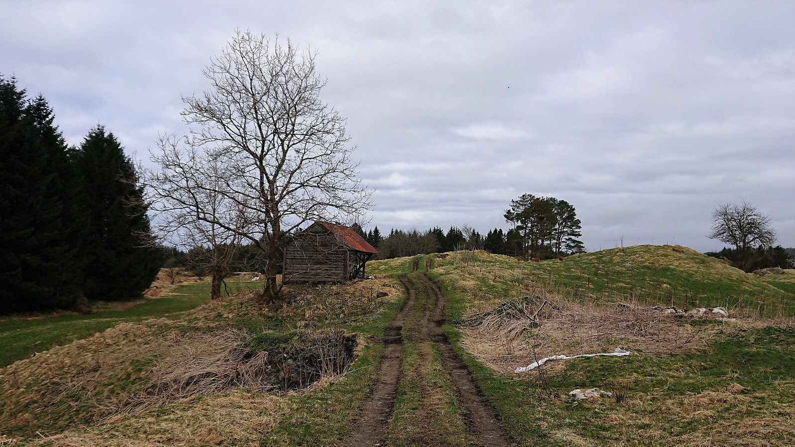
 Short local hike with explorations of Lillevågen (a part of Tømmervågen friluftsområde) before passing by Ørneberget on the way to Lønborg.
Kolåsen and Tveitåsen
- Date:
- 21.04.2018
- Characteristic:
- Hillwalk
- Duration:
- 3:00h
- Distance:
- 14.0km
 Started by taking the bus to Manger and from there walking along the road to Dalland. Only sidewalks at the very start, but not a lot of traffic so this part was slightly better than feared. As soon as I passed the last houses at Dalland the road changed into a tractor road that I followed almost to the end before starting my search for the trailhead to Kolåsen .
My initial search was unsuccessful, but after consulting GPS tracks from previous PB reports to Kolåsen I managed to locate the hidden entrance in between the trees. To my surprise the trail itself was marked (something that would also have been a good idea for the trailhead?) and I soon found myself at the fallen trig marker. As expected there were no views at all from the summit.
Given that the marked trail continued southeast, I decided >>>
Started by taking the bus to Manger and from there walking along the road to Dalland. Only sidewalks at the very start, but not a lot of traffic so this part was slightly better than feared. As soon as I passed the last houses at Dalland the road changed into a tractor road that I followed almost to the end before starting my search for the trailhead to Kolåsen .
My initial search was unsuccessful, but after consulting GPS tracks from previous PB reports to Kolåsen I managed to locate the hidden entrance in between the trees. To my surprise the trail itself was marked (something that would also have been a good idea for the trailhead?) and I soon found myself at the fallen trig marker. As expected there were no views at all from the summit.
Given that the marked trail continued southeast, I decided >>>
Sandviksbatteriet, Håmanen and Ørneberget
- Date:
- 15.04.2018
- Characteristic:
- Hillwalk
- Duration:
- 2:23h
- Distance:
- 9.7km
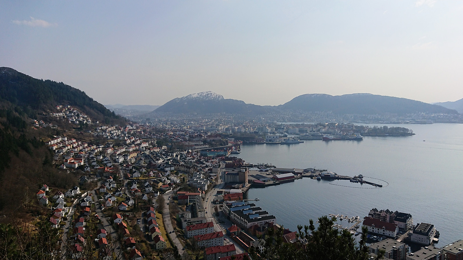 Started from Skuteviken and took a short walk through Sandviken before following Fjellveien back towards Sandviksbatteriet which I ascended via the steep trail directly from Fjellveien. From Sandviksbatteriet I visited both Håmanen and Ørneberget on my way to Lønborg, making this my first 2018 visit of Ørneberget where there was no snow or ice.
Bakkanosi and Fetanipa
- Date:
- 14.04.2018
- Characteristic:
- Backcountry skiing
- Duration:
- 7:07h
- Distance:
- 21.2km
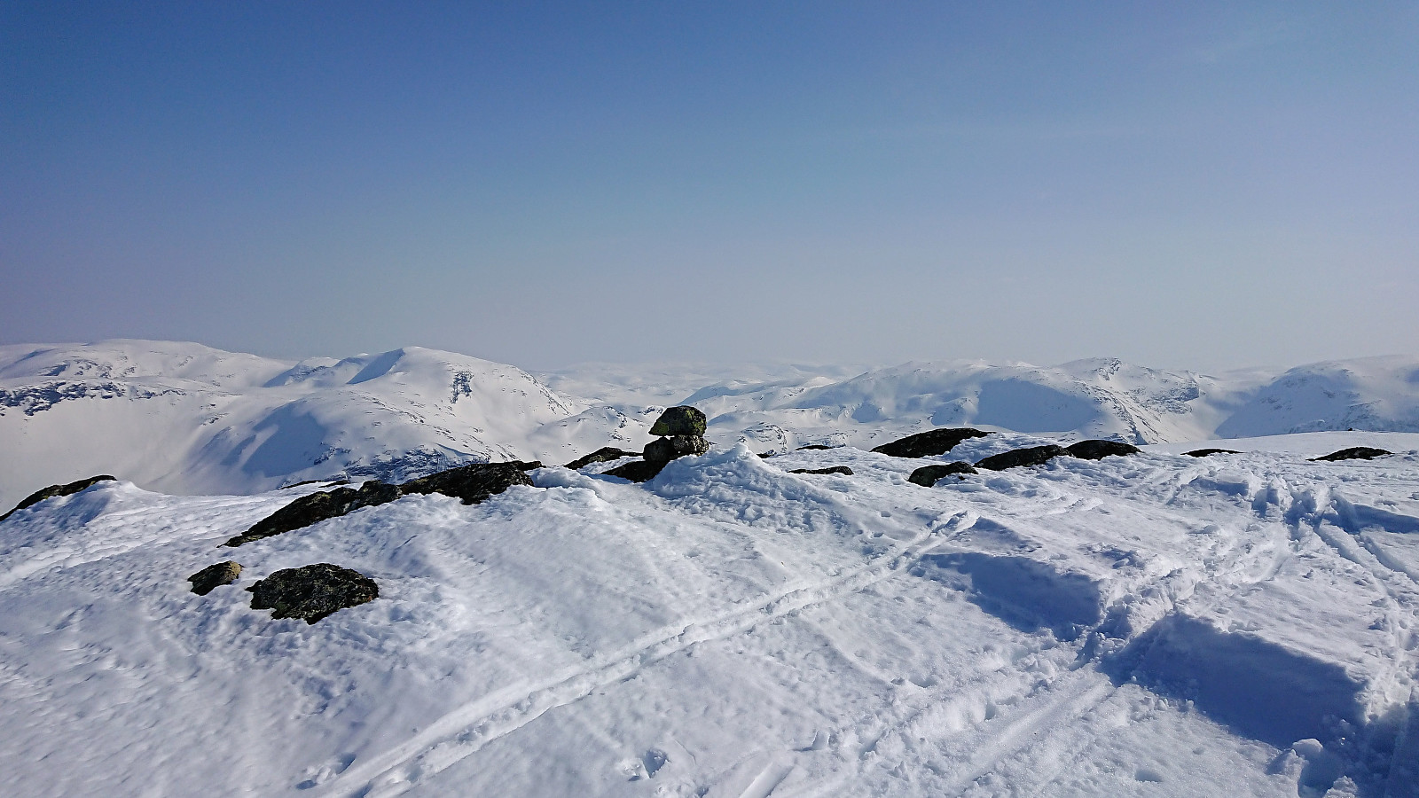 Trip organized by the Norwegian Trekking Association which started by taking the train to Voss and then a joint taxi to Jordalen. We followed the standard route to Bakkanosi , which started out a bit steep along a snow-covered tractor road before levelling off through Slettedalen and the final ascent towards the summit.
The summit itself was quickly passed as we moved closer to the edge for better views. Although getting close the 1300 meters vertical drop down to Nærøyfjorden had to wait for later a summer visit, as the snow made it impossible to see where the firm ground ended, the views were still quite spectacular, but slightly reduced due to a light haze in the distance.
After lunch, half of us made a detour to Fetanipa , where the views could not compare with Bakkanosi. Perhaps explaining why there have been so few registered visits on >>>
Trip organized by the Norwegian Trekking Association which started by taking the train to Voss and then a joint taxi to Jordalen. We followed the standard route to Bakkanosi , which started out a bit steep along a snow-covered tractor road before levelling off through Slettedalen and the final ascent towards the summit.
The summit itself was quickly passed as we moved closer to the edge for better views. Although getting close the 1300 meters vertical drop down to Nærøyfjorden had to wait for later a summer visit, as the snow made it impossible to see where the firm ground ended, the views were still quite spectacular, but slightly reduced due to a light haze in the distance.
After lunch, half of us made a detour to Fetanipa , where the views could not compare with Bakkanosi. Perhaps explaining why there have been so few registered visits on >>>
Across Hellen festning
- Date:
- 12.04.2018
- Characteristic:
- Hike
- Duration:
- 0:34h
- Distance:
- 3.2km
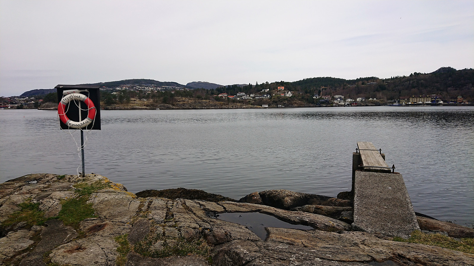
 Short local hike across Hellen festning.
