Archive - Date
Archive - Activity
- Bike trip (2)
-
Climbing (8)
- Alpine climbing (7)
- Mixed climbing (1)
-
Other trip (1)
- Expedition (1)
-
Other winter trip (10)
- Snowshoe trip (10)
-
Ski trip (49)
- Randonnée/Telemark (49)
-
Trip by foot (228)
- Alpine trip (57)
- Hike (69)
- Hillwalk (89)
- Jogging (11)


Collected lists
-
Romsdal ≥ 100m pf.
(134/301)
 44%
44% -
Sunnmøre ≥ 100m pf.
(78/531)
14%
-
Norges 1000 største fjell målt i primærfaktor
(52/1000)
5%

Tour Skiing to the Summit of Mount Roaldshornet
- Date:
- 19.12.2020
- Characteristic:
- Randonnée/Telemark
- Duration:
- 3:02h
- Distance:
- 7.4km
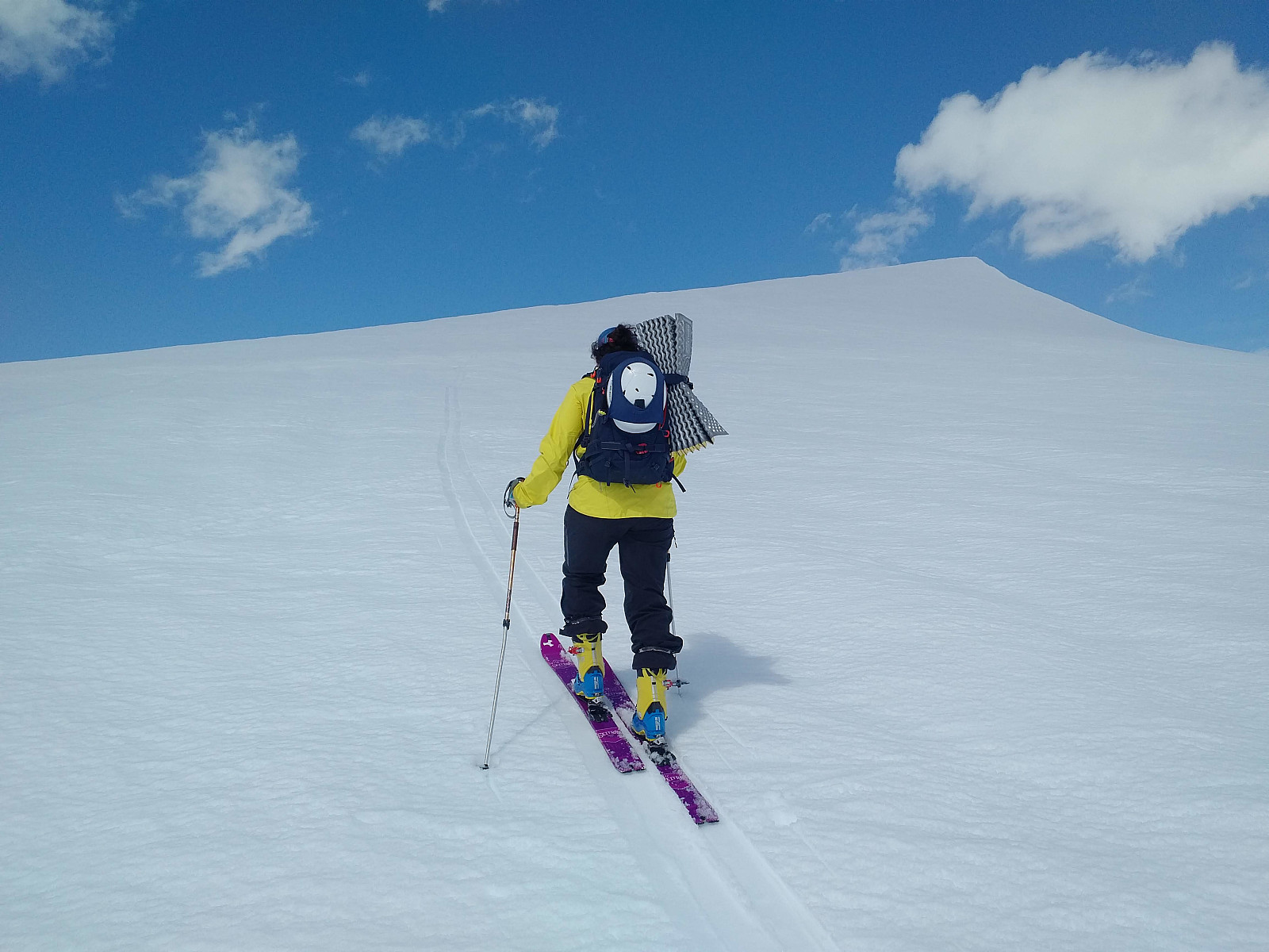
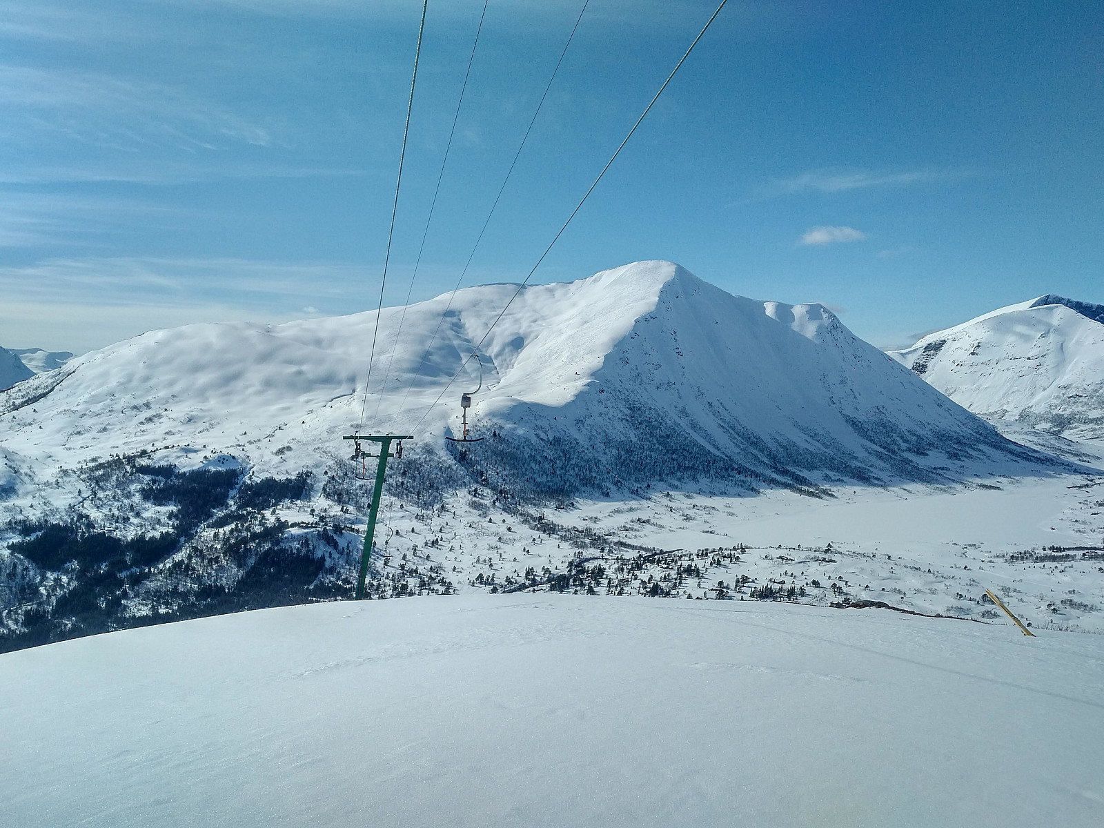
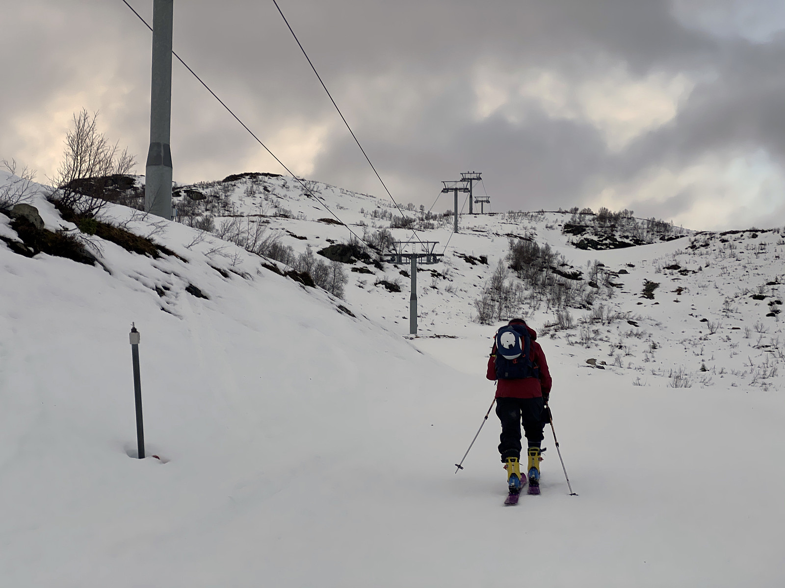 On this day, we had been planning to ascend Mount Høgenibba in the Municipality of Volda, in the county of Møre & Romsdal; and so we went by car, one of my daughters, one of my sons, and myself, to a parking lot by the foot of the mountain; unfortunately, however, there amount of snow at the location was way too scarce for skiing, and so we embarked upon our return towards our home. On our way back home, however, we passed by the Strandafjellet Skiing Centre; and realized it should be possible to ascend Mount Roaldshornet [1230 m.a.m.s.l.] instead. This skiing resort has ski lifts on both sides of Fursetdalen valley. Generally speaking, there tends to be more snow on the south side of the valley, because the sun tends to shine upon the snow on the north side, and make it taw. Moreover, >>>
Ski Touring to Mount Smørbotstinden with my son
- Date:
- 28.11.2020
- Characteristic:
- Randonnée/Telemark
- Duration:
- 3:31h
- Distance:
- 8.1km
 I have previously twice visited Mount Smørbottinden, the first time on Telemark skies, and the second time on alpine touring skis. For tour descriptions including a number of nice pictures, follow these links: Telemark Skiing to Mount Smørbottinden in Rauma Municipality and Alpine Ski Touring to Mount Smørbottind and Mount Kvasstind . The main difference this time compared to my two previous ascents of Mount Smørbotttinden, was that my son joined me this time, and it was actually he that suggested we make this trip. As on previous occasions we drove to Skorgedalen Valley in Rauma Municipality, parked at the parking lot by the ski resort in the valley; and from there we started skiing. The amount of snow was much less on this occasion compared to what it had been on my previous two visits. In the lower part of the trail, the snow was also wet and quite heavy; and at some places we had to cross some open creeks >>>
Tour Skiing to Mount Alnestinden with my Son Dag
- Date:
- 24.10.2020
- Characteristic:
- Randonnée/Telemark
- Duration:
- 3:31h
- Distance:
- 6.7km
 There had been a substantial snowfall a few days ago, and we had lately seen some people sharing online that they had been tour skiing to the summit of Mount Alnestinden in the municipality of Rauma; and so my son and I decided to do the same. The local newspapers reported that there had just been a huge avalanche close to the summit of this mountain, though, but I knew this mountain quite well; and by that I mean well enough to be familiar with an alternative route that we could take to minimize the risk of being caught by an avalanche, if necessary. As we were heading towards Rauma this morning, however, I was a bit curious to see where the avalanche had been taking place, as there was something that didn’t quite add up in the newspaper report. First, the report said that the avalanche >>>
Alpine Ski Touring to Mount Alnestind
- Date:
- 01.07.2020
- Characteristic:
- Randonnée/Telemark
- Duration:
- 2:17h
- Distance:
- 5.2km
 Mount Alnestinden have for years been cherished by many Norwegians as a mountain that you may summit on skis long after the snow’s gone along the trails to the summit of other mountains. The mountain has a long ridge on the east side, and the ski route up to the summit runs along the north side of this ridge. As this is on the leeward side of the mountain, a lot of snow accumulates along the route during winter, and it takes time for it to melt away during the summer months. Moreover, there’s little sun on this north side of the ridge much of the year, and this further contributes to a rather slow meltdown of the snow. In late spring, and during the summer months, i.e. when the Trollstigen escarpment road has been plowed and reopened after the winter months; the skiing trip to Mount Alnestinden >>>
Tour Skiing to Mount Auskjeret with my Daugther
- Date:
- 23.05.2020
- Characteristic:
- Randonnée/Telemark
- Duration:
- 3:18h
- Distance:
- 7.2km
 We woke up early this morning, and went in my daughter’s RAV4 to the Overøye Stordal Alpine Center [N: Overøye Stordal Skisenter]. Due to heavy snowfall over two weeks, followed by rapid thawing over the next few days, there had been a lot of avalanches over the last 4 days; hence when discussing this trip the previous evening, we had been quite eager to pick a mountain that we could hike without climbing any slopes exceeding 30°. Auskjeret in Fjord Municipality is well known as a “safe mountain”; i.e. people even climb it when huge avalanches have just occurred on the neighbour mountain which is called Ørastolen. [We actually climbed Mount Ørastolen a little more than a year ago, my daughter, and I; and just three weeks later there was a tremendous avalanche traversing the entire >>>
Ski Touring to Mount Kyrkjetaket [i.e. "The Church Roof"]
- Date:
- 18.05.2020
- Characteristic:
- Randonnée/Telemark
- Duration:
- 4:43h
- Distance:
- 13.6km
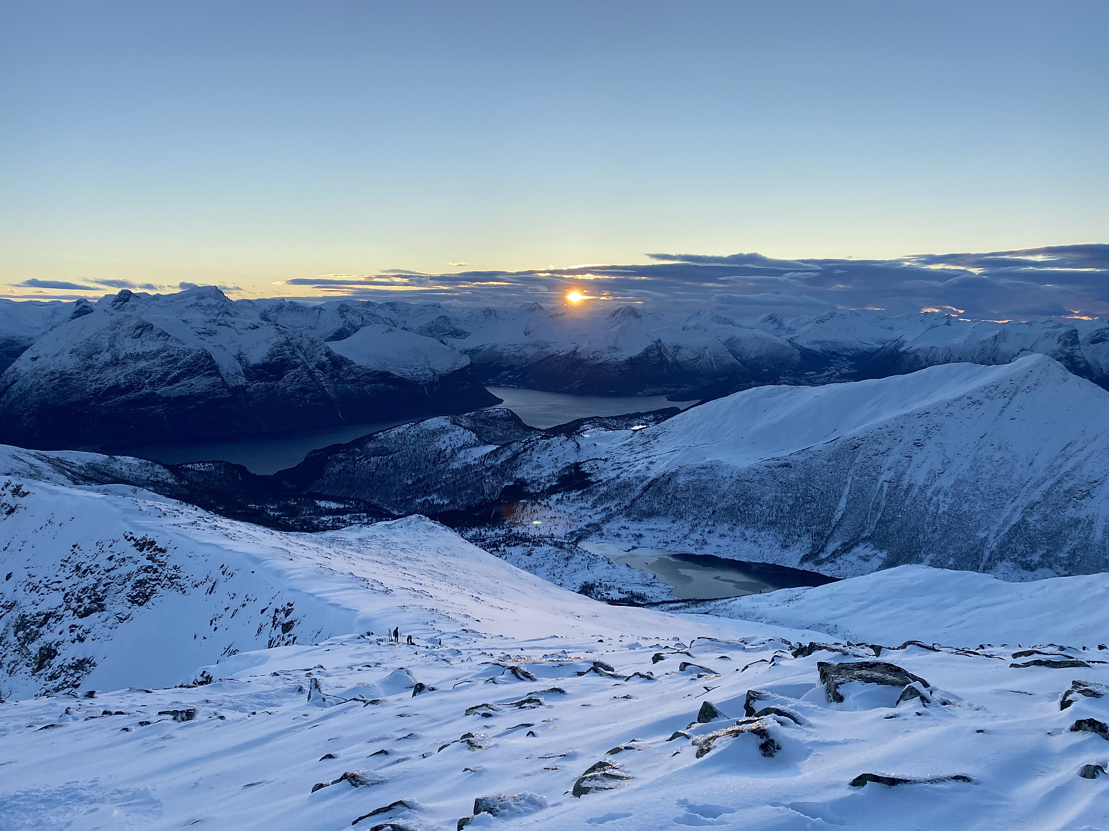
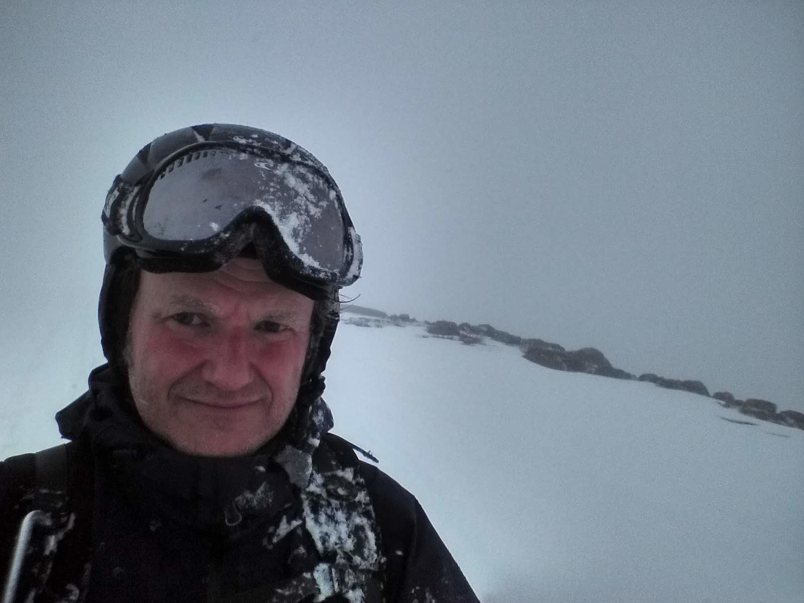
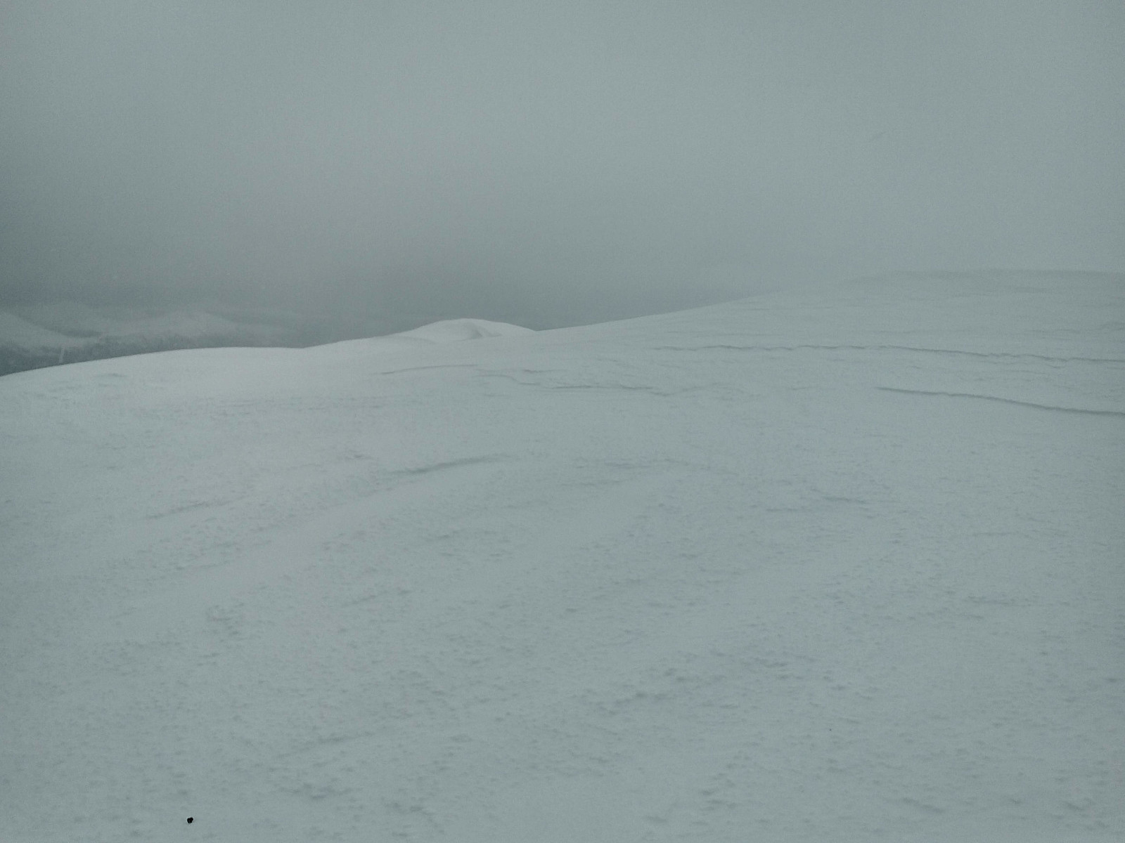
 This was my second attempt at ascending Mount Kyrkjetaket [i.e. The Church Roof ] in Rauma Municipality in the County of Møre & Romsdal. My first attempt was about two weeks earlier, but then I climbed only up to Mount Steinberget (981 m.a.m.s.l.); where I turned around and went back down due to bad weather conditions and low visibility. It's a common saying in Norway, that There's no shame in turning around , meaning that if the weather's not on your side, it's better to abandon the goal for your ski tour and survive, than to push on, and then die in the attempt to reach the goal. Right now I was having one week off work, and I had been planning to make a new attempt on Mount Kyrkjetaket this week. I had actually been thinking of visiting the mountain on the wednesday or so, but according >>>
There's no Shame in Turning Around
- Date:
- 02.05.2020
- Characteristic:
- Randonnée/Telemark
- Duration:
- 3:47h
- Distance:
- 9.5km
 The Norwegian Mountain Code [Norw. Fjellvettreglene] is a set of rules made to ensure safe trekking and skiing in the mountains. Rule number 8 in this set of guidelines, reads Don't be ashamed to turn around. The point with this guideline, is that there are times when your survival in the mountains may depend upon your ability to change your plan. Anyone familiar with the changing weather conditions in the mountains, will know this. There are times when pressing on to reach a goal in spite of treacherous weather, and maybe in spite of bad planning, will mean inevitable death, or at least a high risk of death. On this day the weather forecast said weather was going to be cloudy, but otherwise pretty fair.
I had desired for a while to ascend Mount Kyrkjetaket [i.e. "The Church Roof"] >>>
The Norwegian Mountain Code [Norw. Fjellvettreglene] is a set of rules made to ensure safe trekking and skiing in the mountains. Rule number 8 in this set of guidelines, reads Don't be ashamed to turn around. The point with this guideline, is that there are times when your survival in the mountains may depend upon your ability to change your plan. Anyone familiar with the changing weather conditions in the mountains, will know this. There are times when pressing on to reach a goal in spite of treacherous weather, and maybe in spite of bad planning, will mean inevitable death, or at least a high risk of death. On this day the weather forecast said weather was going to be cloudy, but otherwise pretty fair.
I had desired for a while to ascend Mount Kyrkjetaket [i.e. "The Church Roof"] >>>
Telemark Skiing to Mount Breivikheia in Rauma Municipality
- Date:
- 18.04.2020
- Characteristic:
- Randonnée/Telemark
- Duration:
- 3:42h
- Distance:
- 13.7km
 I have lately been skiing a number of the mountains between the two fjords Langfjorden and Romsdalsfjorden [i.e. The Long Fjord and The Rauma Valley Fjord, respektively]. Many of the mountains on the peninsula between these two fjords are readily accessible from the parking lot at the Rauma Ski Center in Skorgedalen Valley, where space for parking is also plentiful. You do have to pay a fee in order to drive up to the parking lot, though. The ski resort was closed at the moment due to the Covid-19 pandemia closedown, but in Norway we were still allowed to use parking lots like this one, and we were still allowed to go hiking and skiing in the mountains, as long as no more than five persons were out there together. I crossed the river Skorgeelva by use of a nice bridge that have been built there >>>
Telemark Skiing to Mount Tarløysa in Rauma Municipality
- Date:
- 11.04.2020
- Characteristic:
- Randonnée/Telemark
- Duration:
- 2:19h
- Distance:
- 8.3km
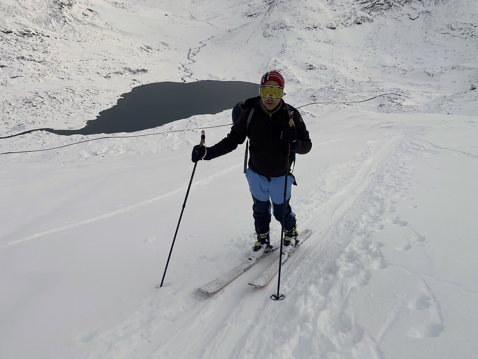
 The summit of Mount Tarløysa is located 1.086 m.a.m.s.l., but you don't have to ascend more than about 675 meters to get there, as the parking lot at Nyseter is located at an elevation of about 400 meters. To get there, you go by car to a village called Sandnes, a few kilometers before you reach Åfarnes, and there, at Sandnes, you take a little gravel road up the mountain side. The road has a few hairpin bends, and you have to pay a fee of about 60 NOK to be allowed to use it; but then, after a few minutes you arrive at the parking lot at Nyseter (image #1). As may be seen on the picture, the parking lot is quite spacious, though it is also used by cabin owners in the area. Snow had been quite scarce this winter (a month later it was abundant, though); and the advantage of setting out from >>>
Telemark Skiing to Mount Smørbottinden in Rauma Municipality
- Date:
- 04.04.2020
- Characteristic:
- Randonnée/Telemark
- Duration:
- 2:50h
- Distance:
- 8.0km
 On this day I went ski touring (by Telemark skies) to the summit of Mount Smørbottind. The mountain is not extremely high, only 1188 m.a.m.s.l., but you start out from a parking lot located at 315 meters, hence you do ascend almost 900 meters as you climb the mountain.
Due to the corona virus pandemic, the Norwegian society have been pretty much locked down for a few weeks. Our authorities have been encouraging hand cleaning and social distancing, as in most countries these days; and we are currently not allowed to travel abroad. Fortunately, though, we do have a lot of nice mountains in our own country, and the authorities have so far not imposed a curfew upon us. They discourage climbs in the higher mountains, as rescue resources may be limited these days, but it’s considered OK to climb >>>
On this day I went ski touring (by Telemark skies) to the summit of Mount Smørbottind. The mountain is not extremely high, only 1188 m.a.m.s.l., but you start out from a parking lot located at 315 meters, hence you do ascend almost 900 meters as you climb the mountain.
Due to the corona virus pandemic, the Norwegian society have been pretty much locked down for a few weeks. Our authorities have been encouraging hand cleaning and social distancing, as in most countries these days; and we are currently not allowed to travel abroad. Fortunately, though, we do have a lot of nice mountains in our own country, and the authorities have so far not imposed a curfew upon us. They discourage climbs in the higher mountains, as rescue resources may be limited these days, but it’s considered OK to climb >>>
