Archive - Date
Archive - Activity
- Bike trip (2)
-
Climbing (8)
- Alpine climbing (7)
- Mixed climbing (1)
-
Other trip (1)
- Expedition (1)
-
Other winter trip (10)
- Snowshoe trip (10)
-
Ski trip (49)
- Randonnée/Telemark (49)
-
Trip by foot (228)
- Alpine trip (57)
- Hike (69)
- Hillwalk (89)
- Jogging (11)


Collected lists
-
Romsdal ≥ 100m pf.
(134/301)
 44%
44% -
Sunnmøre ≥ 100m pf.
(78/531)
14%
-
Norges 1000 største fjell målt i primærfaktor
(52/1000)
5%

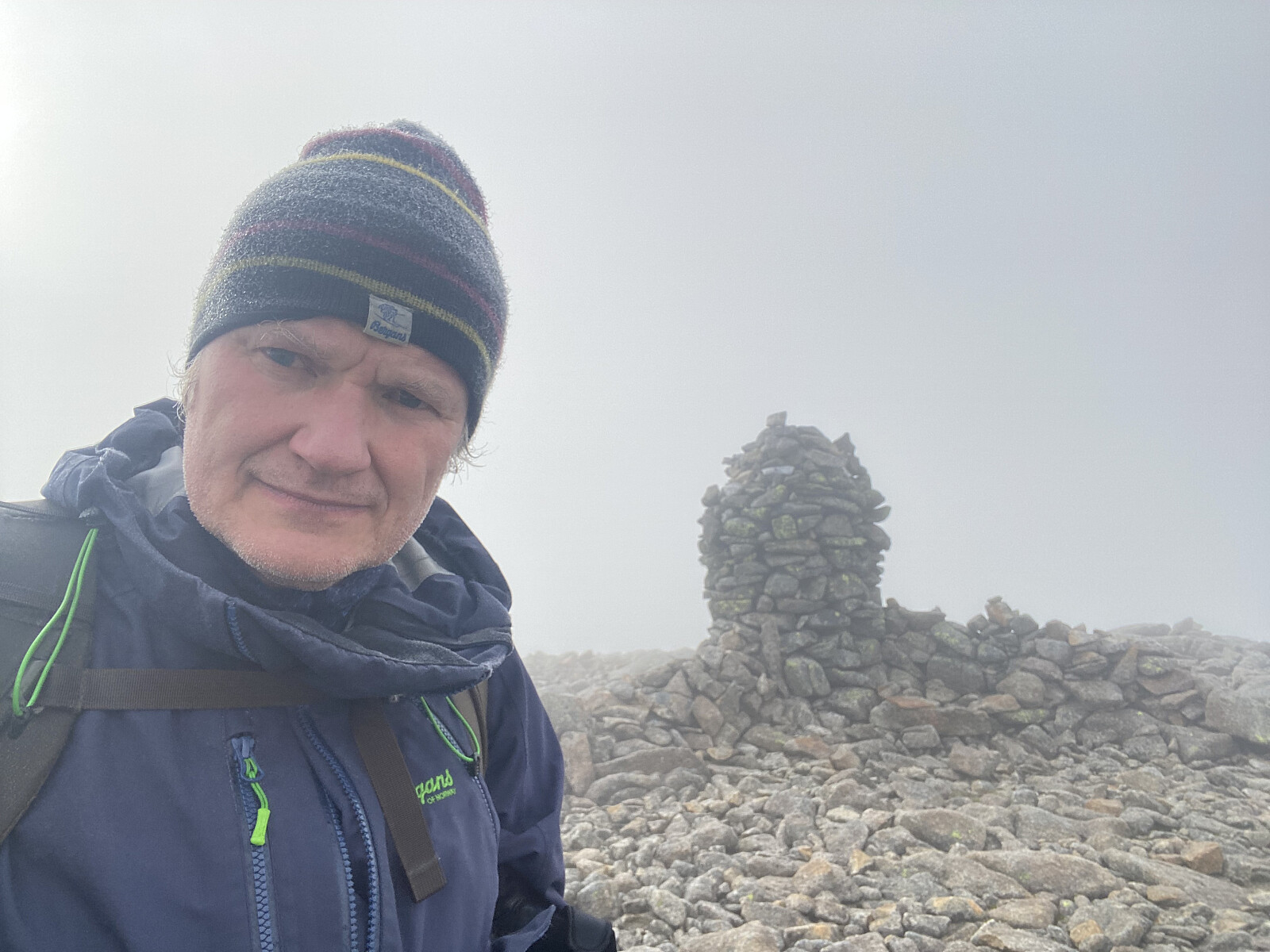
Nasjonaldagstur til Straumshornet i Sykkylven
- Date:
- 17.05.2026
- Characteristic:
- Hillwalk
- Duration:
- 4:48h
- Distance:
- 8.1km
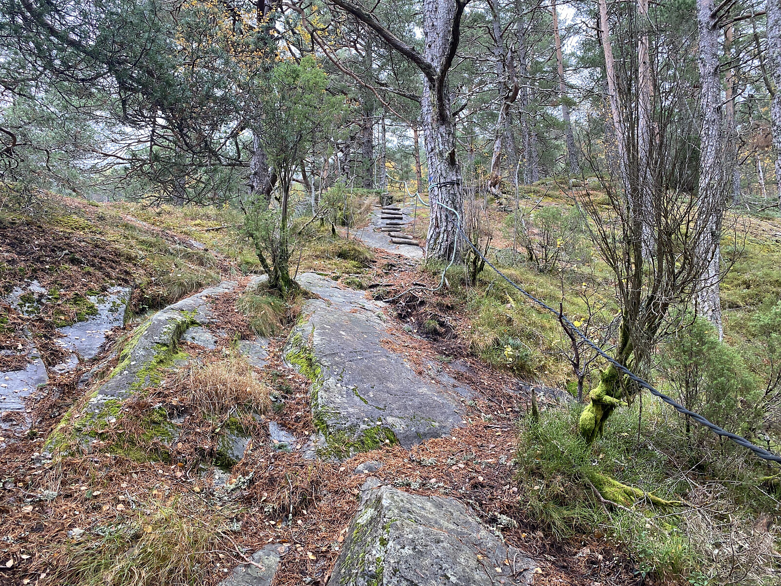
Fjelltur til Frænavarden med Sol
- Date:
- 18.10.2025
- Characteristic:
- Hillwalk
- Duration:
- 4:32h
- Distance:
- 13.7km
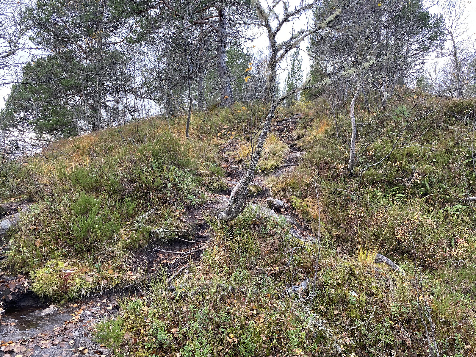 Min eldste datter flyttet til Molde for noen år siden, og det har gitt meg muligheten til å bli litt kjent med Moldemarka og Moldefjellene, når jeg er i Molde og besøker henne. Denne lørdagen bestemte vi oss for å gå opp til Frænavarden [589 m.o.h.], og la i vei innover i Moldemarka. Vi kunne saktens ha kjørt ut til Fjellbrudammen Parkering, og fått en litt kortere vei inn til Frænavarden, men min datter bor ganske tett inntil Moldemarka noe lengre inne (i Nordbyen), så vi valgte å gå derfra.
Vi fulgte en fin grusvei (bilde #1) innover i marka omkring 2 og en halv kilometer, og kom så til skiltet på bilde #2. Her tok vi til venstre, og fulgte en sti som gikk gjennom litt myrlendt terreng de første ca. 100 meter, men som så førte opp på nordøstryggen av Moldeheia, hvor det >>>
Min eldste datter flyttet til Molde for noen år siden, og det har gitt meg muligheten til å bli litt kjent med Moldemarka og Moldefjellene, når jeg er i Molde og besøker henne. Denne lørdagen bestemte vi oss for å gå opp til Frænavarden [589 m.o.h.], og la i vei innover i Moldemarka. Vi kunne saktens ha kjørt ut til Fjellbrudammen Parkering, og fått en litt kortere vei inn til Frænavarden, men min datter bor ganske tett inntil Moldemarka noe lengre inne (i Nordbyen), så vi valgte å gå derfra.
Vi fulgte en fin grusvei (bilde #1) innover i marka omkring 2 og en halv kilometer, og kom så til skiltet på bilde #2. Her tok vi til venstre, og fulgte en sti som gikk gjennom litt myrlendt terreng de første ca. 100 meter, men som så førte opp på nordøstryggen av Moldeheia, hvor det >>>
Tur til Moldurfjellet i Ytre Sogn
- Date:
- 14.10.2025
- Characteristic:
- Hillwalk
- Duration:
- 3:22h
- Distance:
- 9.6km
 Vi var på tur fra Bergen til Ålesund, jeg og eldste sønnen, og hadde bestemt oss for å stoppe, og ta oss en fjelltur underveis. Været var ikke det beste, og det var synd, for vi hadde plukket oss ut et fjell som ved fine værforhold ville gitt fin utsikt utover Sognefjorden, nemlig Moldurfjellet [844 m.o.h.], ikke så langt fra Høyanger i Ytre Sogn. Etter å ha tatt ferja over fra Oppedal til Lavik, fortsatte vi til Vadheim, for så å ta av og kjøre ut Vadheimsfjorden igjen på motsatte side, og så innover langs Sognefjorden til vi kom til Kyrkjebø. Der forlot vi fylkesveien, og kjørte gjennom et byggefelt, og opp til Helleveien, hvor det var anlagt en brukbart stor parkeringsplass (bilde #1), akkurat der en grusvei oppover i skogen starter.
Skogsveien (bilde #3) tok oss bare ca. >>>
Vi var på tur fra Bergen til Ålesund, jeg og eldste sønnen, og hadde bestemt oss for å stoppe, og ta oss en fjelltur underveis. Været var ikke det beste, og det var synd, for vi hadde plukket oss ut et fjell som ved fine værforhold ville gitt fin utsikt utover Sognefjorden, nemlig Moldurfjellet [844 m.o.h.], ikke så langt fra Høyanger i Ytre Sogn. Etter å ha tatt ferja over fra Oppedal til Lavik, fortsatte vi til Vadheim, for så å ta av og kjøre ut Vadheimsfjorden igjen på motsatte side, og så innover langs Sognefjorden til vi kom til Kyrkjebø. Der forlot vi fylkesveien, og kjørte gjennom et byggefelt, og opp til Helleveien, hvor det var anlagt en brukbart stor parkeringsplass (bilde #1), akkurat der en grusvei oppover i skogen starter.
Skogsveien (bilde #3) tok oss bare ca. >>>
Fjelltur til Eggenibba med Dag
- Date:
- 12.10.2025
- Characteristic:
- Hillwalk
- Duration:
- 3:05h
- Distance:
- 5.0km
 Min sønn og jeg hadde hvert vår ærend i Bergen, men valgte å kjøre sammen sørover; og planla da å ta én fjelltur underveis på vei til Bergen, og én på vei hjem igjen noen dager senere. Jeg har mange ganger kjørt gjennom Våtedalen mellom Byrkjelo og Skei når jeg har vært på vei mellom Nordfjord og Sunnfjord, og har da lagt merke til Eggjenibba, et fjell som fra avstand ser ut til å reise seg midt i dalføret; selv om det rent definisjonsmessig selvsagt er én dal på hver side av fjellet (Våtedalen på vestsida av fjellet, og Øvredalen på østsida).
For ikke å bruke for lang tid på turen (vi skulle tross alt helt til Bergen denne dagen), kjørte vi like opp i Øvredalen, og parkerte på Høgredalsvegen parkering, som ligger 542 m.o.h. Har man bedre tid på seg, er det også >>>
Min sønn og jeg hadde hvert vår ærend i Bergen, men valgte å kjøre sammen sørover; og planla da å ta én fjelltur underveis på vei til Bergen, og én på vei hjem igjen noen dager senere. Jeg har mange ganger kjørt gjennom Våtedalen mellom Byrkjelo og Skei når jeg har vært på vei mellom Nordfjord og Sunnfjord, og har da lagt merke til Eggjenibba, et fjell som fra avstand ser ut til å reise seg midt i dalføret; selv om det rent definisjonsmessig selvsagt er én dal på hver side av fjellet (Våtedalen på vestsida av fjellet, og Øvredalen på østsida).
For ikke å bruke for lang tid på turen (vi skulle tross alt helt til Bergen denne dagen), kjørte vi like opp i Øvredalen, og parkerte på Høgredalsvegen parkering, som ligger 542 m.o.h. Har man bedre tid på seg, er det også >>>
Til Liafjellet med Sol
- Date:
- 04.10.2025
- Characteristic:
- Hillwalk
- Duration:
- 2:57h
- Distance:
- 9.0km
 Denne dagen var det jeg og eldste datter som dro på tur sammen. Jeg hadde ikke vært på Liafjellet før, men eldste-sønnen, Dag, hadde fortalt at det var en fin og ikke så lang tur, og han hadde også nevnt at det gikk an å parkere på gamle-veien nedenfor Tøssesvingen, og stort sett følge Liafjellets vestrygg opp til topps. Det nevnte stedet der man kan parkere, er ikke synlig fra riksveien. Da riksveien ble utbedret tidlig på 2000-tallet, ble det anlagt en helt ny sving ca. 30 meter innenfor, og 8 høydemeter ovenfor den gamle Tøssesvingen, slik at veien ikke bare ble utbedret, men svingen også rettet ut en del. Den gamle veien ble imidlertid ikke fjernet, og hvis man tar til høyre like etter svingen (når man kommer kjørende i retning Sjøholt), så er det ikke så vanskelig >>>
Fottur til Englafjellet, Ulvanosa og Geitadalstinden
- Date:
- 20.09.2025
- Characteristic:
- Hillwalk
- Duration:
- 8:53h
- Distance:
- 21.8km
 Jeg var på besøk hos venner i Uskedalen da jeg la ut på denne turen. Været var skyet, og ikke på noen måte det beste, men jeg var blitt lokket til disse traktene med at det skulle være så fine fjell her omkring, og da var det liksom ikke så aktuelt å ikke få seg en fjelltur i løpet av helgen. Vennene jeg besøkte bor omtrent akkurat der Eikedalselva kommer ned, og dermed var enkleste veien til fjells rett og slett å ta veien oppover Eikedalen. Dagens turmål var Englafjell [1200 m.o.h.]. Man kan også bestige dette fjellet ved å følge fjellryggen opp fra Uskedalen, men da måtte jeg enten starte i selve Uskedalen, ved gardsbruket Fet, eller så måtte jeg et eller annet sted krysse Eikedalselva, for å komme meg bort til ryggen.
Jeg fulgte grusveien oppover Eikedalselva så langt >>>
Jeg var på besøk hos venner i Uskedalen da jeg la ut på denne turen. Været var skyet, og ikke på noen måte det beste, men jeg var blitt lokket til disse traktene med at det skulle være så fine fjell her omkring, og da var det liksom ikke så aktuelt å ikke få seg en fjelltur i løpet av helgen. Vennene jeg besøkte bor omtrent akkurat der Eikedalselva kommer ned, og dermed var enkleste veien til fjells rett og slett å ta veien oppover Eikedalen. Dagens turmål var Englafjell [1200 m.o.h.]. Man kan også bestige dette fjellet ved å følge fjellryggen opp fra Uskedalen, men da måtte jeg enten starte i selve Uskedalen, ved gardsbruket Fet, eller så måtte jeg et eller annet sted krysse Eikedalselva, for å komme meg bort til ryggen.
Jeg fulgte grusveien oppover Eikedalselva så langt >>>
Til Taskedalshornet og Taskedalstinden
- Date:
- 19.07.2025
- Characteristic:
- Hillwalk
- Duration:
- 5:52h
- Distance:
- 14.3km
 Jeg hadde helga i forveien besøkt Grønfonnfjellet [1509] og Brekkehornet [1525 m.o.h.] sammen med min eldste sønn. Vi hadde da egentlig snakket om å fortsette fra Brekkehornet bort på Taskedalstinden [1609 m.o.h.], og så følge ryggen mellom Taskedalstinden og Taskedalshornet [1406 m.o.h.] tilbake til start, slik at vi fikk oss en rundtur som omkranset hele Taskedalen. Oppe på Brekkehornet kom vi imidlertid til at det var litt for sent på dag for dette, og tok oss derfor i stedet ned i Taskedalen, og kom oss ned igjen på denne måten [se turbeskrivelse her: Til Grønfonnfjellet og Brekkehornet ]. Og dermed bestemte jeg meg for å ta turen opp på Taskedalstinden denne dagen i stedet.
Jeg parkerte på Nedre Røsta P-plass oppe ved Bøstølen, og fulgte stien innover i dalføret mellom Taskedalshornet og Kammen [1096 m.o.h.]. >>>
Jeg hadde helga i forveien besøkt Grønfonnfjellet [1509] og Brekkehornet [1525 m.o.h.] sammen med min eldste sønn. Vi hadde da egentlig snakket om å fortsette fra Brekkehornet bort på Taskedalstinden [1609 m.o.h.], og så følge ryggen mellom Taskedalstinden og Taskedalshornet [1406 m.o.h.] tilbake til start, slik at vi fikk oss en rundtur som omkranset hele Taskedalen. Oppe på Brekkehornet kom vi imidlertid til at det var litt for sent på dag for dette, og tok oss derfor i stedet ned i Taskedalen, og kom oss ned igjen på denne måten [se turbeskrivelse her: Til Grønfonnfjellet og Brekkehornet ]. Og dermed bestemte jeg meg for å ta turen opp på Taskedalstinden denne dagen i stedet.
Jeg parkerte på Nedre Røsta P-plass oppe ved Bøstølen, og fulgte stien innover i dalføret mellom Taskedalshornet og Kammen [1096 m.o.h.]. >>>
Til Storbua og Månvasstinden
- Date:
- 21.06.2025
- Characteristic:
- Hillwalk
- Duration:
- 7:04h
- Distance:
- 14.5km
 For knappe 5 år siden besøkte jeg Sandfjellet [1470 m.o.h.], som er det høyeste fjellet i Vestnes kommune. Siden den gang har jeg vært innom parkeringsplassen høyt oppe i Øvstedalen to ganger til fots, i forbindelse med at jeg var på vei ned igjen fra henholdsvis Rollsbotnskorka [1334 m.o.h.] og Brudefølget [1343 m.o.h.]; men jeg hadde ikke gått flere turer med utgangspunkt i Dalskleiva Parkering [390 m.o.h.] før nå. Jeg har imidlertid lenge tenkt på å ta turen oppom Storbua [1498 m.o.h.] herfra, og denne dagen gjorde jeg alvor av det.
For turbeskrivelse fra ovenfor nevnte turer, følg disse lenkene:
To Mount Sandfjellet in Vestnes Municipality Til Storskorka, Litleskorka og Rollsbotnskorka Brudefølget Jeg betalte bompenger som seg hør og bør nede i Øvstedalen, og kjørte opp til Dalskleiva parkering, som ligger helt oppe på 390 m.o.h. Underveis opp hit passerer man ei kjøretøy-sluse >>>
For knappe 5 år siden besøkte jeg Sandfjellet [1470 m.o.h.], som er det høyeste fjellet i Vestnes kommune. Siden den gang har jeg vært innom parkeringsplassen høyt oppe i Øvstedalen to ganger til fots, i forbindelse med at jeg var på vei ned igjen fra henholdsvis Rollsbotnskorka [1334 m.o.h.] og Brudefølget [1343 m.o.h.]; men jeg hadde ikke gått flere turer med utgangspunkt i Dalskleiva Parkering [390 m.o.h.] før nå. Jeg har imidlertid lenge tenkt på å ta turen oppom Storbua [1498 m.o.h.] herfra, og denne dagen gjorde jeg alvor av det.
For turbeskrivelse fra ovenfor nevnte turer, følg disse lenkene:
To Mount Sandfjellet in Vestnes Municipality Til Storskorka, Litleskorka og Rollsbotnskorka Brudefølget Jeg betalte bompenger som seg hør og bør nede i Øvstedalen, og kjørte opp til Dalskleiva parkering, som ligger helt oppe på 390 m.o.h. Underveis opp hit passerer man ei kjøretøy-sluse >>>
Til Skåla og Opstadhornet på Otrøya
- Date:
- 19.04.2025
- Characteristic:
- Hillwalk
- Duration:
- 4:57h
- Distance:
- 13.5km
 Jeg har de siste årene drevet og samlet på topper i Romsdalen, og tenkte denne dagen at jeg skulle ta turen oppom en av de tre toppene jeg fortsatt manglet ute i Misund, nemlig Skåla [607 m.o.h.]. Jeg var like ved denne toppen i fjor en gang, men da ble det til at vi etter å ha vært på Foksåta la turen ned i Vågsdalen i stedet for å gå over Skåla på vei tilbake til Rakvågen. Jeg kjørte ut til Brattvågen, tok ferja over til Dryna, og fortsatte til Sør-Heggdal, før jeg tok av til venstre, passerte et gårdsbruk, og parkerte omtrent der Heggdalselva møter Lappedalselva. Herfra tok jeg beina fatt, og fulgte en grusvei nordvestover i retning Heggdalskaret og Skarsheia.
På tvers av Otrøya går det et dalføre i retning nord-sør, og grusveien jeg nå gikk på, løper hele veien >>>
Jeg har de siste årene drevet og samlet på topper i Romsdalen, og tenkte denne dagen at jeg skulle ta turen oppom en av de tre toppene jeg fortsatt manglet ute i Misund, nemlig Skåla [607 m.o.h.]. Jeg var like ved denne toppen i fjor en gang, men da ble det til at vi etter å ha vært på Foksåta la turen ned i Vågsdalen i stedet for å gå over Skåla på vei tilbake til Rakvågen. Jeg kjørte ut til Brattvågen, tok ferja over til Dryna, og fortsatte til Sør-Heggdal, før jeg tok av til venstre, passerte et gårdsbruk, og parkerte omtrent der Heggdalselva møter Lappedalselva. Herfra tok jeg beina fatt, og fulgte en grusvei nordvestover i retning Heggdalskaret og Skarsheia.
På tvers av Otrøya går det et dalføre i retning nord-sør, og grusveien jeg nå gikk på, løper hele veien >>>
Til Sukkertoppen med broder'n & Co.
- Date:
- 18.04.2025
- Characteristic:
- Hillwalk
- Duration:
- 2:06h
- Distance:
- 4.0km
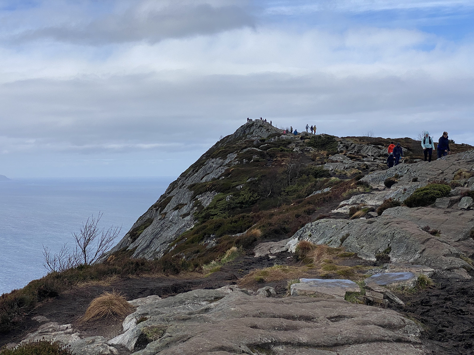 Sukkertoppen i Ålesund [314 m.o.h.] er en topp jeg ikke har vært på før. Hadde man bod på Hessa, er nok Sukkertoppen et fjell man tidt og ofte ville lagt en løpetur opp på når man skulle ha seg en workout; og hadde man bodd i Ålesund sentrum, hadde man kanskje tatt gjester med seg dit opp fra tid til annen for å vise dem utsikten over byen. Men nå har det seg slik at vi bor utenbys, og dermed så hadde jeg ikke vært på Sukkertoppen før nå. Denne påsken var imidlertid min bror med familie på besøk hos min mor, som bor i Ålesund, og så tenkte de å ta seg en tur opp på Sukkertoppen, og så lurte de på om noen av oss ville være med; og dermed ble det til at jeg og eldste datter, som var på besøk hos oss, hev oss rundt og ble med.
Vi kjørte ut på Hessa, parkerte på Hessa >>>
Sukkertoppen i Ålesund [314 m.o.h.] er en topp jeg ikke har vært på før. Hadde man bod på Hessa, er nok Sukkertoppen et fjell man tidt og ofte ville lagt en løpetur opp på når man skulle ha seg en workout; og hadde man bodd i Ålesund sentrum, hadde man kanskje tatt gjester med seg dit opp fra tid til annen for å vise dem utsikten over byen. Men nå har det seg slik at vi bor utenbys, og dermed så hadde jeg ikke vært på Sukkertoppen før nå. Denne påsken var imidlertid min bror med familie på besøk hos min mor, som bor i Ålesund, og så tenkte de å ta seg en tur opp på Sukkertoppen, og så lurte de på om noen av oss ville være med; og dermed ble det til at jeg og eldste datter, som var på besøk hos oss, hev oss rundt og ble med.
Vi kjørte ut på Hessa, parkerte på Hessa >>>
