Archive - Date
Archive - Activity
- Bike trip (2)
-
Climbing (8)
- Alpine climbing (7)
- Mixed climbing (1)
-
Other trip (1)
- Expedition (1)
-
Other winter trip (10)
- Snowshoe trip (10)
-
Ski trip (49)
- Randonnée/Telemark (49)
-
Trip by foot (228)
- Alpine trip (57)
- Hike (69)
- Hillwalk (89)
- Jogging (11)


Collected lists
-
Romsdal ≥ 100m pf.
(134/301)
 44%
44% -
Sunnmøre ≥ 100m pf.
(78/531)
14%
-
Norges 1000 største fjell målt i primærfaktor
(52/1000)
5%

Rundtur fra Jordalsvatnet
- Date:
- 03.05.2026
- Characteristic:
- Hike
- Duration:
- 4:34h
- Distance:
- 13.4km
Hiking to Jemo and Wochecha with a colleague of mine
- Date:
- 02.06.2024
- Characteristic:
- Hike
- Duration:
- 6:24h
- Distance:
- 23.9km
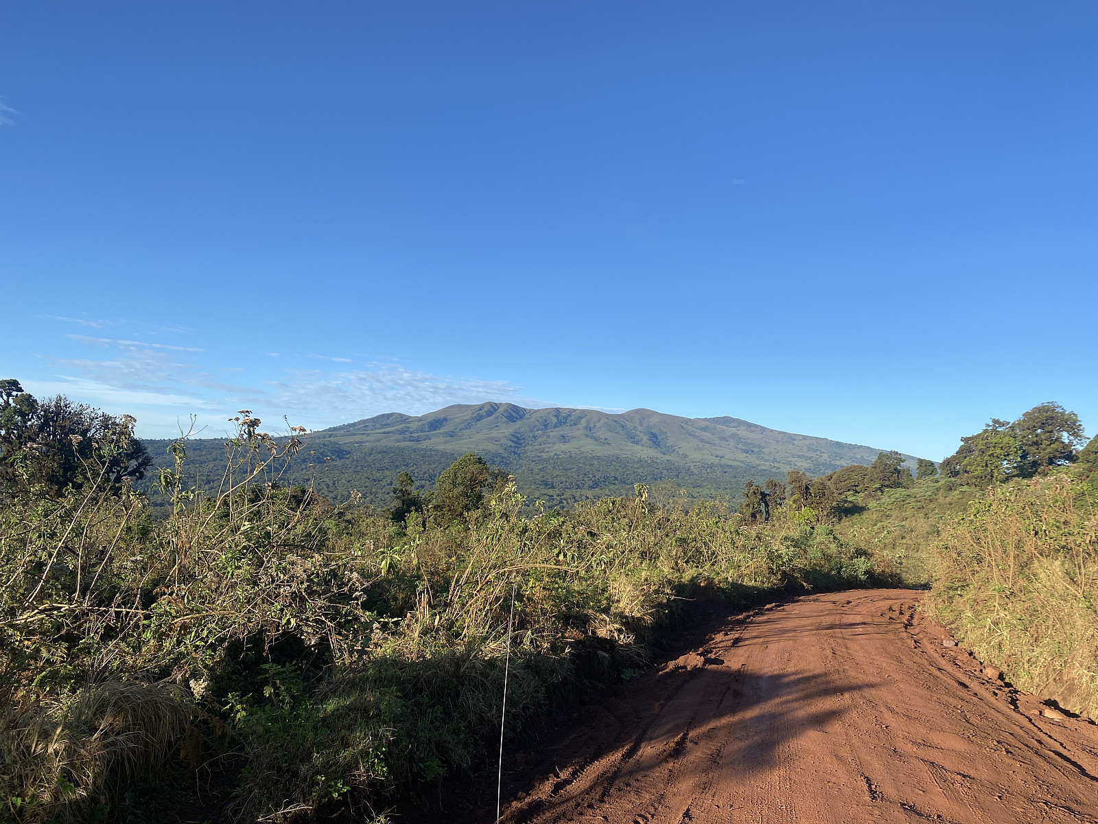
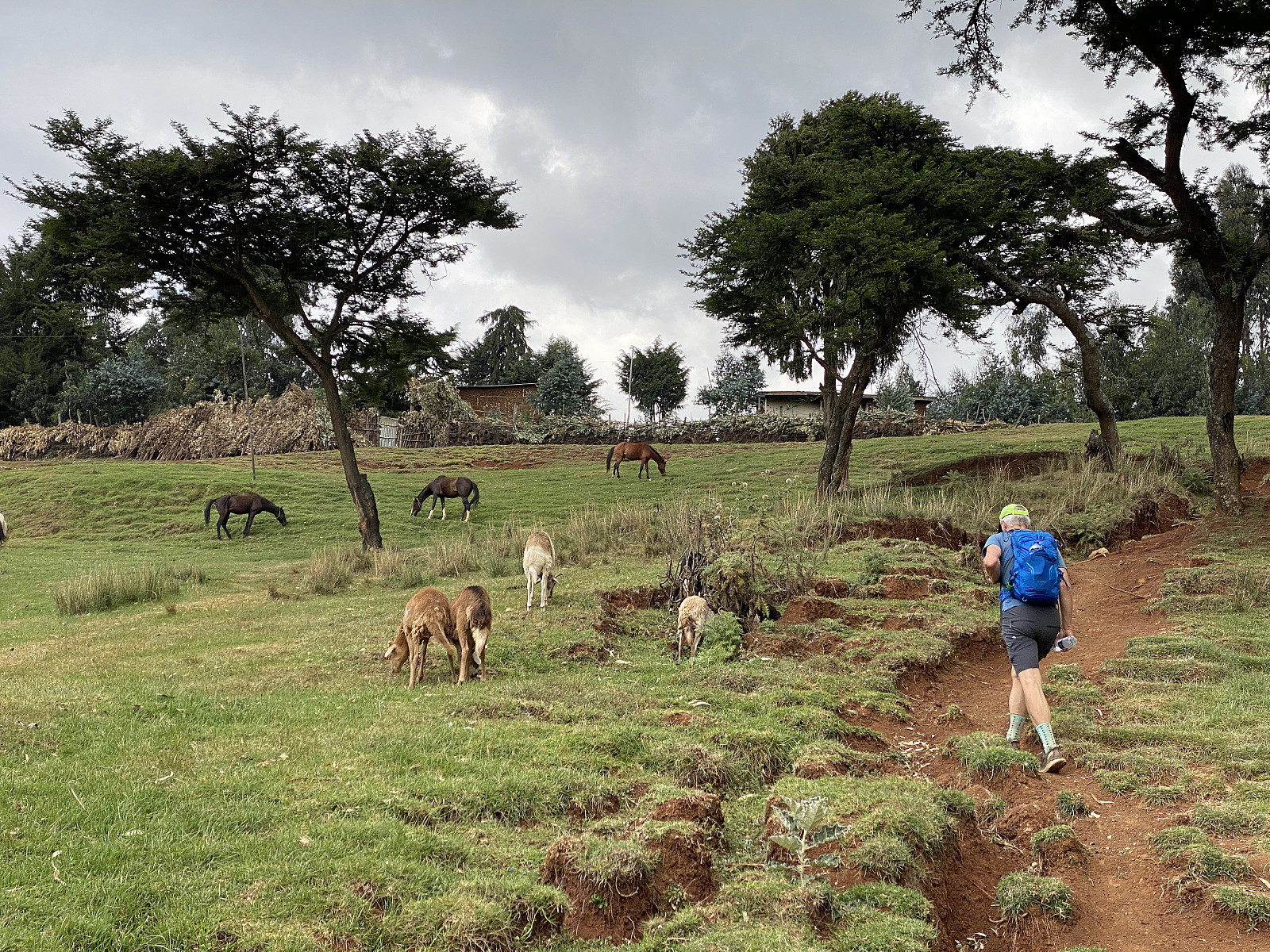 We had been in Addis Ababa for slightly more than a week, my colleague and I, when we decided to have a hike to the summit of Wochecha; the high mountain just west of Addis Ababa. While in Addis, we had frequently been out jogging in the early morning, and that had helped us acclimatise slightly to the high altitude. The summit of Wochecha is, however located at 3391 m.a.m.s.l., while our whereabouts in Addis Ababa were mainly around 2400 m.a.m.s.l.; hence a hike to Wochecha still implied the gain of another 1000 vertical meters.
As for myself, I had been to Addis Ababa multiple times, and this was my third ascent of Wochecha. The first time, I hiked all the way from our hotel in central Addis Ababa, to the western outskirts of the city, before embarking on the real ascent; and so the hike took >>>
We had been in Addis Ababa for slightly more than a week, my colleague and I, when we decided to have a hike to the summit of Wochecha; the high mountain just west of Addis Ababa. While in Addis, we had frequently been out jogging in the early morning, and that had helped us acclimatise slightly to the high altitude. The summit of Wochecha is, however located at 3391 m.a.m.s.l., while our whereabouts in Addis Ababa were mainly around 2400 m.a.m.s.l.; hence a hike to Wochecha still implied the gain of another 1000 vertical meters.
As for myself, I had been to Addis Ababa multiple times, and this was my third ascent of Wochecha. The first time, I hiked all the way from our hotel in central Addis Ababa, to the western outskirts of the city, before embarking on the real ascent; and so the hike took >>>
Fot- og trugetur til Kinnakollen og til Gullkoppen
- Date:
- 13.04.2024
- Characteristic:
- Hike
- Duration:
- 4:07h
- Distance:
- 5.8km
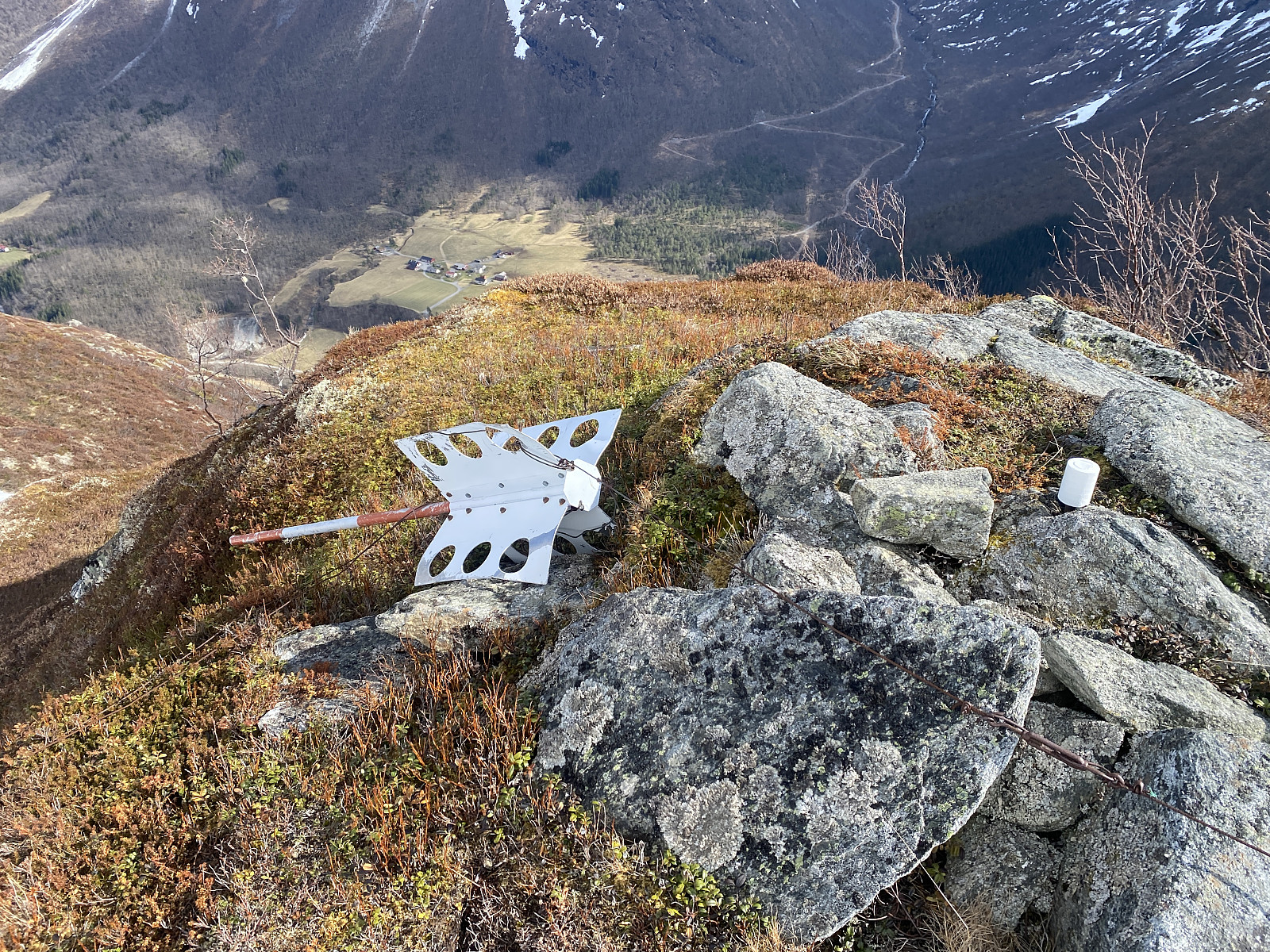 Kinnakollen [729 m.o.h.] er egentlig bare en knaus sørøst på Middagstinden [1568 m.o.h.], men den har primærfaktor på 119 meter, og har derfor fått rød kartnål her i Peakbook; og den inngår i lista over Romsdalstopper med PF > 100 meter. Nå er dette ei av de listene jeg "samler" topper fra, og jeg bestemte meg derfor for å ta turen, selv om toppen ikke er mer en halvparten så høy som mange av de omkringliggende toppene. Jeg hadde lurt litt på om ikke det kunne gå an å kombinere turen med en tur opp på Middagstinden, men når jeg studerte kart og turbeskrivelser i forkant av turen, fant jeg ut at den vanlige traséen opp på Middagstinden starter ca. 2 km lengre inn i dalen (der Bøstøl-veien krysser elva), og går opp via Lille Middagstinden [943 m.o.h.] og Tindevatnet >>>
Til Gjerdsegga og Kjørsetdalshornet
- Date:
- 17.06.2023
- Characteristic:
- Hike
- Duration:
- 4:24h
- Distance:
- 10.5km
 Vi var fortsatt ikke kommet lenger enn til ca. midten av juni, og jeg var nettopp kommet hjem fra en tur i Afrika, så jeg var ennå ikke kommet skikkelig i gang med fottursesongen for dette året, da min eldste sønn foreslo at vi kunne ta turen inn til Valldalen, og for eksempel gå opp på Gjerdegga og Kjørsetdalshornet. Det var meldt fint vær, så vi gjorde som han foreslo, og kjørte opp til noen gårdsbruk i fjellsida ovenfor Gjerde, og parkerte et sted hvor en skogsvei delte seg, og det var litt bredde på krysset, slik at vi ikke skulle stå i veien for noen. Der smatt vi på oss turskoene, og la i vei oppover. De viktigste stiene i området var avmerket på kartet både i Peakbook-app'en og i Varsom-app'en, så det var ikke noe problem å finne riktig trasé oppover gjennom skogen.
Fottur til Snaufjellet ved Rekdalen
- Date:
- 10.06.2023
- Characteristic:
- Hike
- Duration:
- 1:55h
- Distance:
- 5.3km
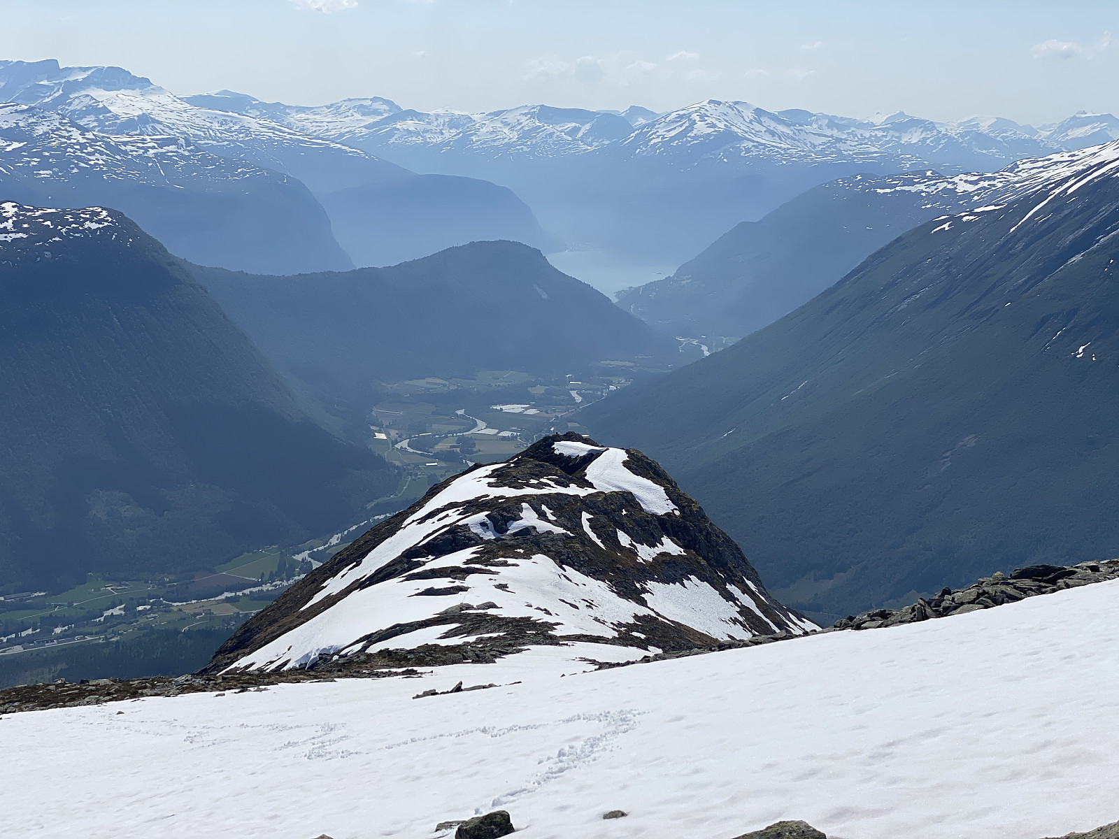
 Jeg må innrømme at dette er en tur jeg neppe ville tatt, om jeg ikke hadde begynt å samle på topper i lista over topper i Romsdal med PF > 100 meter; men når det er sagt, var utsikten spesielt fra nordtoppen såpass bra, at den alene var verdt turen. Jeg tok av fra FV 661 nede i Rekdals-bygda, fulgte Rekdalsetervegen innover dalen; fant meg et sted å parkere kanskje 700 meter før Rekdalssetra, og begynte å gå derfra. Denne gangen hadde jeg imidlertid gjort altfor dårlig research på forhånd, og først mens jeg var underveis, forstod jeg at det hadde vært enklere å gå opp fra Holå ved Gjelsteinlia nede i Rekdalsbygda, og derfra fulgt en sti som går oppover langs Skiftingselva, og som deretter følger nordøstryggen opp til nordtoppen av Snaufjellet. Fra nordtoppen er det så >>>
Til Nakkefjellet ved Fiksdalen
- Date:
- 17.05.2023
- Characteristic:
- Hike
- Duration:
- 3:42h
- Distance:
- 9.1km
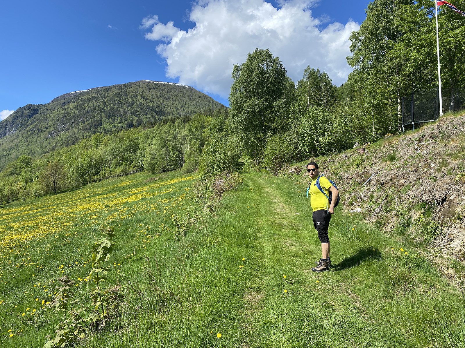
 Etter at barna ble voksne, og vi ikke lenger behøver å være med på feiring av nasjonaldagen i barnehage og på skoler, er det blitt mulig for oss å finne på andre ting denne dagen. Misforstå meg ikke, jeg har ingen ting imot feiring av nasjonaldagen, det er bare den stereotype, tradisjonelle feiringen med barnetog og sekkeløp og taler i skolens gymsal eller aula, som ikke helt passer for meg. Og etterhvert har jeg forstått at dette ikke bare gjelder meg, for jeg registrerer at stadig flere feirer nasjonaldagen på en eller annen fjelltopp, gjerne iført bunad, og viftende med et norsk flagg.
Det ble min eldste sønn som ble med meg på tur denne dagen. Vi fant ei lomme å parkere i på høyre side av Nakkedalsveien (FV 5970), litt nedenfor Ellingsetersetra (som ikke må forveksles med >>>
Etter at barna ble voksne, og vi ikke lenger behøver å være med på feiring av nasjonaldagen i barnehage og på skoler, er det blitt mulig for oss å finne på andre ting denne dagen. Misforstå meg ikke, jeg har ingen ting imot feiring av nasjonaldagen, det er bare den stereotype, tradisjonelle feiringen med barnetog og sekkeløp og taler i skolens gymsal eller aula, som ikke helt passer for meg. Og etterhvert har jeg forstått at dette ikke bare gjelder meg, for jeg registrerer at stadig flere feirer nasjonaldagen på en eller annen fjelltopp, gjerne iført bunad, og viftende med et norsk flagg.
Det ble min eldste sønn som ble med meg på tur denne dagen. Vi fant ei lomme å parkere i på høyre side av Nakkedalsveien (FV 5970), litt nedenfor Ellingsetersetra (som ikke må forveksles med >>>
Hiking to the Eyasi Viewpoint on Mount Oldeani
- Date:
- 02.12.2022
- Characteristic:
- Hike
- Duration:
- 1:25h
- Distance:
- 5.8km
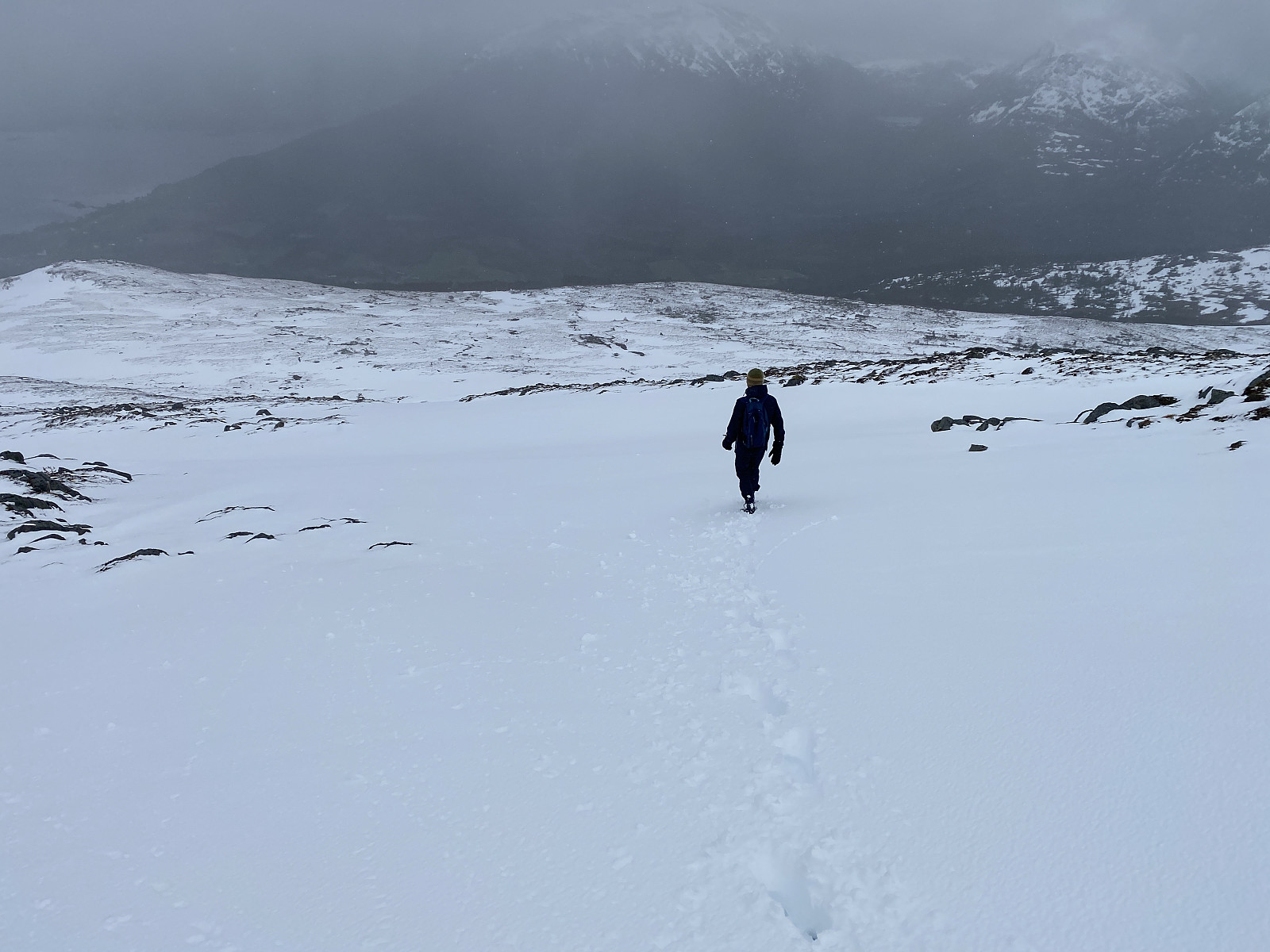
 After our hike to Mount Loolmalasin , Frank and I and our driver spent the night at a nice little lodge just outside of the Ngorongoro Conservation Area, but the very next morning we drove back into the very same conservation area, intending to climb Mount Oldeani [3206 m.a.m.s.l.]. Frank had been in contact with a ranger outpost just by the foot of the mountain, and we went there quite early, eager to meet the ranger that was going to come along with us on our hike. We were at the outpost shortly after seven o'clock, and there we met Elisha Goodluck . He jumped into the car with us, and then we started driving towards our start out point, according to his instructions. To begin with, the road made sense, as it brought us gradually closer to Oldeani, which we had actually had in sight most of >>>
Til Kvitfjellet/Oksen ved Rødvenfjorden
- Date:
- 22.05.2022
- Characteristic:
- Hike
- Duration:
- 5:25h
- Distance:
- 14.0km
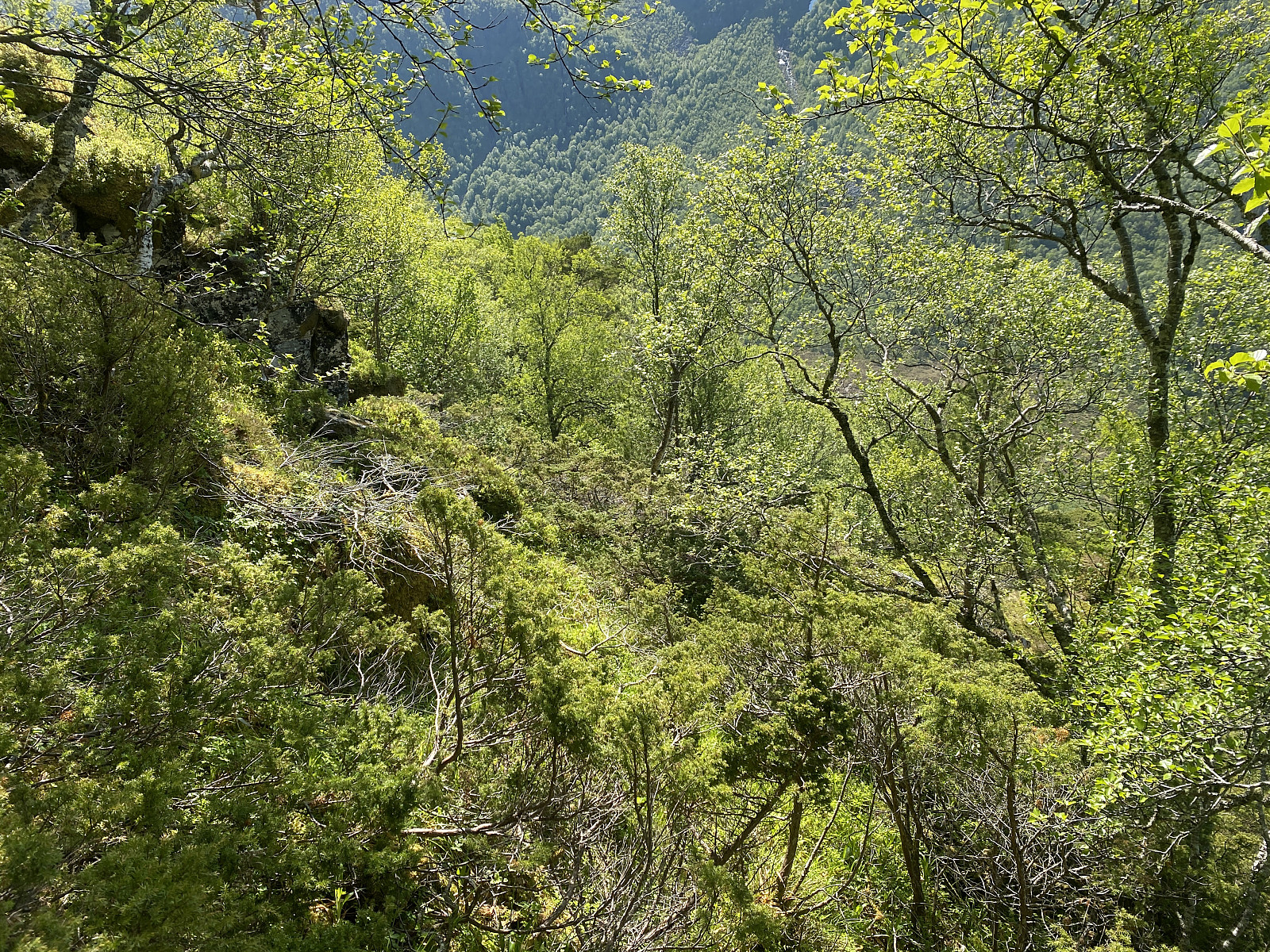
 Det var Dag, eldste sønnen min, som denne dagen foreslo at vi kunne ta turen inn til Eidsbygda og Rødvenhalvøya, og bestige et av fjellene der. Vi kjørte inn til Åndalsnes, rundt Isjorden, og helt til vi kom til Rødvenfjorden, der vi tok av fra hovedveien og kjørte ut til Eidsbygda. Her parkerte vi bilen ved Eid Kirke, og gav oss i kast med turen. Fjellet vi hadde sett oss ut var Kvitfjellet, eller Oksen (dette fjellet har to navn). Traséen fulgte en gammel vei over et jorde helt i starten, deretter gikk det langs skogsvei gjennom skogen; før vi var over på en ganske brukbar sti som gikk oppover fjellsida. Stien skrået mot venstre oppover fjellsida, men hadde retning mot den noe salformede ryggen mellom Kvitfjellet og Eidsfjellet (se kart og GPS-tracking).
Været var strålende denne >>>
Det var Dag, eldste sønnen min, som denne dagen foreslo at vi kunne ta turen inn til Eidsbygda og Rødvenhalvøya, og bestige et av fjellene der. Vi kjørte inn til Åndalsnes, rundt Isjorden, og helt til vi kom til Rødvenfjorden, der vi tok av fra hovedveien og kjørte ut til Eidsbygda. Her parkerte vi bilen ved Eid Kirke, og gav oss i kast med turen. Fjellet vi hadde sett oss ut var Kvitfjellet, eller Oksen (dette fjellet har to navn). Traséen fulgte en gammel vei over et jorde helt i starten, deretter gikk det langs skogsvei gjennom skogen; før vi var over på en ganske brukbar sti som gikk oppover fjellsida. Stien skrået mot venstre oppover fjellsida, men hadde retning mot den noe salformede ryggen mellom Kvitfjellet og Eidsfjellet (se kart og GPS-tracking).
Været var strålende denne >>>
