Archive - Date
Archive - Activity
- Bike trip (2)
-
Climbing (8)
- Alpine climbing (7)
- Mixed climbing (1)
-
Other trip (1)
- Expedition (1)
-
Other winter trip (10)
- Snowshoe trip (10)
-
Ski trip (49)
- Randonnée/Telemark (49)
-
Trip by foot (231)
- Alpine trip (59)
- Hike (69)
- Hillwalk (90)
- Jogging (11)


Collected lists
-
Romsdal ≥ 100m pf.
(134/301)
 44%
44% -
Sunnmøre ≥ 100m pf.
(78/531)
14%
-
Norges 1000 største fjell målt i primærfaktor
(52/1000)
5%

Til Olaskartinden og Hornaksla
- Date:
- 19.08.2022
- Characteristic:
- Alpine trip
- Duration:
- 5:12h
- Distance:
- 11.1km
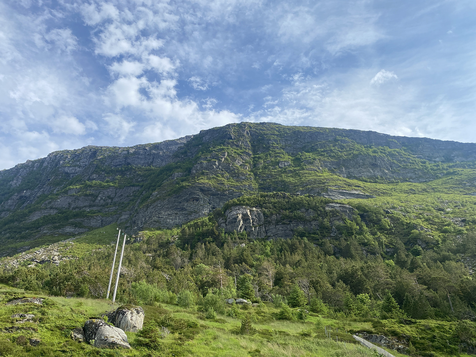
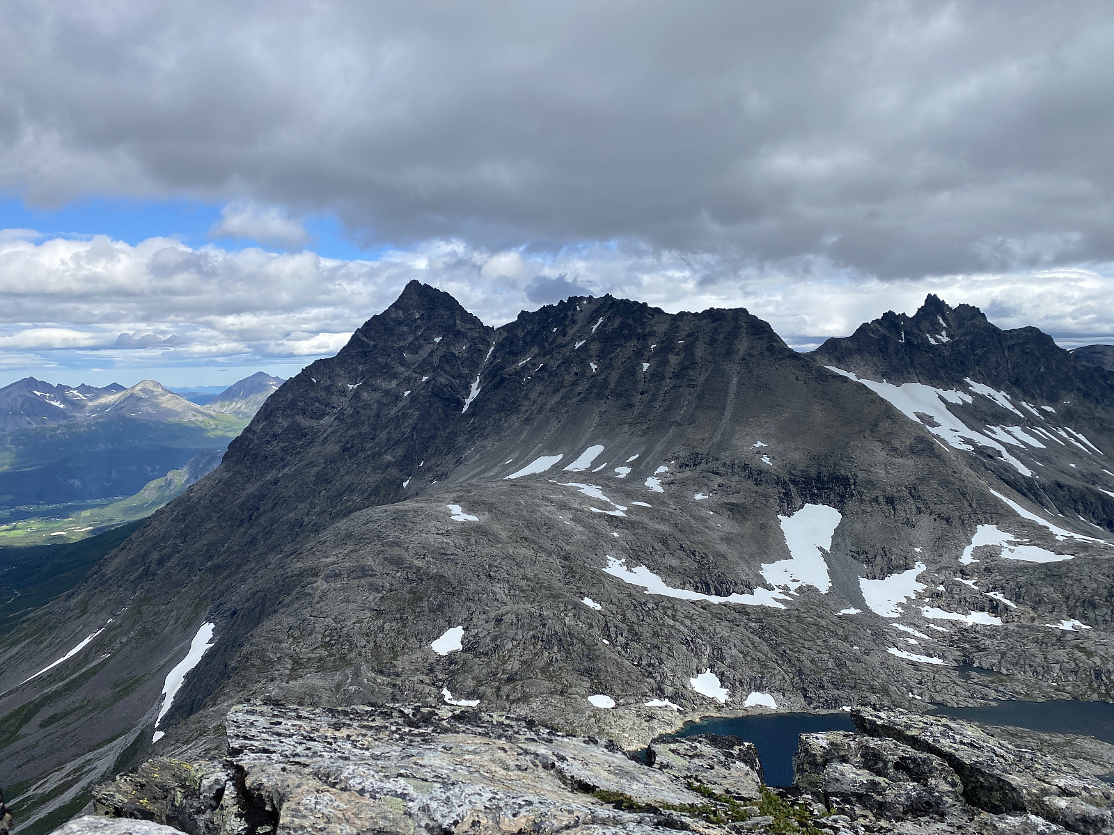 Jeg har gått en del i fjellene i dette området, og tenkt en stund at nå måtte snart Hornaksla og Olaskartinden stå for tur; og når jeg på vei til Venjetindtraversen har passert den bratte nordryggen på Olaskartinden, så har denne hatt en slags nærmest magnetisk tiltrekningskraft på meg. Jeg parkerte øverst i Venjedalen, og fulgte samme trasé forbi hornvatnet som man går når man skal opp til Halls renne på Romsdalshornet, men tok av der stien deler seg, og fulgte den som går inn i gropa mellom Hornaksla og Olaskartinden; krysset den lille bekken som er der, og fortsatte så på samme stien der den runder nordsida av Olaskartinden.
Litt før jeg kom opp til Olaskarsvatnet tok jeg så rett oppover nordryggen på Olaskartinden. Fra begynnelsen var det helt greit å vekselvis klyve >>>
Jeg har gått en del i fjellene i dette området, og tenkt en stund at nå måtte snart Hornaksla og Olaskartinden stå for tur; og når jeg på vei til Venjetindtraversen har passert den bratte nordryggen på Olaskartinden, så har denne hatt en slags nærmest magnetisk tiltrekningskraft på meg. Jeg parkerte øverst i Venjedalen, og fulgte samme trasé forbi hornvatnet som man går når man skal opp til Halls renne på Romsdalshornet, men tok av der stien deler seg, og fulgte den som går inn i gropa mellom Hornaksla og Olaskartinden; krysset den lille bekken som er der, og fortsatte så på samme stien der den runder nordsida av Olaskartinden.
Litt før jeg kom opp til Olaskarsvatnet tok jeg så rett oppover nordryggen på Olaskartinden. Fra begynnelsen var det helt greit å vekselvis klyve >>>
Over Isterdalstindane med en gammel venn
- Date:
- 12.08.2022
- Characteristic:
- Alpine trip
- Duration:
- 14:05h
- Distance:
- 19.3km
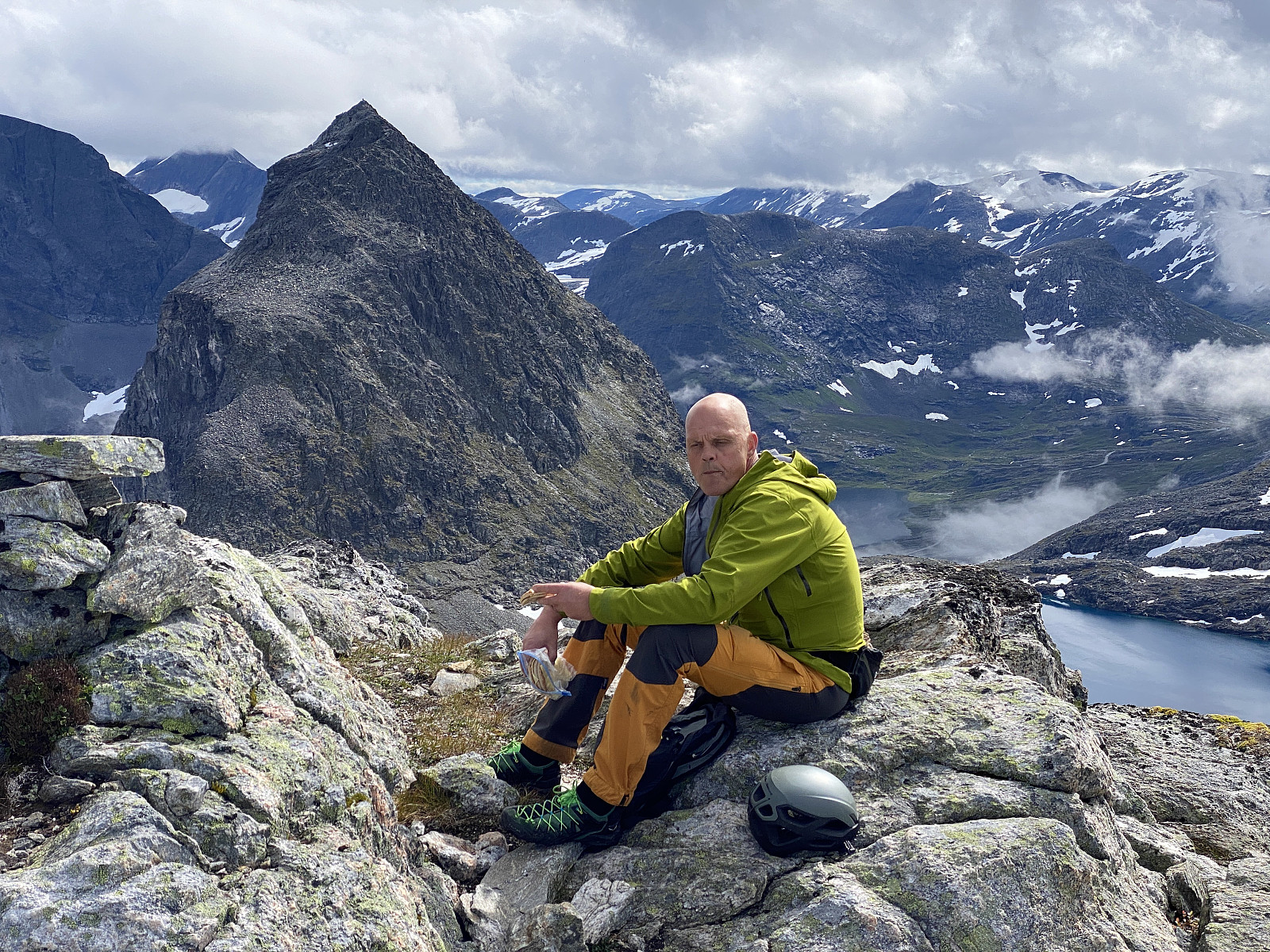 For mange år siden kjente jeg en kar som het William. Vi mistet kontakten da vi begge flyttet fra Ålesund på slutten av 1980-tallet. De siste årene har vi imidlertid fulgt hverandre på sosiale media (Facebook og Instagram), og sist sommer kommuniserte vi på Messenger om å ta en lengre fjelltur sammen; og vi nevnte som en mulighet at vi kunne jo følge tinderekka langs Isterdalen fra Trollstigen i retning Åndalsnes (Bispen, Kongen, Dronninga etc.), og så se om vi endte opp nede i Innfjorden, eller om vi orket å fullføre hele rekka fram til Setnesfjellet og Åndalsnes. (Jeg har gått hele tinderekka i ett tidligere, men det var en lang og strabasiøs tur. For turbeskrivelse fra den turen, klikk her: Hiking the Entire Length of Isterdalstindane Mountain Range. ). Nå ble det ikke noe av dette i fjor, men nå for bare en ukes tid siden tok William >>>
Til Kvandalstinden via Nordryggen
- Date:
- 07.08.2022
- Characteristic:
- Alpine trip
- Duration:
- 14:24h
- Distance:
- 14.6km
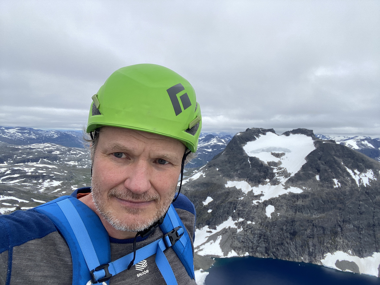 Jeg hadde tidligere sett Kvanndalstinden både fra Venjetindtraversen og fra Romdalshornet, men aldri besteget den. Etter at jeg nå hadde besteget Romsdalshornet to ganger, gikk det imidlertid plutselig opp for meg at Kvanndalstinden var den eneste tinden jeg manglet for å oppnå Fjellkonge-tittelen til Norsk Fjellfestival. Tildelingen av denne tittelen krever at man har besteget følgende 7 topper i Romsdalen: Kongen, Dronninga, Store Trolltind, Juratiden, Store Venjetind, Romsdalshornet, og Kvanndalstinden. Jeg funderte først litt på å booke en guidet tur til Kvanndalstinden med klatreutstyr og det hele, men når jeg leste om Kvanndalstinden for å sette meg inn i det hele, og forberede meg for en slik tur, oppdaget jeg at bestigning av Kvanndalstinden via «nordryggen» kun var klassifisert >>>
Til Kattanakken med Vår og Dag
- Date:
- 30.07.2022
- Characteristic:
- Hillwalk
- Duration:
- 5:46h
- Distance:
- 12.2km
 Det var min sønn Dag som foreslo at vi skulle ta denne turen. Han gikk denne turen sammen med noen venner av seg i fjor sommer, og kunne fortelle om vakker natur, og spektakulær utsikt til Briksdalsbreen, så vel som utover Oldevatnet; og ettersom været slo til, var både jeg og Vår (min datter og yngste søster av dag) med på planen. Vi stod tidlig opp, og kjørte via Volda og Kvivsvegen til Stryn, og derfra videre til Loen og Olden. I Olden tok vi så av fra hovedvegen, og fulgte fylkesvei 5724 sørover 22 km langs Oldevatnet og innover Oldedalen, til vi kom til der Briksdalen munner ut i Oldedalen. Akkurat der ligger Briksdalsbreen Fjellstove, hvor det er godt tilrettelagt med parkeringsplasser, og der parkerte vi, og derfra begynte vi å gå.
Fra Briksdalsbreen Fjellstove fulgte vi >>>
Det var min sønn Dag som foreslo at vi skulle ta denne turen. Han gikk denne turen sammen med noen venner av seg i fjor sommer, og kunne fortelle om vakker natur, og spektakulær utsikt til Briksdalsbreen, så vel som utover Oldevatnet; og ettersom været slo til, var både jeg og Vår (min datter og yngste søster av dag) med på planen. Vi stod tidlig opp, og kjørte via Volda og Kvivsvegen til Stryn, og derfra videre til Loen og Olden. I Olden tok vi så av fra hovedvegen, og fulgte fylkesvei 5724 sørover 22 km langs Oldevatnet og innover Oldedalen, til vi kom til der Briksdalen munner ut i Oldedalen. Akkurat der ligger Briksdalsbreen Fjellstove, hvor det er godt tilrettelagt med parkeringsplasser, og der parkerte vi, og derfra begynte vi å gå.
Fra Briksdalsbreen Fjellstove fulgte vi >>>
Solotur til Romsdalshornet og Litjhornet
- Date:
- 28.07.2022
- Characteristic:
- Alpine trip
- Duration:
- 6:37h
- Distance:
- 4.2km
 Det er ikke mer enn knapt en uke siden jeg besteg Romsdalshornet via Halls renne Solotur til Romsdalshornet via Hall's renne . Nå var det imidlertid meldt fint vær, og jeg bestemte meg da for å ta turen på nytt; dels fordi det ikke hadde vært så mye å se underveis sist jeg tok turen, dels fordi jeg ikke tok turen oppom Litjhornet forrige gang, og dels fordi jeg følte behov for å lære meg traséen litt bedre, slik at jeg kan turen til senere. Så jeg kjørte innover til Rauma, og opp i Venjedalen, og parkerte på øverste parkeringsplassen slik jeg også gjorde sist; og begynte å gå derfra.
Jeg fulgte som sist stien forbi Hornvatnet og oppover fjellsida, men denne gangen tok jeg riktig sti allerede nede ved vatnet. Ved ca. 1000 høydemeter forlot jeg også denne gang stien som går i retning Olaskarvatnet, og fulgte rødmerkingen >>>
Det er ikke mer enn knapt en uke siden jeg besteg Romsdalshornet via Halls renne Solotur til Romsdalshornet via Hall's renne . Nå var det imidlertid meldt fint vær, og jeg bestemte meg da for å ta turen på nytt; dels fordi det ikke hadde vært så mye å se underveis sist jeg tok turen, dels fordi jeg ikke tok turen oppom Litjhornet forrige gang, og dels fordi jeg følte behov for å lære meg traséen litt bedre, slik at jeg kan turen til senere. Så jeg kjørte innover til Rauma, og opp i Venjedalen, og parkerte på øverste parkeringsplassen slik jeg også gjorde sist; og begynte å gå derfra.
Jeg fulgte som sist stien forbi Hornvatnet og oppover fjellsida, men denne gangen tok jeg riktig sti allerede nede ved vatnet. Ved ca. 1000 høydemeter forlot jeg også denne gang stien som går i retning Olaskarvatnet, og fulgte rødmerkingen >>>
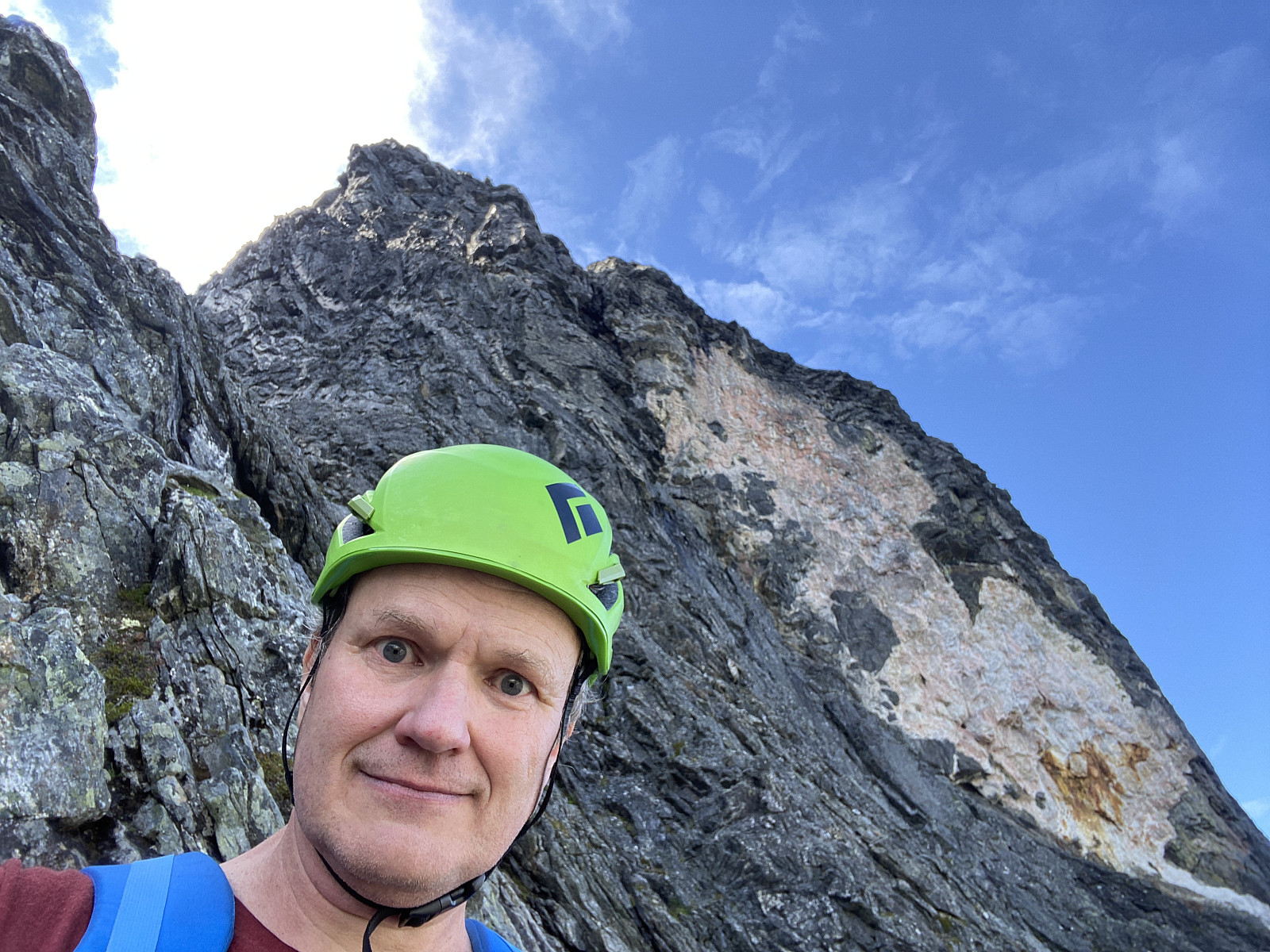
Solotur til Romsdalshornet via Hall's renne
- Date:
- 22.07.2022
- Characteristic:
- Alpine trip
- Duration:
- 6:40h
- Distance:
- 10.0km
 Romsdalshornet har lenge vært et etterlengtet fjell å bestige, for jeg har ofte sett bort på dette fjellet når jeg har besteget andre fjell i området. Jeg hadde så smått begynt å planlegge at jeg kanskje skulle spandere på meg en guidet tur med fjellfører og det hele, for jeg hadde fått forståelsen av at det var snakk om nokså krevende klatring for å komme seg opp Hornet . Når jeg for noen uker siden leste meg opp, rent kunnskapsmessig om dette fjellet, oppdaget jeg at det langs nordryggen ikke er snakk om verre klatring enn grad 4, og at det opp den tradisjonelle vegen (via "Halls renne") egentlig var snakk om litt krevende klyving, men med to crux med klatring grad 3 underveis.
Jeg bestemte meg for å ta denne normalruta nærmere i øyesyn, så jeg kunne vurdere selv >>>
Romsdalshornet har lenge vært et etterlengtet fjell å bestige, for jeg har ofte sett bort på dette fjellet når jeg har besteget andre fjell i området. Jeg hadde så smått begynt å planlegge at jeg kanskje skulle spandere på meg en guidet tur med fjellfører og det hele, for jeg hadde fått forståelsen av at det var snakk om nokså krevende klatring for å komme seg opp Hornet . Når jeg for noen uker siden leste meg opp, rent kunnskapsmessig om dette fjellet, oppdaget jeg at det langs nordryggen ikke er snakk om verre klatring enn grad 4, og at det opp den tradisjonelle vegen (via "Halls renne") egentlig var snakk om litt krevende klyving, men med to crux med klatring grad 3 underveis.
Jeg bestemte meg for å ta denne normalruta nærmere i øyesyn, så jeg kunne vurdere selv >>>
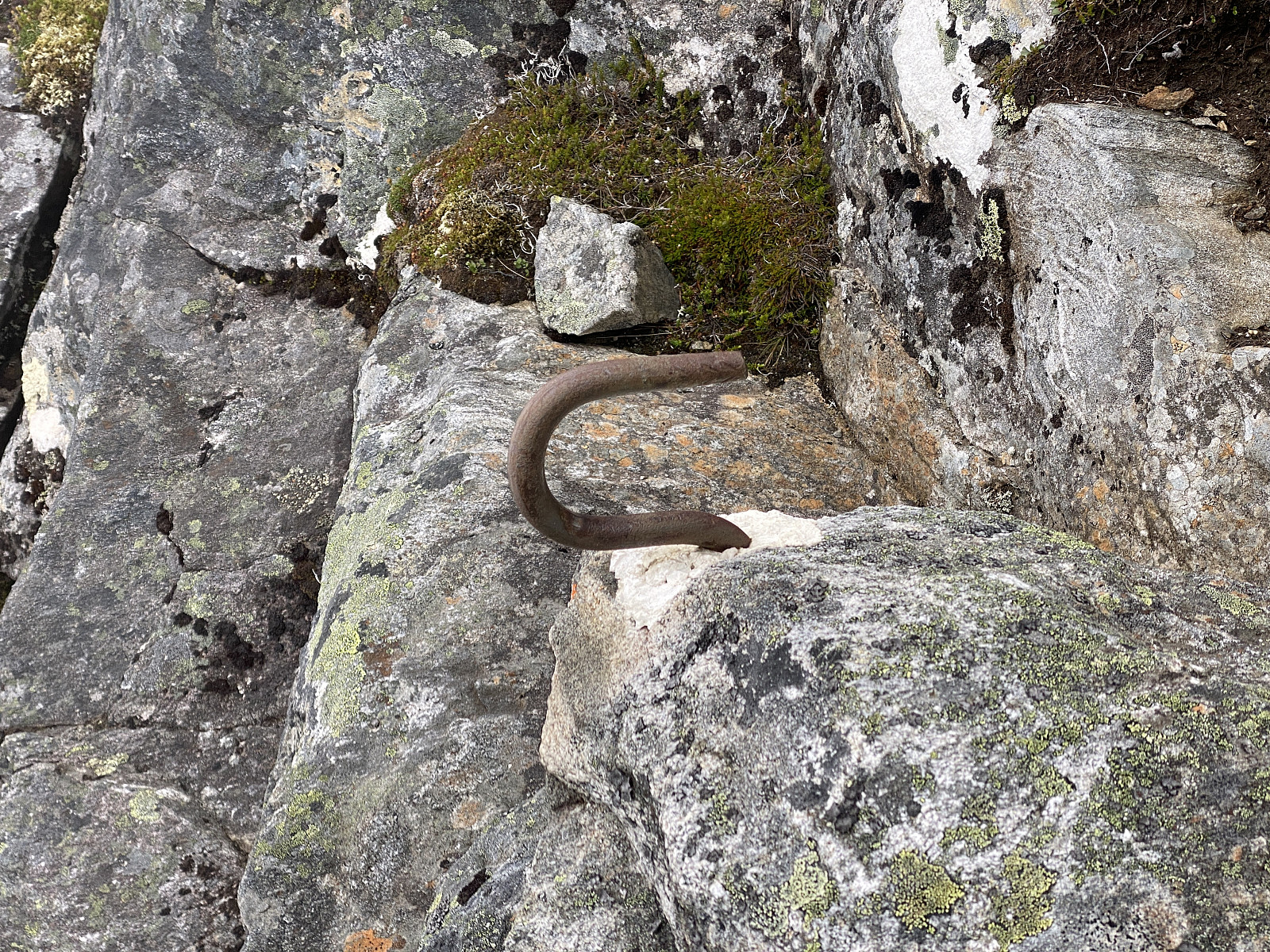
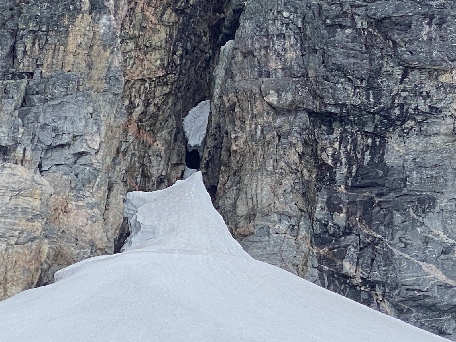
Til Lavskar med teleskopstige
- Date:
- 19.07.2022
- Duration:
- 7:45h
- Distance:
- 12.3km
 Jeg har to ganger tidligere forsøkt å komme meg opp på Store Trolltind via den bratte renna opp til Lavskar; første gangen var 1. juli 2021, og andre gangen var 25. mai 2022. Begge gangene måtte jeg gi tapt ved et isfall bare et lite stykke oppi renna. Første gangen [ To Mt Store Trolltind Via Mt Norafjellet and Mt Trollklørn ] kom jeg meg opp på Store Trolltind via Trollklørn i stedet. Andre gangen [ Via Norafjellet til Lavskar-renna ] gav jeg meg på det, men sa både til meg selv og til dem jeg fortalte om turen, at "neste gang tar jeg med meg stige".
Og som sagt, så gjort. Jeg kjøpte meg en teleskop-stige, som veier ca. 10 kg, og som er ca. 2,5 meter lang når den trekkes helt ut. Denne stroppet jeg fast på ryggsekken, kjørte inn til Åndalsnes, parkerte ved Trollstigen Resort, en campingplass på Soggemoen, og la i vei oppover. Turen oppover gikk greit, selv >>>
Jeg har to ganger tidligere forsøkt å komme meg opp på Store Trolltind via den bratte renna opp til Lavskar; første gangen var 1. juli 2021, og andre gangen var 25. mai 2022. Begge gangene måtte jeg gi tapt ved et isfall bare et lite stykke oppi renna. Første gangen [ To Mt Store Trolltind Via Mt Norafjellet and Mt Trollklørn ] kom jeg meg opp på Store Trolltind via Trollklørn i stedet. Andre gangen [ Via Norafjellet til Lavskar-renna ] gav jeg meg på det, men sa både til meg selv og til dem jeg fortalte om turen, at "neste gang tar jeg med meg stige".
Og som sagt, så gjort. Jeg kjøpte meg en teleskop-stige, som veier ca. 10 kg, og som er ca. 2,5 meter lang når den trekkes helt ut. Denne stroppet jeg fast på ryggsekken, kjørte inn til Åndalsnes, parkerte ved Trollstigen Resort, en campingplass på Soggemoen, og la i vei oppover. Turen oppover gikk greit, selv >>>
Ny tur opp Vindsnesrenna på Godøya
- Date:
- 18.07.2022
- Duration:
- 3:46h
- Distance:
- 5.5km
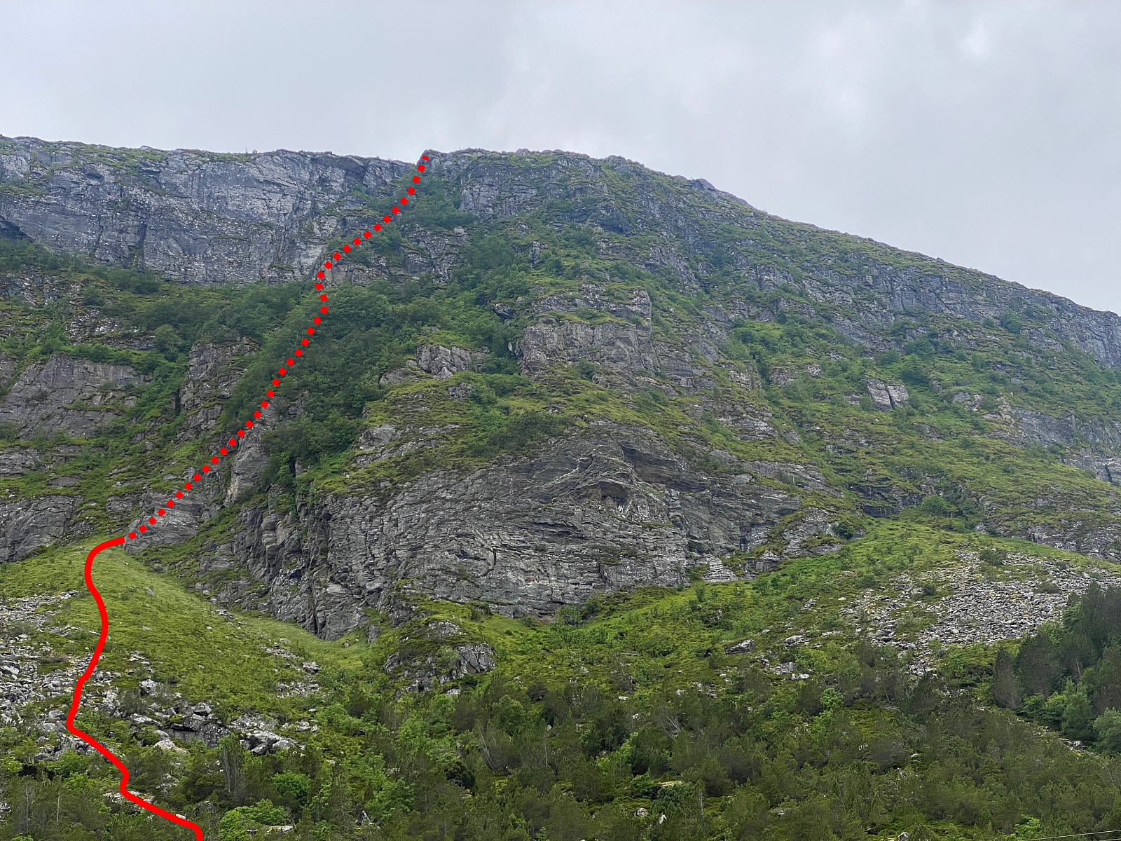 Jeg har gått mye tur på Godøyfjellet, både opp til Storhornet [497 m.o.h.] og til de andre, litt lavere toppene på øya. Når jeg har parkert på parkeringsplassen rett ved tunellåpningen på Alnes, har jeg ofte sett oppover fjellsida, og tenkt at det måtte jo kunne gå an å komme seg opp der på et eller annet vis, i stedet for å gå den vanlige ruta opp, som jo begynner å bli litt rutinepreget etterhvert.
Den 25.06.22 fant jeg så ei renne som jeg kløv opp, med forløp omtrent som angitt på bilde #2. At deler av kurven er stiplet, er for å markere at traséen egentlig ikke er synlig fra der bildet er tatt, men går gjemt inne i bunnen av renna. Renna har jeg i turbeskrivelsen min fra 25.06 kalt Vindsnesrenna, ettersom den ligger rett ovenfor Vindsneset (bilde #5). (Turbeskrivelse >>>
Jeg har gått mye tur på Godøyfjellet, både opp til Storhornet [497 m.o.h.] og til de andre, litt lavere toppene på øya. Når jeg har parkert på parkeringsplassen rett ved tunellåpningen på Alnes, har jeg ofte sett oppover fjellsida, og tenkt at det måtte jo kunne gå an å komme seg opp der på et eller annet vis, i stedet for å gå den vanlige ruta opp, som jo begynner å bli litt rutinepreget etterhvert.
Den 25.06.22 fant jeg så ei renne som jeg kløv opp, med forløp omtrent som angitt på bilde #2. At deler av kurven er stiplet, er for å markere at traséen egentlig ikke er synlig fra der bildet er tatt, men går gjemt inne i bunnen av renna. Renna har jeg i turbeskrivelsen min fra 25.06 kalt Vindsnesrenna, ettersom den ligger rett ovenfor Vindsneset (bilde #5). (Turbeskrivelse >>>
Til Storehornet via Vindsnesrenna
- Date:
- 25.06.2022
- Characteristic:
- Alpine climbing
- Duration:
- 2:50h
- Distance:
- 5.2km
 Jeg aner ikke hvor mange ganger jeg har besteget Storhornet [497 m.o.h.] på Godøya i løpet av de siste 10 årene, men jeg vil gjette på at det er et eller annet sted mellom 50 og 100 ganger. Jeg har oftest gått opp fra Alnes; sjeldnere enten fra Juv eller fra Gøymyrane. Én gang kløv jeg sågar fra Skagen lengst vest på Godøya, og rett opp til Rantane, før jeg fortsatte derfra opp på Storhornet ( A Different Climb on the Godøy Island and Mount Storehornet ). Stort sett har jeg imidlertid gått en av de "vanlige" traséene, og når man har gjort det tilstrekkelig mange ganger, blir det gjerne til at man søker nye utfordringer gjennom nye ruter og traséer opp.
Jeg har mange ganger stått på parkeringsplassen ved enden av Alnestunnellen, og sett oppover på fjellet (bilde #1), og tenkt at det skulle vært moro å enten klatre eller >>>
Jeg aner ikke hvor mange ganger jeg har besteget Storhornet [497 m.o.h.] på Godøya i løpet av de siste 10 årene, men jeg vil gjette på at det er et eller annet sted mellom 50 og 100 ganger. Jeg har oftest gått opp fra Alnes; sjeldnere enten fra Juv eller fra Gøymyrane. Én gang kløv jeg sågar fra Skagen lengst vest på Godøya, og rett opp til Rantane, før jeg fortsatte derfra opp på Storhornet ( A Different Climb on the Godøy Island and Mount Storehornet ). Stort sett har jeg imidlertid gått en av de "vanlige" traséene, og når man har gjort det tilstrekkelig mange ganger, blir det gjerne til at man søker nye utfordringer gjennom nye ruter og traséer opp.
Jeg har mange ganger stått på parkeringsplassen ved enden av Alnestunnellen, og sett oppover på fjellet (bilde #1), og tenkt at det skulle vært moro å enten klatre eller >>>
Runde på Hareidlandet
- Date:
- 28.05.2022
- Characteristic:
- Hillwalk
- Duration:
- 4:47h
- Distance:
- 16.0km
 Det var ikke meldt det beste været noen steder i fylket denne dagen, så vi bestemte oss for å ta en kortreist tur, til noen ikke så altfor høye topper; for det er ofte ikke det store poenget med de høye toppene når man likevel ikke får sett så mye. Så vi tok ferje over til Hareid, og kjørte innover dalen i retning Ulsteinvik, men tok av omtrent akkurat oppe på vannskillet, og fulgte en grusvei mot venstre, til vi kom til det som kalles Halsen Parkeringslomme (se kart/GPS-tracking). Vi var ikke helt fornøyde med været, for skydekket lå lavt over området, så vi gav opp prosjektet først, og kjørte ut til Flø på utsida av øya, for å se om været var bedre der ute. Det var det imidlertid ikke, det var snarere litt mer regn i lufta der ute, så dermed bar det inn igjen til >>>
