Upper left and right images: On the Summit of Mount Sulafjellet, frequently referred to as "Vardane". Middle left image: View towards Godøy Island. Middle right image: View towards Fiskerstranda. Lake Molværvatnet to the right. Lower left image: Heading for the peak called Svanshornet. 2nd bottom image: Our elevation track. 3rd bottom image: At Svanshornet. Lower right image: Heading back down towards Mausavatnet where we started out on this hike.
I went for a cool trip on mount Sulafjellet along with my son Dag this afternoon. We started out from the parking place by the lake Mausavatnet as we've done on previous occasions, and walked past the well known mountain cabin Rollonhytta up to the mountain peak commonly reffered to as Vardane (776 meters above main sea level), though the real name is actually Tverrfjellet or just Sulafjellet from Sula, the name of the island on which the mountain is located [fjell = mountain]. We thereafter descended from Vardane as we headed towards another peak, Grøthornet, located 650 mamsl. From Grøthornet we descended quite a bit towards the village Langevåg, until we found a rather steep track that could take us up to the mountain peak called Svanshornet (552 mamsl). From Svanshornet we followed another track down to the village Mauseidvåg, from where we walked an old gravel road back to our car.
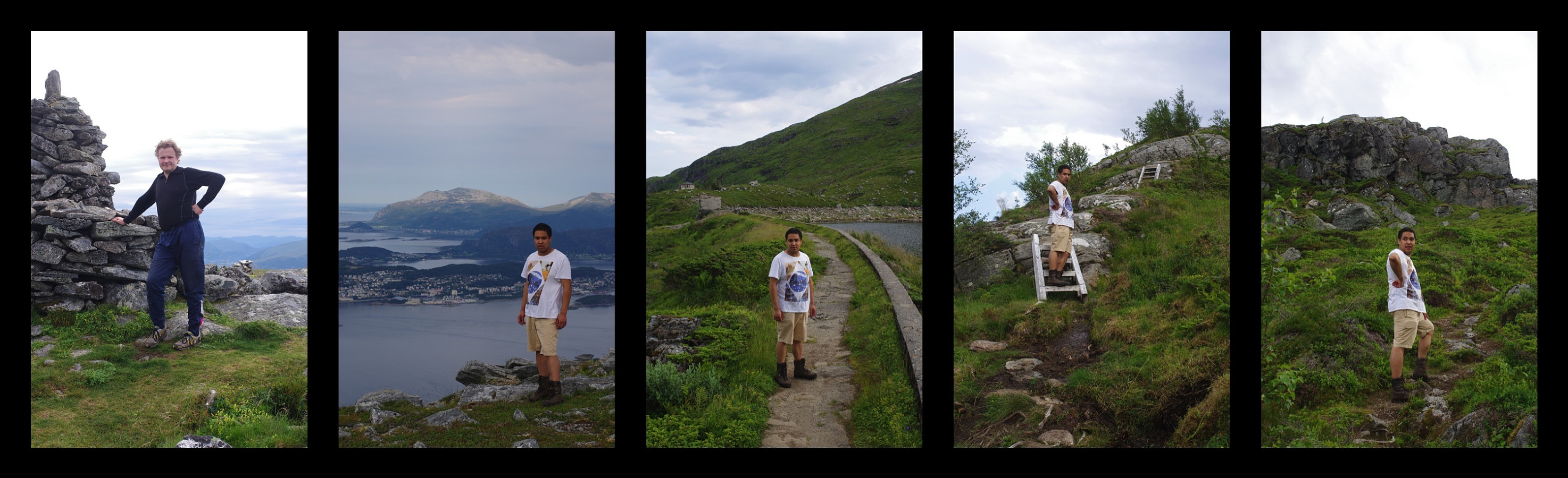
Some more images from this hike. Left image: Me on the summit of Mt. Sulafjellet. 2nd from left: My son on Grøthornet. 3rd from left: My son by Lake Molværvatnet. 4th image from the left: Climbing back up the mountainside after descending quite a bit down towards the village of Langevågen. Right image: Still hiking upwards toward the peak called Svanshornet.


User comments