Archive - Date
Archive - Activity
-
Climbing (23)
- Alpine climbing (9)
- Sport climbing (11)
- Via ferrata (2)
-
Drive (1)
- Car drive (1)
-
Other winter trip (3)
- Snowshoe trip (3)
-
Ski trip (62)
- Backcountry skiing (3)
- Cross-country skiing (1)
- Randonnée/Telemark (58)
- Trip by foot (137)


Favourite trips
Favourite peaks


Northern Norway's highest - Oksskolten
- Date:
- 27.07.2019
- Characteristic:
- Hillwalk
- Duration:
- 7:03h
- Distance:
- 15.8km
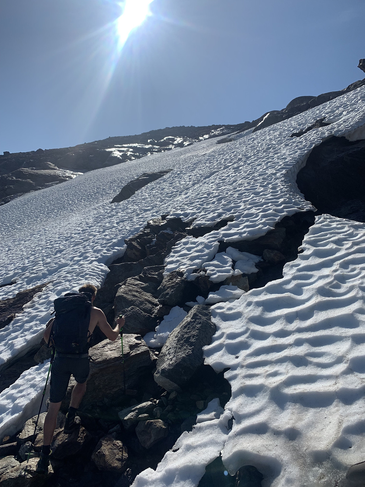 We camped overnight near the trailstart and woke up to what would be the hottest day of the year so far. We started walking around 8.15am and followed the markers up towards the small lake at 855moh. Here we took a wrong turn and followed the trail to the left, which is the circuit trail around Ridaren. We realised we were walking further away from the glacier and made our way back over a bouldery section of rock to the edge of the glacier, by here it was 9am. On with the crampons and ice axes and we started heading over a flat section of the glacier. There ended up being more and more crevasses as we progressed to the middle of the glacier and we had to tread carefully. After reading reports and speaking to otto (Otto Lund) who was last here in summer 10 years ago, the general practise has been to cross this >>>
Synnøvjordtinden
- Date:
- 23.07.2019
- Characteristic:
- Hillwalk
- Duration:
- 2:27h
- Distance:
- 7.8km
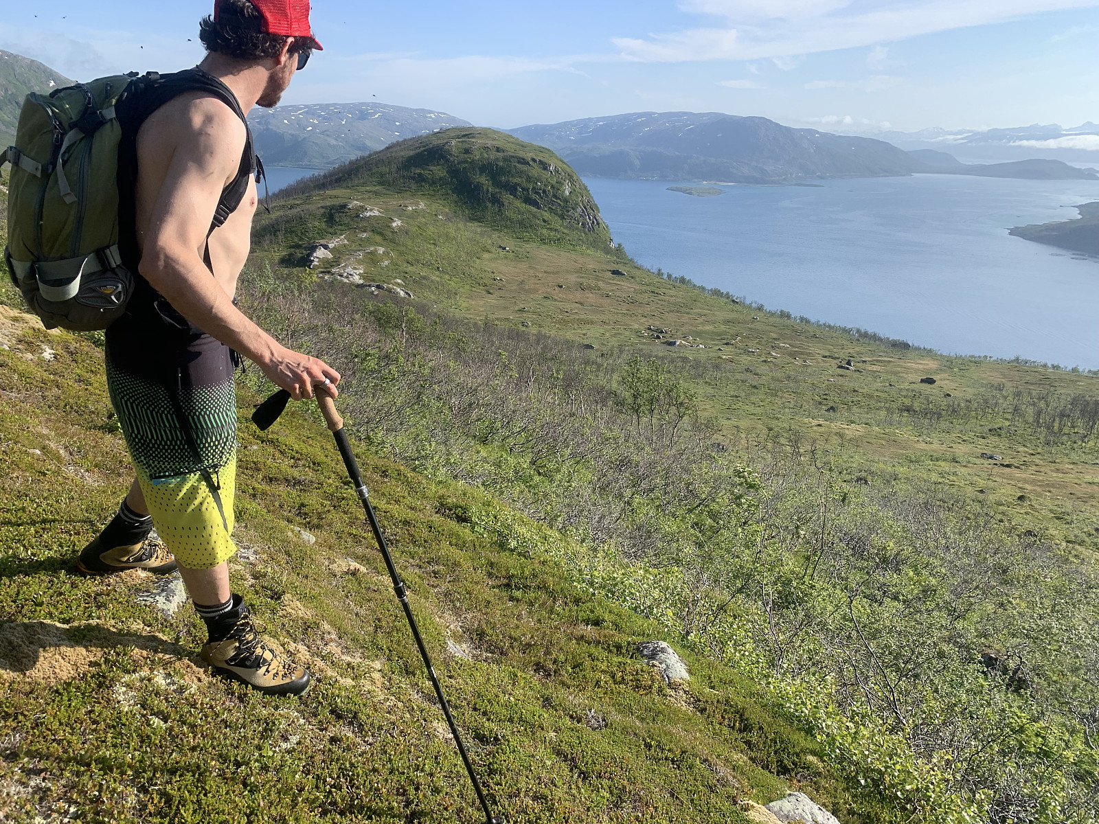
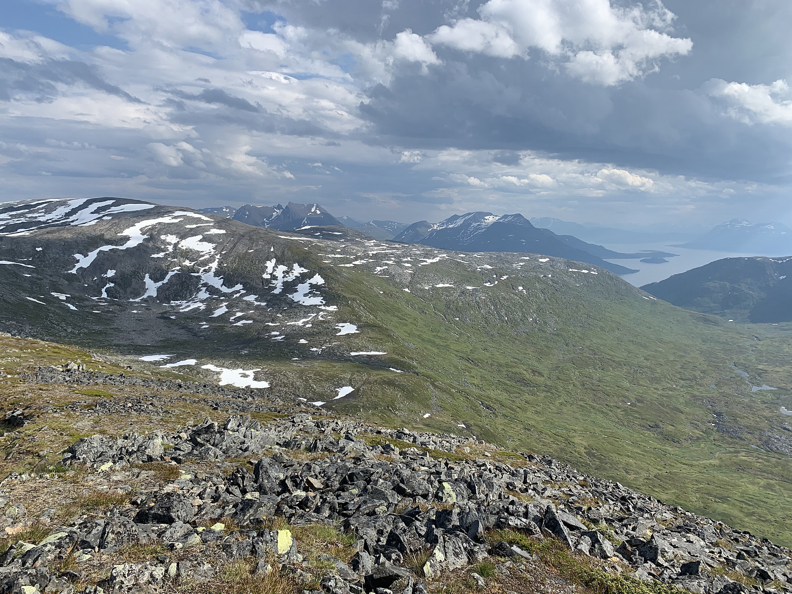 A lovely afternoon hike with Morgan. Parked by the side of where the trail starts on Norgeskart and followed the left hand side of the river up. Great, easily trodden terrain though once we came to the lake it was difficult to follow the unmarked trail up the ridge. We followed the general direction on Norgeskart and encountered the trail on/off again. Walked too fast to talk much on the way up, but the descent was a social one with variable luck following the trail. GPS track looks like I had wine in my camelback and not water ;) Great views over to Vasstinden and Kattfjordeidet. Thanks for great company Morgan!
Styrmannstinden & Melketinden
- Date:
- 21.07.2019
- Characteristic:
- Hillwalk
- Duration:
- 5:28h
- Distance:
- 9.3km
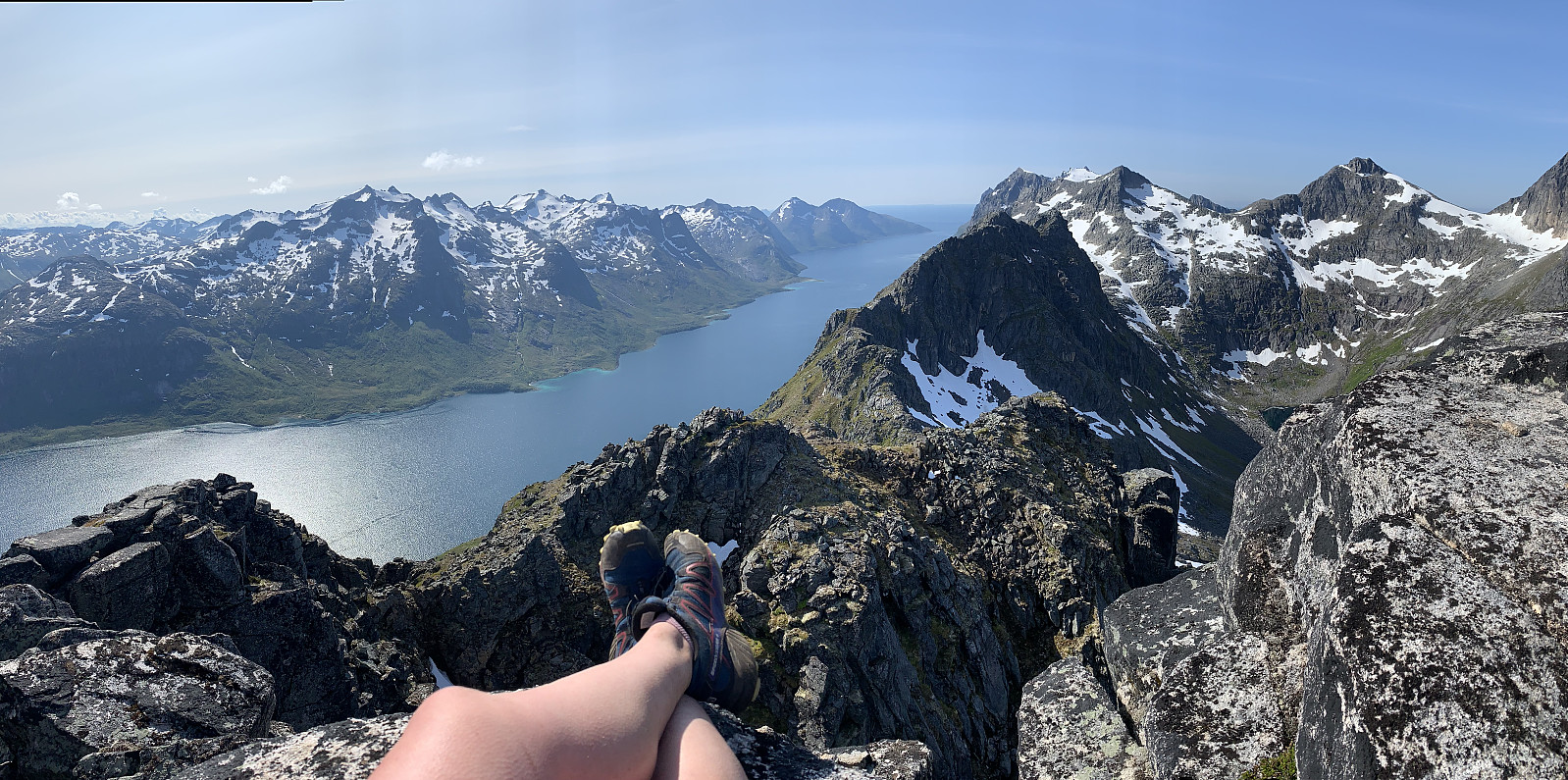
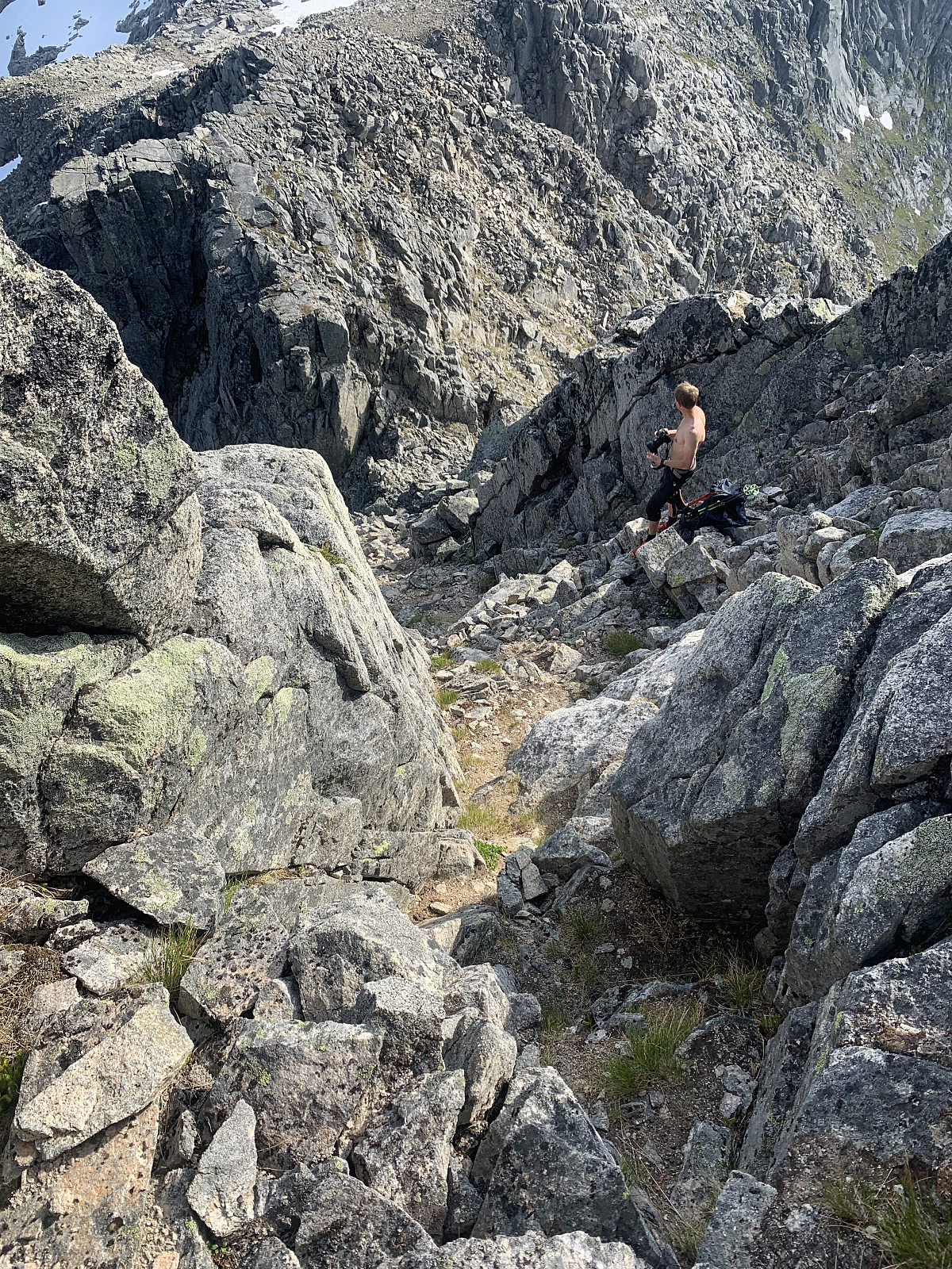 I had long been keen to try reach Melketinden with a traverse from Styrmannstinden, saving the long approach on skiis in Blåmannsvikdalen. We parked in Vågbotn and followed a great trail up to Styrmannstinden. Steady elevation gain the whole way to the top with some sections of snow once we hit around 800moh. 1.5hours later we had come up to Styrmannstinden and got our sights on Melketinden. Majority of the traverse looked fine, though the steep section straight down from Styrmannstinden looked quite gnarly from the top.
We picked a natural trail down and encountered combination of very exposed scrambling and really loose rock. This section was quite time consuming and we used around half an hour to descend the steepest 150m of elevation. From here the ridge levelled out and we started gaining >>>
I had long been keen to try reach Melketinden with a traverse from Styrmannstinden, saving the long approach on skiis in Blåmannsvikdalen. We parked in Vågbotn and followed a great trail up to Styrmannstinden. Steady elevation gain the whole way to the top with some sections of snow once we hit around 800moh. 1.5hours later we had come up to Styrmannstinden and got our sights on Melketinden. Majority of the traverse looked fine, though the steep section straight down from Styrmannstinden looked quite gnarly from the top.
We picked a natural trail down and encountered combination of very exposed scrambling and really loose rock. This section was quite time consuming and we used around half an hour to descend the steepest 150m of elevation. From here the ridge levelled out and we started gaining >>>
Vanntinden
- Date:
- 20.07.2019
- Characteristic:
- Hillwalk
- Duration:
- 5:24h
- Distance:
- 9.4km
 Øytopper ≥ 1000 meter (fastland)
We woke to another beautiful day. After breakfast we drove from our camp and parked at Sjøcampingen where there is a sign for Vanntinden. The trail started in someones backyard, we walked past an elderly couple enjoying the sun on their balcony who informed us they had just gone for a naked swim. The excellent trail then follows the right hand side of the river in the valley with very gradual elevation gain until around 300moh. Here we cooled off in the waterfall and came across a very cosy little cabin (later we ran into a couple on the hike who told us her brother had built the cabin).
From here the trail is well marked with red markers until the top, which was great because the terrain soon turned into rock, rock and more rock. From here it was steady elevation >>>
Øytopper ≥ 1000 meter (fastland)
We woke to another beautiful day. After breakfast we drove from our camp and parked at Sjøcampingen where there is a sign for Vanntinden. The trail started in someones backyard, we walked past an elderly couple enjoying the sun on their balcony who informed us they had just gone for a naked swim. The excellent trail then follows the right hand side of the river in the valley with very gradual elevation gain until around 300moh. Here we cooled off in the waterfall and came across a very cosy little cabin (later we ran into a couple on the hike who told us her brother had built the cabin).
From here the trail is well marked with red markers until the top, which was great because the terrain soon turned into rock, rock and more rock. From here it was steady elevation >>>
Tvinnaren
- Date:
- 19.07.2019
- Characteristic:
- Hillwalk
- Duration:
- 3:40h
- Distance:
- 7.9km
 Kari & I started our weekend off in Vannøya with a late evening trip to Tvinnaren. We parked by the side of the smaller lake and started the trail from the sign. There was a faint path that was marked with red dots, though the trail was quite meandering and difficult to follow. We walked in a relaxed pace and after we came up to Lille Tvinnaren (242) we followed the markers to the right and the terrain became quickly more rocky. From here it was well marked to the top. We had a small break to take in the 360 degree views and then headed down again. We followed red markers on the way back but ended up on a different trail with a much steeper grass gully it sounds like otto (Otto Lund) followed on the way up. Perhaps better as a morning hike, as the midnight sun was out in full force but we walked in the >>>
Buren
- Date:
- 18.07.2019
- Characteristic:
- Hillwalk
- Duration:
- 2:11h
- Distance:
- 7.0km
 Nok en nydelig dag med sol i Tromsø, og da ble det en solo tur til Buren før jobb. Aldri har jeg gått hit om sommeren etter fjellet ble en favoritt på ski. Fulgte stien rett opp fra parkeringsplassen, interresant å se hvordan terrenget er egentlig på fjellet uten at det er dekket i snø. Turen gikk i deilig fart og snart sto jeg med bare de siste høydemeter igjen. Mens jeg spiste lunsj i varmen på toppen, bestemte jeg meg at Buren fungere best som en vintertopp for min del. Avgjørelsen sto mens jeg sutret nedover gruspartiet. Men, etter man har kommet seg gjennom steinuren, terrenget ble så lettgått at man kunne løpe hele veien ned til bilen. Jeg ble kjempefornøyd til slutt :)
Bremnestinden
- Date:
- 12.07.2019
- Characteristic:
- Hillwalk
- Duration:
- 3:45h
- Distance:
- 9.1km
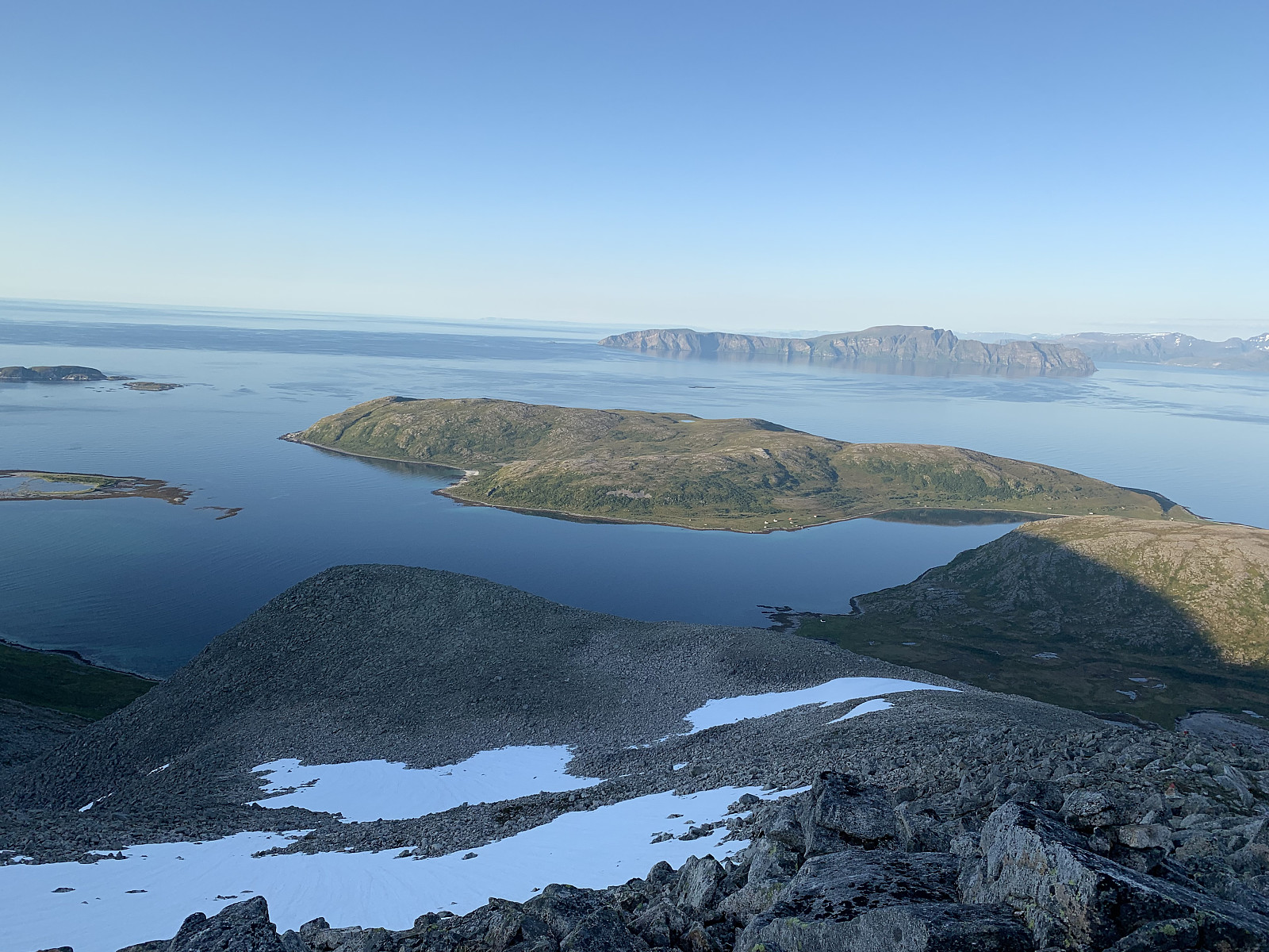
 We drove to the end of the road at Vassstrand and followed a decent path up through the forrest. 10 minutes later, once we got our sights on the summit, the path disapeared and we headed along the right side of Stortuva and the lake. Here we got to enjoy half an hour of shoe-swallowing swamp before we ended up battling our way through a heap of shrubs, bushes & trees. Once we came up to the small lake on the side of Stortuva, the terrain became more of the regular mix of rocks covered in blueberry & cloudberry bushes, and from here we gained elevation quickly to reach the summit. We continued up the grass renna gradually traversing to the left, but looking back we probably should have taken the ridge like hmsv1 (Hannah) did in her last report.
Excellent views down Ersfjorden, out to Håja, Sessøya >>>
We drove to the end of the road at Vassstrand and followed a decent path up through the forrest. 10 minutes later, once we got our sights on the summit, the path disapeared and we headed along the right side of Stortuva and the lake. Here we got to enjoy half an hour of shoe-swallowing swamp before we ended up battling our way through a heap of shrubs, bushes & trees. Once we came up to the small lake on the side of Stortuva, the terrain became more of the regular mix of rocks covered in blueberry & cloudberry bushes, and from here we gained elevation quickly to reach the summit. We continued up the grass renna gradually traversing to the left, but looking back we probably should have taken the ridge like hmsv1 (Hannah) did in her last report.
Excellent views down Ersfjorden, out to Håja, Sessøya >>>
Tåketur til Kyle
- Date:
- 11.07.2019
- Characteristic:
- Hillwalk
- Duration:
- 1:47h
- Distance:
- 3.2km
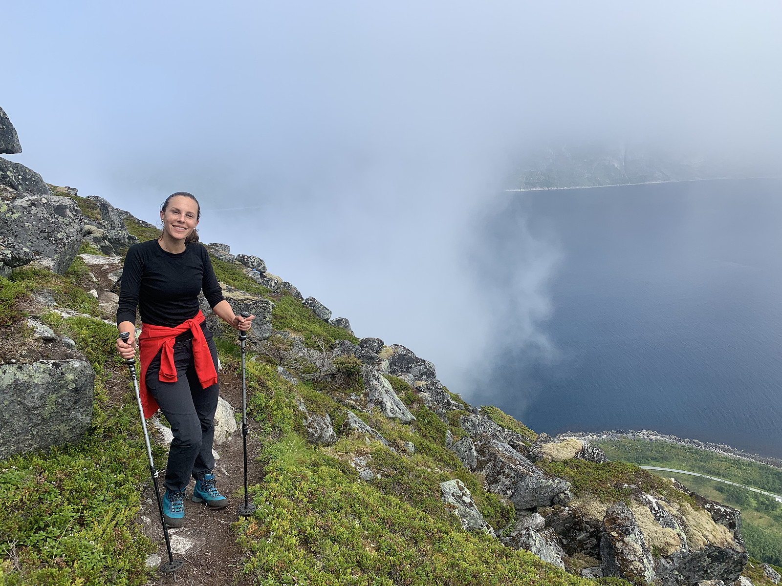 Dette utsiktstopp og en favoritt på Senja når man ønsker en kortere tur. Vi hadde litt dårlig tid om vi skulle rekke fergen tilbake til Kvaløya så toppen passet perfekt i dag. Parkerte ved siden av veien og fulgte stien opp fjellet. Fin sti og veldig effektive høydemeter. Det ble dessverre masse tåke de siste 150 høydemeter så Lani fikk ikke nyte den nydelige utsikten fra toppen i dag. En fin tur uansett og vår siste tur sammen før Lani reiser hjem i morgen :)

