Archive - Date
Archive - Activity
- Bike trip (1)
-
Other trip (123)
- Expedition (123)
-
Other winter trip (7)
- Snowshoe trip (7)
-
Trip by foot (34)
- Alpine trip (2)
- Hike (7)
- Hillwalk (10)
Peakbook-Friends
Collected lists


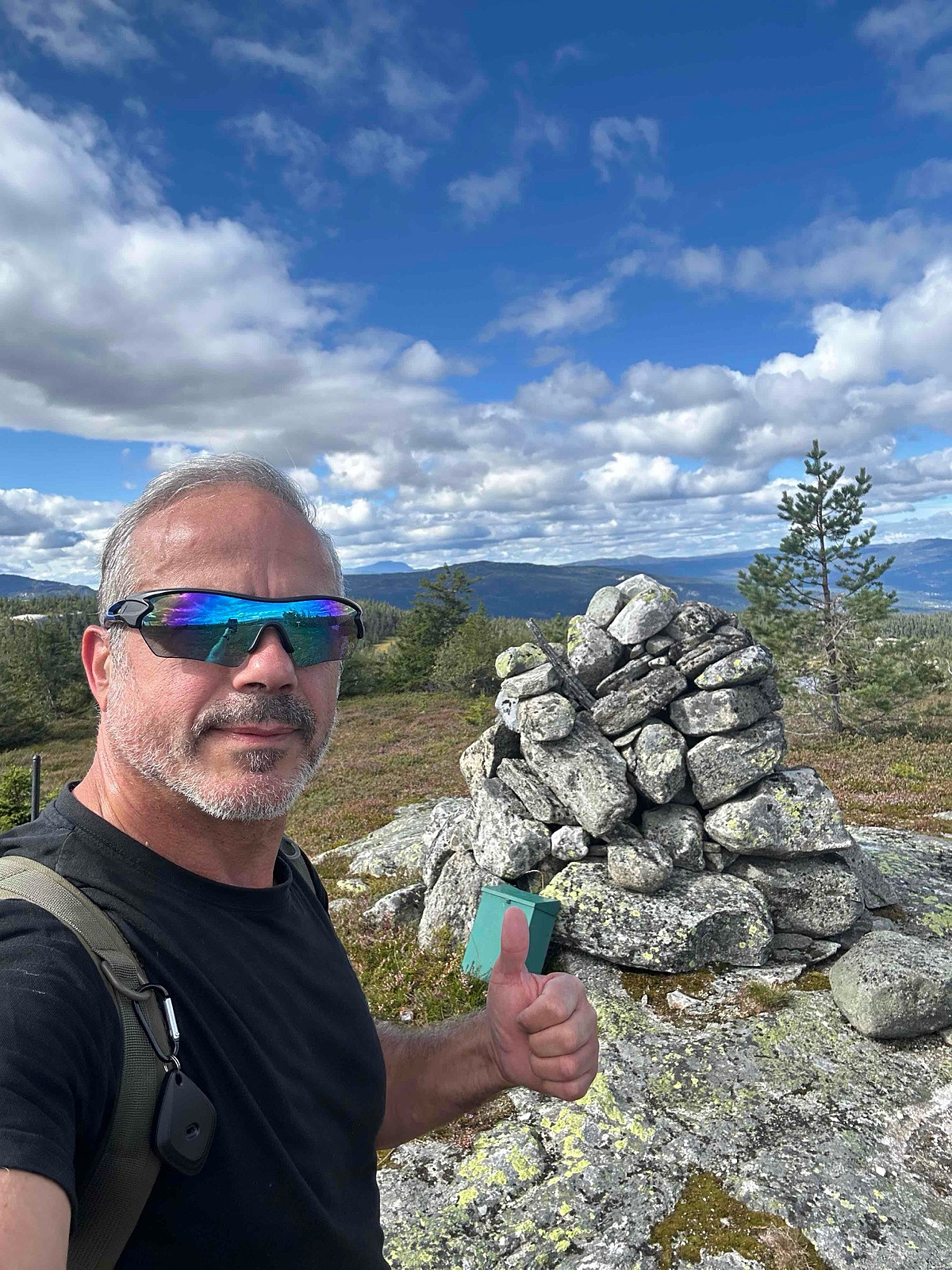
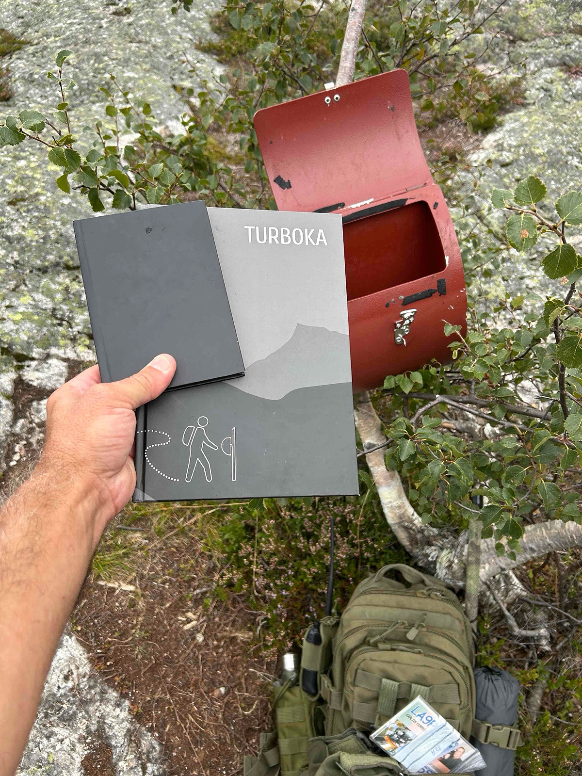
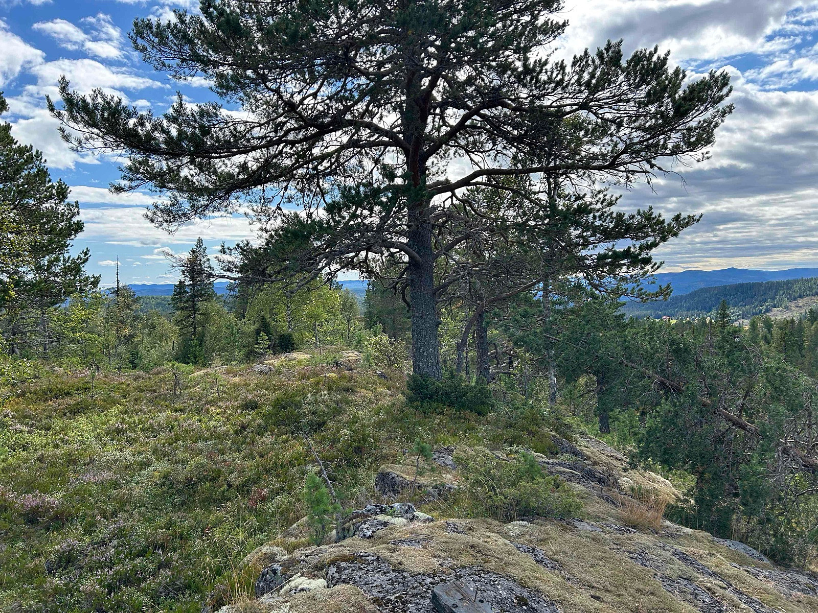
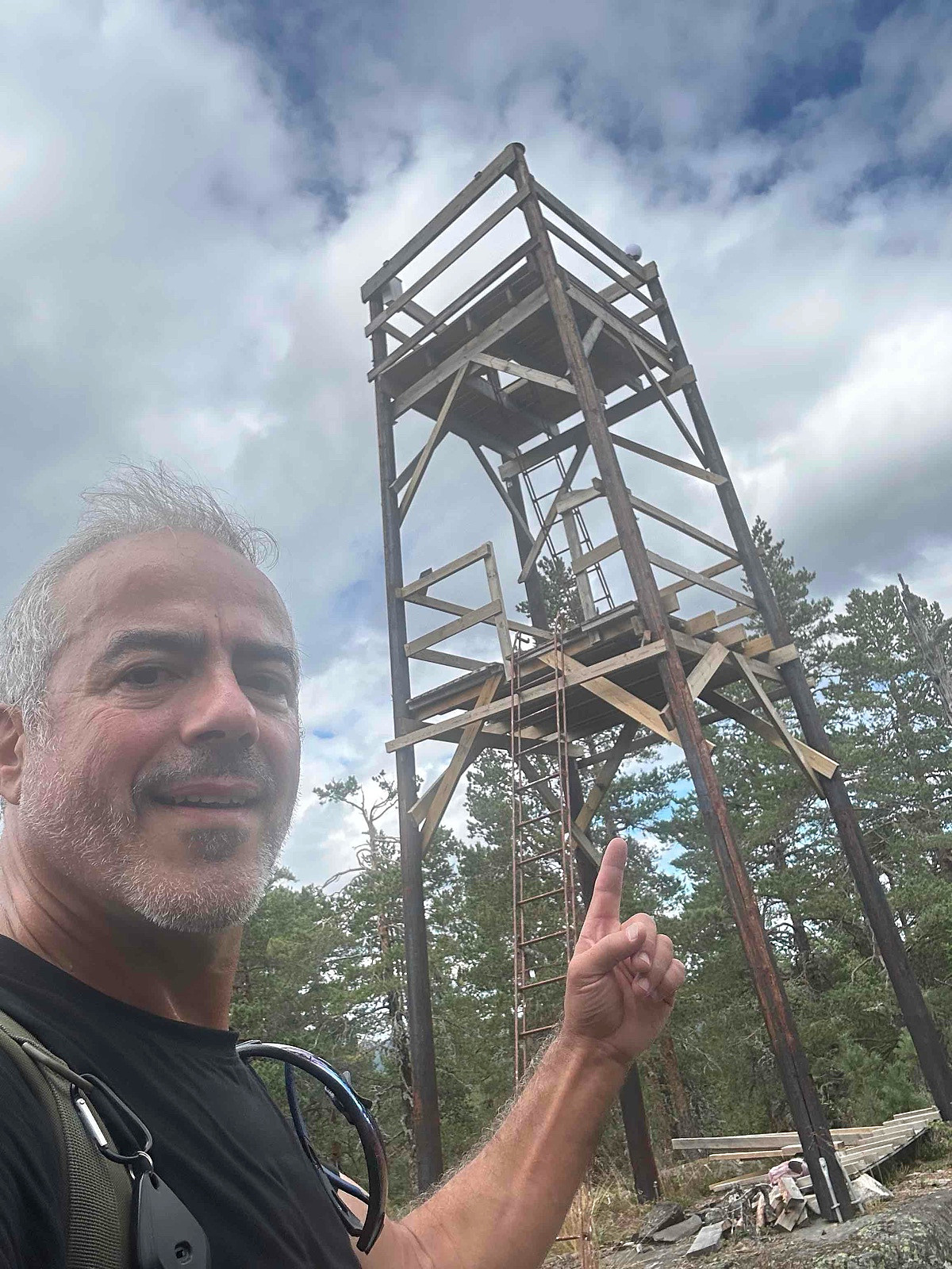
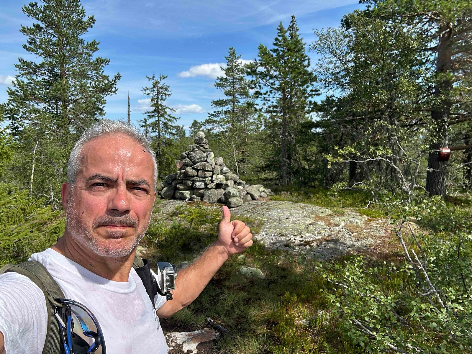
LA/HM-095 Sæterberget 538 moh
- Date:
- 26.08.2025
- Characteristic:
- Expedition
- Distance:
- 1.7km
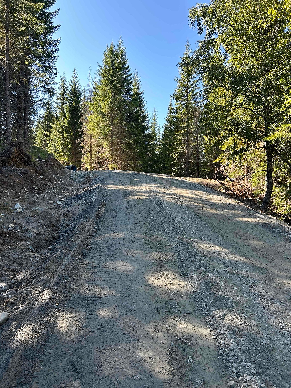
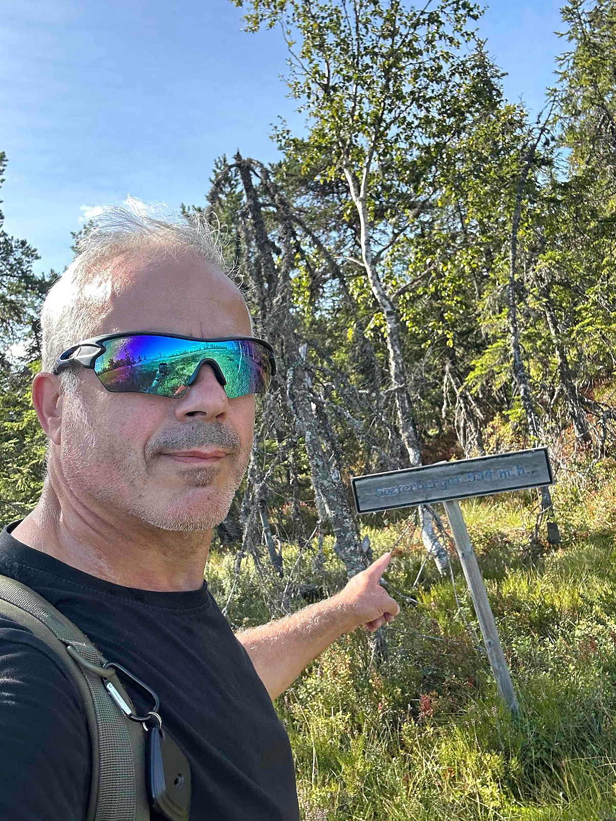 Nice and easy hike up to summit, possible to bike as well. The spot has no great view but there is always possible to operate from another place inside activation zone.
Distance: abt 4 km t/r
Start: Stormyrvegen P-lomme (parking) before bom.
Summer: Bike / Walk -> Bike or Hike up to summit.
Winter: Skiis / Snowshoes -> Yes skiis or snowshoes and/or boots with crampons when is a lot of ice.
Tollroad/Bom: NO - 0 kr
Equipment: KX3 15w & 1/4~wave Vertical (APRS LA9PJA-7/LA9PJA-9)
Apps / Resources: SOTA Goat, SOTLAS, PeakBook, APRS.FI, QTHnow / POTA, POTA-MAP.fr, AllTrails
- - - -
Photos & Track: Courtesy of LA9PJA :)
Nice and easy hike up to summit, possible to bike as well. The spot has no great view but there is always possible to operate from another place inside activation zone.
Distance: abt 4 km t/r
Start: Stormyrvegen P-lomme (parking) before bom.
Summer: Bike / Walk -> Bike or Hike up to summit.
Winter: Skiis / Snowshoes -> Yes skiis or snowshoes and/or boots with crampons when is a lot of ice.
Tollroad/Bom: NO - 0 kr
Equipment: KX3 15w & 1/4~wave Vertical (APRS LA9PJA-7/LA9PJA-9)
Apps / Resources: SOTA Goat, SOTLAS, PeakBook, APRS.FI, QTHnow / POTA, POTA-MAP.fr, AllTrails
- - - -
Photos & Track: Courtesy of LA9PJA :)
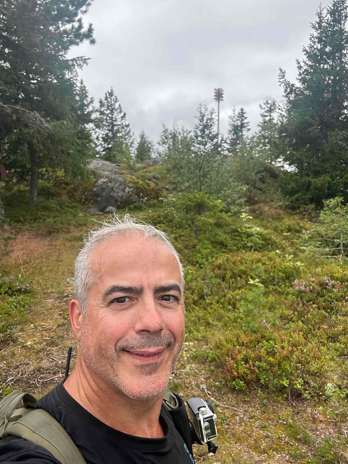
LA/BU-093 Raudsteinvarden 897 moh
- Date:
- 22.08.2025
- Characteristic:
- Expedition
- Distance:
- 1.8km
 Fantastikk fin tur på en solfylt dag.
Distance: abt 3 km t/r
Start: Milebotten p-plass (parking).
Summer: Bike / Walk -> Hike up to summit.
Winter: Skiis / Snowshoes -> Yes snowshoes and boots with crampons when is a lot of ice.
Tollroad/Bom: 50 kr cash & VIPS i 2025
Equipment: KX3 15w & 1/4~wave Vertical (APRS LA9PJA-7/LA9PJA-9)
Apps / Resources: SOTA Goat, SOTLAS, PeakBook, APRS.FI, QTHnow / POTA, POTA-MAP.fr, AllTrails
- - - -
Photos & Track: Courtesy of LA9PJA :)
Fantastikk fin tur på en solfylt dag.
Distance: abt 3 km t/r
Start: Milebotten p-plass (parking).
Summer: Bike / Walk -> Hike up to summit.
Winter: Skiis / Snowshoes -> Yes snowshoes and boots with crampons when is a lot of ice.
Tollroad/Bom: 50 kr cash & VIPS i 2025
Equipment: KX3 15w & 1/4~wave Vertical (APRS LA9PJA-7/LA9PJA-9)
Apps / Resources: SOTA Goat, SOTLAS, PeakBook, APRS.FI, QTHnow / POTA, POTA-MAP.fr, AllTrails
- - - -
Photos & Track: Courtesy of LA9PJA :)
LA/BU-101 Tekslehogget 721 moh
- Date:
- 20.08.2025
- Characteristic:
- Expedition
- Distance:
- 1.6km
 It looks like there are several ways to get to the summit, probably driving further the road up and parking at the end and go over the other top to the summit. I decided to go for the safer one and most used by other trakers (Not SOTA related) that I found online, most used this track.
For some reason my Garmin clock Track GPS file up, got corrupted, seems never got saved, luckly I have found GPS file from another app I had activated.
Distance: abt 3 km t/r
Start: Tekslehogget parking.
Summer: Bike / Walk -> Hike up to summit.
Winter: Skiis / Snowshoes -> Yes snowshoes and boots with crampons when is a lot of ice.
Tollroad/Bom: 50 kr (2025)
Equipment: KX3 15w & 1/4~wave Vertical (APRS LA9PJA-7/LA9PJA-9)
Apps / Resources: SOTA Goat, SOTLAS, PeakBook, APRS.FI, QTHnow / POTA, POTA-MAP.fr, AllTrails
- >>>
It looks like there are several ways to get to the summit, probably driving further the road up and parking at the end and go over the other top to the summit. I decided to go for the safer one and most used by other trakers (Not SOTA related) that I found online, most used this track.
For some reason my Garmin clock Track GPS file up, got corrupted, seems never got saved, luckly I have found GPS file from another app I had activated.
Distance: abt 3 km t/r
Start: Tekslehogget parking.
Summer: Bike / Walk -> Hike up to summit.
Winter: Skiis / Snowshoes -> Yes snowshoes and boots with crampons when is a lot of ice.
Tollroad/Bom: 50 kr (2025)
Equipment: KX3 15w & 1/4~wave Vertical (APRS LA9PJA-7/LA9PJA-9)
Apps / Resources: SOTA Goat, SOTLAS, PeakBook, APRS.FI, QTHnow / POTA, POTA-MAP.fr, AllTrails
- >>>
LA/BU-142 Blåmyråsen 574 moh
- Date:
- 20.08.2025
- Characteristic:
- Expedition
- Distance:
- 0.6km
 I was on work duty, parked on the top after agreement with the owner, you probably must park before you arrive at the farmers house, as it is private area.
Anyway, short track to the top.
Distance: abt 1 km t/r
Start: Farmers house private (parking).
Summer: Bike / Walk -> Hike up to summit.
Winter: Skiis / Snowshoes -> Yes snowshoes and boots with crampons when is a lot of ice.
Tollroad/Bom: NO - 0 kr
Equipment: KX3 15w & 1/4~wave Vertical (APRS LA9PJA-7/LA9PJA-9)
Apps / Resources: SOTA Goat, SOTLAS, PeakBook, APRS.FI, QTHnow / POTA, POTA-MAP.fr, AllTrails
- - - -
Photos & Track: Courtesy of LA9PJA :)
I was on work duty, parked on the top after agreement with the owner, you probably must park before you arrive at the farmers house, as it is private area.
Anyway, short track to the top.
Distance: abt 1 km t/r
Start: Farmers house private (parking).
Summer: Bike / Walk -> Hike up to summit.
Winter: Skiis / Snowshoes -> Yes snowshoes and boots with crampons when is a lot of ice.
Tollroad/Bom: NO - 0 kr
Equipment: KX3 15w & 1/4~wave Vertical (APRS LA9PJA-7/LA9PJA-9)
Apps / Resources: SOTA Goat, SOTLAS, PeakBook, APRS.FI, QTHnow / POTA, POTA-MAP.fr, AllTrails
- - - -
Photos & Track: Courtesy of LA9PJA :)
LA/BU-015 Gjørrtjennåsen 564 moh
- Date:
- 19.08.2025
- Characteristic:
- Expedition
- Distance:
- 2.7km
 It seems to be several possible routes. After looking around on possible tracks. In winter is probably a bit more difficult, looks like there is a route that is much longer from the right side (Unknown) but I see some other people (not sota related) have taken the route from another side to avoid the high rocks, none done in winter one in 01.11.2024 and no snow.
My route came to a point where I had to climb really a lot, on my way down I found another route still very high. I should have taken to the right and go around, but this way I saved about 500 m :)
Distance: abt 5 km t/r
Start: Letmoliveien p-plass (parking).
Summer: Bike / Walk -> Hike up to summit.
Winter: Skiis / Snowshoes -> Yes snowshoes and boots with crampons when is a lot of ice.
Tollroad/Bom: NO - 0 kr (2025)
Equipment: KX3 >>>
It seems to be several possible routes. After looking around on possible tracks. In winter is probably a bit more difficult, looks like there is a route that is much longer from the right side (Unknown) but I see some other people (not sota related) have taken the route from another side to avoid the high rocks, none done in winter one in 01.11.2024 and no snow.
My route came to a point where I had to climb really a lot, on my way down I found another route still very high. I should have taken to the right and go around, but this way I saved about 500 m :)
Distance: abt 5 km t/r
Start: Letmoliveien p-plass (parking).
Summer: Bike / Walk -> Hike up to summit.
Winter: Skiis / Snowshoes -> Yes snowshoes and boots with crampons when is a lot of ice.
Tollroad/Bom: NO - 0 kr (2025)
Equipment: KX3 >>>
LA/BU-141 Liåsen 578 moh
- Date:
- 18.08.2025
- Characteristic:
- Expedition
- Distance:
- 2.8km
 There is a bom (was open) but normaly it is closed, I talked to the workers with escavators, fixing the road (engaged in logging of wood), do not try to drive up, they close the road/bom.
I made the long run around, just for fun and to get known with the area, otherwise can save 300/400 m or more by going up right to the left instead going around like I did.
There is no view from on the spot, so there is option of activating in a open space longer down and still within sota activation zone.
I like always to go to the spot anyway, no short cuts :)
Distance: abt 5.5 km t/r
Start: Liåsen P-plass.
Summer: Bike / Walk -> Bike or Hike up to summit.
Winter: Skiis / Snowshoes -> Yes skiis / snowshoes and boots with crampons when is a lot of ice.
Tollroad/Bom: NO - 0 kr (2025)
Equipment: KX3 15w & >>>
There is a bom (was open) but normaly it is closed, I talked to the workers with escavators, fixing the road (engaged in logging of wood), do not try to drive up, they close the road/bom.
I made the long run around, just for fun and to get known with the area, otherwise can save 300/400 m or more by going up right to the left instead going around like I did.
There is no view from on the spot, so there is option of activating in a open space longer down and still within sota activation zone.
I like always to go to the spot anyway, no short cuts :)
Distance: abt 5.5 km t/r
Start: Liåsen P-plass.
Summer: Bike / Walk -> Bike or Hike up to summit.
Winter: Skiis / Snowshoes -> Yes skiis / snowshoes and boots with crampons when is a lot of ice.
Tollroad/Bom: NO - 0 kr (2025)
Equipment: KX3 15w & >>>
LA/BU-018 Storehorn 1482 moh
- Date:
- 20.07.2025
- Characteristic:
- Expedition
- Distance:
- 3.5km
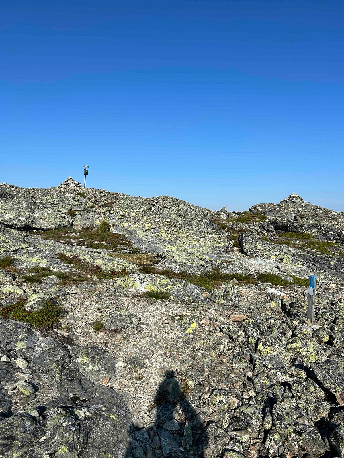 There are several routes. This is my shortest route, but also the most difficult. On my way down I took another route to see the falls from the lake.
It is a heavy route for only 4 points (under 1500 missing the 6 points) that may explain why not many sota hams make this nice SOTA, many just choose easy points vs altitude / track :)
- - - - -
Distance: abt 7 km t/r
Start: Hornslie p-plass.
Summer: Bike / Walk -> Bike up to parking then Hike up to summit.
Winter: Skis / Snowshoes -> Yes snowshoes and boots with crampons when is a lot of ice.
Tollroad/Bom: Yes 70 kr (2025) huge parking place, possible to overnight there.
Equipment: KX3 15w & 1/4~wave Vertical (APRS LA9PJA-7/LA9PJA-9)
Apps / Resources: SOTA Goat, SOTLAS, PeakBook, APRS.FI, QTHnow / POTA, POTA-MAP.fr, AllTrails
- - - -
Photos >>>
There are several routes. This is my shortest route, but also the most difficult. On my way down I took another route to see the falls from the lake.
It is a heavy route for only 4 points (under 1500 missing the 6 points) that may explain why not many sota hams make this nice SOTA, many just choose easy points vs altitude / track :)
- - - - -
Distance: abt 7 km t/r
Start: Hornslie p-plass.
Summer: Bike / Walk -> Bike up to parking then Hike up to summit.
Winter: Skis / Snowshoes -> Yes snowshoes and boots with crampons when is a lot of ice.
Tollroad/Bom: Yes 70 kr (2025) huge parking place, possible to overnight there.
Equipment: KX3 15w & 1/4~wave Vertical (APRS LA9PJA-7/LA9PJA-9)
Apps / Resources: SOTA Goat, SOTLAS, PeakBook, APRS.FI, QTHnow / POTA, POTA-MAP.fr, AllTrails
- - - -
Photos >>>
