Archive - Date
Archive - Activity
-
Bike trip (137)
- Bike trip - mixed (51)
- Bike trip - road (9)
-
Other trip (1)
- Kayaking (1)
-
Other winter trip (4)
- Snowshoe trip (4)
- Ski trip (4)
- Trip by foot (740)
Archive - Geography
Peakbook-Friends


Collected lists
-
Bergen ≥ 50m pf. og ≥ 100 m.o.h.
(87/89)
 97%
97% -
Most dominating tops of the Bergen peninsula
(68/75)
90%
-
Utvalgte topper og turmål i Bergen
(316/350)
90%
-
Alle topper i Bergen
(357/398)
89%
-
Opptur Bergen
(100/113)
88%
-
De syv fjell rundt Bergen
(6/7)
85%
-
Sund ≥ 50m pf.
(14/18)
77%
-
Os ≥ 50m pf.
(25/34)
73%
-
Søyler (fastmerker) i Bergen
(68/100)
68%
-
Fjell ≥ 50m pf.
(21/32)
65%

Round around the Imperial Palace (and Kanda)
- Date:
- 11.07.2025
- Characteristic:
- Walk
- Duration:
- 7:00h
- Distance:
- 13.1km
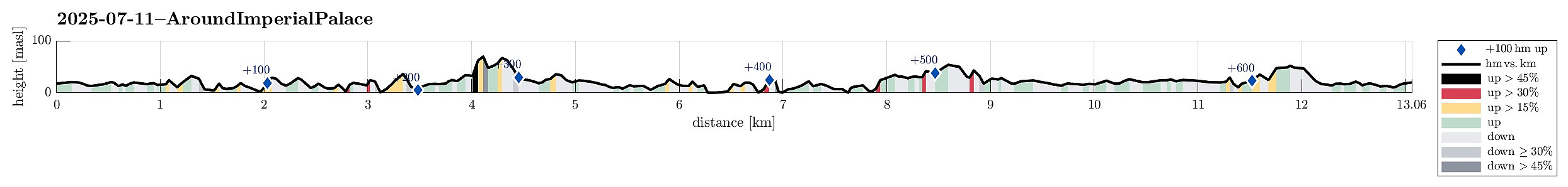 We had still some time before our flights back to Europe and thus made an attempt to see the Imperial Palace in Tokyo. Apparently, however, we seemingly had looked up the wrong information ahead of time -- just to find out that the very Palace was closed. We thus decided to walk around the Palace area, which also turned out as an interesting walk. With even more time left, we then added a short extra-loop to get an impression of Kanda, just north of the main railway station of Tokyo. Clearly, Tokyo has a lot variety to offer! :-)
Selected photos are available as Google photo album .
See also the related FB-page Hiking around Bergen, Norway .
We had still some time before our flights back to Europe and thus made an attempt to see the Imperial Palace in Tokyo. Apparently, however, we seemingly had looked up the wrong information ahead of time -- just to find out that the very Palace was closed. We thus decided to walk around the Palace area, which also turned out as an interesting walk. With even more time left, we then added a short extra-loop to get an impression of Kanda, just north of the main railway station of Tokyo. Clearly, Tokyo has a lot variety to offer! :-)
Selected photos are available as Google photo album .
See also the related FB-page Hiking around Bergen, Norway .
Visiting Odaiba beach to see the Rainbow Bridge
- Date:
- 09.07.2025
- Characteristic:
- Walk
- Duration:
- 2:30h
- Distance:
- 3.1km
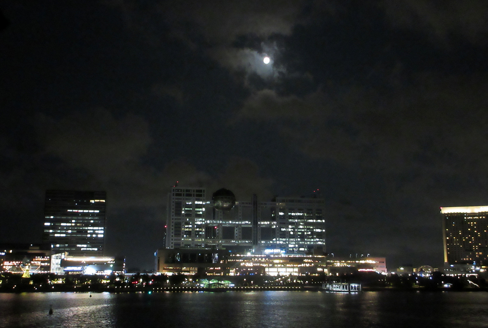 Very nice evening excursion to the Odaiba beach in Tokyo near the Rainbow Bridge. After first enjoying some nice time at the beach, we then walked around the Odaiba Marina to also see the Daiba Park on the other side, offer even more close-up views to the Rainbow Bridge (and to Tokyo behind it). While the beach was crowded -- mostly with young people in the evening -- we found ourselves 100% "alone" in the Daiba Park (after sunset). Interesting! :-)
Selected photos are available as Google photo album .
See also the related FB-page Hiking around Bergen, Norway .
Very nice evening excursion to the Odaiba beach in Tokyo near the Rainbow Bridge. After first enjoying some nice time at the beach, we then walked around the Odaiba Marina to also see the Daiba Park on the other side, offer even more close-up views to the Rainbow Bridge (and to Tokyo behind it). While the beach was crowded -- mostly with young people in the evening -- we found ourselves 100% "alone" in the Daiba Park (after sunset). Interesting! :-)
Selected photos are available as Google photo album .
See also the related FB-page Hiking around Bergen, Norway .
Meiji Temple
- Date:
- 05.07.2025
- Characteristic:
- Walk
- Duration:
- 1:30h
- Distance:
- 3.4km
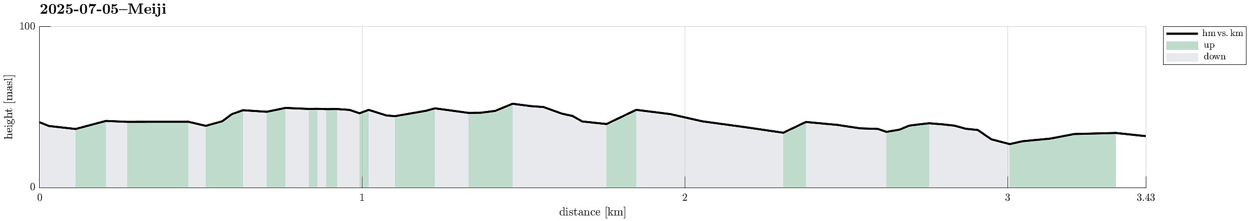 Short excursion during our visit to Tokyo with the Meiji temple and the rather crazy streets near to it! :-)
Selected photos are available as Google photo album .
See also the related FB-page Hiking around Bergen, Norway .
Short excursion during our visit to Tokyo with the Meiji temple and the rather crazy streets near to it! :-)
Selected photos are available as Google photo album .
See also the related FB-page Hiking around Bergen, Norway .
Roppongi hills and Shibuya
- Date:
- 04.07.2025
- Characteristic:
- Walk
- Duration:
- 4:30h
- Distance:
- 5.6km
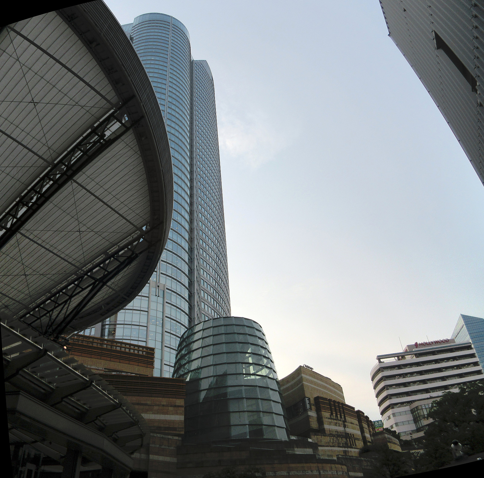 On our first full day in Tokyo, we decided to first visit Roppongi hills (and a very nice exhibition in the Mori Art Musuem, there). From there, we then chose to walk over to Shibuya to experience the famous Shibuya crossing in the evening. In in fact got to see it twice (actually three times), once before the rain, and then again during the rain. The packing density varied clearly, without dropping to any low value, though. :-)
Selected photos are available as Google photo album .
See also the related FB-page Hiking around Bergen, Norway .
On our first full day in Tokyo, we decided to first visit Roppongi hills (and a very nice exhibition in the Mori Art Musuem, there). From there, we then chose to walk over to Shibuya to experience the famous Shibuya crossing in the evening. In in fact got to see it twice (actually three times), once before the rain, and then again during the rain. The packing density varied clearly, without dropping to any low value, though. :-)
Selected photos are available as Google photo album .
See also the related FB-page Hiking around Bergen, Norway .
Evening visit to the Shiratani Unsui Gorge
- Date:
- 02.07.2025
- Characteristic:
- Hillwalk
- Duration:
- 1:00h
- Distance:
- 3.3km
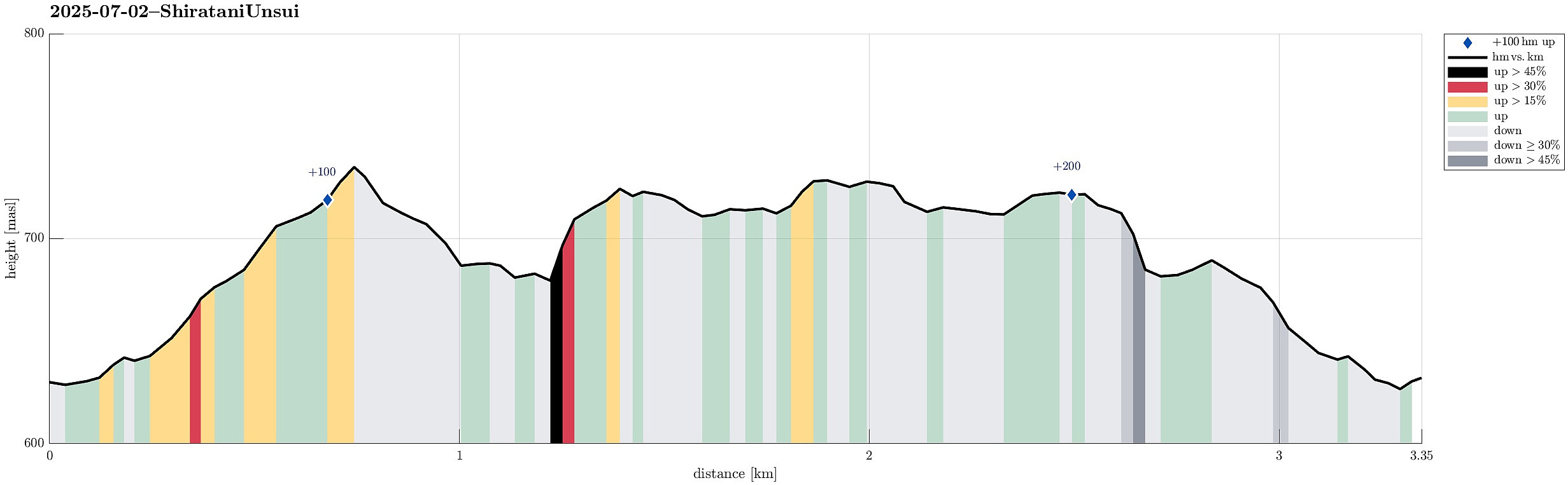 There was still a bit of daylight time left -- we thus drove up to the Shiratani Unsui Gorge to have one relatively quick look. In principle, one could start from this place to extensive hikes, but given the relatively short time left, we only walked around the gorge for short while. Clearly, experiencing the jungle in the evening is also something very special! :-)
Selected photos are available as Google photo album .
See also the related FB-page Hiking around Bergen, Norway .
There was still a bit of daylight time left -- we thus drove up to the Shiratani Unsui Gorge to have one relatively quick look. In principle, one could start from this place to extensive hikes, but given the relatively short time left, we only walked around the gorge for short while. Clearly, experiencing the jungle in the evening is also something very special! :-)
Selected photos are available as Google photo album .
See also the related FB-page Hiking around Bergen, Norway .
Mt. Miyanoura on Yakushima
- Date:
- 01.07.2025
- Characteristic:
- Hike
- Duration:
- 7:30h
- Distance:
- 13.6km
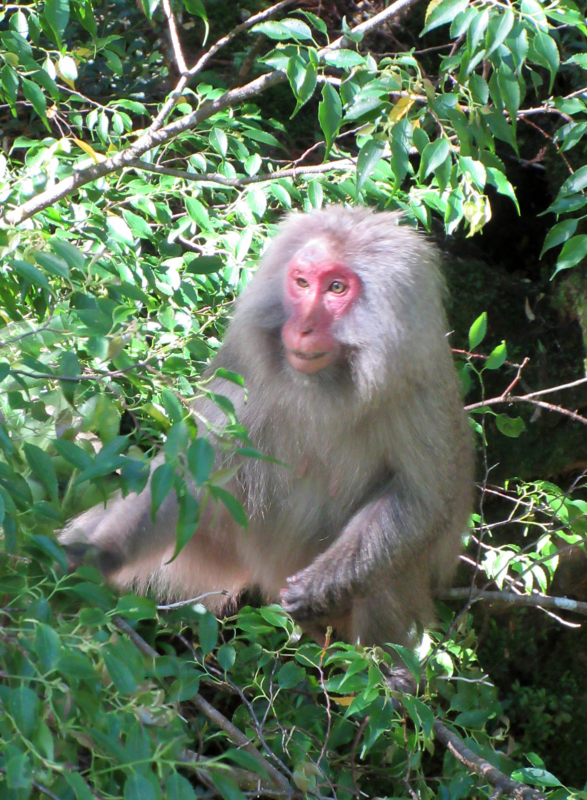 To include a nice hike had been part of our original plans for our visit to Yakushima. Depending on the circumstances, we also had looked at an ascent to Mt. Miyanoura, the hightest top of Yakushima, but wanted to wait until we would be in a better position to understand the weather, our form, etc. After one nice day of chilling on Yakushima, everything looked good and we made an early start to give us enough time for the there-and-back hike (officially 2*8km according to all signs). To make the actual ascent to Mt. Miyanoura possible for us on this day, we first drove up to the Yodogawa Mountain Trail Entrance at some 1370masl. This drive, already, to the high up end of a narrow mountain road, was a nice experience -- with numerous turns and a close-up impression of the surrounding jungle. >>>
Visiting Kumamoto Castle
- Date:
- 29.06.2025
- Characteristic:
- Hillwalk
- Duration:
- 1:30h
- Distance:
- 3.2km
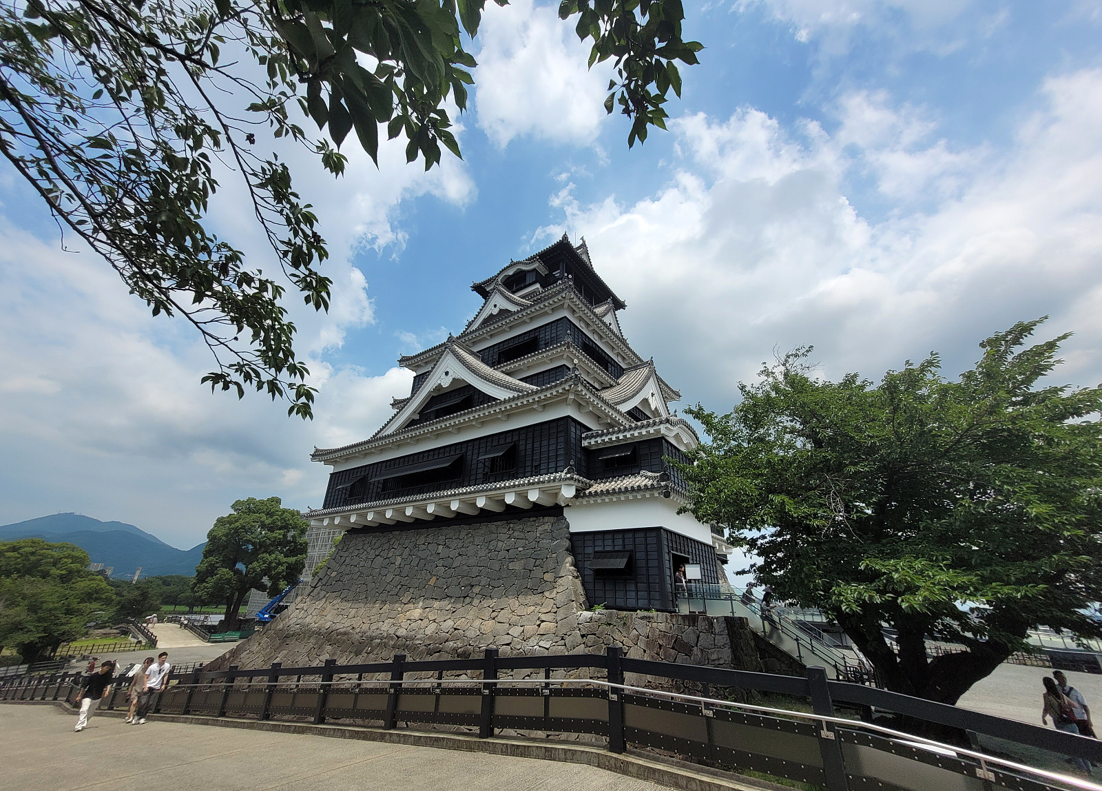 We had chosen to stay over night in Kumamoto to see Kumamoto Castle. After finding the actual entry to the castle area, we then approached it via a big bridge, which is errected to bypass major renovation work that became necessary after an earthquake had caused serious damage to multiple structure at and around the historc castle. It was possible, though, to enter the castle and to make a tour through it (with many, many others!). Eventually, we just made it back in an attempt to limit our time in the substantial heat of the day.
Selected photos are available as Google photo album .
See also the related FB-page Hiking around Bergen, Norway .
We had chosen to stay over night in Kumamoto to see Kumamoto Castle. After finding the actual entry to the castle area, we then approached it via a big bridge, which is errected to bypass major renovation work that became necessary after an earthquake had caused serious damage to multiple structure at and around the historc castle. It was possible, though, to enter the castle and to make a tour through it (with many, many others!). Eventually, we just made it back in an attempt to limit our time in the substantial heat of the day.
Selected photos are available as Google photo album .
See also the related FB-page Hiking around Bergen, Norway .
Nakadake (Kuju mountains) from Makinoto Pass
- Date:
- 28.06.2025
- Characteristic:
- Hike
- Duration:
- 5:00h
- Distance:
- 12.2km
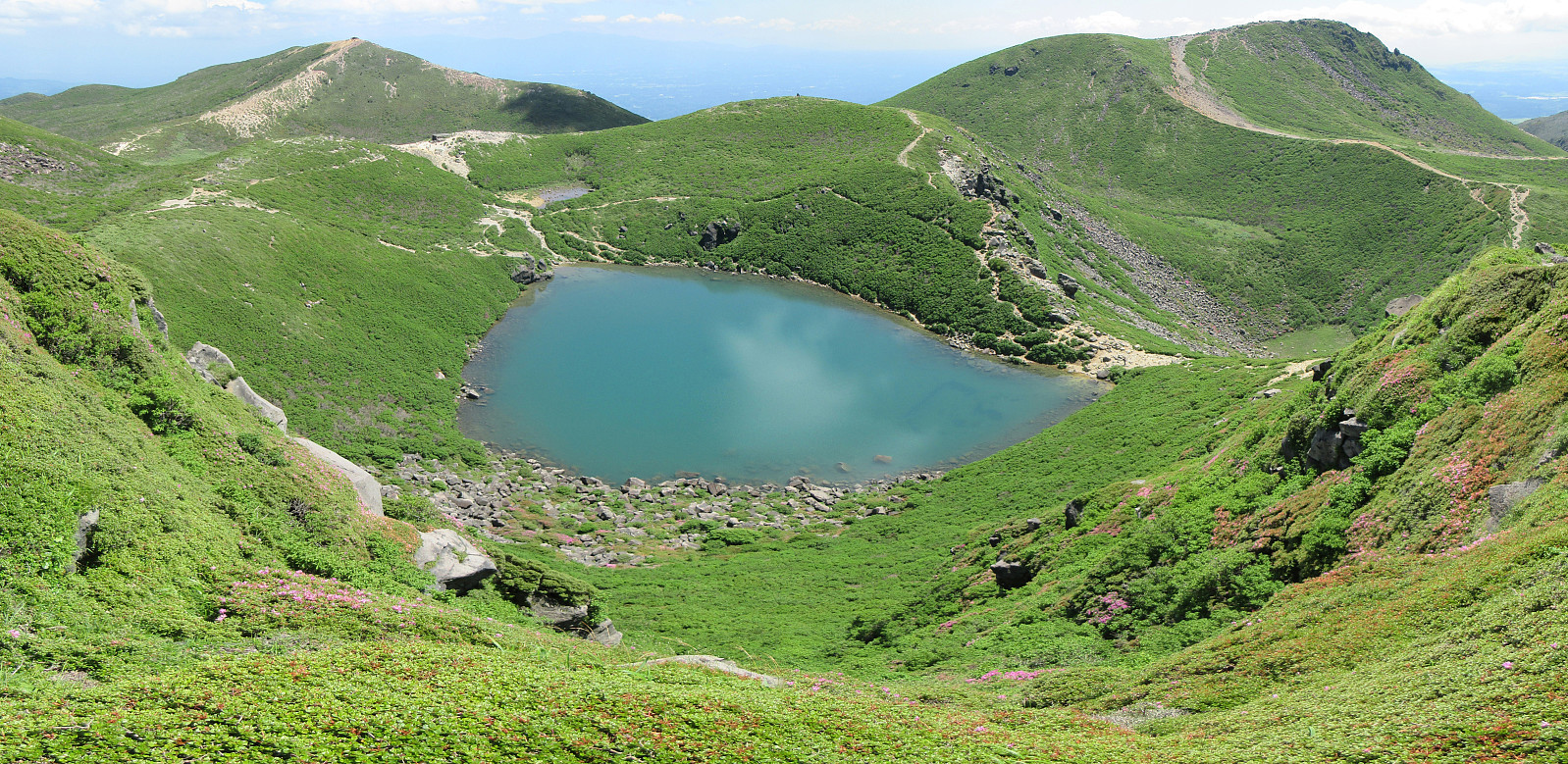 It was one of our goals for our visit to Kyushu to make a nice hike near Mt. Aso and this hike in the Kuju mountains, north of the massive caldera of volcano Aso, seemed very nice from its description. To get started, we drove to the Makinoto Pass in the West of Mt. Nakadake, but found that all parking spots had been taken, already. A bit further down the road, however, we found a place, where we could leave the car. After first walking back to the pass, we then followed the main trail in easterly direction. Gaining height steadily, we came to a place, where it was to Mt. Ogigahana to the right, and to "all other tops" to the left. Just shortly after choosing the latter option, we then followed a side-trail (without any signs) to get up to Mt. Hossho (not choosing the "main >>>
Evening attempt to reach Mt. Inasa
- Date:
- 26.06.2025
- Characteristic:
- Walk
- Duration:
- 1:30h
- Distance:
- 4.2km
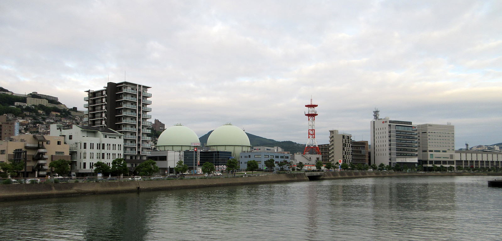 After first visiting the Atom Bomb Museum and Peace Park, earlier the same day, we then thought that it would be nice to take night looks at Nagasaki from Mt. Inasa. We first walked along Uragami River northwards, in order to find a trail that we had spotted on OpenCycleMap and which was supposed to bring us up to Mt. Inasa from the Fuchimachi part of Nagasaki. After walking around the Mitsubishi Industries near the valley station of the Nagasaki Ropeway, we then aimed at the road leading up to Fuchimachi. At this highest-most point of a side-road, however, we had to understand that finding a trail there was too optimistic. Also a local resident made it clear to us that there was no way further up from there! We thus retreated back down and instead connected to a bus stop to get up to >>>
Hypocenter Park, Atomic Bomb Museum, and Peace Park
- Date:
- 26.06.2025
- Characteristic:
- Walk
- Duration:
- 5:30h
- Distance:
- 5.0km
 One main goal for the visit of Nagasaki, obviously, was to visit the Atom Bomb Museum, along with the surrounding areas. To get there, we walked northwards from the main railway station, passing by the large and modern Stadium City of Nagasaki. Continuing along Sanno Street, the first strong impression came with the one-legged Torii Gate and a plate, explaining its brutal history. Continuing further northwards, we then first visited the Hypocenter Park, which now marks the place, where -- right above -- the atom bomb exploded. After spending time in this park, we then walked up to the Atom Bomb Museum. Also there, we could take substantial time to carefully visit the museum as well as the peace hall. When were all through it, we then walked over to the Peace Park, after crossing over >>>
