Archive - Date
Archive - Activity
-
Bike trip (120)
- Bike trip - mixed (38)
- Bike trip - road (5)
-
Other trip (1)
- Kayaking (1)
-
Other winter trip (4)
- Snowshoe trip (4)
- Ski trip (4)
- Trip by foot (732)
Archive - Geography
Peakbook-Friends
Katrin
- Date:
- 07.08.2014
- Characteristic:
- Hillwalk
- Duration:
- 3:00h
- Distance:
- 6.6km
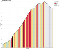
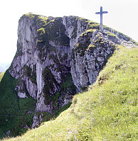
 Up from Bad Ischl (where the cable car starts, at 470m, via Bildweg) to Katrinalm (1413m), which is a nice, steep hike up (about 1000m up) and then -- after some nice rest with served food and drinks -- quickly up to Katrin-Kreuz (1542m) and Elferkogel (1601m). Down, then, very comfortably with the cable car. :-)
Hochleckenhaus (Höllengebirge)
- Date:
- 06.08.2014
- Characteristic:
- Hillwalk
- Duration:
- 4:00h
- Distance:
- 12.1km
 Starting from Taferlklaussee (763m), we first ascended to Hochleckenhaus (1574m) via a well-marked path (note: the start is somehow unclear -- mostly due to many other small trails near and around Taferlklausssee). After a nice and refreshing rest at Hochleckenhaus -- yes, with served food and drinks! :-) -- we descended towards Steinbach am Attersee (via Geissalm and Stieg -- the 2nd option for hiking to Steinbach), which offers terrific views -- not at the least to Attersee! The path down from Höllengebirge is (partially) steep and it's hundreds of meters straight down next to the path in selected places (you better are not afraid of heights there). All in all, a great hike! :-)
Selected photos are available as a Google photo album .
From Schafberg down to St. Wolfgang
- Date:
- 06.07.2005
- Characteristic:
- Hike
- Duration:
- 6:00h
- Distance:
- 10.5km
 We first took the mountain rail up to the top of Schafberg with the plan to walk down from there to St. Wolfgang. From the top, we then descended first towards the nearby Himmelspforte (in northwestern direction). There, we then started the real descent, which indeed is quite steep on the northern side of Schafberg, at least in the beginning. We followed the Himmelspfortenweg downwards, passing by Suissensee, and rounding another ridge to get to Mittersee, a nice little lake underneath the majestic Schafberg. From there, we continued further along this path, getting very close to Mönichsee, before we eventually got (back) to the southwestern side of Schafberg, heading down towards St. Wolfgang. We quickly arrived at the Auerriesenweg, which we then followed down until we basically were >>>


