Archive - Date
Archive - Activity
-
Bike trip (137)
- Bike trip - mixed (51)
- Bike trip - road (9)
-
Other trip (1)
- Kayaking (1)
-
Other winter trip (4)
- Snowshoe trip (4)
- Ski trip (4)
- Trip by foot (740)
Archive - Geography
Peakbook-Friends


Collected lists
-
Bergen ≥ 50m pf. og ≥ 100 m.o.h.
(87/89)
 97%
97% -
Most dominating tops of the Bergen peninsula
(68/75)
90%
-
Utvalgte topper og turmål i Bergen
(316/350)
90%
-
Alle topper i Bergen
(357/398)
89%
-
Opptur Bergen
(100/113)
88%
-
De syv fjell rundt Bergen
(6/7)
85%
-
Sund ≥ 50m pf.
(14/18)
77%
-
Os ≥ 50m pf.
(25/34)
73%
-
Søyler (fastmerker) i Bergen
(68/100)
68%
-
Fjell ≥ 50m pf.
(21/32)
65%

Skiing Bildøybakken
- Date:
- 14.02.2026
- Characteristic:
- Backcountry skiing
- Duration:
- 2:00h
- Distance:
- 5.2km
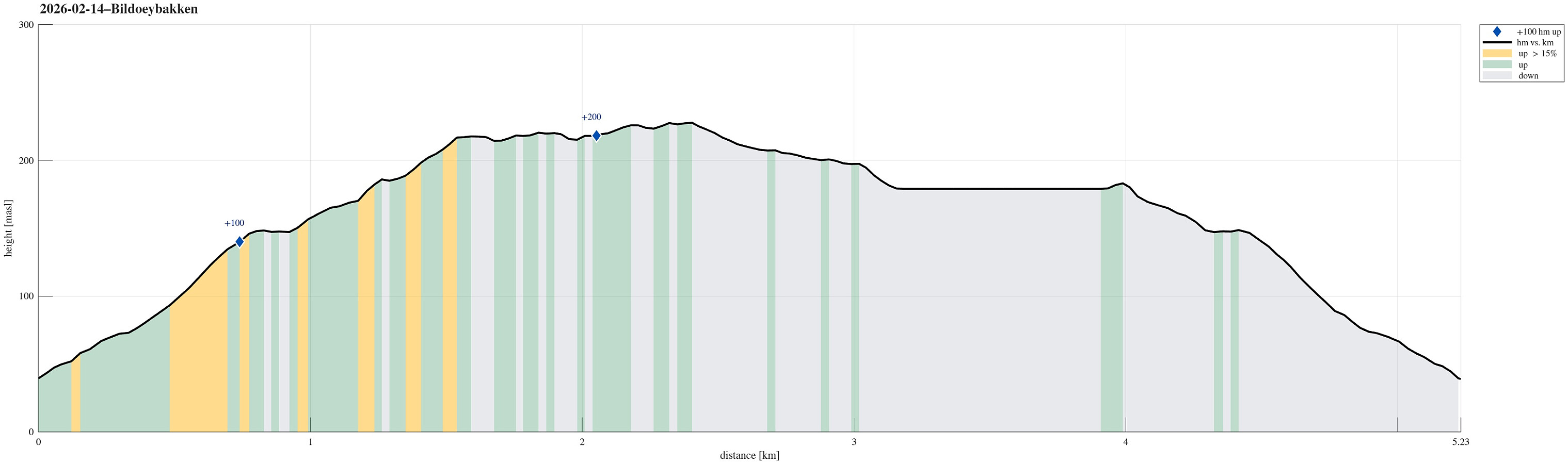 With new snow outside, we decided to take our skies and head towards Bildøybakken for an excursion into the snow. We parked at the lower end of the road which leads up to the dam of Bildøyvatnet, then following this road up to the dam. From there, we then ascended to Bildøyfjellet. Then, we continued across the heights of Bildøybakken (southwards to Vardafjellet). We then decided to connect to the southern end of Bildøyvatnet in order to cross it (on skies) south-to-north. This worked just fine and it did not take us all to long before we were back where we had started the afternoon.
Selected photos are available as Google photo album .
See also the related FB-page Hiking around Bergen, Norway .
With new snow outside, we decided to take our skies and head towards Bildøybakken for an excursion into the snow. We parked at the lower end of the road which leads up to the dam of Bildøyvatnet, then following this road up to the dam. From there, we then ascended to Bildøyfjellet. Then, we continued across the heights of Bildøybakken (southwards to Vardafjellet). We then decided to connect to the southern end of Bildøyvatnet in order to cross it (on skies) south-to-north. This worked just fine and it did not take us all to long before we were back where we had started the afternoon.
Selected photos are available as Google photo album .
See also the related FB-page Hiking around Bergen, Norway .
Skogsøyna on a nice winter day
- Date:
- 17.01.2026
- Characteristic:
- Hillwalk
- Duration:
- 2:00h
- Distance:
- 5.3km
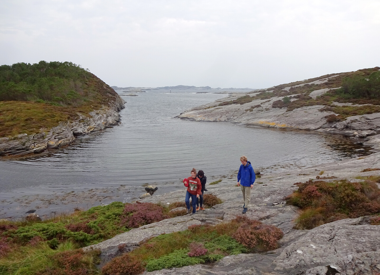
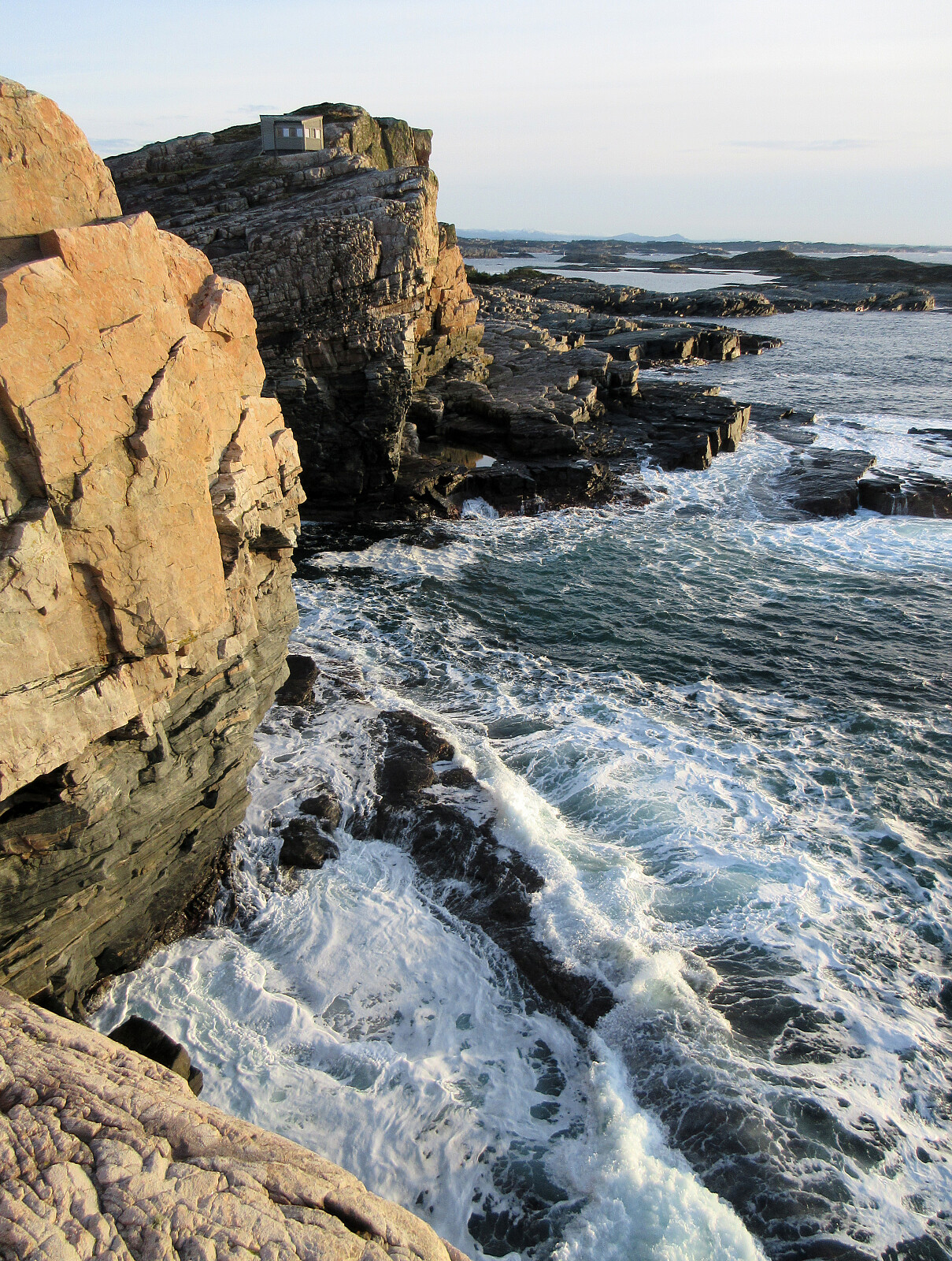 With a friend, visiting from abroad, we chose Skogsøyna as a very nice outing option. Following the main trail, which by now has been upgraded in multiple places, we soon reached Skogsøytua at the southwestern end of the island. After walking around the spectacular cliff area out there, we then walked basically the same (main) trail back. As always very nice to visit Skogsøyna!
Selected photos are available as Google photo album .
See also the related FB-page Hiking around Bergen, Norway .
With a friend, visiting from abroad, we chose Skogsøyna as a very nice outing option. Following the main trail, which by now has been upgraded in multiple places, we soon reached Skogsøytua at the southwestern end of the island. After walking around the spectacular cliff area out there, we then walked basically the same (main) trail back. As always very nice to visit Skogsøyna!
Selected photos are available as Google photo album .
See also the related FB-page Hiking around Bergen, Norway .
Førdesveten from Kleppe
- Date:
- 27.12.2025
- Characteristic:
- Hike
- Duration:
- 2:30h
- Distance:
- 8.1km
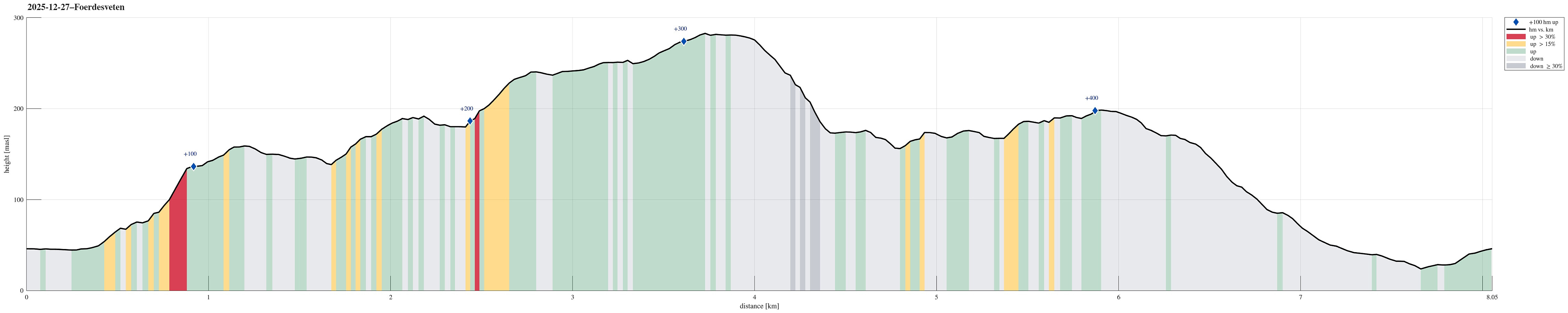 Yes, quite some wind was predicted, but still the weather seemed too good to not go out for a short while. After enjoying a nice round around Dyrdalsvatnet the day before, we decided that it should be Førdesveten south in Øygarden this day. We parked in Kleppe and took the route via Høylandsfjellet, Midtfjellet, and Lyngfjellet up to Veten. The higher we got, the more we experienced the rather strong winds! Near the top, we then took a short break in the still relatively new Dagsturhytten before heading back down via Ramnaberget and Kleppaksla. On the way down from Kleppaksla, we found a trail with pink markers in the southwest of Fenadalen, which brought us down to Sundvegen not far from where we had parked.
Selected photos are available as Google photo album .
See also the related FB-page Hiking around Bergen, Norway .
Petter Bjørstad has a useful page about Veten and also web page WestCoastPeaks.com provides useful information about Førdesveten .
Web >>>
Yes, quite some wind was predicted, but still the weather seemed too good to not go out for a short while. After enjoying a nice round around Dyrdalsvatnet the day before, we decided that it should be Førdesveten south in Øygarden this day. We parked in Kleppe and took the route via Høylandsfjellet, Midtfjellet, and Lyngfjellet up to Veten. The higher we got, the more we experienced the rather strong winds! Near the top, we then took a short break in the still relatively new Dagsturhytten before heading back down via Ramnaberget and Kleppaksla. On the way down from Kleppaksla, we found a trail with pink markers in the southwest of Fenadalen, which brought us down to Sundvegen not far from where we had parked.
Selected photos are available as Google photo album .
See also the related FB-page Hiking around Bergen, Norway .
Petter Bjørstad has a useful page about Veten and also web page WestCoastPeaks.com provides useful information about Førdesveten .
Web >>>
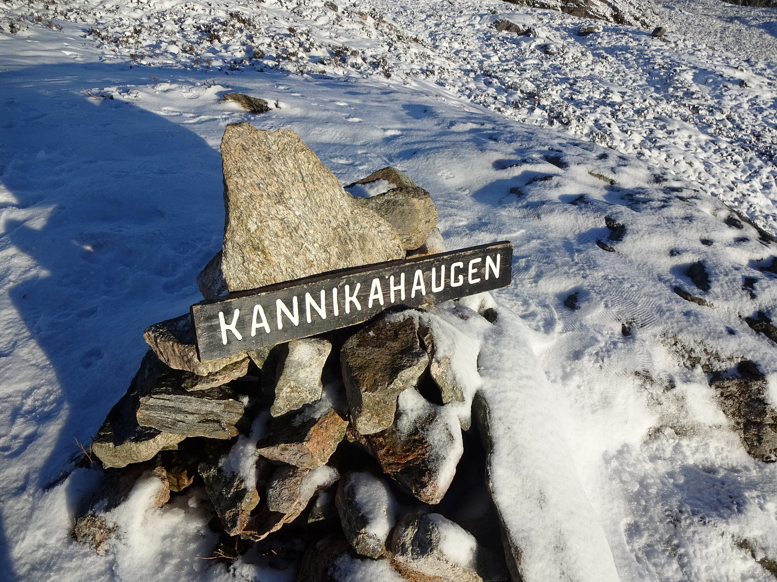
Liatårnet from Fjellavegen via Fjellasåta
- Date:
- 12.10.2025
- Characteristic:
- Hike
- Duration:
- 4:00h
- Distance:
- 7.4km
 We parked south of Fjell along Søre Fjellavegen and started our hike by aiming at Fjellasåta via Rindane. Basically at the saddle, where Søre Fjellavegen starts to descend again towards the south, we found a very basic trail (or something like that), which brought us well up and onto Rindane (towards the east). Even though this trail (or "trail") was not always immediately obvious, we still made it quickly and easily to Fjellasåta (Kannikahaugen). From there, and instead of following the north-south oriented trail across Fjellasåta, we proceeded further eastwards (towards the southern end of Gyravatnet). When down at Festningsvegen, we did not have to search long before we found a little opening in the thick valley forest. This opening connected to a simple "trail" >>>
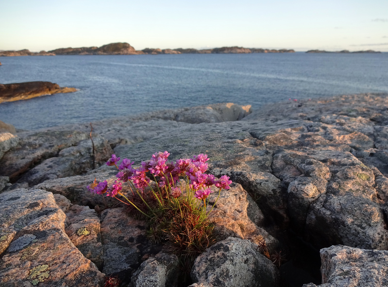
Golta in mixed weather
- Date:
- 31.08.2025
- Characteristic:
- Walk
- Duration:
- 2:00h
- Distance:
- 5.0km
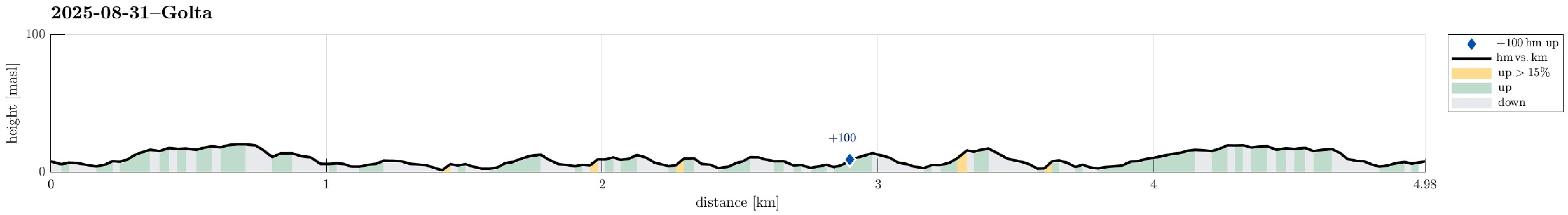 With a rather mixed weather forecast, we wished to make a brief excursion to the Atlantic and chose Golta as our goal. After driving there from Bergen and parking at Goltavegen, right between Vogga in the west and Goltosen in the east, we walked towards the coast from there, first following the marked trail. To get around Lutavika, we then followed the coast in norther direction, crossing over to the northwestern part of Golta at the southern end of Jonsvikadalen. On the other side, we then first visited a nice vista point south of Luten, before walking further to Sandvika. There, we basically turned around, then following the marked trail all the way back to the parking place. Given that the day was overall rainy, we actually had quite OK weather and enjoyed this short walk very much! >>>
Exploring the south of Turøyna
- Date:
- 30.05.2025
- Characteristic:
- Hillwalk
- Duration:
- 2:00h
- Distance:
- 5.2km
 The day was just too nice to not escape in the evening for a short exploration of the south of Turøyna. We parked near the central roundabout at Turøyna and tried to find a good entry point from Kalderasvegen to start our exploration. We first left the road prematurely and then, after getting back we tried again a few meters further in the southwest. The trail head is basically invisible from the road, but we found it anyway (at the second attempt). From there, the trail is barely visible and one quickly gets in a pretty wet forest just a few meters from the road. Navigating some minor ups and downs, we then made it to the northern ridge of a small hill south of Kalderasvegen. We then made it through another small valley to get to the next hill, a bit further to the SSW. After crossing >>>
Kannikahaugen from Bildøybakken
- Date:
- 15.02.2025
- Characteristic:
- Hike
- Duration:
- 5:00h
- Distance:
- 12.0km
 With a really nice weather forecast, we just wished to use the good weather for a nice walk. The idea was to start at Bildøyfjellet, north of Liatårnet on Sotra, and then hike a (squished) round from there (without any plan to actually ascend to Pyttane nor Liatårnet). We parked right next to Bildøybakken, not far from the corner, where one can also drive to Liaskjeret. Instead of using the access road towards the dam of Bildøyvatnet, we aimed at Bildøyfjellet directly (and without a trail). Given the below freezing temperatures, we found the conditions just right for such an off-trail ascent. Within not too long, we then arrived at Bildøykletten (and at the trail, there). We then followed the trail southwards (via Steinane and Vardafjellet). Before descending to Fjellfestningen, >>>
Kyrkjenibben etc.
- Date:
- 23.12.2024
- Characteristic:
- Hike
- Duration:
- 3:00h
- Distance:
- 8.4km
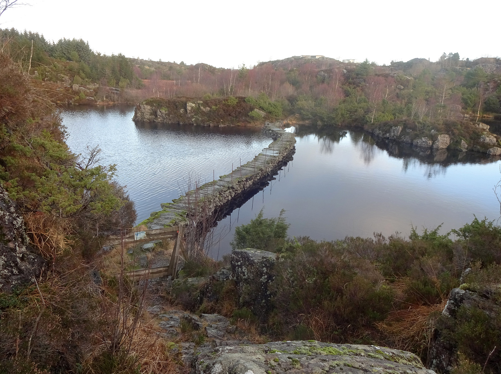 We expected the higher tops to be covered with clouds and thus decided to instead head towards the coast for a simple hike. We knew that one should be able to find a historic connection between Morland and Fjell, kyrkjevegen, which apparently was used by the people of Morland to get to the church in Fjell previously. We started near the church in Fjell and followed kyrkjevegen until we came to the south end of Eidesvatnet. Instead of following kyrkjevegen further northwards from there, we had already decided that we wished to include a detour to Gardafjellet a bit further west. Following a trail around Kvernhaugen (around the south of Liavatnet) brought us to the trail up to Gardafjellet (in northwestern direction). At Gardafjellet we enjoyed some nice views, before continuing -- then >>>
Jurefethaugen and Vikåsen
- Date:
- 27.10.2024
- Characteristic:
- Hike
- Duration:
- 2:00h
- Distance:
- 4.9km
 The main idea was to use a window between some predicted rain showers and to go and have a look at the place, where some 40 years ago two wave power stations were built at Kalvøyna in Øygarden. To make this at least somewhat a hike, also, we parked near Balsvågen right next to Turøyvegen. From there, our first goal was to step up to Jurefethaugen (or Gjugrefethaugen or ...). This worked out without difficulties (we only needed to walk around a rather wet spot between the street and the hill). Close to the top, we passed a really impressive stone wall. From Jurefethaugen, we aimed at Lykleneset a bit further north. The idea was to see if we could make it there via the wild west-side of this peninsula. This worked well, but it should be noted that progress is not necessarily possible >>>
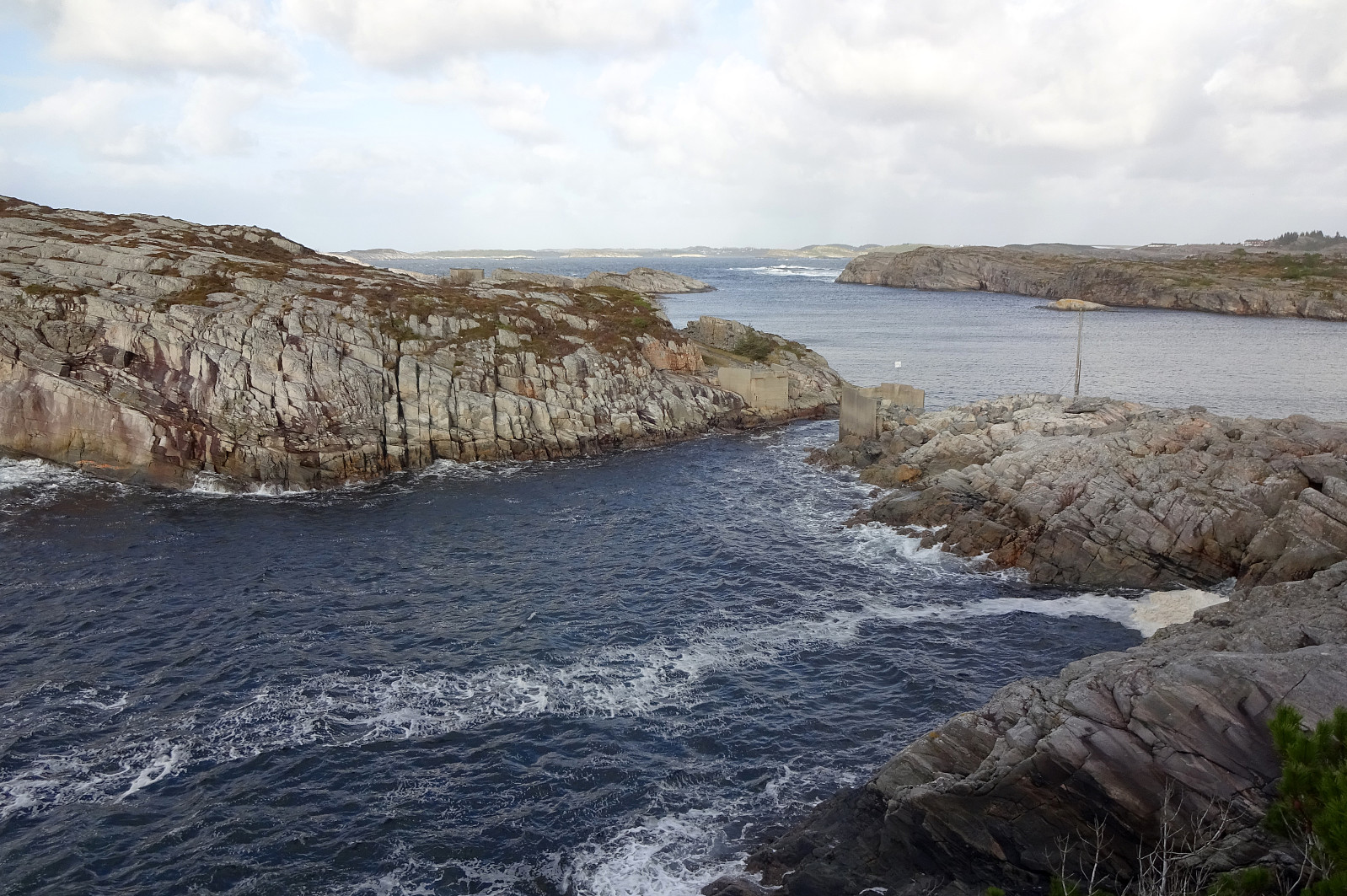
Evening Ormhelleren
- Date:
- 28.08.2024
- Characteristic:
- Walk
- Duration:
- 1:30h
- Distance:
- 2.5km
 Given a likely rain-free evening, we headed out to Ormhelleren in the south of Rongøyna in Øygarden. We first explored the area around Hesthaugen before then testing the waters in the bay southeast of Hesthaugen. On the way back, an attempt to cross over Rongaloftet failed due to a lack of time, the trail leading towards the east (instead of the north), and the absence of a willingness for some evening bush war...
Selected photos are available as Google photo album .
See also the related FB-page Hiking around Bergen, Norway .
Given a likely rain-free evening, we headed out to Ormhelleren in the south of Rongøyna in Øygarden. We first explored the area around Hesthaugen before then testing the waters in the bay southeast of Hesthaugen. On the way back, an attempt to cross over Rongaloftet failed due to a lack of time, the trail leading towards the east (instead of the north), and the absence of a willingness for some evening bush war...
Selected photos are available as Google photo album .
See also the related FB-page Hiking around Bergen, Norway .
