Archive - Date
Archive - Activity
-
Bike trip (137)
- Bike trip - mixed (51)
- Bike trip - road (9)
-
Other trip (1)
- Kayaking (1)
-
Other winter trip (4)
- Snowshoe trip (4)
- Ski trip (4)
- Trip by foot (740)
Archive - Geography
Peakbook-Friends


Collected lists
-
Bergen ≥ 50m pf. og ≥ 100 m.o.h.
(87/89)
 97%
97% -
Most dominating tops of the Bergen peninsula
(68/75)
90%
-
Utvalgte topper og turmål i Bergen
(316/350)
90%
-
Alle topper i Bergen
(357/398)
89%
-
Opptur Bergen
(100/113)
88%
-
De syv fjell rundt Bergen
(6/7)
85%
-
Sund ≥ 50m pf.
(14/18)
77%
-
Os ≥ 50m pf.
(25/34)
73%
-
Søyler (fastmerker) i Bergen
(68/100)
68%
-
Fjell ≥ 50m pf.
(21/32)
65%

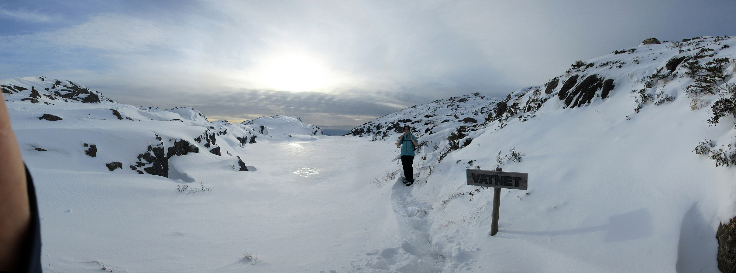
Liatårnet from Li
- Date:
- 11.12.2021
- Characteristic:
- Hike
- Duration:
- 2:30h
- Distance:
- 5.3km
 We expected some sunshine (not any long day, though, of course) and thus headed for some snow near Bergen! :-) Remembering a very nice winter hike up to Liatårnet in Jan. 2019 , we aimed at Liatårnet, again, but this time via a slightly different route. Also this time, we drove to Li (on the eastside of Liatårnet) and parked near Liaskjærshallen right next to Liaskjervegen at Liaskjeret. From there, we first walked back a little (north along Liaskjervegen) until we turned left (onto Elvabakkvegen). After walking up this road for a few meters, the road splits into two in a T-junction; there, straight onwards, one finds a trail head from which one can get behind the houses in westwards direction (for ex., towards Trollhaugen in the southwest). Our plan was to ascend into the direction of Liatårnet from there, so we did not >>>
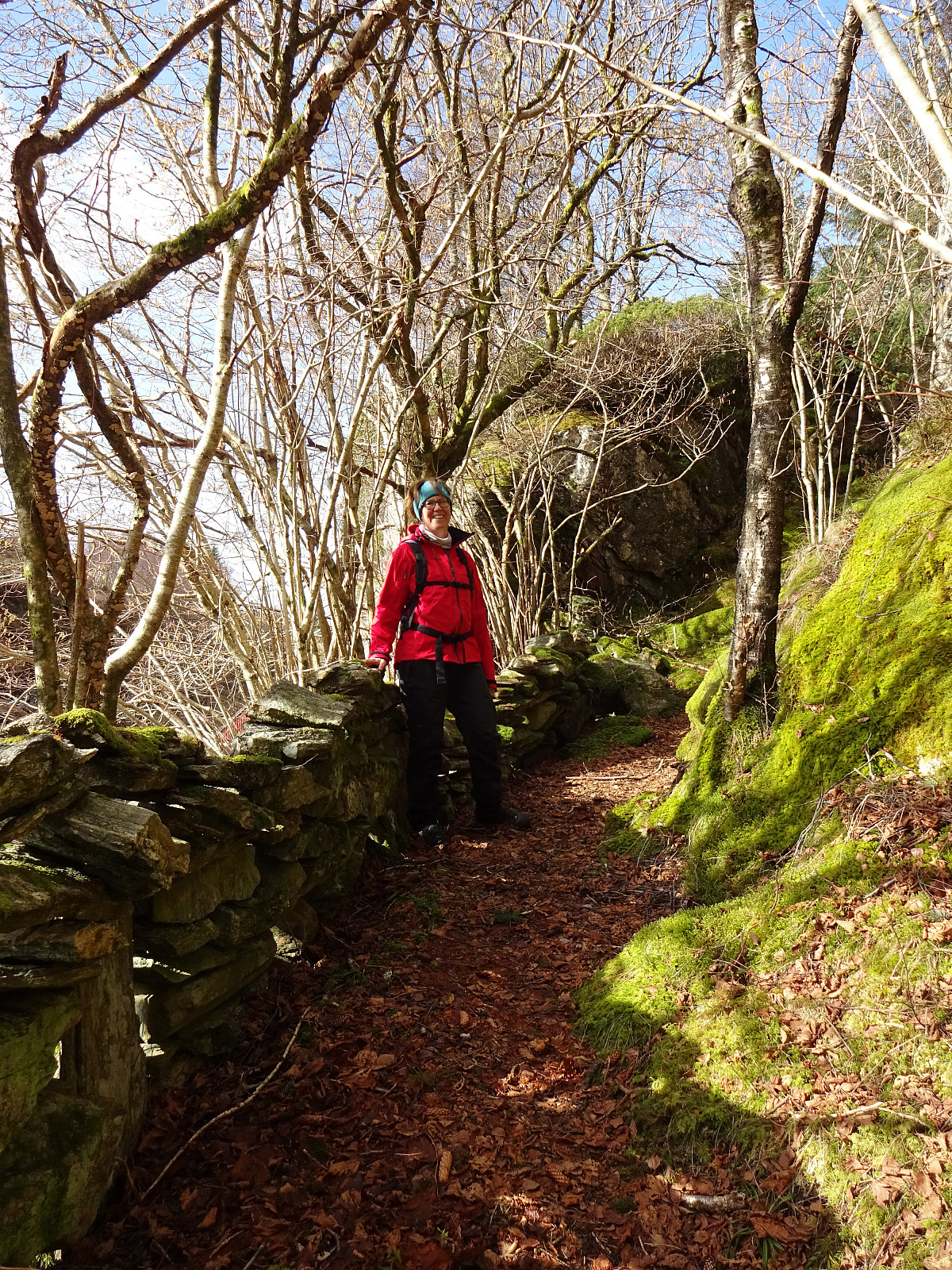
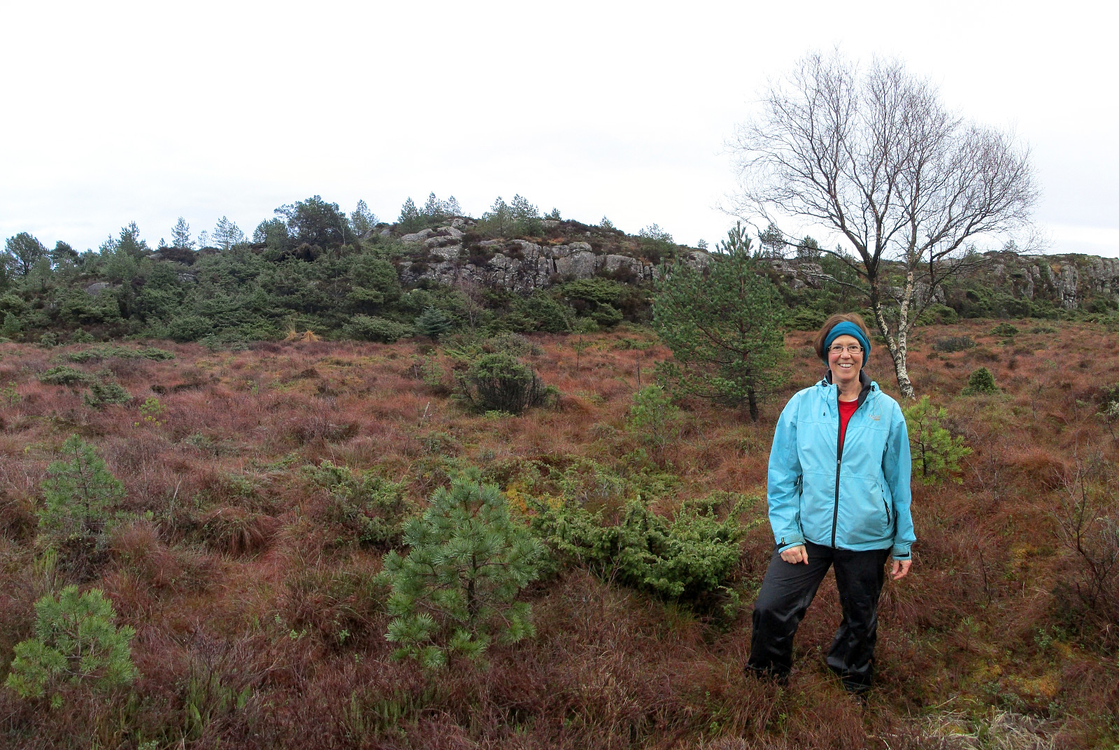
Exploring Knappen near Kallestad
- Date:
- 04.07.2021
- Characteristic:
- Hillwalk
- Duration:
- 4:00h
- Distance:
- 6.7km
 The plan was to use a nice, warm summer day and hike into the north of Kallestad. We parked next to Grendahuset in Kallestad and first walked the street back northwards until we came to Sjoartjørna. Where Kallestadvikvegen turns around this little lake (in its west), a trail heads off in northwestern direction. After only a few meters, already, one has the choice between going directly to Storhaugen, or ascending to Austre Storhaugen, first. We did the latter, heading up to Austre Storhaugen, first, enjoying some nice views, including one back down to Sjoartjørna. From Austre Storhaugen, one can then connect to Storhaugen via a steep descent, first, and then joining the trail that comes around Austre Storhaugen in its south. From Vestre Storhaugen, just a few meters in the west of Storhaugen, >>>
Steinafjellet and Skjerhaugen
- Date:
- 16.05.2021
- Characteristic:
- Hillwalk
- Duration:
- 1:00h
- Distance:
- 3.0km
 Being already very close, I decided to make a quick excursion to Steinafjellet and the coastal area there. After parking next to the school in Landro, my first "challenge" was to get behind the used areas (towards the open landscape with Steinafjellet). I found a way to pass by a farm there, but would have found it even better with a trail head to use. Once behind the farm area, proceeding to Steinafjellet was quick and easy. Once there, I decided to walk a little further (towards the coast) and started to do so in northwestern direction from Steinafjellet. This brought me within a few minutes to a little height, just in the south of Sørdalen. In order to get even closer to the sea, I then descended into Sørdalen, choosing a place which was a little steeper than what was just >>>
Stortårnet and Nilskyrkja
- Date:
- 21.03.2021
- Characteristic:
- Hillwalk
- Duration:
- 2:00h
- Distance:
- 7.6km
 Our idea was to explore the west of Dala, south of Fjell in Øygarden. After driving westwards from Bergen, we turned south once on Sotra. Passing by Fjell, we soon arrived in Dala, where we parked next to the main road. The first (small) hiking goal of the day was Stortårnet in th southwest of Dala. After crossing a playing ground right next to Dalseidet, we started a short ascent (first without any trail). Once above 70mosl, we connected to a simple trail which then lead us to Stortårnet. Before turning back, we first explored the area a little, including the mobile sender mast in the southeast of the top (northwest of Dalatjørna). We then continued northwestwards from Stortårnet, reaching Ærhaugane soon after while walking over the ridge parallel to Trengereidpollen some 75 meters >>>
Rounding Storavatnet in the south of Kallestad
- Date:
- 24.01.2021
- Characteristic:
- Hike
- Duration:
- 3:30h
- Distance:
- 10.3km
 After discussing a few ideas for another nice hike, we eventually decided to drive out to Øygarden, once again, and explore the region near Kallestad again. We thought that the available daylight should be enough to attempt a round around Storavatnet in the southwest of Kallestad. Driving west from Bergen, you get, after a bit, to Sotra. There, turning left, brings one via Fjell further south. At Trengereid, we then turned right in order to drive out to Kallestad, where we parked near Grendahuset. Since our plan was to round Storavatnet in counterclockwise direction, we first walked out of Kallestad in western direction, passing by Vassenden, south of Stølstjørna. There, instead of further following the trail into the direction of Kjereidet, we just walked up the first little hill, >>>
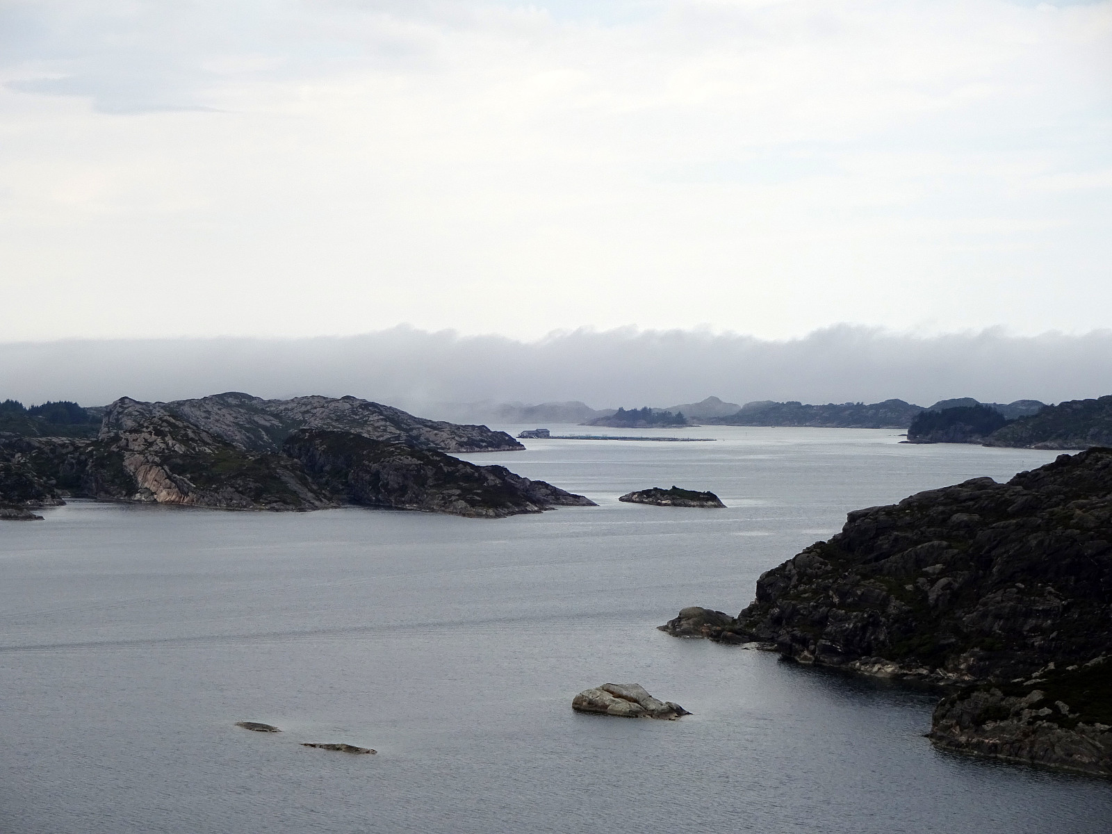
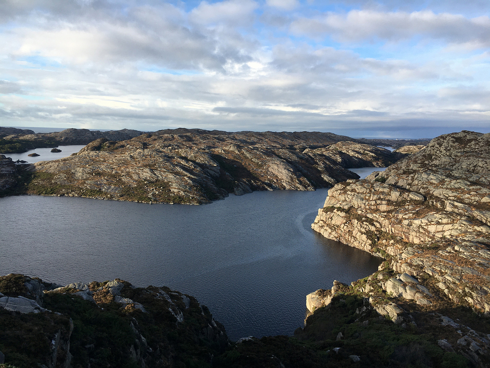
Visiting Ånesvika on Algrøyna
- Date:
- 16.01.2021
- Characteristic:
- Hillwalk
- Duration:
- 3:30h
- Distance:
- 8.2km
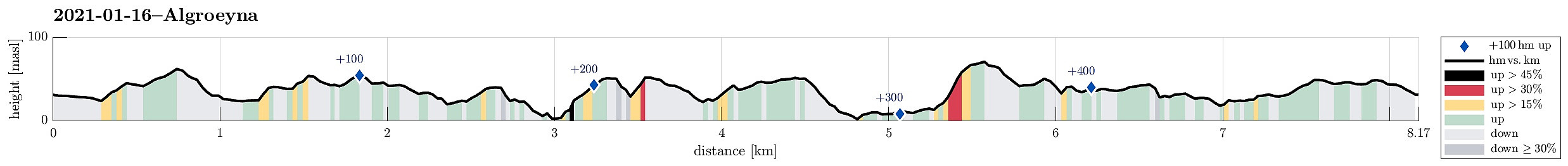 We had heard about a new place for staying overnight in the middle of the wild nature of Algrøyna (at Ånesvika) and thus decided to go and have a look ourselves. :-) After first driving along road 555 towards Sotra in the west of Bergen, we turned towards south after passing through the tunnel in the south of Kolltveit, heading towards Fjell. There, we turned right, again, following road 559 into the direction of Møvik at the west-side of Sotra. Following this road further (eventually northwards along the coast), we came to Skålvik, where we turned left, again, and onto a narrow road leading us to Algrøyna (the road also connects to Langøyna and Lokøyna). Once on Algrøyna, and a little less than half way towards the main village on that island, we parked a bit up the hill, where >>>
Liatårnet from Fjell Festningen
- Date:
- 30.12.2020
- Characteristic:
- Hike
- Duration:
- 4:00h
- Distance:
- 10.5km
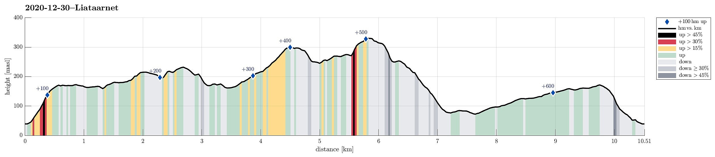 Even though it was already a little later on the day (not a great lot of daylight left), we still wished to make a nice hike somewhere in the neighborhood. We then arrived at the following: first, we would ascend to Fjell Festningen (from Søre Fjell), then walk over to Pyttane and Liatårnet, before eventually returning via Fjell Festningen, again. And so we did it. :-) After using road 555 from Bergen towards Sotra (in western direction), we turned left (southwards) on Sotra, arriving in Fjell soon after that. Continuing along road 560 further southwards (from Fjell for about half a kilometer), we soon came to Søre Fjell, where we found a parking place right next to the road. From there, we followed a properly marked trail (in eastern direction), ascending to Fjell Festningen within >>>
Short round on Bjorøyna
- Date:
- 31.12.2019
- Characteristic:
- Hillwalk
- Duration:
- 1:30h
- Distance:
- 3.1km
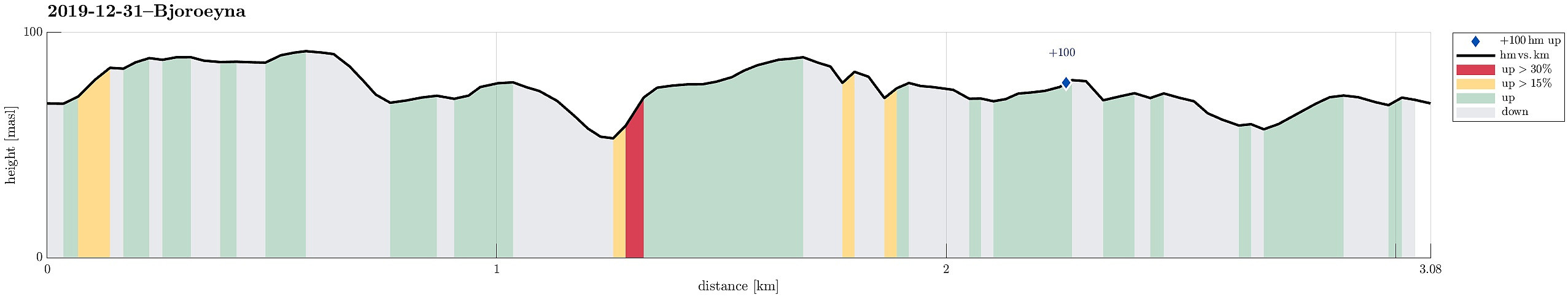 We took the car to the west of Bergen and from Loddefjord along Hillerenveien to get to the undersea tunnel, which connects to Bjorøyna. There, we continued along the "main road" across Bjorøyna (Fv207) until we parked next to the school of Bjorøy. From there, we first ascended to Rundelen across its northern ridge, Bjorøyna's highest hill, right in the east of the school. Once up there -- it's only a few meters above the school --, we continued in southern direction across the north-south going heights. Before eventually turning westwards, we first included a smaller hill in the southeast of the heights of Rundelen. From there, we then descended in western direction (northwest of Stokkhaugen) until we crossed some minor swamp to get over to another hill on the other (western) >>>
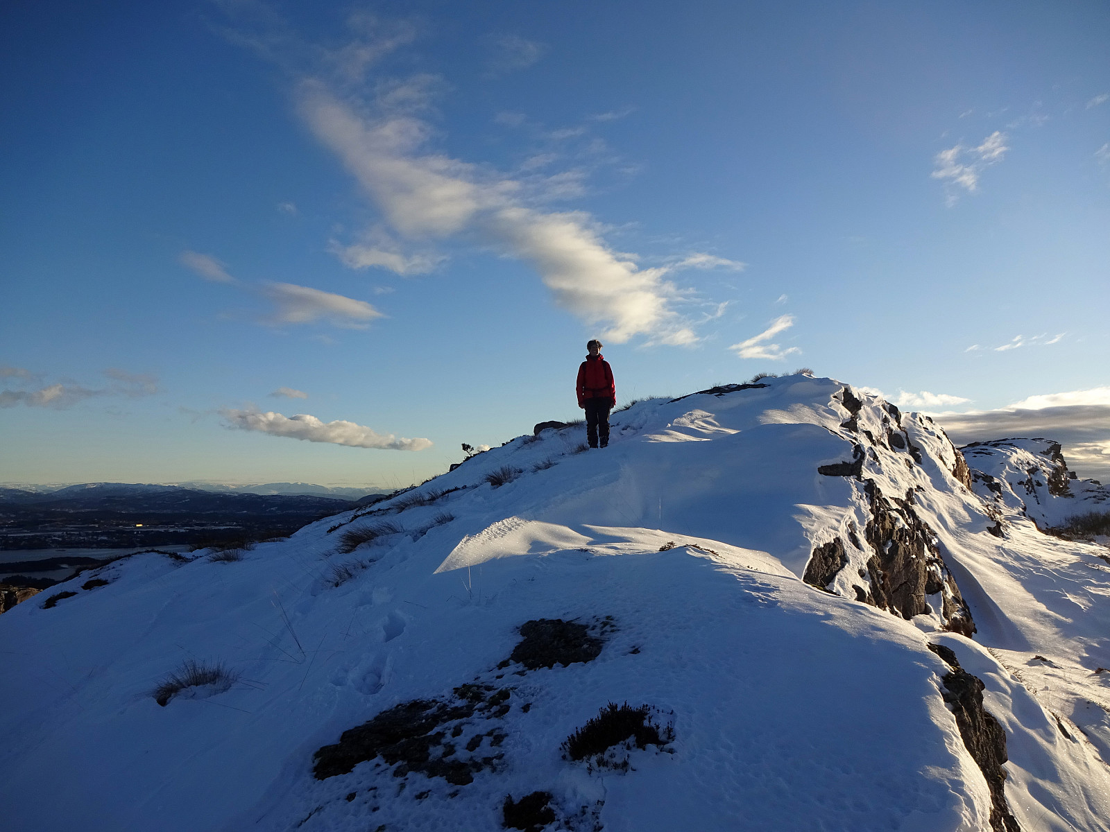
Snow-covered Liatårnet from Li
- Date:
- 27.01.2019
- Characteristic:
- Hillwalk
- Duration:
- 2:15h
- Distance:
- 4.8km
 Considering the snow-covered landscape outside and comparably good weather, it was not too difficult to decide for a nice Sunday hike. We took our car towards the west (Sotra) and there to Li (on the east-side of Liatårnet). Near Haugane, we parked and continued along Liaskjervegen walking until we came to Hola, where we found Hølo (a short road up to the west from F206). Pretty much at the top end of this short road, we then found the path to Liatårnet (and were positively surprised that it was easy to find!). Since someone had gone there already, it was even easy to step up the snow-covered path. Furthermore, we got the impression that rather recently a substantial effort must have been put into this path (with a few signs here and there, a proper stone bridge across a small stream, >>>
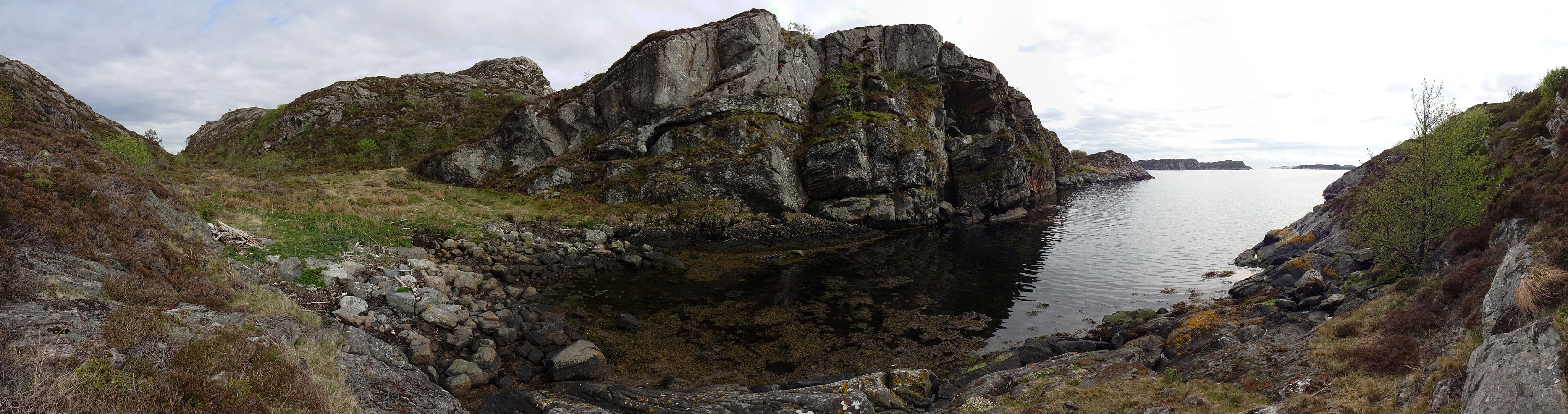
Storskaret and Ebbesvikfjellet on Litlesotra
- Date:
- 28.12.2018
- Characteristic:
- Hillwalk
- Duration:
- 2:00h
- Distance:
- 8.2km
 Since we had plans to buy a few things at a shop at Straume, we decided to use a bit of time for getting some fresh air nearby. While driving to Litlesotra, we repeatedly changed our minds in terms of which road to follow, ending up in Straumsfjellvegen, eventually. Understanding that his road would not let us drive further into the south of Litlesotra, we decided to park at a southern spot along Svartabergje and to walk from there. We used a connection for pedestrians to get down to Arefjordvegen first, before following this street in eastern direction a bit (until a rather large roundabout right next to Storskaret). Looking at the rather steep northern flank of Storskaret, we got a bit unsure concerning the idea to climb up to it (instead of following some more streets). We still gave >>>
